| Report Type | Full |
| Peak(s) |
Little Bear Peak - 14,041 feet Blanca Peak - 14,350 feet "South Little Bear" - 14,028 feet |
| Date Posted | 06/22/2020 |
| Date Climbed | 06/21/2020 |
| Author | Wentzl |
| Another take on Little Bear SW Ridge |
|---|
|
I have been interested in the several reports on the SW Ridge of Little Bear, especially because of the various descriptions of the bushwhack necessary to get to the start of the climb. Whether trespassing through the subdivision that abuts public land near Tobin Creek, or hiking overland from the Como Lake Road, everyone seems to agree that this part of the hike is as unpleasant going up as coming down. So, here for your consideration, is an alternative that makes the bushwhack a one way trip! It was a Saturday night, and the first day of summer, so I did expect some traffic on the Lake Como road. But when I saw just how many cars were parked lower down, I figured I would be out of luck for a decent campsite. There were at least 40 vehicles scattered along the first few miles of the road. But my plan was to seek out a road right around 8,800' that is easily visible when searching googlemaps, satellite view, which is how I researched this approach. The road goes off to the right, just an 1/8 of a mile or so after the sign warning of bears in the area. There are actually a couple good sites right there, but I saw one just a little earlier on and grabbed it. 
From my camp, I could easily see the bear sign. Just after this sign, the road turns sharply steeper. 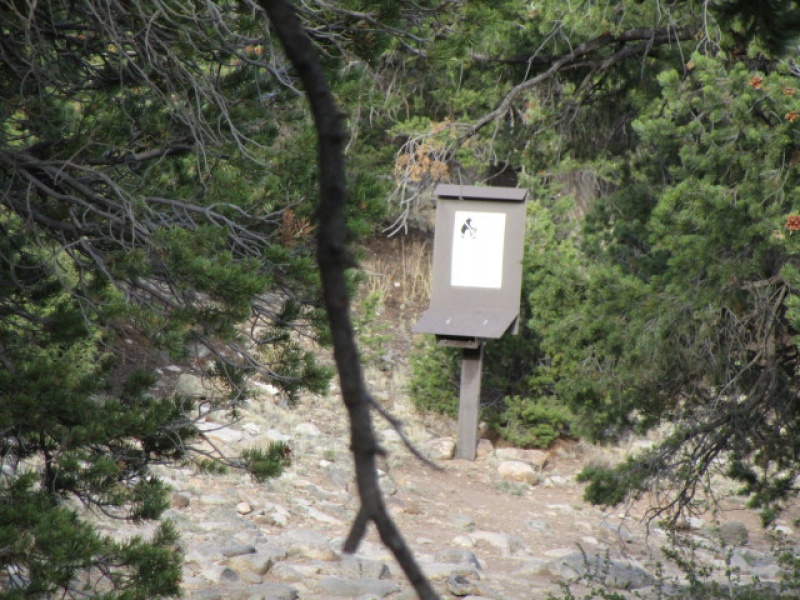
The road is obvious and hard to miss. 
Just 100 yards or so off the road are some nice campsites and the road continues on, contouring at about the same elevation to the southeast. There is an old ladder back there. 
Some of the other SW Ridge reports talk about driving near Tobin Creek through the "Hills Have Eyes" sort of subdivision. Since I have not hiked that route, I can't say this road is easier, but I can say that it was not the exhausting, time consuming effort that I expected. It took just about an hour to reach, and cross Tobin Creek. 45 minutes of that time was spent walking on decent roads connected by substantial game trails. The hike up from the Como Lake road from below treeline would be substantially more of an endeavor both for route finding and stamina. 


The previous few photos show the travel for the first 30 or 40 minutes. The last bit, getting to Tobin Creek is where the bushwhacking began on my trip. My guess is that there are better ways to get across the creek, but when I could hear the waterfall, I tried to make more of a beeline, than follow the path of least resistance, and there was some mild cursing. When the creek came into view, I was a little disheartened by the canyon which presented. It was not as substantial as it appeared on first view, but I did have to scramble down 150 vertical feet to get across the stream. I think I was downstream a couple hundred yards from where mickknu16 took the photo of the waterfall in his SW Ridge report posted last week. Anyway, I left camp around 6:00 a.m. and was across the creek and heading uphill by 7:00 a.m. so all in all, this was a good approach. The creek was 2.4 miles from camp. NOTE ON MILEAGE: While I did carry a GPS to track distance, I forgot to turn it on until approximately 40 minutes into the hike. So for the duration of the trip, I added one mile to the gps reading. Not perfect, but probably pretty accurate, and distance as measured from the creek are correct. 
Surveying the opposite side of the creek it was not at all obvious what the best path would be to get on the ridge. But once across, it was just as straightforward as could be with game tracks making way pretty much straight up. This turned out to be the theme for the next 90 minutes until I reached tree line. Just move straight up over ground that presented few obstacles on talus that was for the most part very stable under foot. 
I crossed the creek at 9,465' at 7:00 and reached treeline at 11,300' 80 minutes later, at 8:20. The distance up the hill was 0.8 miles. It was brutally steep for just the first 15 minutes or so and then gradually eased back. Up on a level perch I found a nice bivy shelter someone had constructed. Hard to tell how long it had been there. Couple weeks? Couple decades. Anyone recognize it as a temporary camp? 
The terrain up to treeline, after the steep section was very pleasant. Easy grade, no doubt about travel direction, sheltered from wind and sun by beautiful trees. 


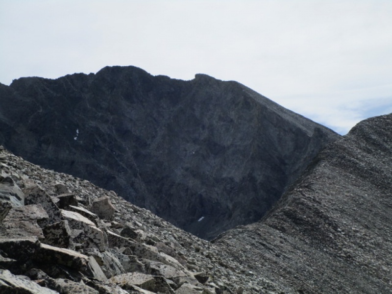
The ridge didn't really have any surprises along the way. There were a couple dips, but none that required any real additional effort to move over .The SW Ridge does give an excellent observation deck for checking out the Hourglass route, which looks absolutely insane from this vantage point. 
After a while the ridge turns to the north and gets steep again to reach S Little Bear summit. 
The steep climbing is easy 3rd class and is punctuated with a short knife edge section which is fun. 
I reached the S Little Bear summit at noon, almost exactly 6 hours after starting out. While there I noticed a couple folks hiking toward me from the Little Bear summit, who turned out to be a couple other 14er.com members. 
The hike over to Little Bear from S Little Bear was not too complicated. Not nearly as exciting as it has been presented elsewhere. Basically, when travel on the ridge crest becomes difficult, drop down and to the left, sometimes even retreating a little along the lower section of the ridge. About 20 minutes from one summit to the other. 
There was one obstacle I thought I could get around to the right, but that didn't work out. Stay to the left (west) side of the ridge, is about all you need to know. 
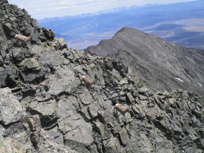
So, Little Bear summit at 12:20 and 6.56 miles from camp. That is all the information I have on the SW Ridge route. Since I intended this to be a one way trip through the bush country down below, and since my camp was on the Como Lake road, I figured it would be easier to just saunter over to Blanca and hike down the road. The rest of this trip report will briefly talk about the Little Bear/Blanca traverse, which has been written about extensively by myself and others. BUT I did have a nice wildlife sighting, and stuck in a few action shots of sheep running down rocks. PART II This would be my 4th trip across the LB/B traverse, so I was not expecting any surprises. There was snow visible along the route, but I had read a trip report earlier in the week that said the snow was not an issue on the route. That was correct, and the threatened snowstorm, which was supposed to dump considerable snow on the mountains a couple days earlier apparently never materialized. So at 12:30, with clear skies, light wind and a pretty good idea what lie ahead, I set off. 

I made decent time, stopping mid way for a long lunch break and to just soak up the atmosphere in this pretty wonderful place. I reached the summit of Blanca Pk. at 2:40. My GPS told me I have traveled 8.11 miles. But before I topped out on Blanca, I was greeted with this: 
I have to just post a few of the photos as these guys (girls) made short work of getting around an unwelcome intruder. 


This was the first day of summer, but there was still plenty of ice on the uppermost of the lakes in the Blanca basin. 
The hike from the summit of Blanca back to camp took about 4 hours. 1 1/2 hours down off the mountain and back on the very end of the Como road and another 2 1/2 down the road to camp. The distance traveled for the loop, approximately 15 miles. In the next photo I share my navigational tool for anyone who thinks this sounds like fun. Where I hashed out the green highlight mark, and inserted the blue ink, is the actual path, as opposed to the intended. Like I said, I did carry a GPS, but that is just to track mileage. I did save the track, but not sure how to download it, so don't ask unless you are prepared to give technical advice. 
Final thought, wear shorts through the bushes at your own peril. 
Thumbnails for uploaded photos (click to open slideshow): ")
")
")
")
")
")
")
")
")
")
")
")
")
")
")
")
")
")
")
")
")
")
")
")
")
")
")
")
")
")
")
")
")
")
")
")
")
|
| Comments or Questions | |||
|---|---|---|---|
|
Caution: The information contained in this report may not be accurate and should not be the only resource used in preparation for your climb. Failure to have the necessary experience, physical conditioning, supplies or equipment can result in injury or death. 14ers.com and the author(s) of this report provide no warranties, either express or implied, that the information provided is accurate or reliable. By using the information provided, you agree to indemnify and hold harmless 14ers.com and the report author(s) with respect to any claims and demands against them, including any attorney fees and expenses. Please read the 14ers.com Safety and Disclaimer pages for more information.
Please respect private property: 14ers.com supports the rights of private landowners to determine how and by whom their land will be used. In Colorado, it is your responsibility to determine if land is private and to obtain the appropriate permission before entering the property.


