Download Agreement, Release, and Acknowledgement of Risk:
You (the person requesting this file download) fully understand mountain climbing ("Activity") involves risks and dangers of serious bodily injury, including permanent disability, paralysis, and death ("Risks") and you fully accept and assume all such risks and all responsibility for losses, costs, and damages you incur as a result of your participation in this Activity.
You acknowledge that information in the file you have chosen to download may not be accurate and may contain errors. You agree to assume all risks when using this information and agree to release and discharge 14ers.com, 14ers Inc. and the author(s) of such information (collectively, the "Released Parties").
You hereby discharge the Released Parties from all damages, actions, claims and liabilities of any nature, specifically including, but not limited to, damages, actions, claims and liabilities arising from or related to the negligence of the Released Parties. You further agree to indemnify, hold harmless and defend 14ers.com, 14ers Inc. and each of the other Released Parties from and against any loss, damage, liability and expense, including costs and attorney fees, incurred by 14ers.com, 14ers Inc. or any of the other Released Parties as a result of you using information provided on the 14ers.com or 14ers Inc. websites.
You have read this agreement, fully understand its terms and intend it to be a complete and unconditional release of all liability to the greatest extent allowed by law and agree that if any portion of this agreement is held to be invalid the balance, notwithstanding, shall continue in full force and effect.
By clicking "OK" you agree to these terms. If you DO NOT agree, click "Cancel"...
"Teakettle Mt. (13,725 ft.) has by far the finest summit of any of the San Juan peaks that we have visited; it is small, solid, and well isolated and one can pleasantly perch on its flat surface with a fine sense of segregation from the rest of the world."
Dwight G. Lavender and T. Melvin Griffiths Climbing in the Mount Sneffels Region, Colorado, 1933
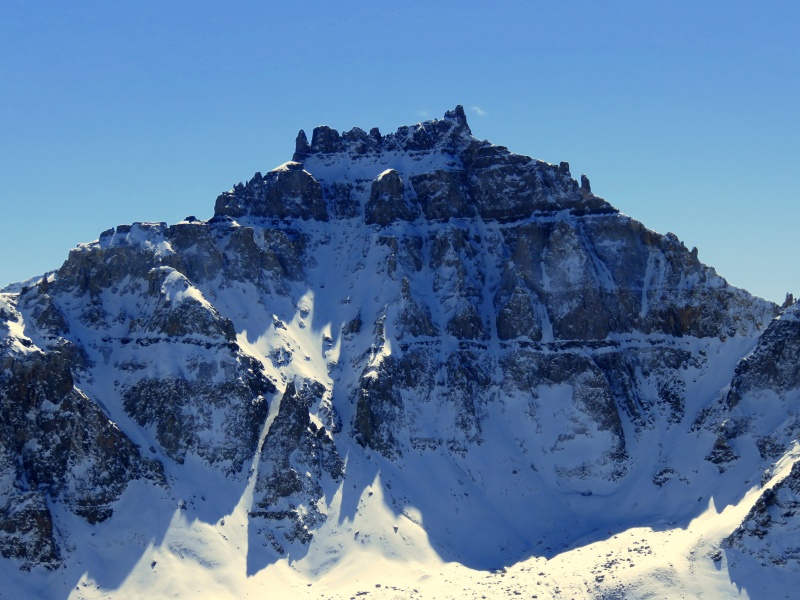
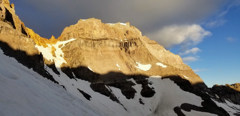
Teakettle N face in October
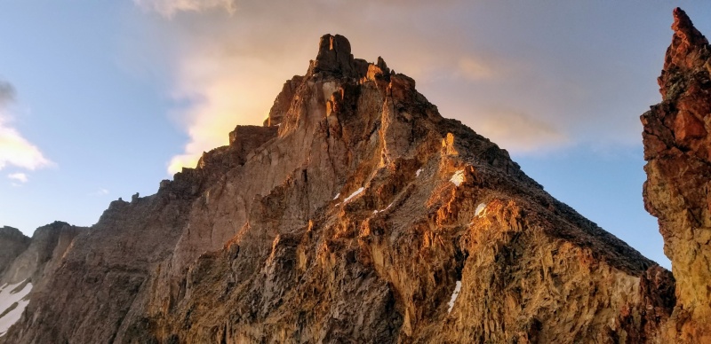
While the distinctive summit ridge of Teakettle Mountain can be easily identified from many places in and around the northern San Juans, unlike the sweeping northern aspects of most Sneffels Range peaks the full extent of its 1,200-foot north face is tucked into the back of a high basin and overshadowed there by the sheer cliffs of Cirque Mountain.
Thus the allure of this face did not strike me until one sunny October afternoon Kylie and I hiked up nearby Reconnoiter Peak, itself a worthy destination, which lies to the northwest of Mount Ridgway and is easily mistaken for one or other of its higher neighbors. From this vantage point the north face of Teakettle features prominently to the south, and fresh snow highlighted possible routes sneaking up through bands of several kinds of volcanic refuse, each uniquely unfit to be the stuff of mountains.
For some time John has been steadily approaching his goal to complete Colorado's highest 100 peaks. We had discussed Teakettle off and on for years but failed to execute for a variety of the usual reasons: priorities, injuries, weather, scheduling. By this spring only Teakettle and Mount Meeker remained on John's list and he was itching to tackle his final San Juan centennial. I convinced him we should attempt the north face, and the pieces fell into place, with Ryan and Kevin joining to make a party of five.
Our original plan was to approach from Blaine Basin and camp just below the tongue of the rock glacier, and after Teakettle continue on to Coffeepot and Potosi Peak. Ryan pointed out that we could avoid the complications of traversing back into Blaine by approaching from Yankee Boy over the Cirque-Teakettle saddle. This turned out to be a wise modification; Ryan and I spent Saturday out in the rain and wind.
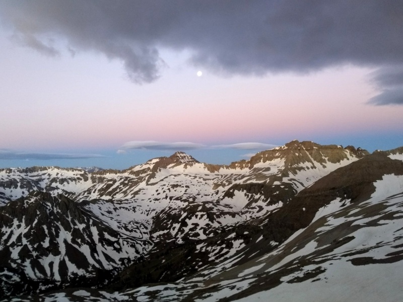
By degrees we assembled and eventually convoyed on Saturday afternoon to Yankee Boy Basin under now-cloudless skies promising a flash freeze of the snow overnight. At 3:30 AM we trudged up steep tundra slopes as low clouds briskly raked Sneffels to the west. To the south, the skies were clear and the waxing moon shone so brightly that headlamps became unnecessary.
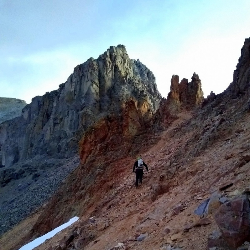
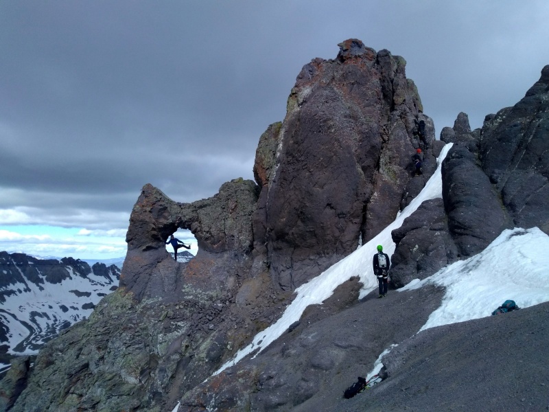
Upon reaching the Cirque-Teakettle saddle, we found it occupied by a junky spire offering only a sharp notch on either side for passage into the basin to the north. Though both options looked feasible, the left one appeared less involved. We set up a hand line to assist the 4th class step down to a snowfield that dropped steeply into the basin below. I was glad to leave behind the wind ripping through the notch as the sun's welcome first rays graced our party's descent.
We descended firm snow for around 500 feet and then contoured east to the apron beneath the broad north couloir. Except for a promising sunrise, the skies had remained locally overcast, and as we huddled shivering on the margins of the apron preparing to climb, the unrelenting wind loosed a volley of softball- to basketball-sized blocks from high in a tributary gully to our left, which hurtled by alarmingly close to our shelter.
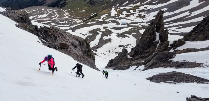
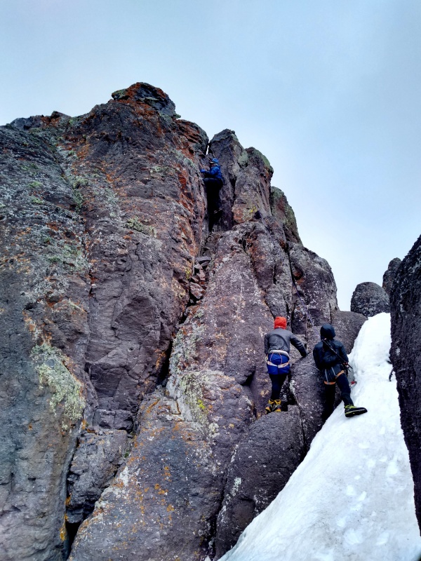
At this shot across the bow, we scurried up a hundred feet to distance ourselves from the garbage chute and began the climb in earnest, aiming slightly right for a prominent outcrop that might divert any further debris. The snow was in near-perfect condition, and thus without any material impediment to upward progress we battled only our own fitness. After a break on a shallow snow ledge nestled against the outcrop we continued up, staying to the right side of the couloir, towards a gap in the cliff band guarding the upper north face.
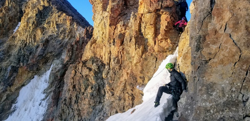
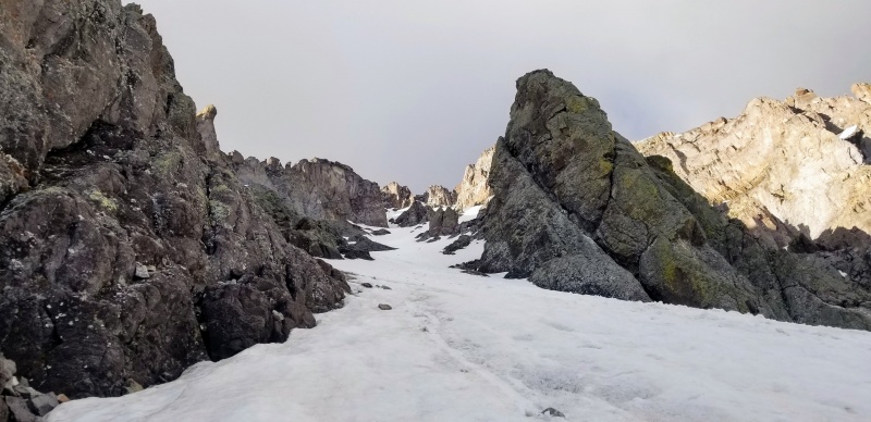
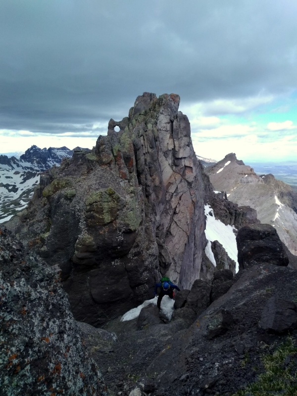
From a spacious platform below the gap, we proceeded up, moving through a steep curve to access the upper snowfield, which spans the length of the summit ridge and presents several options to top out. The far left side terminates in a ledge that appears to exit the north face by rounding the east end of the summit ridge; and directly above the gap are several notches and a finger of snow leading up. We bet on the obvious exit and punched our way up the final steep snowfield and chute, which deposited us in a notch on the ridge where the wind greeted us furiously.
An easy slope led down to mellow terrain south of the ridge and a five minute walk to the summit tower, where we hustled to set up a toprope. We likely established a record time for a party of five to ascend the pinnacle, rotating climbers onto the summit with a quickness motivated by the icy wind nipping at our heels. All perched on the summit, though perhaps none pleasantly. John's 99th centennial summit was well-climbed, and though he claims he would not have been disappointed to summit by a much easier route, we hope he enjoyed the route as much as we enjoyed his company.
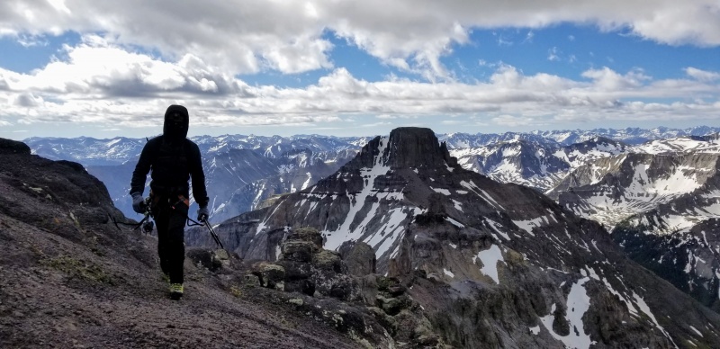
We descended east, passing through the black gully, where we decided to forego Coffeepot and instead surfed directly down the mud and scree below.
All photos Ryan unless otherwise noted.
Saturday weather: In case of flood climb to safety.
Sunday weather (photo: Kylie)
Saddle-obstructing pinnacle (photo: Kylie)
First light on Teakettle's west ridge
The gang descends the notch
Kylie downclimbs below the notch
View of descent from notch
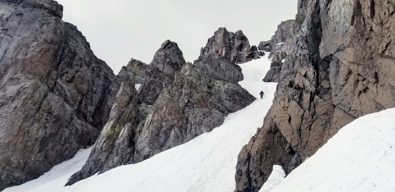
Looking up the route
The gang climbs the north face
John wields classic axes (photo: Kylie)
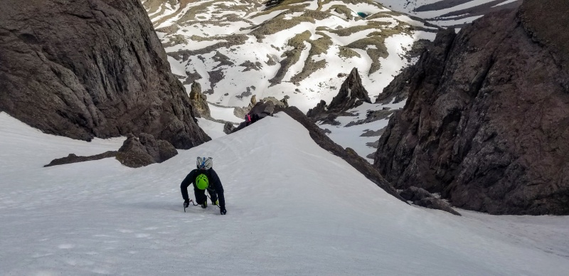
Kevin and Kylie ascend steeps
View of the topout through the gap. The left side here also goes.
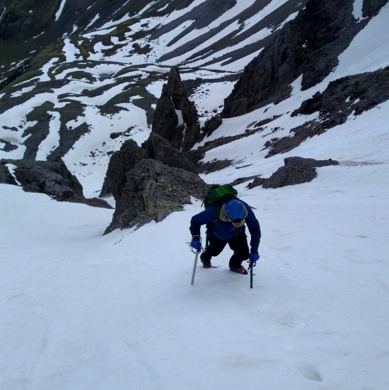
Kevin climbs the final slope
Kylie punches it to the ridge (photo: me)
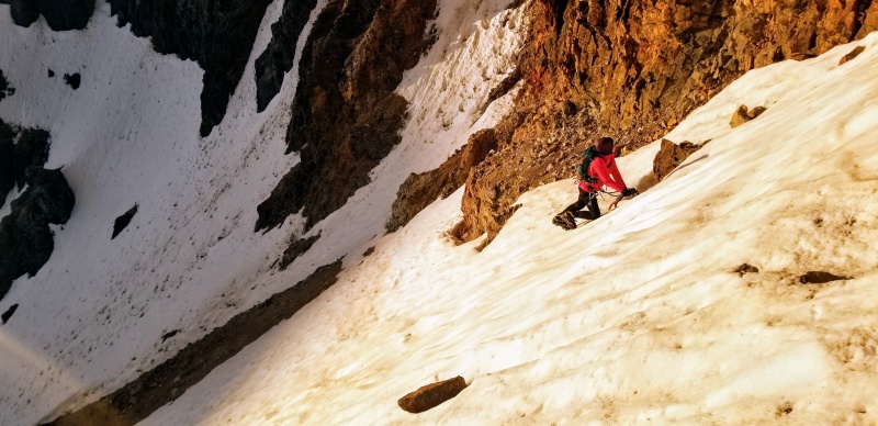
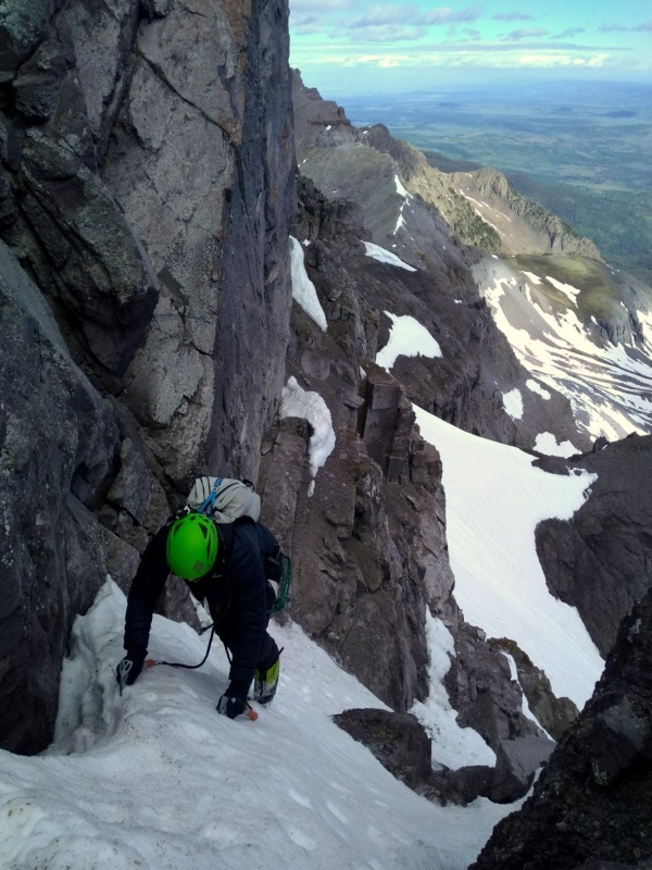
John climbs the final slope. Snow was poor through this section.
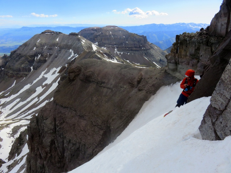
Ryan ponders (photo: me)
Kevin tops out (photo: Kylie)
John tops out (photo: Kylie)
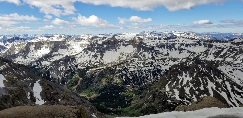
Views
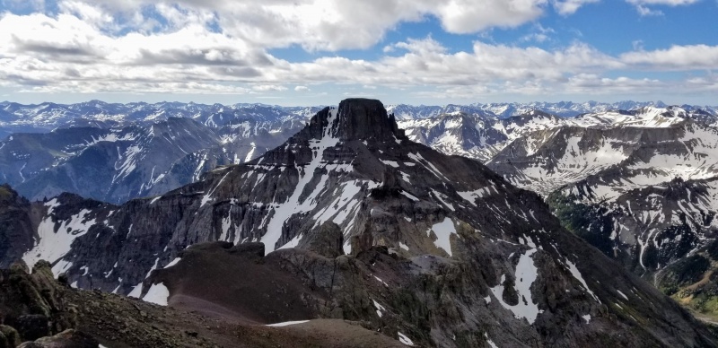
Potosi N face
The Punisher
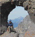
Summit activities (photo: Kylie)
John summits #99 (photo: Kylie)
Thumbnails for uploaded photos (click to open slideshow):
Thank you Michael, Kylie, Ryan and Kevin for an unforgettable route and trip up Teakettle. Like always great trip report and photos.
It was every bit as challenging as it looks. Perfect snow. 45 degrees 55 in places sometimes felt like 90 :)
I am blessed to be able to share time with you on such epic mountains.
Thanks again
John
@John, you're crushing it! Looking forward to Meeker, but I bet you've already set your sights higher (or, slightly lower).
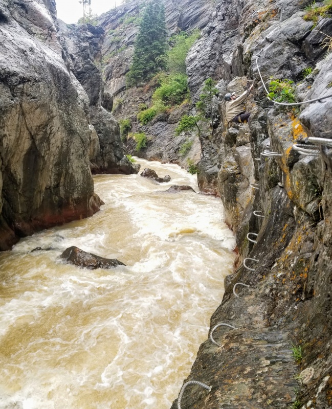
@Darin, the Ouray VF is fun. Ridiculously safe and bomber. There's a lot more climbing than on the Telluride VF but it does lack the sketchy exposure you get on that one, if adrenaline is your thing. When it's "open" (8a - 4p) the entrance is staffed by a local guide who will turn you back if you don't have the required equipment (pricey lanyard). It was suggested to us that poachers would not be prosecuted, so that's what we did (started at 7, finished in 1:15 at a casual pace). The max unarrested vertical is 15'.
Go John, go! Awesome to see you soo close and great way to get a classic peak! I'd love to join you on Meeker this summer if you have room in the party!
Nice to meet you this past week on the Taylor-Aetna ridge. Congrats on #99 of the Centennials - looks like an epic route. From the last photo it appears that you climbed the tower pitch w/o protection. We roped up for it. I am a few years younger than you but perhaps you are bolder :-)
I'd be open to joining you on #100 if you are inviting others. Let's stay in touch.
Mid September Centennial Finisher 6/22/2020 2:25pm
@ Darin Thank you, my son Tyler is getting married just below Longs September 19 so I think #100 around then
@Ryan I'd enjoy having you join us, I'll keep you posted
@Phil, No badass here. Everyone made the final pitch look like cake. It did not resemble that on my attempt?
I'd like to join up on some peaks and the finisher if you can.
Missed when you posted it a few days ago, glad I happened to notice it today. Looks like a fine day out there, and congrats on #99 John!
Caution: The information contained in this report may not be accurate and should not be the only resource used in preparation for your climb. Failure to have the necessary experience, physical conditioning, supplies or equipment can result in injury or death. 14ers.com and the author(s) of this report provide no warranties, either express or implied, that the information provided is accurate or reliable. By using the information provided, you agree to indemnify and hold harmless 14ers.com and the report author(s) with respect to any claims and demands against them, including any attorney fees and expenses. Please read the 14ers.com Safety and Disclaimer pages for more information.
Please respect private property: 14ers.com supports the rights of private landowners to determine how and by whom their land will be used. In Colorado, it is your responsibility to determine if land is private and to obtain the appropriate permission before entering the property.


")
")
")
")
")
")
")
")
")
")
")
")
")
")
")
")
")
")
")
")
")
")
")
")