Download Agreement, Release, and Acknowledgement of Risk:
You (the person requesting this file download) fully understand mountain climbing ("Activity") involves risks and dangers of serious bodily injury, including permanent disability, paralysis, and death ("Risks") and you fully accept and assume all such risks and all responsibility for losses, costs, and damages you incur as a result of your participation in this Activity.
You acknowledge that information in the file you have chosen to download may not be accurate and may contain errors. You agree to assume all risks when using this information and agree to release and discharge 14ers.com, 14ers Inc. and the author(s) of such information (collectively, the "Released Parties").
You hereby discharge the Released Parties from all damages, actions, claims and liabilities of any nature, specifically including, but not limited to, damages, actions, claims and liabilities arising from or related to the negligence of the Released Parties. You further agree to indemnify, hold harmless and defend 14ers.com, 14ers Inc. and each of the other Released Parties from and against any loss, damage, liability and expense, including costs and attorney fees, incurred by 14ers.com, 14ers Inc. or any of the other Released Parties as a result of you using information provided on the 14ers.com or 14ers Inc. websites.
You have read this agreement, fully understand its terms and intend it to be a complete and unconditional release of all liability to the greatest extent allowed by law and agree that if any portion of this agreement is held to be invalid the balance, notwithstanding, shall continue in full force and effect.
By clicking "OK" you agree to these terms. If you DO NOT agree, click "Cancel"...
After finishing the 14'ers last summer, I needed a new goal to set my sights on for 2020. Unfortunately I can only work on winter 14'ers 3 months a year:(. So I'm hereby declaring this the Centennial Summer.
This trip was the first time I went hiking since mid March, and life started moving towards normal and away from Covid 19 lockdown. I knew I'd be a little slow and rusty after a 2 month hiatus, so looked for something on the short and easy side. Camping at the Lily Lake trailhead fit the bill nicely, the Sangre's had a light year of snow so it would be mostly melted out, and I could knock out 2 centennials and stand atop a 14'er all in the same weekend.
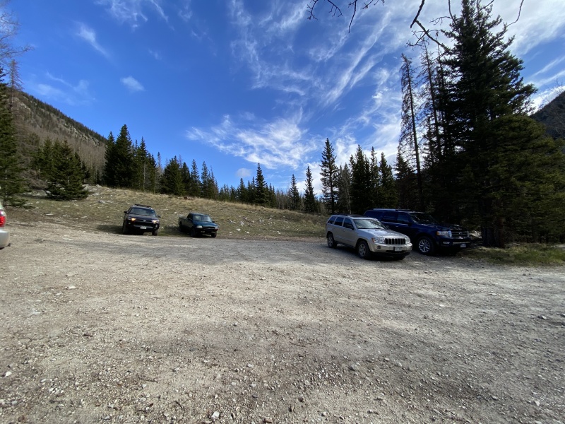
I arrived at the TH Friday afternoon early enough to find a great spot for my toaster, I was surprised how many vehicles were camping, as well as at the TH.
Met the guy in the 2wd Ford Ranger, told him I was impressed he made it all the way to the TH.
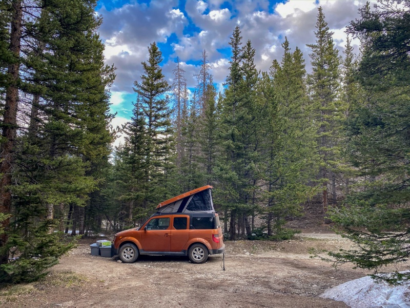
Scored a nice secluded spot for my toaster, only about a half mile from the TH.
No snow on the road at all. In 2019 I did Lindsey on first day of June and there were lots of impassable drifts, I had to park a few miles from the TH then.
Saturday's goal was to get Huerfano and Iron Nipple, I wasn't sure if I'd go after Lindsey as well, all depended on how I felt after the two 13'ers. Started up the road a little after 8. Met a couple of college age kids from California that were going after Lindsey. I wore my winter boots, figured I'd likely encounter some snow at some point. Took my axe and micro spikes as well, though wouldn't end up using them.
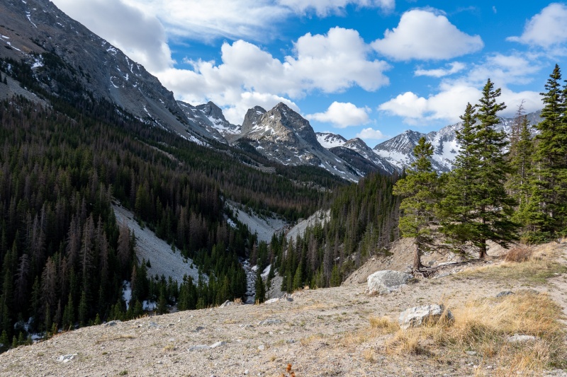
View from the road
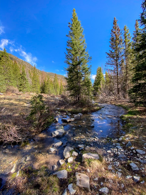
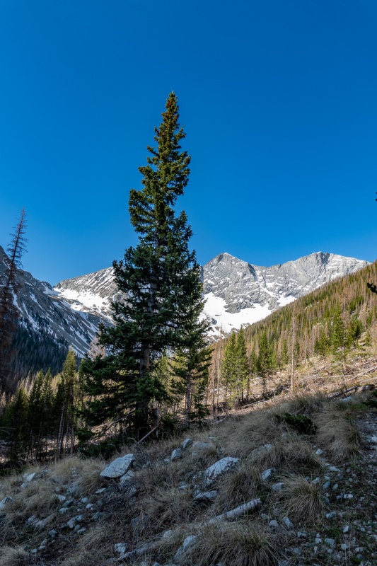
First part of the trail is pretty straightforward, and no snow kept things moving along.
First stream crossing.
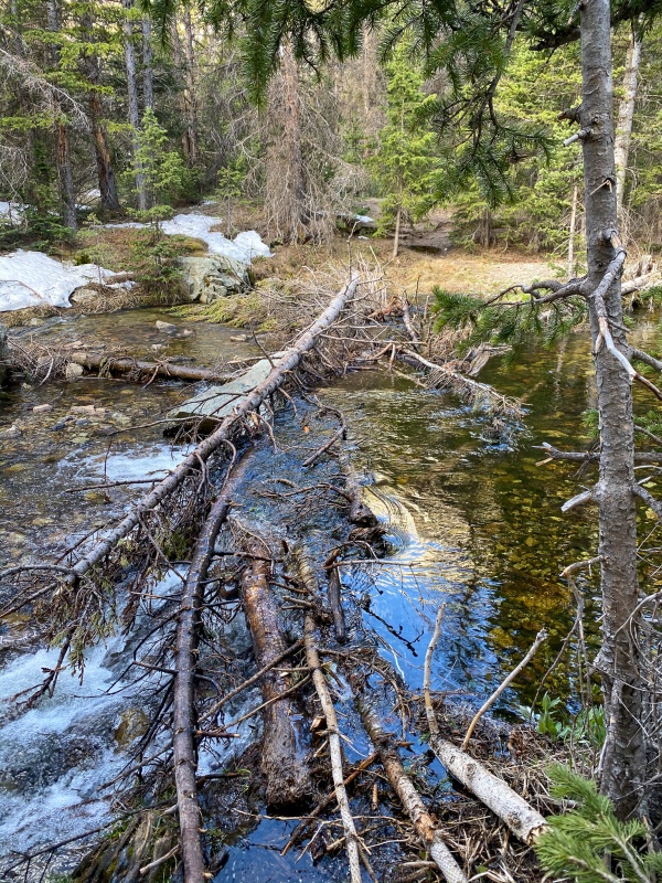
Second stream crossing was a little more challenging.
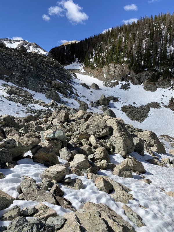
Trail was a little harder to follow through this avalanche field.
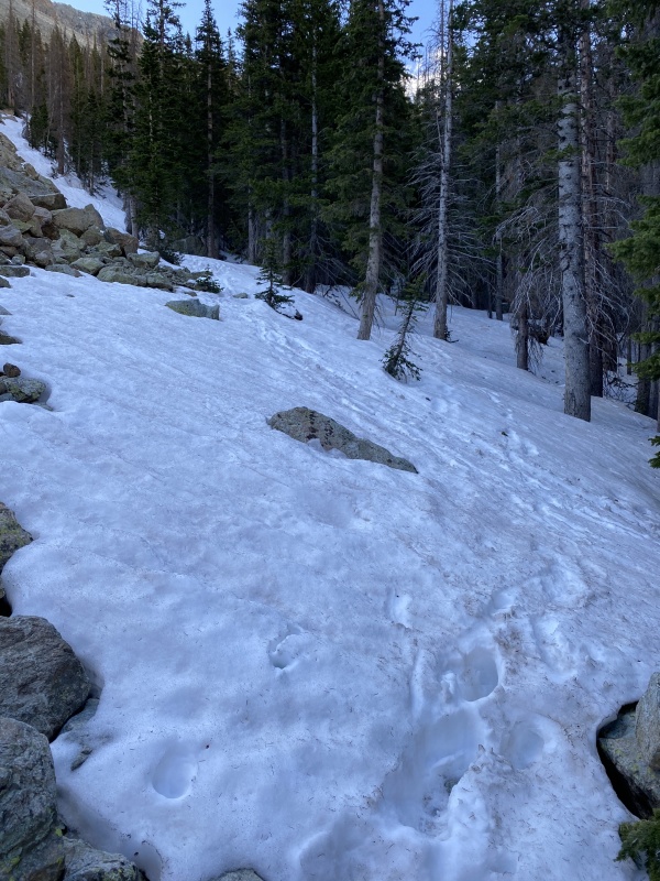
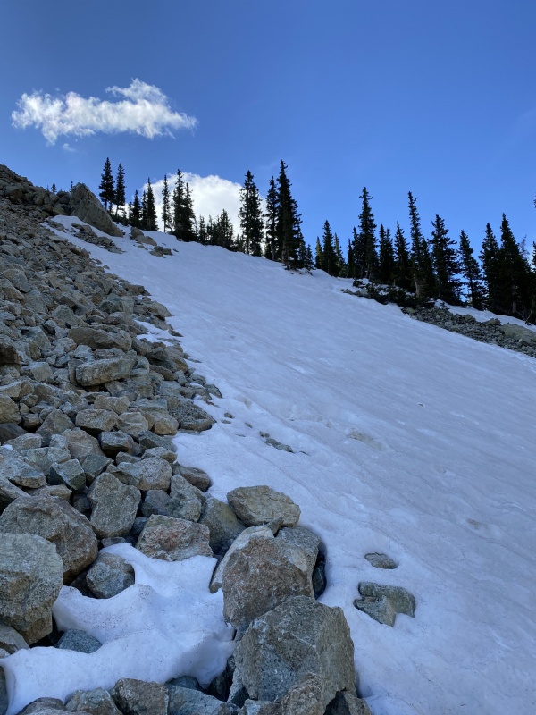
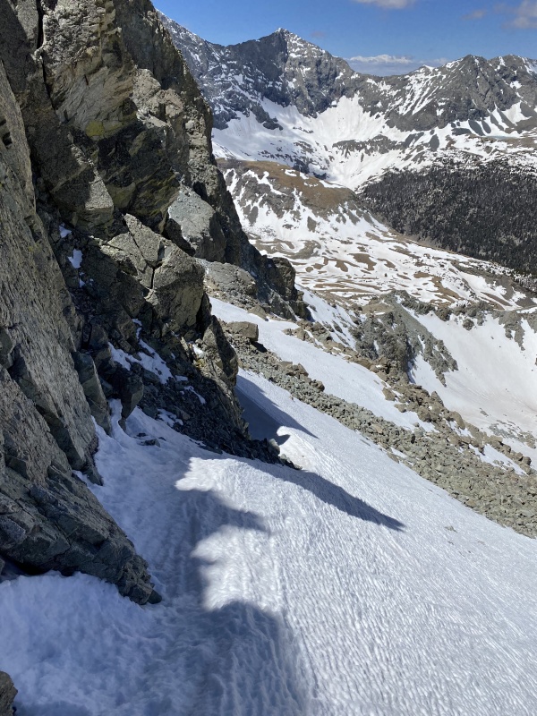
The trail follows the river/stream/creek/whatever you want to call it, then bares left to begin gaining elevation. This is the first area that had some patchy snow. Mostly avoidable, or had nice packed footsteps through it.
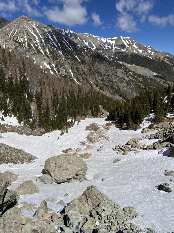
Initially I followed the traditional Lindsey route through some snowy sections.
Broke left here to avoid snow, had a little bit of scree, but mostly easy talus hopping.
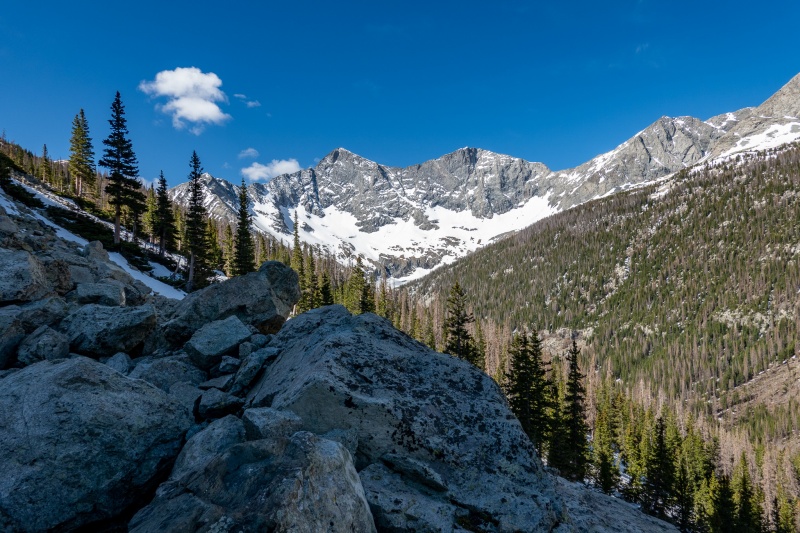
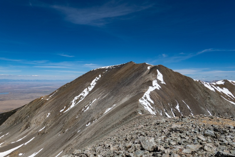
Nearing the top of the talus field. Blanca and Ellingwood off in the distance.
Going just above the snow filled gullies.
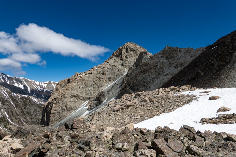
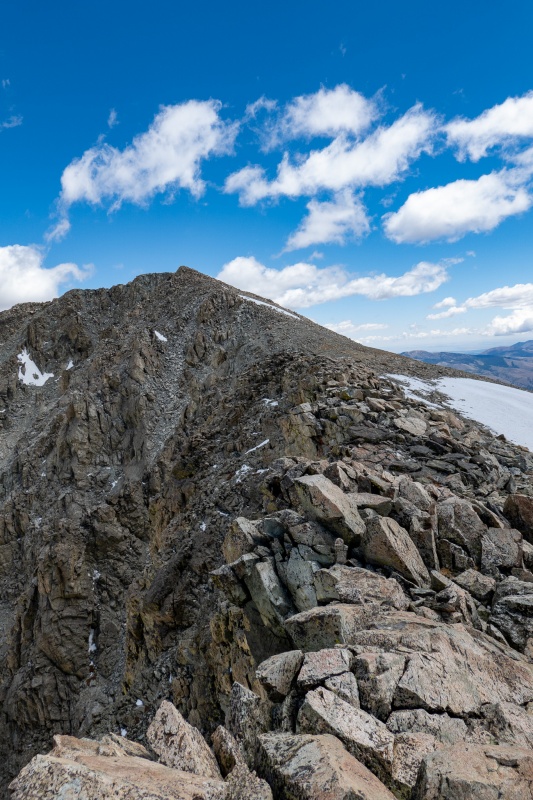
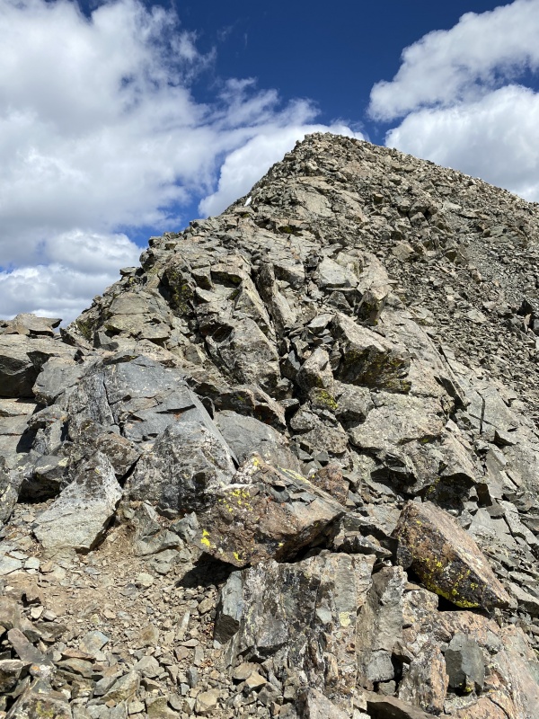
Looking north from top of talus field. I'm not finding anything on the peak.
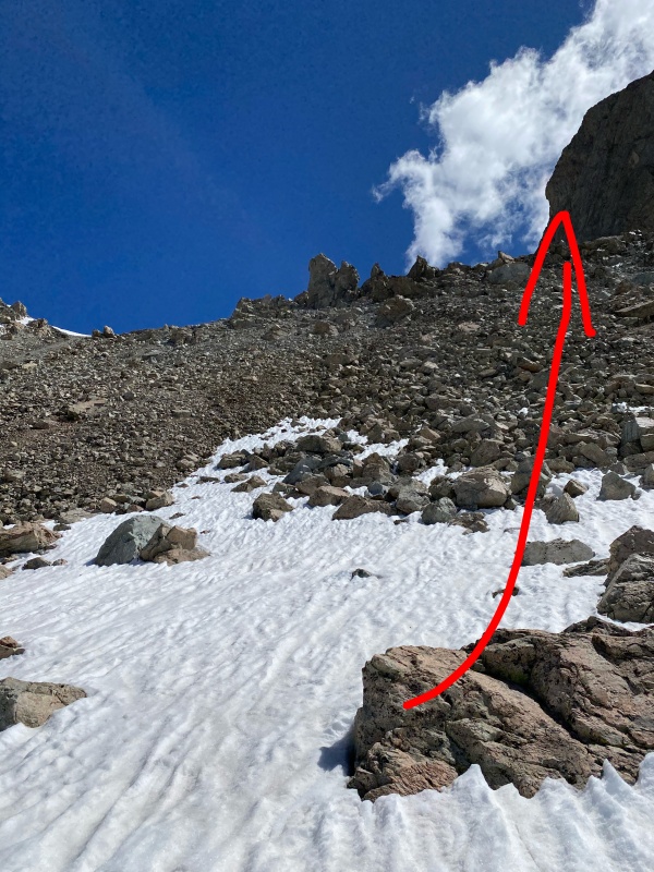
The top of the gulley on Lindsey's standard route.
Looking down gully on Lindsey's standard route.
As I made my way to rejoin Lindsey’s standard route, which had been my plan, I came across a boulder field that looked like a shortcut. Normally I don't look for shortcuts, and have even occasionally been known to look for ways to add distance to my hikes. Decided to give it a go. Looked like it would cut out some snowfield action as well.
"Shortcut"
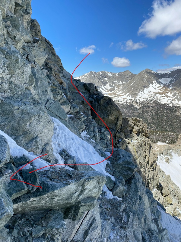
I'm not the greatest navigator around, and rely on Google Maps and GPX files pretty regularly. I'm not sure I could have climbed some of the peaks I've done without GPX files leading me, particularly in winter. My basic rule of thumb for safety/risk has always been "don't climb up something you aren't willing to climb down, and don't climb down something you aren't willing to climb up", basically always giving me the option to backtrack. It has worked pretty well for me so far. My shortcut put me crossing along the north side of Iron Nipple, which had some challenge to it.
Starting around Iron Nipple's north side.
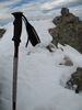
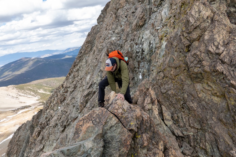
The down climb here was spicy.
Some pretty challenging moves getting around the nipple's south side, and some decent exposure to boot. Not what I had planned for the day, but I wasn't going to backtrack. Really, the worst that could happen is I could fall and endure a painful death, right?
Continuing on North side of Iron Nipple.
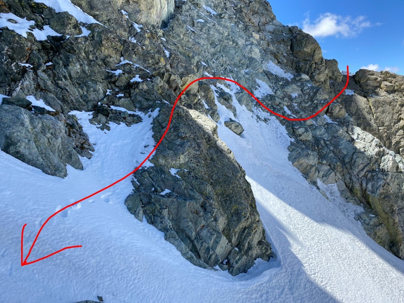
Past the sketchy stuff, now looking towards Huerfano.
Looking back, Ellingwood in the distance.
Felt some relief after getting to the other side of the nipple, and now Huerfano was in sight.
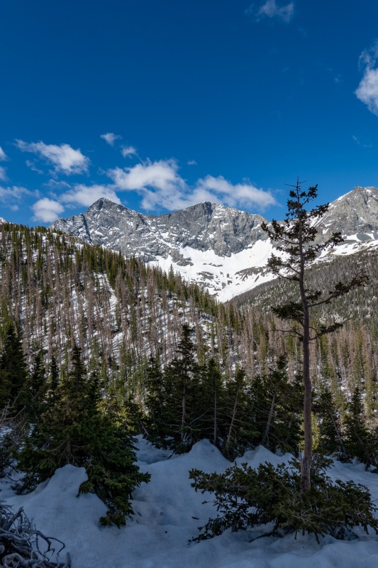
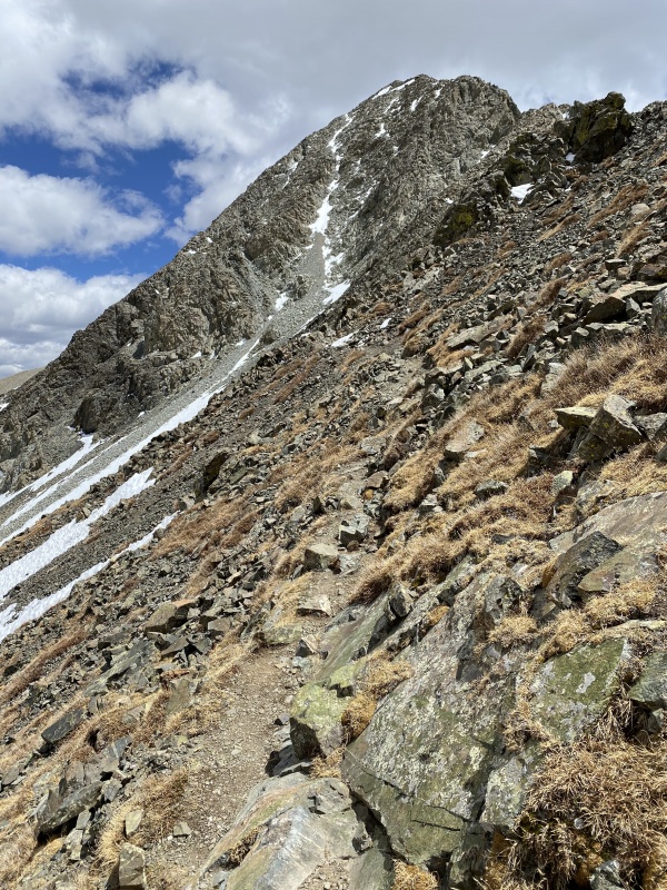
Ridge from Iron Nipple to Huerfano.
From here the route to Huerfano is pretty straightforward. No shortcuts necessary.
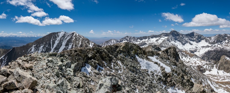
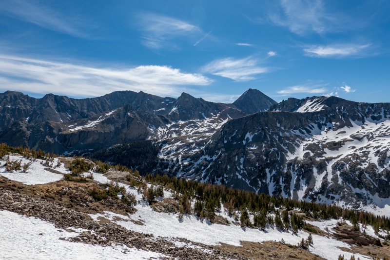
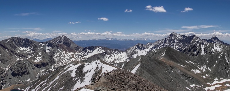
From the top of Huerfano. Left to right, Lindsey, Blanca, Ellingwood.
Zoomed in on Iron Nipple, Blanca and Ellingwood.
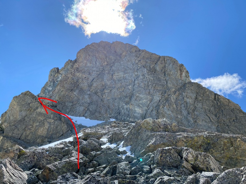
Departed Huerfano, next planned stop was Iron Nipple. Pretty straightforward to summit the nipple, just a little class 2ish fun.
From Huerfano to Iron Nipple.
After summitting Iron Nipple, was feeling pretty good, so decided to get Lindsey. This would be my first time climbing Lindsey without meaningful snow.
Just below Iron Nipple.
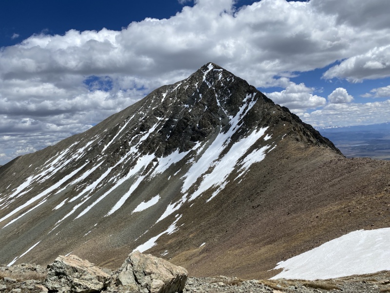
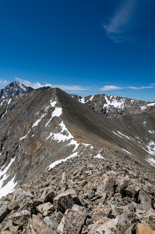
Was looking forward to Lindsey's ridge, its great low risk fun.
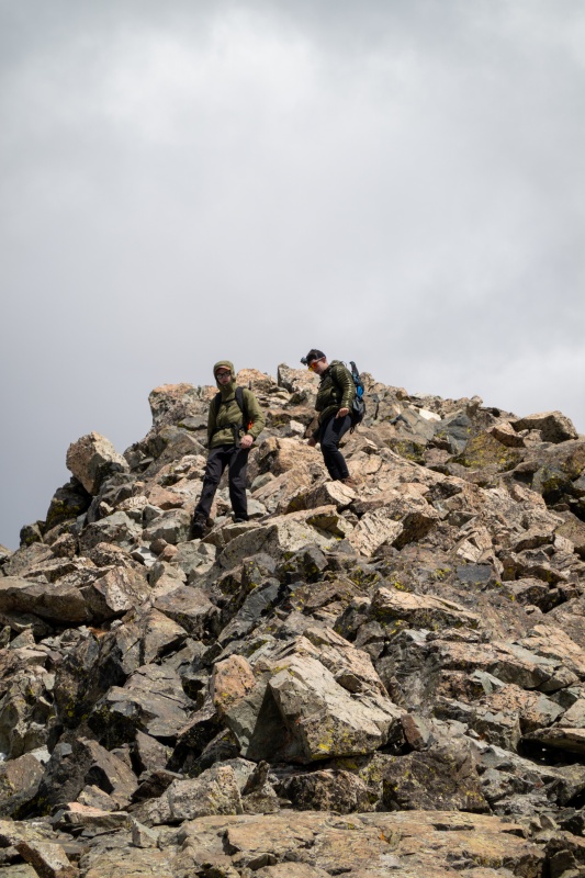
As I started up Lindsey I didn't realize I was on the trail leading towards the gully rather than the ridge. Just before I realized that I needed to get up to gain the ridge, I ran into the 2 California kids. They literally had no idea how to reach Lindsey's summit. No map, no GPX file, no set of awesomely helpful pictures from 14ers.com. They let me pass and followed me. We made a hard right turn and went straight up to the ridge. When we got halfway up to the ridge, one of them asks me "how do you feel about down climbing this?". I told them there would be tougher sections ahead, and worried just a bit that these kids might be in over their heads. They continued to follow me. They had each done 1 14'er in California, I don't recall which one. Told them Lindsey was an odd choice for newbies to this.
Lindsey's ridge. So much fun.
Looking down the steepest part of the ridge.
Reached Lindsey's summit without issue, with California kids in tow. I'm a little faster than average, and slowed down a little to make sure my newfound partners could see my route/moves. They didn't slow me down as much as I expected.
Top of Lindsey
Descending Lindsey was pretty straightforward, I took a few shots of my impromptu hiking partners on the way down to send to them later.
Just past the notch.
They were a little slower on the down than the up, but I waited until we passed the notch to leave them in my dust, there isn't anything beyond that point that is very dangerous. I followed Lindsey's standard route back to camp. College kids passed by about an hour later, so know they got down okay.
The next day I woke up and headed to California Peak. I'm not sure why, but I had in my head that this was going to be a much shorter hike than the previous day's.
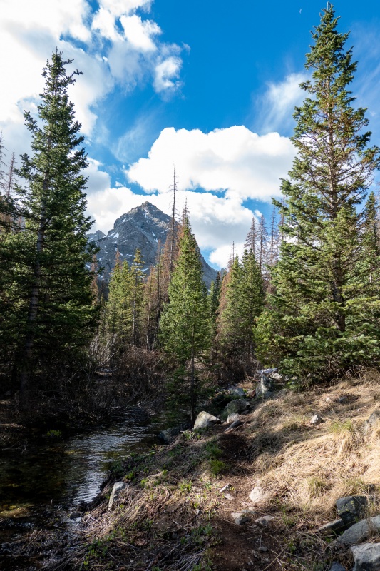
The trail starts on same track to Lindsey, then breaks right just before the big creek/stream/river/whatever crossing. Was glad I didn't have to cross it again.
Getting to Lily lake had some routefinding challenges, there was a lot more snow to get around, and in some cases had to go straight through. My winter boots weren't completely dried out from previous day so I wore my summer boots, so just dealt with wet feet most of the day.
Just a little avy damage on the Lily lake trail.
Nearing treeline, and Lily lake.
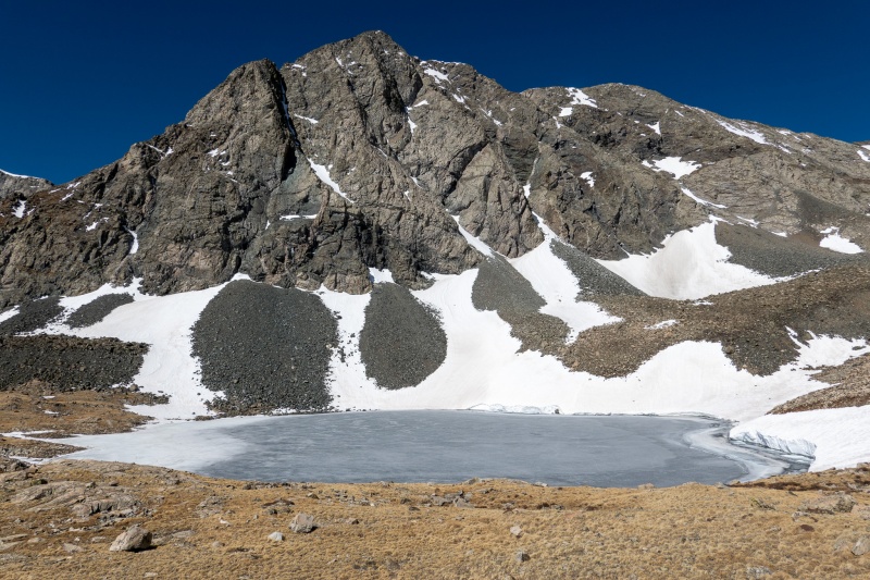
Lily Lake
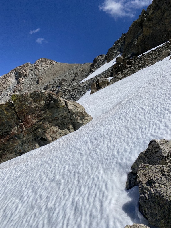
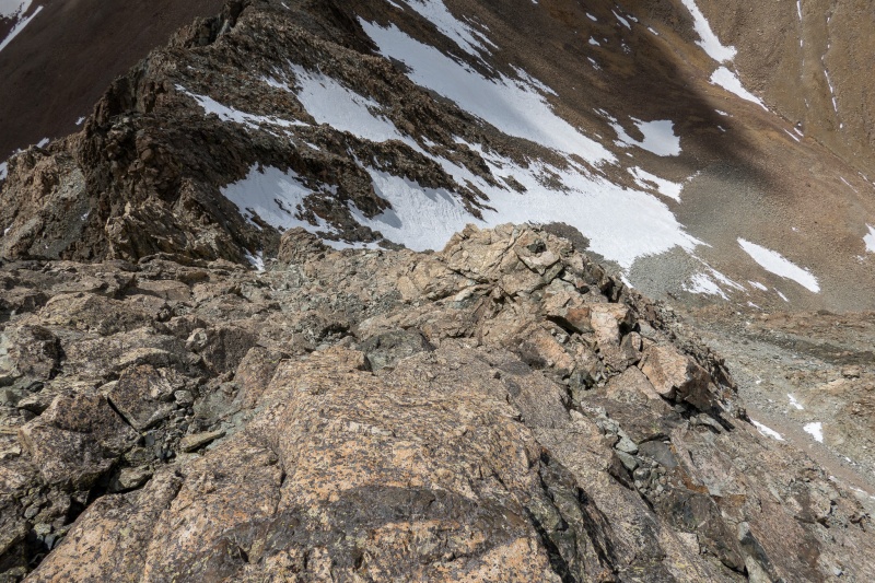
After reaching Lily lake, there really isn't so much of a trail to California, but I had a GPX route just to be safe, even though its really pretty straightforward. From Lily lake there is a nasty slope of scree and loose rocks of various sizes. It just kinda sucks. Oh how I dreamed of being on the 2,800 ft. of greatness while ascending this. I'm naming this section the 1,100 ft of shittiness. I don't know if its 1,100 ft, but it felt like it.
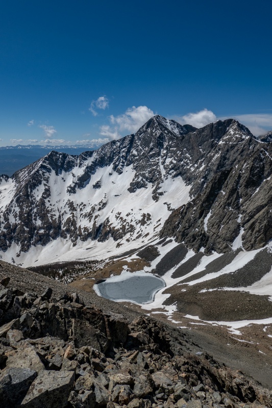
Lily lake from the 1,100 FOS.
Nearing the top of the 1,100 FOS. Seriously, it's not a good time.
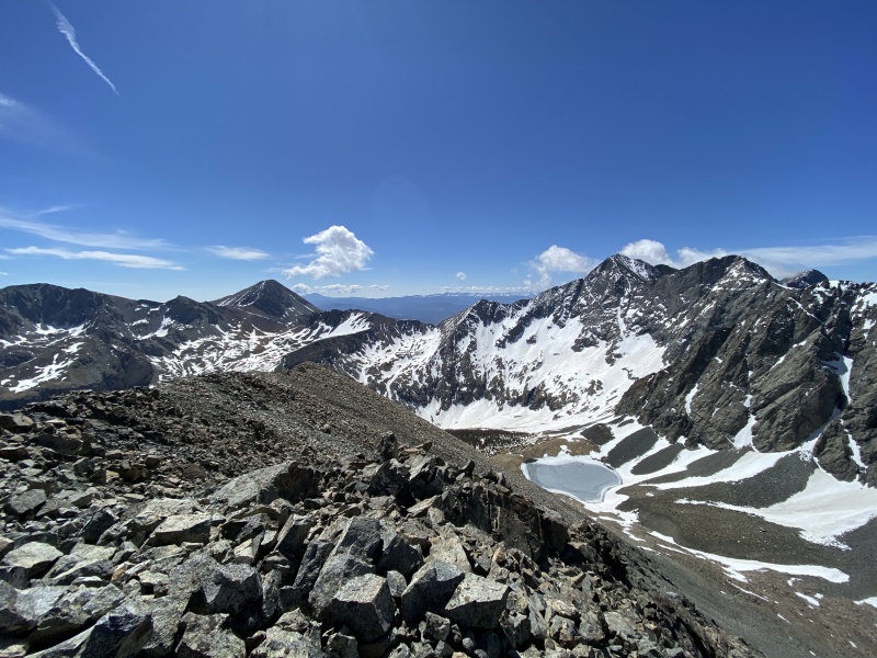
After getting to the top of the 1,100 FOS, just a few ups and downs along easy ridges to reach my objective. First was 13,660 A.
Wide angle shot from top of 13,660. iPhone 11 FTW.
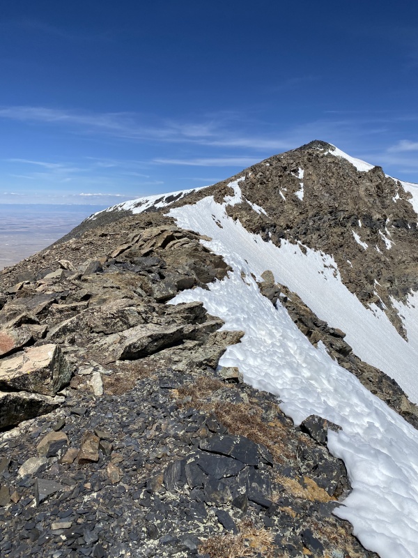
Next, I followed the ridge to 13,577.
From 13,577, California Peak is finally in sight.
Looking back from 13,577 to 13,660.
Following the ridges to California is super easy and straightforward, and no snow to navigate.
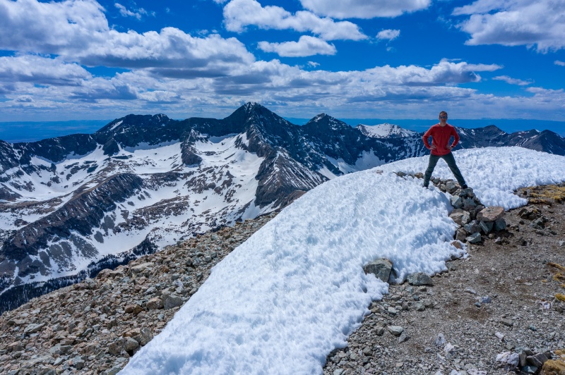
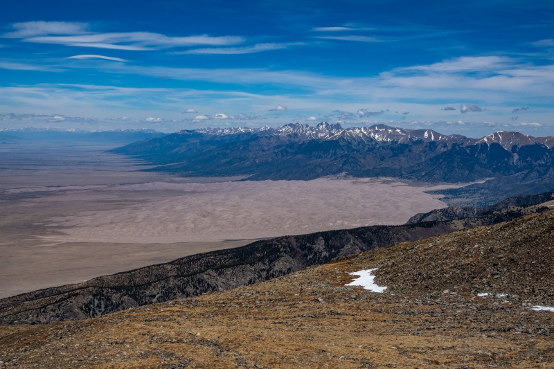
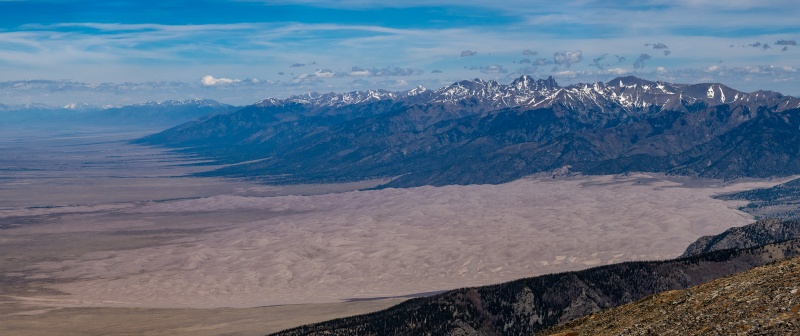
I was not prepared for the incredible views of the Great Sand Dunes that California provides. This was my favorite moment of the weekend.
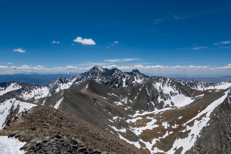
Blanca, Ellingwood and Little Bear from California Peak.
Playing with zoom/pano.
The return was pretty easy, other than descending the 1,100 FOS, which sucked even more than the ascent. Great weekend.
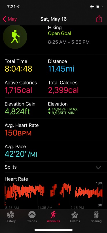
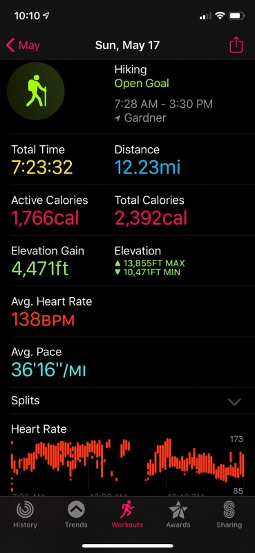
Huerfano/Nipple/Lindsey stats
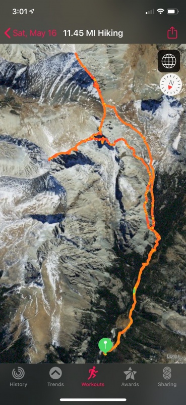
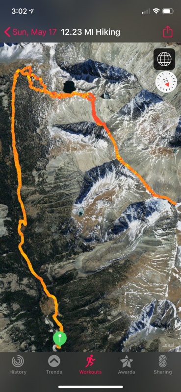
Huerfano/Nipple/Lindsey GPS track
California/13,660/13,577 stats. Longer distance than expected.
California/13,660/13,577 GPS track.
Thanks for reading.
Thumbnails for uploaded photos (click to open slideshow):
Looking at your GPS track for California, I think you are confusing which summit was which, and you didn't actually climb 13660A. What you are calling 13660A is appears to be 13577, your 13577 is an unranked point 13420, and the real 13660A is up on the top-right by the compass point. 660A is not on a straight-ish line between California and Lily Lake, but rather a spur to the west.
That said, still sounds like a great trip. I was up on California a week later and also loved the views of the Sand Dunes and the rest of the Blanca group. An underrated summit for sure.
Will, I'll go back to get 13,660 with ya. But only if you want to join me for a stupid loop that nets 13,550, Huerfano, Iron Nipple, Lindsey, Northwest Lindsey, Huerfanito, 12,915, 13,577, and California along with it, all one shot. Two days there is one day too many.
Went looking for beta on grabbing the iron nipple and recalled you did it recently. Thanks for a fabulous trip report, it looks like a great day!
Caution: The information contained in this report may not be accurate and should not be the only resource used in preparation for your climb. Failure to have the necessary experience, physical conditioning, supplies or equipment can result in injury or death. 14ers.com and the author(s) of this report provide no warranties, either express or implied, that the information provided is accurate or reliable. By using the information provided, you agree to indemnify and hold harmless 14ers.com and the report author(s) with respect to any claims and demands against them, including any attorney fees and expenses. Please read the 14ers.com Safety and Disclaimer pages for more information.
Please respect private property: 14ers.com supports the rights of private landowners to determine how and by whom their land will be used. In Colorado, it is your responsibility to determine if land is private and to obtain the appropriate permission before entering the property.


")
")
")
")
")
")
")
")
")
")
")
")
")
")
")
")
")
")
")
")
")
")
")
")
")
")
")
")
")
")
")
")
")
")
")
")
")
")
")
")
")
")
")
")
")
")
")
")
")
")