Download Agreement, Release, and Acknowledgement of Risk:
You (the person requesting this file download) fully understand mountain climbing ("Activity") involves risks and dangers of serious bodily injury, including permanent disability, paralysis, and death ("Risks") and you fully accept and assume all such risks and all responsibility for losses, costs, and damages you incur as a result of your participation in this Activity.
You acknowledge that information in the file you have chosen to download may not be accurate and may contain errors. You agree to assume all risks when using this information and agree to release and discharge 14ers.com, 14ers Inc. and the author(s) of such information (collectively, the "Released Parties").
You hereby discharge the Released Parties from all damages, actions, claims and liabilities of any nature, specifically including, but not limited to, damages, actions, claims and liabilities arising from or related to the negligence of the Released Parties. You further agree to indemnify, hold harmless and defend 14ers.com, 14ers Inc. and each of the other Released Parties from and against any loss, damage, liability and expense, including costs and attorney fees, incurred by 14ers.com, 14ers Inc. or any of the other Released Parties as a result of you using information provided on the 14ers.com or 14ers Inc. websites.
You have read this agreement, fully understand its terms and intend it to be a complete and unconditional release of all liability to the greatest extent allowed by law and agree that if any portion of this agreement is held to be invalid the balance, notwithstanding, shall continue in full force and effect.
By clicking "OK" you agree to these terms. If you DO NOT agree, click "Cancel"...
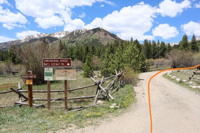
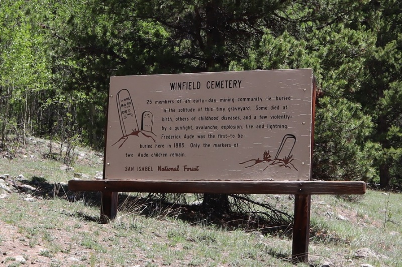
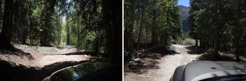
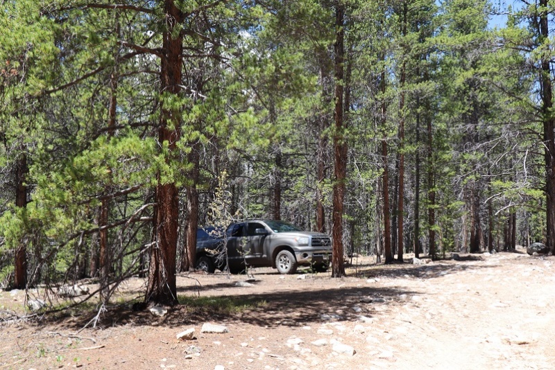
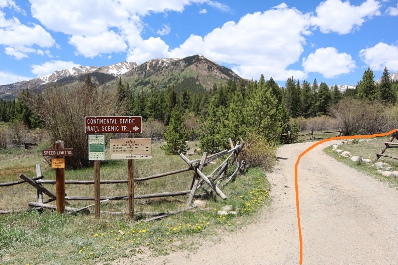
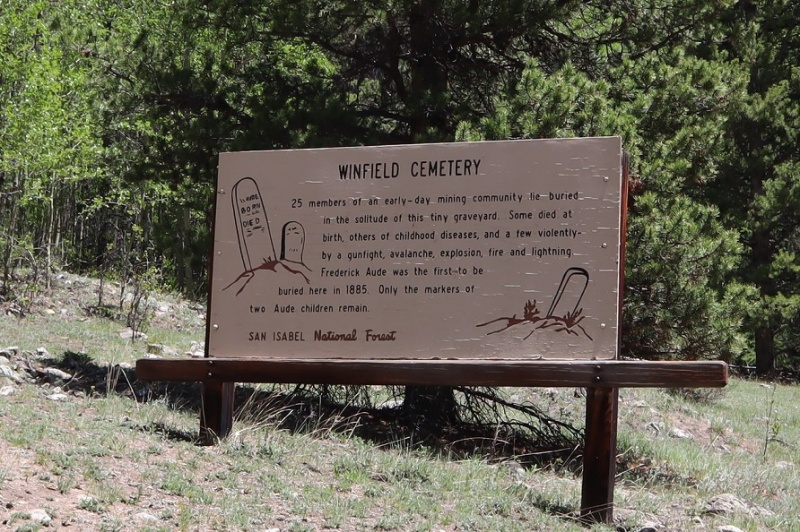
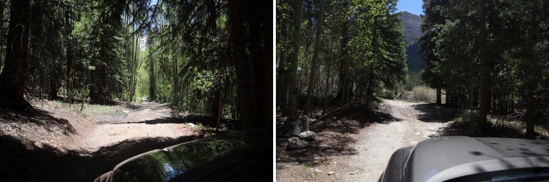
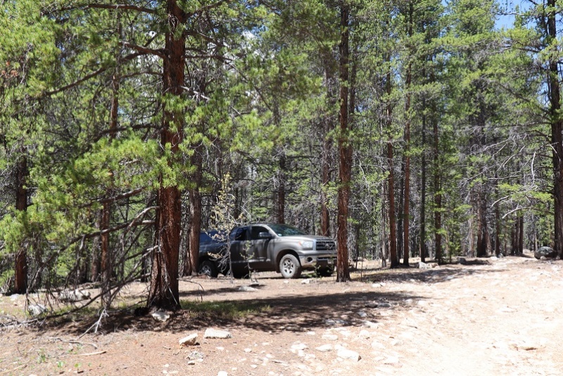
There’s currently a curfew in place in Colorado Springs, so the beginning of the drive felt a bit ominous: I didn’t see any other vehicles on the road until I made it to the freeway, and even then there were very few vehicles compared to normal, even for 1am, and even when compared to being quarantined. I’d stopped for gas the day before so I didn’t need to stop at all this morning. With less people out I felt like I saw more wildlife: 4 foxes and a dozen or so elk. I made it to Winfield around 4am and decided to take the easy 4WD dirt road a little further, past the cemetery to some dispersed camping spots .85 of a mile from Winfield. You can park at Winfield and it won’t add more than 2 miles to this hike.
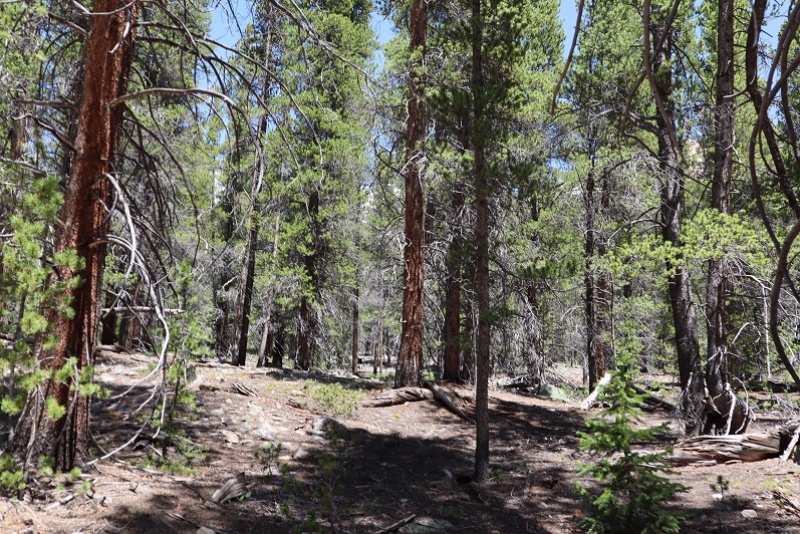
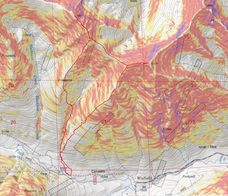
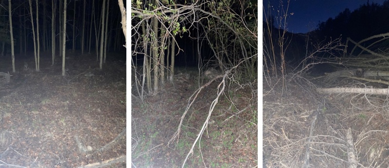
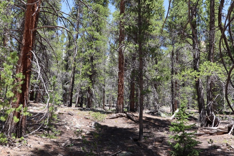
Looking at a topo map, I wanted to follow Grey Copper Creek to begin. After finding a dispersed parking spot I headed northwest in the dark, following game trails, zig-zagging in what felt like I was in a horror movie until I hit the creek. The creek was easy to find because there’s been a recent avalanche in the area. This also made the creek easy to follow (after initially climbing over some downed trees).
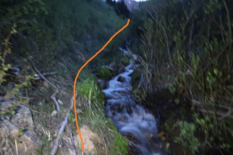
I crossed the creek and stayed on the west side, startling a porcupine as I went. There are new game trails starting here that parallel the creek.
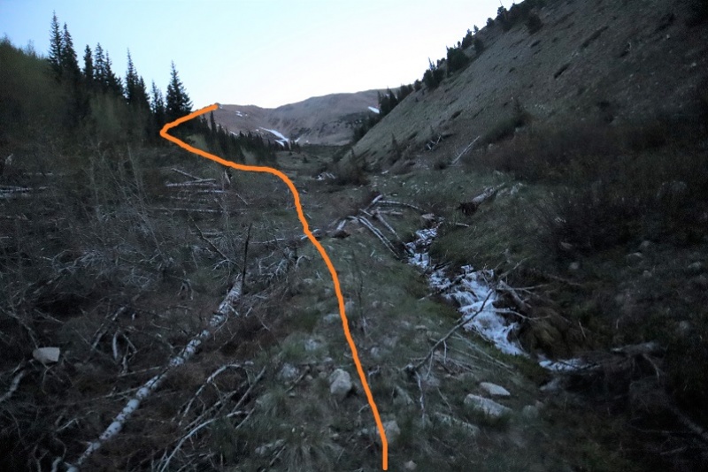
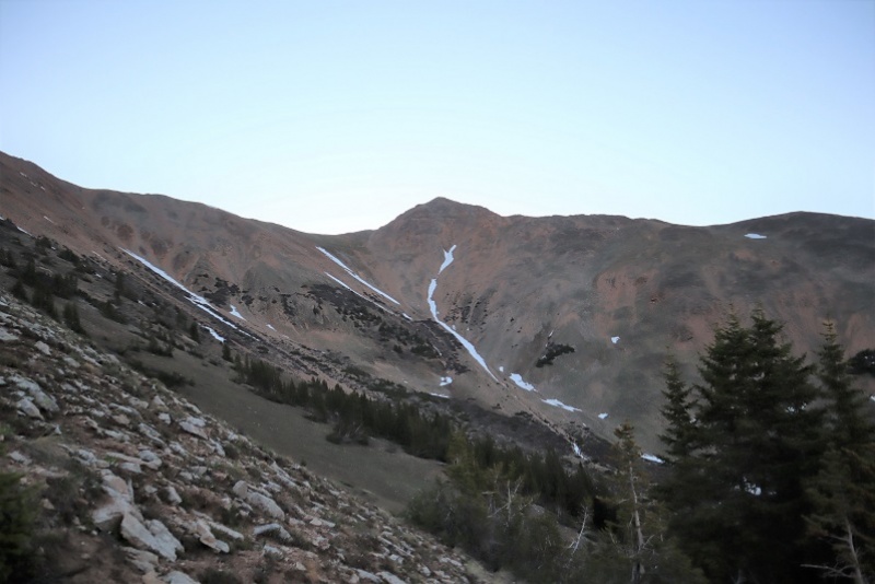
There are a few ways to summit Mt Blaurock: You can follow the creek until it ends and continue climbing until you make it to the Blaurock/Ervin saddle, or gain the south ridge and follow that route. There was still some snow in the gully so I decided to take the south ridge route.
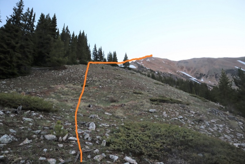
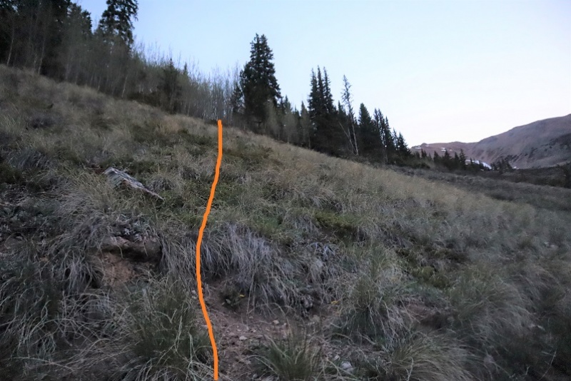
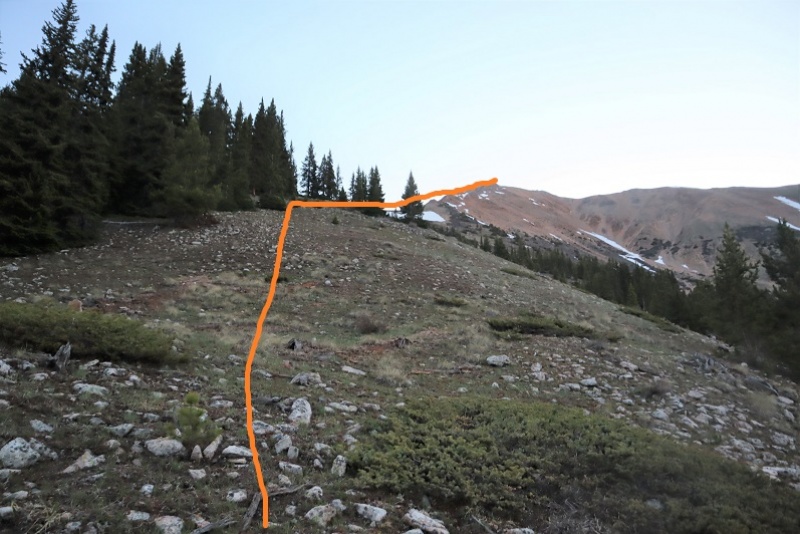
There is no special point to gain the south ridge. I turned and headed west after a little over a mile of hiking, aiming for the ridge
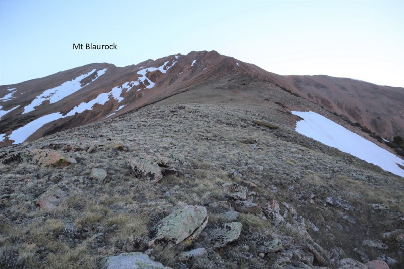
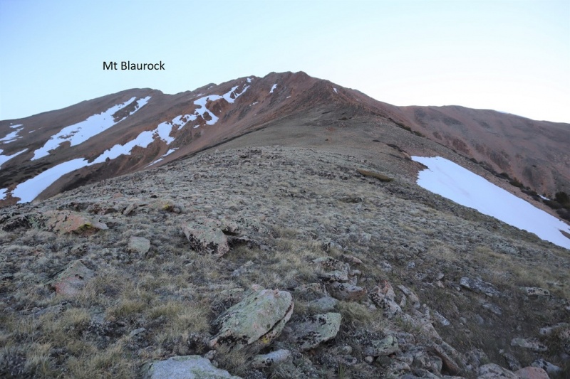
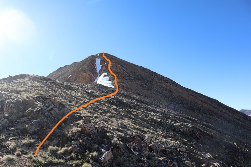
From treeline it was easy to see the route, following the ridge northeast
The first part of the ridge is an easy stroll on tundra
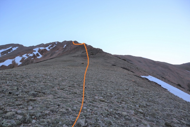
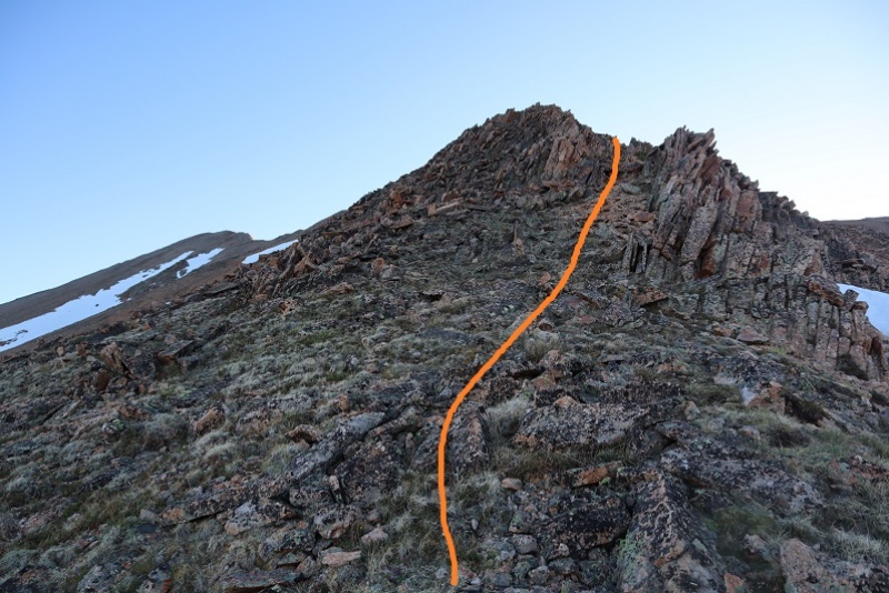
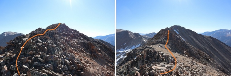
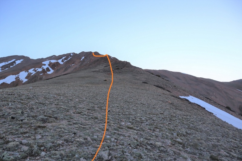
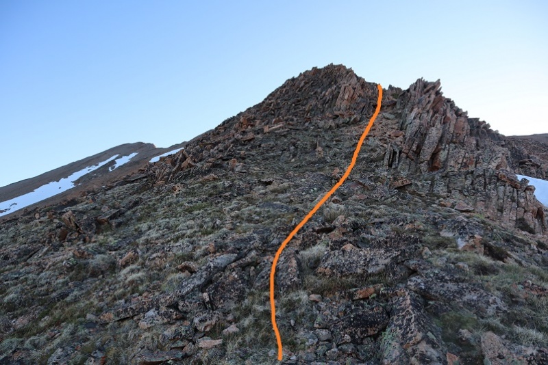
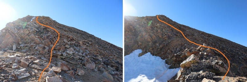
Once the tundra ended the loose rock began and didn’t quit until the hike was almost over and I was back at the avy area. I’d call it rotten rubble, or choss most of the way. I rounded the first bump in the ridge to the left, climbed straight over the second, and then took a gully up to the top. There is some loose rock here.
Here’s a look back down to this point
Turning left (northwest) I dipped down to the left a few times to avoid snow and unnecessary ridge crossings
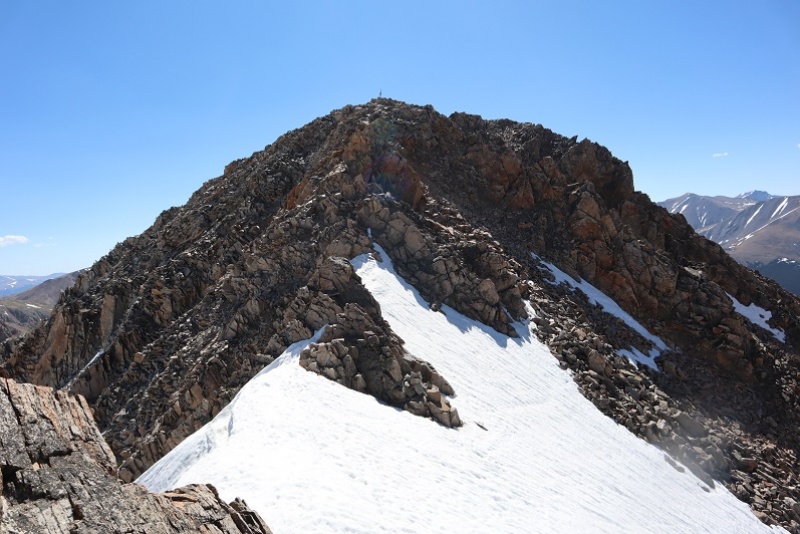
Of course, the summit is the furthest ‘hump’ on the ridge
I followed a small, rock filled gully to the summit
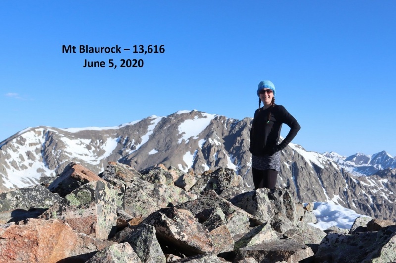
I summited Mt Blaurock at 7:30am
Mt Blaurock Summit:
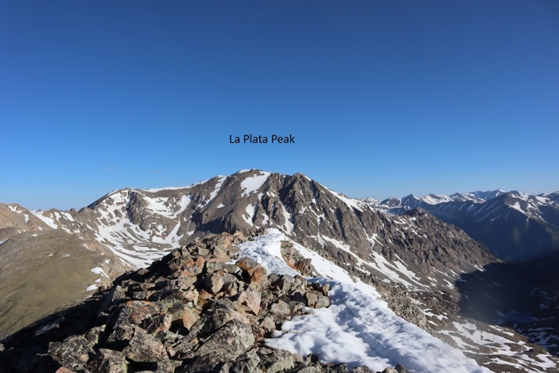
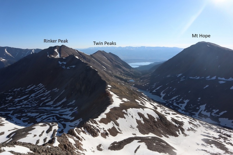
There are some great views of surrounding peaks, a few of which I visited last week;
I headed back over the ridge on the same path I took in:
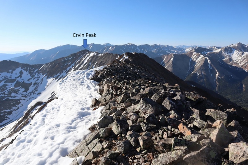
Here’s looking down at the traverse between Blaurock and Ervin Peak. The hike down to the saddle from Blaurock is easy
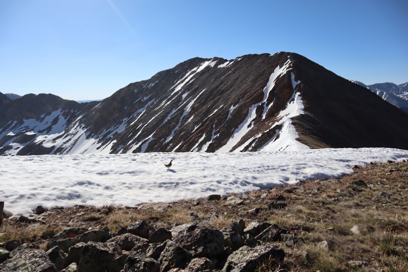
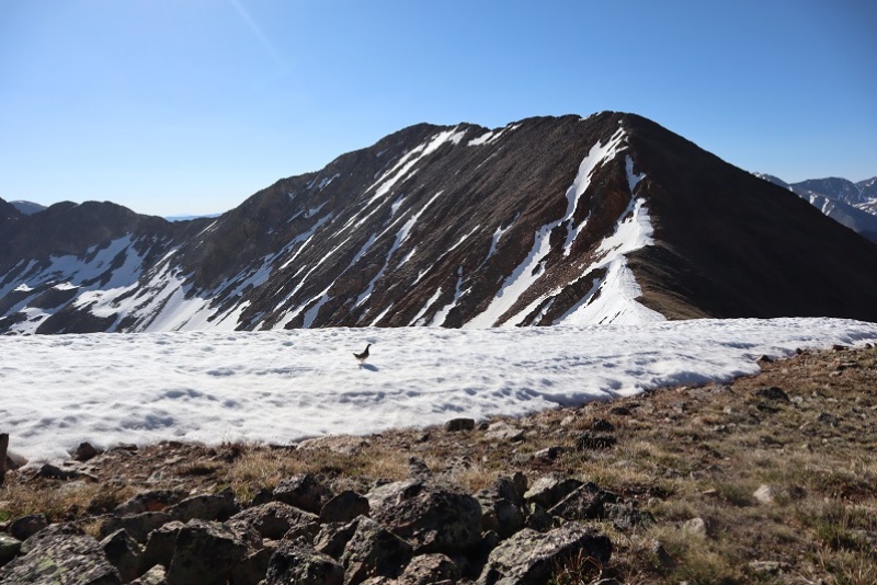
I met a nice ptarmigan along the way
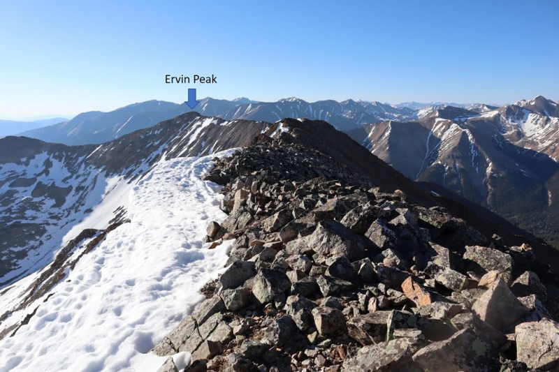
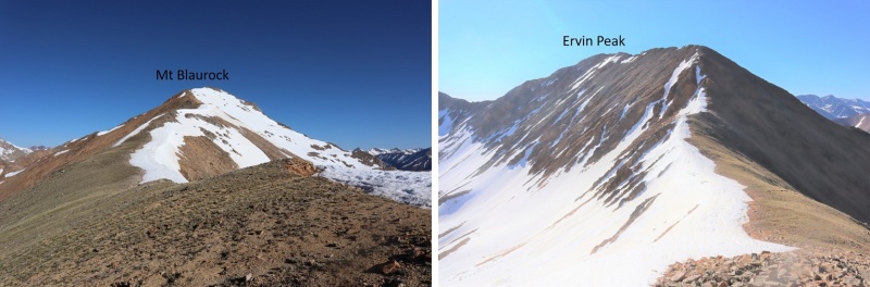
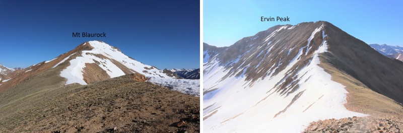
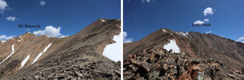
Here’s a look from the saddle of the ridge to Blaurock and Ervin
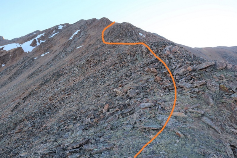
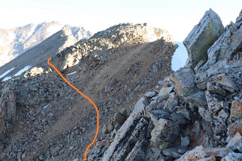
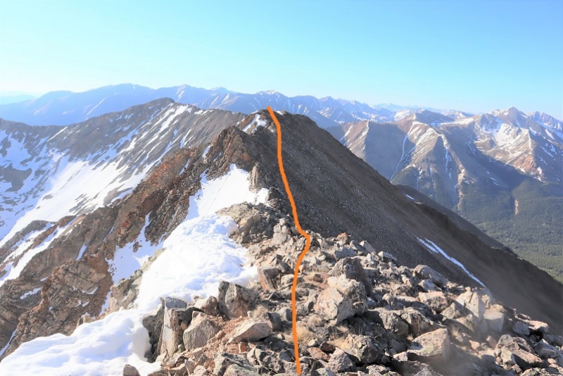
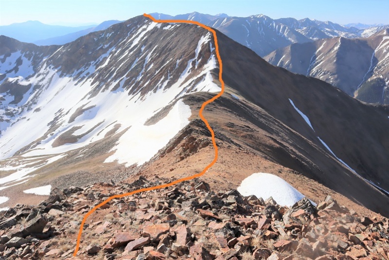
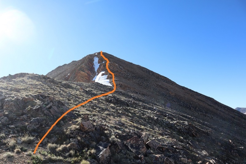
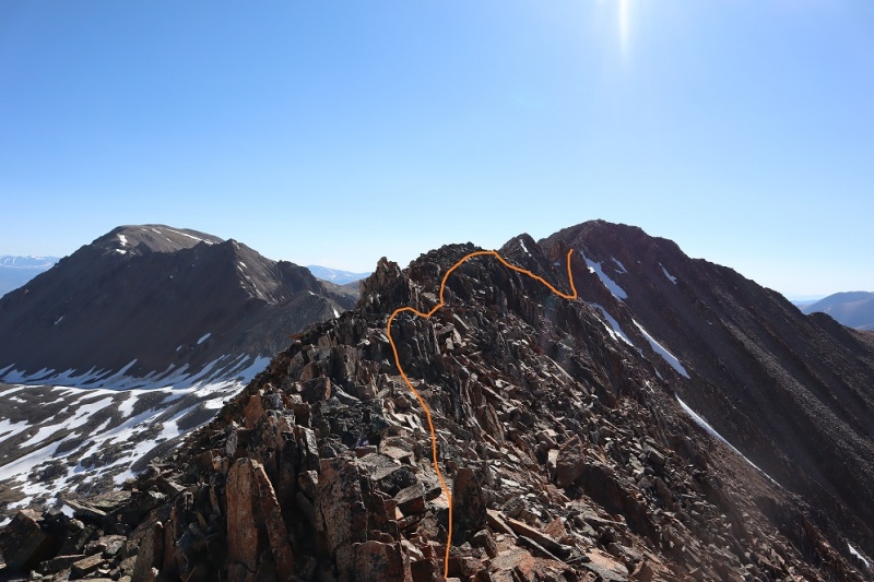
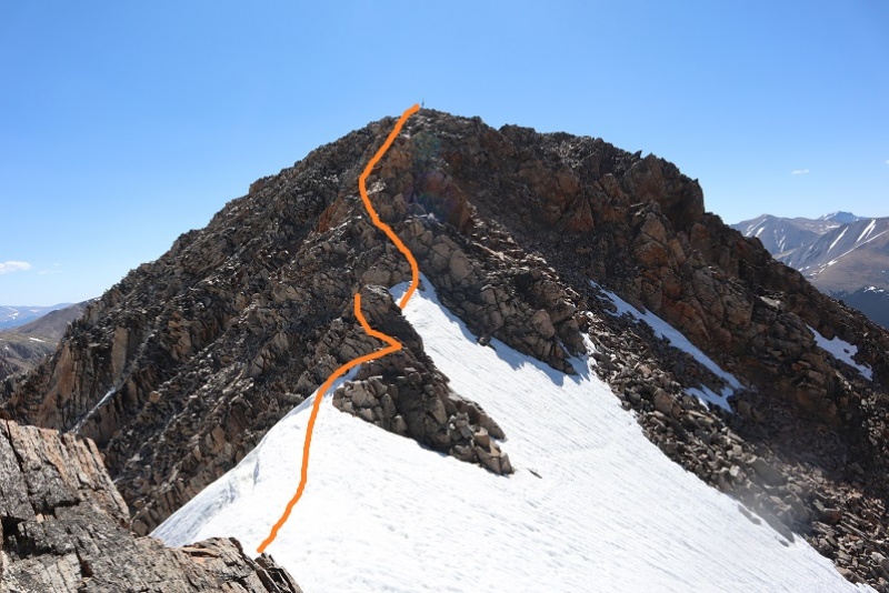
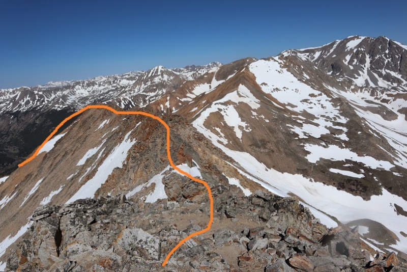
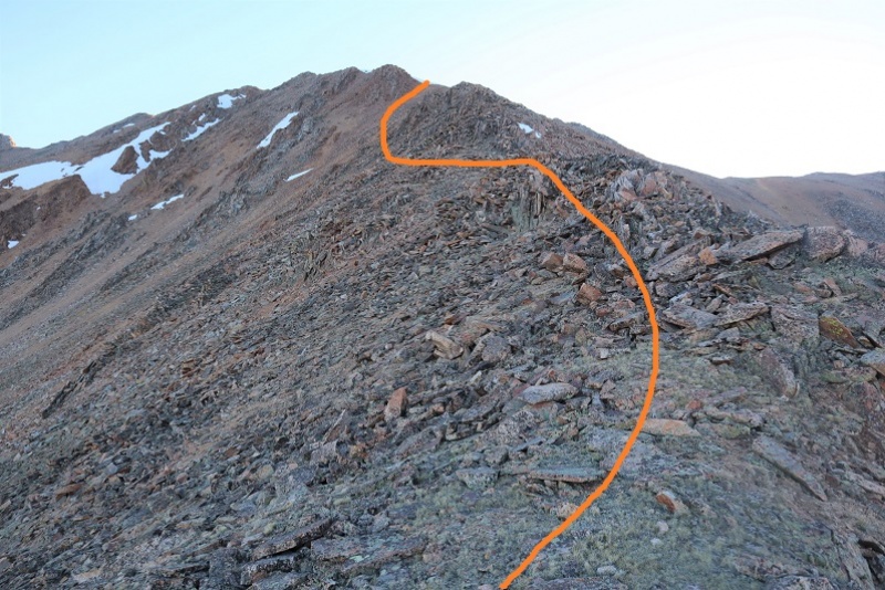
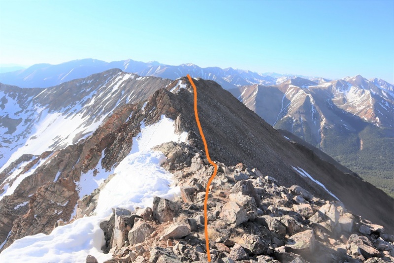
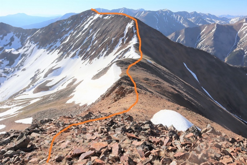
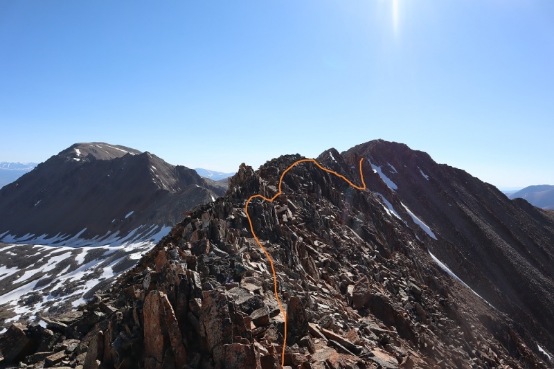
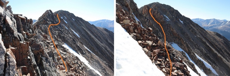
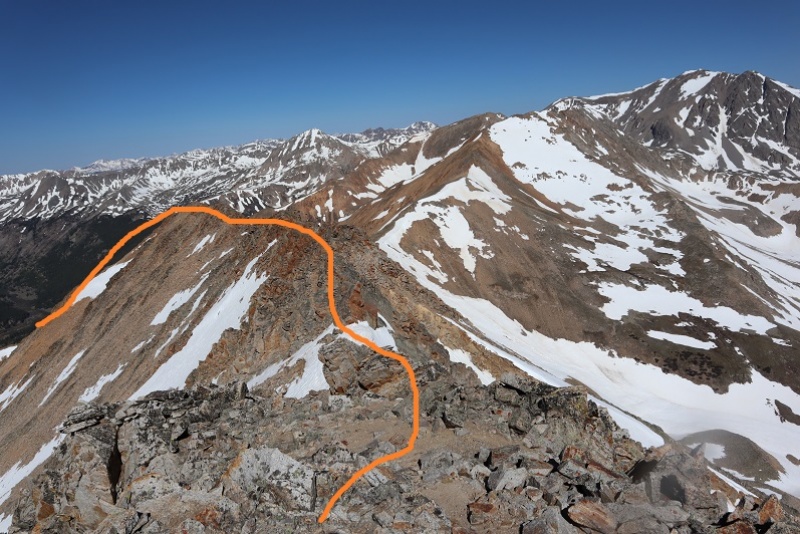
This is where it gets tricky. Here’s the route I took to avoid the snow:
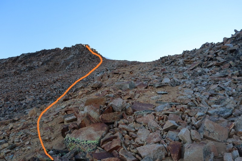
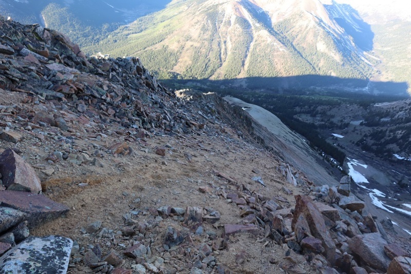
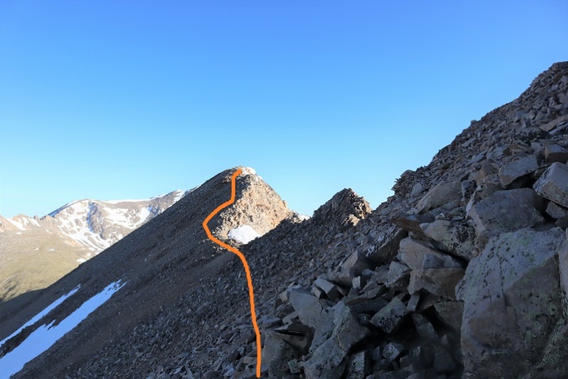
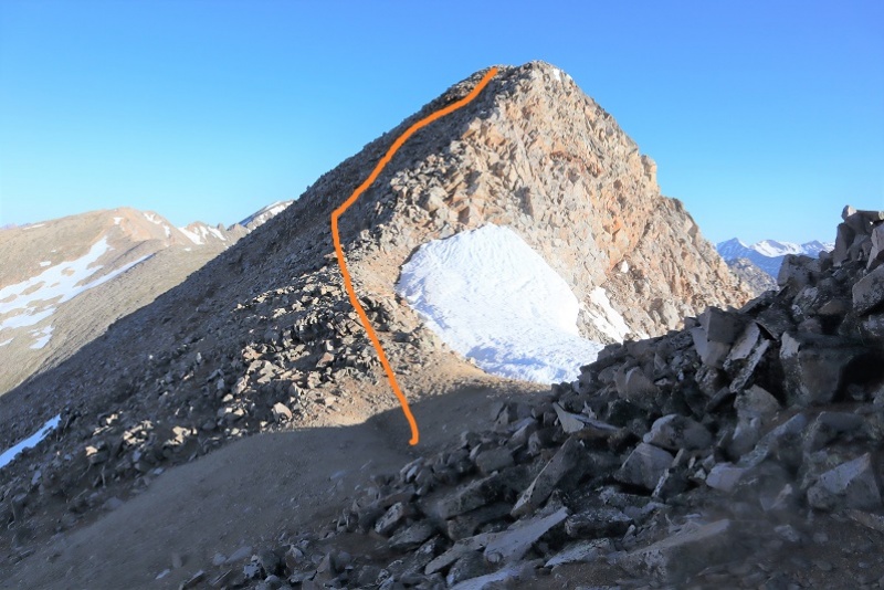
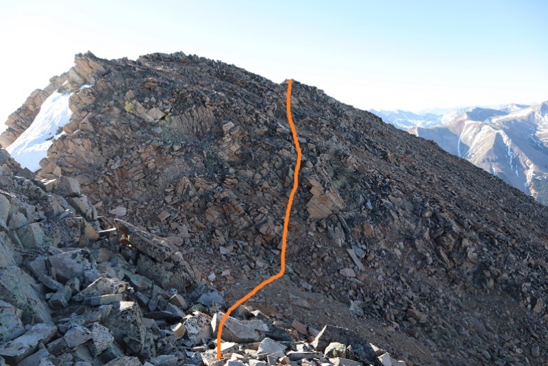
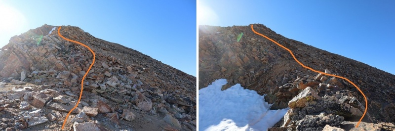
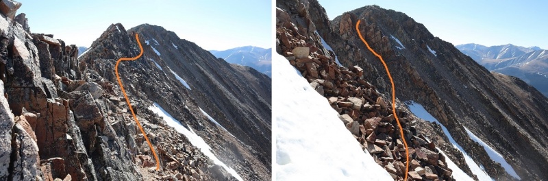
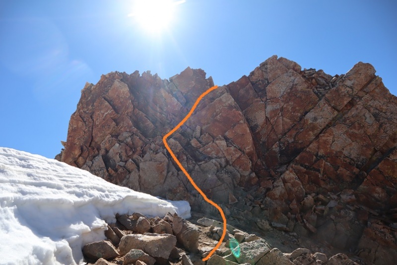
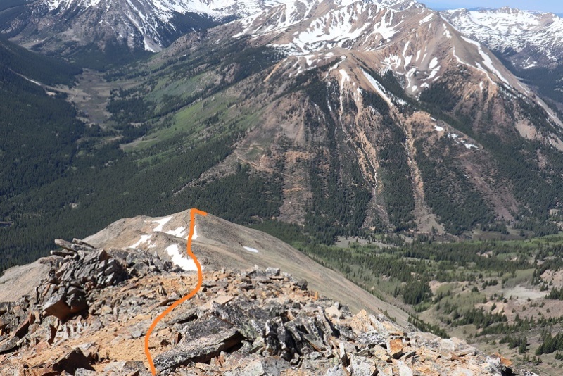
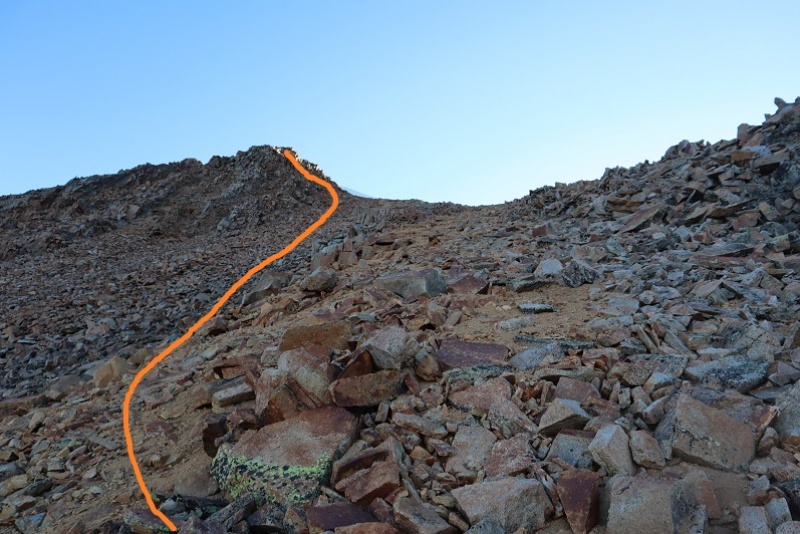
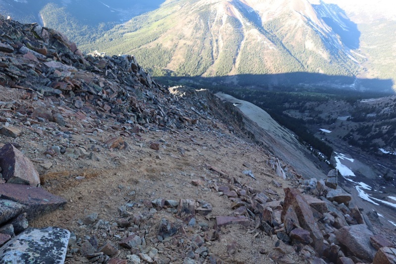
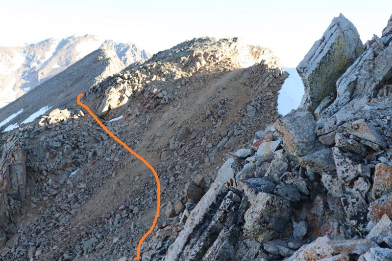
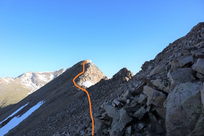
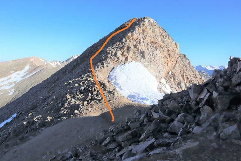
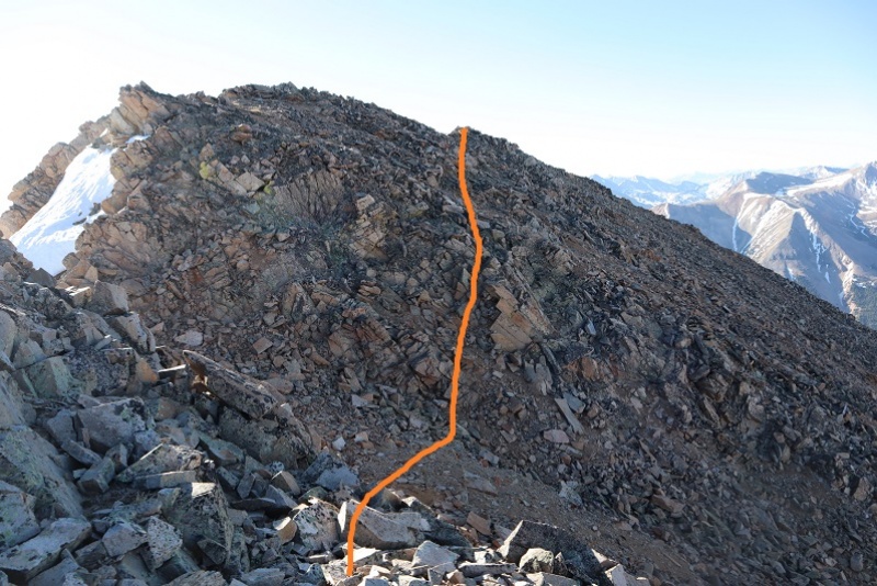
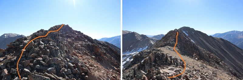
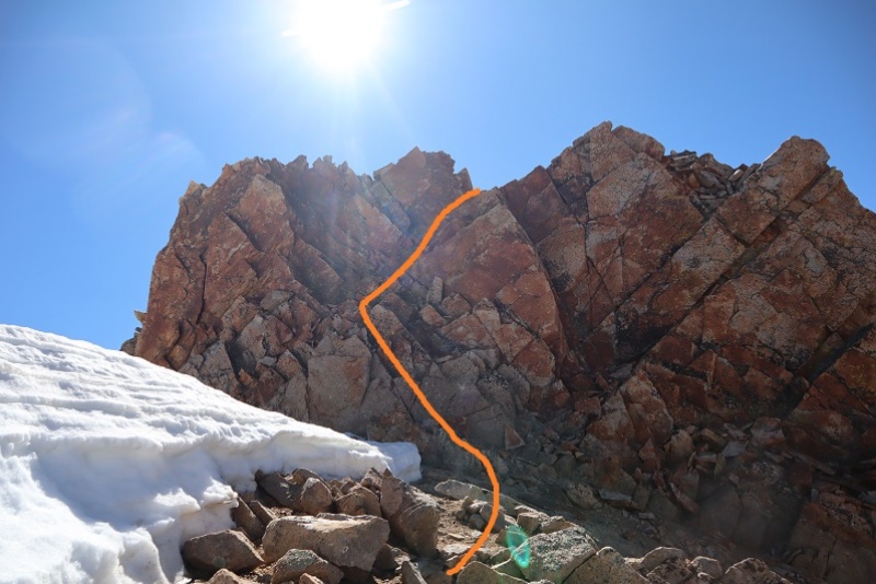
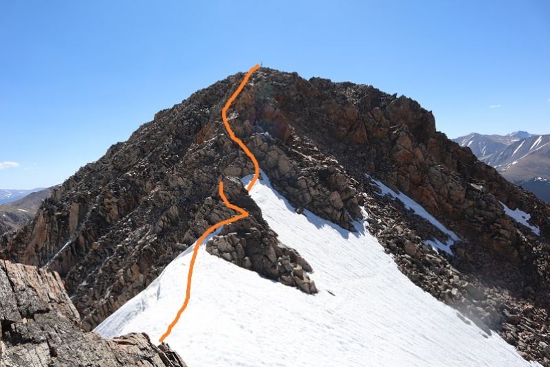
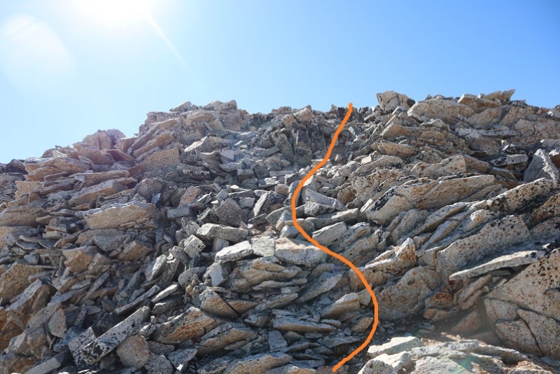
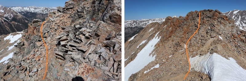
It looks like there might be a class 2 path here along the right (south) side, but with the snow in key areas I wasn’t able to take that route. There was snow in this section, turning the rest of the hike into class 3 on loose rock. I had one rock the size of a microwave fall while I was testing it. Luckily, I was just testing and didn’t have any weight on the rock. It scared me though. A helmet would be a good idea. Note which areas actually “go”: The dirt gullies here make it look like there are trails where there are not. Here are pictures of how I navigated the ridge. This took quite a bit of careful route finding.
This is actually easier than it looks. Class 3, and I placed a cairn here so I’d remember how to get back (there are a lot of drastic drops in this area).
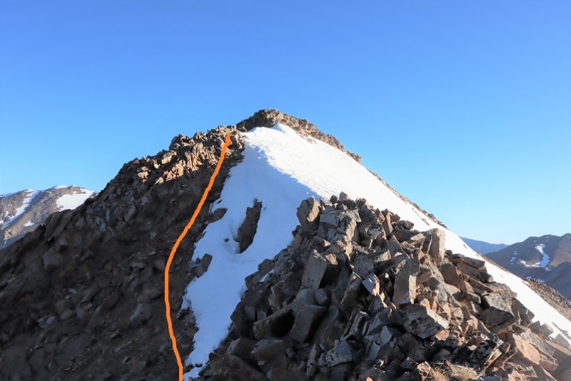
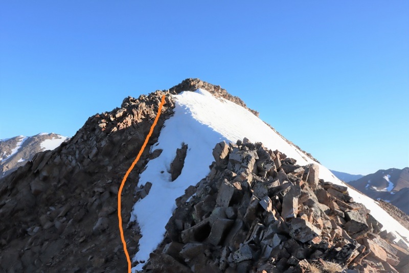
The last hurdle was unavoidable snow just before the summit. I tested the snow and honestly considered turning back. The snow was slippery and a fall would have took me a long way. In the end I strapped on my crampons and got out my ice axe, glad I’d brought both. I traversed these two areas (about 40 feet each) gingerly.
The last bit up to the summit was full of loose rock but was straightforward
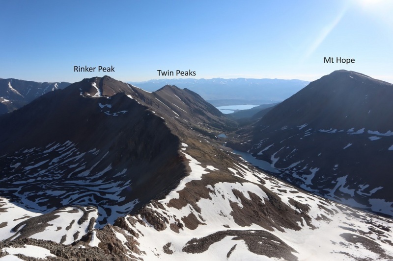
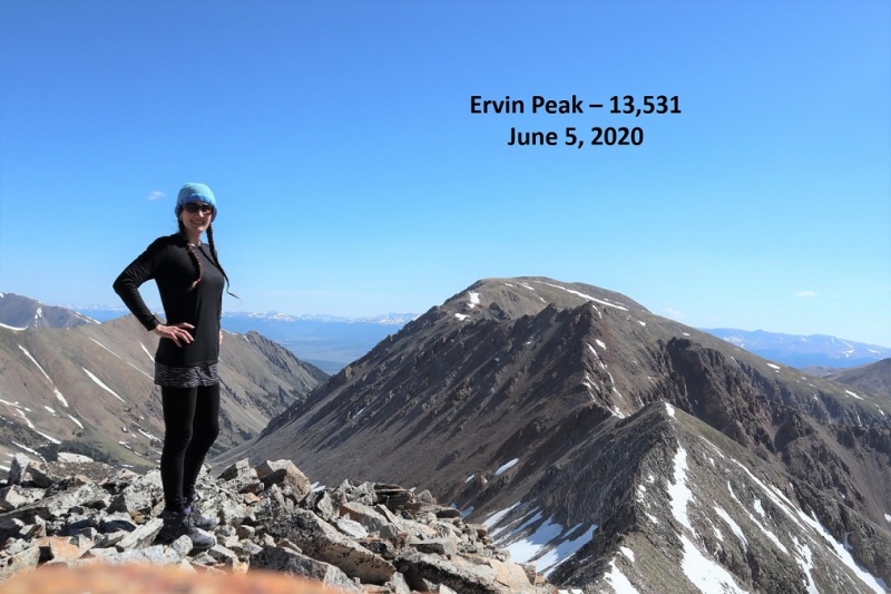
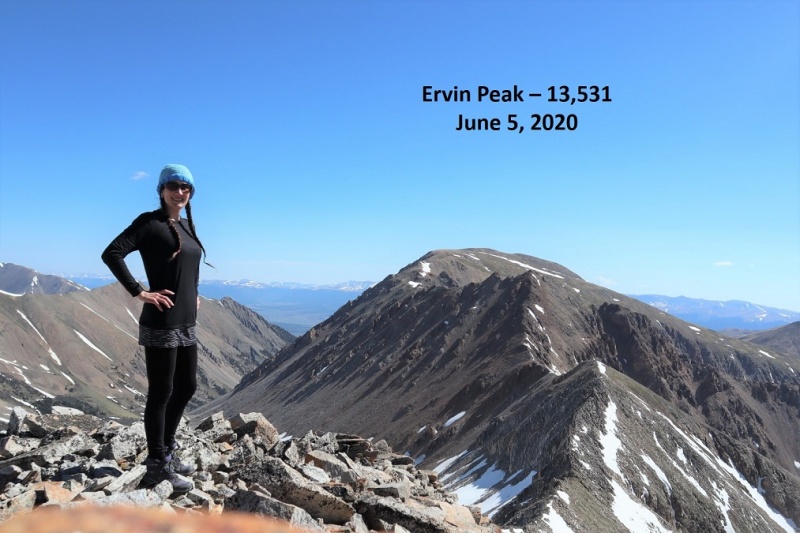
I summited Mt Ervin at 9:30am (that’s Mt Hope in the background)
Ervin Peak Summit:
I didn’t stay long on the summit. The day was warm and the snow was melting fast: I wanted to cross the snowy areas as quickly as possible to avoid slipping. I turned around and headed back the way I’d come.
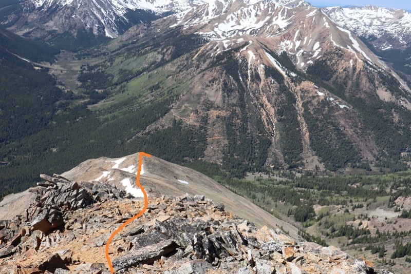
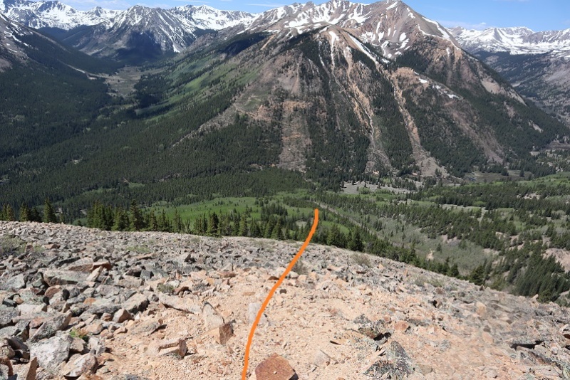
I was making this a loop, so when I hit the westernmost part of the ridge I turned and headed southwest down. This ridge was easy to navigate but full of loose, rolling rocks. It was slow going because I had to be careful with foot placement. This ridge kind of turns right as it goes. Here’s a hint: If it’s daylight, just keep heading towards the switchbacks that you can see in the middle of the picture below.
From about halfway down the ridge here’s looking back at Mt Blaurock and Ervin Peak. The blue arrow points to where you could hike from the landslide area straight to the saddle instead of taking the ridges up and down
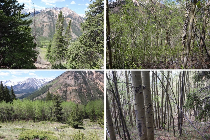
Here you can see you want to meet back up with the landslide area, and that to do so you’ll be bushwhacking through dense aspen. I could still see the switchbacks, but only just barely and only because the aspens aren’t completely full of leaves yet.
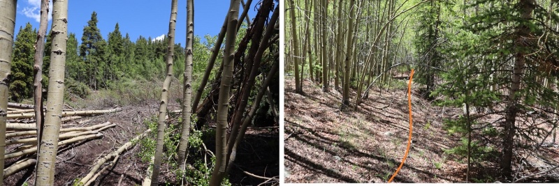
There were enough game trails here to follow not to make this too difficult. It would have been easier if I were 2 feet tall though, because those trails go under logs and through brush.
I made it back to the landslide area, took a picture of it in the daylight, and turned and headed south towards my parking space.
I made it back to my truck at 12pm, making this a 6 mile hike/climb with 3821’ of elevation gain in 8 hours, most of it spent route finding and watching for rolling rocks.
Here’s a picture of the saddle, should you choose to ascend that way
When I got home and started jotting down notes I realized today I’d hiked my 145th unique 13er, as well as my 145th unique bicentennial. Pretty cool!
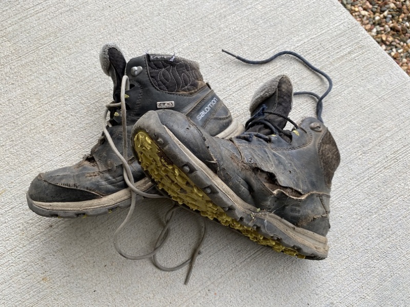
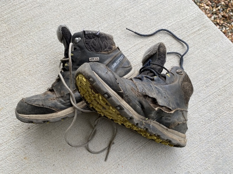
Also, it’s time to retire my hiking boots, as they are no longer waterproof. They almost made it a year….
Thumbnails for uploaded photos (click to open slideshow):
I did the same hike (reversed) on July 12 (5 weeks later in the season) last year. I, too, almost turned around at the same place on Ervin. Because it was a heavy snow year and this year is dry, the snow looked almost identical to your pic #37.
I'm planning to attempt Blaurock. Thanks for the awesome TR, very much appreciated.
-Karl
Caution: The information contained in this report may not be accurate and should not be the only resource used in preparation for your climb. Failure to have the necessary experience, physical conditioning, supplies or equipment can result in injury or death. 14ers.com and the author(s) of this report provide no warranties, either express or implied, that the information provided is accurate or reliable. By using the information provided, you agree to indemnify and hold harmless 14ers.com and the report author(s) with respect to any claims and demands against them, including any attorney fees and expenses. Please read the 14ers.com Safety and Disclaimer pages for more information.
Copyright: Route information, text, risk factors, maps, GPX files, charts, photos, 14ers.com-created map imagery, flythroughs, and other content provided in this route description are copyrighted by 14ers.com and may not be copied, reproduced, republished, distributed, modified, or used to create derivative works without prior written permission.
Please respect private property: 14ers.com supports the rights of private landowners to determine how and by whom their land will be used. In Colorado, it is your responsibility to determine if land is private and to obtain the appropriate permission before entering the property.