Download Agreement, Release, and Acknowledgement of Risk:
You (the person requesting this file download) fully understand mountain climbing ("Activity") involves risks and dangers of serious bodily injury, including permanent disability, paralysis, and death ("Risks") and you fully accept and assume all such risks and all responsibility for losses, costs, and damages you incur as a result of your participation in this Activity.
You acknowledge that information in the file you have chosen to download may not be accurate and may contain errors. You agree to assume all risks when using this information and agree to release and discharge 14ers.com, 14ers Inc. and the author(s) of such information (collectively, the "Released Parties").
You hereby discharge the Released Parties from all damages, actions, claims and liabilities of any nature, specifically including, but not limited to, damages, actions, claims and liabilities arising from or related to the negligence of the Released Parties. You further agree to indemnify, hold harmless and defend 14ers.com, 14ers Inc. and each of the other Released Parties from and against any loss, damage, liability and expense, including costs and attorney fees, incurred by 14ers.com, 14ers Inc. or any of the other Released Parties as a result of you using information provided on the 14ers.com or 14ers Inc. websites.
You have read this agreement, fully understand its terms and intend it to be a complete and unconditional release of all liability to the greatest extent allowed by law and agree that if any portion of this agreement is held to be invalid the balance, notwithstanding, shall continue in full force and effect.
By clicking "OK" you agree to these terms. If you DO NOT agree, click "Cancel"...
Oh boy, another Sneffels trip report from Wentzl, just what we need. Well, I noticed I have the Fall and Winter seasons covered, so why not add Spring!
But more than that, I post this trip report to share the North side of the mountain with all those folks who run up the South Slopes, check the box and move on. There is much more to Sneffels, which I try to share here.
I was inspired by Desertdog, who posted his peak condition report wherein he did a strange loop from Yankee Boy Basin, over to Blaine and then up the Snake Couloir. That is a lot of work, almost like climbing the mountain twice in one day, so hat's off to Desertdog. I planned on a more conventional circuit on the North side.
The day started at the East Fork of Dallas Creek trailhead, more commonly known as the Blue Lakes Trailhead at around 7:30 a.m. Thursday, June 4th was forecast to be a nice day with only a slight chance of afternoon showers, which turned out to be exactly right. Bluebird skies and not a breath of wind for the first few hours of the day.
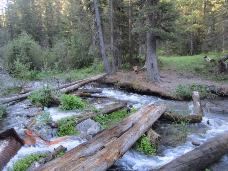
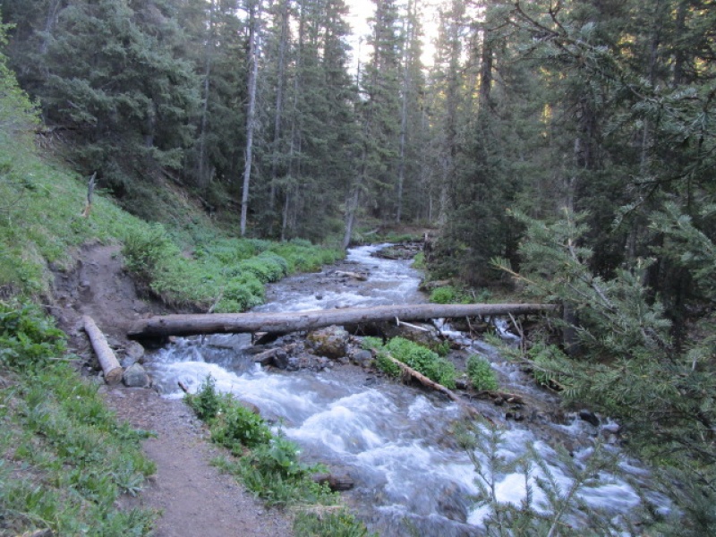
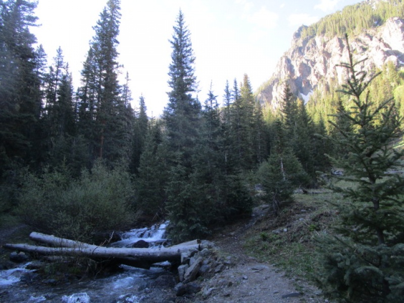
The trailhead services both the Blue Lakes trail and much less frequently traveled Blaine Basin trail. The Blaine Basin trail winds through the trees for about three miles before reaching treeline and opening up into one of the most beautiful places in Colorado. Along the way it crosses a tributary to East Dallas Creek three times on decent log bridges.
First Creek Crossing
2nd Creek Crossing
3rd Creek Crossing
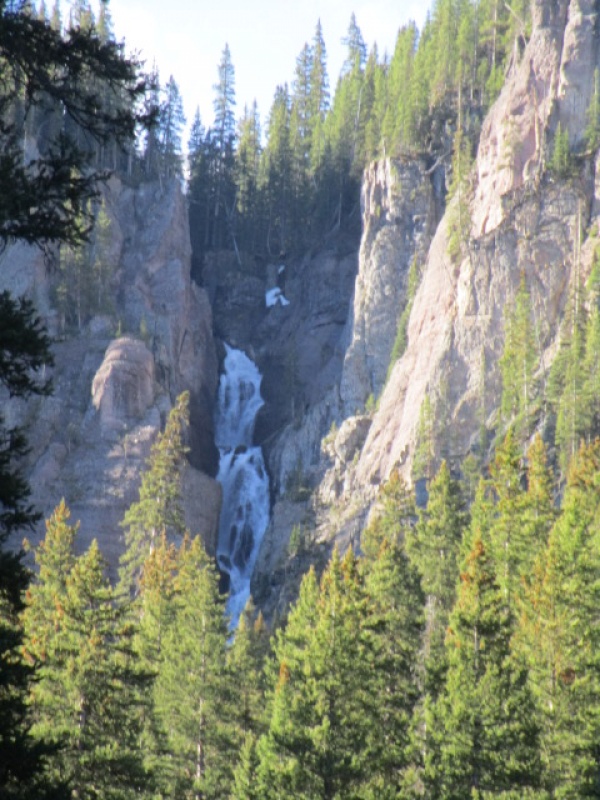
And, if there is still plenty of snow up high, a pretty spectacular waterfall can be seen along the way.
Waterfall
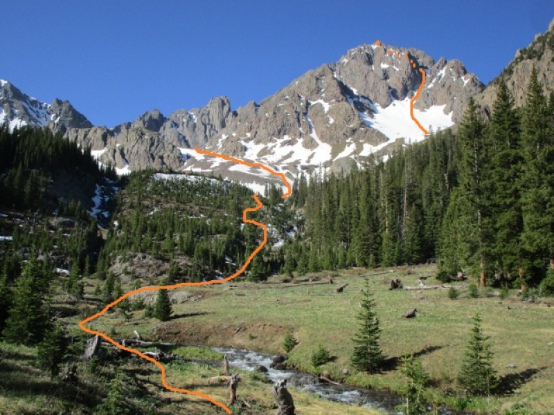
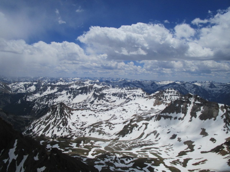
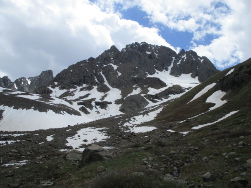
The transition from trees to open skies comes abruptly. Once you get out of the trees you are greeted with the grand North Face of Mt. Sneffels.
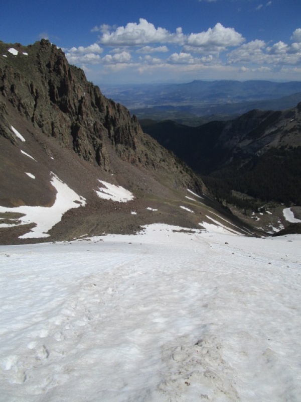
Lower Blaine Basin
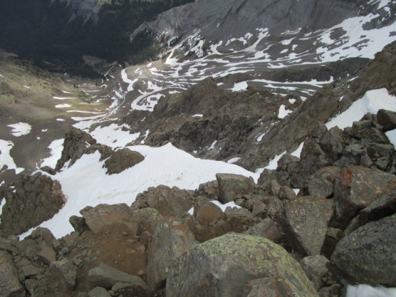
In the previous photo, the big snowfield on the right is at the bottom of the Snake Couloir. Just left of center, the square top block is Kismet Peak. The East Slopes route, which I took on the return trip, is behind the skyline from the summit of Sneffels, passing right below the Kismet block then winding around and finishing on the lower snow slopes. I have outlined the route here.
North Side Circuit illustrated
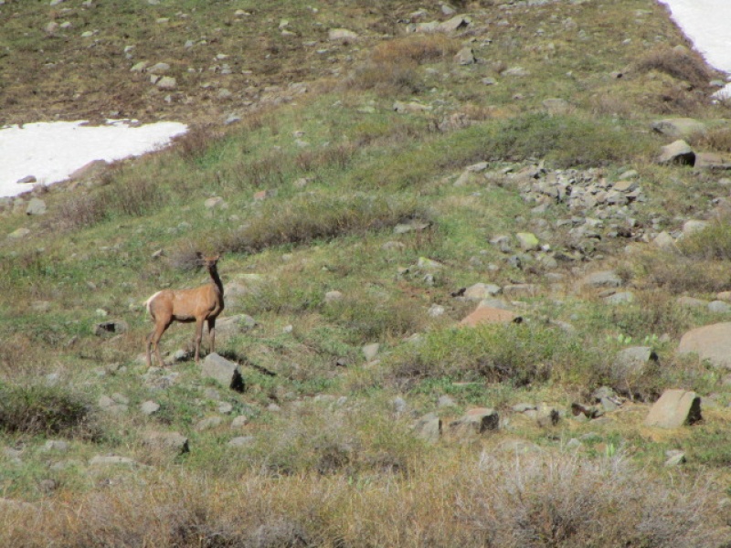
There were a couple of elk hanging around up high
One of the two elk I spied
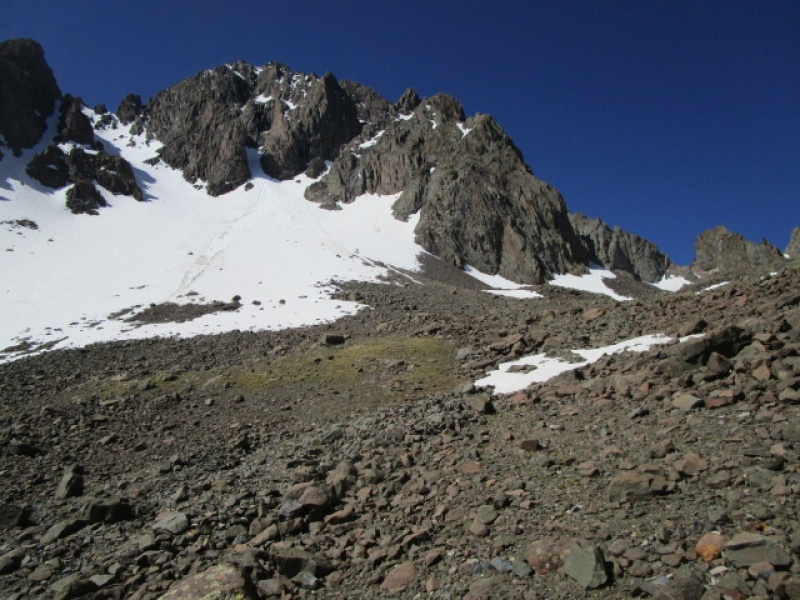
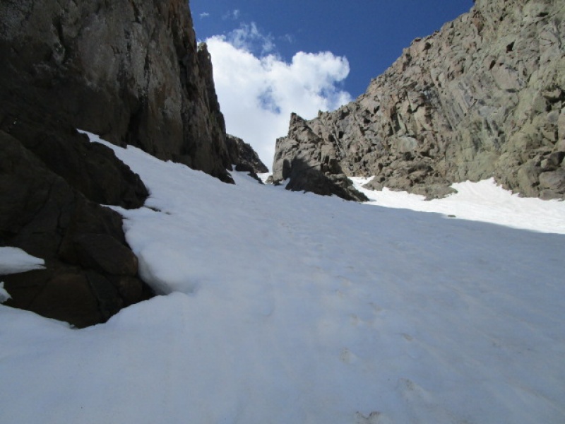
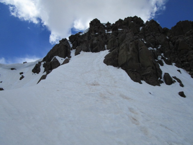
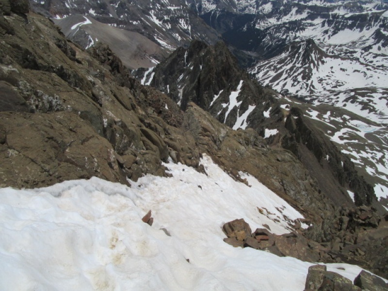
Alright, now the goods. The Snake Couloir is mostly a low angle snow climb. In the middle, there is a narrow section, some call it the choke, where the angle does go above 45 degrees. I have been here several times, and the condition of the snow varies from trip to trip. On this trip it was about as difficult as I have seen. In the past, it has been possible to kick a platform just about anywhere on route and take a rest. I once did the whole thing without crampons. This time, there was about 200' in the choke where it was icy enough that resting was not practical and for that section it was a pretty committed climb. Not a two tool ice climb, but such that I used the pick, rather than driving in the shaft of the axe, to make forward progress in some spots. Crampons were not optional. My guess is that this will get icier as the spring turns to summer. If you get up here and don't like the conditions, retreat would be easy.
Nearing the snow
The switchbacks from lower Blaine Basin up to where the snow begins are pretty steep. The trail is obvious and easy to see from way down in the valley.
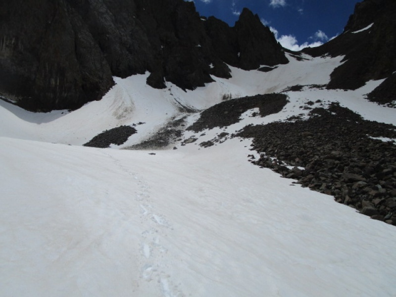
Crampons on Here
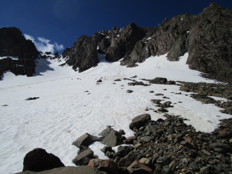
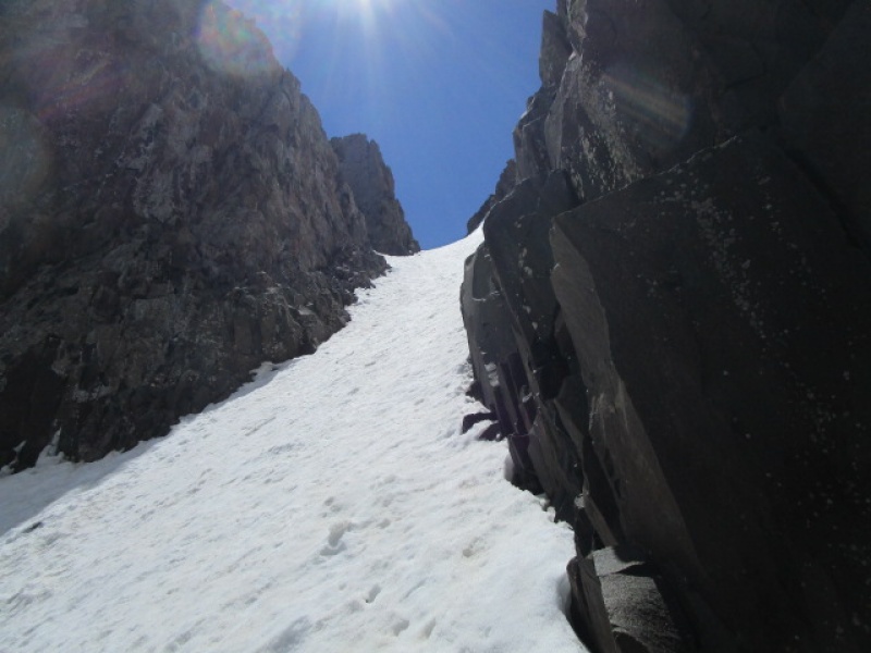
The snowfield starts at a very low angle and just turns gradually steeper as you ascend. It was just after 10:30 when I started up. The snow was firm and easy to walk on here.
Looking at where the snowfield enters the Couloir
Looking back down before it turns steep.
I was looking for the footprints from Desertdog's trip, but they were mostly melted out. Up higher it was obvious where he had passed, but instead of depressions in the snow, the footsteps were little pedestals, which shows how quickly things are melting out.
Last good rest before things get serious
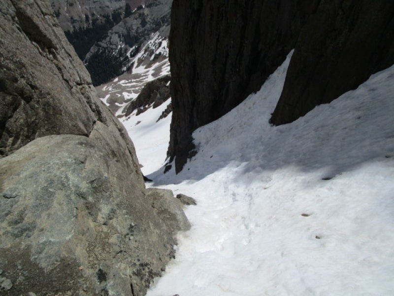
Looking down after entering the Couloir
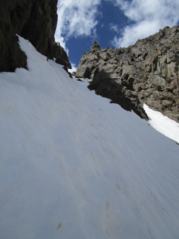
The Choke
The Choke w/ Axe to show steepness
Looking down after angle eases up a bit
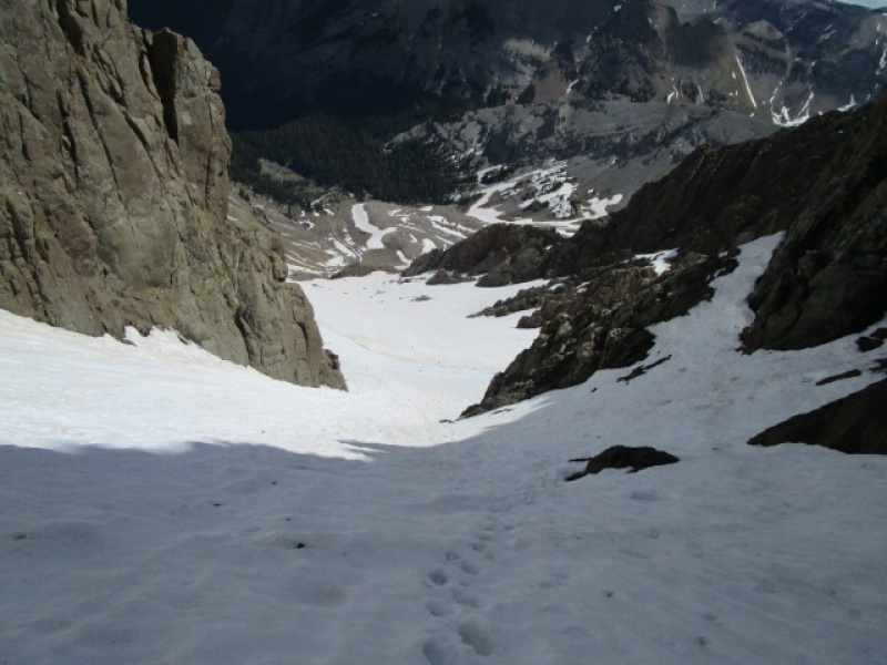
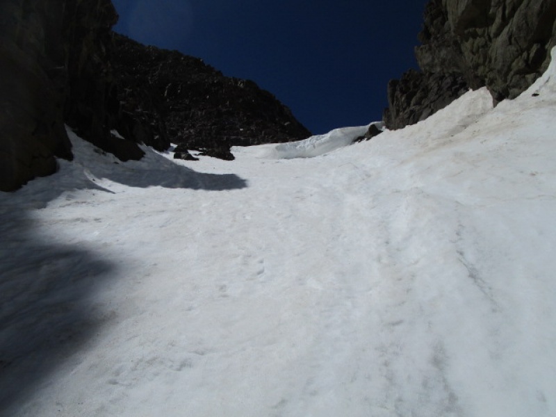
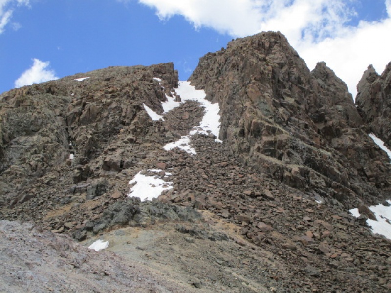
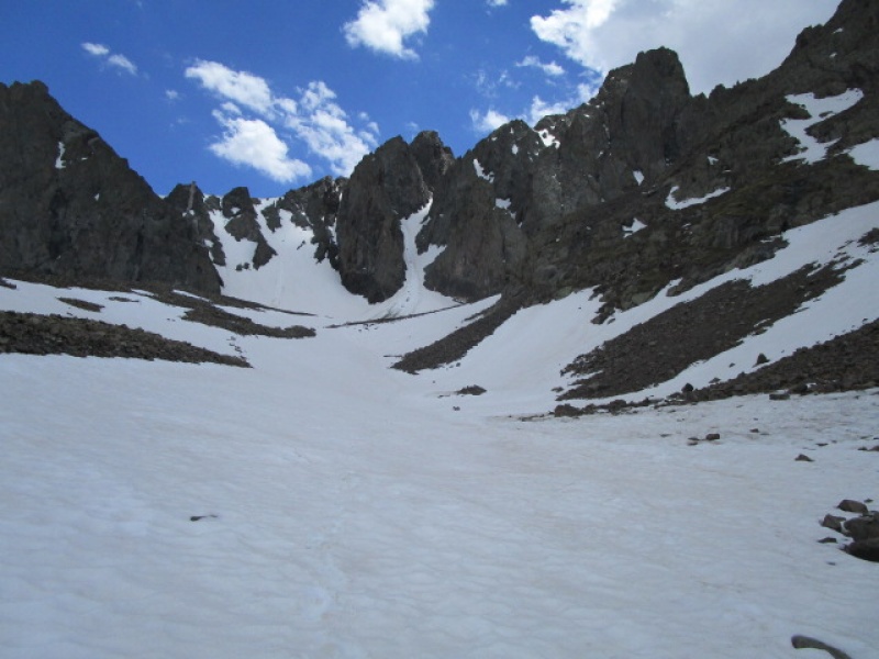
There is a large cornice that forms at the top of the first leg of the Couloir. This marks where the route jogs hard to the left. Once you make the turn, the angle really eases up and it is just a short bit to the end of the snow.
Cornice at the top of 1st leg
Looking down after turning the corner
2nd leg of the Couoir
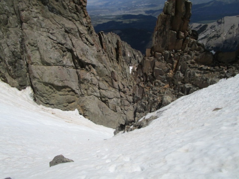
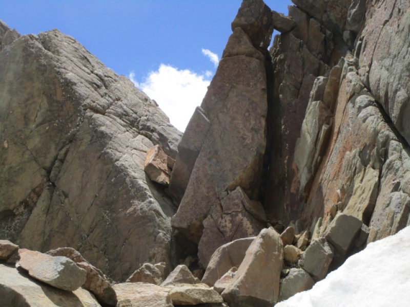
At the top of the e Couloir there is a short rocky bit that leads to the summit. In his guide Gerry Roach puts this bit at 5.6 but it didn't seem that difficult the times I have done it. There are several variations.
Summit Block
I took my crampons off on a nice rocky ledge from which I took the previous photo. The snow was soft and easy to walk on to approach the 5.6 rock pitch ahead. I followed what seemed like the path of least resistance which was just to the right of the footprints in the snow.
Looking down from the top of the rock pitch
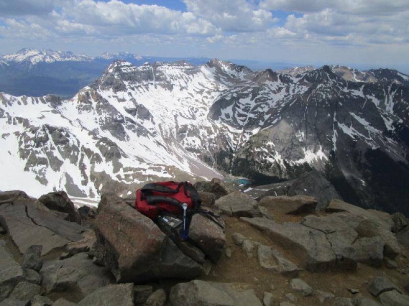
I made the summit by 1:00, taking almost 2.5 hours from the time I donned my crampons.
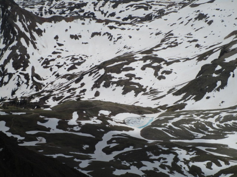
Summit with Lower Blue Lake
Wrights Lake in Yankee Boy Basin
View to the SE from summit
There is a bit of snow still laying in between the summit and the V Notch. It is soft and well trampled so that crampons are not necessary, but still a good idea to have an axe.
Snow above the V Notch
The V Notch is now snow free and dry.
V Notch
The section between the Lavender Col and the V Notch is still half snow. Great condition for plunge stepping on the way down.
Lavender Col to V Notch
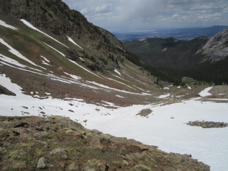
The descent of the East Slopes route this time of year is one of the most fun things you can do. The snow is in perfect condition for all sorts of play. A little butt sliding, a little standing glissade, a little heel step running, whatever turns you on! The snow right now takes you from just below the Lavender Col all the way down to treeline. As slow as I was going up, I got from the summit to the car in just a little over 2.5 hours.
Easy Snow Descent from Lavender Col
Continuing snow descent
Find the right snow band and ride it to the trees!
It was late in the day, around 2:30 when I was tromping around in this snow. It held up just great. No post holing at all. Just a good firm surface for running and sliding with just enough slush on top for traction and sure footedness.
One last look back at the North Face of Sneffels
This was a really fun day and a way to climb Sneffels that I highly recommend for anyone comfortable on steep snow.
The breakdown on time were like this. Left the car at 7:30. Summit at 1:00. Departed Summit at 1:30. Return to car at 4:00.
Thanks for reading the Spring Edition of my Sneffels Report.
Thumbnails for uploaded photos (click to open slideshow):
Turn left before the cornice. So long as it does not collapse it won't be a problem.
Caution: The information contained in this report may not be accurate and should not be the only resource used in preparation for your climb. Failure to have the necessary experience, physical conditioning, supplies or equipment can result in injury or death. 14ers.com and the author(s) of this report provide no warranties, either express or implied, that the information provided is accurate or reliable. By using the information provided, you agree to indemnify and hold harmless 14ers.com and the report author(s) with respect to any claims and demands against them, including any attorney fees and expenses. Please read the 14ers.com Safety and Disclaimer pages for more information.
Please respect private property: 14ers.com supports the rights of private landowners to determine how and by whom their land will be used. In Colorado, it is your responsibility to determine if land is private and to obtain the appropriate permission before entering the property.


")
")
")
")
")
")
")
")
")
")
")
")
")
")
")
")
")
")
")
")
")
")
")
")
")
")
")
")
")
")
")


