Download Agreement, Release, and Acknowledgement of Risk:
You (the person requesting this file download) fully understand mountain climbing ("Activity") involves risks and dangers of serious bodily injury, including permanent disability, paralysis, and death ("Risks") and you fully accept and assume all such risks and all responsibility for losses, costs, and damages you incur as a result of your participation in this Activity.
You acknowledge that information in the file you have chosen to download may not be accurate and may contain errors. You agree to assume all risks when using this information and agree to release and discharge 14ers.com, 14ers Inc. and the author(s) of such information (collectively, the "Released Parties").
You hereby discharge the Released Parties from all damages, actions, claims and liabilities of any nature, specifically including, but not limited to, damages, actions, claims and liabilities arising from or related to the negligence of the Released Parties. You further agree to indemnify, hold harmless and defend 14ers.com, 14ers Inc. and each of the other Released Parties from and against any loss, damage, liability and expense, including costs and attorney fees, incurred by 14ers.com, 14ers Inc. or any of the other Released Parties as a result of you using information provided on the 14ers.com or 14ers Inc. websites.
You have read this agreement, fully understand its terms and intend it to be a complete and unconditional release of all liability to the greatest extent allowed by law and agree that if any portion of this agreement is held to be invalid the balance, notwithstanding, shall continue in full force and effect.
By clicking "OK" you agree to these terms. If you DO NOT agree, click "Cancel"...
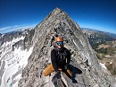
Type 2 fun on San Luis Peak (via West Willow Creek)
Posthole Sufferfest: Memorial Day Weekend 2020 (San Luis Peak via the West Willow Creek approach)
I haven't been one for writing trip reports, as I think they should contribute something valuable or unique in order to be justified. Hopefully this provides value for someone down the road who is curious about what this route might look like in May (because we sure were flying blind). There have been many great trip reports and information written about San Luis Peak, but very few are about the nonstandard South Ridge route, and none (at least that I could find) were during the spring. As we would learn the hard way, just because a recent conditions report for the standard NE Ridge route says "full summer conditions" doesn't mean that you should leave the snowshoes at home if you go for the nonstandard route; in fact, the two approaches looked like entirely different worlds from the summit.
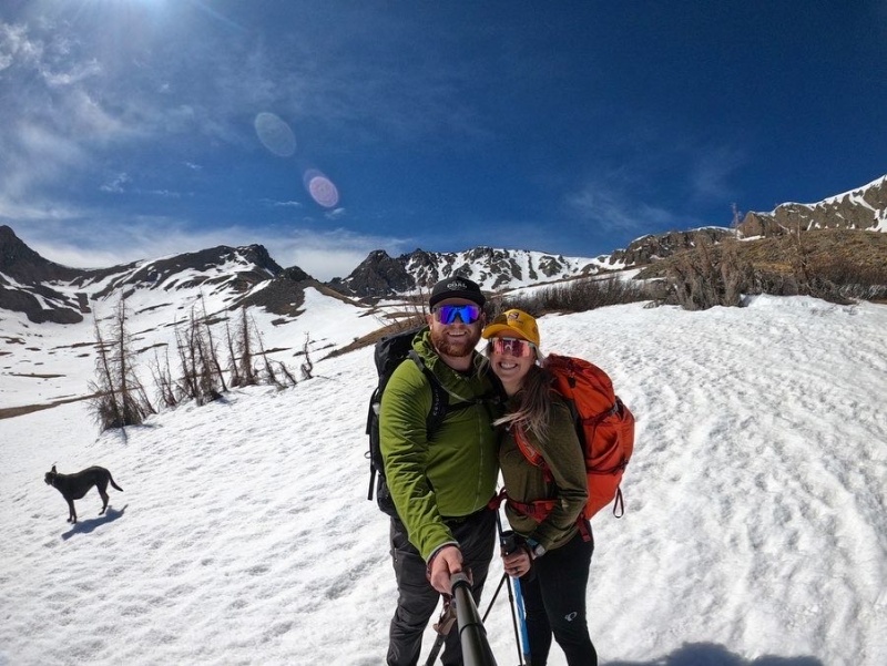
My wife Taylor and I decided on the S Ridge route for two reasons. If you are reading this, you might be thinking the same:
1) We like the seclusion of nonstandard routes and opt for this option whenever makes sense (it's also less mileage, which can be a plus for some folks) 2) We figured "South" ridge means more sun exposure, and therefore less snow in the spring, as is to be expected in the northern hemisphere.
If the conditions report for the NE Ridge says "full summer conditions" it only makes sense the south side would be the same, right? Negative, Ghostrider. We overlooked the fact that this route crosses two different basins, with aspects covering the Northern half of the compass rose. As backcountry skiers, we spend all winter chasing cold pow on northern aspects, so I'm not sure how I didn't piece it together that the north aspects on this route would hold snow later in the year. But alas, it made for some great type 2 fun with my wife and dog...
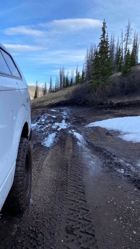
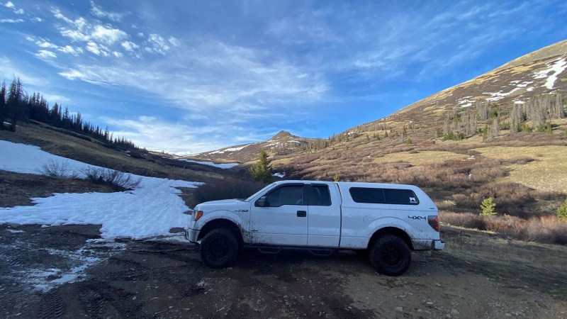
The 503 was open all the way the Equity Mine. This road has been known to close in the spring due to excessive runoff, so I called the Creede Chamber of Commerce to confirm that the road was open prior to making the 4+ hour trip from home. Above the mine, the road got a bit dicey with some snow drifts and muddy spots, but was manageable with a good vehicle and careful driving. Beyond the creek crossing at 8.2 miles, things got pretty hairy. I would not recommend proceeding past the crossing until you are sure it is dry. There were tire tracks on the other side, so I figured I'd go for it. After further inspection, I realized that they were UTV tracks and I was presumably the first passenger vehicle up that far this year. About 100 yards from the trailhead, there was a deceptively deep mud bog but I was able to get through with some throttle love (I later learned that early the next morning, there was a Dodge Ram who had gotten buried in thick mud up to their headlights in that spot).
Deep, truck-eating quicksand disguised as a standard mud puddle...At the TH: It was a chilly, quiet night. I stepped out of the truck into a fresh pile of moose poop and the parking area was covered in prints.
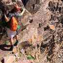
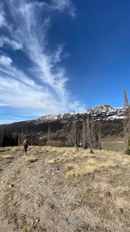
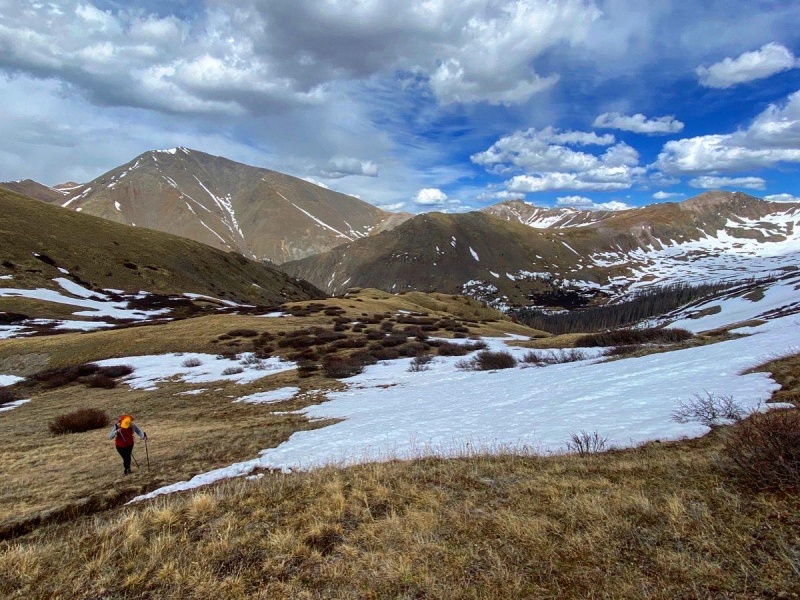
We had a later start than usual, since the weather forecast looked great and we were blissfully unaware that timing the snow was a factor. We left the TH around 8:20 am and ascended up to the first rocky point. True to the character of the road, the trail was also a muddy mess, but the snow was negligible. We made sure to walk through the mud, not around it, as to not widen the beautiful singletrack trail. There aren't many of these left :) In several spots, the trail completely disappears, which really added to the remote feeling of this peak and route.
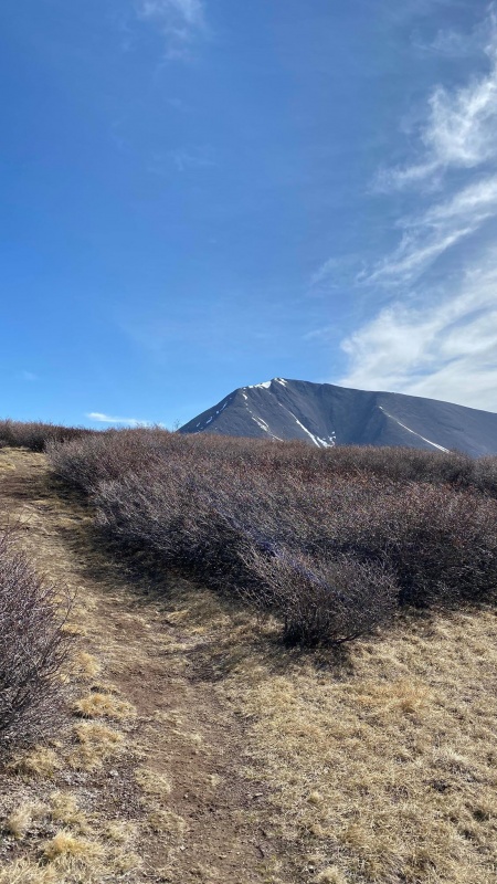
Just below first rocky point. Trail totally dry.San Luis comes into view, and the trail fades into the willows... Route still deceivingly dry looking.
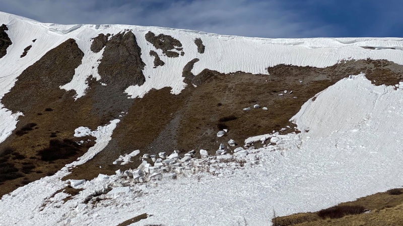
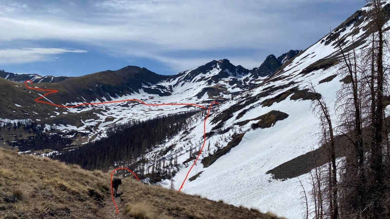
Just before cresting the hill, we encountered another party who had already turned around. They said something to the effect of "We took one look into the basin and decided to turn around. We got too late of a start. Plus there's avalanche debris." I smiled, nodded, and wished them well on their short journey back to the trailhead, thinking to myself that they were crazy and wondered if they knew there needed to be snow for an avalanche to happen. When we crested the hill, we realized their concerns were warranted as we looked into the first basin.
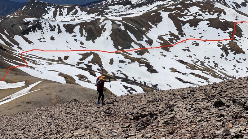
Evidence of a somewhat recent cornice fall/wet slide. Debris pieces were truck-sized.View as you drop into the first basin. Approximate route in red. Cornice fall directly overhead to the right.
While the slide wasn't alarmingly recent, I would recommend being aware of what's above you on this section, as the slide covered a good portion of the trail.
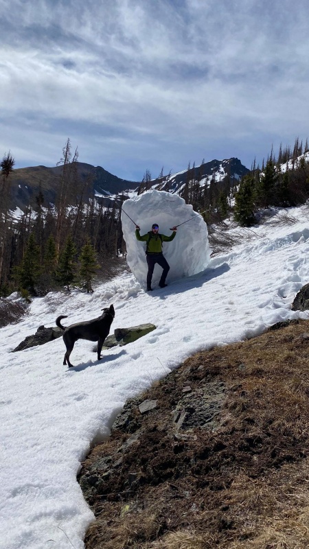
Several of these massive cornice chunks had taken out trees.
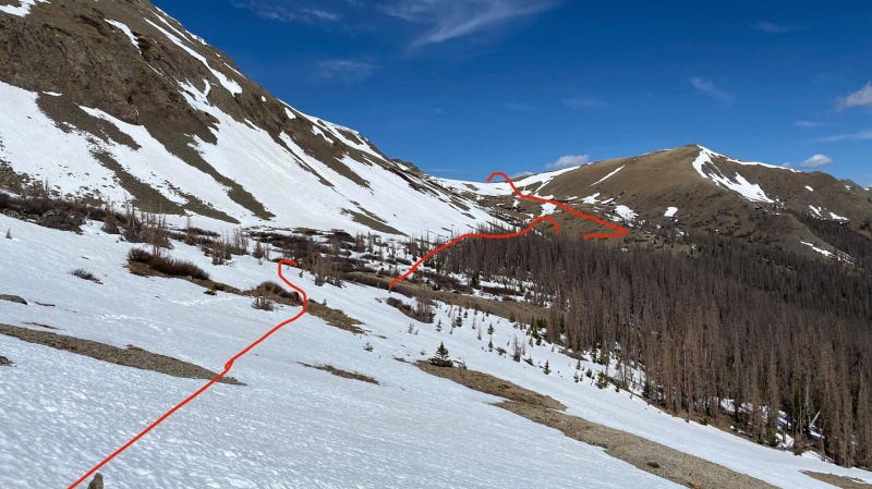
It became apparent that we were in for a long afternoon of postholing if we decided to continue on, so it was time to take a break and reevaluate. We agreed that, while we'd be miserable on the way out, our objective risk was still minimal so we pressed on. At this point, we ran into another party (this time with proper equipment and snowshoes) who had decided to turn around too.
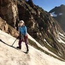
About a quarter of the way across the basin, looking backLooking back across the first basin, starting to wish the next basin will magically be drier.
The snow was still somewhat supportive at this point, but around 11 am, it started to become unsupportive (even with a hard 21 degree freeze the night before)
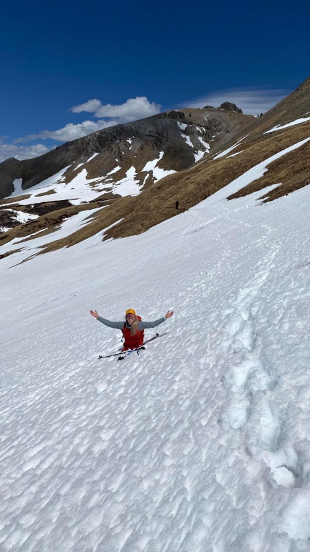
Still all smiles (minimal postholing to this point).
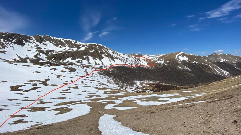
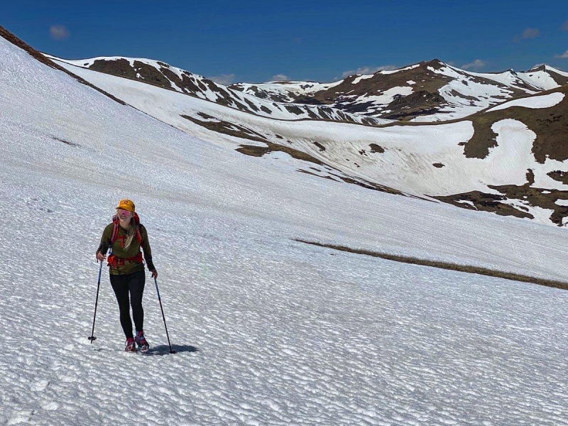
Once we were into the second basin, I stopped taking as many photos, as my efforts were acutely focused on walking delicately and anticipating the next posthole.
Spoiler alert: it was much snowier.
Taylor donned her Microspikes since she was still staying on top of the snow, but I opted to leave mine off since they weren't going to help my case. After walking/postholing across the longer and snowier second basin, we gained the ridge and had a pleasant, albeit windy, walk up to the summit.
About 1/3 of the way up the ridge with the traverse across the second basin in the background.
The two photos above were taken in the exact same spot on the ridge, just 180 degrees apart. I've lived and played in the Colorado mountains all my life, and I don't think I've ever see this dramatic of a difference in snowpack one ridge apart. Maybe rainshadow effect? I don't know, but it was like two different worlds were divided by San Luis' South Ridge.
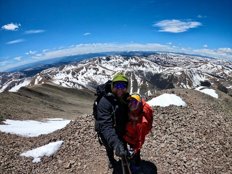
I can't remember if we shame summit selfies here or not? At least we don't have a summit sign...
We shared the summit with Eric from St. Louis, who had summited this peak via the same route for his first 14er summit! Eric, if you're reading this, congrats on a strong effort and well-earned first 14er!
Miles of this on the way back. No, she's not sitting down.Tired legs and soaked boots
Overall, this route made for some great type 2 fun (if that's your sort of thing). If you're looking to add some spice to one of the least difficult 14ers, this is a great way to do it. However, for most, this would be a completely undesirable route during the spring, especially when there is most likely a drier alternative on the opposite side. This is not one that we will be eager to repeat in the same conditions.
We were thankful for our microspikes, Gore-Tex gaiters (MVP of the trip), and waterproof boots. The snow was too sporadic for skis to have made sense, and it was too rotten for snowshoes to have been of much help in the afternoon. You might be able to get ahead of the melting with a super early start, but there aren't a whole lot of ways to avoid this being a miserable day of postholing if you choose to do it the same way we did.
Thanks for reading! Hope this helped someone. See you guys out there!
Jace
Garmin Stats: Total Time: 8 hr 18 min Moving Time: 7 hr 20 min Mileage: 11.5 RT Vertical Gain: 4,049' Calories: 4,873 cal (earned our pizza on this one)
Thumbnails for uploaded photos (click to open slideshow):
Thanks for this report. I had seen/heard of conditions on the south side and started assuming the Stewart Creek side was probably just as bad. Andrew, or someone else, showed a recent pic of Stew side and gave me more hope. Your comparisons of both sides are amazing!
We did this route in November one year and assumed we'd be okay despite recent snow for exactly the same reasons you did. Ended up with endless hours of sidehilling through just enough snow to be obnoxious. And then the ~800 foot of elevation to regain (or however much it is, in my head we reclimbed the whole damn peak) at the end was a nice kick in the pants. Definitely one I'm glad to not have to revisit...
Michelle - Good to know we weren't the only ones! I agree with you on the elevation regain at the end... Felt like a miniature version of Half Moon Pass on the return from Holy Cross. It's a rough way to finish after all the postholing.
Thanks, Sawneagle, and congrats on your summit! I already knew that Stewart Creek was the better alternative that day, but your comment to greenonion really rubs it in ;)
My wife and I got to the top of the hill around noon Saturday to scope it out and were very glad we did before committing to climbing Sunday. I'll be heading to the Stewart Creek trailhead this weekend instead (weather permitting)!
I'll gladly take the title of being the second passenger vehicle to make it up to the TH this year - probably one of the most foolish things I have ever done (stock Taco, balding tires). Very thankful I made it down, and that you did too!
nxchjhgvbi - Nice! Yeah the drive to the TH was the scariest part of the whole trip. In retrospect, would have been smarter to have chains or another partner vehicle along in case a tow was needed. Glad you guys made it out unscathed. Good luck this weekend!
. . . couldn't have been more of a sufferfest then trying to find a campsite near Navajo Lake!
If someone as tiny and light as Taylor was sinking into her waist in the snow, I don't even want to imagine that trek! Good work getting an isolated 14er out of the way via a non-standard route in half-winter/half-spring conditions (green snowflake icon?).
Rumor has it you may be heading up to Chicago Basin this year. Keep me posted!
That's the route I took to bag San Luis....minus the snow, but we had horrible (50+ mph) winds on a clear September day. Brought back a lot of fond memories looking at San Luis from that vantage point. One thing that stood out to me in your report was talking about some of the cornice chunks taking out trees, when we hiked it we noticed that so many of the trees were dead from the pine beetle infestation that has been spreading in the region over the last several years, we actually saw a few trees snap off at the ground due to the wind. Fortunately they were either behind us or ahead of us, but it did make the hike though some of the patches of trees a little nerve wracking.
Jay - Thanks for the kind words. Much appreciated!
EM - If only we had done this with a 50lb pack, in the dark, in pouring rain, and no food... but given your status as a sufferfest aficionado, I think you still would have appreciated/enjoyed this one. Thanks for the Kudos... Would love to get a trip in with you this year!
Huffy - Thanks! Glad you enjoyed the report. The beetle kill in the area is definitely sad. Makes for a scary combo when you mix in high winds - yikes!
This is Eric from the summit. Reading this put me right back into that wonderfully amazing day of postholing. Well written and spot on. Thanks for allowing me to tag along for as long as I could hang. I was in Denver last week for work and summited both Grays and Torreys. It didn't take long to find myself at the top of #2 and #3. Hope y'all have a great summer. Thanks again.
Caution: The information contained in this report may not be accurate and should not be the only resource used in preparation for your climb. Failure to have the necessary experience, physical conditioning, supplies or equipment can result in injury or death. 14ers.com and the author(s) of this report provide no warranties, either express or implied, that the information provided is accurate or reliable. By using the information provided, you agree to indemnify and hold harmless 14ers.com and the report author(s) with respect to any claims and demands against them, including any attorney fees and expenses. Please read the 14ers.com Safety and Disclaimer pages for more information.
Please respect private property: 14ers.com supports the rights of private landowners to determine how and by whom their land will be used. In Colorado, it is your responsibility to determine if land is private and to obtain the appropriate permission before entering the property.


")
")
")
")
")
")
")
")
")
")
")
")
")
")
")
")
")