| Report Type | Full |
| Peak(s) |
Turner Peak - 13,238 feet Ruby Mountain - 13,278 feet Mt. Guyot - 13,372 feet Lenawee Mountain - 13,201 feet Mt. Audubon - 13,217 feet |
| Date Posted | 06/09/2020 |
| Modified | 11/01/2020 |
| Date Climbed | 05/22/2020 |
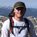
| Author | SnowAlien |
| Skiing in the Springtime of Corona |
|---|
|
Turner peak SE face ski descent Trailhead: Denny Creek Cottonwood pass road was blocked, so I started from Denny creek TH. The approach to Hartenstein lake was fairly straightforward and I was able to skin to the summit, arriving around 1pm. The mellow NE face I was planning on skiing was still unskiable, but the steeper SE face looked very nice. I was unsure about the bushwhack back to the road, but the terrain was still mostly snow covered, so it wasn't too terrible, although the willows did get tight in a few spots. The road was also still snow covered (except for the last 0.5 mile), so the ski out was quick. 


Ruby mountain South face ski descent Trailhead: Peru Creek Peru creek road was still very much snow covered, and skinning was efficient. The overnight freeze was marginal, so I had to stay ahead of the game. I was able to skin to about 12,000 (with ski crampons). I booted the remaining vertical (with a few postholes in warming snow). The summit was windy, and after considering other options, I decided on the same line for the descent. The ski back down the road was quick. 


 Mt Guyot Swan dive/NW face ski descent Trailhead: French gulch With the great freeze, there was not need to start extra early. I started around 7am and hiked the dry road to the turn off. Skins went on after that. I climbed the still solidly frozen NW face, arriving at the summit just past 10am. I could see a few other parties in the basin, still coming up. Without further wait, I dropped into the Swan Dive around 10.30am, which was mostly great corn. Near 11,500 ft, I was able to traverse the basin and regain the ridge. After checking out the old mining cabin on the North-facing shoulder, I kept traversing towards the NW gully, which was still pretty firm around noon. I caught up to a couple local kids at the end of the run, returning back at the car just before 1pm. 


Lenawee mountain SE face ski descent Trailhead: Peru Creek A week after skiing Ruby, I was back at Peru creek. While a lot of snow has melted in just a week, the road was still skinnable for the most part. I skied Marjories couloir in the past, but with the great freeze that day, I thought the wait for the western aspect will be very long. The east side of Lenawee looked great from Ruby the other day, so I decided to check it out, unsure what I will find. I took the Chihuahua gulch turn-off this time and then the south ridge to the summit. The snow on the SW aspect was still pretty frozen even after 11 am. So after checking the impressive cornices towards Grizzly, I decided on the east face and determined the easiest, cornice-free entry was just slightly south off the summit. The ski down was great. Snow was still in great shape, but I could see the old avy debris from prior days. This was one of my favorite lines this spring, least because it was so unexpected. I was able to push and pole almost all the way back to the car. 


Mt. Audubon and Toll Crooked couloir Trailhead: Brainard lake winter closure After skiing Mt. Paiute a few years ago, I knew the drill. I started pedaling on my bike from the TH at 5.45 am, and the 3.5 miles went by in 30 minutes. I stashed the bike near Mitchell lake TH. I didn't bring crampons or an ice ax to save on weight, so the route was clear - the summer route. Not sure how much snow to expect, I packed the trail runners, and good thing I did. After a couple of miles on snow, the trail above the treeline was mostly dry. I changed back from ski boots into trail runners and hiked to the summit, arriving around 10.30 am. The direct line from the summit wasn't in, but the Crooked couloir was still in great shape. I dropped in around 11 am. The very top of the line was still firm, but the snow transitioned to great corn after a couple hundred feet. After skiing down to 11,700 feet, I was disappointed that the ski was over too soon, and the long slog out awaited. The snow was still holding up and Mt Toll beckoned. After some pep talk, I put the skins back on (at least I carried them around not for nothing!) and tried to hurry up. I managed to arrive on Toll summit by 1pm. Snow was soft, but I skied worse snow before. The slog back to the bike was even longer than I remembered despite the trail still snow covered. At least the downhill bike part was very quick. 


|
| Comments or Questions | ||||||
|---|---|---|---|---|---|---|
|
Caution: The information contained in this report may not be accurate and should not be the only resource used in preparation for your climb. Failure to have the necessary experience, physical conditioning, supplies or equipment can result in injury or death. 14ers.com and the author(s) of this report provide no warranties, either express or implied, that the information provided is accurate or reliable. By using the information provided, you agree to indemnify and hold harmless 14ers.com and the report author(s) with respect to any claims and demands against them, including any attorney fees and expenses. Please read the 14ers.com Safety and Disclaimer pages for more information.
Please respect private property: 14ers.com supports the rights of private landowners to determine how and by whom their land will be used. In Colorado, it is your responsibility to determine if land is private and to obtain the appropriate permission before entering the property.