| Report Type | Full |
| Peak(s) |
Quail Mountain - 13,465 feet |
| Date Posted | 05/11/2020 |
| Date Climbed | 05/09/2020 |
| Author | Trotter |
| Quail Mtn has a couloir?!?! |
|---|
|
Poor Quail mountain doesn't get climbed as much as its much more popular centennial neighbor, Mt Hope. Mt Hope is also more popular because of its fantastic couloir. But now Quail mountain can also brag about its own good snow climb. STATS 5.7 miles roundtrip 4000 feet gain (according to strava, but I think its very close to the west ridge route gain, which Bill has listed as 3650 feet) My buddy Eric and I decided on Quail mountain for several reasons. There was recent conditions reports for Hope pass and the trailhead, and there was a strong NW wind forecasted. Having done Mt Hope via Hope couloir a couple years ago, I discovered that the trail up to Hope pass and anything east of Mt Hope doesn't get hit by a NW wind. Mt Hope's south ridge and summit do a fantastic job of blocking the wind. In addition, since we would be ascending a SW facing couloir, the sun wouldn't hit it until well after sunrise and so we could get a later start. With Quail, there is apparently only one way that everyone climbs this mountain, which is the west ridge. I researched the mountain before we left, and there was no records of anyone doing a couloir on it that I could find. But looking at the topo map and my pictures from my Mt Hope climb, I spotted some gullies that would be good snow climbs if they were holding snow still. So our plan was to bring our crampons and ice axes, and if we could find a couloir that looked good, we would take that. And if we couldn't find a good couloir, we knew we could continue hiking to Hope pass, and take the west ridge like everyone else does. But as you can imagine, once you've hauled the extra gear up a couple thousand feet, you'd like to use it. So we were really hoping for a filled in couloir. Sidenote, during my research, it is possible to do the east ridge of Quail. Sounds like there is a 2WD road that goes to 12,000 feet on its east side called Lost Canyon road. You could hike from there, or if really lazy, take the same road, which is now a 4x4 road, all the way to 13,100 feet! However, very few people have done that side of Quail. So we started out at the Sheep gulch trailhead at dawn. Several skiers had left predawn, in order to catch Hope couloir. You start by following the Colorado trail towards Hope pass. Or is it the CDT trail? Google maps says CDT, topo maps say Colorado trail. Or perhaps they both use this section? Apart from a single signed turn about a half mile up, its super simple navigation all the way to Hope pass. The trail was in excellent shape, and we didn't hit any kind of snow or mud until about 11,000 feet. Even then, it was 20 foot sections that were easily stepped on top of in the chilly morning. At about 11,600', the trees began to thin and the snow cover began to build. We had trouble locating the exact trail, because of the snow cover. But since we knew we had to continue straight up the drainage, it wasn't a problem. Plus, the trail would peek out periodically to reassure us. However, the snow was solidly frozen from the night before, and our choice to not bring snowshoes remained a good one. Soon, we got to about 12,000' and could see our objective, the southwest face of Quail, and it was our moment of truth. The couloir was in!!!! 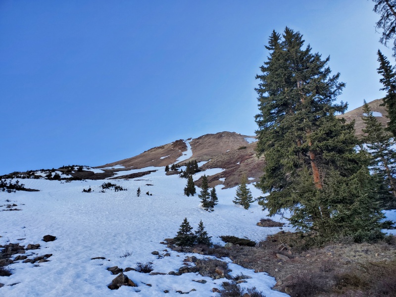
While narrow, it looked to be in great shape. No evidence of slides, minimum rockfall, and our choices of two exits at the top where it Y-ed off. So we strapped on our crampons, and headed up. We had timed it just right, and it was just being hit with sunlight as we started up it. Part of the way up, we discovered footprints. Sadly, we were not the first people to be here. However, the footprints appeared to be someone periodically traversing across the snow, rather then someone heading up it. Since there was some disturbance in the scree next to the couloir, we figured it was someone climbing the SW face and just using the snow sometimes. 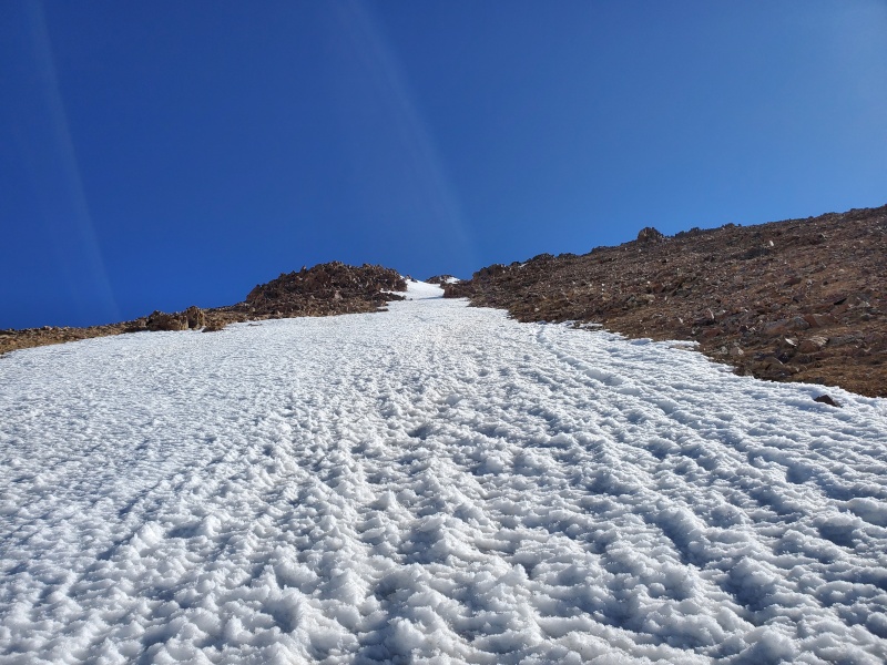
It went at about 35 degrees for the bottom 2/3rds, and then going to about 45 degrees near the top. We exited the left Y, at the top. 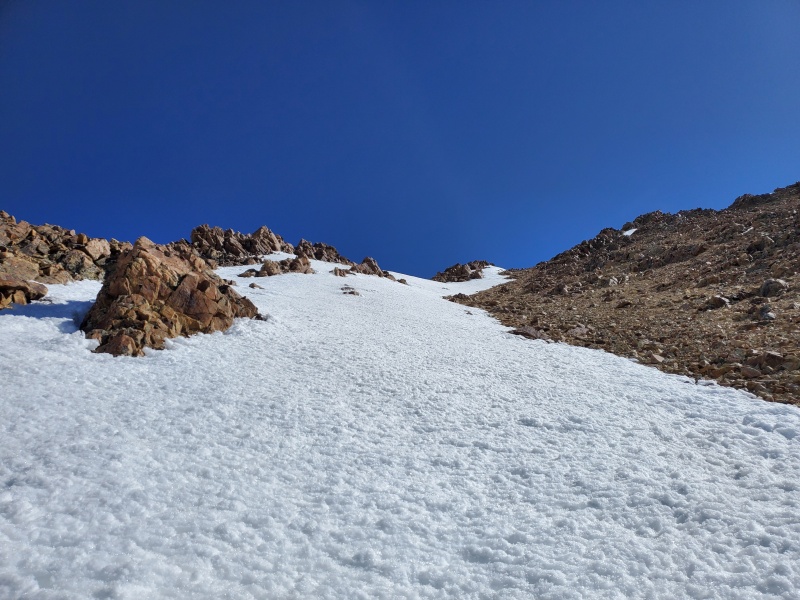
It was immediately loose scree and small talus. After popping off our crampons, we headed up and angled left in order to hit the west ridge. This section was loose and it sucked, but it was only about 100 yards until we could get ridge proper. 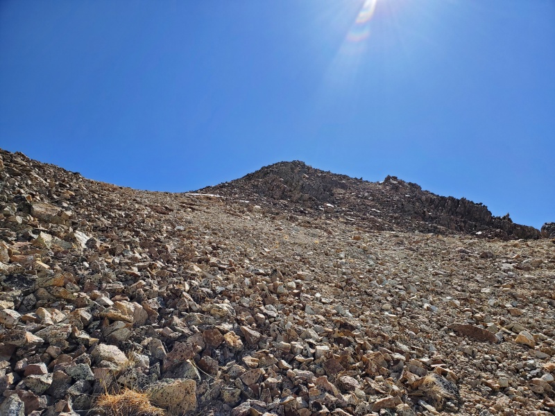
Eric used a rock rib to stay out of the loosest stuff, and to also make his photo look more epic. 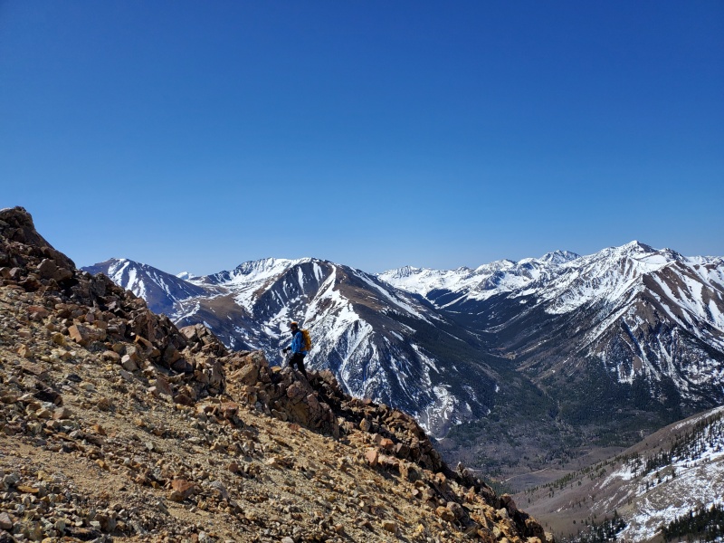
Periodically, we would watch the two groups of skiers heading up Mt Hope. One had gone up the Hope couloir, and the other group had gone up the SE face of Hope. 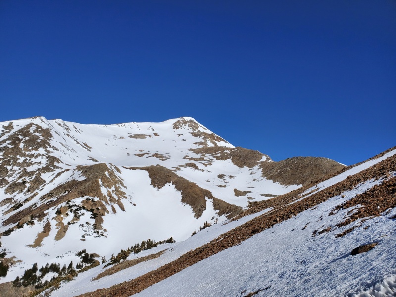
Soon we gained the west ridge, and headed up the last hundred feet to gain the summit ridge. From there it was a very easy walk over to the true summit. There was about 100 yards of snow, but it was still solid. 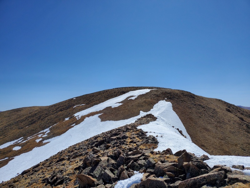
Once on the summit ridge, we were finally out of Mt Hopes wind blocking abilities, and the wind was strong. However, upon reaching the true summit, we discovered the two ramshackle cabins perched there. They are literally 20 feet from the summit, and make a fantastic wind block. So we could sit in the sun and out of the wind, and enjoy the fantastic views. 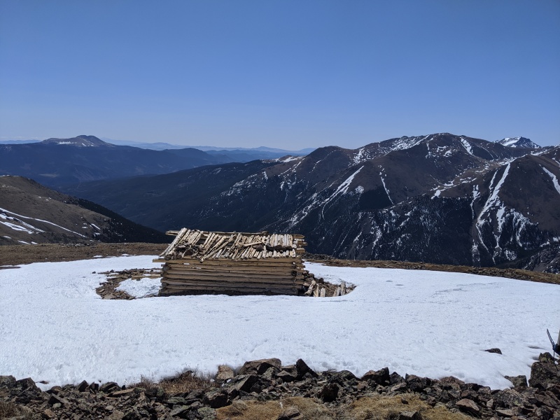
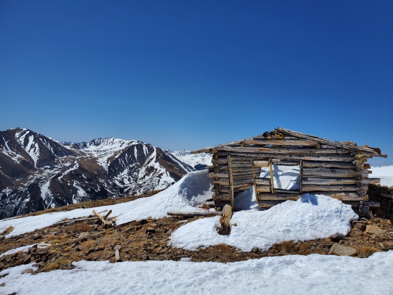
I could find no info on these cabins at the summit. There appears to be no mines anywhere nearby. The nearest mining activity is a mile east, and lower down. And it was TWO cabins. What kind of miner needs two cabins? Who hauled all that lumber to the summit of a 13er? From its construction and the type of wood and nails used, it definitely wasn't recent, but I don't think it was 1870s old. An interesting fact about Quail mountain... It was strongly considered for a ski resort on its north side. It has an impressive vertical drop down to Indy pass. But apparently they did some snow studies, and it didn't get enough snow for a resort. Were the cabins related to the ski resort considerations? If anyone has any info I'd be interested. 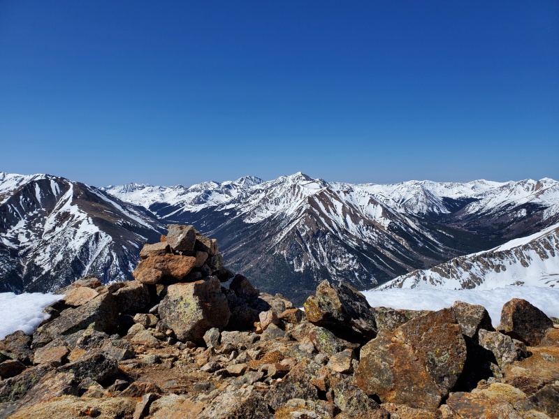
After a nice snack and rest, we headed back down. 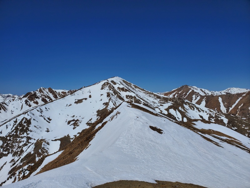
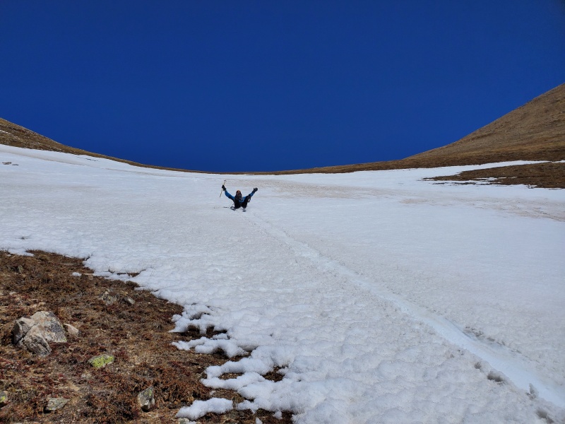
Now we had a decision to make, to descend down the Quail couloir we came up, or to descend to Hope pass via west ridge, and go down Sheep gulch from there? We really wanted to glissade, and we realized the Quail couloir would not be enjoyable for that, as it was narrow and had rocks sticking out on its runout. Having spied a lot of good snow in Sheep gulch, we knew it was the better choice. Plus, we had seen one group of the skiers descend it, and it looked fun. So we descended down the west ridge, which is fairly loose but tolerable. Once we reached Hope pass, we got out our axes again and started glissading straight down Sheep gulch. The snow was perfect, and we were able to string together about 1000 feet of glissades right back onto the trail back down. 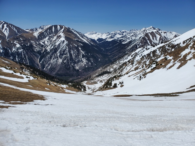
We headed down the trail, but as we got into the trees, the patches of snow across the trail would periodically posthole, which was fun. At this point, we ran into several groups of day hikers in T shirts and trail runners. I bet they had fun once they started postholing up higher. The trail is loaded with aspen trees, and would make a good choice for a fall hike if you want color and only wanted to do the west ridge. 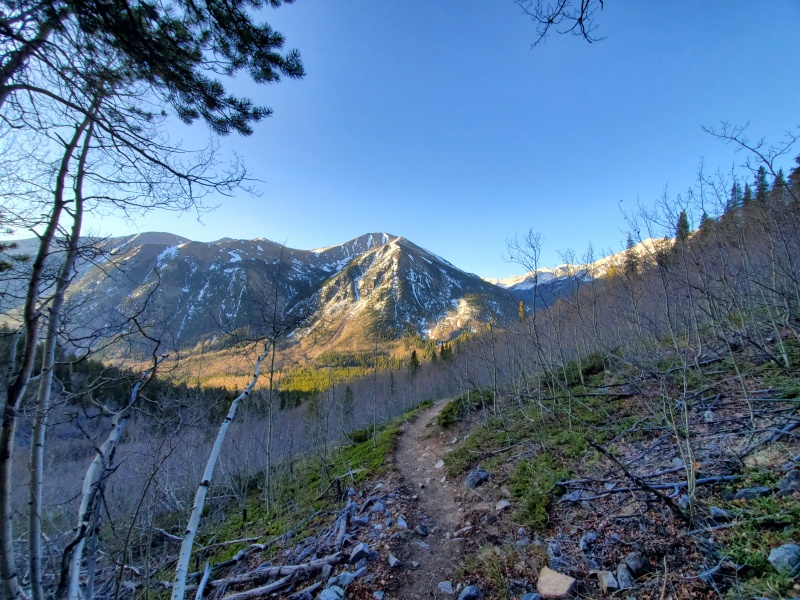
So in conclusion, a fantastic hike with a rarely done, but fun snow climb. Thumbnails for uploaded photos (click to open slideshow): ")
")
")
")
")
")
")
")
")
")
")
")
")
")
|
| Comments or Questions | |||
|---|---|---|---|
|
Caution: The information contained in this report may not be accurate and should not be the only resource used in preparation for your climb. Failure to have the necessary experience, physical conditioning, supplies or equipment can result in injury or death. 14ers.com and the author(s) of this report provide no warranties, either express or implied, that the information provided is accurate or reliable. By using the information provided, you agree to indemnify and hold harmless 14ers.com and the report author(s) with respect to any claims and demands against them, including any attorney fees and expenses. Please read the 14ers.com Safety and Disclaimer pages for more information.
Please respect private property: 14ers.com supports the rights of private landowners to determine how and by whom their land will be used. In Colorado, it is your responsibility to determine if land is private and to obtain the appropriate permission before entering the property.