Download Agreement, Release, and Acknowledgement of Risk:
You (the person requesting this file download) fully understand mountain climbing ("Activity") involves risks and dangers of serious bodily injury, including permanent disability, paralysis, and death ("Risks") and you fully accept and assume all such risks and all responsibility for losses, costs, and damages you incur as a result of your participation in this Activity.
You acknowledge that information in the file you have chosen to download may not be accurate and may contain errors. You agree to assume all risks when using this information and agree to release and discharge 14ers.com, 14ers Inc. and the author(s) of such information (collectively, the "Released Parties").
You hereby discharge the Released Parties from all damages, actions, claims and liabilities of any nature, specifically including, but not limited to, damages, actions, claims and liabilities arising from or related to the negligence of the Released Parties. You further agree to indemnify, hold harmless and defend 14ers.com, 14ers Inc. and each of the other Released Parties from and against any loss, damage, liability and expense, including costs and attorney fees, incurred by 14ers.com, 14ers Inc. or any of the other Released Parties as a result of you using information provided on the 14ers.com or 14ers Inc. websites.
You have read this agreement, fully understand its terms and intend it to be a complete and unconditional release of all liability to the greatest extent allowed by law and agree that if any portion of this agreement is held to be invalid the balance, notwithstanding, shall continue in full force and effect.
By clicking "OK" you agree to these terms. If you DO NOT agree, click "Cancel"...
As winter began drawing to a close, I was running out of 3 day weekends with which I could get farther peaks from home in Aurora. Weather was looking good for leap year weekend, so I started looking for options. I thoroughly enjoy Gunnison and Lake City, and hadn't been there this winter yet, so decided that would be my base for the weekend's adventures.
I've been working in Hastings, NE since New Years, which has it positives and negatives. On the negative, it's Hastings, NE. On the positive, its only about a 5.5 hour drive to home, and when I'm asked to work that far from home I get a 3 day weekend to come home twice a month. The weekend did not start out ideally. I had planned to leave Hastings around 10am which would allow me get home around 3 (time zone change FTW), unpack, repack, and be on the road by 4ish, hoping to miss traffic driving from home in Aurora to 285 across town. At 9:30, just as I'm winding down, Regional Vice President shows up (I work for Walmart). As I see it, I had 2 options: A. Let RVP know that I'm scheduled to drive home at 10am due to some important plans for the weekend, or B. Suck it up and tour the store with her, and hope it goes quickly. I went with option B. Tour went well, but I didn't get out of there until 11:30am. Hopped in the car, booked it down I-80 and I-76, had some Raising Cane's chicken on the way, and made it home around 4:30.
Unpacked, repacked, and got back on the road. Traffic wasn't bad getting across town, thankfully. However, after passing Conifer one of the roadside signs said something about road closure on 285. Ugh. I pulled over at Pine Junction to check the CDOT website, and it was confirmed, 285 was closed for some distance around Fairplay. My only real option was to take Deckers Rd. to Woodland Park, then 24 to 285. Fortunately the detour only cost me maybe 90 minutes or so, and just a short section of nasty weather just before getting back onto 285 from Highway 24. Made it to Gunnison around 10:30pm. Not bad, all things considered.
Initially I had been planning to do Uncompahgre or Wetterhorn on Friday, then drive home Saturday morning. I've had many days this winter with a 3 hour drive on both sides of a long ass hike, thought I'd give myself a break and take it easy for a weekend. Then I started looking at the East ridge route up to Sunshine/Redcloud. Only 9 miles? And I'd get 2 precious purple snowflakes? Now I was considering just doing those 2 peaks. But after seeing the nearly perfect weather forecast for Friday *and* Saturday, I pretty much had no choice but to hike both days. First world problems, right?
After getting in late Thursday night, decided I'd do the easier day Friday. I wouldn't need to be up super early, and I'd be able to get back early Friday for an early start Saturday morning.
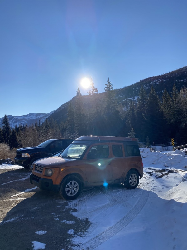
Up at 6am, on the road a little before 7, I reached the Mill Creek Campground around 8am. To my surprise, I was not the only vehicle in this small parking area. I was off hiking about 8:10.
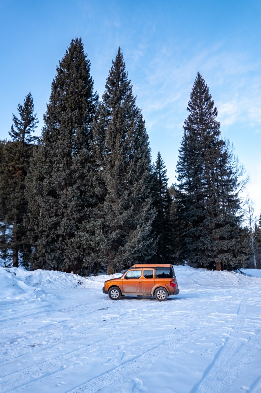
Backing in is in style.
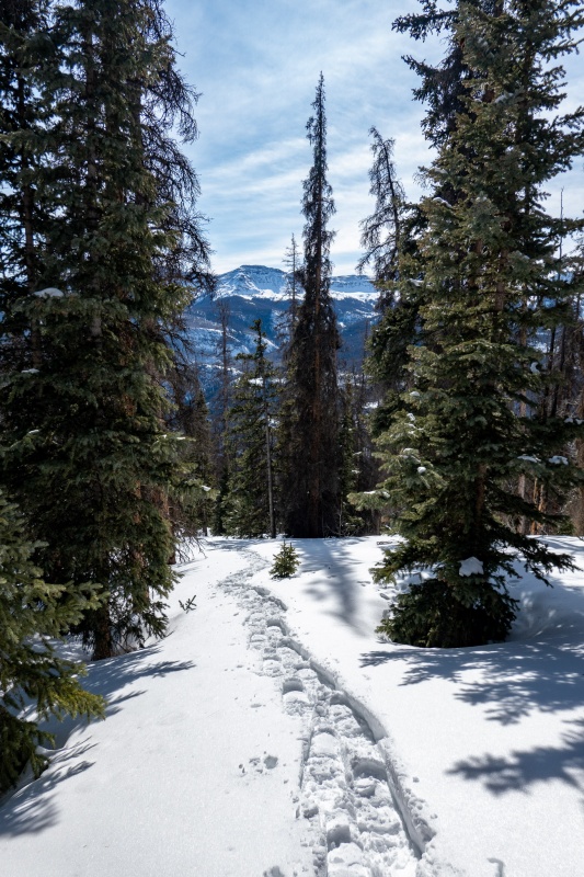
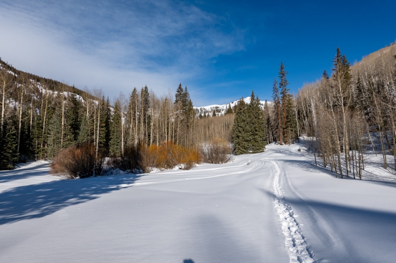
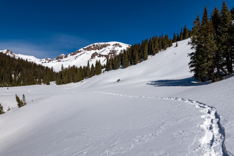
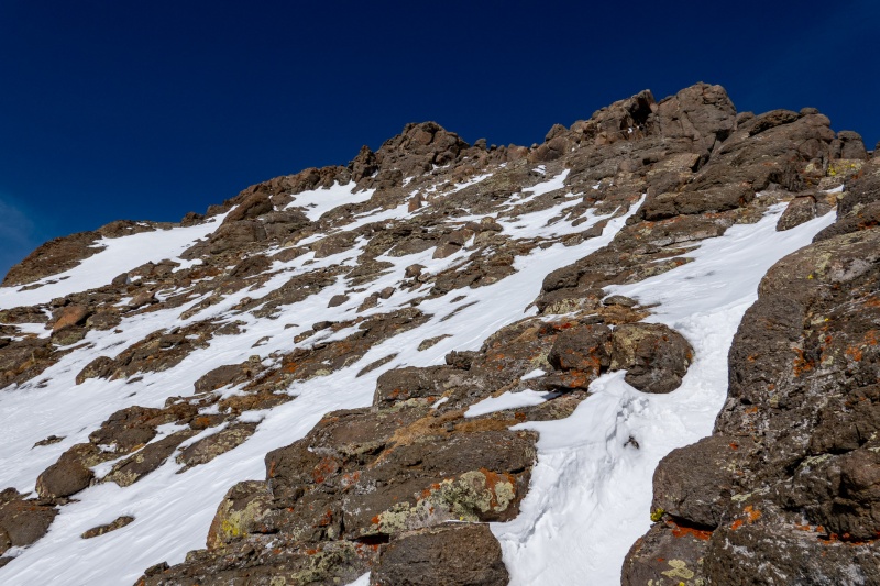
I hadn't done this route up to Sunshine, and was a bit caught off guard by how steep it was. The route isn't hard to follow (particularly since there were 2 people ahead of me breaking trail and leaving tracks), but man is it steep. I showed 1200 ft of elevation gain after the first mile. And it doesn't relent until shortly after treeline. Also complicating the route below treeline is a healthy mix of deep snow, dry rocks, and mud. I was in snowshoes almost immediately.
I made the mistake of taking off my snowshoes one time after making it up maybe 3/4 of the way through treeline when traversing a dry rocky section. Immediately put them right back on, and wouldn't take them off again until after reaching summit of Sunshine Peak. I just dealt with the clanking on rocks, dirt and mud. Having heal risers on your snowshoes is mandatory for this route.
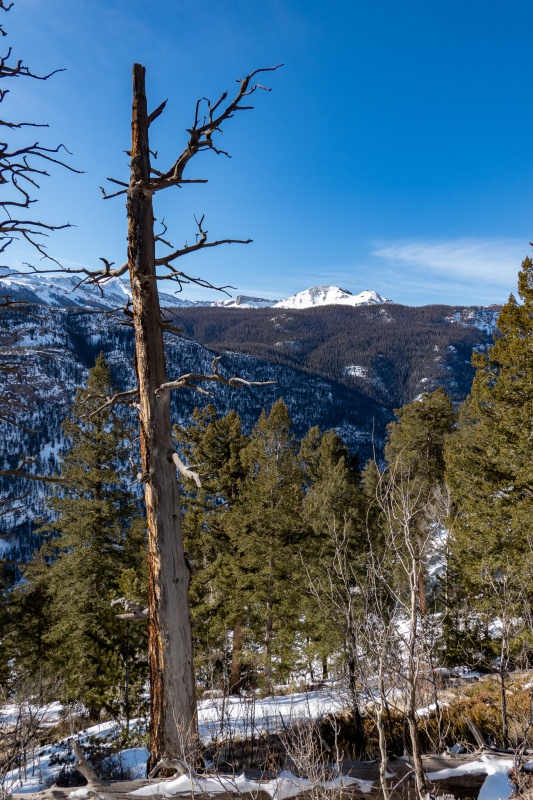
The mystery of who's tracks I was following would eventually be solved. Nearing treeline.
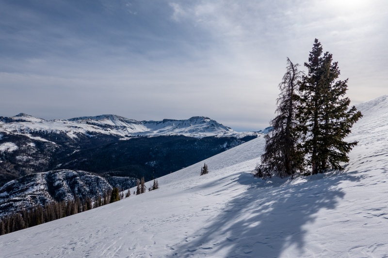
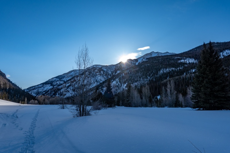
It was an extremely warm day, and with no wind below treeline I was using just 2 layers. Once above treeline the winds picked up, more of a nice breeze than anything else.
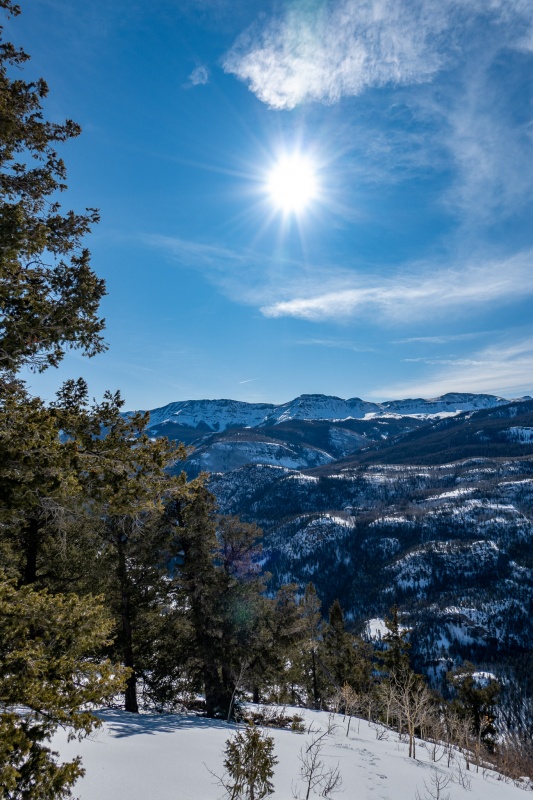
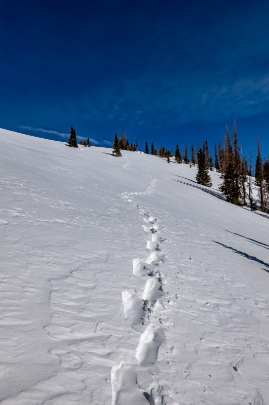
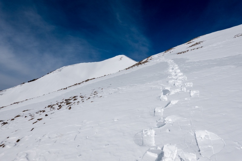
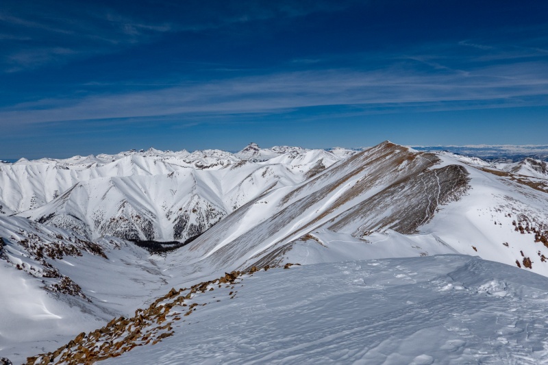
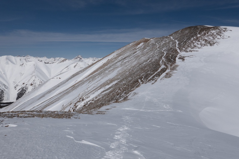
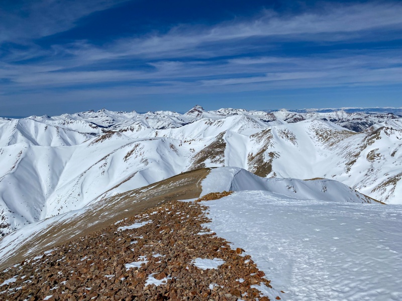
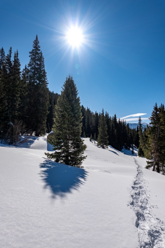
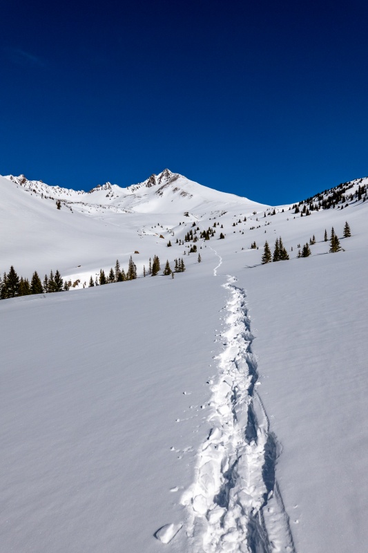
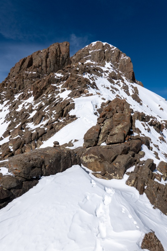
Once above treeline you can pretty much see the entire route to summit. Its steep, but not quite "Sunshine East ridge treeline steep". I feel like anytime someone complains about how steep a route is, I'm going to refer them to this route to understand the true definition of steep.
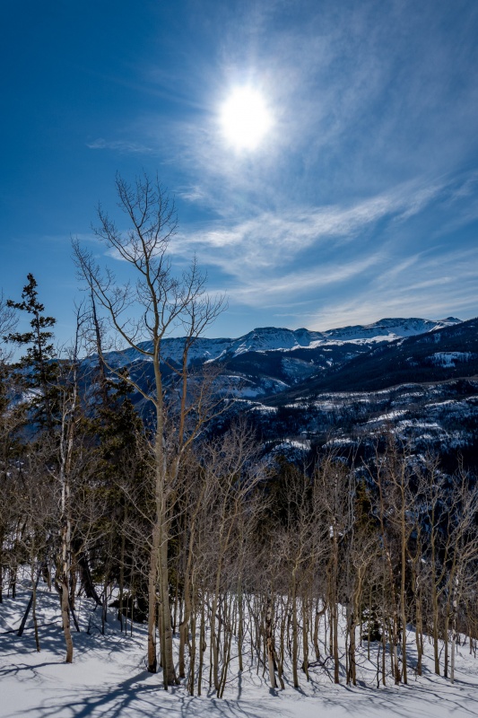
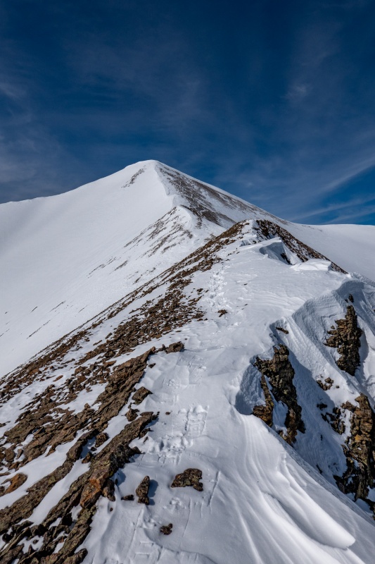
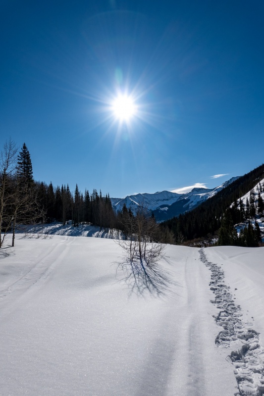
Can just see Sunshine's summit in the distance.
Getting closer.
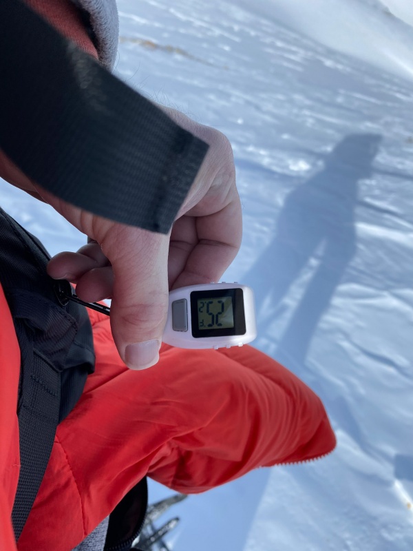
I reached Redcloud's summit at 10:52, decent pace for the steepness. A little bit of wind at the peak, but not horrible.
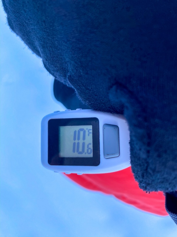
Summit temp was 25°.
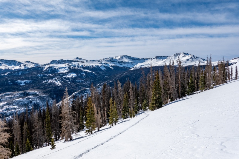
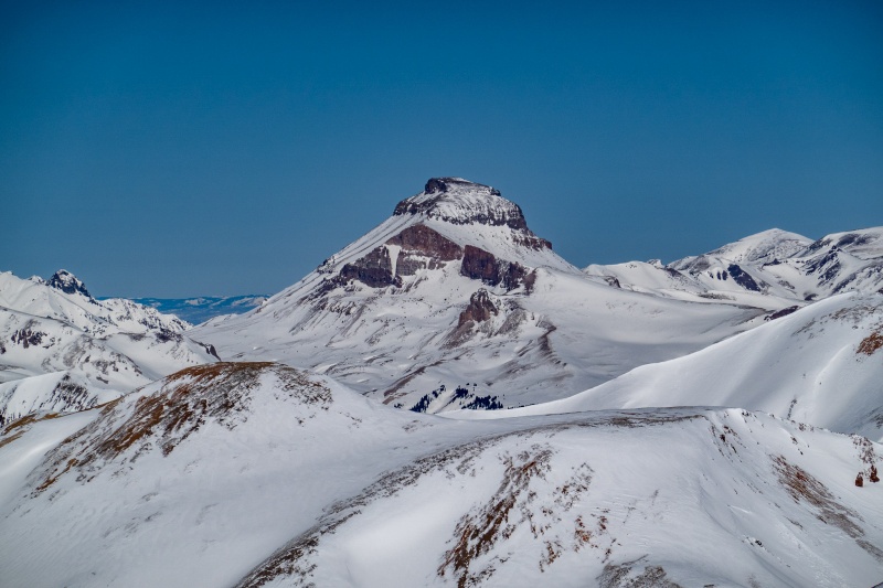
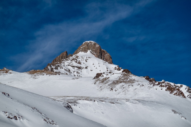
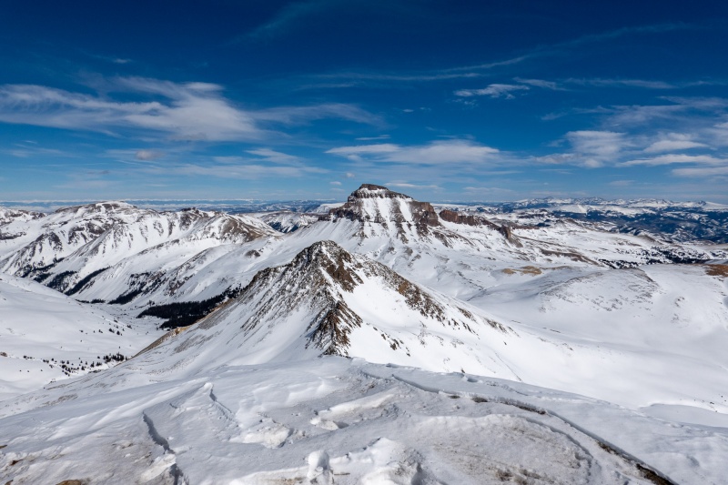
Looking towards Uncompahgre. Can easily see the route to Redcloud's summit.
Zoomed in on Uncompahgre from Sunshine's summit. I love that mountain.
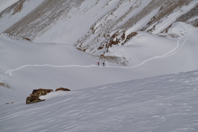
As I'm making my way down Sunshine towards Redcloud, I spot the mystery trail breakers. Quickly grabbed camera and took a poorly focused zoomed in shot. We missed crossing paths by maybe 15 minutes. Would later discover this to be CaptainSuburbia and Supranihilest. Honestly, at the rate the 3 of us have been bagging peaks this winter, it was statistically only a matter of time before all 3 of us ended up on the same mountain together.
Note to self, when rushing to take a pic, check results before putting camera away.
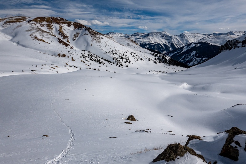
The trek to Redcloud was simple and uneventful, with great views of Uncompahgre most of the way. Left my snowshoes at the saddle between the 2 peaks.
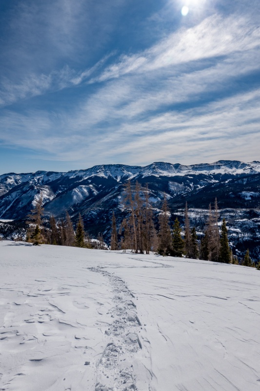
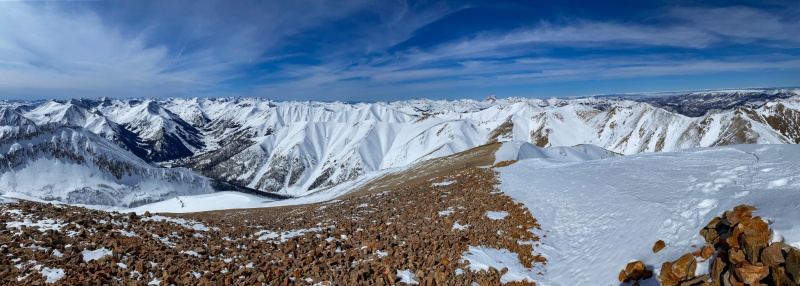
From Redcloud's summit, all I can focus on is Uncompahgre. It just towers above everything.
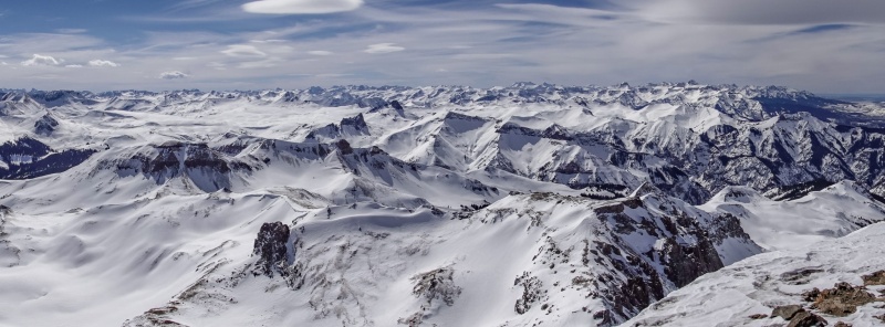
Pano from Redcloud. I'm going to name my firstborn child 'Uncompahgre'. Maybe 'Uncompahgre Maroon'. Has a great ring to it.
The return was uneventful, although the steep treeline section was worse in the afternoon. The snow was mushy, and there was now substantial mud, it was nearly as bad as potholing, but not quite.
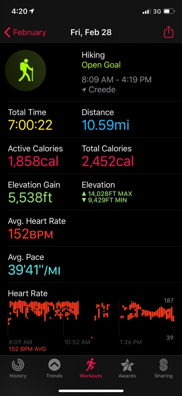
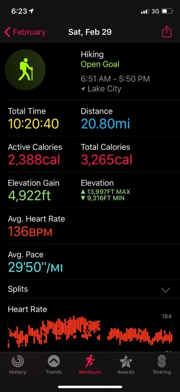
Apple stats. Crazy elevation gain for such a short distance.
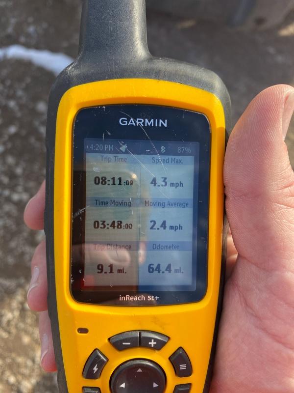
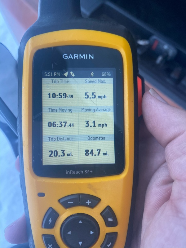
Garmin stats.
Got back to Gunnison early enough to have a nice steak at the Ol' Miner (highly recommend the pretzel bites too), and get to bed early for an early start Saturday. At this point I was still undecided between Uncompahgre and Wetterhorn.
The next morning I was up early, but didn't get quite as early a start as I would have liked, had to pack up the car as I would be driving straight home after the day's adventure. I was on the road about 5:30, but neglected to notice I was low on gas until halfway to Lake City. I was pretty sure I could get to Lake City and back to Gunnison before running dry, but I'm every bit as apprehensive about running out of gas as I am running out of juice in my iPhone or camera. I wasn't even sure Lake City had a gas station, I mean, the whole county doesn't even have a Walmart. Or a stoplight. I can confirm two things from this early morning trip to Lake City: 1)There is in fact a gas station in Lake City (its even open 24 hours) and 2) If you ever wondered where the slowest gas pump in the world is, its the aforementioned station. I had just enough patience for 3 gallons.
After putting in my 3 gallons, then heading to the end of County rd. 20, I still hadn't made my mind up as to which peak I would attempt. I knew Wetterhorn would be the longer/harder option, and my legs were just a touch sore from Friday's trek. I parked at the end of the rd, went and looked beyond the gate, the road was well packed. Tempting. I love Uncompahgre, and hadn't been up on it since last April. Decided that was the safer bet, as it was nearly 7am, and after I finished the day I'd still have a 5 hour drive back home. Drove back to the base of Nellie Creek rd. Used the restroom (lots of TP in there, BTW). Changed my mind again, decided to just eff it and do the harder peak. Drove back to the end of the road and started my long road walk a little before 7am.
Made great time on the road walk, first 4 miles I was averaging ~21 minute miles. I think the cold helped speed me up. It was chilly in the shadow.
Coldest temp of the day was in the early morning shadow walking the road.
Road was well groomed.
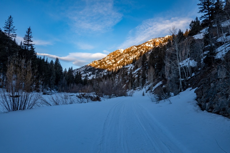
Finally nearing the end of the shadow as the route turns right at the first junction. Looking forward to being in the sun.
Turning right yields sun and warmer temps.
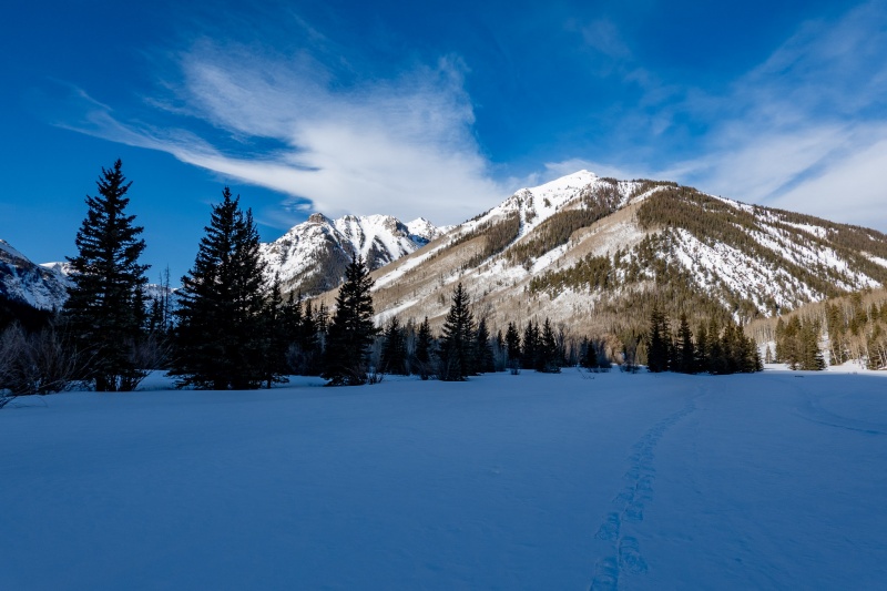
A short distance after turning north, the snow started getting deeper, I snowshoed up about the same time as whoever had left a nice track for me.
Continued on as I reached the official start of the trail, continuing to follow the nice tracks.
Matterhorn straight ahead.
Snowshoe tracks are so artistic.
Getting closer.
When I finally made my way to the base of Wetterhorn, I stashed my snowshoes.
Followed the tracks in this section, snow was soft enough I didn't need traction.
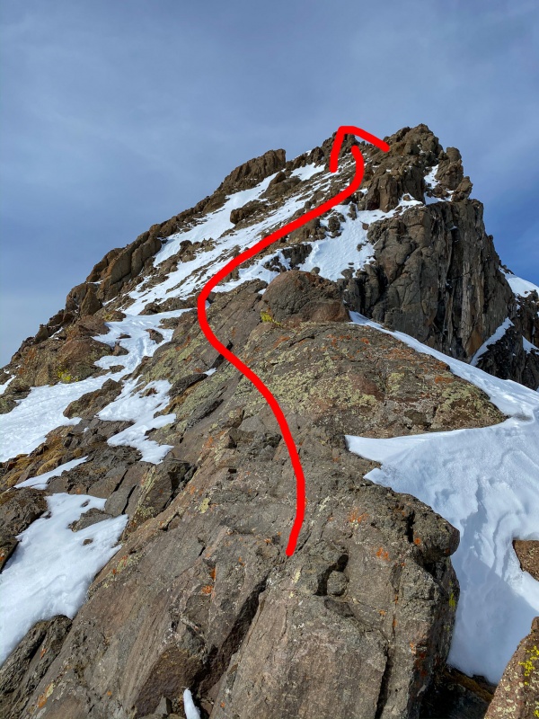
Stayed climber's right all the way up this section, it was a lot of fun, and allowed me to be lazy and not unpack crampons. This is what makes Wetterhorn great. Only had to hike 9 miles to get here;)
Followed this line along dry rock. Just a short section of snow beyond prior to the notch.
After making my way to the notch, not knowing what the snow might look like on the final climb to summit, I'm relieved to see that it is mostly dry.
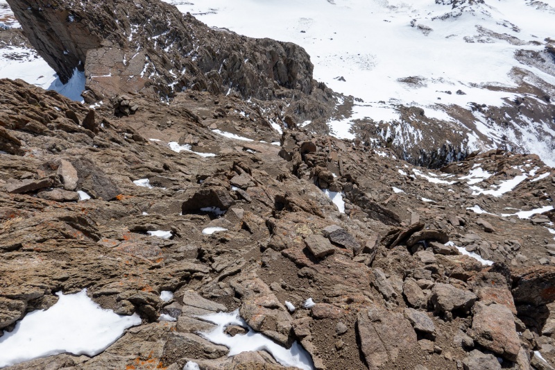
Final section. This is gonna be fun.
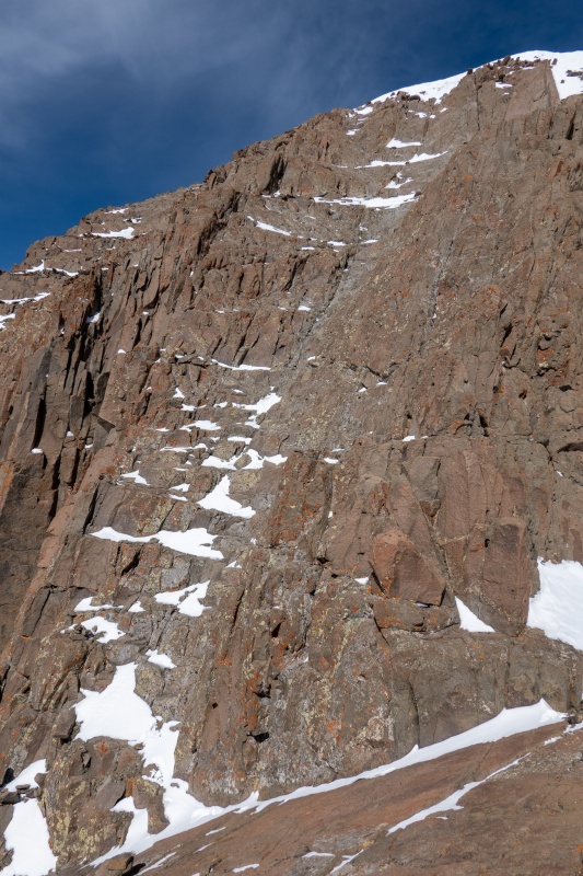
Looking down the final pitch.
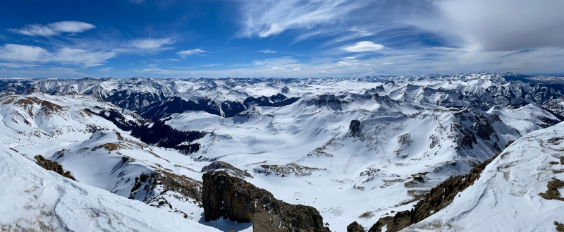
Made it to Wetterhorn's summit just after 1pm, 6 hours and 12 minutes from start. Weather was great, 22° at the summit, and not much wind. I was glad I did Wetterhorn rather than Uncompahgre, I'd rather be looking at Uncompahgre than standing on it. The views on this day were spectacular.
Matterhorn and Uncompahgre.
Looking west.
Looking south.
Return trip was uneventful, there hadn't been much wind today, so tracks were completely intact. Made it back to the car by 6pm, was home in Aurora just after 11pm. Great weekend. Glad I pushed myself to hike both days.
Apple stats. Crazy that Sunshine/Redcloud is half the distance, but slightly greater elevation gain.
Garmin stats.
Thanks for reading.
Thumbnails for uploaded photos (click to open slideshow):
I like it! Unc was my first 14er about a million years ago when I was 15 or so, and have done it about 5 more x since. Love that one and Wetterhorn too! AND, Yes, Sunshine was so dang steep. I did that route in May a few years ago while mosquitoes were out. Imagine trying not to stop or slow down on the steep section so skeeters wouldn't swarm. Ugh!
That's my car (barely visible) and Judd's (CaptainSuburbia) truck in the first picture! Haha. You followed us up Sunshine and Redcloud and I think we followed you up Wetterhorn (albeit a week later). Nice solo climb of the latter, Will.
Thank you for making my day at home a better one during these times with your trip report. I was wondering where you bought that cute thermometer that you always show in your reports!
Caution: The information contained in this report may not be accurate and should not be the only resource used in preparation for your climb. Failure to have the necessary experience, physical conditioning, supplies or equipment can result in injury or death. 14ers.com and the author(s) of this report provide no warranties, either express or implied, that the information provided is accurate or reliable. By using the information provided, you agree to indemnify and hold harmless 14ers.com and the report author(s) with respect to any claims and demands against them, including any attorney fees and expenses. Please read the 14ers.com Safety and Disclaimer pages for more information.
Please respect private property: 14ers.com supports the rights of private landowners to determine how and by whom their land will be used. In Colorado, it is your responsibility to determine if land is private and to obtain the appropriate permission before entering the property.


")
")
")
")
")
")
")
")
")
")
")
")
")
")
")
")
")
")
")
")
")
")
")
")
")
")
")
")
")
")
")
")
")
")
")
")
")
")
")
")
")
")
")
")
")


