Download Agreement, Release, and Acknowledgement of Risk:
You (the person requesting this file download) fully understand mountain climbing ("Activity") involves risks and dangers of serious bodily injury, including permanent disability, paralysis, and death ("Risks") and you fully accept and assume all such risks and all responsibility for losses, costs, and damages you incur as a result of your participation in this Activity.
You acknowledge that information in the file you have chosen to download may not be accurate and may contain errors. You agree to assume all risks when using this information and agree to release and discharge 14ers.com, 14ers Inc. and the author(s) of such information (collectively, the "Released Parties").
You hereby discharge the Released Parties from all damages, actions, claims and liabilities of any nature, specifically including, but not limited to, damages, actions, claims and liabilities arising from or related to the negligence of the Released Parties. You further agree to indemnify, hold harmless and defend 14ers.com, 14ers Inc. and each of the other Released Parties from and against any loss, damage, liability and expense, including costs and attorney fees, incurred by 14ers.com, 14ers Inc. or any of the other Released Parties as a result of you using information provided on the 14ers.com or 14ers Inc. websites.
You have read this agreement, fully understand its terms and intend it to be a complete and unconditional release of all liability to the greatest extent allowed by law and agree that if any portion of this agreement is held to be invalid the balance, notwithstanding, shall continue in full force and effect.
By clicking "OK" you agree to these terms. If you DO NOT agree, click "Cancel"...
Whenever we have a great weather forecast in winter, I try to hit the long approach peaks. Blanca was on my radar well before winter started, just needed a great forecast, as I knew it'd be a hella long day. On Friday January 17, 2020 I headed down to Alamosa to stay the night so I could be well rested for a long day in the Sangre's.
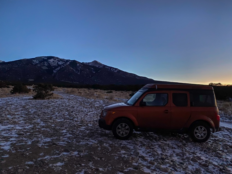
As far as I was willing to drive my toaster.
I started around 8,000 ft just after 6:30, plan was to be hiking around sunrise. I knew I'd likely be using a headlamp for the day's adventure, but I'd just as soon use my headlamp at the end of the day than at the beginning. Pretty cold to start the day, but not much wind.
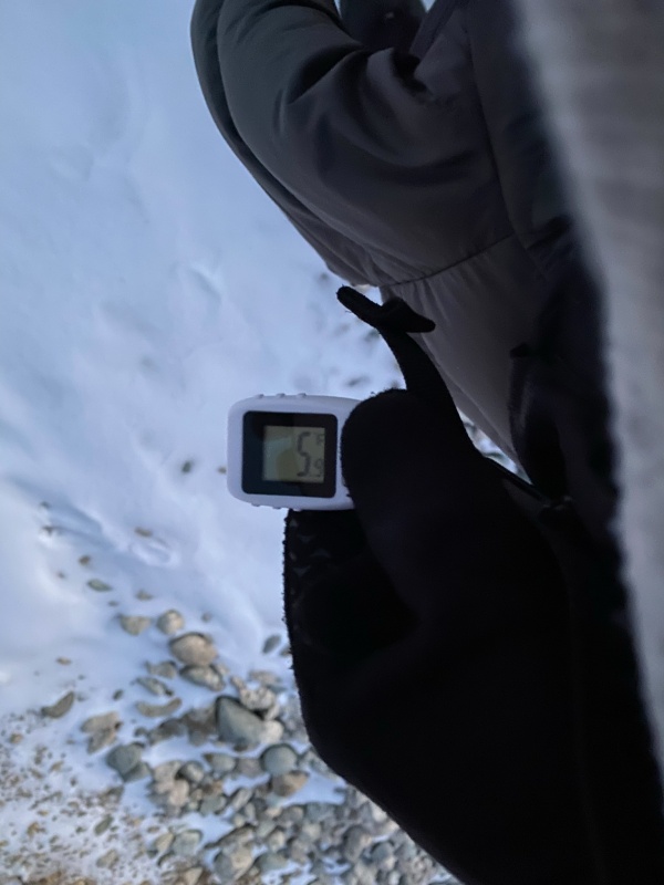
6° measured when I left my toaster (I can't really call it a car).
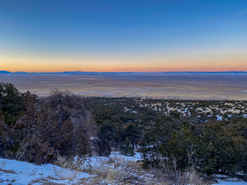
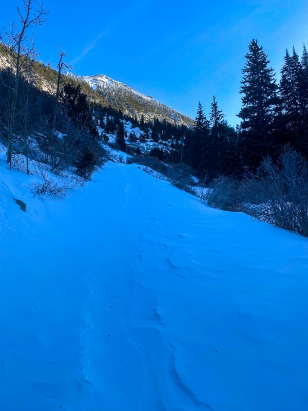
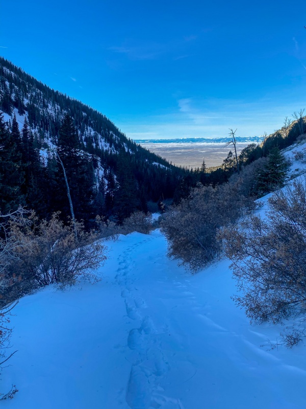
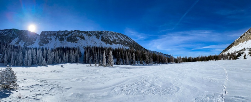
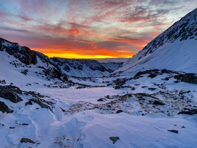
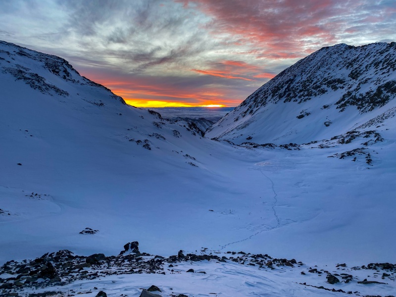
Initially Lake Como road was mostly dry or had light snow, I didn't need any traction or flotation. Seeing the sunrise over the valley was cool.
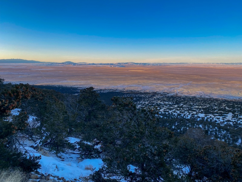
San Luis valley
Made good time the first 3 miles, around 29 minutes per mile. I see lots of complaints about the long walk up Lake Como Rd, I don't mind it so much, its great cardio.
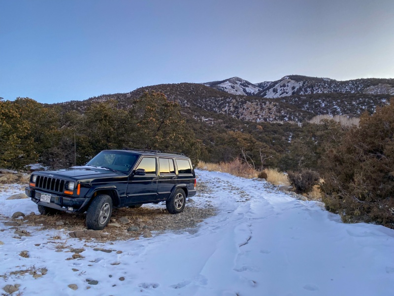
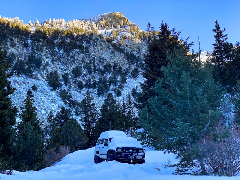
Broken down Cherokee #1.
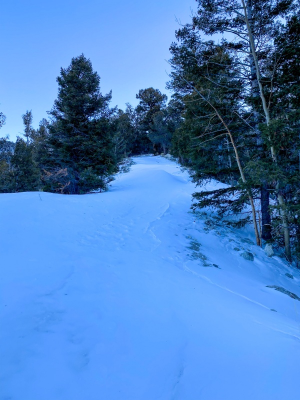
Snow was nice and stiff.
I made it 3.5 miles up the road before the snow finally deepened and I put my snowshoes on.
Snowshoe time!
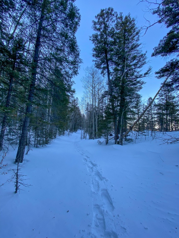
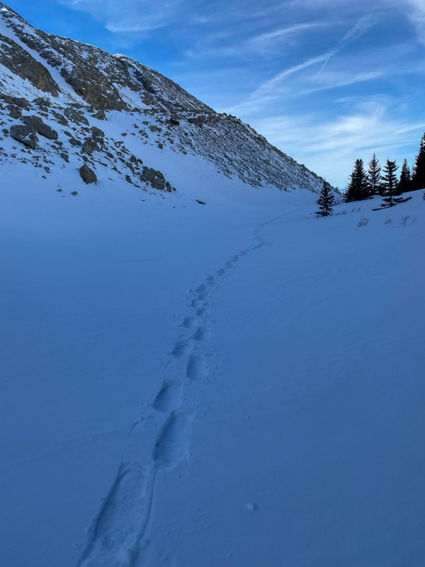
Initially after putting on snowshoes I was breaking trail, but shortly thereafter...
A trench appears!
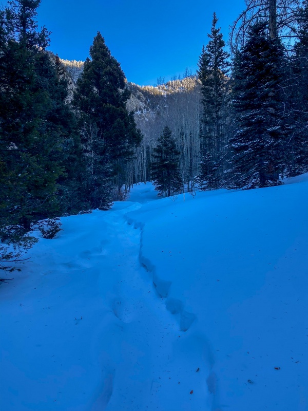
I was surprised to see a trench, I was expecting a long day breaking trail. It was generally consistent up until maybe a mile from Lake Como. This day just kept getting better.
Broken down Cherokee #2.
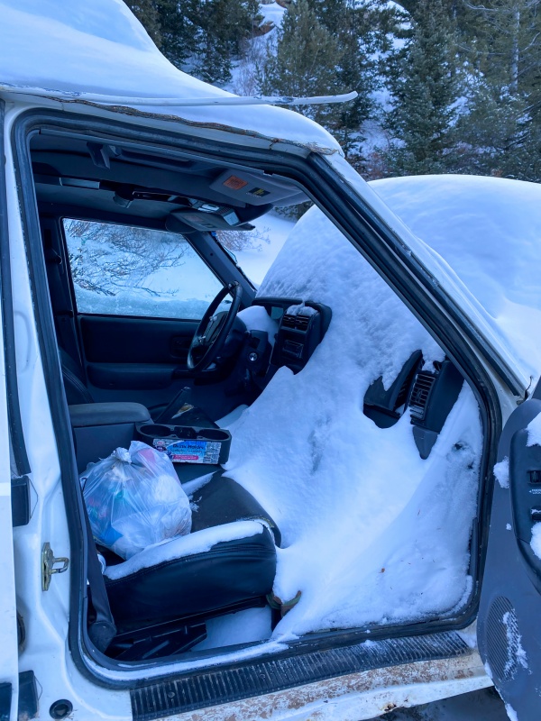
I had to see what it looked like inside. Ouch. (it wasn't locked;)
The trench.
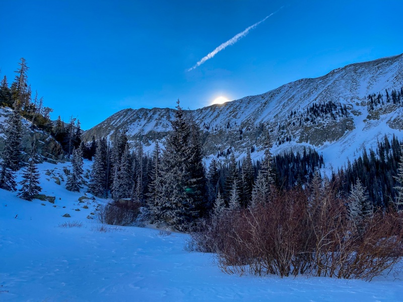
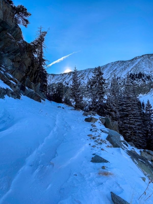
Sun coming up over the ridge.
I like to think of myself as a photographer first and mountain climber second, this day would be great from both aspects. Many of my favorite shots this winter would be taken on this trek.
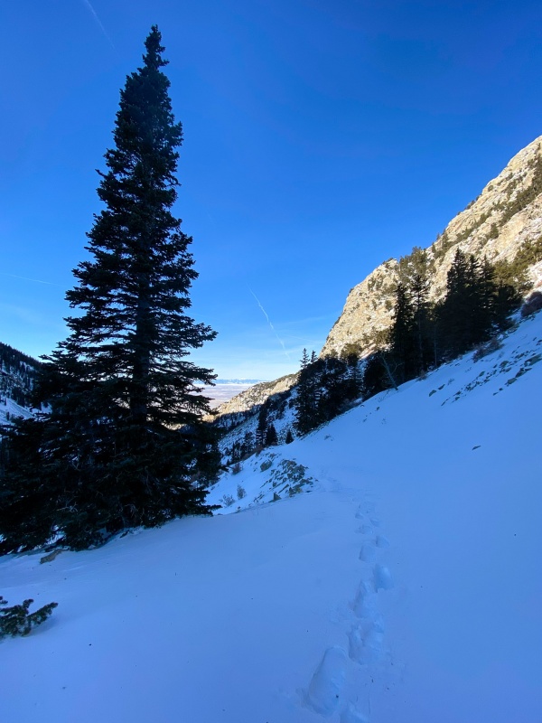
Sidehilling near Lake Como. Ugh.
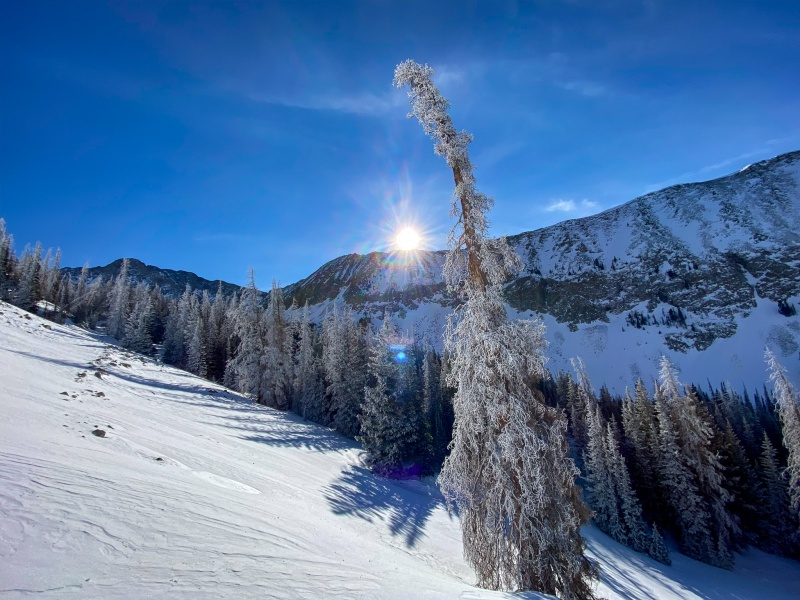
I don't know what kind of tree this is, I’ll just call it awesome.
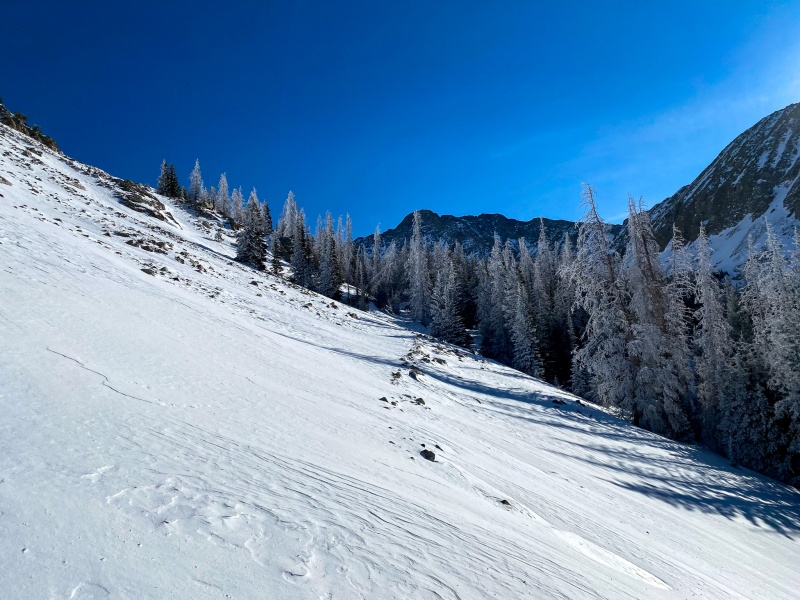
Love these frost covered trees.
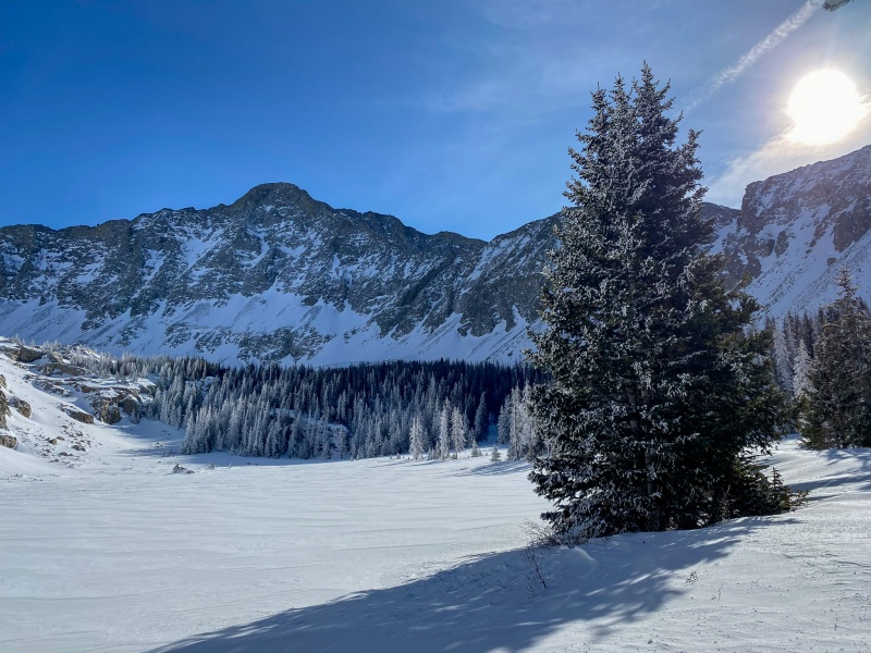
Made pretty good time to Lake Como, a little over 3 hours from start. I was pretty excited to walk across it, the kid in me gets a little over eager to walk across a frozen lake.
Lake Como, with Little Bear.
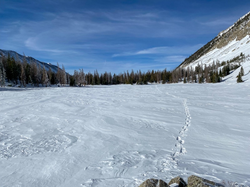
I usually keep a nice straight line across lakes. Not today.
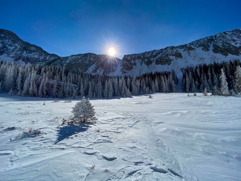
One of my favorites from the day.
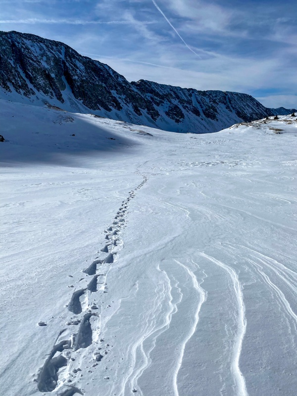
Past Lake Como I followed the Jeep road, the nastiest snow of the day was in the steep section immediately after Lake Como. Fortunately its not terribly long.
Near the Little Bear turnoff.
Finally above treeline.
Continued in snowshoes until I got past the upper lakes. It had been over a year since my first summit of Blanca, I didn't remember it being so far beyond Lake Como.
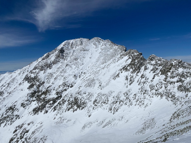
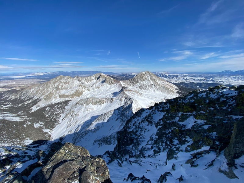
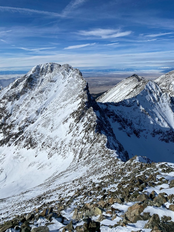
Ellingwood point as I make my way up Blanca.
Mt. Lindsey on the right.
The climb up Blanca's face was pretty uneventful, there was a mix of dry rocks and not terribly deeps snow. I didn't use crampons or microspikes.I reached Blanca's summit around 1:30.
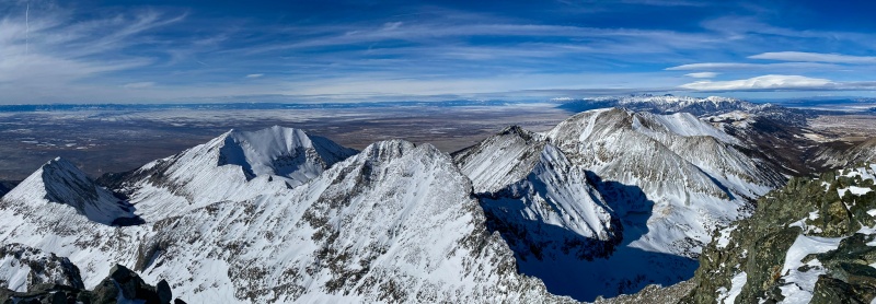
From Blanca's summit.
Little Bear
When I started down Blanca I had been contemplating Ellingwood. First I talked myself out of it, thinking it was getting too late, I don't mind hiking in the dark, but didn't want to be coming down Ellingwood's face in the dark. Decided I would go down the ridge and just have a look. Subconsciously, I think I knew if I got to that point I'd go for it. Ugh, playing mind games with myself.
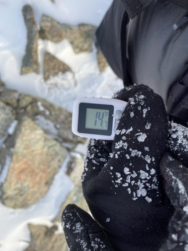
Summit temp. It was pretty windy, I didn't need goggles very often this winter, but had them on from probably 13k ft. today.
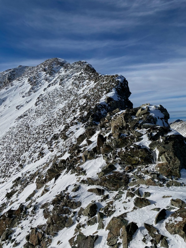
Connecting ridge to Ellingwood. Surely it can't take very long...
Once I reached the low point on the ridge, I looked at the sun. It was deceptively high. I purposely did not look at my watch, I didn't want a different data point to talk me out of going for it. I convinced myself that I could surely summit Ellingwood, then get down to Lake Como before dark, and I'd just have an easy road walk by headlamp.
The ridge up to Ellingwood.
There were a few tough maneuvers required across the middle of the connecting ridge, mostly to stay on dry rocks. I wasn't expecting that.
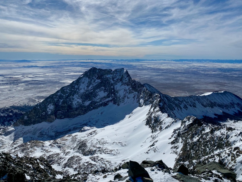
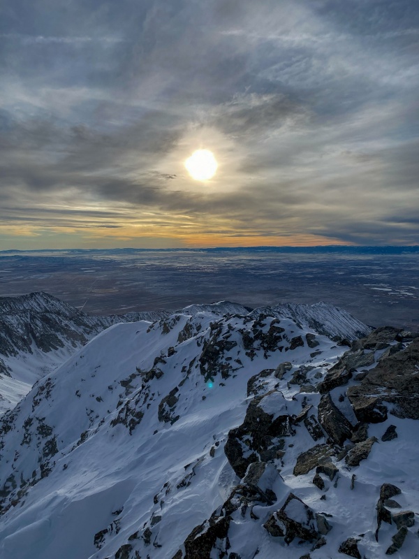
Reached the summit of Ellingwood around 3:30. It was great timing for photos, the best picture I've taken this winter was from the summit of Ellingwood point.
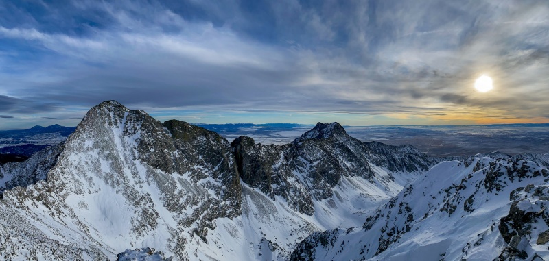
Looking back at Blanca.
The money shot. Blanca, Little Bear, San Luis Valley, the sun. This should be on a wall in my house.
Left the summit of Ellingwood a little before 4pm. I knew I wasn't going to get to Como before dark, but had no issue getting down the steep part of Ellingwood. The sunset as I descended was awesome. I was glad I pushed on to Ellingwood. Long days like this are what I live for.
We have the best sunsets anywhere.
Sunset plus snowshoe tracks? These are a few of my favorite things.
I was able to get to my snowshoes before dark, my tracks were intact pretty much the whole way down, so getting back was uneventful.
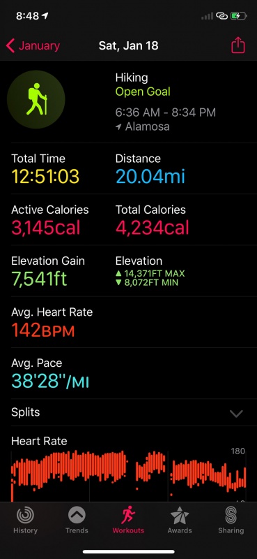
Final stats.
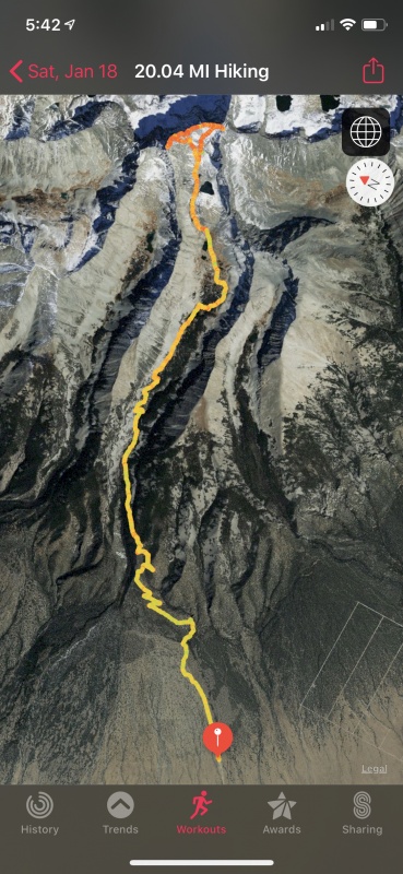
GPS track.
Thanks for reading.
Thumbnails for uploaded photos (click to open slideshow):
I'm glad you held off from posting this trip report. In these stay at home days there are not many reports to view. I appreciate yours enchanting report. Your photos are great. I'd love to hang a few in my home with your permission. I really like that you included a shot of your trip time, HBR, and calorie burn. That's some great fitness beta. Again, thank you for posting, staying safe, and giving some respit from this lull.
Nice trip and good work!
I love that area up by Lake Como. Bad day for Cherokees huh.
Great photos, made me feel I were there.
Did you bring a tripod up there with you, what kind of gear do you have?
@Redorgreen Help yourself to any pics. Send me your email and I can get you full resolution images, I had to resize them for here.
@Jay Thanks, it was fantastic up there.
@KSU Thanks, I'm enjoying going back through my winter's adventures.
@Supra Couldn't be president, no real mountains near DC!
@Nyker Yeah, won't be considering a Cherokee anytime soon. I'm a bit curious as to what stranded them. All of my shots on this trip were from iPhone (11 pro). I'm too lazy to drag my SLR up a mountain, but I do drag a small lightweight tripod sometimes, usually just use it for a summit selfie.
@Tornado I'm almost always behind on going through pictures, as I'd rather spend my free time hiking, but have a bit more free time than usual given current world events.
Caution: The information contained in this report may not be accurate and should not be the only resource used in preparation for your climb. Failure to have the necessary experience, physical conditioning, supplies or equipment can result in injury or death. 14ers.com and the author(s) of this report provide no warranties, either express or implied, that the information provided is accurate or reliable. By using the information provided, you agree to indemnify and hold harmless 14ers.com and the report author(s) with respect to any claims and demands against them, including any attorney fees and expenses. Please read the 14ers.com Safety and Disclaimer pages for more information.
Please respect private property: 14ers.com supports the rights of private landowners to determine how and by whom their land will be used. In Colorado, it is your responsibility to determine if land is private and to obtain the appropriate permission before entering the property.


")
")
")
")
")
")
")
")
")
")
")
")
")
")
")
")
")
")
")
")
")
")
")
")
")
")
")
")
")
")
")
")
")
")
")
")
")
")
")
")
")
")
")
")
")
")
")
")
")
")


