Download Agreement, Release, and Acknowledgement of Risk:
You (the person requesting this file download) fully understand mountain climbing ("Activity") involves risks and dangers of serious bodily injury, including permanent disability, paralysis, and death ("Risks") and you fully accept and assume all such risks and all responsibility for losses, costs, and damages you incur as a result of your participation in this Activity.
You acknowledge that information in the file you have chosen to download may not be accurate and may contain errors. You agree to assume all risks when using this information and agree to release and discharge 14ers.com, 14ers Inc. and the author(s) of such information (collectively, the "Released Parties").
You hereby discharge the Released Parties from all damages, actions, claims and liabilities of any nature, specifically including, but not limited to, damages, actions, claims and liabilities arising from or related to the negligence of the Released Parties. You further agree to indemnify, hold harmless and defend 14ers.com, 14ers Inc. and each of the other Released Parties from and against any loss, damage, liability and expense, including costs and attorney fees, incurred by 14ers.com, 14ers Inc. or any of the other Released Parties as a result of you using information provided on the 14ers.com or 14ers Inc. websites.
You have read this agreement, fully understand its terms and intend it to be a complete and unconditional release of all liability to the greatest extent allowed by law and agree that if any portion of this agreement is held to be invalid the balance, notwithstanding, shall continue in full force and effect.
By clicking "OK" you agree to these terms. If you DO NOT agree, click "Cancel"...
Report Type
Full
Peak(s)
Mt. Washington, 6,288 ft.
Mount Moosilauke, 4,802 ft.
Mount Tecumseh, 4,003 ft.
Of Mountains and Molehills: Climbing all 48 New Hampshire 4000ers
.
On the eastern edge of our continent there is another great mountain range. And in one of the most rugged regions of this range, there are the White Mountains. And in these mountains there is a list: 48 summits enticing hikers to explore rugged trails and treeless peaks. This is the story of hiking that list.
.
When I started college at Dartmouth in New Hampshire in the fall of 2018, I had finished climbing all the CO 14ers a few weeks earlier. (74 14ers Trip Report) Of course, I was eager to jump on a new goal: all 48 of the official New Hampshire 4000ers.
.
Would they compare to my beloved Western peaks? Tourists and tree-covered summits; or wilderness areas and alpine sunrises? Join me on a photographic journey through the White Mountains, and we'll find all this and more. This report is less of a how-to for hiking these peaks, and more of a what's-out-there for regional discovery. While the West will always be home, I have learned to appreciate these peaks too, and I hope you will enjoy seeing some pictures from "those other mountains." (All lyrics in italics credit the Grateful Dead.)
.
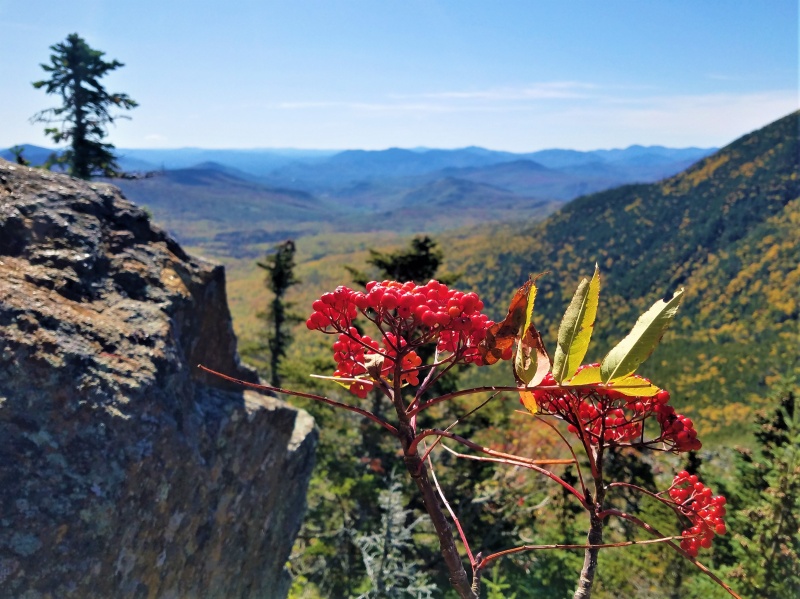
A hawthorn somewhere in the White Mountains
.
The Appalachian Mountain Club identifies 48 distinct "4000ers," or peaks with elevations above 4000 feet and at least 200 feet of optimistic prominence, in the state of New Hampshire. All of these are in the White Mountains, a region of rounded granite summits tangled in deep forest cover, occasionally jutting above treeline to form rare regions of alpine tundra in the Eastern USA.
.
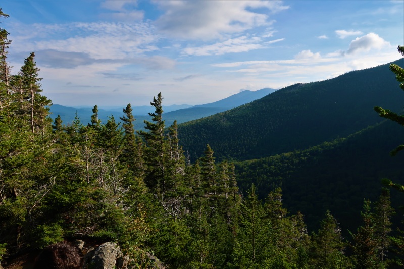
My first 4000er was Mount Moosilauke, the summit of which is actually owned by Dartmouth, so it made a fitting introduction. Most of the scenery looks roughly like this: trees, ridges, sky...not unlike Colorado montane forests.
.
Along the flanks of Mount Moosilauke, my first 4000er
.
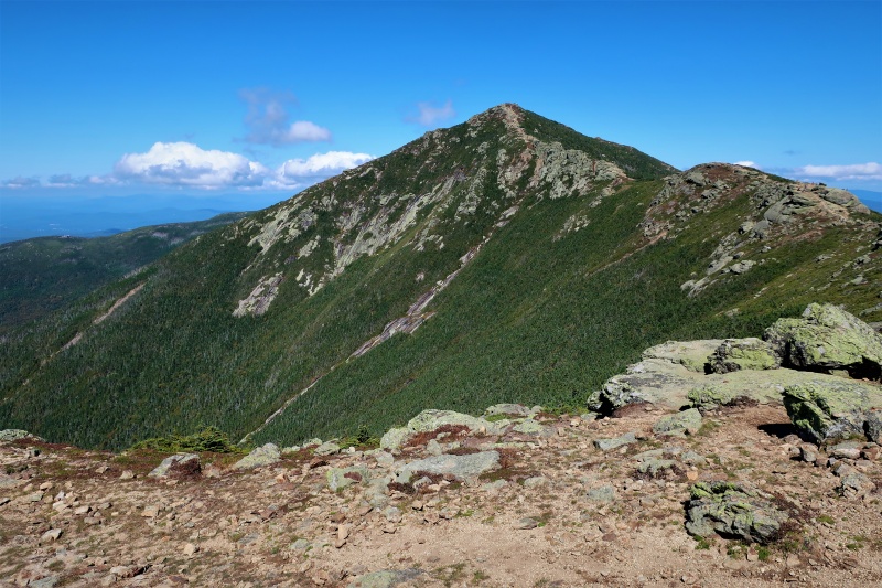
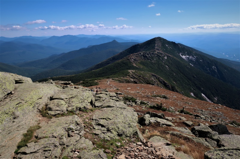
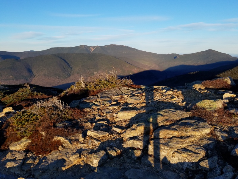
Those who hike long enough through the forest are sometimes rewarded with a bit of alpine tundra: while low by objective standards, some 4000ers (like Franconia Ridge, pictured below) are high enough to catch the cold winds coming off the Canadian Shield, creating rare patches of true alpine tundra, with a treeline around 5,000 feet.
.
Along Franconia Ridge: Mount Lincoln
.
What you don't see in these photos: small string fences along the trail to keep people in line. The concept of strolling uninhibited across endless seas of untracked tundra is unheard of here. With the whole Northeast hiking population visiting a handful of treeless zones which combine to about the area of one Colorado mountain, maybe this different ethic makes sense. Still, "something there is that doesn't love a wall" (Robert Frost, a Dartmouth student for a short time).
.
Along Franconia Ridge: the view from Mount Lafayette
.
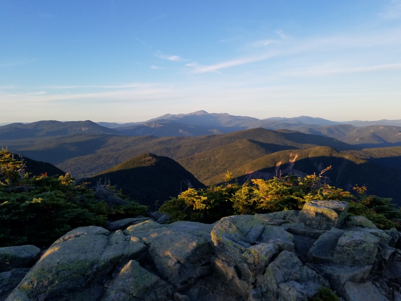
Of course, even the alpine peaks here are a bit different than the mountains I'm used to: Mount Washington, the high point of range, reaches only 6,288 feet; yet its summit observatory routinely records -50F windchills in winter, and the nearest higher ground is over 800 miles away in North Carolina. But some of the other peaks on the list are less complex: with a prominence threshold around half that required to be ranked in Colorado (160 versus 300 feet of clean rise), many of these peaks would be unnoticeable, tree-covered shoulders in the midst of what I usually think of as "real mountains."
.
So are these mountains or molehills? I routinely joke that "there's no mountains in the East" (particularly when talking to people from the East). Then again, does it matter if these are just glorified foothills lacking any true "high peaks?" They're not that bad...
.
Mount Madison from the slopes of Mount Adams in the Northern Presidentials
.
A Presi Traverse is one of the White Mountains' most classic alpine events. On my second weekend at Dartmouth, I joined an outing club hike across this range. In a long dayhike of about 22 miles, we summited 8 official 4000ers (Madison, Adams, Jefferson, Washington, Monroe, Eisenhower, Pierce, Jackson) as well as plenty of other subpeaks. Weather ranged from blowing fog to bluebird sun. Welcome to the top of New England!
.
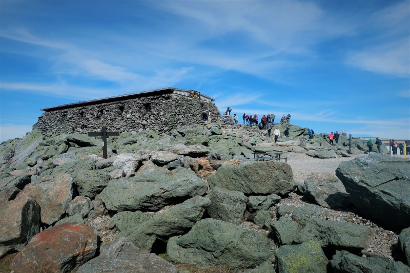
The summit of Mount Washington: stand in line to be the highest person in the Northeast
.
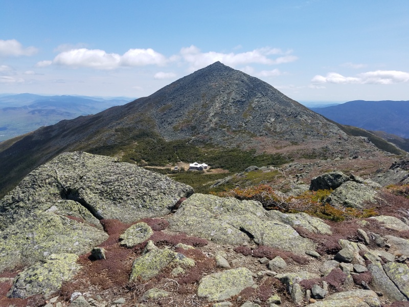
The alpine zone in the Presidential Range is a bit more relaxed than Franconia Ridge: no fences here, but still plenty of people (oh and a road to the top and a train, not unlike Pikes Peak). Alpine lakes are the rarest of the rare in the White Mountains, but there's a particularly nice one just to the south of Mount Washington. There's even a pretty expensive lodge ("hut") located just on the shoreline to accommodate hikers doing the traverse in multiple days. (Dispersed camping doesn't seem to be the norm, and is prohibited above treeline unless you're camping on top of snow.)
.
Lake of the Clouds
.
The southern Presis undulate along treeline--krumholtz, tundra, cairns, tourists--I almost feel at home! Imagine the Sawatch, but shorten everything by two-thirds.
.
Mount Washington from the top of Mount Eisenhower in the Southern Presis
.
Long days still end in treeline sunsets, no so different from "out here."
.
Webster cliffs at the end of a one-day Presi Traverse
.
The only thing better than a Presi Traverse is going back and doing another Presi Traverse the next weekend in the middle of the night, in a blowing ice storm, without actually summiting any of the high peaks. I kid, I kid...or am I serious? Yeah, we actually did that. It's called a "Hut Traverse," but they're more like lodges than huts, and you cross more ranges than you traverse, but anyway...
.
The AMC (Appalachian Mountain Club) manages 8 huts in the White Mountains, and the lodge crews have long maintained a tradition of hiking between each of the huts within a single calendar day. It's about 50 miles and +17,000 vertical feet, starting at midnight from Carter Notch Hut (itself a moderate hike uphill from the trailhead), climbing across the entire spine of the Presidential Range at night in the aforementioned freezing, blowing sleet storm (tagging Madison Hut, Lake of the Clouds Hut, and Mizpah Springs Hut), crossing the Willey Range and hitting Zealand Hut, then Galehead Hut on the edge of the Pemigewasset Wilderness, pushing up over Franconia Ridge after sunset to surprise the visitors to Greenleaf Hut, and finally racing over to Lonesome Lake Hut to finish with an hour or so to spare before midnight.
.
On the notoriously rocky, swampy, steep trails of the Whites (no switchbacks ever), 50 miles is a long day. It was crazy to look back in the afternoon and see the distant Presidential Range (on the skyline) we had crossed in the dark, a half-day earlier.
.
A moment of peace: Zealand Pond, somewhere around mile 30 or so
.
Keep on rolling, just a mile to go
Keep on rolling, my old buddy, you're moving much too slow
.
Sunset from the summit of Mount Garfield, around mile 40; 2 huts later, we'd finish with a time of 22 hr. 52 min.
.
There's one 4000er in the Presidential Range which isn't easily combined with the others: Mount Isolation. It is somewhat notorious for being one of the longer required hikes for finishing the NH48, with the most common route (12 miles, +4,700 vertical feet roundtrip) climbing over the shoulder of Mount Washington and descending into the Dry River Wilderness to reach the summit, a relatively nondescript bump, albeit with beautiful views.
.
The Carter Range as seen from the Glen Boulder Trail to Isolation
.
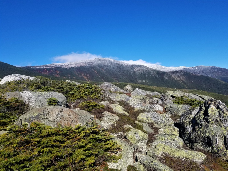
When I climbed Mount Isolation with a Dartmouth Outing Club group in the middle of October (2018), the first snows of the year had just come to the highest parts of Mount Washington.
.
First snow on the Presidential Range high peaks
.
The tundra in this region really reminds me of Colorado's sub-alpine zone (areas like the Indian Peaks particularly come to mind). Isolation's granite peak barely peeks out of the trees, but this diminutive area hosts tiny alpine tarns, wind-battered krumholtz, and far-ranging views.
.
Mount Washington from the summit of Mount Isolation
.
Not all days feature such bluebird weather: one loop I arranged over Cannon Mountain and the North/South Kinsmans in late autumn featured a lovely mix of alternating fog and freezing rain.
.
White-on-gray: the summit of South Kinsman
.
It's definitely hit-or-miss with the late-season weather. My experience with watching Colorado forecast models helped me predict one particularly beautiful day in November. The trails were beginning to get icy at this point--a tricky proposition considering their general steepness and rockiness. Except for the altitude, the New Hampshire trails tend to be quite a bit more difficult than their Colorado counterparts (of similar length) in my experience.
.
East Osceola seen during the traverse from Mount Osceola
.
On my last hiking day before the end of freshman fall term, I made it back (solo) to the trio of Willey Range summits we had merely passed near on the hut traverse. These peaks (Mounts Tom, Field, and Willey) are well-suited for winter-conditions hiking, as they are close to a major paved highway and the trails are popular and not too difficult. I tended to surprise the locals with my style: they often wore snowshoes even when there was less than a foot of snow on the trail, and almost everyone seemed to start hiking in the late morning. I was often on the trail well before almost anyone else, breaking trail to the summit in regular boots and a light coat before passing most other hikers on my way down.
.
A view into the Southern Presis from the top of Mount Willey
.
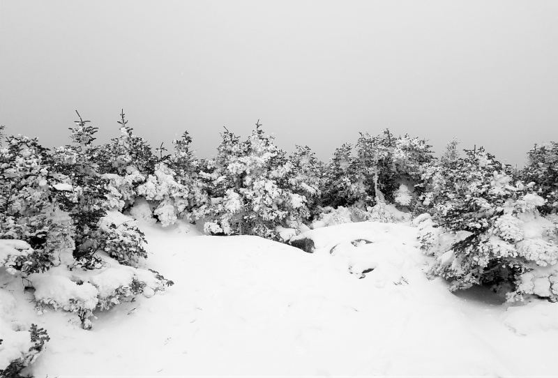
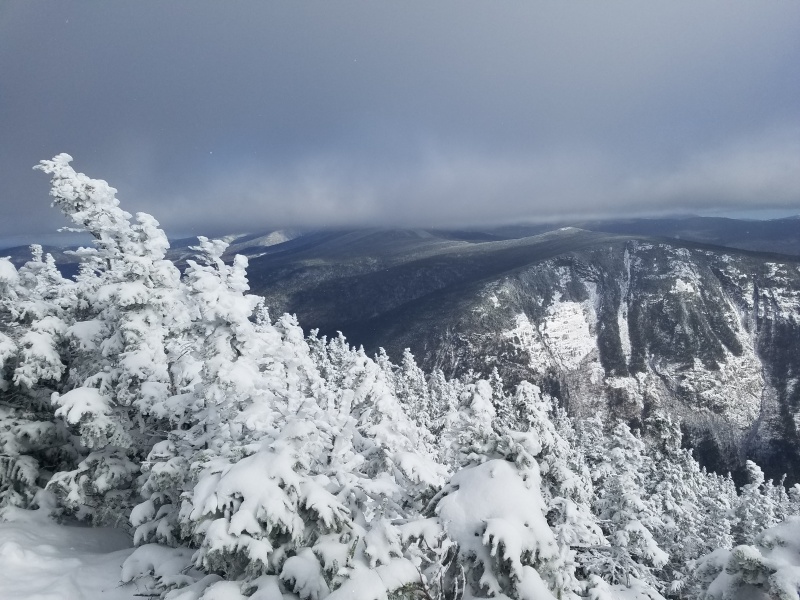
I only did one true winter hike in the White Mountains, mainly due to taking an extra-intensive course load both of my winter terms. The one that I did do was an Outing Club jaunt up Mounts Liberty and Flume, the lower neighbors of Franconia Ridge. It wasn't the world's best weather, but we did manage to score some respectable views given the notoriously low-visibility winter conditions.
.
Franconia Ridge (center) and Mount Garfield (right) from Mount Liberty in February 2019
.
After that, I took a long hiatus from the 4000ers to pursue other goals: in spring, a Wilderness First Responder class filled my "mountain time," and I spent summer on distant peaks (Wyoming--various peaks, Washington--Rainier solo, Tanzania--Kilimanjaro unsupported). I returned for my sophomore year in late August of 2019, this time with the trusty Subaru 2000 Outback (freshman aren't allowed to have cars on campus). One day I had the afternoon off during my training to become a UGA (our equivalent of an RA), so I hastily set off to get two summits before sunset.
.
The first was Mount Hale, by far the easiest of the 4000ers (think Democrat from Kite Lake). However, the 2.2-mile one-way trek to the summit includes over 2,200 feet of elevation gain. I used the steep gradient of this well-trod trail to push my cardio a bit, making it to the summit in just over an hour.
.
August on the summit of Mount Hale
.
I raced back to the car from Hale and drove a ways to another trailhead, this time for Mount Carrigain. I headed up that trail in the late afternoon, and it was clear to everyone (myself most of all) that I wouldn't be back before dark. Plenty of descending hikers gave me concerned looks--night hiking is not normal in the White Mountains, and solo hiking is somewhat frowned-upon, even during the day. One couple even voiced their concerns...but I continued hiking, perhaps saying something over my shoulder along the lines of "Kilimanjaro" ... "just returned" ... "solo mountaineering" ... "not afraid of hiking at night" ....
.
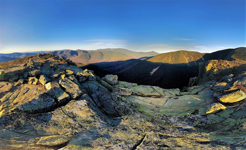
Anyway, the plan was to actually watch sunset from the famous firetower atop Carrigain (with its 360-degree views), but as I have a habit of doing, I hiked too fast for my own good, reached the top an hour before sunset, and didn't want to sit around in the cold wind. Thus I took some summit panoramas and hastened back down, pausing to take sunset pictures from outcrops on the ridge. (Yes, I made it back to the car after an hour or two of solo night-hiking, oh the horror!)
.
Late evening light from Signal Ridge on Mount Carrigain, looking north to the Presidentials
.
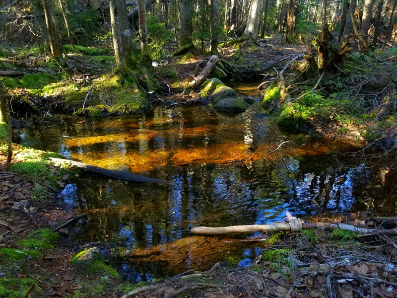
Sometimes it's the big views that inspire, but it's often the micro-scenes that dominate, such as this brook on my hike of North and South Hancock in September.
.
Serenity Now
.
Obviously, the White Mountains are much more of a forest-hiking experience than the high, open peaks of the 14ers. One advantage of this is that the far-ranging views which do exist are extra valuable and form distinctive highlights of the hike. In a way, it helped me appreciate classic views more than ever.
.
A fleeting glimpse of Mount Carrigain while traversing between the Hancocks
.
Indeed, the common fog cover and relentless rainy days make it even more exhilarating when the fog rolls back and the terrain opens up in a vast array--just as it happened on one day while I was traversing the Carter Range.
.
A sudden view opens into the Wild River Wilderness
.
The Carter Range parallels the Presidentials, albeit a bit lower, allowing a fun 20-mile day of hiking across tons of summits (the official 4000ers here are Mount Moriah, Middle and South Carter, Carter Dome, Wildcat A and D). It's extra special when the morning fog (which had enclosed the mountains for hours) rolled back all at once to reveal crystal-blue skies above the sprawling extent of the White Mountains' highest range.
.
The Presidential Range from somewhere along the Carters
.
Another one of the elusive mountain lakes is found in Carter Notch (where we started the Hut Traverse at midnight last year). It was great to finally see this marvelous locale under daylight!
.
A lake in the bottom of Carter Notch
.
This is also home of some short but rather steep hiking as the Appalachian Trail cross the Notch from peak-to-peak: the ascent and descent to the Notch both have about 1,000 feet of elevation change in a half-mile. After finishing the Wildcats Traverse, I picked up the road-bike I had staged in Pinkham Notch and rode 10 miles down the scenic mountain highway back to the car.
.
Carter Dome seen from the top of Wildcat A (separated by Carter Notch)
.
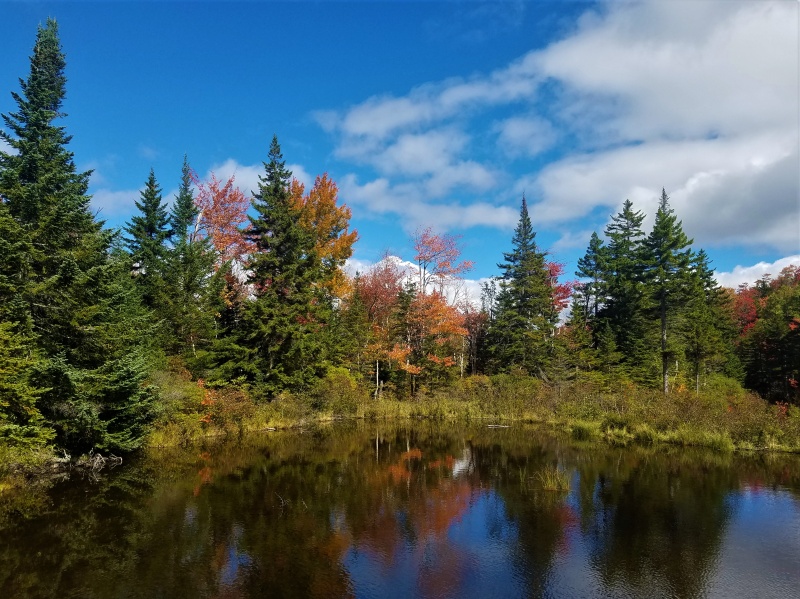
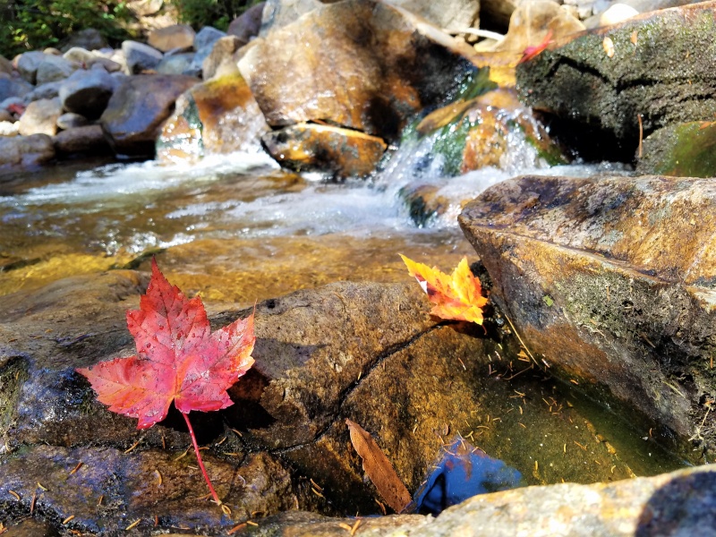
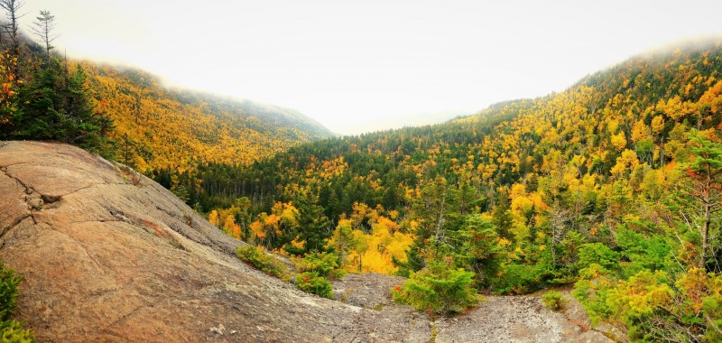
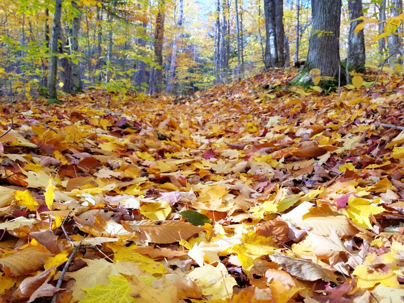
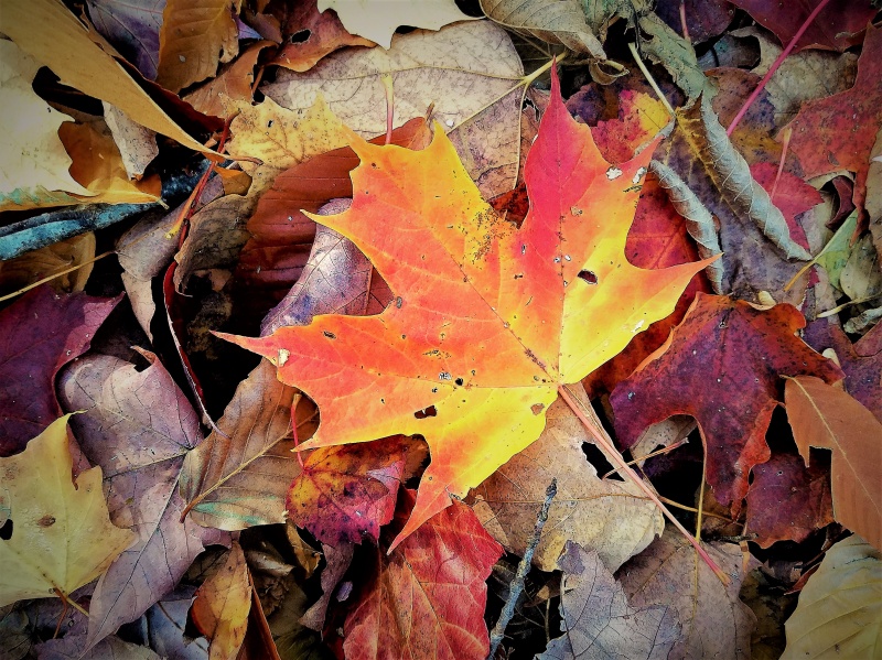
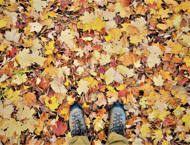
The fall foliage is truly incredible in the White Mountains. I miss the unbroken yellow of our Colorado aspen stands, but leaves from the oak, birch, maple, beech, ash, and other New Hampshire tree species combine to form an almost-magical carpet in mid-Fall.
.
The yellow brick road (Sandwich Range Wilderness)
.
Some folks look for answers, others look for fights
Some folks up in treetops, just look to see the sights
.
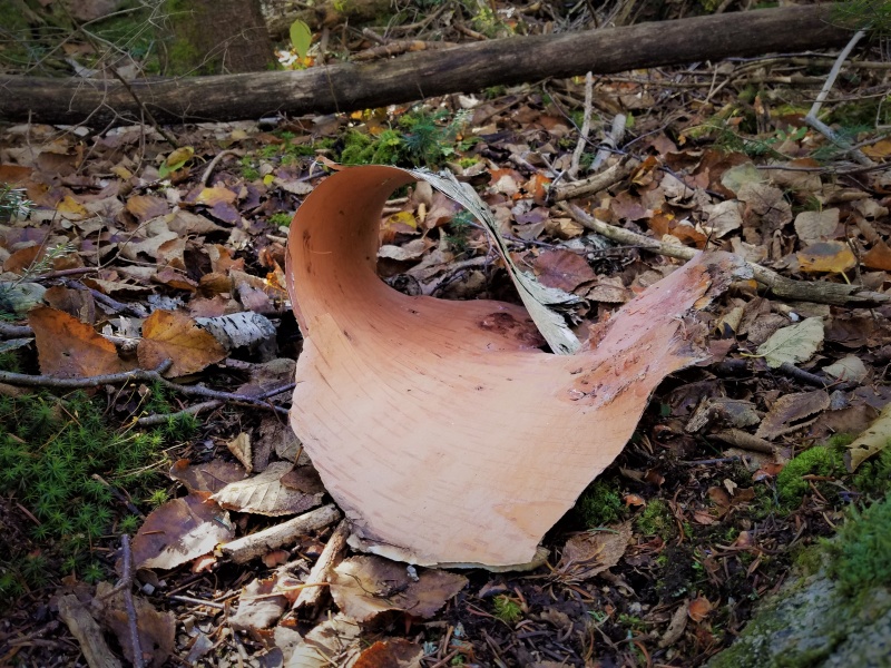
Forest sights
.
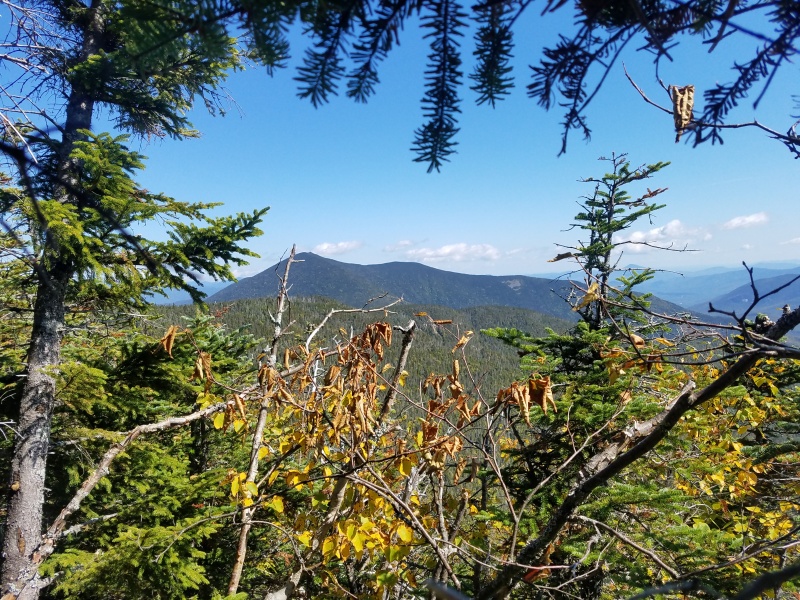
One of my favorite parts about the 4000ers is the ability to get quite a number of summits in one day. In the Sandwich Range, for instance, I made a fun loop over Mounts Passaconaway and Whiteface before using a relatively untraveled trail to cut over to the Tripyramids (Middle and North Tripyramid count on the official list). On the descent, I briefly saw a black bear crossing the trail some distance ahead of me--my first solo backcountry bear sighting. A quick bike ride connected the two trailheads.
.
The first sign of winter graces the Tripyramids
.
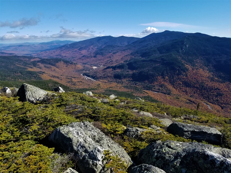
Eventually, I dragged myself around to tackling a project I had planned for over a year--a modified Pemi Loop, picking up various summits I had missed on previous trips into the area (we didn't have time for side-trips on the Hut Traverse). My route was about 35 miles with over 15,000 vertical feet of elevation gain, tagging arguably the best peaks in the whole state.
.
After executing a predawn start, by sunrise I was hiking alone, far past any crowds, deep in the Pemigewasset Wilderness. Shortly after sunrise, I popped out of the trees on the rocky crest of Bondcliff, one of the White Mountains' most alpine-feeling peaks. With rugged cliffs dropping into the shadowed abyss of the Pemigewasset River headwaters below me, alpine tundra all around, and distant 4000ers lit up with the morning light, this quickly became my favorite part of the NH 48, even though it's also one of the hardest to reach parts. (The common route to summit the trio of Bonds is over 22 miles round-trip, even excluding further peak additions.)
.
Bondcliff sunrise, looking into the heart of the Pemigewasset Wilderness
.
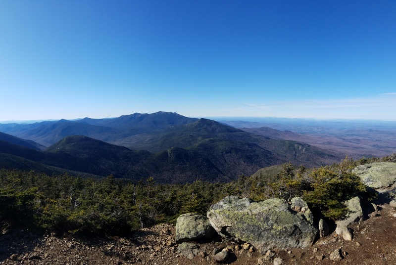
The natural course is to proceed from Bondcliff to the higher (but somewhat less-impressive-looking) Mount Bond before following a spur to the diminutive West Bond, all of which had resplendent views on this gorgeous day.
.
Bondcliff (lower left) from Mount Bond
.
A rolling hike along a treed ridge connected me to South and North Twin, where I met some tourists who gaped at my plans for the 35-mile loop-hike and chastised me for hiking solo. They weren't comfortable with my preferred hiking style: long days starting and ending in the dark, usually solo, often using little-known routes and off-trail connections. This kind of backcountry travel is almost a taboo subculture of the Eastern hiking scene. Oh well, I would be free of the crowds very soon anyway.
.
The view from North Twin (Galehead is visible as a dark lump in the lower left)
.
In only another hour or so of hiking after my tourist encounters, I reached the tree-covered Galehead Mountain and promptly disappeared off other hikers' radar by plunging down a nearly abandoned trail into the depths of the upper Pemigewasset, where I crossed some beautiful and hidden terrain to sneak up on yet another peak from the backside.
.
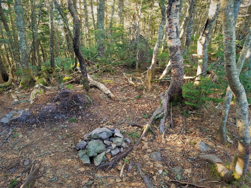
A secret spot found alone, deep in the untrammeled forest
.
Owls Head is by far the most notoriously difficult of the 4000ers--far from any trailheads, it's almost never combined with other peaks (see above), and it doesn't have a maintained trail to the top. Instead, hikers scramble up a steep rock-slide through the trees for a thousand feet or so to reach a wooded crest, where a short stroll ends at the nondescript summit.
.
The summit of Owls Head
.
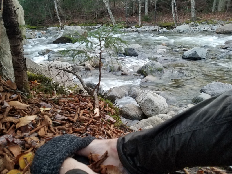
Getting away from Owls Head was harder than climbing it. To finish my loop, I forded several significant whitewater creeks at dusk. The rushing channels were thigh-deep in places (albeit with comfortable granite boulders sticking out of the water to grab while crossing), making it plenty exhilarating solo. Eventually, despite all tourist expectations to the contrary, I arrived at the car some hours later that night, right on schedule.
.
Using my hat as a foot-warmer after a frigid crossing--the second brook (not pictured) was much deeper
.
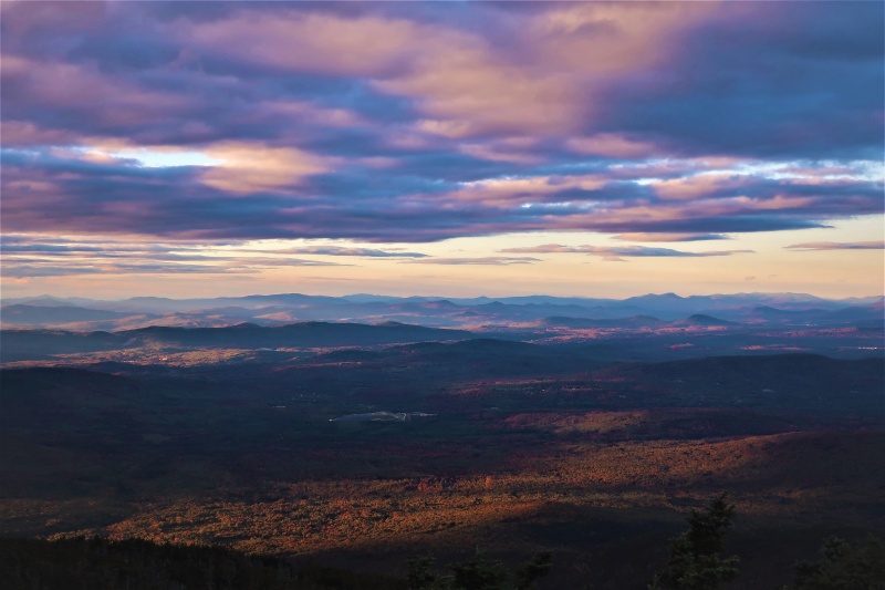
This ambitious loop put me within striking distance to finish the 4000ers that fall (2019). Mounts Waumbek and Cabot called for a quick but cold trip to the northern reaches of the White Mountains; I connected these two separate out-and-back hikes in one long day, driving between the trailheads. There weren't too many other hikers--these peaks are less famous, farther from Boston, and November temperatures in the single-digits limited the crowds even further.
.
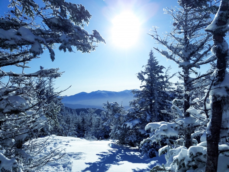
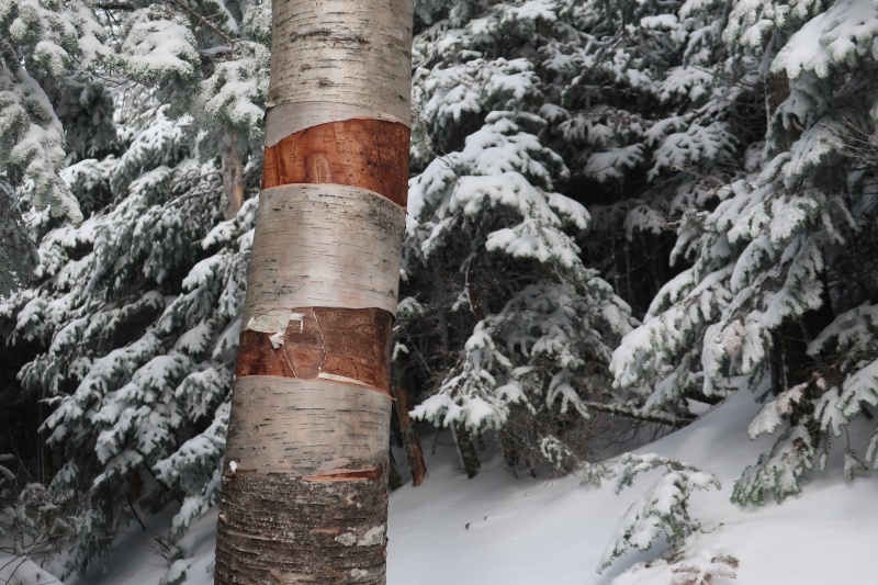
The arrival of winter on Mount Waumbek
.
The Great North Woods provided solace and quiet scenery on the flanks of Mount Cabot, New Hampshire's northernmost 4000er.
.
Sunset in the Great North Woods while descending Mount Cabot
.
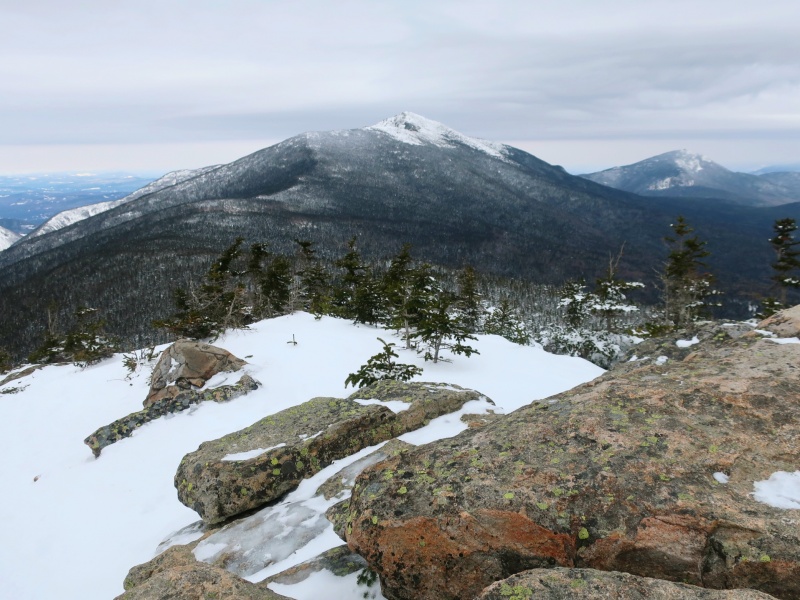
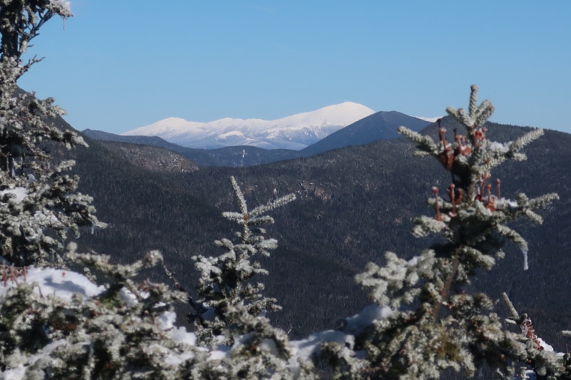
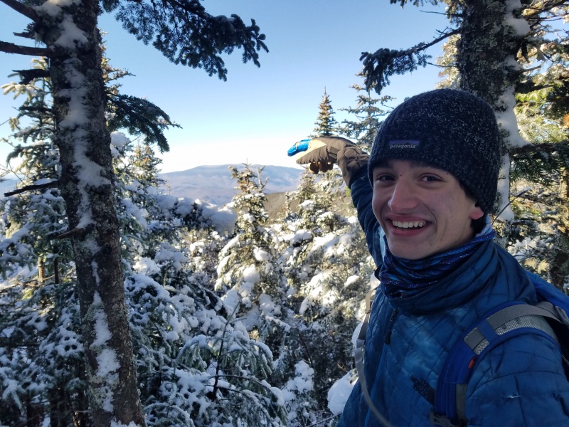
At last, it was time for my finisher: Mount Tecumseh, a friendly peak of 4,003 feet elevation, the lowest of all the 4000ers. This was fitting in some strange way, as I had finished the 14ers on the highest peak (Mount Elbert), so if I finished the high peaks on their highpoint, it made sense to finish the low 4000ers on their lowpoint.
.
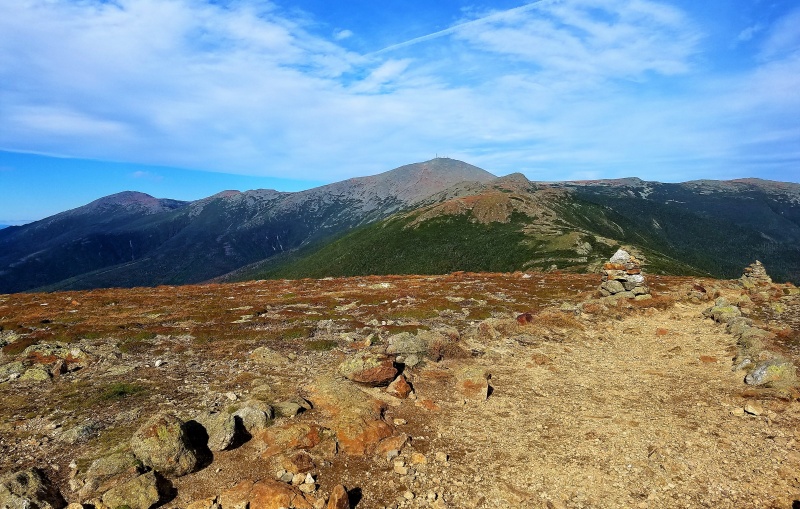
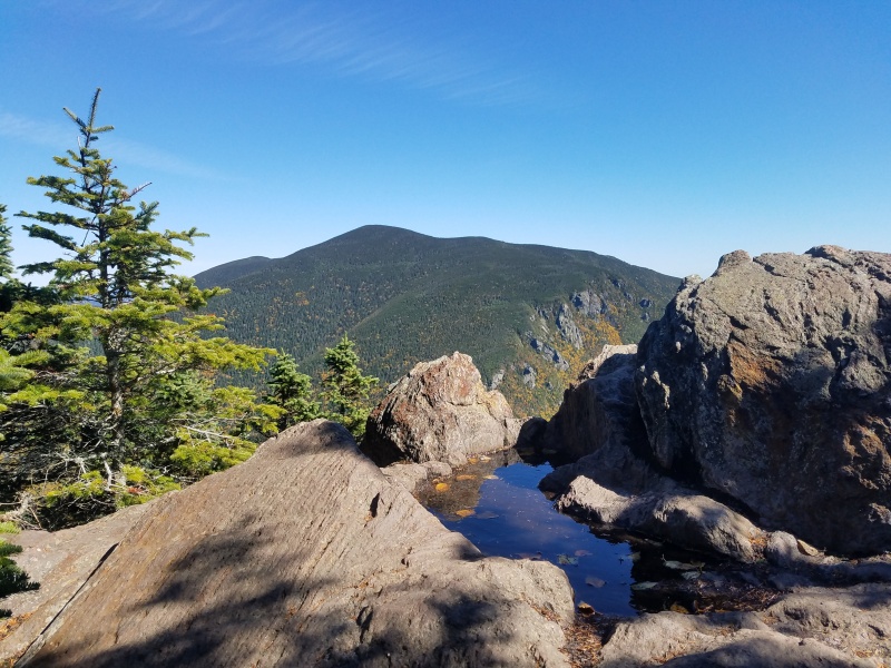
Mount Tecumseh summit view, featuring the fabulously snow-laden Mount Washington
.
Final Thoughts on the 48 New Hampshire 4000ers:
.
So, mountains or molehills? In elevation, they've got nothing: the highest barely reach above the altitude of Colorado's front-range cities. Prominence and isolation tell a different story--on these metrics, some of the 4000ers can indeed compete with the 14ers for status as "mountains." Overall though, it's not really fair to compare the Appalachians and Rockies, as their geology, geography, appearance, outdoor culture, and recreational opportunities are so drastically different. Ultimately, it's best to just appreciate both the 4000ers and the 14ers for what they are: wildly different ranges, both with unique benefits to offer, and both worthy of repeated peakbagging.
.
In total, I hiked over 250 miles to summit all 48 of the official 4000ers. This number is pushed up due to excessive days like the Hut Traverse, but my other long days tended to combine many peaks which would have been longer if done individually, making for an overall lower cumulative mileage. It is also worth noting that while the Appalachian Mountain Club publishes the official list of 48 detailed here, Mount Guyot (between the Bonds and Twins) appears to have sufficient elevation and prominence to also qualify according to Peakbagger, and I tagged its summit twice.
.
Should you find yourself in the area, I definitely recommend hiking in the White Mountains. These rounded peaks provide a welcome counterpoint to our familiar stark alpine ridges. My personal favorites are the Bonds for their wilderness character and stunning views, but each of these summits makes a worthy destination, and I'm happy to have been able to visit them all.
.
My first and last: standing on Tecumseh (#48), pointing to Moosilauke (#1)
.
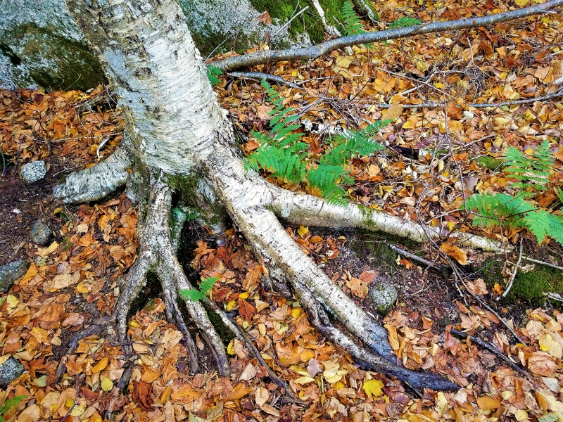
Perhaps what I gained most from this period of my mountain career is a greater ability to appreciate all facets of the mountains, not just the soaring views and snow-clad peaks.
.
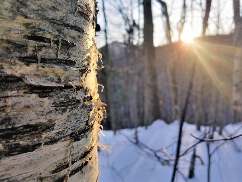
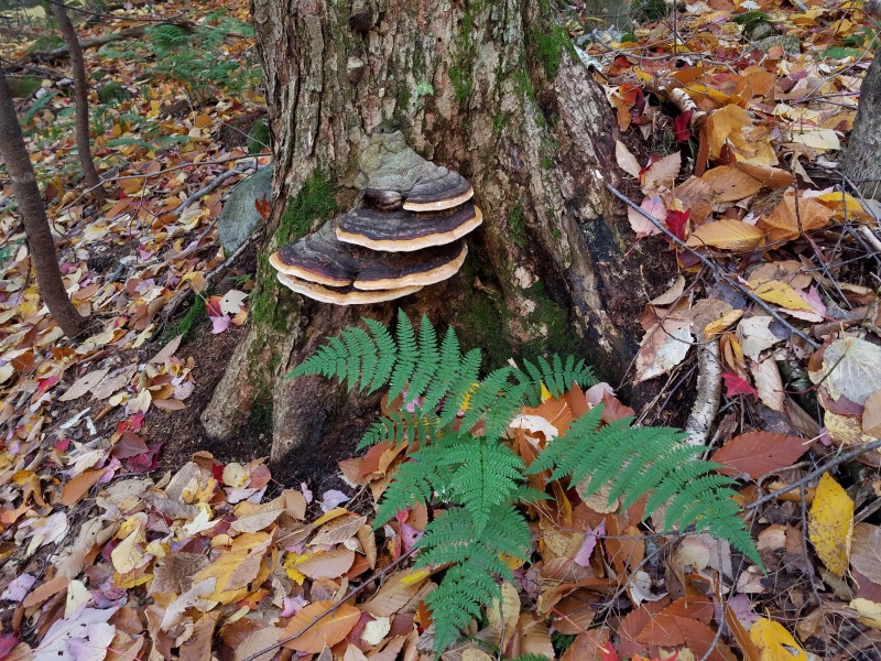
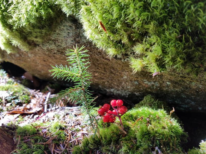
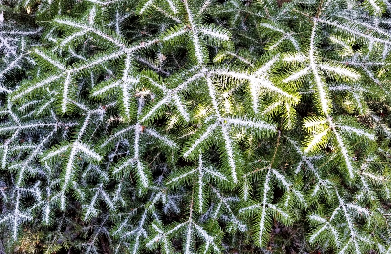
Enjoying the White Mountains is about looking down, not just up and out. It's about seeing the textures. Frosty hemlock needles, burbling brooks, glowing sugar maples. It's about learning to see the magnificence of moss as well as glaciers, leaves as well as summits.
.
Autumn
.
I'm still walkin', so I'm sure that I can dance
Just a saint of circumstance
.
Solo in the Sandwich Range Wilderness
.
Seasons round, creatures great and small, up and down, as we rise and fall
.
A perfect garden; I sighted a black bear close by here
.
Ah, child of countless trees...
Come, wash the nighttime clean
Come, grow the scorched ground green
.
The forest starts another generation
.
What shall we say, shall we call it by a name
As well to count the angels dancing on a pin
.
"The Fractal Geometry of Nature" ~ Benoit Mandelbrot
.
In the timbers of Fennario, the wolves are running 'round
The winter was so hard and cold, froze ten feet 'neath the ground...
The wolf came in, I got my cards, we sat down for a game
I cut my deck to the queen of spades, but the cards were all the same
.
Two sorts of trees
Blue light rain, unbroken chain
.
A picturesque moment in the process of making new dirt
.
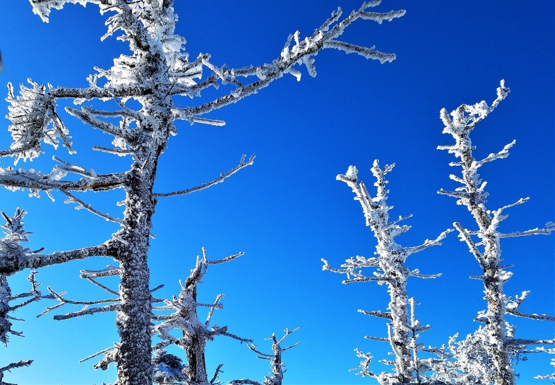
Ice petal flowers revolving
.
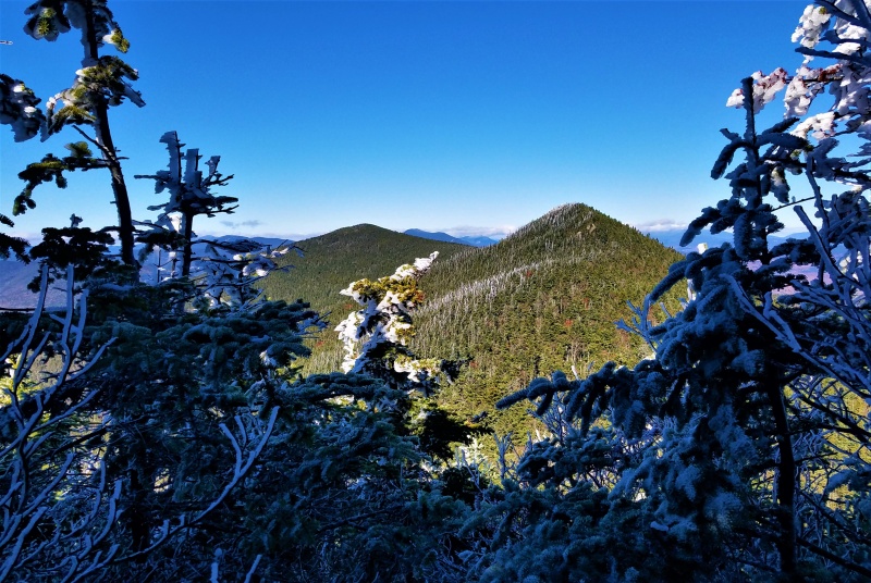
Summit of Mount Cabot, the northernmost 4000er in New Hampshire
.
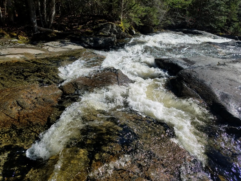
Water bright as the sky from which it came
And the name is on the earth that takes it in...
Let it flow, greatly flow, wide and clear
.
Crossing at Thirteen Falls, hidden deep in the Pemigewasset Wilderness
.
Roll away, the dew
Roll away, the dew
.
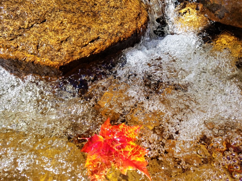
Ebullience!
.
Goes to show, you don't ever know
Watch each card you play and play it slow
.
Bondcliff summit; sunrise over the Pemigewasset Wilderness
.
Mountain high, river wide
So many roads to ride
So many roads...
So many roads I know
So many roads to ease my soul
Thumbnails for uploaded photos (click to open slideshow):
I enjoyed your report, Eli, esp the hysterical comments about the hiking subculture in the NE, e.g. stay on the trails/don't hike solo/don't hike at night...and oh please please don't hike solo at night! Too funny. I've only hiked up Mt. Washington in winter a couple of times, so not much experience out there, but I agree, you just need to recognize and appreciate the regional differences for what they are. Oh, and beautiful pics!
This really brings back some memories...the Whites are where I really started cutting my teeth on mountaineering--especially winter climbing--in my college days. While I made it up less than half of the 4000'ers in my time there, I'll always remember those crisp, clear fall and winter days, the granite of New Hampshire, and that lovely smell of the pines...someday, I will return.
Sheeesh! Could you imagine not finishing the 4000'ers? Pretty lame to be working on low-tier lists like ULTRAS and CoHPs before finishing what is widely considered the most infamous mountaineering list in North America (excluding Indiana ranked peaks of course)...
Thanks for this, Eli! Great photos and nicely done text.
I'm mainly familiar with the Presidentials in the Whites and it's nice to see some really outstanding shots of those peaks. Some of the time I spent there hiking was in the mists and drizzles and fog -- still interesting in its own way, but it's also nice to see them in beautiful sunlight, especially with fall colors. Thanks for sharing this and congratulations in bagging them all!
Great write up and pictures, all the seasons, relaxing to look at now. Being from New England, I enjoy the different trees and fall colors, NH has a very distinct scent. Rough trails, more paint markers than cairns, lots of Canadian hikers. There was a thread on here a couple years ago about a huge charge there for SAR rescue. Hadn't heard of the anti solo culture but that may be why, also mainly big city people hiking.
My east coast brethren! Nice write up and great photos, makes me want to head up there. I can relate to using your hat as a foot warmer.
The Whites are a wonderful place. I have fond memories of being on Mt Washington on a beautiful fall morning with nearly 90 mph winds on the summit.
I may reach out to you to ask for some local beta, can share some ADK beta with you in return.
Congrats on finishing.
This one took me a while to get through, Eli. But I'm sure it took you MUCH longer to write it. As always, your reports are well written and the photographs are top notch. Keep doing what you do, my friend...
I lived in NH for a few years in my early 20s and you got up there much more than I did. I did manage to hike a few of them, including Mt Washington twice, but didn't know the area like you do. You've got a great eye for photography and great knowledge of the land. Impressive stuff.
I always appreciate hearing from everyone on the trip reports, I'm glad that people enjoy them! I've really been enjoying the photography and writing aspects lately, and I'm grateful for the opportunity to share that with others through this site. (Thanks to Bill for being tolerant of occasional non-Colorado trip reports!)
Nyker (and others), I'm more than happy to share any beta I can, feel free to PM anytime. I'm hoping to get into the Adirondacks a bit more in the future, and maybe someday we can organize an east-coast 14ers gathering of sorts.
As you might be able to guess by my username I'm a fan of our beloved White Mountains here in NE. Just bagged Owl's Head alone last weekend, descending through the night. Best to not talk to anyone while you're out here, they'll only ruin the fun! Why do you think us New Englanders are the way we are? Too many sticks in the mud! I appreciate your perspective coming from out west, and hope to find a similar experience when I make it out to CO.
Caution: The information contained in this report may not be accurate and should not be the only resource used in preparation for your climb. Failure to have the necessary experience, physical conditioning, supplies or equipment can result in injury or death. 14ers.com and the author(s) of this report provide no warranties, either express or implied, that the information provided is accurate or reliable. By using the information provided, you agree to indemnify and hold harmless 14ers.com and the report author(s) with respect to any claims and demands against them, including any attorney fees and expenses. Please read the 14ers.com Safety and Disclaimer pages for more information.
Please respect private property: 14ers.com supports the rights of private landowners to determine how and by whom their land will be used. In Colorado, it is your responsibility to determine if land is private and to obtain the appropriate permission before entering the property.


")
")
")
")
")
")
")
")
")
")
")
")
")
")
")
")
")
")
")
")
")
")
")
")
")
")
")
")
")
")
")
")
")
")
")
")
")
")
")
")
")
")
")
")
")
")
")
")
")
")