Download Agreement, Release, and Acknowledgement of Risk:
You (the person requesting this file download) fully understand mountain climbing ("Activity") involves risks and dangers of serious bodily injury, including permanent disability, paralysis, and death ("Risks") and you fully accept and assume all such risks and all responsibility for losses, costs, and damages you incur as a result of your participation in this Activity.
You acknowledge that information in the file you have chosen to download may not be accurate and may contain errors. You agree to assume all risks when using this information and agree to release and discharge 14ers.com, 14ers Inc. and the author(s) of such information (collectively, the "Released Parties").
You hereby discharge the Released Parties from all damages, actions, claims and liabilities of any nature, specifically including, but not limited to, damages, actions, claims and liabilities arising from or related to the negligence of the Released Parties. You further agree to indemnify, hold harmless and defend 14ers.com, 14ers Inc. and each of the other Released Parties from and against any loss, damage, liability and expense, including costs and attorney fees, incurred by 14ers.com, 14ers Inc. or any of the other Released Parties as a result of you using information provided on the 14ers.com or 14ers Inc. websites.
You have read this agreement, fully understand its terms and intend it to be a complete and unconditional release of all liability to the greatest extent allowed by law and agree that if any portion of this agreement is held to be invalid the balance, notwithstanding, shall continue in full force and effect.
By clicking "OK" you agree to these terms. If you DO NOT agree, click "Cancel"...
This climb happened the day before Governor Jared Polis declared a state-wide "stay at home" policy. Up to this point we've been 2-3 weeks of non-stop Corona virus news. Denver and a few other Colorado communities had a mandated, "get inside your house and don't infect others" policy!
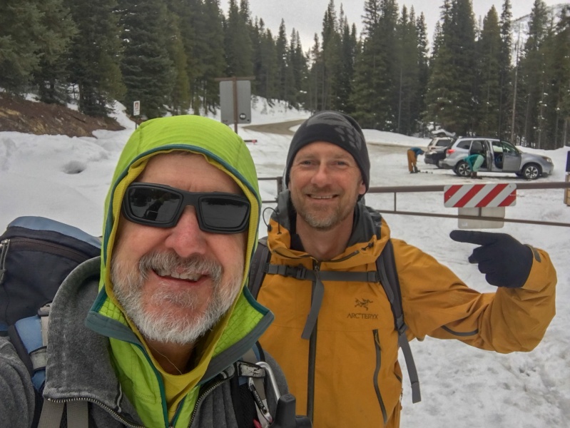
My long time climbing friend Kiefer, texted me on Monday night: "Hey Britt. Would you have any interest in climbing Quandary Couloir with me on Wednesday if you're able to?" I checked my calendar and had nothing on it for Wednesday. After a full week of corona self-confinement, I was absolutely interested in climbing something with him that day! Due to the avy risk, I told him I wasn't interested in a north facing couloir until May or June but, I said, I would be up for a south facing couloir. (We had numerous warm sunny days recently, so I though the iso-thermal/freeze-thaw cycle would probably already be firming up those south slopes.) So, I looked here on 14ers.com to find a 13er which we both hadn't climbed. I proposed Lenawee Mountain. However, I was thinking the packed ski slopes up through Arapahoe Basin ski area would be a nice approach. Well, due to the Covid-19 Corona virus, the ski area was currently closed and even all uphill travel had been banned. (Stupid COVID-19!) Well, Kiefer counter-offered with Lenawee via the south slopes. ChicagoTransplant had a trip report which showed this south slope route. Perfect, this could work.
Kiefer would be driving from Ouray and I'd be driving from Monument; so we decided to meet in Silverthorn. (I prefer to always meet up with partners where there is cell service instead of out at trailheads where there is often no cell service.) To respect the social distancing requirements, we did not shake hands...just a virtual fist bump in the air. And then he drove his car and I drove my Jeep out towards Montezuma, CO to the Peru Creek Trailhead at CR 5 & CR 260. We found that the CR 260 winter road closure parking area had several backcountry skiers gearing up. In just a short time we had geared up and were inside the barricade hiking up the packed 260 road at 8:35am.
Time to climb!
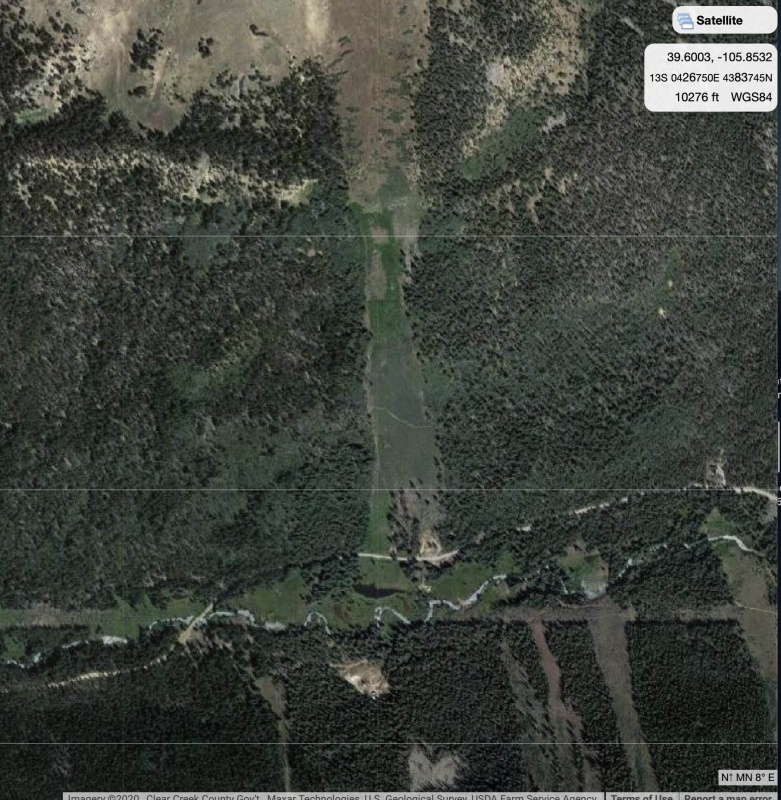
In researching the route, ChicagoTransplant had mentioned they had a good amount of potholing in the snow up through the trees. I pulled up CalTopo and clicked on the Satellite view. Look what I found!
CalTopo revealed an avalanche swath 1.3 miles in from the winter road closure.
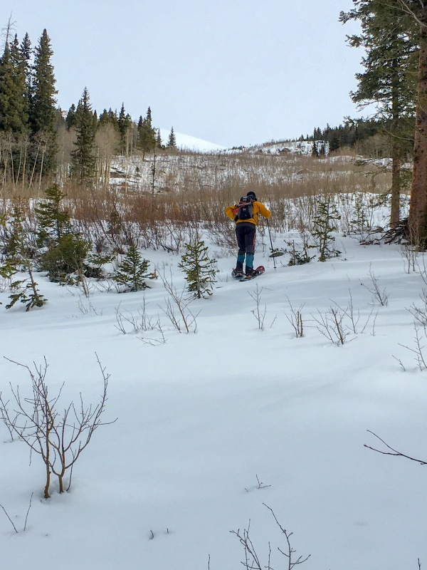
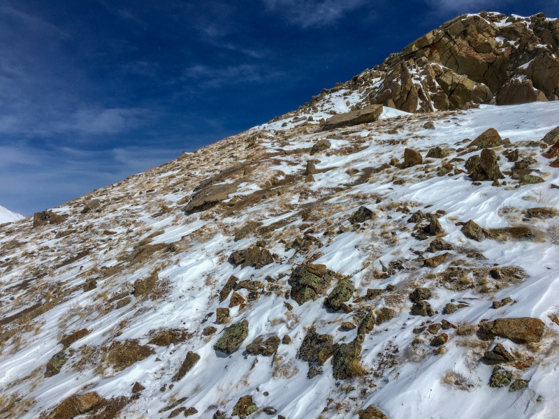
Just 2/10's of mile beyond where Mike and Jamie left the 2060 road at a clearing, there was a nicely cleared avalanche slope. I figured that sun-baked slope would be the perfect approach slope. We found it at 9:18am, after 43 minutes of hiking. And I was right, the iso-thermal effect had taken place and we were cruising up on firm snow. No postholing all the way up!
No tracks left behind on this avy slope!
Of course, knowing this was a path of an avalanche sure was weighing on my mind as we went up, but it felt extremely firm as we had just had a good weeks worth of warm/sunny days and CAIC was showing Low (green) below treeline, and Moderate (yellow) above treeline.
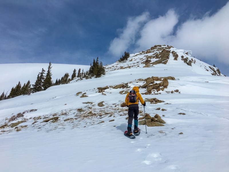
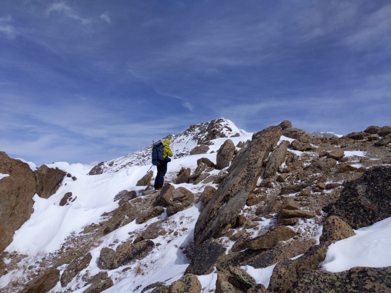
Reaching treeline
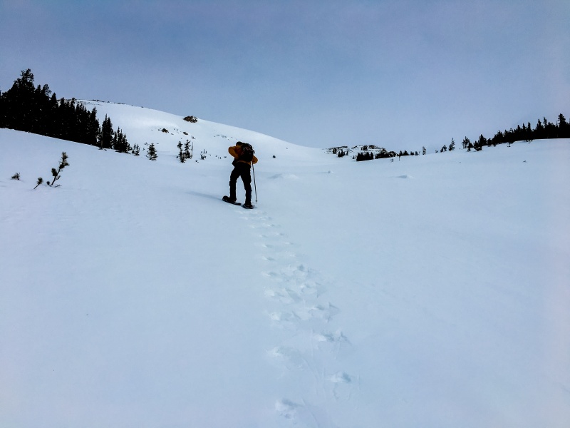
As we were reaching treeline, we could see the source of where those avalanches would trigger. See that convex slope above Kiefer? That slope gets very steep. So we quickly moved out of the death zone and made our way over to the trees on the right. Once out of the trees, we aimed for this rocky knoll, top-right of the avy slope.
Heading for this would get us out from underneath that really steep and dangerous looking avalanche slope over to the left and we were hoping we could just circumvent this rocky knoll around to it's right side.
Once at the base of the rocky knoll, we saw...nope. There's NO going to the right of it as that's the ridge dropping off. So, up and over the top we had to go.
No going that way!
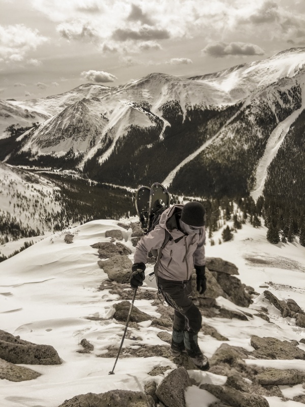
Kiefer took his snowshoes off during this rocky section. I left mine on. I'm glad I did.
I'm pretty sure Kiefer is NOT a fan of snowshoes.
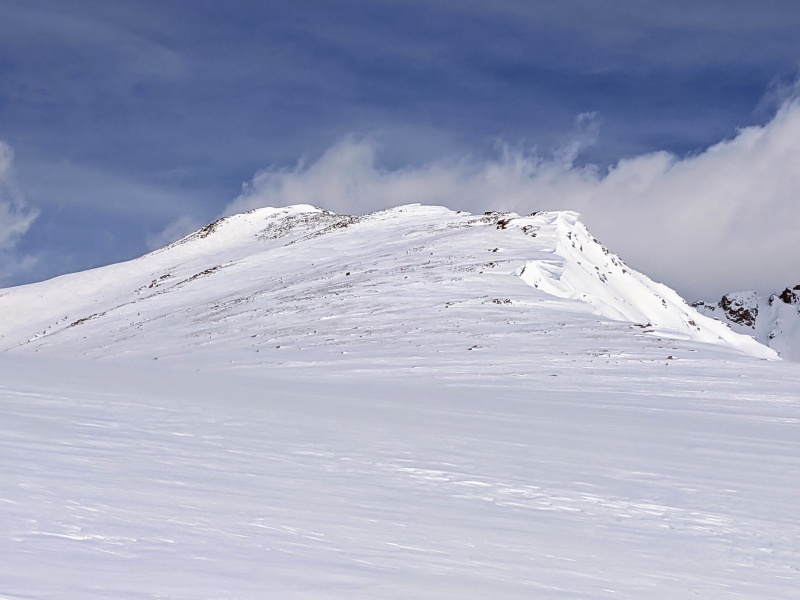
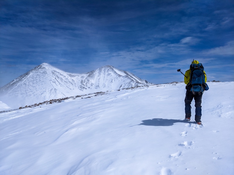
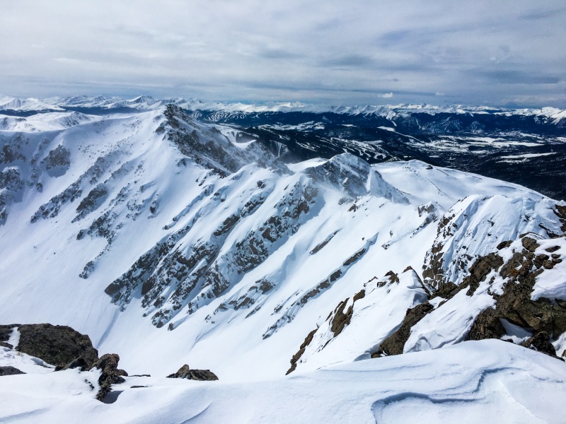
Once on top, there is this huge expanse that reminded me of James Peak. There is this huge snow field and then the summit is just a long, long ways back there.
Photo courtesy of Kiefer (SW Lenawee in the back left side)
Years ago I had read a trip report from SarahT about her breaking though a cornice on this ridge, and then riding an avalanche down. Believe me, I was remembering her experience and was giving these huge cornices their due respect and a wide berth. If you ever plan to climb the high peaks of Colorado when there is snow up high, I would encourage you to read Sarah's "I Shouldn't Be Alive" trip report:
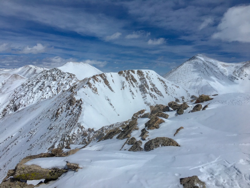
There is an expansive view across Chihauhua Gulch towards the peaks of Grays & Torrey's and Ruby & Cooper.
L to R: Torrey's, Grays, Ruby, Cooper
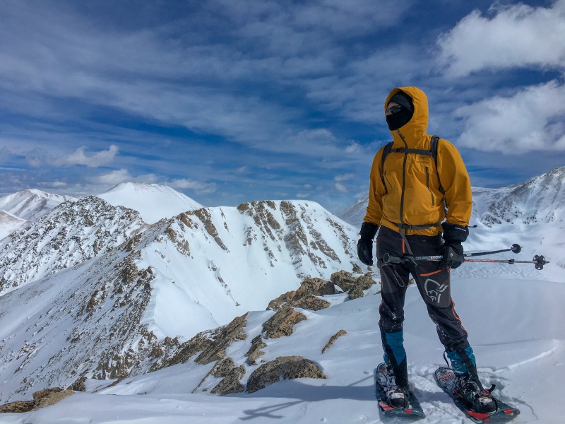
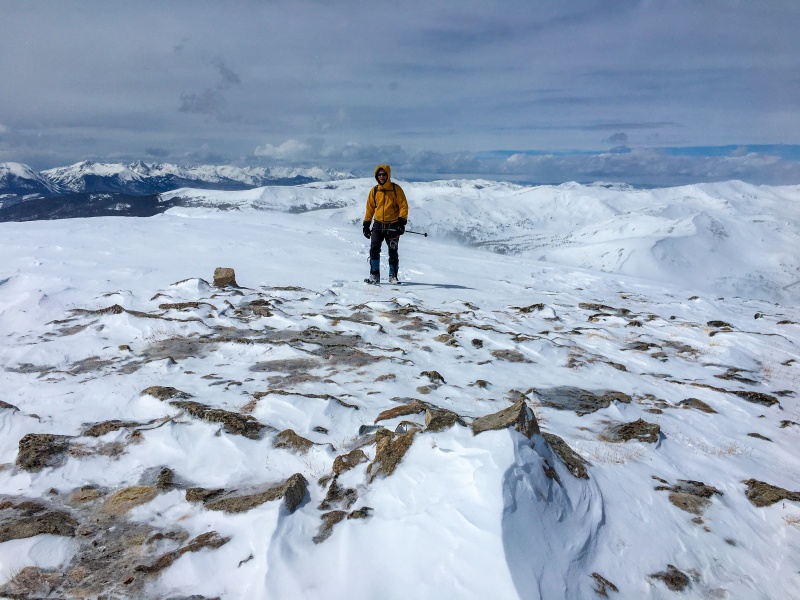
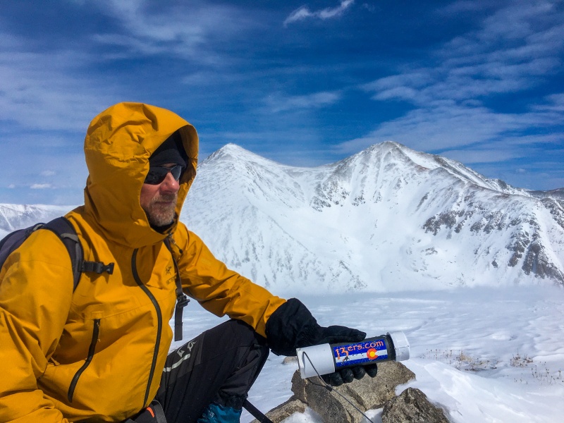
At 12:15pm, we finally reached our first summit goal, Southwest Lenawee-13,180'. It was a beautiful day inspite of it being quite windy.
Kiefer on the summit of SW Lenawee-13,180' with Lenawee Mountain. (our ranked summit) behind.
There's pretty much always a smile when I reach a summit!
The corona mania relief was working. We both were feeling good to be outdoors in the fresh air and sunshine and getting that Rocky Mountain High. (Well, not today's more common rocky mountain "high.")
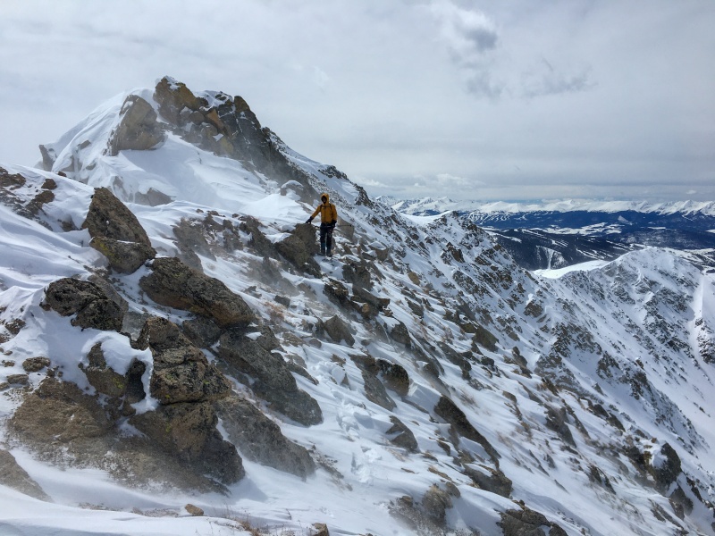
To be honest, the traverse was looking more ominous than I was expecting.
Ridge traverse. (It's more scramble than this photos shows.)
I had to push down the fear and focus on the goal of the ranked peak on the other side of this traverse. The deep snow, verglas, and high winds made this quite difficult to say the least.
There was dropping into deep snow holes which made for a lot of hard work and energy expended.
Kiefer up to his waist!
We definitely had to "keep our head in the game" during this portion. We couldn't let our attention be diverted and unwittingly step too close to an overhanging cornice. Also, some of the most dangerous and scary parts of this traverse would be on steep angled down sloping rock slabs buried under the snow. We had to make sure we had good hand holds on every step or we would be goners. There were times I my feet would slide off and I was just hanging by my hands. Unfortunately, neither Kiefer or I took any photos during the more difficult Class 3 sections. So our photos aren't going to give an idea of what the Class 3 sections of this traverse were like.
Once we were off the more tricky middle section, we were back to pulling out our phones again.
Coming out of the Class 3 stuffWinds added to making this traverse feel more ominous.
The last 3rd of this traverse is a less talusy (is that a word?) easy Class. 2, gentle slope. The wind blown slope is fast walking up to a large flat mesa summit.
You can move quickly through this section.With a commanding view of Torrey's and Gray's, we cruise across the large summit to the summit carin at 13,204'.
It took us about an hour and 15 minutes to do the traverse from SW Lenawee to the ranked Lenawee Mountain-13,204'. Kiefer makes his way up to the summit carin engulfed in snow arriving about 1:40pm.
Kiefer makes his way to summit #2.
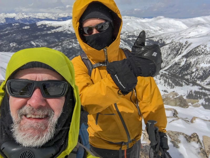
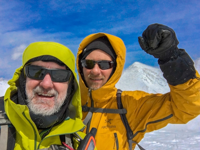
We were thrilled to have successfully made both of our summit goals today.
Britt-left, Kiefer-right.
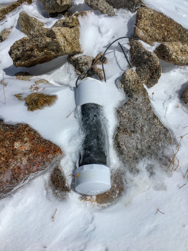
The summit register looked frozen so we didn't even try to open it, Besides, I'd hate for it to get blown out of our hands down into Chihuahua Gulch!
Lenawee summit register looking frozen and lonely.Kiefer finds one of the 13ers.com bumper stickers on the summit register tube.
We now have to turn our heads back into the wind for our return trip. We were not looking forward to this portion of today's program!
Time to return to SW Lenwee. You can see the spindrift blowing up off of the ridge.
Can you say, "breezy?" The forecast was for 26mph winds sustained with gusts up over 40mph. The forecast on this day didn't disappoint.
On our way back we found a little wind block and this cool looking cornice formation,.
It took the same amount of time to reverse the traverse. and were back on SW Lenawee just after 3:00pm.
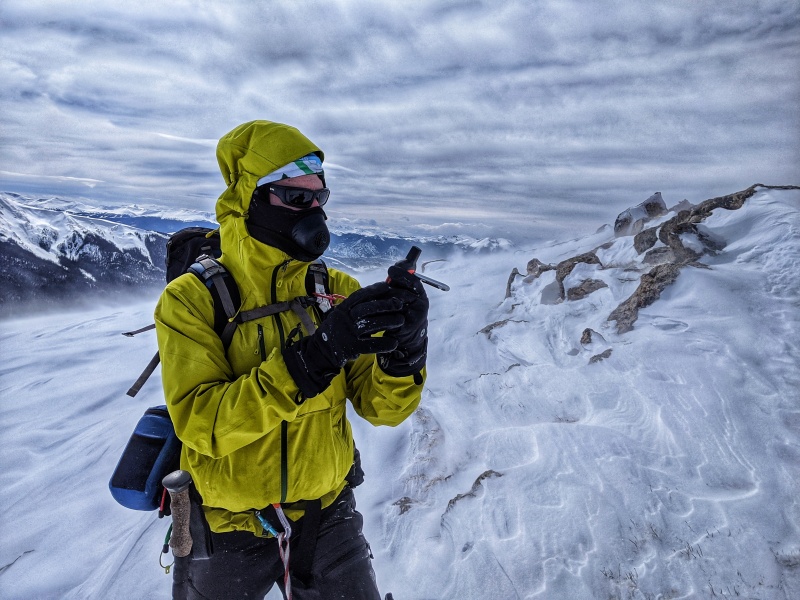
The wind blowing snow felt like a sandblaster on the face! So before our return, I put on goggles heading back into the wind, a buff to completely cover my forehead, and this face make to completely cover my nose down to my neck.
Photo from Kiefer during our down climb.
It worked and I didn't feel any of those snow needles piercing my face. Kiefer didn't fair so well. He was thinking he may have even got a hint of frostbite.
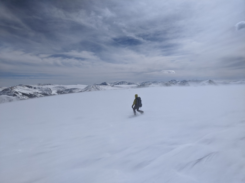
On that big open flat area below SW Lenawee with the winds howling, I commented to Kiefer that it felt like we were down on Antartica crossing that huge frozen, icy expanse. It was a surreal sense being in today's winds.
Photo courtesy of Kiefer
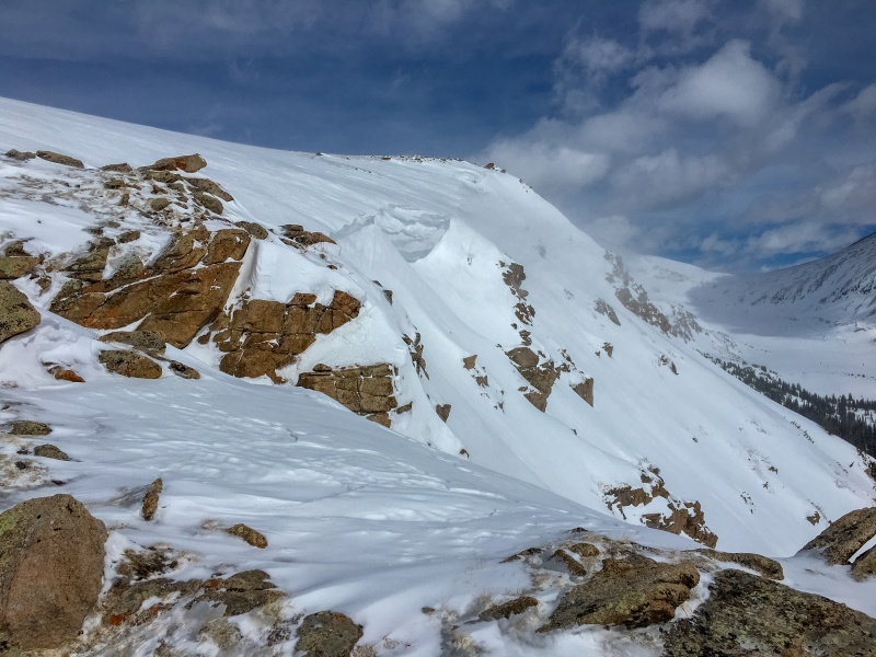
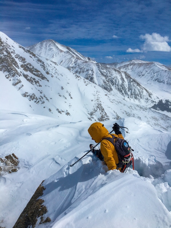
Once back at the top of the avalanche chute, we could really see the steep convex nature of that slope. It was easy to see why it would slide and come down and create this clear path. So we down climbed that rocky knoll again instead of taking the easier route on snow under the convex slope. It turned out well. My Garmin InReach showed a round trip of 8.4 miles. We made it back to the Peru Creek winter trailhead just after 5:00pm for a trip time of 8 1/2 hours.
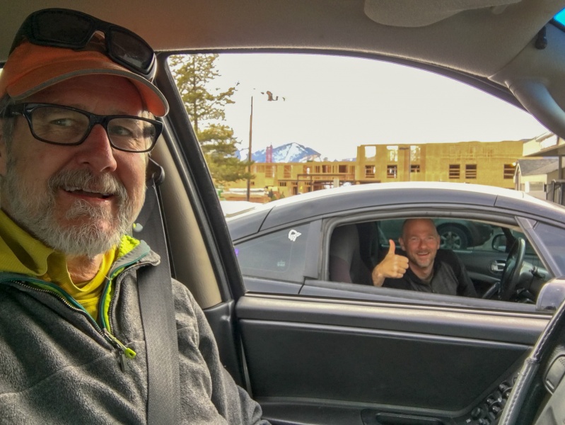
We now had to enter back into a world filled with a pandemic. Argh! We stopped at Pug Ryan's brew pub in Silverthorn hoping for some take out. Of course the parking lot was empty, the OPEN sign was dark, and the time had come that we had to re-focus on (like on that ridge traverse) our social distancing. So, we did what we had to do...a quick stop at a store for some liquid refreshments and a post climb conversation keeping our distance...in our cars!
A modified aprés!
All in all, it was a day lathered in AWESOME SAUCE which is probably a good way to describe it. Thanks Kiefer for reaching out. Let's do it again soon...as soon as COVID-19 allows.
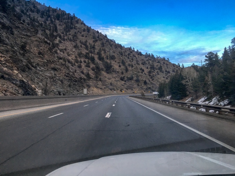
I guess there is a silver lining to a pandemic with a "stay at home" order....
Have you ever seen I-70 looking like this??
I-70
Yeah...me neither!
Thumbnails for uploaded photos (click to open slideshow):
Very, very nice report, Britt. Looks like you two earned your stripes on those two summits. The ridge between the two sounds treacherous... Love the second vid...
In summer I banged my thigh up when a gust of wind hit and pushed me around between Lenawee and SW Lenawee. That ridge with snow would be a bit tough. Glad you had a great day!
Nice report, Britt. I did the Lenawees in August and had a blast on the ridge between them. I have no doubt it would be rather spicy with snow, but fun in its own way!
That picture of I-70 is crazy!! Thanks for a sweet day, Britt. My nose & left cheek are still a bit raw from being sand-blasted with 4 grit snow. But it sure beats staying home. Those upper plateaus were like Antarctica, to use your words.
Love the vids!!! I laughed.
Great shots! Looks like it was a crisp day out there.
Caution: The information contained in this report may not be accurate and should not be the only resource used in preparation for your climb. Failure to have the necessary experience, physical conditioning, supplies or equipment can result in injury or death. 14ers.com and the author(s) of this report provide no warranties, either express or implied, that the information provided is accurate or reliable. By using the information provided, you agree to indemnify and hold harmless 14ers.com and the report author(s) with respect to any claims and demands against them, including any attorney fees and expenses. Please read the 14ers.com Safety and Disclaimer pages for more information.
Please respect private property: 14ers.com supports the rights of private landowners to determine how and by whom their land will be used. In Colorado, it is your responsibility to determine if land is private and to obtain the appropriate permission before entering the property.

")
")
")
")
")
")
")
")
")
")
")
")
")
")
")
")
")
")
")
")
")
")
")
")
")
")
")
")
")
")
")
")
")
")
")
")
")
")
")
")
")
")
")
")
")
")
")
")


