Download Agreement, Release, and Acknowledgement of Risk:
You (the person requesting this file download) fully understand mountain climbing ("Activity") involves risks and dangers of serious bodily injury, including permanent disability, paralysis, and death ("Risks") and you fully accept and assume all such risks and all responsibility for losses, costs, and damages you incur as a result of your participation in this Activity.
You acknowledge that information in the file you have chosen to download may not be accurate and may contain errors. You agree to assume all risks when using this information and agree to release and discharge 14ers.com, 14ers Inc. and the author(s) of such information (collectively, the "Released Parties").
You hereby discharge the Released Parties from all damages, actions, claims and liabilities of any nature, specifically including, but not limited to, damages, actions, claims and liabilities arising from or related to the negligence of the Released Parties. You further agree to indemnify, hold harmless and defend 14ers.com, 14ers Inc. and each of the other Released Parties from and against any loss, damage, liability and expense, including costs and attorney fees, incurred by 14ers.com, 14ers Inc. or any of the other Released Parties as a result of you using information provided on the 14ers.com or 14ers Inc. websites.
You have read this agreement, fully understand its terms and intend it to be a complete and unconditional release of all liability to the greatest extent allowed by law and agree that if any portion of this agreement is held to be invalid the balance, notwithstanding, shall continue in full force and effect.
By clicking "OK" you agree to these terms. If you DO NOT agree, click "Cancel"...
First things first, thanks to Dad Mike for the info on the route! Turned out to be a good one
These peaks are cool. They're just so prominent and isolated from the rest of the Mosquito range, and make for an awesome view from Fairplay. I'd been eyeing them this winter, but snow and closed roads make access tough. The route on this site from the north ends up being 20+ miles with the road closure. That's long. This route is long too, but not THAT long.
The route starts up road 375 just north of Buena Vista. The driving ends abruptly in a gate closure at 9,000. From there, the route follows the 375 road and subsequent trail for 4 1/2 miles, veers off right when the snow gets deep and unconsolidated, and finds the path of least resistance up the peaks.
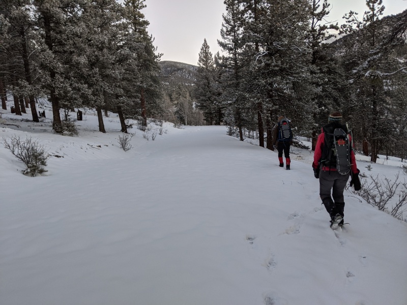
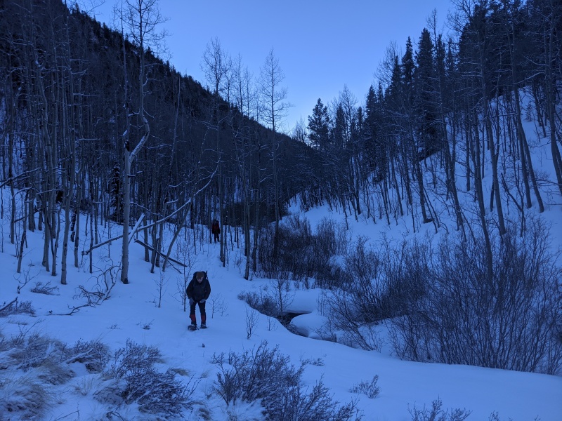
We started from the gate closure right before 7; Kirsten, Jeremy, and myself. There was a light dusting of snow from the previous day, maybe a couple of inches, but we were able to boot the first 2 1/2 miles of the road (maybe should have snowshoed a liiiiiittle earlier).
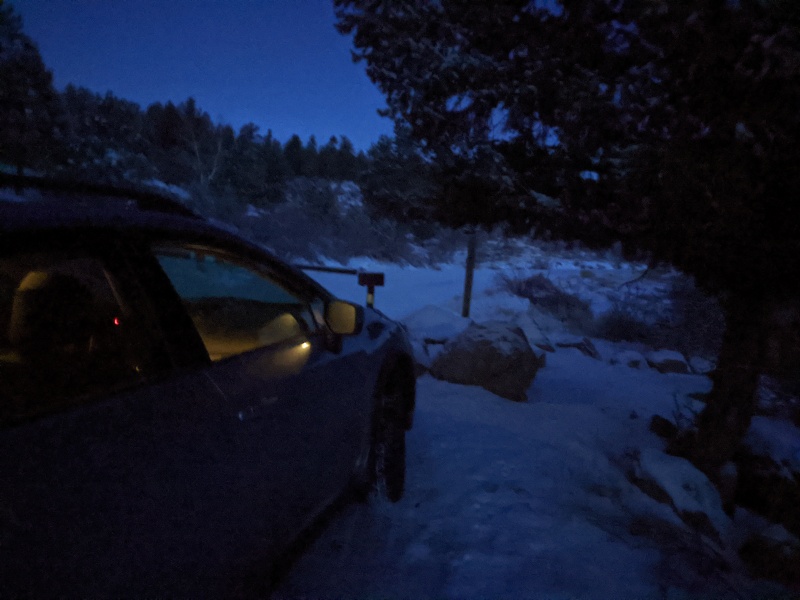
Gate closure at 9,000. Parking for one Crosstrek only
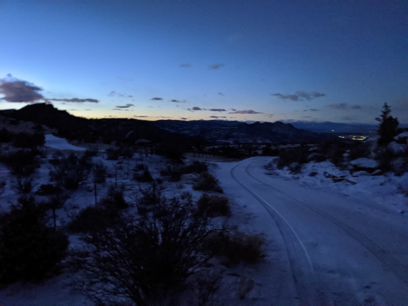
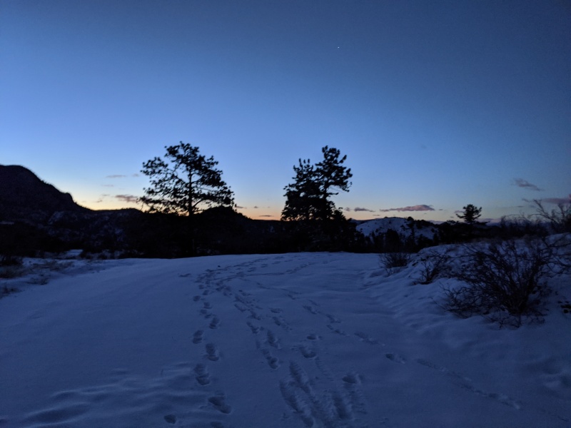
First light over BV, looking back down the road from the gate
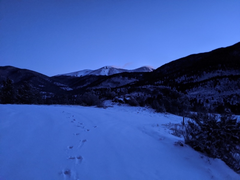
Buff Peaks! They don't look so far, do they?
After about a mile, 375 takes a hard right, while 377 goes straight. Take the right and follow 375.
Somehow these tracks were made by only 3 completely sober people
Stubbornly booting
Let there be light!
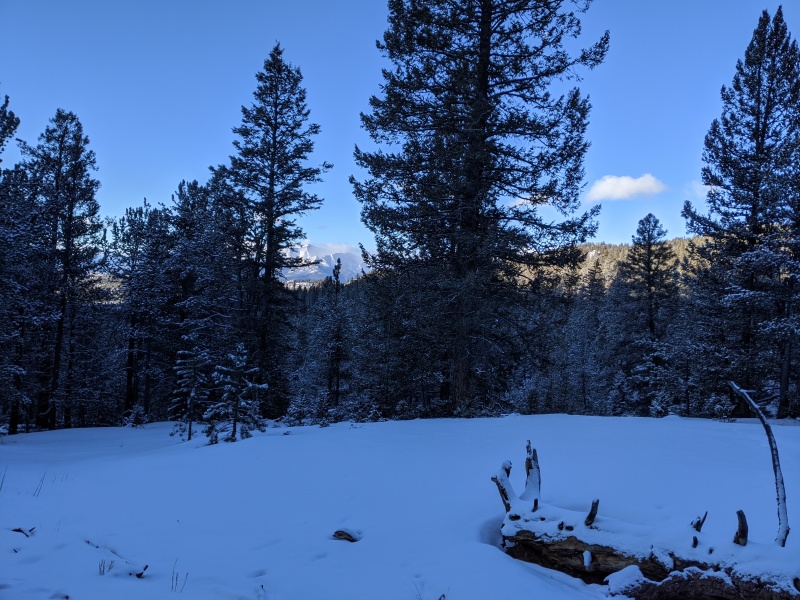
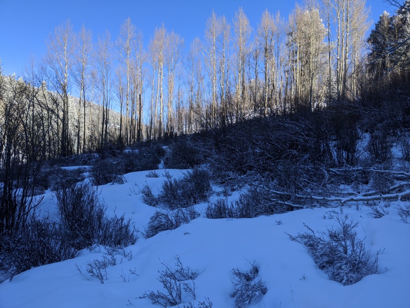
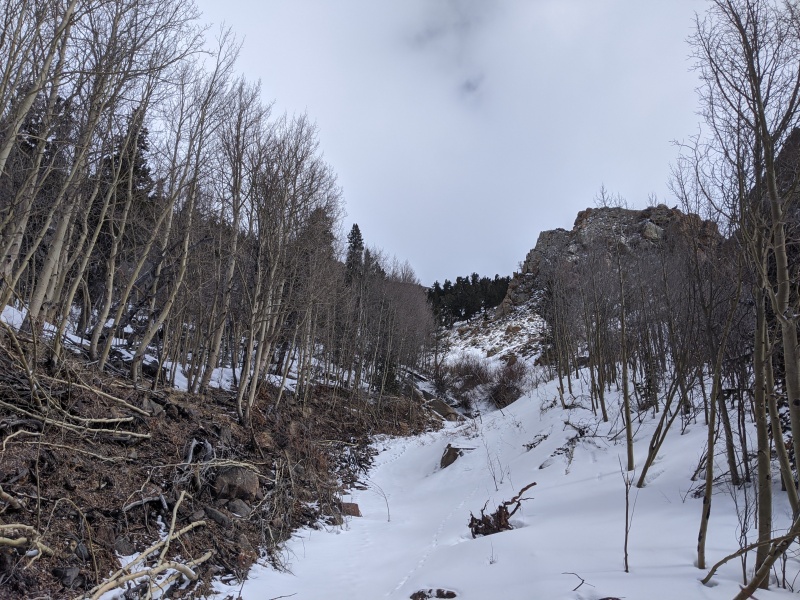
There were 3 separate parking lots with what appeared to be trail signs encountered along the way. Each time, the road seemed to shrink from a superhighway to a highway to a country road to a trail.
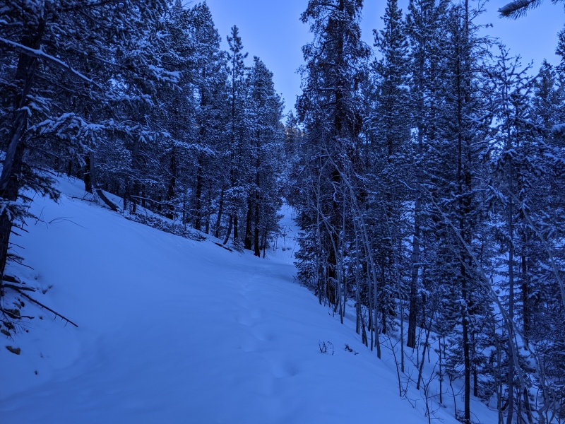
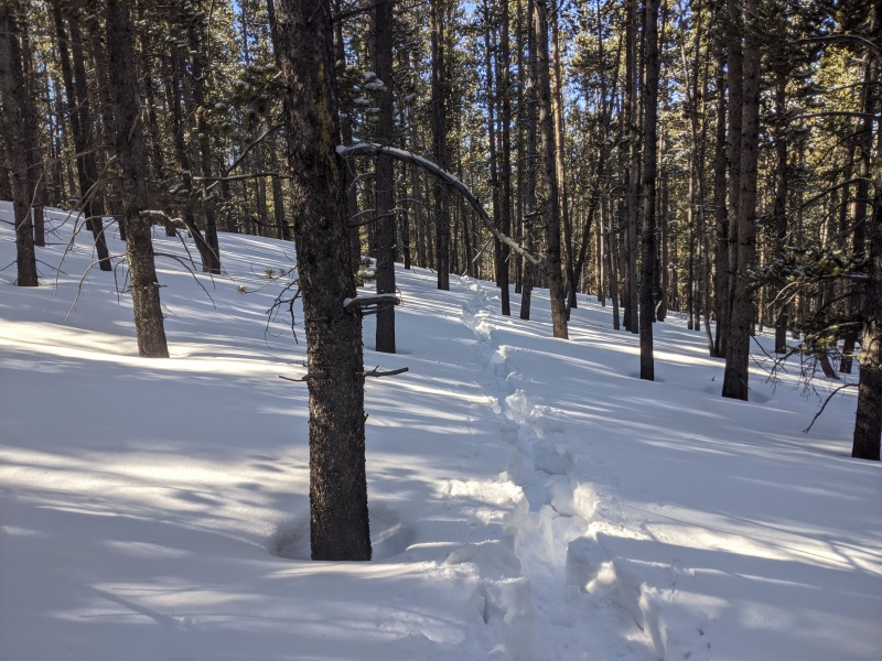
Road narrows and snow deepens. Faint trench, probably from Mike back in January
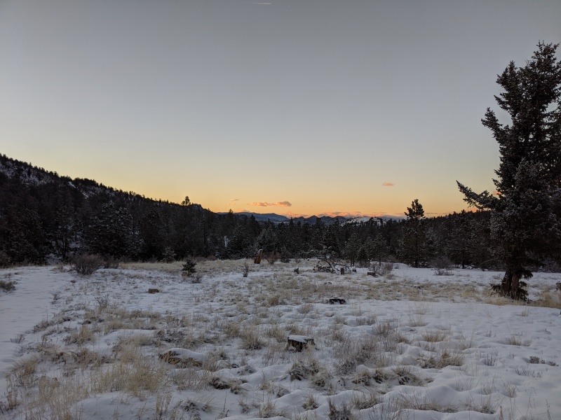
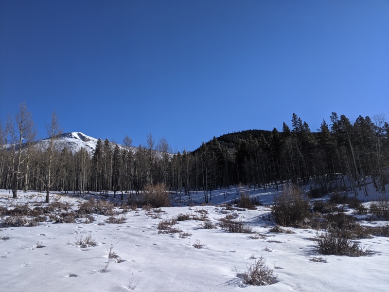
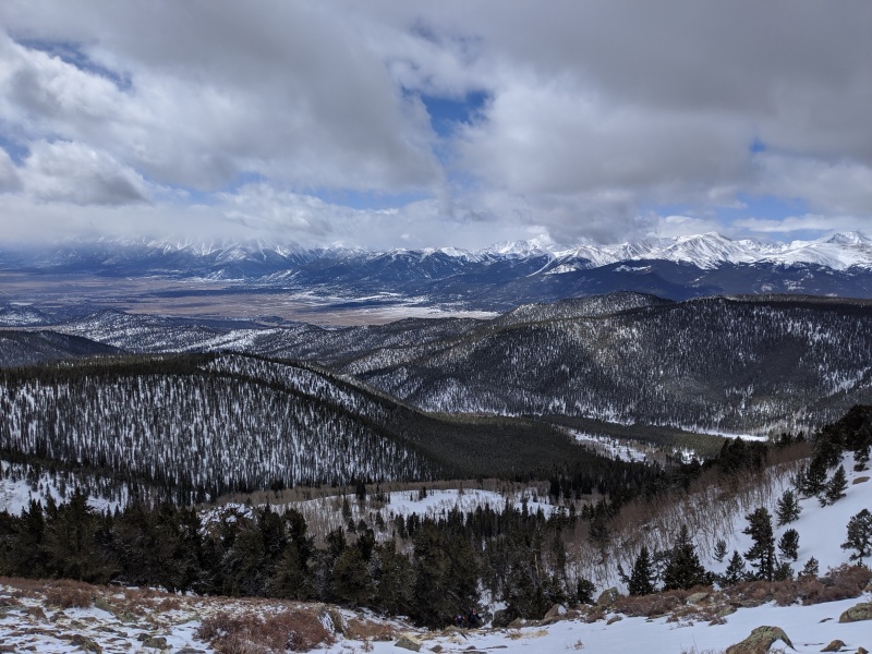
Sawatch views through the trees
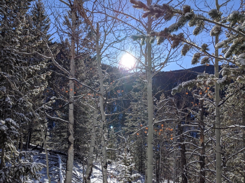
Sun! Always warms the spirits....and the toes
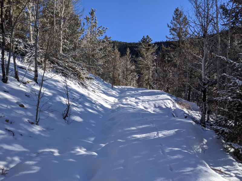
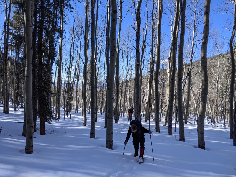
Okay snowshoes might help now
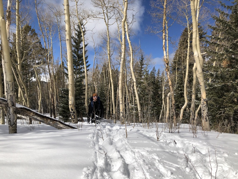
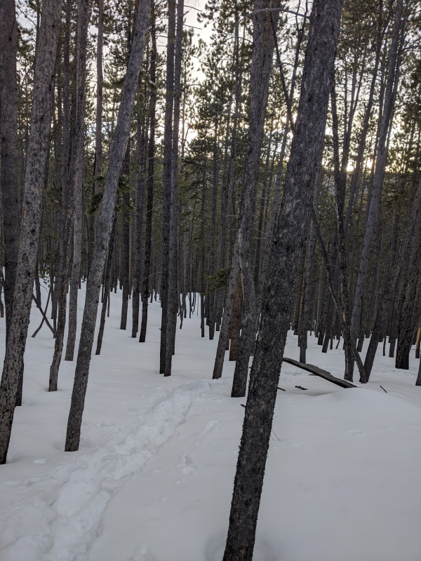
Eventually we snowshoed up and immediately sped up. We passed the last parking area, which spit us on a trail that dropped elevation, directed us through a gate reminiscent of the TSA security corrals at the airport, and led to the spot where we leave the trail, cross the creek, and start the bushwhack.
It's worth noting that the road, though going on for at least 4 1/2 miles, gains minimal elevation. In fact, the first mile or two of the road may lose elevation. At the point where we veered off the main road/trail, we'd gained less than a thousand feet of elevation.
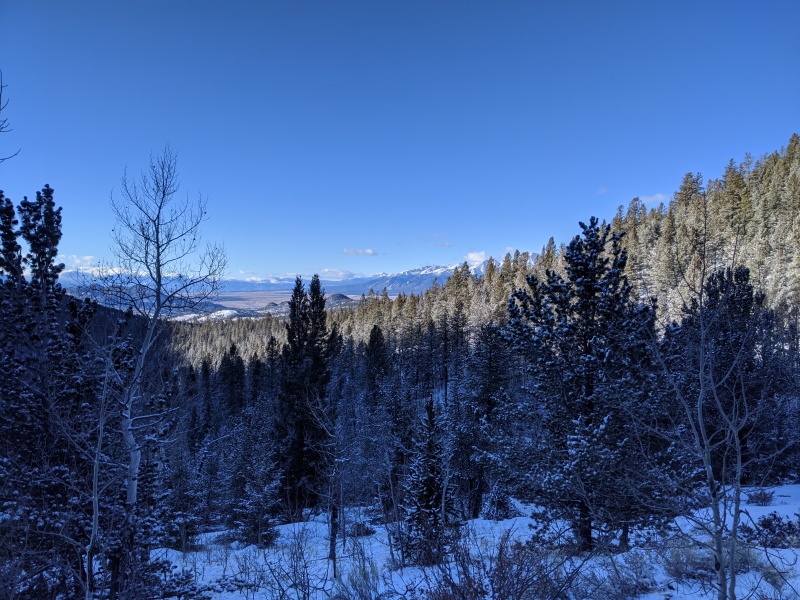
More Sawatch views
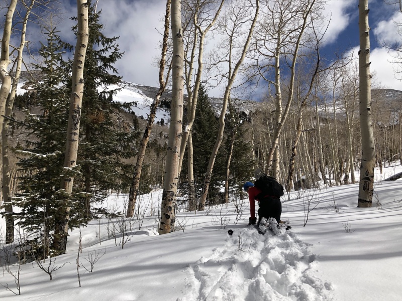
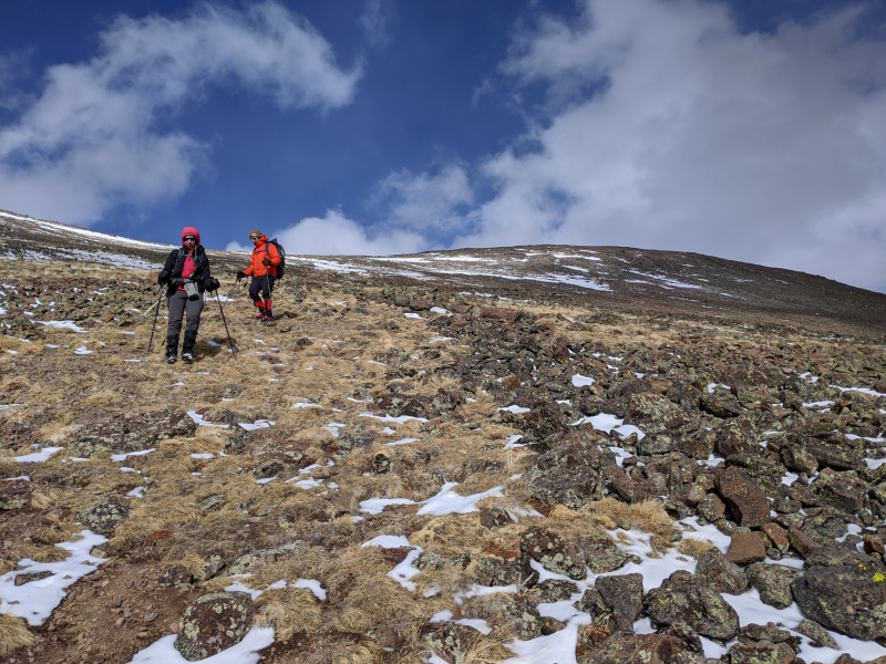
Jeremy at the turnoff, starting the bushwhack
Looking up from where the prior photo was taken. Ascend the hill, locate the peaks, go to them.
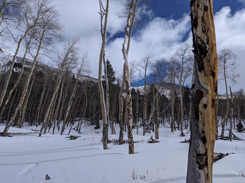
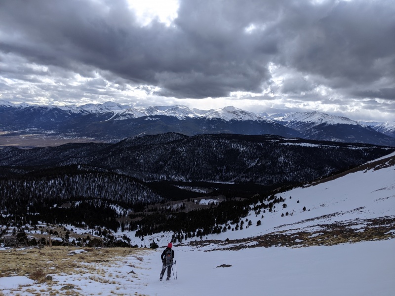
In the meadow above the initial climb from the creek, looking at West Buff on the left. It looks so close!
Once in the meadow seen above, we picked a line somewhat toward the general vicinity of the peaks. We hadn't decided our ascent line (and didn't until the last minute), but knew generally where we needed to go.
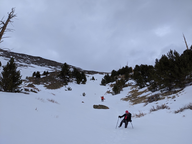
Unfortunately, this is where things bogged down. The snow was wildly inconsistent; supportive slab for 20 steps, then sinking to mid-thigh for 20 steps, then a step on supportive slab, then sinking for one step then supportive, then sinking, and on and on forever. The worst part was not knowing which was coming. It wasn't that bad breaking trail and it was awesome not sinking in, but the uncertainty with each step made this exhausting.
Kirsten and Jeremy vs. the snow
Looking back on part of the trench
We eventually fought our way out of that area and to a snow-covered ridge above a creek. We followed the ridge for 10 minutes or so before crossing the creek to the south facing slopes below West Buffalo. This portion was dry, so we took off our snowshoes, thinking we were done with them. But of course, we weren't. After ascending the dry slope, we found ourselves in a large, snow-covered meadow. This had the worst snow of the day, and we had just taken off the snowshoes and had nowhere to put them on. Our progress slowed to a crawl (literally) and we had to swim our way to find anything supportive to get the 'shoes back on
Snow 1, Jeremy 0
"We may not get a summit, but at least we'll have our dignity!" - me
Finally past the crawling section, getting those snowshoes on
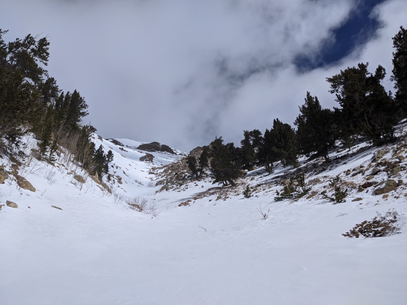
We got the snowshoes back on, but still didn't have a planned route up the mountain. I noticed a gully up to our left that seemed to head up (which was good, because we hadn't done a lot of that yet). Forward toward the saddle of East and West Buffalo seemed to encounter a lot more deep snow and trailbreaking, which none of us wanted to do. We shot up the gully and figured that based on what we'd seen from a distance, we'd have options once we got higher.
Bottom of gully. Guessing this guy ran last year during avalanchocalypse
Moving up the gully. Our exit branch is just before the rock outcropping dead center in the photo.
Looking down the gully
The gully helped us gain some altitude quickly. The snow was mostly supportive for a change. Upon reaching the fork in the gully, we chose to go right, as snow quality deteriorated in the main gully, and the right would put us on rock sooner and let our tired legs get out of the snowshoes.
Me heading up the exit branch of the gully
Looking down from on top of the exit branch
Nasty cornice overhanging the main gully
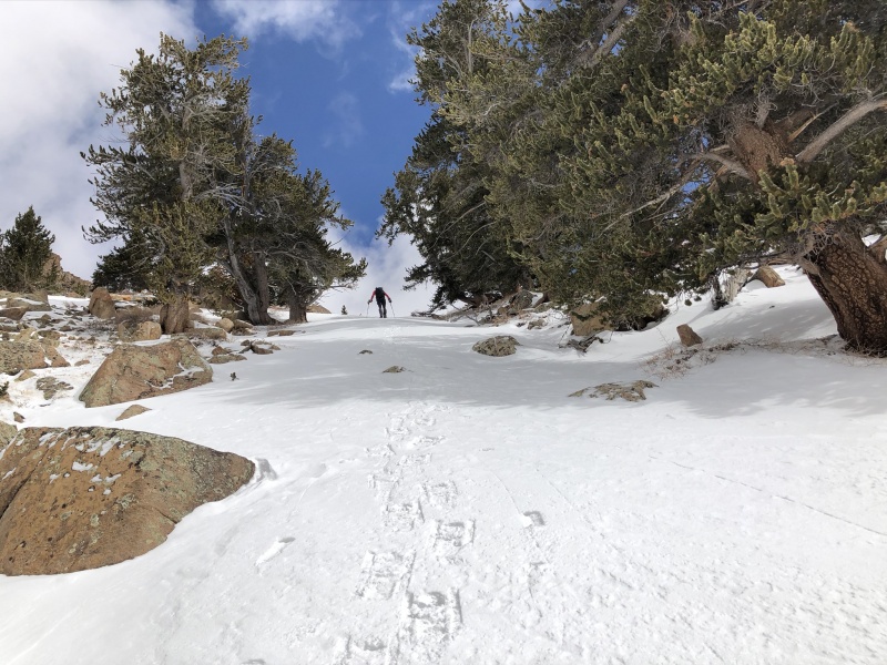
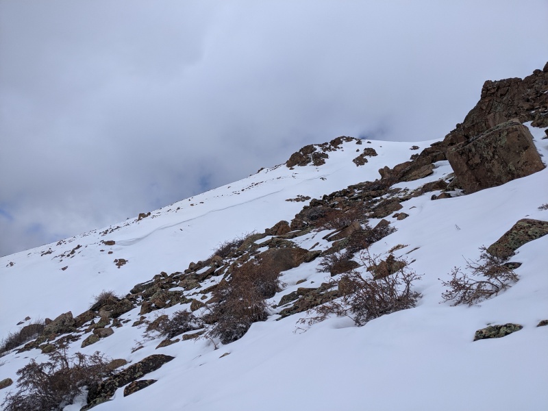
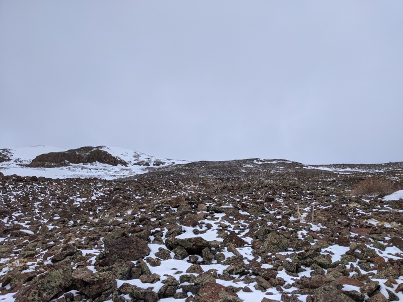
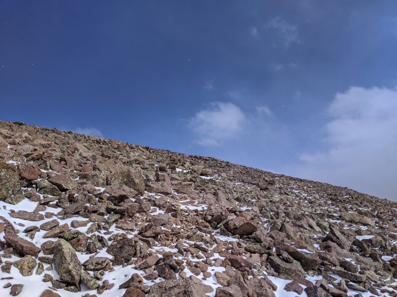
We made it to rock! From the top of the right branch of the gully, we were put onto a sea of talus that extended all the way to the summit ridge. Getting snowshoes off never felt so good! It gave a nice burst of energy too.
Talus to the top!
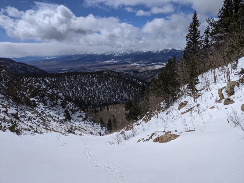
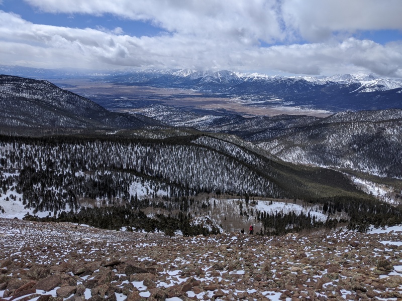
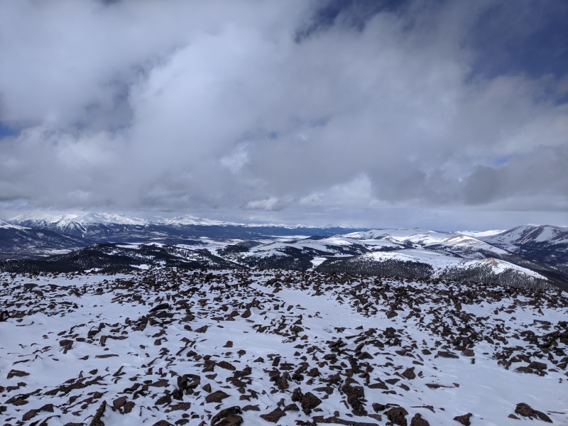
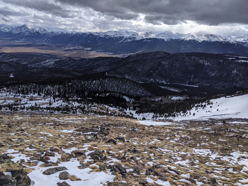
Looking back down on the approach valley, Buena Vista, and the Sawatch
Our route up the rock took us to just a couple hundred feet from the summit of West Buffalo. There were a few minor snowfields to cross, but nothing of consequence and the snow was good. The snow above treeline was generally supportive and stable, while below was inconsistent and frustrating. We were quickly to the summit of West!
Summit of West
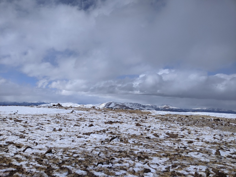
clouds
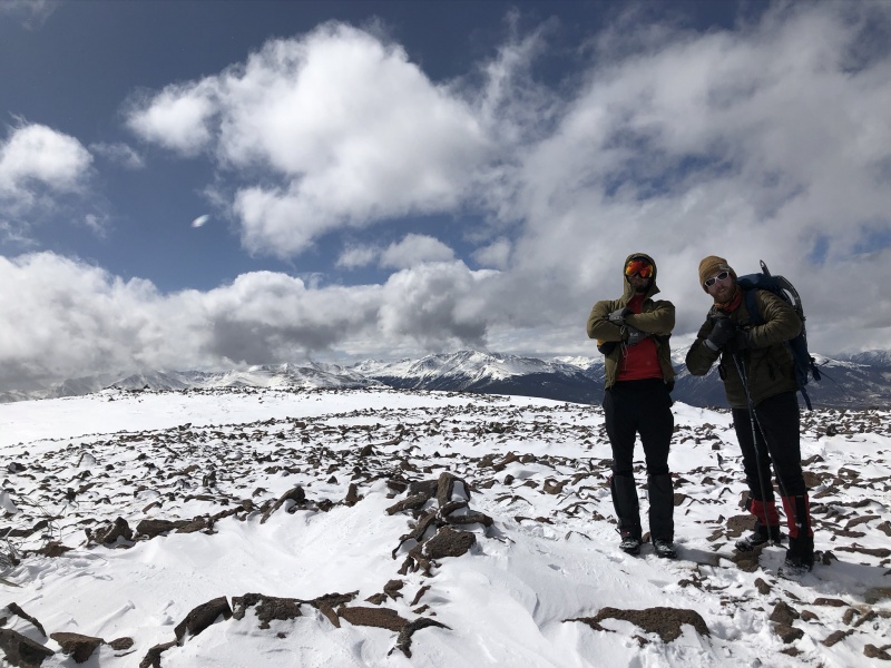
Kirsten and Jeremy coming up, East in the background
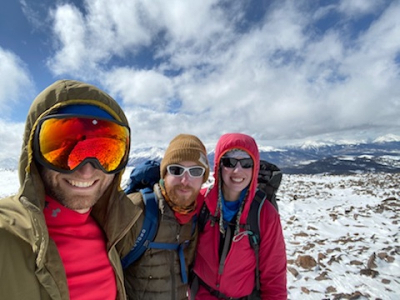
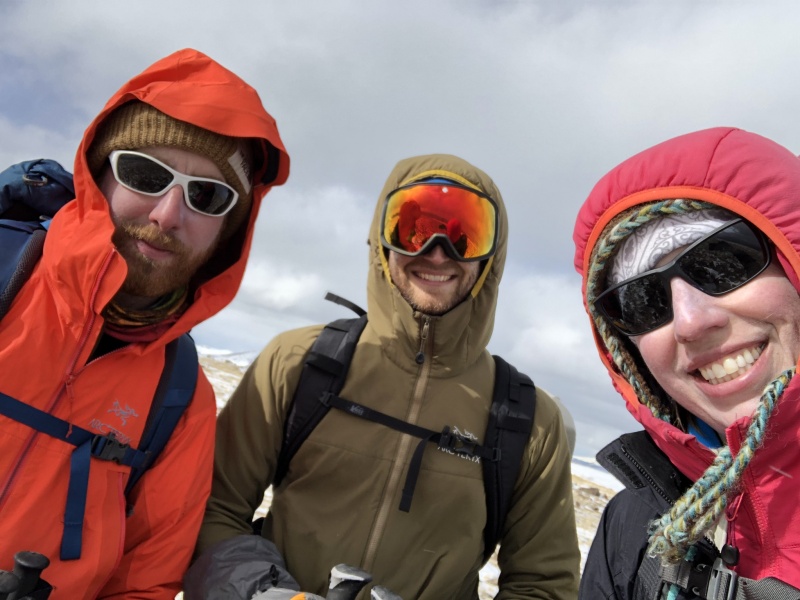
Honestly can't tell which summit selfie was from which mountain....oh well
We hard out here
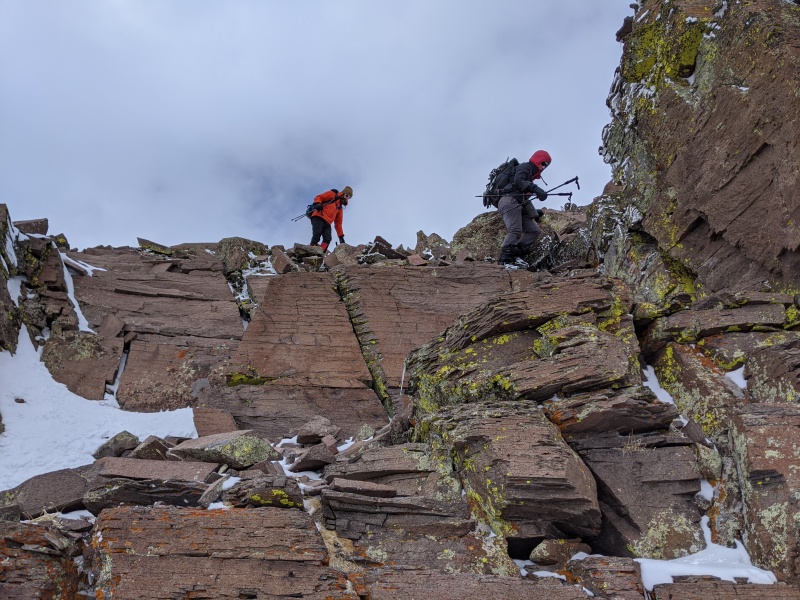
We didn't take too much time on the summit, as the job wasn't done. We stayed fairly high on the ridge for the traverse to East Buffalo and only found one scrambly section. For the most part, it was class 2 angled talus with snow in between each block. We were typically no more than 20 feet below the ridgecrest until the last point on the ridge, at which point we dropped lower
Scrambly downclimb on the ridge
Almost to the saddle, East staring us in the face
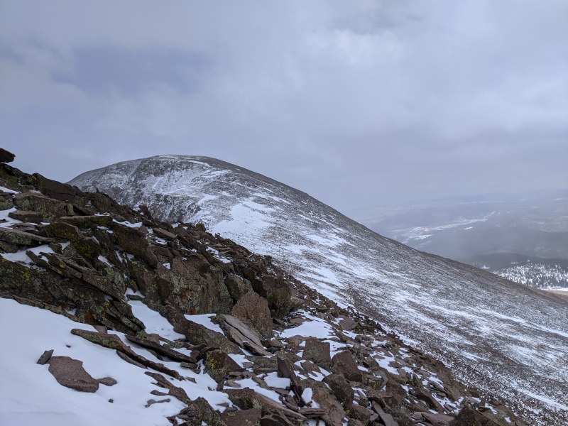
From the saddle, it's a pretty uneventful hike up East. A few minor snowfields to cross, but nothing worth using traction or shoes. For the most part, it was rock hopping on Mosquito-quality talus.
at the saddle
Up at east, one of the snowfields in sight
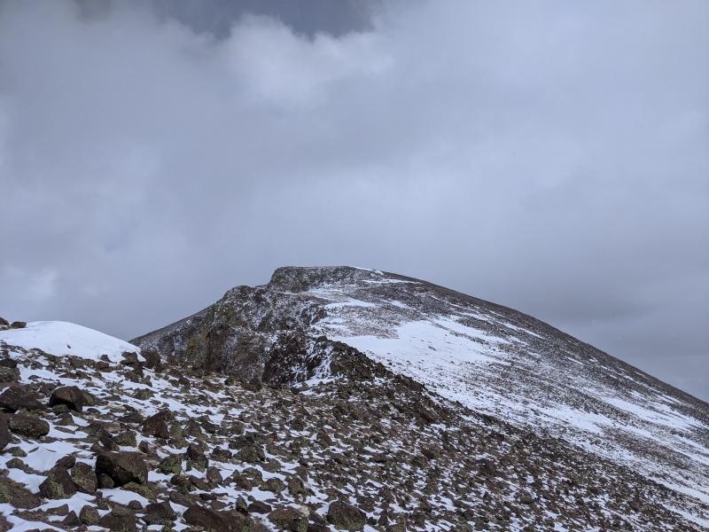
Looking back at West from an outcropping on the ridge
Final push up to the summit
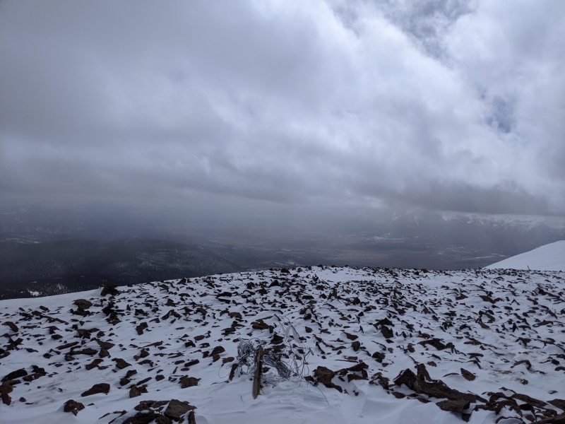
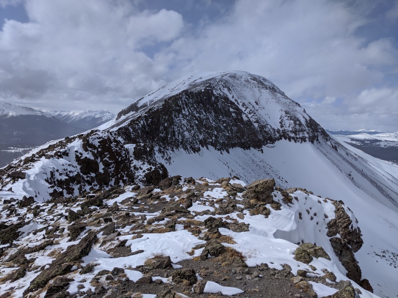
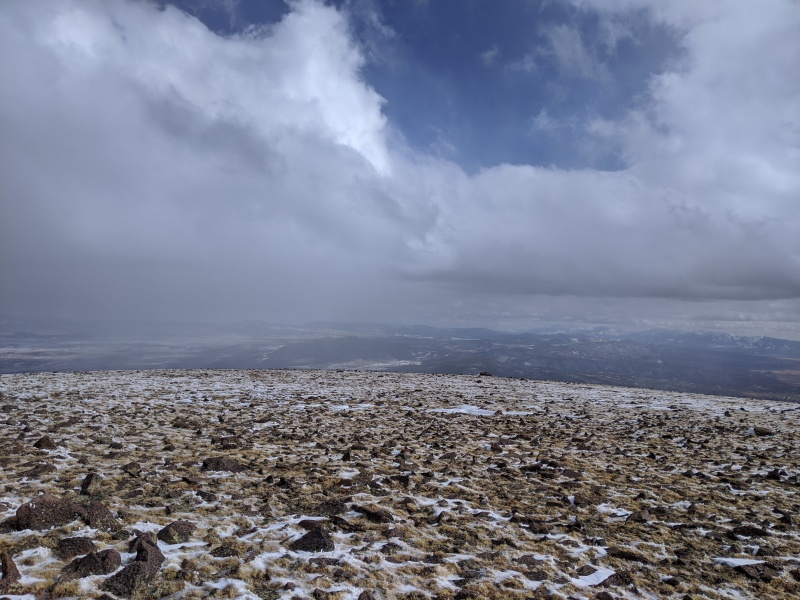
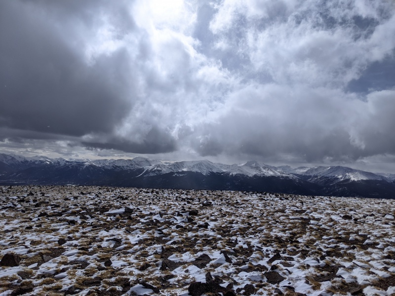
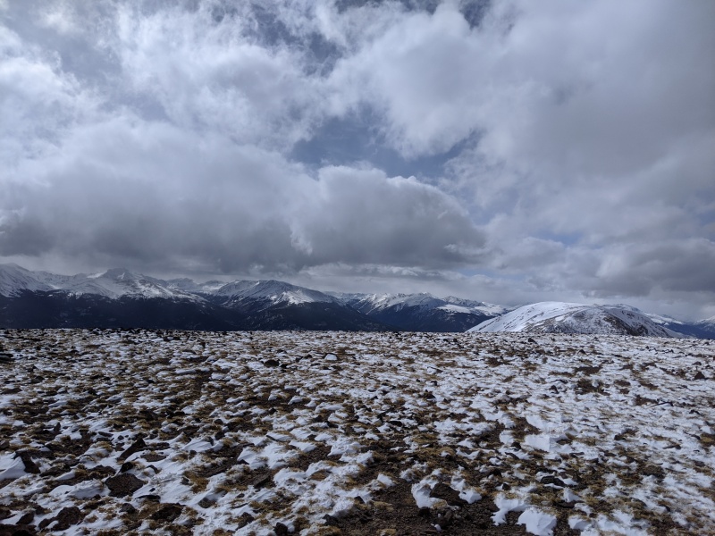
We made it! East has a broad, expansive summit, with your choice of windblocks. The summit was special; it was snowing in almost every direction other than where we were, which was sunny.
Summit #2!
Sawatch
The summit's so big it blocks most of West from view
You could land a helicopter up here, which would definitely make the descent faster
pretty sure this was from East?
For our descent, we spied mellow slopes leading to a gully not too far below the saddle of the peaks. We aimed for the gully, in hopes that a good butt-slide would save our legs some work.
Descending from the saddle
Top of gully is the patch of snow in the middle right of the picture
Top of descent gully
Unfortunately, the snow was too soft to get a good glissade, but with some swimming motions we were able to keep enough momentum to at least move. The second we stood up, it was back to posthole hell.
The rare double posthole, caught on camera!
The trip back to the car was long and tough. The snow had warmed up, so all of the trail we broke previously was even softer, and the areas where we didn't posthole in the morning we sunk in now. We made it back to the creek crossover and the trail right as the light was disappearing.
retrenching...fun
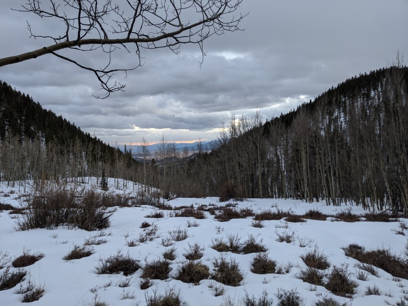
In the meadow right above the main trail
The hike out seemed to drag, but after the trenching, loose talus, and retrenching, mindless trail and road miles weren't too bad. According to my watch, we ended the day at about 16.5 miles and right on 5k in elevation gain. Solid day!
Thanks again to Kirsten and Jeremy for volunteering to join me on this one!
My GPS Tracks on Google Maps (made from a .GPX file upload):
mountains. Never thought of going at them from the south out of BV. Might have to follow in your footsteps when the snow clears. And yeah - when you don't know if the snow is supportive or not - that is that absolute worst! Especially when it seems like it will hold you and then as you get ready to take the next step, it gives. Ugh...
Those are outstanding and underrated 13ers. I had been thinking of doing them from the BV side sometime. Thanks for the beta, would be a lot easier in summer but what fun is that ;)
I have a property near by and have been eyeing them for a long time. Thanks for sharing your GPS I can always use those if my route doesn't turn out. I want to approach them from the east side hwy 285.
I am looking to possibly take your decent route roughly (might cut back east before its a full on gully to meet the salt creek trail to do the loop) this weekend (mid May) and I think it's fair to say that the upper south facing slopes will be pretty dry.
Happy this helped! It's a great alternate way of getting these done. Best of luck!
Caution: The information contained in this report may not be accurate and should not be the only resource used in preparation for your climb. Failure to have the necessary experience, physical conditioning, supplies or equipment can result in injury or death. 14ers.com and the author(s) of this report provide no warranties, either express or implied, that the information provided is accurate or reliable. By using the information provided, you agree to indemnify and hold harmless 14ers.com and the report author(s) with respect to any claims and demands against them, including any attorney fees and expenses. Please read the 14ers.com Safety and Disclaimer pages for more information.
Please respect private property: 14ers.com supports the rights of private landowners to determine how and by whom their land will be used. In Colorado, it is your responsibility to determine if land is private and to obtain the appropriate permission before entering the property.


")
")
")
")
")
")
")
")
")
")
")
")
")
")
")
")
")
")
")
")
")
")
")
")
")
")
")
")
")
")
")
")
")
")
")
")
")
")
")
")
")
")
")
")
")
")
")
")
")
")