|
Homestake Peak 13,209'
2/29/2020
Route: East Ridge
TH: intersection of Lake County 19 and Wurtz Ditch Rd
Stats: 10.37 miles, 2,992' (CalTopo), 8 hours 25 minutes
Partners: rebeccasimeone and Henry
As good as the snow has been in bounds recently, we've been itching to get out and ride some peaks. The prior weekend we climbed St. Vrain Mountain which got us hooked and ready for Spring! Considering the improving but still winter snowpack, I wanted to find a mellow, if long, thirteener with little avalanche danger. While riding Ski Cooper in January on a bluebird day, Homestake's broad, mellow, snow covered East Ridge kept grabbing my attention. Becca was getting sick of me talking to myself about how good it looked. So after reading every trip report on this peak (thank you, SnowAlien, SurfNTurf, BobbyFinn, Taylorzs, and KevinBaker!), Homestake seemed to fit the bill.
There are two primary trails in the area providing access to the 10th Mountain Hut and Homestake's East Ridge. Another undulating trail comes in from Tennessee Pass that I won't discuss. The main trailhead for Homestake is the Crane Park Trailhead at the corner of Highway 24 and Lake County 19. Route descriptions for the 10th Mountain Division Hut start from here, and use the green approach shown in the map below. This is the Winter trail. It begins by hiking 0.3 miles on the plowed Lake County 19 road before turning right onto the signed 10th Mountain Division Hut Winter trail.
Just under a mile up Lake County 19 on the right side of the road lies a plowed pull off at the signed intersection with the unplowed Wurtz Ditch Road. There were no cars there but no signs indicating you couldn't park there (for now). This is where we parked and started our route up Wurtz Ditch Road following the Summer route noted in Red on the map below.

Red: our route using the Summer trail; Green: 10th Mountain Hut Winter trail
If you aren't skiing or snowboarding you can ignore this paragraph. My goal was to take the most efficient route up to and down from the 10th Mountain Hut allowing for the most continuous riding on snowboards. Taylorzs mentioned in his trip report that they took the Summer trail up and the Winter trail down, and he recommended ascending and descending the Winter trail. However he did mention that near the end there was a 20 minute hike uphill to get back near the intersection of the Winter trail and Wurtz Ditch Rd. I could clearly see on topo maps this reclimb appearing to be ~150ish vertical, which sounded horrendous to me after a long day. According to the map and SnowAlien's GPX track, the summer trail appeared more continuously downhill, or at least more flat. I spoke with TakeMeToYourSummit Friday evening to pick his brain on this line, as I knew he had climbed and snowboarded this a few years ago. He mentioned when his group rode Homestake, they descended the Summer trail and were able to ride almost the entire way to the car with only a little bit of poling and a couple short bits of hiking. Based on this and eyeballing the map, we went for the Summer trail in both directions. While there was no 150' reclimb on the Summer trail, we definitely found many slight uphills and had to unclip and hike several times. I even gave both splitties a hot wax the night before and it was still a pain. In retrospect, I don't know if there's a better way to slide down this on a snowboard - either route is going to involve some poling and reclimb on the way out. Skiers may have to exert a little less effort than boarders on the Summer route considering all the micro-climbs that could be side stepped or shuffled.

Henry leading the way up Wurtz Ditch Road
Anyhow, the three of us set off at 7:27 skinning up the gradual but well traveled Wurtz Ditch road. At 1/3 mile, we reached the intersection with the Winter 10 Mountain Hut Trail/Colorado Trail/CDT. Turning left would have taken us up the Winter trail, so we continued straight on Wurtz Ditch Road.

Henry was confused that we weren't turning onto the Winter trail
At 2/3 mile, the road crests a small gap on the Continental Divide at a summer parking area with a big sign. At this point the road splits onto either side of the Wurtz Ditch. We took the FS 145 road on climbers left of the Ditch, paralleling the ditch for a bit before the trail bears off and left into back into the woods. Shortly thereafter we passed this sign:

Shortly after this sign is where the FS 145 road/Summer trail start undulating roughly along the Continental Divide for about half a mile. This is the section that would annoy us on the ride out. But from ~10,850' onward it was a pretty continuous, gradual climb to the 10th mountain hut. The views begin to open up and we had plenty of opportunities to drool at Homestake's gorgeous East Ridge along the way.

Homestake's East Ridge on the left


At around 3.2 miles and 1,000' from the trailhead, we reached the 10th Mountain Hut. The views of Homestake from the Hut proved inspiring. We continued past the hut by dropping a bit down into a meadow and angling toward Homestake's lower East Ridge.

Becca skinning through the meadow just past the 10th Mountain Hut
At the edge of the meadow we all stopped for a long break. From here, we followed a generally West-Southwest course alternating through woods and meadows, aiming for the small saddle on Homestake's East ridge just west of the point labeled "11,847'" on FS and USGS topo maps. There was an excellent skin track to follow the entire way.

Just below where we gained the ridge, we stopped to dig a snow pit on an ENE aspect around 11,850'. We wanted to check the snowpack to assess if we would be comfortable dropping into a small E - NE facing bowl that departs the East Ridge around 12,400'. The bowl's angle appears to top out in the high 20s to 30 degrees according to CalTopo. SnowAlien and TakeMeToYourSummit's pictures of their turns in the bowl looked yummy and we wanted some of those goods, not to mention it looked untracked! We felt the similar aspect and position just under a ridge line might be an adequate representative sample of what the snowpack could look like on that bowl. Since we were dog sitting Henry for the day, and I want his owner to let him climb more mountains with us, we wanted to be 100% confident in the snow before we dropped anything that could slide.
After digging down about 1.5 meters and still not finding the ground, a group of 6 skiers skinned by us. Two guys stopped to chat for a bit and check out what the pit looked like. Becca and I took our AIARE I December 2018 and are still figuring out how to analyze snowpack. From what we saw without conducting any tests, we were not comfortable dropping into the bowl. There were many weak layers with harder slabs on top at about 6", 18" and lower. I asked one of the guys - Jay - what his thoughts were and explained that we were still in the early stages of learning snowpack analysis. Jay, who mentioned he'd been riding backcountry and studying snow around 20 years, went into full on instructor mode! He shaved a little more snow off the walls and felt around for weak layers, then cut out a quick column that effortlessly sheared off the top 18" or so of the snowpack. This confirmed our thoughts and was a great mini-refresher course. We really appreciated him stopping to look at the snow with us and share his expertise.
On a less serious note, Henry absolutely LOVED rolling around in the snowpit!


Low on the East Ridge
Once established on the ridge, there an obvious skin track led all the way to the summit. Jay's group climbed and skied the line the day before and may have put it in. We had to cross over a couple short sections with a bit of rocks, but nothing you couldn't skin over. On the way down we would ride around these on skiers left.


Looking down the ridge toward Ski Cooper
Just below the summit we crossed paths with a pair of snowshoers descending. We chatted for a bit and continued. After checking the forum and conditions reports, I think it was user 13erRetriever and her dad. Nice chatting with yall!

Last push to the summit. The climber coming down from the summit may be 13ersRetriever or her dad
Around 50 vertical feet or so below the summit, the continuous snow ran out. We stopped to transition and put on puffies. Then we booted across some talus and onto a short, steeper snow covered slope onto the top.

The summit views were spectacular! You could see most major mountain ranges in the state except the San Juan. The Elk and Gore especially shined from this vantage. While winds were tolerable on most of the ridge, the summit was a bit blustery so we only stayed a few minutes.

Ski Cooper and the Southern Gore with Tenmile-Mosquito behind

Looking down toward Tennessee Park and onward into the Arkansas River Valley

Sawatch

Much of the Elk Range

Savage on the right, Sopris just right of center in the distance

Holy Cross Wilderness

Gore - Tenmile

Becca

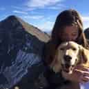
Henry

Me
We scampered quickly back down to our boards and strapped in. The three of us took turns on the firm based, soft-ish on top, funky but fun snow. I'm not sure who had the most fun, but it might have been Henry.


Henry and me

Henry getting after it!

The meaning of life

Henry checking up on Becca

Just past/skiers right of the turn into the main bowl at 12,400', we were lured into a shallow gully with great snow leading to the edge of the ridge. We regrouped a way from the edge and thought there might be a smaller, less steep gully leading down into the basin. When we arrived just above the rollover, the pitch looked at least as steep as the main bowl, so we bailed by traversing back hard right onto the ridge. Once in sight of the skin track below the ridge, we pointed it down onto our ascent route. There were two annoying poling sections and one short portion we had to unclip and hike the on skin track for a couple hundred feet. This led back to the flat meadow below the 10th Mtn Division Hut.


Henry gazes back in admiration of his accomplishment. Becca later informed me this was him waiting eagerly for me to finish in the outhouse
At this point one could skate across the meadow and try to pick up the winter trail down to the trailhead, or do what we did, where we quickly transitioned back onto skins until gaining the 4wd road of the Summer trail. After a quick bathroom break in the luxurious 10th Mountain Division Hut's outhouse (complete with a wooden squatty potty!), we quickly regained the road and began the frustrating descent. We were able to ride most of it, but there were at least 4 points where we had to unclip and hike a little bit - the longest stretch was a very gradual uphill around a 10,800' minor saddle. Once back at the pass/gap at the Crest of Wurtz Ditch Rd, we easily rode down the rest of the trail to the car. While we were the only car in the lot that morning, there were 4 other Subarus and 2 Yotas blocking each other in at this point.
In summary, this is a reasonably safe winter option for snowshoeing or sliding on skis or splitboards. While the deproach is less than ideal, it's still more efficient than snowshoeing or hiking out. I'm curious to hear what others' opinions are on the Summer vs. Winter trail providing the best ride out on skis/board.
Thumbnails for uploaded photos (click to open slideshow):
")
")
")
")
")
")
")
")
")
")
")
")
")
")
")
")
")
")
")
")
")
")
")
")
")
")
")
")
")
")
")
")
")
")
")
")
")
")
|
")
")
")
")
")
")
")
")
")
")
")
")
")
")
")
")
")
")
")
")
")
")
")
")
")
")
")
")
")
")
")
")
")
")
")
")
")
")