| Report Type | Full |
| Peak(s) |
Mt. Democrat - 14,154 feet Mt. Cameron - 14,248 feet |
| Date Posted | 02/17/2020 |
| Date Climbed | 02/15/2020 |
| Author | daway8 |
| Decamdy with Decalibron avy analysis |
|---|
|
Why bother with yet another trip report on such a heavily documented, well known loop like Decalibron? Two main reasons: 1) When looking through trip reports to prep for this hike I was having trouble finding the kind of beta I was looking for (such as specifics on route modifications for avy concerns) and since I didn’t get all 4 peaks I want to document the data I gathered so I don’t have to search for it all again if I decide some year to go back for the others. 2) This hike had some unexpected twists and turns which I wanted to make a record of and figured some people might find interesting. So this report will be broken into two main parts: Part 1: The Story (If you’re only interested in beta and/or pictures, skip to part 2 – there’s some beta buried in the story but it’ll be easier to find in part 2) Part 2: The Beta (this will be more like my typical TR) Specifically, in part 1 I’ll tell a tale familiar to most winter hikers of how a lovely day turns fierce with crazy winds and an early arriving storm (plus some vehicle recoveries afterwards) then in part 2 I’ll cover:
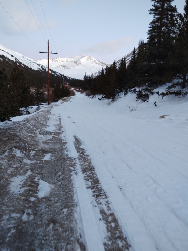
Part 1: The Story I normally don’t bother going into story mode for my trip reports, especially on a loop considered one of the easiest of the 14ers but this hike proved how you have to be prepared even on “easy” hikes (if you just want the climax scroll to the section in bold in the middle or just skip to part 2 for pictures and beta). I had planned to start at first light but some issues with snow drifts and lack of signage (see Trailhead section in part 2) slowed me down. But after I finally got going it was a beautiful day and I was pleasantly surprised to catch a glimpse from afar of the Democrat-Cameron saddle and see that it was swept almost totally clean of snow. There was one brief sketchy section of snow to cross to get up into the bowl and later another brief bit of steep snow to cross on the mostly dry face of Democrat (I didn’t bother leaving the summer trail to stick to the ridge since everything was mostly barren) but other than that much of the hike up Democrat was on bare rock until the last little bit between the false summit and the summit. I was surprised at how little wind there had been up to this point and noted that what wind there was had mostly been at my back. Only upon getting to the summit of Democrat did I encounter notable winds, but even then not too bad. I checked my watch and, though I was running a little later than I would have liked I figured I still had time to finish the loop and a quick scan of the horizon said I was probably ok weather wise for the time being. So I made good time down Democrat, took a break at the saddle then started up. The wind picked up considerably as I went up Cameron. Oddly, though there had been a light wind at my back going up Democrat, now that I was going up Cameron (heading directly opposite from going up Democrat) the wind was also at my back in this direction – occasionally gusting strong enough to help boost my speed a little! Then I got to a spot high on the ridge where there were some wind cornices that dropped off into some very steep snow fields on my right (SE). I took one look at that and said “no way am I going to try to cross that” (in the pictures at home it doesn’t look as intimidating but it was a show stopper up there). But I didn’t really want to backtrack face first into that wind so I moved over to where I could see the left side of the ridge and was happy to see it was clear. Coming out from behind a bit of a hump of rocks on the ridge I headed over to the left (NW) side of the wind cornices. No sooner had I stepped out than I got an education on how wind cornices like that get formed in the first place – I barely managed to brace myself with my trekking poles in time to prevent being slammed into the rocks. But then I could feel myself almost start to lift off the ground, which would have almost certainly resulted in me being tossed up onto and crashing through the cornices and then sliding down the steep snowfields on the opposite side until crashing into the exposed rocks a few hundred feet or so below. Instantly I dropped to me knees, leaned against the rocks and put my trekking poles in a bracing position. The large gust that I had feared might lift me eased up slightly and so I carefully moved forward in a crouched position along the ridge, having to stop another time or two to brace myself against strong gusts. After I got past the wind cornices the wind eased a tiny bit as I went along the ridge but was still strong enough to occasionally stagger me. By this point I was pretty sure I was going to have to abandon Lincoln since, even though I could have probably made it over there, I didn’t want to have to come back face first into that kind of wind. But I also didn’t want to get only one 14er out of this ordeal and since the best route back was to go over Cameron anyways I decided I might as well summit that poor, despised unofficial 14er on my way back to the Jeep. As I started up to the summit of Cameron the wind renewed its strength and was now hitting me almost directly in the back. I decided my best bet was to drop down off the NW face of Cameron towards the bypass trail if it was clear. As I got closer to the edge I saw there were some small cornices here too but underneath everything was bare rock. So I started moving along the edge walking towards the end of the cornices so I could bypass them and drop onto the rocks going down to the bypass trail but the wind was so strong I thought several times that I was going to be thrown out onto the cornices. Somehow I made it far enough along to get past the cornices but as I began dropping down to the bypass trail I was dismayed to note that the wind – which was blowing from the opposite side of the mountain – was every bit as strong as it swept over and dropped down on the opposite side! Now the concern was being knocked off my feet and sent tumbling down the mix of rocks and snow above the bypass trail. I had microspikes on – which I was very glad to have – but what happened next is what inspired me to write this section. As the wind was hammering me I decided I needed to pause and catch my breath before fighting my way down to the bypass trail where the ground was more level. With microspikes on I dug my feet down into the dirt and rocks and leaned over against the hill, basically laying down with my feet firmly dug into the mountain. Just when I thought I could finally relax a huge gust of wind came over the top of Cameron, down the opposite side of the peak and even though I was laying down with my microspike clad boots dug into the mountain the wind began to push me down the side of the mountain, churning up the rocks and dirt under my feet as if I was a bulldozer!!! My eyes almost popped out of my head and in panic I clawed at the side of the mountain until the gust let up a few seconds later. Despite being worn out at this point I scrambled down the remaining distance to the bypass trail without wasting any time. The trail had a little bit of snow packed into it but it was a relatively flat surface and, with my microspikes on, traction was not an issue. I stayed leaning into the hill for safety as I moved hastily towards Bross. Eventually I found a spot where there was enough of a reprieve from the wind that I could take a short break but then I noticed my next dilemma – the weatherman was wrong again! It wasn’t even midafternoon and already the snowstorm was darkening the horizon! Even though I knew the trail from this point on was pretty simple I wasn’t quite confident enough to want to navigate it in a whiteout and with these kind of winds I knew a whiteout could come very easily even with a little bit of snow falling. So I reluctantly hoisted myself back to my feet and moved forward along the ridge to Bross, soon being hammered again by the strong winds. As I drew closer I looked up to the ooh so close summit of Bross, looked over at the approaching storm, looked at the wind ripping across the peaks and decided it just wasn’t worth it – I’d have to settle for 2/4 today. Fortunately I made it to the descent portion of Bross before the first flakes began to fall and I was already back to the road (with 3 miles of hiking to get to my Jeep) when the near whiteouts started. It never got to where I totally lost sight of everything but multiple times I could only see a couple rocks or trees for a few seconds before the wind let up a little. I kept my eyes fixed ahead so as to stay the course if I did lose all sight. I had two independent means of electronic navigation plus a compass and map which, especially having made it to the road – though it was buried in snow – I felt confident I could have made it back to the Jeep even in a prolonged whiteout. Well, almost confident. But I was glad I didn’t end up needing to test that theory. After finally making it back to the Jeep and driving down CR8 I came across a couple stuck in a snowbank near the spot where I had almost got stuck that morning. My recovery strap made quick work of pulling them out but then no sooner had I made it out onto Hwy 9 towards Fairplay then I saw another car in the ditch which everyone else was driving by. I put my blinkers on and stopped next to them, confirming they needed help. Soon a collection of people pulled over and someone hooked my recovery strap up to their “superior” vehicle (after getting quite a speech on the impressive specs of his rig I said – go for it!). Despite his awesome torque and such it still took several tries to get them out. In the meantime I grabbed my avalanche shovel and started trying to dig a path in the front of the vehicle through the crusty snowplow deposited junk in the ditch on the side of the road. I figured this was as good of a simulation of avalanche snow as I could get without being on site of a real one so I shoveled as if I was trying to extract someone with only 10 minutes or so to live. The couple of guys who had been trying to scoop stuff by hand decided not to bother when they saw how fast I was making that snow fly (I was very happy with the performance of my Black Diamond Evac 7 shovel with D grip and large flat metal blade even though I forgot to try out the hoe mode!). So all in all this “boring, easy loop” which often seems looked down upon by serious climbers proved that even the “easy” peaks can give you a run for your money in winter time. I’m going to be much more cautious about hiking solo in winter on anything other than a bluebird day, though I’m happy to report that my layering system kept me adequately warm the entire time! P.S. My quirky title of Decamdy comes from trying the Decalibron loop but missing Lincoln and Bross because of how windy it was. Part 2: The Beta Ok if you don’t care about stories then here’s where to pick up again for the beta – divided into sections for easier access. Trailhead I had planned to hit the trailhead at first light but was stalled a little bit when I got momentarily stuck in a snow drift covering the road about a mile before Paris Mill. I backed up and put traction devices on my Renegade (can’t fit chains on with the tires I have so I used AutoSocks instead) and then made it through the drifts with no problem. I was navigating off the coordinates for Kite Lake and forgot to mark Paris Mill on the map. There was a large plowed out region along the road but no signs or markings of any kind. So I drove on until the plowing stopped next to a sign saying “Kite Lake 2.5” and pulled up the hill towards someone’s driveway in order to turn around and then parked in the clearing which was about 3 miles short of Kite Lake, as the Paris Mill site was reported to be. 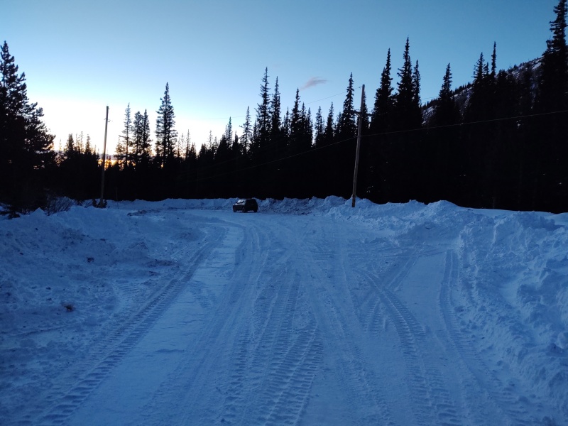
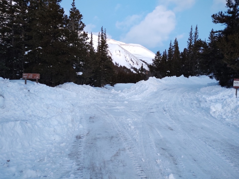
I parked at about 6:30am and found the actual sign for Paris Mill a little ways up the road. By the time I got back to the Jeep late that afternoon the road had been plowed out a lot more. 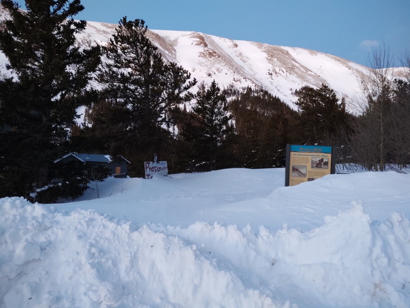
Loop Direction: Decalibron or Brolicamdem? When I was researching this trip I noticed that most people seemed to start the loop with Democrat though a person or two had done it in reverse. So I read up a little and come up with these conclusions. Standard direction advantages:
Reverse (Bross First) advantages:
So in summary, if you’re worried about avalanche danger on Democrat you might want to start with Bross. But if Democrat seems likely to be safe then you’ll probably be better off starting the loop there. Avalanche Analysis Sometimes the hardest piece of information to find for a winter hike/climb/whatever-you-call-it is specific details about avalanche dangers. Obviously it changes from year to year and even hour to hour so there’s no way to highlight every possible hazard but there are some spots that are known to slide almost every year while others rarely, if ever, have been known to slide. What follows below is an attempt to highlight a few of the most notable areas with the best available summaries I have put together from research and observation. 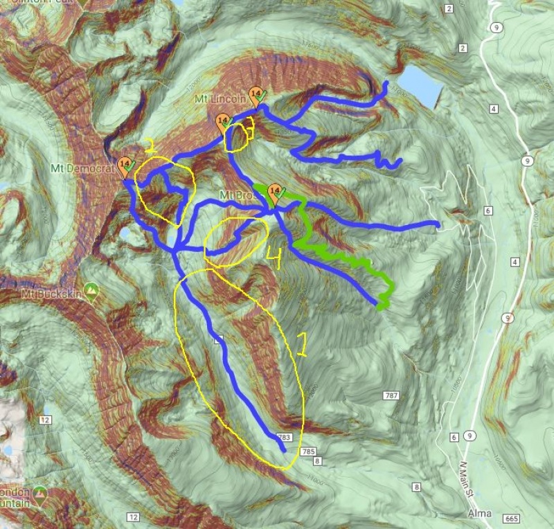
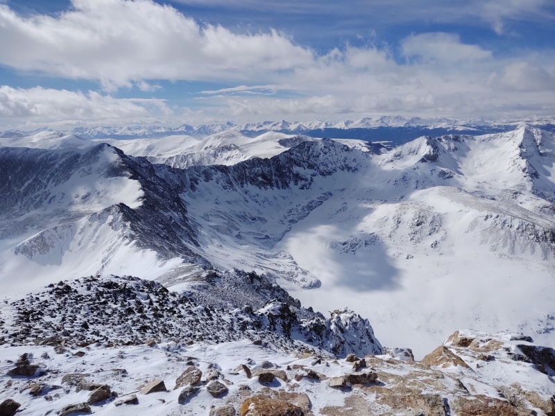
In the photo above I’ve highlighted 4 zones significant enough to point out. This doesn’t mean there are no other concerns out there, just that you’ll want to especially take note of these areas. Zone 1: The approach.
Zone 2: Democrat-Cameron bowl and surrounding regions.
Zone 3: Cameron bypass
Zone 4: Bross slopes
(NOTE: if any of this is inaccurate please comment or PM me and I can modify this section for the benefit of anyone who might come across this TR in the future - not to mention for my own benefit if I go back!) Zone 1 details: At first glance all that red along the 3 mile stretch of road that you have to walk up from Paris Mill looks a little concerning. But I marked the avalanche potential as “typically low” for a couple reasons. On the map view the first portion of the road looks the most concerning due to the proximity of a notable amount of red near the road. But once you turn on the satellite view you can see that there is a thick stand of mature trees here, plus there are also some inhabited houses in this region. Doesn’t mean slides are impossible, just much less likely. 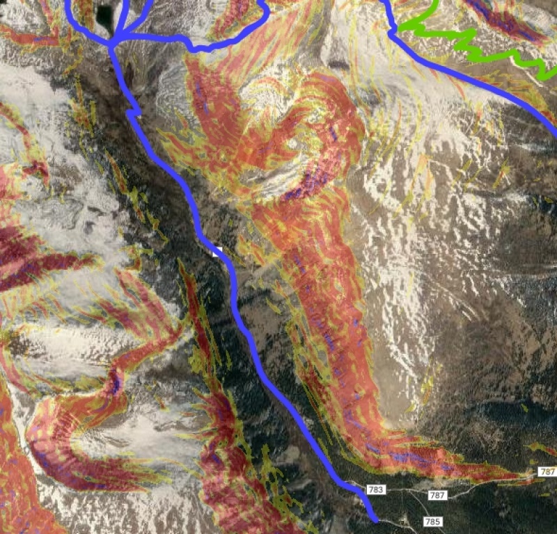
Beyond that you’ll note that the road pulls away a bit more from the red and experience (together with the Weekly High-Res satellite photos on CalTopo – see https://caltopo.com/map.html ) shows that this region is often stripped bare by the wind. I’ve not yet heard specific reports of slides in this region but keep your eyes open during periods of exceptional loading. 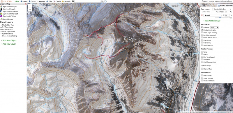
As of this writing the Weekly High-Res satellite view is currently available for free on CalTopo but there's a note saying this may become a subscription only layer. Find the layer by going to the menu in the top right and for base layers select the pull down and scroll way down near the bottom to Weekly High-Res. Then you'll be able to select Latest, 1 Week Ago, 2 Weeks Ago, etc. Zone 2 details: 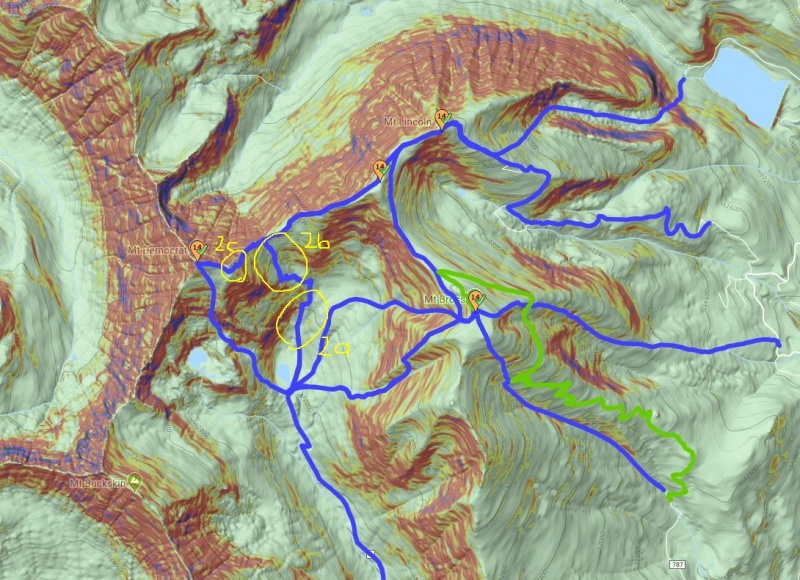
Zone 2a problem: Specifically in zone 2 there is some potential concern down in the basin if you stick to the trail since sufficient loading of the face above you could bury you in a bit of a gully there. Zone 2a solution: If concerned, you can easily avoid this danger by going up the hill in the middle of the basin – basically follow the track for Bross S Gully to the top of the hill then cut over to the normal route. Zone 2b problem: This is potentially the most risky spot of the entire loop. While the slope angles along the summer route going up the middle of the bowl are only marginally in the danger zone, there is concern also about the slopes above and there have been reports of slides in this region. Zone2b solution: the winds seem to often play with the loading in this area – cheat the route over towards the most wind blown side or consider going up Bross to start with and possibly skipping this peak unless you're confident you can safely evaluate the loading and conditions of the slope. Zone 2c problem: The east face has slope angles of concern and is less likely to be wind swept. Zone 2c solution: Just nudge the route over to stay on the ridgeline. Zones 3 details: Zone 3, the Cameron bypass, might slide under certain conditions but you can most likely found a safe route to both Lincoln and Bross by picking a route along the less steep slopes and avoid the bypass if it looks suspect. Zone 4 details: The descent of Bross looks very concerning on a slope angle map but this region gets so blasted by the wind that it doesn’t seem to often get loaded enough to slide. If there was a lot of snow you could consider nudging the route over to stay strictly on the ridge. General Route details/photos: Following is a scattering of possibly useful tidbits in the order in which they're encountered doing the standard Decalibron loop. It's potentially very handy that you can see at least part of the Democrat-Cameron bowl as you approach along the road from Paris Mill and thus get an early idea of whether or not it's swept free vs loaded. 
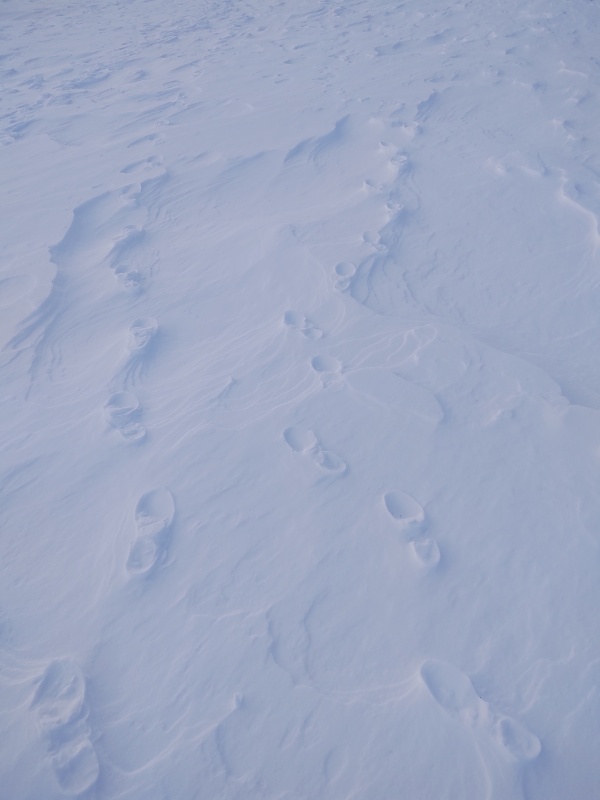
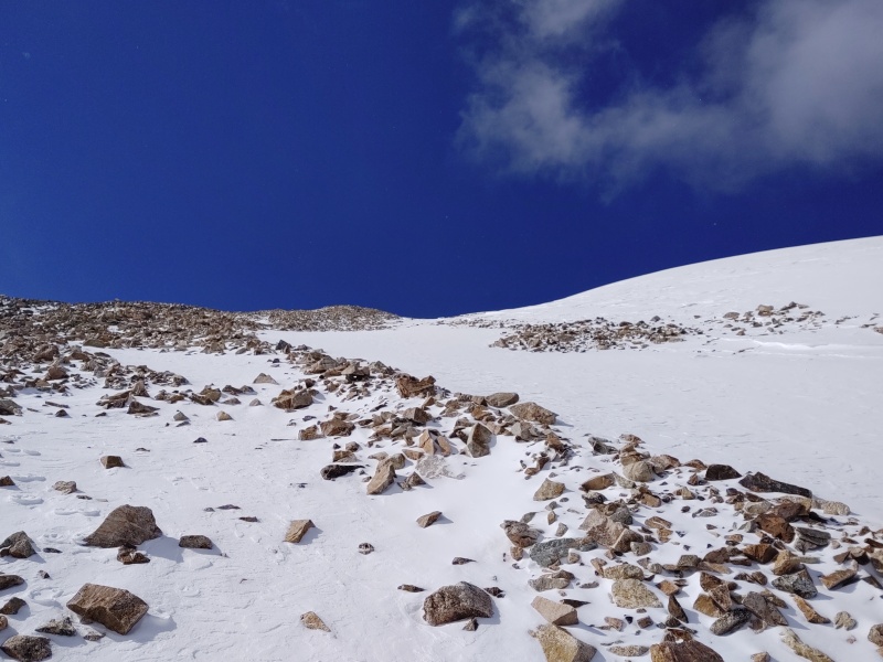
By the time you get to Kite Lake your view of the route up Democrat is going to be getting blocked so you'll want to keep your eyes open as you come down the road (if it's light enough out) to help decide what approach to take. What I found worked best on this particular day was to swing over to the right towards the center of the basin and hike up to the wind blown hill in the middle, off to the right of the summer trail - basically aligned with the route labeled as "Bross S Gully" in the route descriptions, then cut over to the summer trail once on top of the hill (I needlessly curved over to the left but you could easily take a straight line to the top of the hill). This path has the advantage of removing any danger from the potentially heavily loaded east face of Democrat (the loading that day probably wasn't too bad but the gully was filled with snow and the steep ridges above it were covered in snow while the hill in the middle of the basin had lots of bare spots which made progress faster). 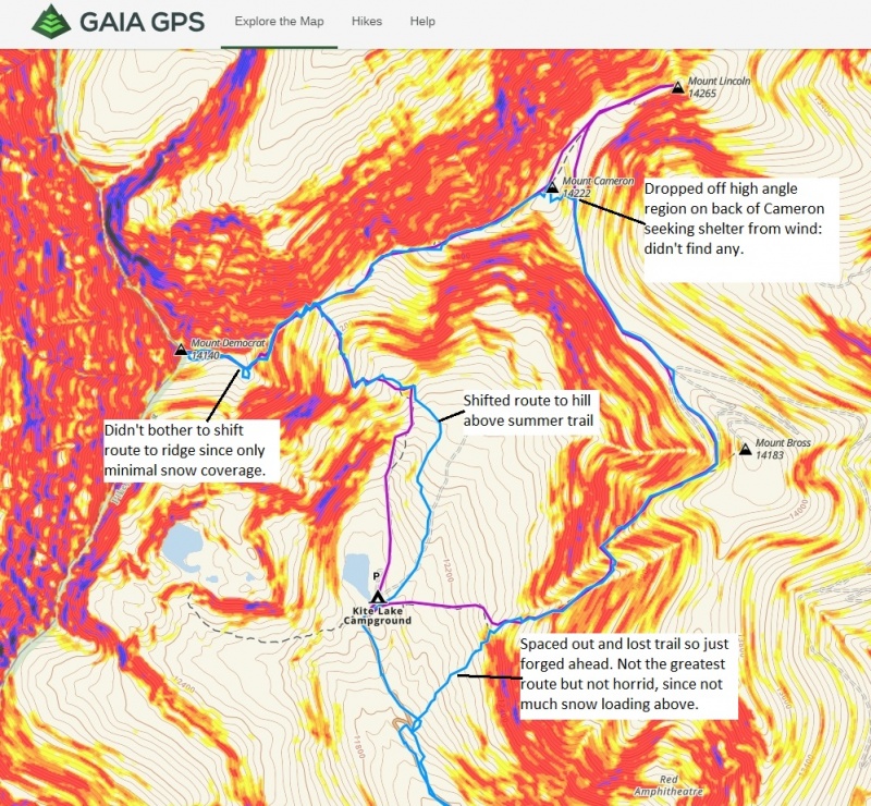
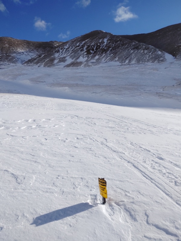
The route through the middle of the basin more or less follows the signs marking the boundary of the National Forest. 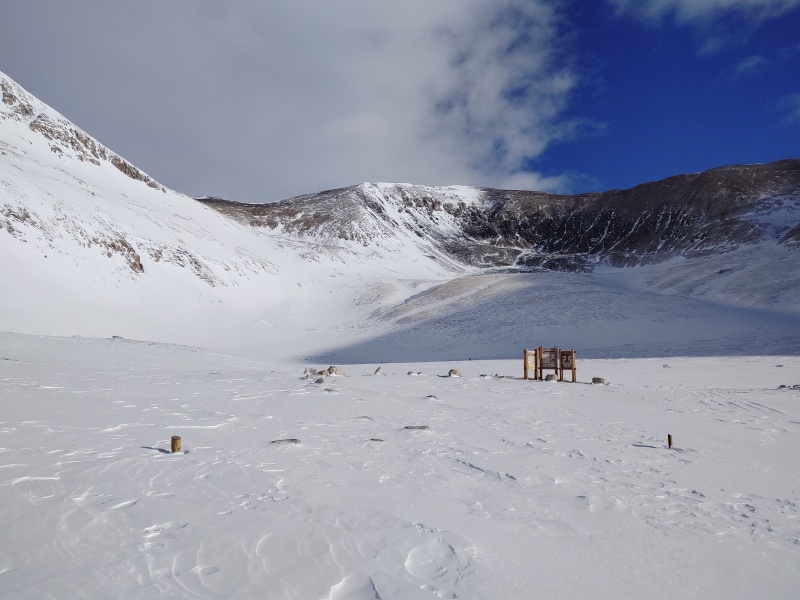
As you start going up the hill in the middle of the basin it may look like you're going to gain too much altitude and have to drop down on the far side of the hill but that's not the case. You can go straight to the top and it will put you on level ground to walk right over to the Democrat-Cameron bowl. 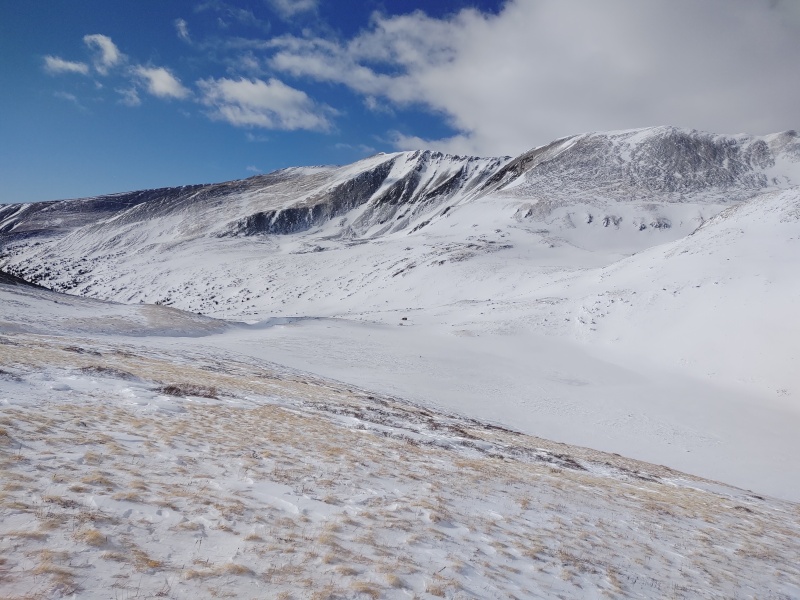
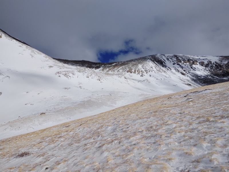
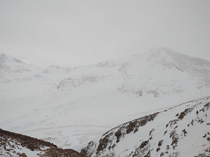
As you get to the top of the hill this is where your avy awareness needs to go on heightened alert. As I crossed over to the summer trail as it hits the bottom of the Democrat-Cameron bowl the snow went from rock solid crust to sinking up to my knees, then fluffy powder then ice then crusty again. This says that there are all sorts of weak layers at the base of this steep section. That should be a red flag for later in the season if this area continues to load. 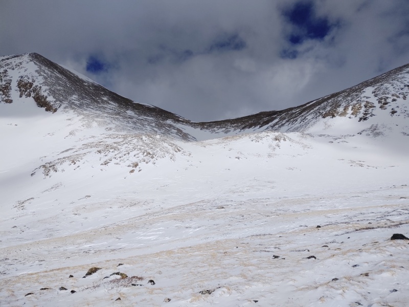
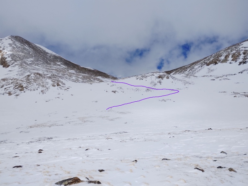
About the point where the bend in the purple line in the photo above is at is where my slope meter was reading somewhere around 30-35 degrees. 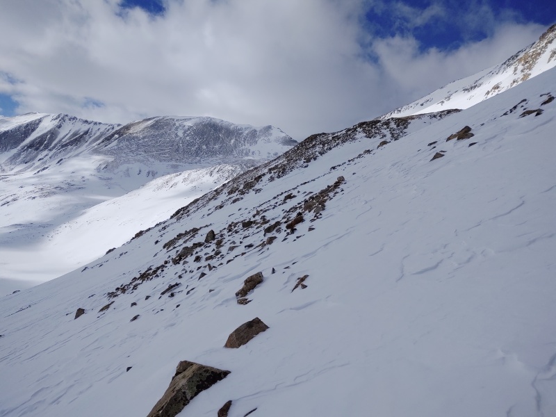
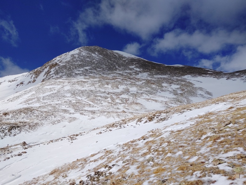
You'll note that the east face of Democrat has a lot of "dents" to fill in before there's danger of a continuous slab being able to form but if sufficiently loaded this slope could cause concern. 
Neither the saddle nor the ridges up either peak had all that much snow on this particular day. 
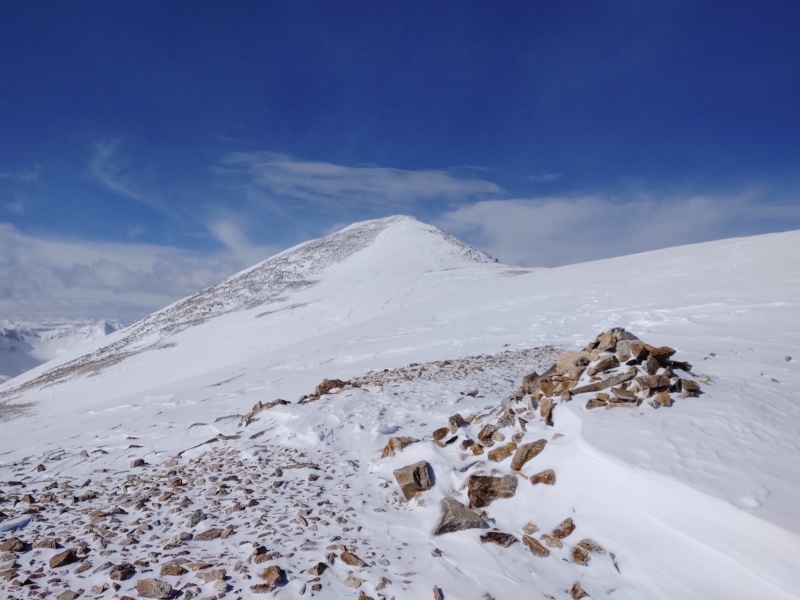
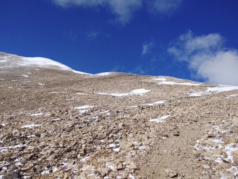
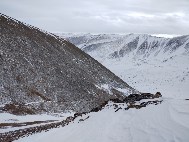
Upon getting to the top of Democrat you'll have excellent views to help you confirm the state of much of the rest of the loop. 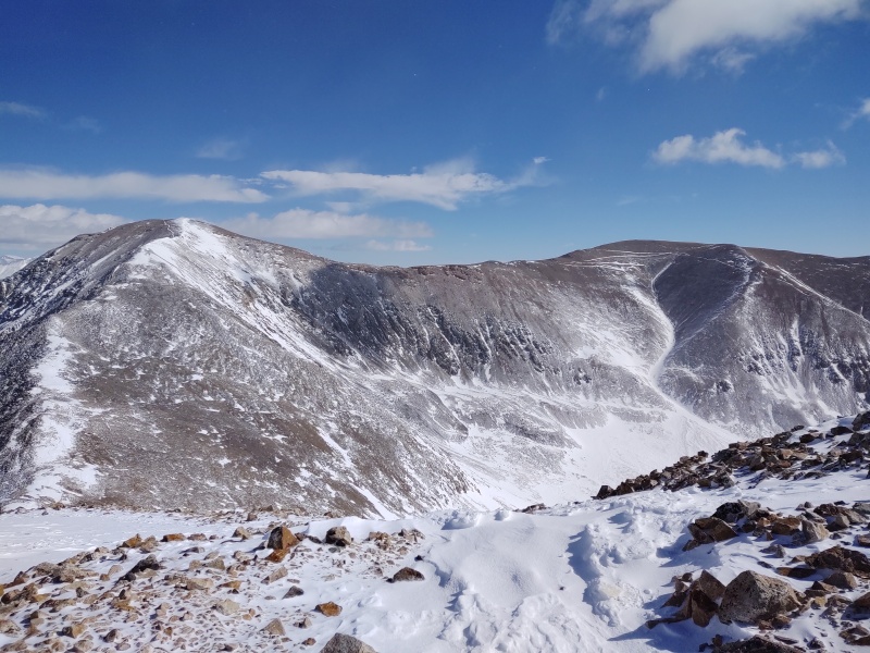
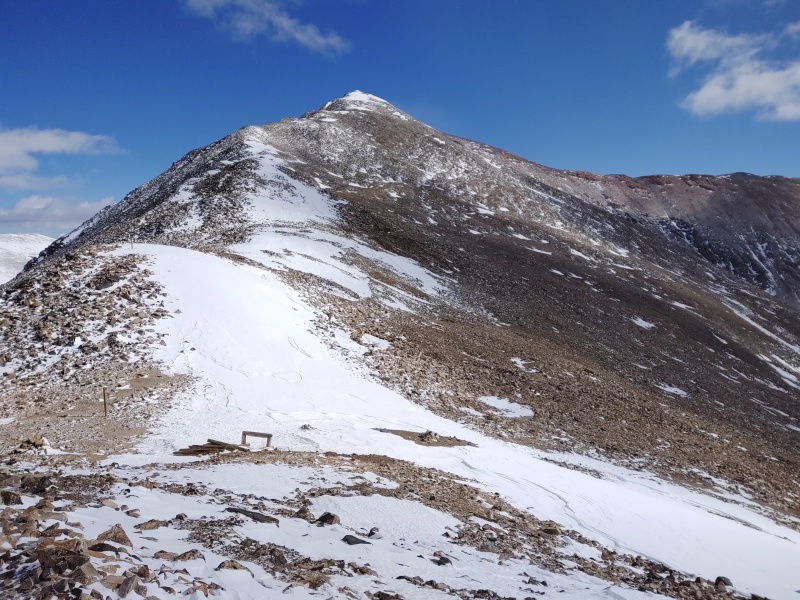
The ridge over to Cameron is where the action started (thus inspiring part 1 of this trip report). The winds were forming what I swear looked like some pretty significant cornices but in the picture I have they don't seem to look near as bad. 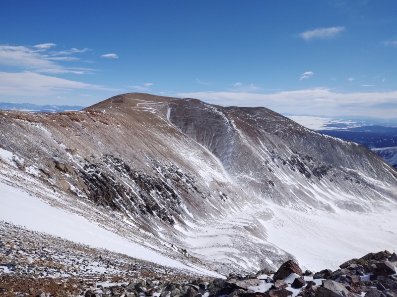
By the time I got on top of Cameron the winds were just ridiculous. If you missed the drama of the wind powered human bulldozer, scroll back up to part 1 and check out at least the center section in bold... 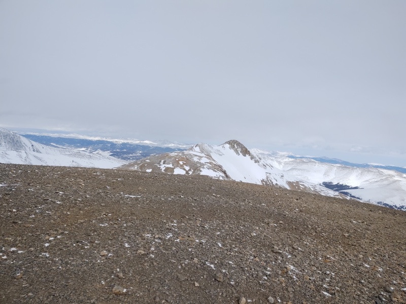
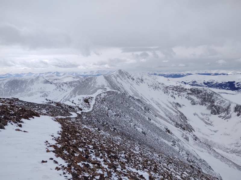
For the descent down Bross I still had my microspikes on and they made just as much difference and then some as when I had them on going down this section in summer. Partway down the ridge I thought I had lost the trail and was just going to have to follow the ridge all the way down but then the trail showed up clearly off to the left as a snow-filled rut. Later on, towards the bottom I did in fact lose the trail and by the time I recognized my error I looked over to the snow filled basin between me and the Kite Lake trailhead vs. a straight line to the road and decided to take the straight line. Not sure if I would do that again since it involved some awkward sloped rock hopping but it might have been slightly faster than potentially wading through snow in the basin. 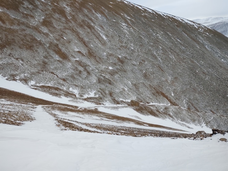
By the time I got to the road, with 3 miles of hiking left to get to Paris Mill I was getting caught in multiple near whiteouts but you can check out part 1 if you want the scoop on that. My times: 6:33am start from clearing just below Paris Mill. 7:46am continue after long stop at the fee sign to gear up against the wind. 8:40am Kite Lake trailhead. 9:26am top of the hill in the middle of the basin. 10am made it across the first steep snow slope to bare rock. 13,150ft went across another potential slide zone where I had to cross a steep snow field coming up to the saddle. 10:48am Democrat-Cameron saddle 11:15am finally put on spikes at about 13,800ft to cross a steep snow field on the face of Democrat. With a little more snow it would be worth avoiding this and sticking to the ridgeline. 11:38am top of ridge by false summit - can see real summit. 11:56am Democrat summit 12:30pm back at Democrat-Cameron saddle. 12:43pm start up Cameron. 1:38pm wind cornices look like they might be blocking ridge to Cameron (but bypassed on the left). Note taking stopped here as the winds went berserk. Sometime a little before 5pm I finally made it back to my Jeep by Paris Mill. GPX note: See my annotated GAIA GPS snapshot about midpoint of the report for commentary on where and where not to follow these GPX tracks based on conditions... Thumbnails for uploaded photos (click to open slideshow): ")
")
")
")
")
")
")
")
")
")
")
")
")
")
")
")
")
")
")
")
")
")
")
")
")
")
")
")
")
")
")
")
")
")
|
| Comments or Questions | ||||||||||||
|---|---|---|---|---|---|---|---|---|---|---|---|---|
|
Caution: The information contained in this report may not be accurate and should not be the only resource used in preparation for your climb. Failure to have the necessary experience, physical conditioning, supplies or equipment can result in injury or death. 14ers.com and the author(s) of this report provide no warranties, either express or implied, that the information provided is accurate or reliable. By using the information provided, you agree to indemnify and hold harmless 14ers.com and the report author(s) with respect to any claims and demands against them, including any attorney fees and expenses. Please read the 14ers.com Safety and Disclaimer pages for more information.
Please respect private property: 14ers.com supports the rights of private landowners to determine how and by whom their land will be used. In Colorado, it is your responsibility to determine if land is private and to obtain the appropriate permission before entering the property.