Download Agreement, Release, and Acknowledgement of Risk:
You (the person requesting this file download) fully understand mountain climbing ("Activity") involves risks and dangers of serious bodily injury, including permanent disability, paralysis, and death ("Risks") and you fully accept and assume all such risks and all responsibility for losses, costs, and damages you incur as a result of your participation in this Activity.
You acknowledge that information in the file you have chosen to download may not be accurate and may contain errors. You agree to assume all risks when using this information and agree to release and discharge 14ers.com, 14ers Inc. and the author(s) of such information (collectively, the "Released Parties").
You hereby discharge the Released Parties from all damages, actions, claims and liabilities of any nature, specifically including, but not limited to, damages, actions, claims and liabilities arising from or related to the negligence of the Released Parties. You further agree to indemnify, hold harmless and defend 14ers.com, 14ers Inc. and each of the other Released Parties from and against any loss, damage, liability and expense, including costs and attorney fees, incurred by 14ers.com, 14ers Inc. or any of the other Released Parties as a result of you using information provided on the 14ers.com or 14ers Inc. websites.
You have read this agreement, fully understand its terms and intend it to be a complete and unconditional release of all liability to the greatest extent allowed by law and agree that if any portion of this agreement is held to be invalid the balance, notwithstanding, shall continue in full force and effect.
By clicking "OK" you agree to these terms. If you DO NOT agree, click "Cancel"...
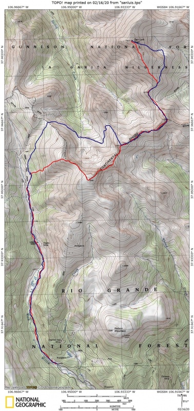
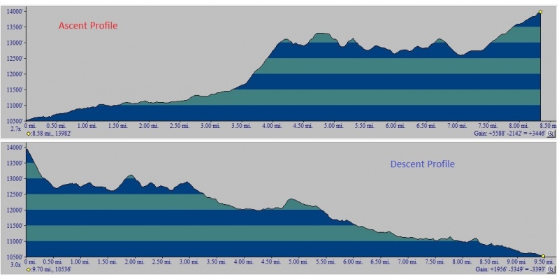
Date: February 15, 2020 Trailhead: West Willow Creek Winter road closure. Approximately 10,550 ft at the Intersection of 503 and 504, about 2.4 miles short of the Equity Mine. Route: Variation of the South Ridge route (Roach book calls it the Pointfest.) Ascended the high ridge route along the Continental Divide starting at Point 13,100. On the descent, I reclimbed Point 13,155 and 12,935 before dropping into the basin staying above the trees and climbed out Southeast of Point 12,540. Stats: Elevation Gain - 7,400' (approx) Roundtrip Mileage - 18 miles (approx) Roundtrip Time - 12 hours
I have been keeping a close watch on the conditions of San Luis the last Month. Snow levels in the area are right on par with an average year and avalanche status has consistently been forecasted as moderate. And even though the front range was getting hit with multiple storms and an increased avalanche risk, I noticed the southern/central part of the state was staying pretty dry. On Thursday I saw the CAIC downgraded the avalanche risk of the Southern San Juan to "Generally Safe" so I packed up and headed down to Creede Friday night.
I slept comfortably in the CRV at the winter road closure along West Willow creek and woke up to 3 degree temps as the sun was rising. I wasn't eager to head out into the cold so slept for another hour before finally gearing up and heading out into the 10 degree clear morning air at 8:30am. With snowshoes on the pack I was able to walk to the Equity Mine on a firm snowmobile track in about an hour. At the mine, the snowmobile track fizzled out so I continued into the valley on snowshoes. Snow varied from firm to punching in about 8 inches for about a mile and then when I started punching in a little deeper I started looking for an alternative route. I could continue trenching towards the pass, or I could start heading up the slope through the trees where it appeared to be windblown grass above. I chose to follow some short lived moose tracks into the trees and then continue up onto the lightly snow covered grass. Out of the snow, I was able to quickly gain access to Point 13,100 and get my first glimpse of San Luis. At this point, I put the snowshoes back onto the pack and put microspikes on the boots. I also had to make a route decision - I could travel down towards the pass and then into the snow filled basin or I could stay high on the ridge along the divide. I knew there would be some gain and loss of elevation with either choice but I decided to stay high and do some route finding and scrambling and maybe pick up a couple of bonus peaks along the way.
There were plenty of ups and downs along the ridge. I bypassed most of the snow covered rock steps by staying in the 8-16" snow on the right side of the ridge. The ridge traverse went really well, the difficulties are mostly within the first fourth of the ridge, then it gets gentle for a long period with a couple of rock steps thrown in near Point 13,155. Once I got down to the saddle between San Luis and Point 13,155 (where the Colorado trail passes through) I took the snowshoes off my pack for the final climb up San Luis. I made the summit just before 3:00 in what seemed to be calm, clear but cold conditions. I took off my pack, sent an OK message on my SPOT, and started taking some surrounding photos from the summit. Just then a gust of wind came up and my pack started rolling past my feet. I lunged to grab it but it was travelling too fast, it was gone! I finished taking some pictures and then went to look where my pack could have ended up, I couldn't believe it but it traveled down over a 1200 feet in the Eastern bowl, not exactly where I was headed down. After almost 500 Colorado 14ers climbed, you would think I should not let something like this happen!! The snow was in good condition going down and then I traversed without too much elevation to gain to just above the saddle where I left my snowshoes. I guess it could have been worse!
So one last route decision to make. Either retrace my route along the ridge, drop from the saddle and climb over the intermediate ridge's saddle, or reclimb Point 13,155 and travel to Point 12,935 and drop into the 2nd basin and climb out near San Luis pass. I opted for the latter. I got to the pass at dark, put on my head lamp and walked down the West Willow Creek drainage arriving at my car at 8:30pm. Overall, a super enjoyable outing to get my 55th Frozen Fourteener.
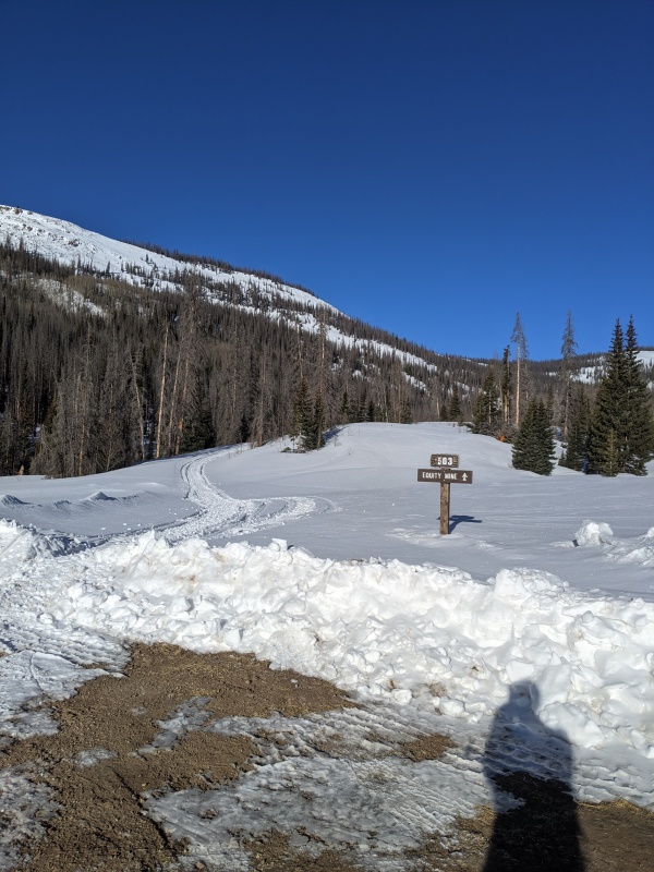
Nice snowmobile tracks to follow from Winter Road closure
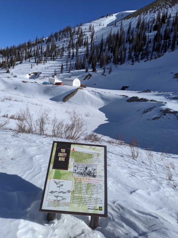
Equity Mine and end of snowmobile track
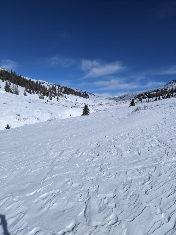
Large meadow near 11,550 where I came across two moose. In about 400 yds I take a sharp right and head up through the trees.
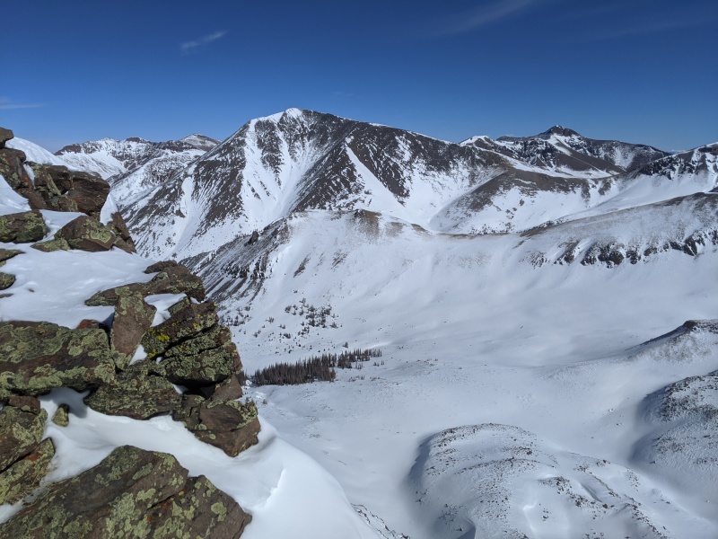
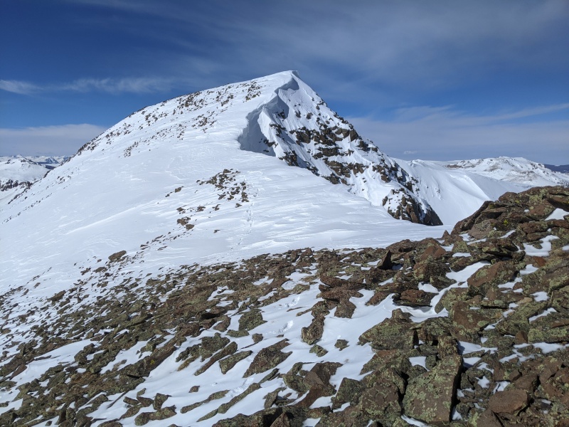
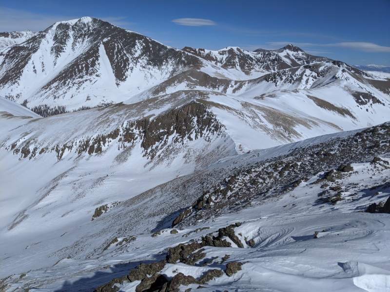
After reaching Point 13,100 I was rewarded with my first view of the objective for the day. The saddle on the intermediate ridge is where I drop down on the return trip.
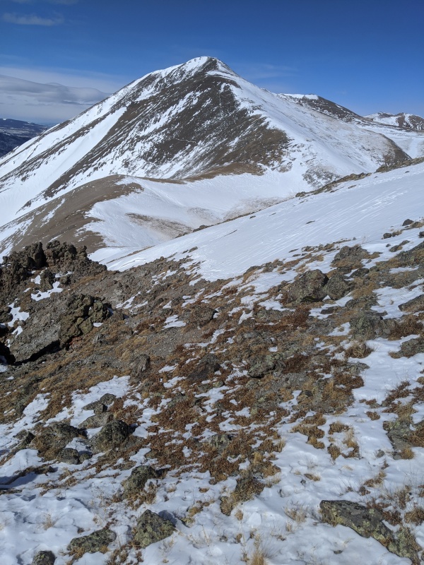
Looking back at Point 13,100 while heading towards Point 13,285
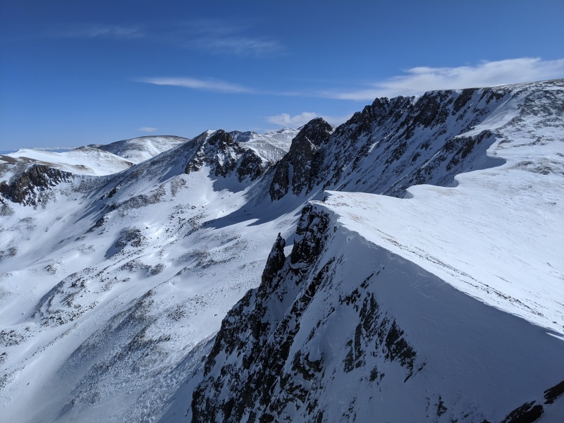
The ridge along the Continental Divide
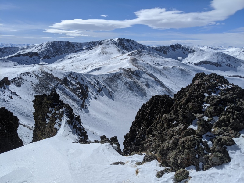
Looking back at the first major drop coming off of Point 13,285
One of the many ups and downs - I usually stayed on right (east side) of any difficulties
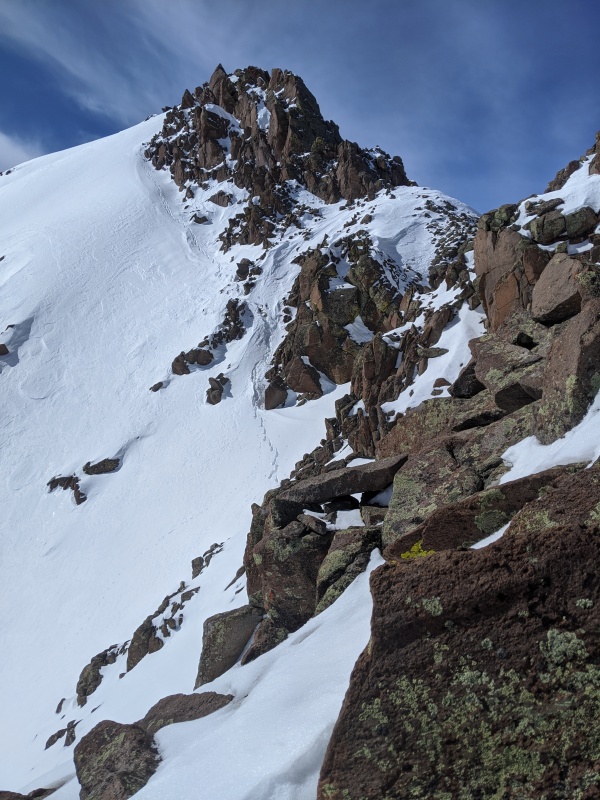
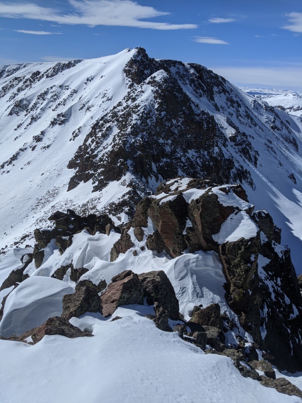
Topping out after the crux of the climb
Halfway along the ridge and still have a long way to go!
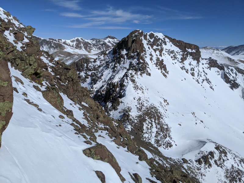
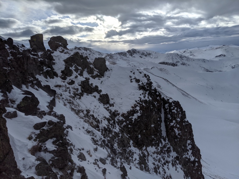
View of the final South Ridge climb as I am bypassing Point 13,155
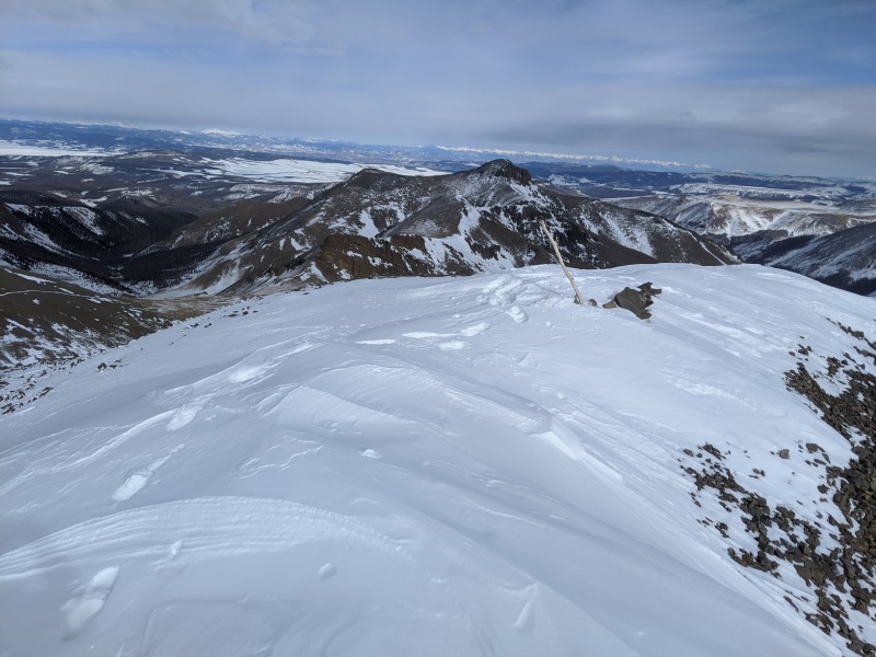
Looking back at the entire ridge I traveled
Summit shot - after my backpack just got blown off into the Eastern Bowl
Fading light and a long way to go - I climb out of the 2nd basin from here near the low point on the right of the distant ridge
Ascent in red, descent in blue - (view with large photos for best quality)Caption Here
Thumbnails for uploaded photos (click to open slideshow):
Thanks guys. Super fun route, I really enjoy climbs where there are many route options available and can make choices on the fly. The ridge was great fun and I got to experience some of the standard route on the way back. Was great getting to see where Moose spend their winters too!
Brad: Getting close to the end but with the Maroon Bells left, could be next month or in ten years!
Jay: Fetching the pack added just a little distance and time. There were minimal ups and downs on some moraine debris at the bottom of the bowl but was able to traverse relatively easily to get back to the main route. Was a bit disgruntled when I first saw the pack go out of sight but it did give me a chance to walk briefly in a basin that I will probably never visit again.
Caution: The information contained in this report may not be accurate and should not be the only resource used in preparation for your climb. Failure to have the necessary experience, physical conditioning, supplies or equipment can result in injury or death. 14ers.com and the author(s) of this report provide no warranties, either express or implied, that the information provided is accurate or reliable. By using the information provided, you agree to indemnify and hold harmless 14ers.com and the report author(s) with respect to any claims and demands against them, including any attorney fees and expenses. Please read the 14ers.com Safety and Disclaimer pages for more information.
Please respect private property: 14ers.com supports the rights of private landowners to determine how and by whom their land will be used. In Colorado, it is your responsibility to determine if land is private and to obtain the appropriate permission before entering the property.
")
")
")
")
")
")
")
")
")
")
")
")
")
")
")
")


