| Report Type | Full |
| Peak(s) |
Margherita Peak (16,763') |
| Date Posted | 02/27/2020 |
| Date Climbed | 01/28/2020 |
| Author | Conor |
| Mountains of the Moon |
|---|
|
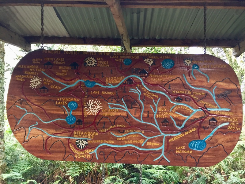
"It was the afternoon of 30th of April 1889; the air was calm and the sky clear; all eyes were turned to the south; clouds which obscured the great mountains, moving with increased rapidity, broke up and rose; the sun darted its vivid rays, and through a clear and limpid atmosphere there appeared the crest of the Virika or Ruwenzori, the great mountain of the Vacangio. The top and sides clothed in white showed that it was a snow-clad mountain. Its height is gigantic and, although the distance is considerable, the Alpine form was distinctly visible. It is the Varicampanga, of which the poeple of Unyoro say that no one who has attempted its mysteries has ever returned. Cold and horrible monsters are said to rule over it. As if offended by the intensity of our scrutiny, the protecting clouds resumed their usual office, leaving us with a keener desire than ever to solve the mystery." -Gaetano Casati Africa's third highest peak resides in Uganda. The area is rugged, leaving the predominately blue haired tourism population to more or less gawk at the remaining glacier from Kasese (tourist jumping off point for Queen Elizabeth National Park). Despite guides and porters, this was was one of my toughest outings to date. The scenery, however, is out of this world. I will always remember my time in the mountains of the moon. The mud is so bad my wife has sworn off ever going back. But, we all know how time can erode memories of the negative parts and polish the positive. History & BackgroundThe earliest known reference to the mountains was in 470 BC. The greek tragedian Aeschylus wrote of "Egypt nutured by the snows." Google seems to really highlight Alexandrine Claudius Ptolemy around 150 AD referring to the range as the "Mountains of the Moon." Of course, with Mt Kenya and Kilimanjaro dawning a snow cap throughout time, it is debated which mountain or mountains these historical bits refer to. Today, however, the Rwenzori mountains claim the true source of the white Nile. And by extension, claim the historical references as the "Mountains of the Moon." The late 19th century brought many Europeans to the area and Uganda became a protectorate of the UK starting in 1894. The first known ascent of Margherita Peak is by the Italian mountaineer and explorer, the Duke of Abruzzi on June 18th, 1906. The first known ascent by a woman was on Jan 18th, 1835 by Miss D.Una Cameron. As with most African colonizations, Uganda did suffer a period of turmoil after independence. Probably the most notorious instance to us Americans is the Israeli strike on Entebbe airport. Today, however, one is greeted with smiles and waves accompanied by the slang term for a foreigner, mzunga. 
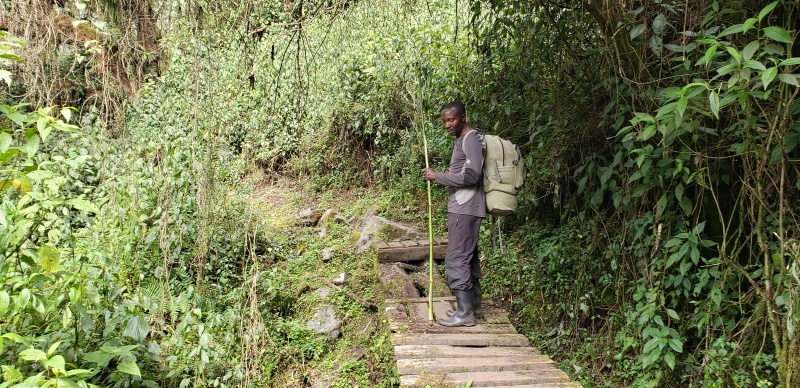
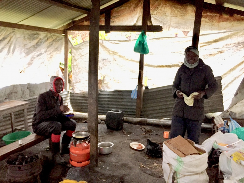
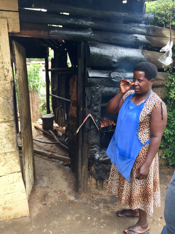
PracticalitiesMoneyOne can travel purely on greenbacks. The US dollar is widely accepted and changed throughout the country for the official currency, Ugandan Schillings. We changed money one time after the banks closed with a lady who sold mattresses and market rate. Most tour operators, as well as the government, prefer crisp US dollars. Credit card acceptance is becoming more and more common, but don't make the mistake we did and confuse 'becoming more common' with 'being common.' If somewhere does take credit cards, expect 3 to 5% to be added to the bill. The place we rented vehicles and drivers from took credit cards. RMS took only cash. Our trip to Bwindi for hotel (operations based in the UK) and gorilla tour would allow you to settle your bill with a credit card, but expected you to wire the balance for the room and gorilla permits ($600+$50 for arranging the permit per person) in advance of arrival. We were short on cash and had to have family members send us money via Western Union at an awful exchange rate (3200 vs 3600 UGX:USD). USD need to be the latest series, definitely no tears, $50 and $100 crisp bills get you the best exchange rate. It is possible to do smaller bills at a worse exchange rate (similar to Western Union) and outside of Kampala no one will take torn bills. And even then you need to search high and low to find a forex that will do so if in Kampala. Credit cards would not work at gas stations, as they are still stuck in the European chip and pin model. We eventually got pin numbers to credit cards mailed to us for cash advances, but that is a different pin for purchases. My suggestion is to have cash in $100 bills for the entire trip. Visa/Entry RequirementsOne needs a visa to enter Uganda (assuming US citizenship). Uganda has moved to an eVisa system which is easy and costs you $50 + credit card processing fee. I do think it is entirely possible to obtain a visa on arrival. This is based on online reports, the fact that the airlines never once asked to see our eVisas and separate queues at the airport for 'visa on arrival.' You'll also need evidence of a yellow fever vaccination. Unlike the Congo, Uganda does recognize the yellow fever vaccination as lifetime. Mine was marked as a 10 year vaccine. Getting AroundIt is possible to get around cheaply via minibuses or link buses. Expect it to be slower than hiring a self drive or private vehicle with a driver. We hired a vehicle and driver from 4x4uganda.com. They were prompt, friendly, helpful and accepted credit cards. A Rav4 was $60/day and a driver was another $30/day. We were expected to pay for the fuel. Ugandans have a unique skill of showing up with the gas tank empty and also dropping you off with the tank empty. We were also expected to pay for the vehicle to travel back after getting dropped off, which cost $90 (a full day). Entebbe to Kasese was 5.5 hours. Kasese to Buhoma where we tracked gorillas was over 6 hours (despite google saying 4) and Buhoma to Entebbe was about 11 hours drive with a stop at a Pork Joint. Rwenzori Tour OperatorsCurrently there are 2 official tour operators. Rwenzori Mountaineering Services and Rwenzori Trekking Services. RMS is the "original" and we found to be slightly more affordable than RTS. We paid $1250/person for Margherita Peak. That included pick up in Kasese, an overnight (with dinner) at RMS' Mihunga lodge, UWA's $35/day/person + $10/night/person for beds. It excluded tips and the taxi ride back down to Kasese. We were originally signed up for the entire central circuit, but we opted to shave a day off and descend directly back down. The price is more or less fixed regardless of how many days you do (porters and guides are paid based on destination, not on days), but I would push back on the essentially $45/day if you plan to burn up and down. RMS did offer to make it a full tour (airport transfer, private vehicle to kasese, hotels, meals etc), but at $1400 extra/person ($2650/person total) we opted to more or less just show up in Kasese for $1250/person. I personally found the guides/cook/porter to be very friendly and helpful. The technical skills of the guides I found to be atrocious. The good news is the peak isn't that difficult. The guides are trained in a very specific way and it is somewhat safe, but they are truly awful at managing technical skills with time. I'm not sure I would go if I wasn't comfortable doing it myself. But, people do it quite often and they're not dead yet. Day 1 - ArrivalWe were supposed to land at 10pm. We were on the Brussel's Airlines Brussels/Kigali/Entebbe route. We had some technical glitches in Brussels that set us back about 3 hours. We opted to stay at the 'Guinea Fowl' hotel which offered airport transfer, breakfast, clean rooms and credit card acceptance for $88/night. I think it was technically $80, but after credit card fees and the traditional non-discretionary service fee, we ended up just under $90. Breakfast was pretty good, nothing to write home about but no complaints either. Day 2 - Travel to KaseseOur driver, Huntington, was more or less on time, perhaps about 10 mins late. We checked out of the Guinea Fowl and went on a search for money. Our efforts were fruitless. We decided to just show up and let RMS know we didn't have all the cash. Turns out we weren't the first. We made the exchange to the RMS arranged 'taxi' in Kasese and our driver Jerome took us up to RMS' Mihunga lodge. In hingsight, I would stay the night in Kasese. You could get a nice dinner, a better hotel room with hot water that is cleaner and has fast wifi for about $25/night for 2 people (breakfast included). Conversely, the Mihunga lodge "has hot water" (the guides even made a joke about this), has no wifi, isn't really that clean and we had animals crawling all over in the roof keeping us up at night. When we mentioned the animals the next morning the staff brushed it off as being "just bats." PS, it is recommended that you go through the rabies shot series if you ever know you're sleeping in room with a bat. The Mihunga lodge did a good job of trying to make us feel welcome, but it would be a hard pass for me if I ever returned. Day 3 - Hike to Nyabitaba HutWe awoke, had breakfast and went through some hassle with our money situation. We paid what we had, which was about half, and they trusted that we would get the rest to them in due time. While there is no wifi near the Mihunga lodge, there is cell service. The cell service area is well known and it is where many UWA (Uganda Wildlife Authority) employees hang out on the road. You can't miss it. We texted a family member that we would need them to send us cash via western union. Our guides came to meet us and we sorted gear, decided what we would bring (which was basically everything but our sleeping pads) and they took our overnight bag. We essentially carried water, lunch & snacks provided by RMS and our rain jackets/pants. We started up the mountain about an hour late. The GPS unit on my phone showed 3.83 miles & 2800' of vert from RMS' Mihunga lodge to Nyabitaba hut. They say 3 to 4 hours. We were right about 3 at a leisurely pace and break. We hiked the entire day in our trail runners. 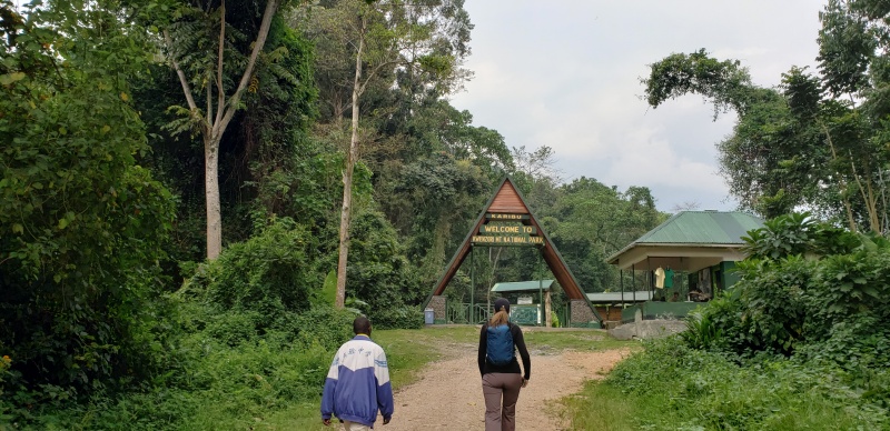
We were told to keep our eyes out for the 3 horned chameleon, which we didn't see. Sometimes in the area is also mountain elephants, but they also were a no show. 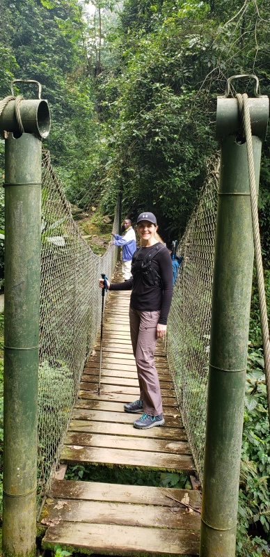
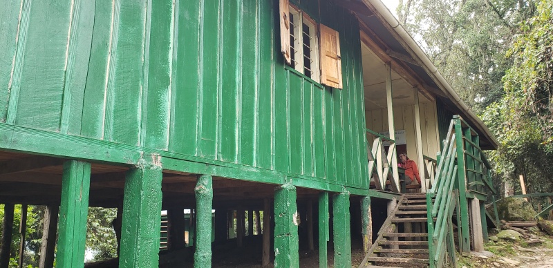
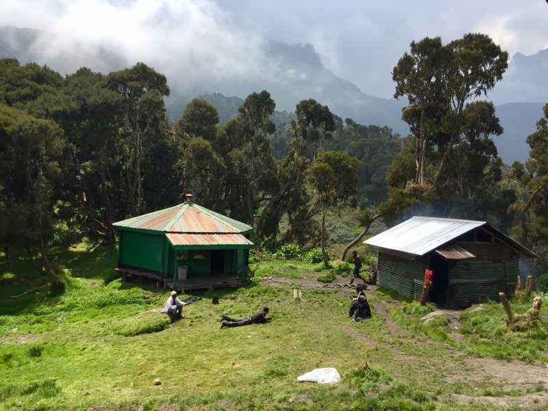
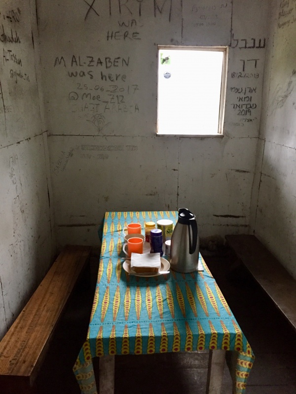
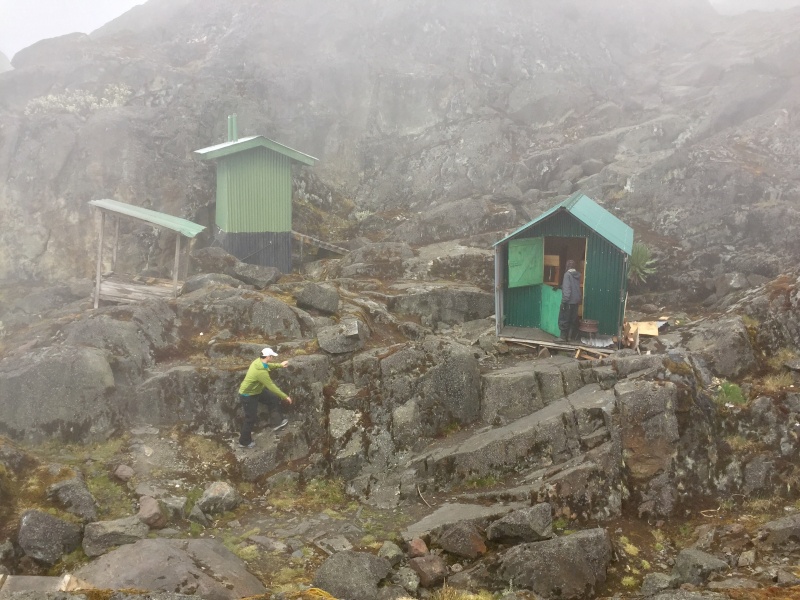
Nyabitaba hut provides the most lux of accommodations on the mountain. Some rooms have lights. There is running water and a flushable squatter toilet. Day 4 - Nyabitaba to John MatteNo days are incredibly early starts with the exception of summit day. We shoved off at a somewhat lazy time, around 9:30 or 10. They say it is about 5 to 6 hours to John Matte, we clocked in slightly above 5 hours. It is about 4.7 miles & 2,700' of vert between the huts. Again, a pretty leisurely pace and one major break. We hiked the entire day in our trail runners. 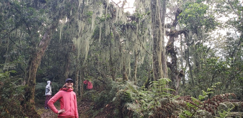
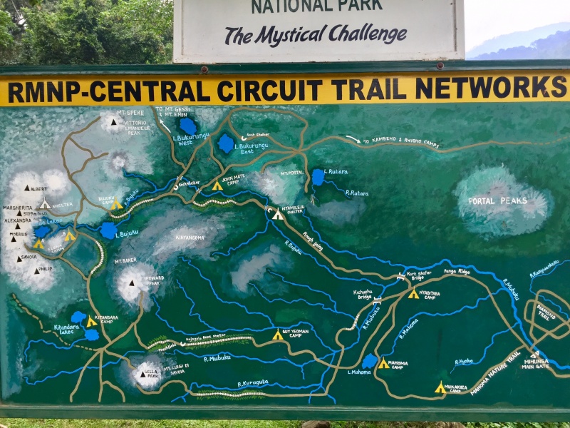
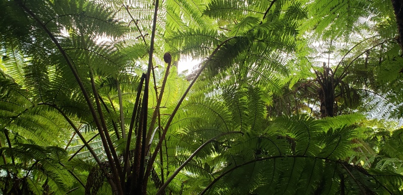
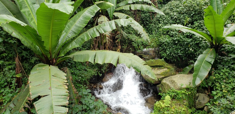
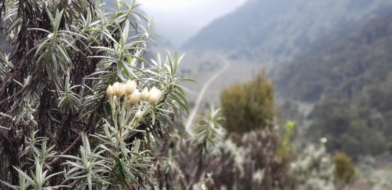
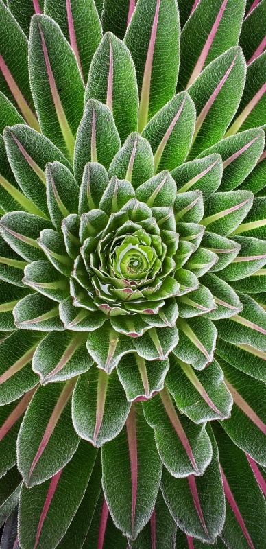
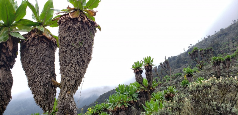
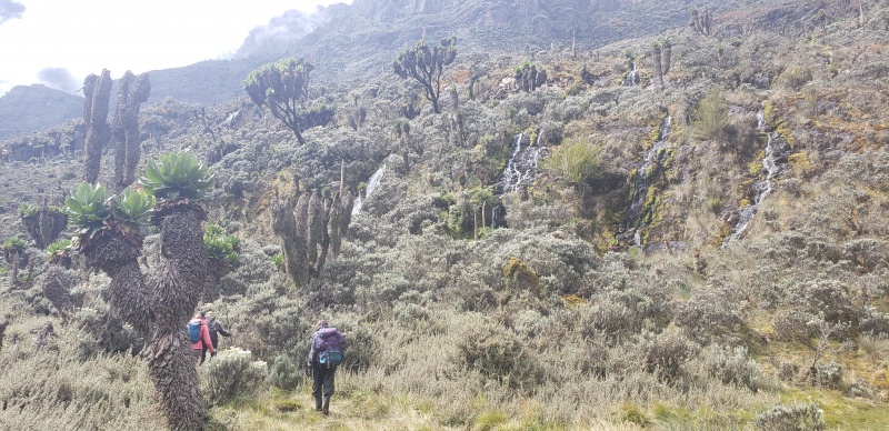
There are 5 vegetation zones - Forest, Bamboo, Heather, Alpine and Glacier. Going from Nyabitaba to John Matte touches 3 of them. There isn't actually a lot of bamboo, you do see it, but it isn't like anything you'll see in Hawaii or Japan. The downside of the day if you do drop about 300' to cross the Mubuku river. 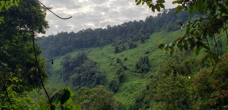
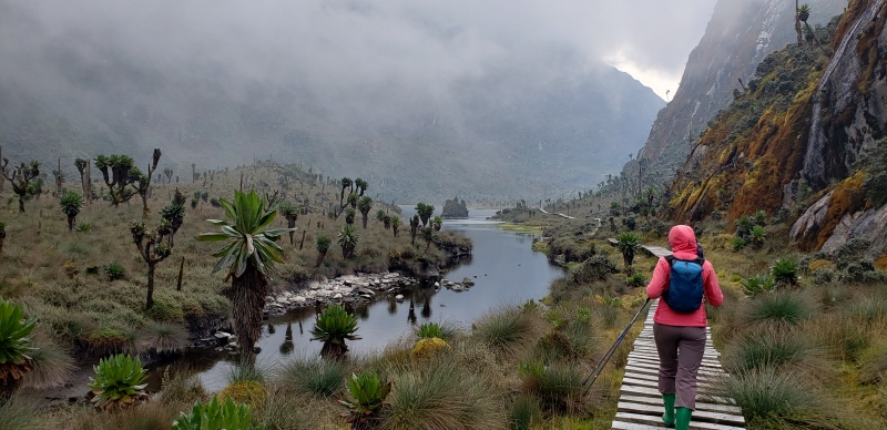
The sun was out when we arrived at John Matte. Gabrielle heated some water for us so we could take a "shower." Before dinner Paul invited us to go for an evening walk and we went across the entire lower Bigo Bog's boardwalk. If you plan to just go up to John Matte, the 20 min walk across the lower Bigo Bog is a must in my book. You'll start to the lobelias and you'll have views you haven't had anywhere else. 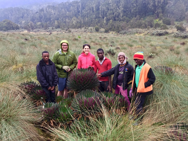
Day 5 - John Matte to BujukuOur trip kept getting shorter and shorter. At first we had arranged for 7 days, Margherita and the central circuit. They then cut it down to 6 days (I assume our money situation had something to do this) and after the briefing we were at 5 days. We sort of rolled with it for a while, but we decided that we should go to 6 days. If we were to try for 5 days, we would have had an 8 to 9 hour day (and then summit day with a lot of descent) vs a 4 to 5 hour day (followed by a 3 hour day and then summit day). Being in the worse shape of my life, we opted for an extra day. I don't think our guides were super happy about it, but they never complained nor showed any real angst. They were just worried about our plans afterwards and wanted to make sure we would be back in time. This day has the least amount of vert at 1800' and is shorter in distance than the previous day at about 3.75 miles. The terrain is rugged, lots of mud and climbing up and down over tree roots (10-15' at a time and probably not really captured in my vert estimates as it is based off of the map). We wore our trail runners to the end of the 2nd boardwalk, just above the upper Bigo Bog. 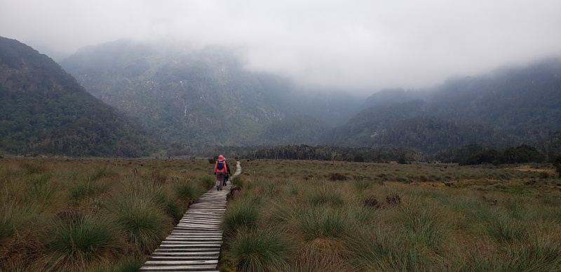
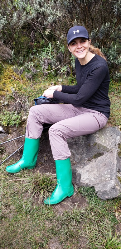
Day 6 - Bujuku to ElenaThis day was the latest start we would have. Joel, the head guide, wanted to take it easy, but he warned hanging out at Elena all day isn't really that much fun. There isn't a lot of places to walk around and it can be cold. I think we left around 10:30 and we arrived around 2. The walk is about 1.5 miles and 2k' vert. We wore the wellies from Bujuku almost all the way to the hut. We changed our shoes probably a 1/4 mile from Elena hut. 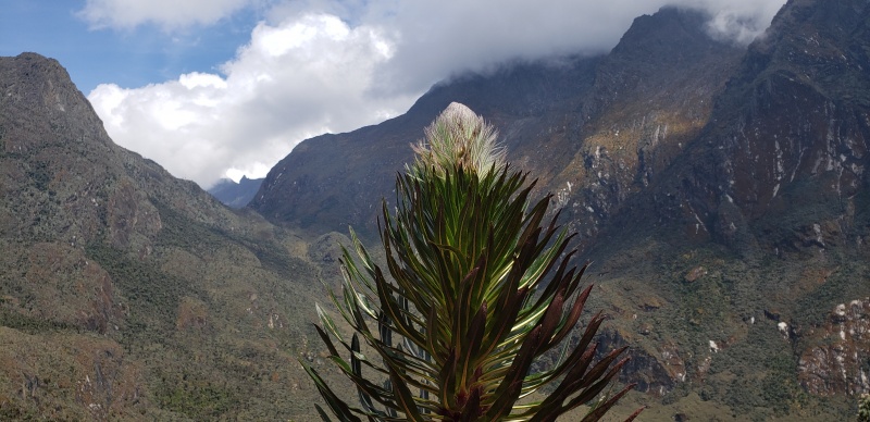
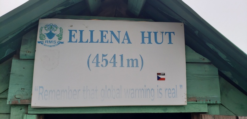
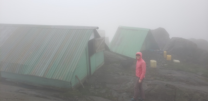
We relaxed and took a nap. It started to rain, which made the rock very slippery. We were nervous about doing the next day on the slippery rock, but decided to take things as they came. By dinner time, the sun was out for a fabulous sunset. 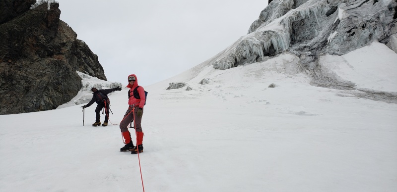
Day 7 - Summit Day (Elena -> Margherita -> John Matte)We had arranged a 3am start, but as normal with me it was about 3:20. The stars were out, which was a welcome change of pace. We still hadn't seen the peak despite being on our 5th day. There are a few fixed ropes, the Stanley Glacier to cross which we didn't rope up for, a descent to gain the Margherita glacier (again, fixed ropes) and then some wet 5.2ish climbing, climbing the Margherita glacier and then a short scramble to the summit. The guides did an excellent job with keeping us on route. Never once did they even take a step in the wrong direction and we have to back track even 10'. They do insist on fixing ropes and having you "jug" the line. It was sort of a bad time to ask, but at Elena hut Joel asked where our ascenders were. Luckily I brought some tiblocs. In hindsight, going more Alps style and belaying us would be faster. We hit the "technical section" right about 5 am and I felt we did our part. Joel said it would take an hour and half to get to that point, and we got to that point right on time. We hit a ton of snags with the rope work and equipment. First, while Joel was fixing the line Paul asked me to tie a figure 8 on a bight. I thought it weird, but I did it anyway, I was trying to let them do their thing. In hind sight, I think Paul thought he was going to tie in and then get belayed up. Paul also left Joel's ice ax at the bottom, so Joel eventually went back down and came back up to fetch his ax (also to unsnag the rope which was caught because of the knot). Joel then did the "2nd pitch" and fixed the line. We again, at the strong suggestion of the guides jugged the line, I think climbing would have been faster. After that, we put on crampons. Problem 2, I think Paul's crampons were from the Duke of Abruzzi's 1906 expedition. They kept falling off on the Stanley Glacier, but that is basically flat. Paul and Joel think they have the crampon situation squared away so we start up the glacier roped together. Paul's crampon falls off again. Of course, we're about 20 deg pitch, so they ask me to pull him up. I french up the slope, dragging single crampon Paul. We find a flat spot and I donate one of our rappelling backups as cord to secure Paul's crampon on his foot. We finally get that taken care of. All in all, the Margherita glacier should take 20-30 mins. We're way past that. At the top of the glacier is a quick and fun little section. Joel wants to reset the rope, which takes time. Of course, we have one ice screw since they didn't put it on the packing list. So maybe not a bad idea. We eventualay make our way back to rock. We leave the crampons and I ask if we can leave our packs. Most clients seem to want to snack on the top, I tell them I would rather go up, take some pictures and come back down to eat out of the wind. I get no push back on that plan. 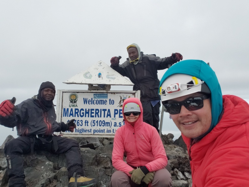
The descent is easily as big of a mess as the ascent. Resetting the rope all the time. At one point we were probably on a 15 degree slope and Joel stops to put in his ice screw and wants to belay us each down. It was very clear they were not comfortable on the snow. More time wasted. For the last fixed rope portion I took the end and found a rock to fix the line to. I tied a bowline and Joel undid it and tied 2 figure 8's on a bight and used 3 locking carabiners somehow to fix the line around the same rock. It was also very clear they were taught a very specific regimen on how to climb the mountain (and didn't know much beyond that). We eventually made it back to Elena. We were about 11 hours, should have been 8. So I estimate about 3 hours screwing around with the rope, old crampons and being overly cautious. I share this not to complain, but rather as a flavor for where you would like your technical skills to be. If anything, the Ugandan guides want to be safe, which is a good mentality in anyone's book. 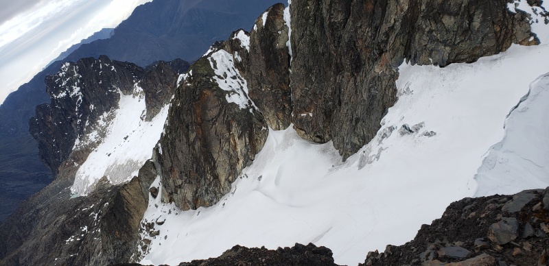
We regrouped at Elena hut with all the porters and cook still waiting for us. We rearranged some gear, packed up our bags and then made the descent to John Matte hut. We left around 2:30 and it had started to rain. The rock was very slippery and we looped by RTS' Elena hut and then headed down. We bypassed Bujuku hut on the other side of Bujuku hut. By the time we reached the end of Bujuku lake, it was more than clear to me that we would be finishing in the dark. The rain had made the "dry mud" turn into "mud" and it was extremely slow going through the bogs. I guess we thought the Ugandans were awful on the glacier, I'm sure their sentiment was the same for us through the mud (which there is much more of than glacier). Even though we were descending, we were hopping tussock to tussock and it was very tedious hiking. I slipped and fell a few times, and my arm sleeves were coated with mud. 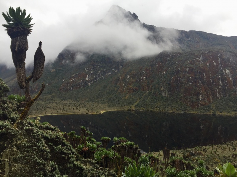
We hit the upper Bigo Bog and started to make quick work of the boardwalk. The boards are annoyingly spaced and I eventually went through the boards as I was walking in my wellies. They were slippery on the wood and I was tired. Luckily just my shin ended up a bit bruised. The section between the upper and lower Bigo Bogs is where dark hit. It was clear that it had rained a lot since we passed through 2 days prior and it made the up and down over the tree roots very tedious. Of course, my headlamp died a few minutes after I put it on and my wife packed her's with the porter. We managed with a combination of cell phones, dim head lamps and one of our guide's D cell plastic handheld flash light. I think at some point I didn't really care if I fell between boards on the boardwalk again. I may have actually wished for a broken leg and to just lay there all night, eventually to be carried out the next day. My spirits were low. We eventually stumbled into the John Matte hut - muddy, sore, tired and swearing "never again." I think my wife threw up at some point. And I pondered on the Ugandan phrase of "You're Welcome" as we ate dinner and then crashed. Day 8 - John Matte to EntranceIt took about 7 hours to walk out from John Matte. Of course the stretch between John Matte and Nyabitaba is "rocky" meaning lots of up and down, so it takes some time. Once we reached Nyabitaba, we removed our wellies and put on our trail runners. The wellies certainly have their benefits, but for those not used to them you feel ever root and rock. They become Ugandan torture devices eventually. It was on our second and final arrival to Nyabitaba that I grasped the meaning of "you're welcome." They mean to say, "Welcome to Nyabitaba" not that they did you some sore of favor. When I was tuckered out and stumbling into John Matte the night before, I thought it was quite the cheeky greeting from our guide. With a much clearer head, I realized what he truly meant. We checked out with UWA and the lady took $90 of the $200 we had remaining. We grabbed a receipt to give to RMS to reduce our balance. Once back at the Mihunga lodge, we broke the news to the porters that we didn't have the cash to tip them on the spot. Our guides wrote down their names and then had us write what we would eventually leave them. They then read it aloud and we all agreed that I would give the money to one of the guides and he would be responsible for dispersing the money. We couldn't really tell if they were upset or not. The one porter/guide in training was smiling and seemed happy. We tipped the 6 general porters 60,000 UGX or about $18. The guide in training got 70,000 UGX. The porter carrying our bag got 80,000 UGX (who was pointed out many times and was also the son of one of the guides). Our cook got 120,000 UGX. And the guides got 300,000 UGX each. We then arranged for a taxi ride back. At first we were told it would 800,000 shillings, which is over $200. I told the girl I would walk to town to find a minibus as I didn't have the money and she seemed confused. It was later clarified that she actually meant 80,000 shillings or about $22. We negotiated down to 60,000. When our well liked driver, Moses, arrived everyone piled into the vehicle and we dropped people off as we drove down the hill. 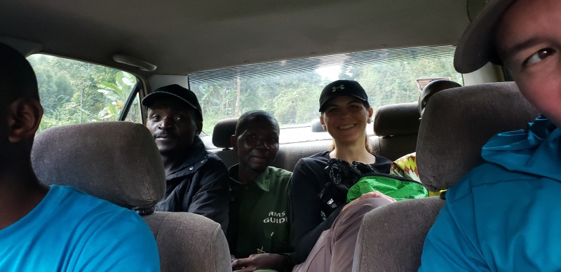
Moses is a "tour guide" and spoke excellent english. He suggested a hotel in Kasese, the Snow View Hotel. For 90,000 shillings we got a clean room with a fan, fast wifi and breakfast. We took dinner at the hotel as well, which was about 40,000 shillings and was excellent. We arranged for Moses to pick us up the next morning and we took our long awaited hot shower. Day 9 - Return to pay balance for trek and drive to BuhomaMoses was prompt in picking us up and we arranged a noon checkout at the hotel. We had our driver from 4x4uganda, which we thought was coming from Kampala, to pick us up at 11 am, but I thought he would be in around noon. Moses drove me to the bank to pick up our western union money and then took us back up the hill. We saw one of our guides on the way up, which we paid him his tip. Strangely it felt like we were indebted to him. We then got to RMS "headquarters" to see probably 100 porters lounging around hoping to get some work. Apparently they show up every day and wait in the hopes of getting work. In theory it is possible to show up the morning of and arrange a trek. Not sure how the negotiation in total price would be, but everything is on the website. We paid our balance to RMS. Then some of our guides and porters were around and we gave them the money directly. The rest was given to agreed upon guide and we said our farewells. 4x4Uganda told us he gave us a free upgrade and this is what showed up.... 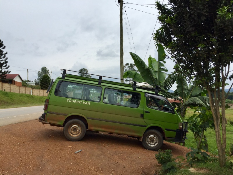
Our driver, Kenny, was cool. I had googled the trip from Kasese to Buhoma and google said about 4 hours, it took over 6. As one of the staff members at our hotel said, "lots of Ugandan massage." Day 10 - Gorilla TrackingWe joined the old people in tracking Gorillas. It is a unique experience to see them in the wild. And you pay a lot of money for it. The manger at our hotel told us how difficult the tracking would be and we had a bit of doubt as we were still sore from descending 11,000' in 2 days. But as a 50 something british woman, as wide as she was tall, waddled to the breakfast buffet, we had some reassurance that we would be ok. The short of it is, it can take anywhere from 5 mins to hike to find the gorillas to what happened to us. We tracked them for about 1.5 hours to find the stubborn stinkers in the trees and unwilling to come down. We sat on the side of a hill for about 3 hours in the rain hoping they would come down. Our guide then moved us last minute to another group and we spent about 30 minutes with them. Very cool experience! 
Day 11 - Travel back to KampalaIt took about 11 hours to drive back to Kampala. It was a long, tiresome journey. Especially since we went straight to the airport to take a 9 hour and then 10 hour flight. 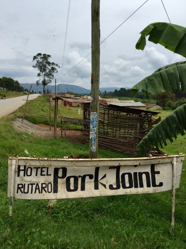
Thumbnails for uploaded photos (click to open slideshow): ")
")
")
")
")
")
")
")
")
")
")
")
")
")
")
")
")
")
")
")
")
")
")
")
")
")
")
")
")
")
")
")
")
")
")
")
")
")
|
| Comments or Questions | ||||||||||||
|---|---|---|---|---|---|---|---|---|---|---|---|---|
|
Caution: The information contained in this report may not be accurate and should not be the only resource used in preparation for your climb. Failure to have the necessary experience, physical conditioning, supplies or equipment can result in injury or death. 14ers.com and the author(s) of this report provide no warranties, either express or implied, that the information provided is accurate or reliable. By using the information provided, you agree to indemnify and hold harmless 14ers.com and the report author(s) with respect to any claims and demands against them, including any attorney fees and expenses. Please read the 14ers.com Safety and Disclaimer pages for more information.
Please respect private property: 14ers.com supports the rights of private landowners to determine how and by whom their land will be used. In Colorado, it is your responsibility to determine if land is private and to obtain the appropriate permission before entering the property.