Download Agreement, Release, and Acknowledgement of Risk:
You (the person requesting this file download) fully understand mountain climbing ("Activity") involves risks and dangers of serious bodily injury, including permanent disability, paralysis, and death ("Risks") and you fully accept and assume all such risks and all responsibility for losses, costs, and damages you incur as a result of your participation in this Activity.
You acknowledge that information in the file you have chosen to download may not be accurate and may contain errors. You agree to assume all risks when using this information and agree to release and discharge 14ers.com, 14ers Inc. and the author(s) of such information (collectively, the "Released Parties").
You hereby discharge the Released Parties from all damages, actions, claims and liabilities of any nature, specifically including, but not limited to, damages, actions, claims and liabilities arising from or related to the negligence of the Released Parties. You further agree to indemnify, hold harmless and defend 14ers.com, 14ers Inc. and each of the other Released Parties from and against any loss, damage, liability and expense, including costs and attorney fees, incurred by 14ers.com, 14ers Inc. or any of the other Released Parties as a result of you using information provided on the 14ers.com or 14ers Inc. websites.
You have read this agreement, fully understand its terms and intend it to be a complete and unconditional release of all liability to the greatest extent allowed by law and agree that if any portion of this agreement is held to be invalid the balance, notwithstanding, shall continue in full force and effect.
By clicking "OK" you agree to these terms. If you DO NOT agree, click "Cancel"...
This report will serve as a summary and photo journal of climbing Mt. Sneffels on February, 2, 2020, mid winter in what appears to be a "normal" season as concerns typical snowfall and temperatures so far this year.
Winter access to Yankee Boy Basin is closed to vehicle traffic past the locked gate at Senator Gulch, which is somewhere around 3 1/2 miles from the turn off from Hwy. 550. The road is typically plowed and often sanded, but 4wd will be required to get up the hills nonetheless. This year a large area has been plowed out to accommodate parking and there is plenty of room for 15 or so vehicles.
I arrived around 9:00 a.m. and began hiking on the road, which is plowed for the next 2.5 miles to the Revenue Mine, located just a little ways past the turn off to Imogene Pass. (emergency phone located here). After the Revenue Mine snowshoes or skis required for further travel. I had snowshoes and followed a well established trench up to, and past the outhouse which marks the lower 4wd trailhead. After another 30 minutes or so I caught up to a woman named Lisa and her dog, who had been packing the trail so well for me up to that point. This was just about at treeline, after which I did not see another soul for the rest of the day.
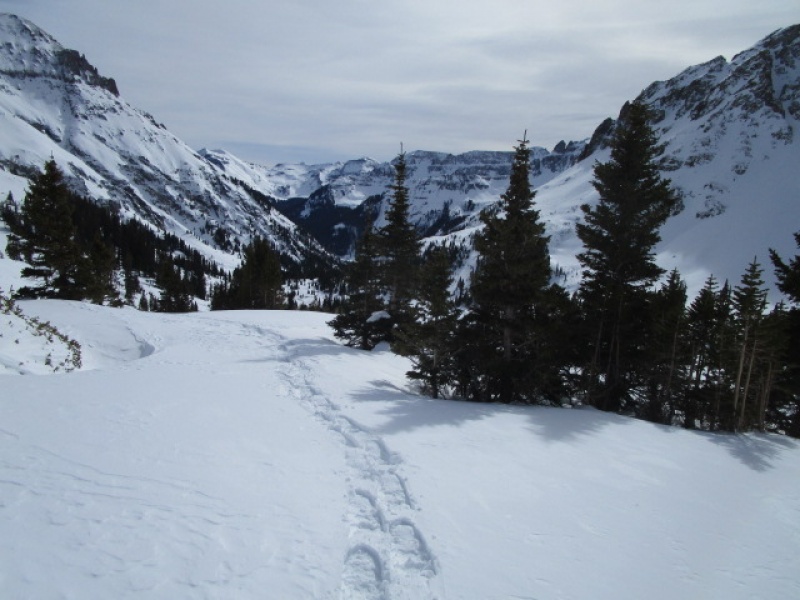
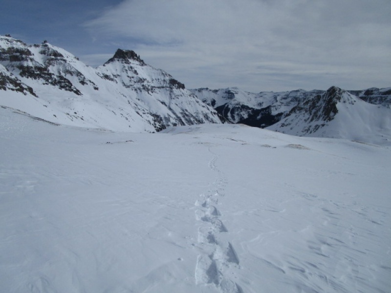
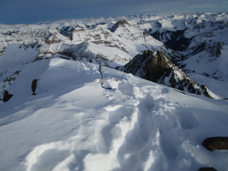
Treeline in Lower Yankee Boy Basin, looking east back down toward Ouray.
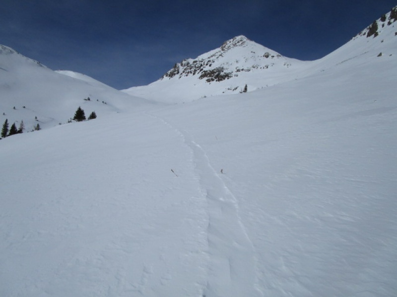
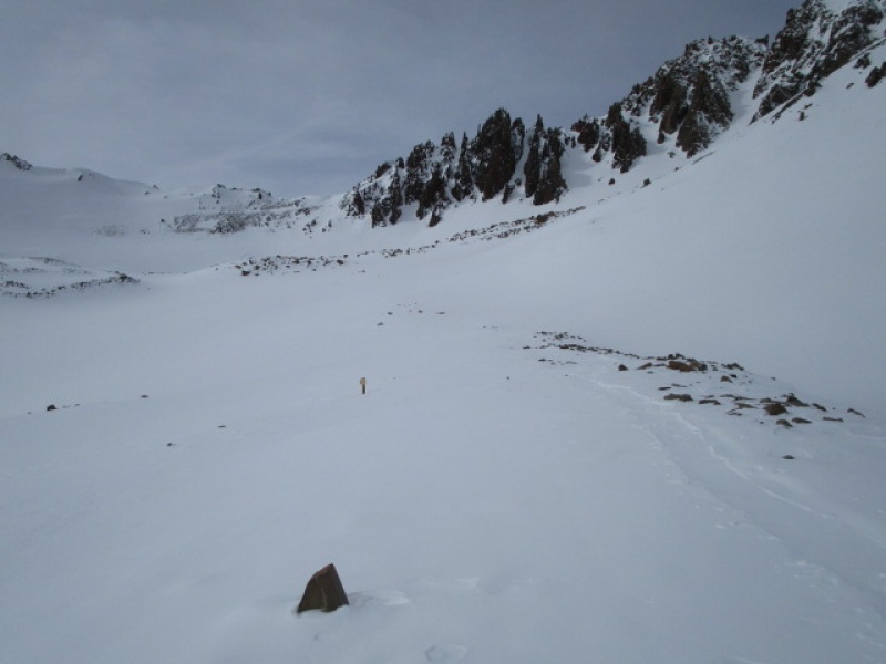
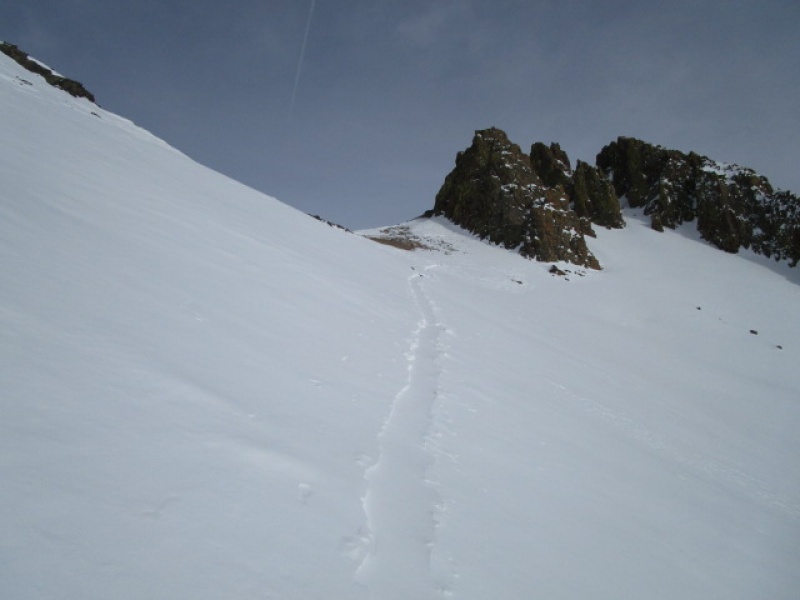
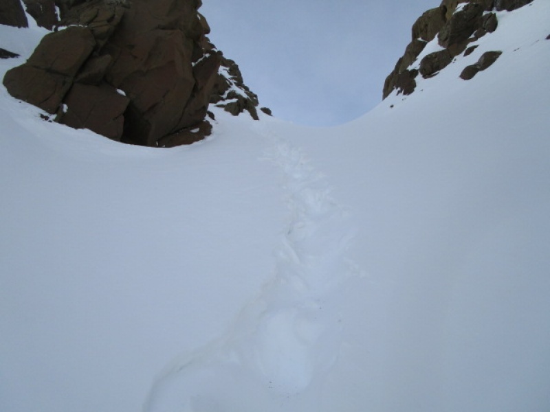
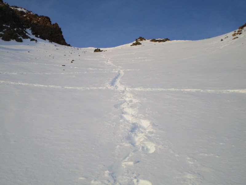
There was a windswept trail that continued on, which I suspected was left by Angry, based on her condition report, but later learned that it had been left by ScreeSurfer, who had just climbed Sneffels the day before. (Thanks again ScreeSurfer! I would not have finished without your inspired track.)
Windswept track left by ScreeSurfer 1/31/20
Walking in the track was straightforward and enjoyable. Conditions were basically perfect. About 30 degrees and no wind and a firm snowpack. Despite the favorable conditions, I was not making the best time. Winter doldrums and all. But it was 1:00 p.m. when I finally reached the upper 4wd trailhead.
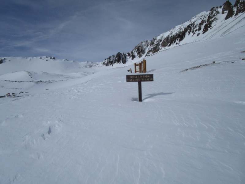
Upper 4wd Trailhead. Last year these signs were totally buried by snow by the end of February.
With nothing but blue sky and a half moon to make a night hike sound like a good idea, I didn't consider the time an issue. And with the trail beaten ahead of me, I just followed on.
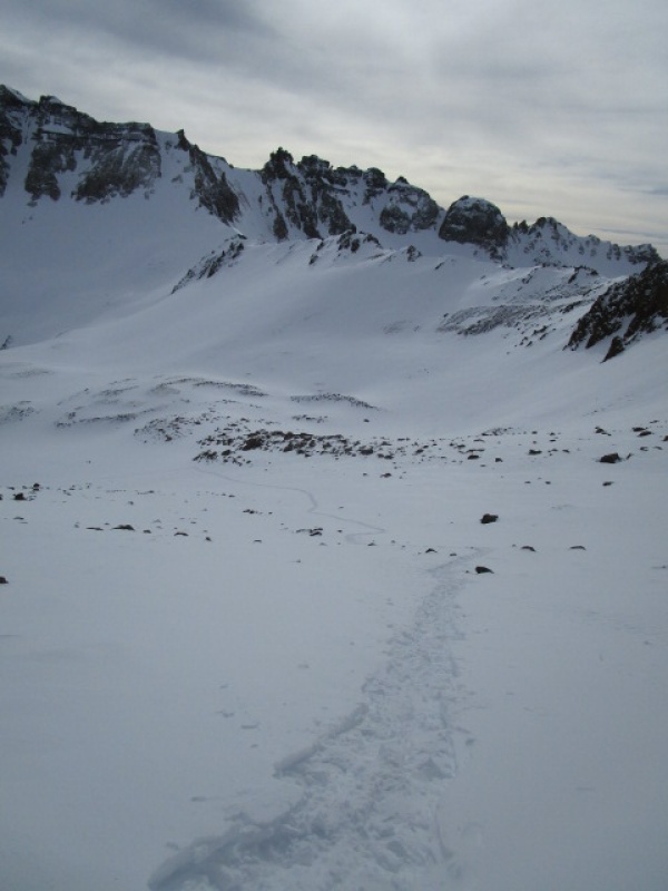
Looking back at Potosi from upper Yankee Boy Basin
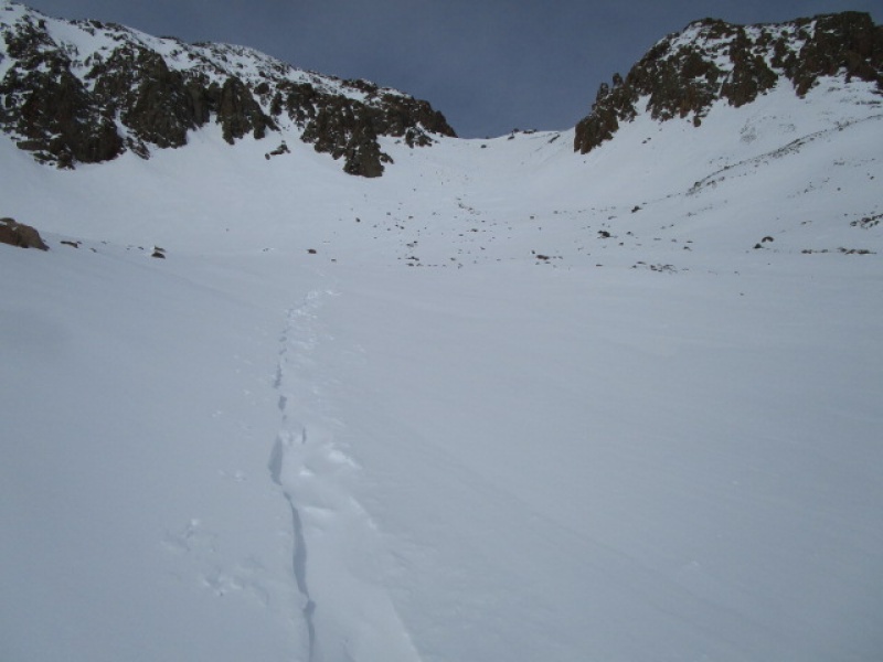
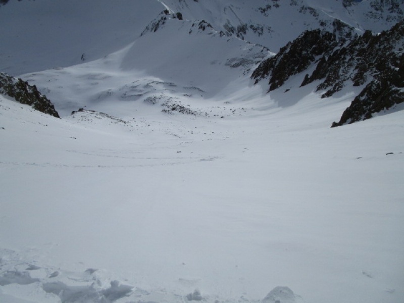
Fork in the road
The post near the center of the previous photo marks where the trail splits. To the left, takes you to Blue Lakes Pass, which is on the skyline, just left of center. To the right, the proper start of the S. Slopes route. First timers take note. If you start up the slopes before this, you will end up on Kismet Pk., which is what I did some years ago. (1995) I mention this because every now and then I see folks scrambling up there and wonder if Kismet is their goal or if they just got anxious.
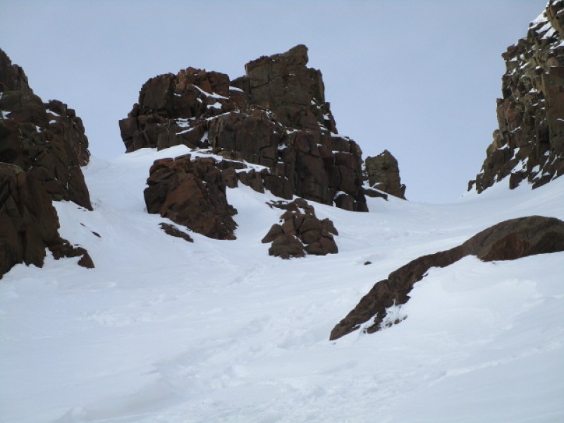
Anyway, back to our story. Here is a view of the South Slopes.
South Slopes during a "dry average" snow year.
You can see there are still plenty of rocks poking out here and there on the South Slopes. Seemed to me that there was plenty of snow so that skiers can avoid rocks taking a track in the fall line.
The track I was following looked like ScreeSurfer kept his snowshoes on all the way to the top of the slope, to the start of the Lavender Col. I ditched mine much lower down, based on past experience I expected the snow to firm up on the upper parts of the slope. Not today. I would have saved much time and energy if I kept them on as well. Oh well, live and learn. Much post holing and some mild cursing to get up the South Slopes. After 3:00 p.m. by the time I finally got there.
Looking at Blue Lakes Pass from part way up S. Slopes
The last of about 11 switchbacks. Yep, wish I still had my snowshoes here!
Looking back down the S. Slopes.
The snow on the saddle was windblown and very hardpacked. I did not bring crampons but most people would probably want the added security on just this short bit. Elsewhere up the col, I think they would have been more of a hindrance, especially on the rocky exit which is an alternative to the summer route V-Notch. But personal preference.
Hardpack, but not so hard you could not kick steps.
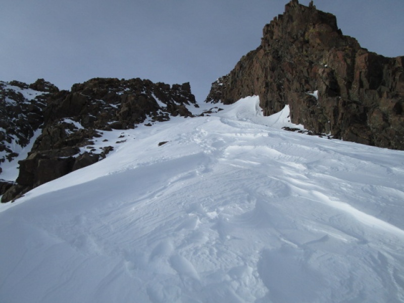
Looking back at top of S. Slopes from start of Lavender Col.
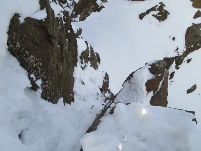
The excellent steps kicked up the Lavender Col by ScreeSurfer were mostly in great shape. About half way up the stability of the snow deteriorated and post holing became an issue. There is an alternate exit a couple hundred feet below the V Notch where an old rope anchor can be seen.
Alternate Exit right. Rope anchor visible.
I have used this several times. I got to about an arms length from the rope to scout it out, but decided to stick with the standard route. The alternative puts you about half way up the rocky scramble that is described elsewhere as an alternative to climbing the Lavender Col. On this day it was very steep and too hardpack and icy to attempt without crampons. In the spring, when things loosen up a bit, it makes a really fun butt slide!
The last couple hundred feet, to get up to and past the V-Notch was on very loose, unconsolidated snow. Even with the footprints from the day before, creativity and determination was required to crawl up this last bit. I think about 30 minutes to move about 100 feet seems about right.
From here to there, it almost beat me!
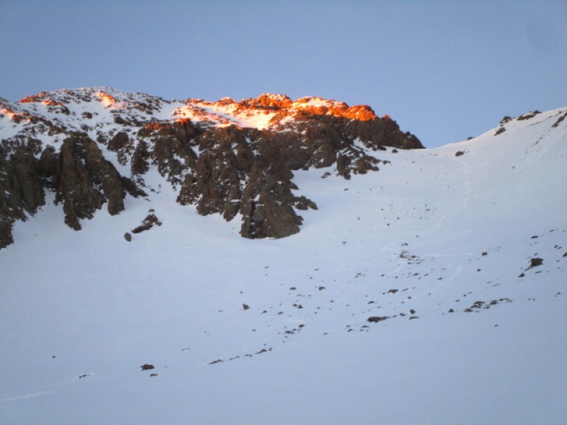
As mentioned before, the V-Notch gets hopelessly choked with snow each winter. There are several alternatives, both above and below the notch.
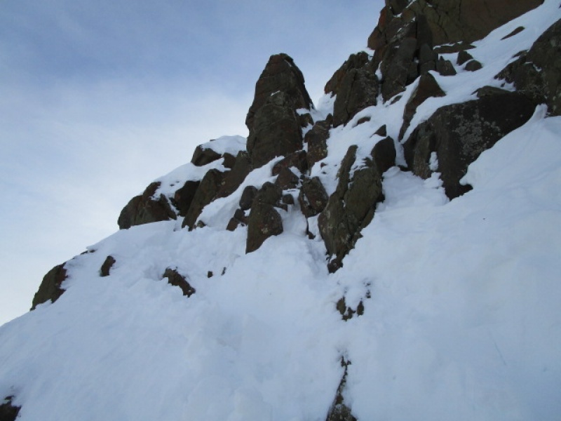
Short mixed pitch.
Climbing out of the Col was pretty straightforward. Decent hand holds on rock and good packed snow footholds. Seemed a little sketch, thinking about reversing it. But a pleasant surprise was that it actually went easier on the way out, facing out and just scooching down on your butt.
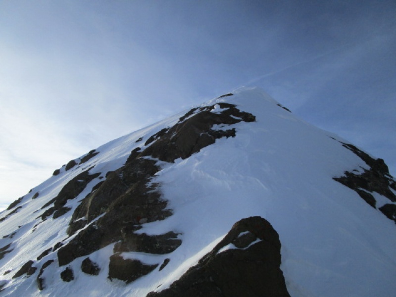
From where the previous photo was taken, you could turn and look down on the V-Notch exit and also look up and see the summit not far off.
Summit just ahead. Slightly beyond what is visible in the photo.
For me, the most technically difficult move on the whole climb was a bit of a stretch step necessary to get from the rock back onto the snow for the final pitch. This always varies with conditions, but today there was a blank section of rock, some steep loose snow and a long run out. This one was easier going, because you could commit to the snow. Coming back, to regain the rock, was a little trickier.
Final push
Summit
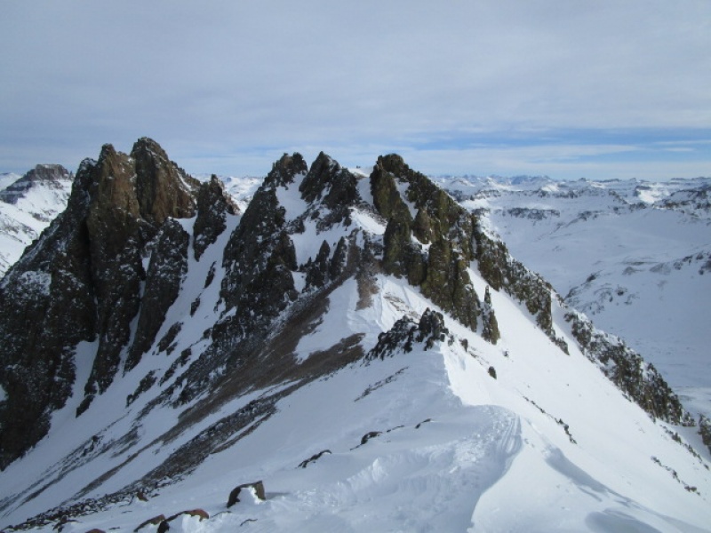
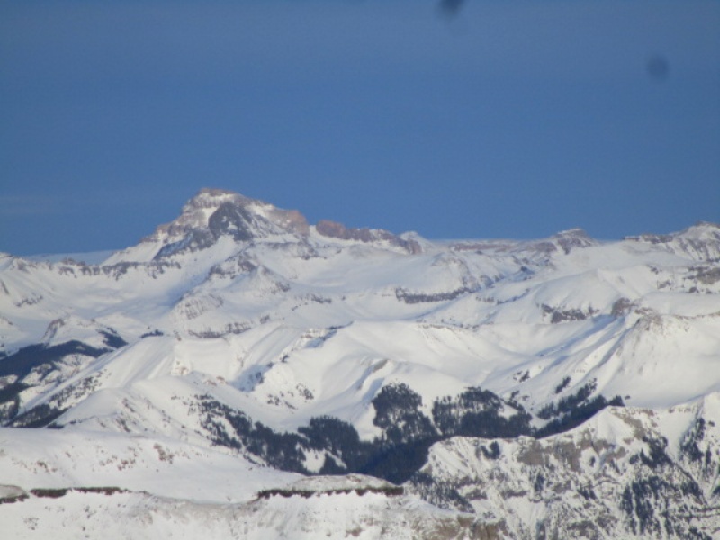
Wetterhorn in the foreground, backed by Uncompahgre.
I made the summit just a little before 5:00 p.m. 8 hours after leaving the truck. I checked with ScreeSurfer who managed to break the trail and finish in 5 hours. Hats off to that!
I didn't dally too much on the summit. I wanted to get at least back to the upper 4wd trailhead before dark. As it turned out, I managed to get back down to that point in just about 1 hour. 4 hours up and 1 hour down on the upper part of the mountain. All day was 8 hours up and 3 hours down.
Scooch this.
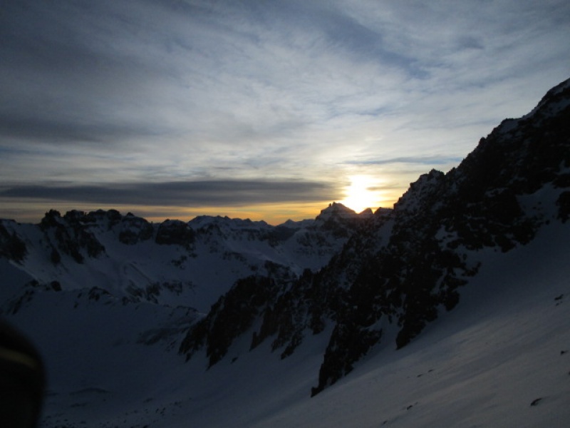
The twin summit of Dallas Pk clearly outlined by the setting sun.
4 hours up, 1 hour down!
Sneffels summit in fine alpenglow light.
The evening could not have been any nicer. What wind there was earlier in the day died down and it was dead calm. Temperature dropped a bit, but not colder than 20 degrees. The walk down to the truck from the upper 4wd trailhead took about two hours by moonlight.
Potosi in the evening
GOOD NIGHT!
Thumbnails for uploaded photos (click to open slideshow):
Excellent job documenting Sneffels conditions in a typical average snowfall Winter. Will be very beneficial for future climbers. So many great views of Teakettle, Potosi, Dallas and the whole basin. Love this area!
What a great Trip Report. It really covers all the basics for a Winter ascent. Sneffles was my first 14er back in 2014, and this report makes me want to get out there in the Winter. Safe Trails!
Caution: The information contained in this report may not be accurate and should not be the only resource used in preparation for your climb. Failure to have the necessary experience, physical conditioning, supplies or equipment can result in injury or death. 14ers.com and the author(s) of this report provide no warranties, either express or implied, that the information provided is accurate or reliable. By using the information provided, you agree to indemnify and hold harmless 14ers.com and the report author(s) with respect to any claims and demands against them, including any attorney fees and expenses. Please read the 14ers.com Safety and Disclaimer pages for more information.
Please respect private property: 14ers.com supports the rights of private landowners to determine how and by whom their land will be used. In Colorado, it is your responsibility to determine if land is private and to obtain the appropriate permission before entering the property.

")
")
")
")
")
")
")
")
")
")
")
")
")
")
")
")
")
")
")
")
")
")
")
")