Download Agreement, Release, and Acknowledgement of Risk:
You (the person requesting this file download) fully understand mountain climbing ("Activity") involves risks and dangers of serious bodily injury, including permanent disability, paralysis, and death ("Risks") and you fully accept and assume all such risks and all responsibility for losses, costs, and damages you incur as a result of your participation in this Activity.
You acknowledge that information in the file you have chosen to download may not be accurate and may contain errors. You agree to assume all risks when using this information and agree to release and discharge 14ers.com, 14ers Inc. and the author(s) of such information (collectively, the "Released Parties").
You hereby discharge the Released Parties from all damages, actions, claims and liabilities of any nature, specifically including, but not limited to, damages, actions, claims and liabilities arising from or related to the negligence of the Released Parties. You further agree to indemnify, hold harmless and defend 14ers.com, 14ers Inc. and each of the other Released Parties from and against any loss, damage, liability and expense, including costs and attorney fees, incurred by 14ers.com, 14ers Inc. or any of the other Released Parties as a result of you using information provided on the 14ers.com or 14ers Inc. websites.
You have read this agreement, fully understand its terms and intend it to be a complete and unconditional release of all liability to the greatest extent allowed by law and agree that if any portion of this agreement is held to be invalid the balance, notwithstanding, shall continue in full force and effect.
By clicking "OK" you agree to these terms. If you DO NOT agree, click "Cancel"...
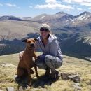
Trailhead: Bear Lake Route: West Ridge Length: 7.5 miles Vertical: 2000 feet Partners: Solo
OK - so how does one pronounce "Wuh"? Is it with a long U so it sounds like Woo? Or a short U so it sounds like Duh? Well, duh - I don't know. And bottom line, I don't really care. It is a named point on a map in RMNP so it just HAD to be climbed! Woo-hoo.
Seriously, if anyone knows how it got its name - or how it should be pronounced, I would love to know. I did a little research - very little, actually - and could not come up with an answer. So, now you all have your homework.
A couple years ago, I read a TR by Kimo I think, on Joe Mills and Wuh. I couldn't find that report when I decided to get Wuh but I think I followed his route more or less.
Like so many beautiful hikes in the Park, this one starts out at the Bear Lake Parking lot. Arriving just after sunrise on a weekday meant there were only a couple other vehicles in the parking lot when I started out. The story was quite different when I got back down. Bear Lake is a popular place - even in the winter on a week day.
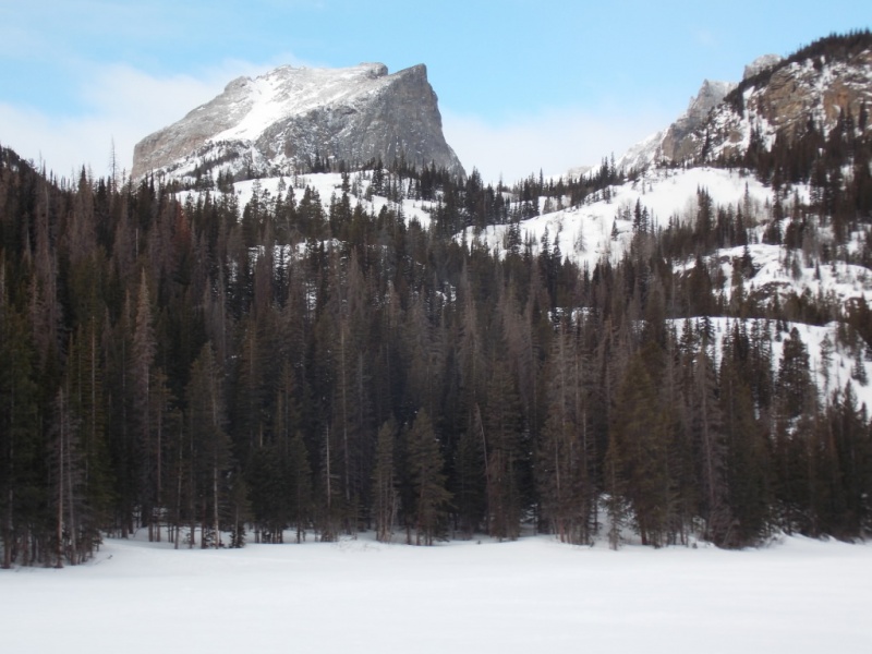
It is impossible to pass by Bear Lake without taking a picture of Hallett Peak behind Bear Lake.
No problems navigating the trail portion of this hike. Follow the signage from the northeast side of Bear Lake that directs you to Flattop Mountain, take the first left about a half mile later that points you to Flattop and Odessa Lake then continue another half mile where the sign says go left to Flattop or go straight to Odessa/Fern Lake. Go straight which will skirt you around the north side of Flattop Mountain.
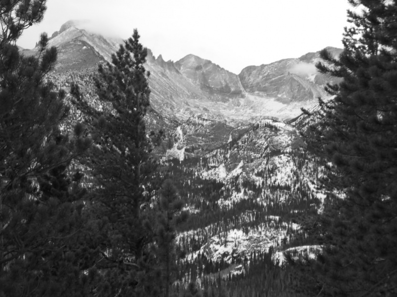
It is also impossible to take this trail without rubber-necking for views of Longs Peak.
As you continue on the trail, don't forget to look back every now and then. This next shot shows Bierstadt Lake in the distance.
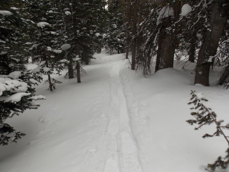
Once past the last cutoff to Flattop, I was breaking trail the rest of the way up.
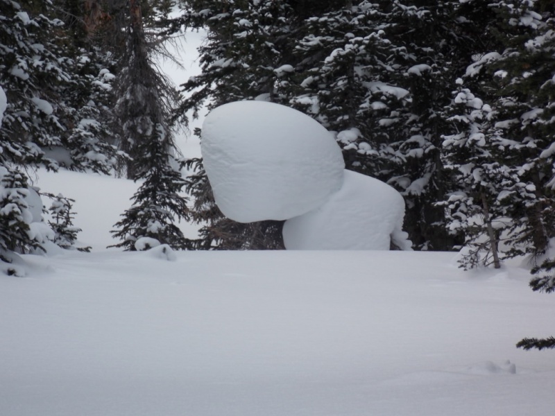
I'm the first one on the trail since the last snowfall.Looking back - trail breaking here was super easy. That would change...I spotted this off to the left as I was going up. Looks like a character from a children's cartoon.
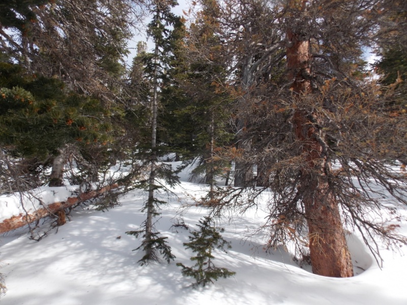
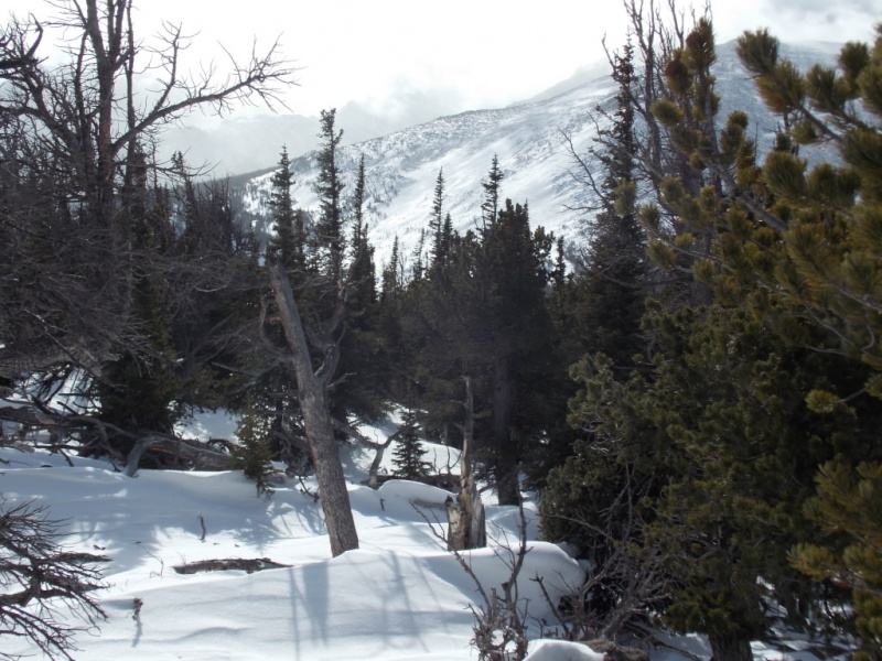
I left the trail just about the point where it crossed Mills Creek. My intention was to maintain elevation as I curved back north east but topography didn't cooperate and I ended up having to gain probably 200 vertical feet. This put me above the saddle I was aiming for but it all worked out. Ultimately, after giving back the 200 feet, I started up the west ridge of Wuh and that's where it got tough.
The only picture I took as I went up the west slopes.
I gotta tell ya that this hike up - although it was only something like 400 vertical feet - was one of the toughest I've done in recent years. The snow was deep. And soft. I have rather large snowshoes (32" MSR lightning ascents) and I was sinking to my knees every "good" step and sinking to my hips the rest of the time. The snow completely covered deadfall and small trees and when I stepped on either, I was sunk. Literally. I spent more time pulling myself out of holes than I would like to admit. More than once, I thought I should just come back when snow conditions were a bit better. But I am Norwegian and my ex-wife had a t-shirt that said "You can always tell a Norwegian - you just can't tell him much." Translation: Norwegians are stubborn. Duh. So I kept on. And did finally make the summit. Although the views from Joe Mills are better, the ones from Wuh aren't bad. And I'm pretty sure that Wuh doesn't get a whole lot of visits...
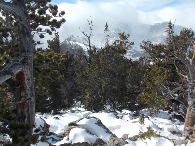
Views looking back west on the way up.
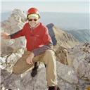
Approaching the summit.
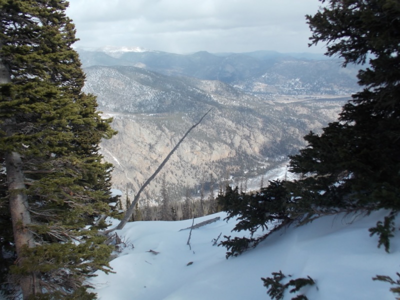
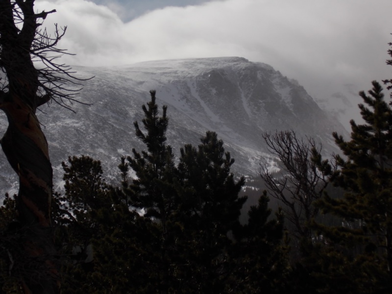
Summit views.
Looking NortheastLooking Southeast
Looking westFlattop Mtn
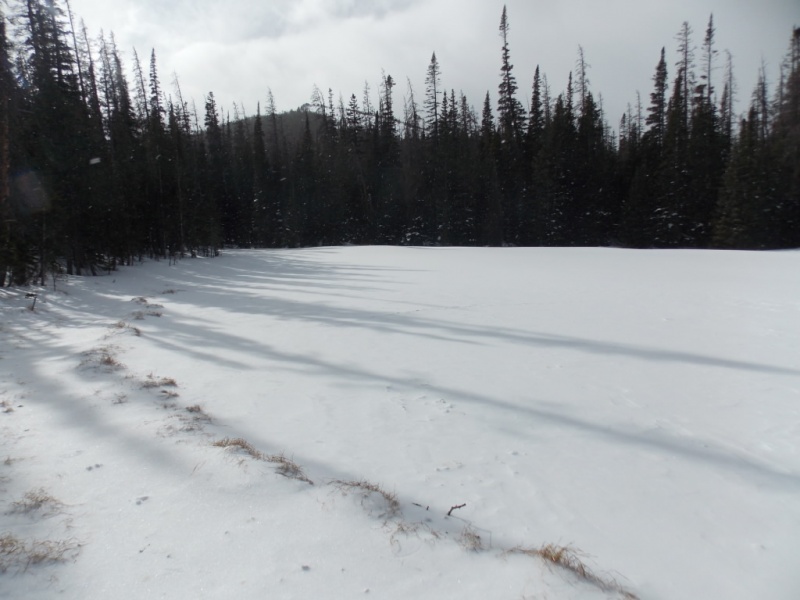
Only one thing remained on my to-do list. Find Round Pond. I had missed it when I did Joe Mills Mtn a few weeks back (and I should do a TR on that trip as the views were incredible). I suppose if I carried a GPS with cooridnates, it would be easy but what is the fun in that? Anyway, I started dead reckoning my way and I lucked out and found it. Although a moose wasn't quite so lucky....
Round Pond
Moose carcass on the shore of Round Pond
Obviously, animals had been feeding on the carcass. From the scat around, it appeared to me that foxes and/or coyotes were certainly present.
This was a fun day, and a more difficult climb than I expected followed by a sobering view of a moose by Round Pond. Call it Nature taking its course.
Most of you know that I don't carry a GPS so this is an approximation of my route.
Thanks for taking the time to read this and please be careful out there You don't want to end up like the moose!
Thumbnails for uploaded photos (click to open slideshow):
Great find there with the moose. Dpage found a bear skull on the summit a year or two ago. I recall some metal trail markers by round pond.
A good winter outing and underrated mountain. I did about the same line in March a few years ago, easier snow conditions then. Headed over to Steep mtn after for a much longer day with lots of uphill on the trail back. The ridge east of Wuh summit has good views.
Jay, really enjoyed the report! I spent a while trying to pronounce the 'Wuh' before opening this page. I think if one pronounces it to rhyme with 'huh' then it could be a single pulse of a Spruce Grouse's drum song.
Nice report and pics and kudos to you for braving Mt. Wuh in the
snow (by the way I also have no idea what the correct pronunciation
is). I did Joe Mills once but couldn't generate much enthusiasm for
Wuh because I wasn't sure if you could really see much from the summit
given the tree cover. Turns out, from your photos, that you can see
more than I would have expected. You're definitely checking all the boxes
to qualify as a true RMNP trail blazer.
So the story is that it originally was an acronym: Winter Undertaking [from] Hell. You proved it true, Jay! :-) Sorry, couldn't resist...I have no ideas re: history or pronunciation.
Nice report, Jay, I enjoyed it. But man, that moose...creepy how it was hollowed out!
@Cougar - I will likely do Wuh again - maybe in the summer when it won't be quite so much work. Bear skull?? Wow! How cool is that? I'll have to ask Dpage about that.
@Rob - Thanks, Man! And you might be right about the grouse drumming...
@MathGuy - I was surprised at the views also. I didn't expect them but they did not disappoint. And I have a LONG way to go before I am any sort of authority on RMNP. It sure is a beautiful place.
@Tom - OK - You totally cracked me up! Your acronym makes perfect sense to me!
@Doug - Thanks for the compliment on thee pix. Sometimes weird weather can make for some great shots. I never realize it when I take them (I'm just a point and shoot guy) but then I get them home and go "Wow"
@Kirsten - Thanks so much! Like you, I dearly love the Park.
Thanks for the report. I wasn't familiar with Wuh, nor do I know how to pronounce it. My guess would be it rhymes with duh. I can tell you how to pronounce Mills if you need help with that. Hah!
I have never climbed Wuh, to the best of my memory, though we both have climbed nearby Joe Mills, as you know. I think Wuh doesn't get climbed much. Like you, I don't really know how to pronounce "Wuh." I did find what seems to be a valid explanation of the origin of the name in a trip report on a 2015 climb of the mountain by Stefan and Richard Hollos, who write:
We've long wondered how Mount Wuh got its name. It sounds Chinese, but the "h" at the end adds some doubt to that. To shed light on the question, Stefan suggested we email RMNP to see if they knew the origin of the name. Elizabeth Howard of the RMNP information office kindly and promptly answered our question by saying "the name of Mt. Wuh comes from the Arapaho Indian word for Grizzly Bear. It was named in 1923 by Roger Toll, even though, by that time, there were no more Grizzlies in the park".
So - it's Arapaho for Grizz, eh? Now I know (although I think I like Tom Pierce's meaning better ) I took your suggestion and called the park and they told me that unless it was in a common public area, they just let Nature take its course. Thanks for your kind words - I do enjoy winter although I end up doing the easier accessed peaks cuz I just can't cover the miles on snowshoes like I used to.
I'm going to pronounce it Mount WOW! This is awesome, I'd imagine this peak gets so few ascents per year you could count them on your fingers and toes.
Jay, excellent report--I really gotta get out there sometime when everything's white and cold. Sooo beautiful! I remember telling you that I owned those same snow-shoes and that I wasn't impressed. (expensive too). If you're sinking up to your hips---how can they even be called snowshoes? Think you told me they really "rocked" on higher, harder snow, but would you really need them in those conditions. WUH'S the scoop?
Hi Pete - Nice to hear from you and thanks for your comments. Regarding the snowshoes - they actually do quite well in snow - not quite as good as my old 60" wooden ones but those don't do well on inclines at all. That day, the snow was just horrible - flotation-wise. Lots of fresh unconsolidated powder in shade. No support at all. And the "up to the hips" part was when I literally would step on a totally hidden small tree or deadfall. Just a perfect storm of conditions. And yeah - you do need to get out this way in winter. More fun than you can imagine.
Caution: The information contained in this report may not be accurate and should not be the only resource used in preparation for your climb. Failure to have the necessary experience, physical conditioning, supplies or equipment can result in injury or death. 14ers.com and the author(s) of this report provide no warranties, either express or implied, that the information provided is accurate or reliable. By using the information provided, you agree to indemnify and hold harmless 14ers.com and the report author(s) with respect to any claims and demands against them, including any attorney fees and expenses. Please read the 14ers.com Safety and Disclaimer pages for more information.
Please respect private property: 14ers.com supports the rights of private landowners to determine how and by whom their land will be used. In Colorado, it is your responsibility to determine if land is private and to obtain the appropriate permission before entering the property.


")
")
")
")
")
")
")
")
")
")
")
")
")
")
")
")
")
")
")
")
")
")