Download Agreement, Release, and Acknowledgement of Risk:
You (the person requesting this file download) fully understand mountain climbing ("Activity") involves risks and dangers of serious bodily injury, including permanent disability, paralysis, and death ("Risks") and you fully accept and assume all such risks and all responsibility for losses, costs, and damages you incur as a result of your participation in this Activity.
You acknowledge that information in the file you have chosen to download may not be accurate and may contain errors. You agree to assume all risks when using this information and agree to release and discharge 14ers.com, 14ers Inc. and the author(s) of such information (collectively, the "Released Parties").
You hereby discharge the Released Parties from all damages, actions, claims and liabilities of any nature, specifically including, but not limited to, damages, actions, claims and liabilities arising from or related to the negligence of the Released Parties. You further agree to indemnify, hold harmless and defend 14ers.com, 14ers Inc. and each of the other Released Parties from and against any loss, damage, liability and expense, including costs and attorney fees, incurred by 14ers.com, 14ers Inc. or any of the other Released Parties as a result of you using information provided on the 14ers.com or 14ers Inc. websites.
You have read this agreement, fully understand its terms and intend it to be a complete and unconditional release of all liability to the greatest extent allowed by law and agree that if any portion of this agreement is held to be invalid the balance, notwithstanding, shall continue in full force and effect.
By clicking "OK" you agree to these terms. If you DO NOT agree, click "Cancel"...
March of 2019. The CAIC picture looked like this a few days before my upcoming week off.
Even "playing it safe" on Elbert or Quandary or Humboldt was not guaranteed in these historic conditions, so I opted for a range closer to home for the first time and hiked the Texas highpoint.
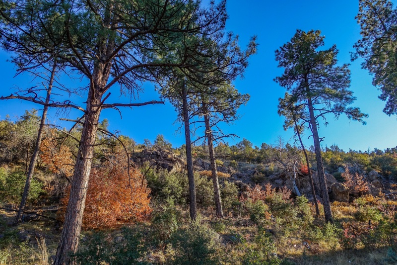
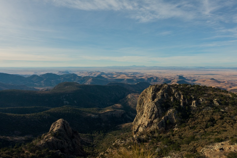
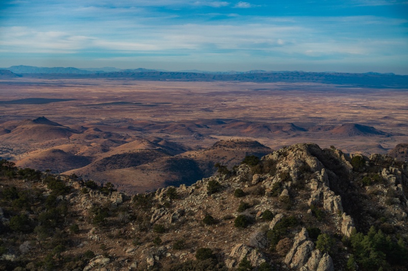
Despite the fact that this range never holds snow and that the rock is absolute crap for climbing, I really liked the vibe the Guadalupes put off. The entire range is basically an ancient coral reef which is pretty cool, and the desolate nature of it towering over the vast Chihuahuan desert gives really unique views far to the horizon. Add in a haze caused by all the carbon extraction in the Permian basin to give really colorful sunrises and you get a remarkably resilient range of mountains with a strong personality. I started making regular trips down there to continue bagging the other Texas high peaks, all of which reside in the park except for two.
The only 8000'er list I'll ever start.
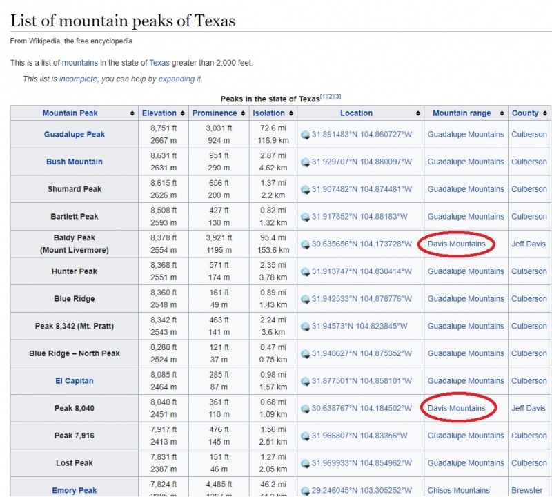
The last two 8000ers in Texas sit on private land owned by the Texas Nature Conservancy in the Davis Mountains, and are only open to the public four weekends a year. The four open weekends are in March, July, October, and December, so for the hiker who doesn't enjoy carrying a gallon of water in middle of the Chihuahuan desert, it's really only open one time per year, in December.
It's surprisingly difficult to find any official information on trails in the preserve, but I found a few resources online and discovered that Mt. Livermore (also mysteriously called Mt. Baldy because so is every mountain) has a 4WD road up nearly to the summit and then a short scramble to the top, and that Mescalero mountain, also called Peak 8,040, is a class 4 scramble along a narrow ridgeline that drops from Livermore. My time-crunch for the given weekend in December meant I would only have time for Livermore this trip.
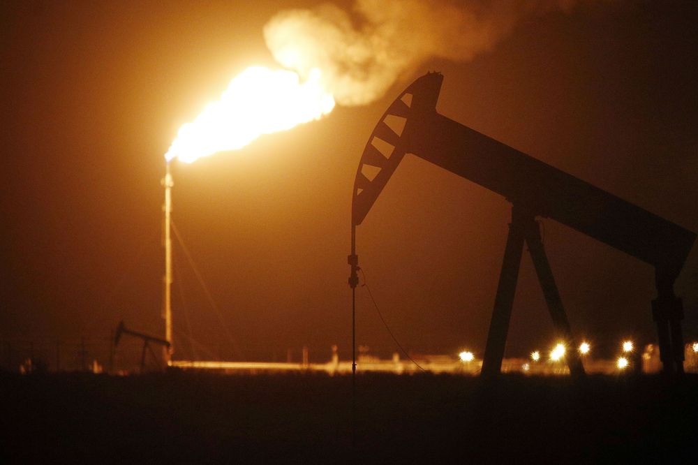
The drive out into the Davis mountains is really something. The resource extraction going on down in the Permian basin is on a colossal scale. Hundreds of short pipe-towers dot the desert landscape spewing flames from flaring off natural gas the oil companies deem too expensive to collect, and driving through the area at night is like riding through a mad-max apocalyptic world with fireballs blazing in the sky as far as the eye can see. Occasionally the desert darkness is broken up by frakking rigs which are bathed in floodlights and crawling with petroleum workers. The extraction never stops. The highways are clogged with hundreds of big-rigs pulling tanker cars. The last town before the desert opens up is Pecos, Texas, and at a gas station there the customers walking around were all wearing orange or white jumpsuits covered in filth. It feels like it's a race to get as much carbon out of the ground down there before it runs out, and it's so frantic and fast that they're just straight burning off some of the product.
West from Pecos, the traffic diminishes as the mountains loom, and from the turnoff on I-10 towards Fort Davis and the McDonald astronomical observatory, I did not see another vehicle until reaching the preserve 45 minutes later. This area redefines desolate.
The turnoff into the preserve is easy to miss, a dirt road near a hairpin turn with a handwritten sign on an 8 1/2 by 11 sheet of paper hanging on a fence post. A short dirt road leads to the McIvor conservation center, where all guests are required to check-in and out. I anticipated it being crowded given this place is only open a few times a year and this was the most mild weather-weekend of the year, but there were only a few cars parked outside the building. I walked in and signed a waiver and then talked to one of the volunteers there about camping higher up on the road and learned that overnight camping at the trailhead wasn't allowed but that there were numerous campsites along the road, and that the closest camping area to the trailhead was by an old windmill. I also read all the little informational posters in the lobby of the building to figure out how exactly this preserve came into being and discovered that the initial donation of land was by a ranch owner who needed to ease his tax burden, and that numerous other landowners around the preserve had followed his lead and added to the conservancy. Public land is non-existent in Texas so outdoor recreators have to rely on the generosity (or financial hardship) of landowners to gain access to anywhere not contained within a state or national park. The conservancy only opens this land a few times a year to the public to "protect the natural resources."
The road up beyond the conservation center was marked 4WD only and passed through a savanna-like ecosystem studded with coniferous trees. The terrain is far from lush, but given that it grows in the middle of the largest desert in North America it commands a certain respect. I followed the road up about 5 miles before coming to the windmill and a few obvious campsites.
Fall happens in December near the Texas/Mexico border.
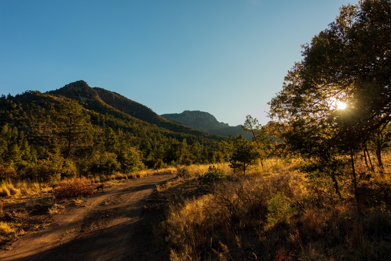
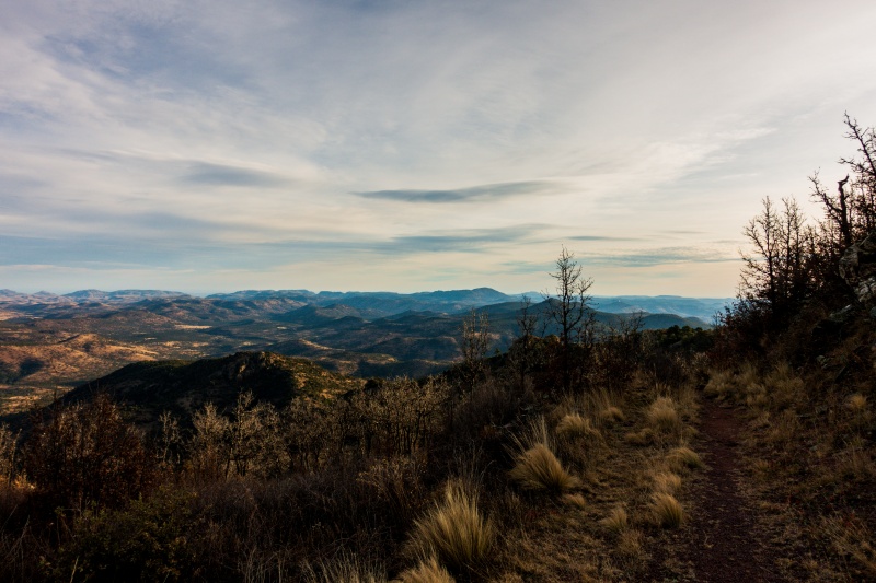
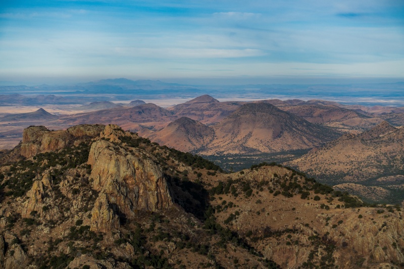
One of the more scenic drives in Texas.
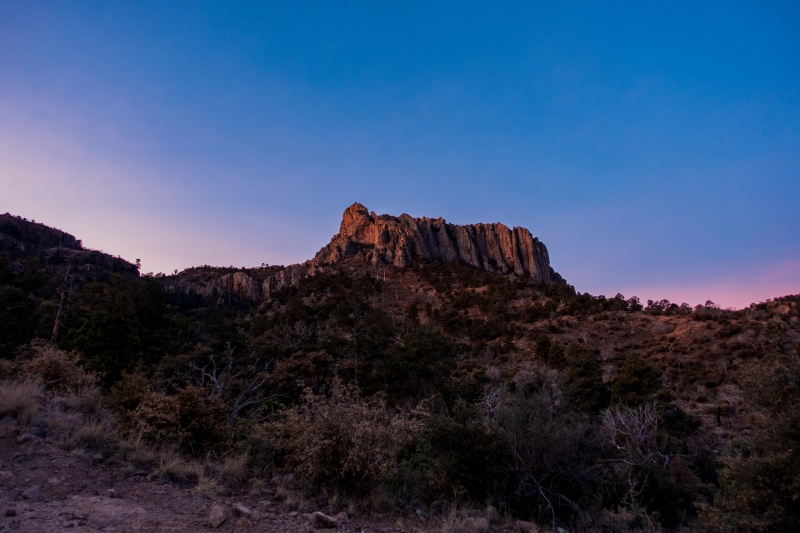
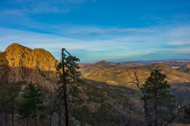
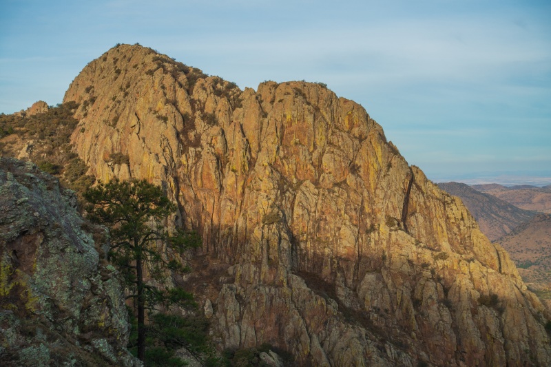
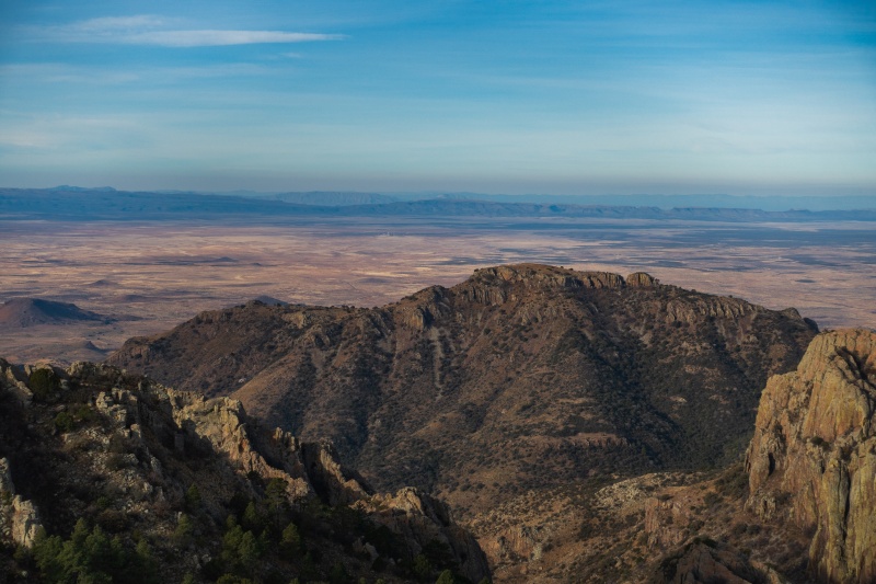
Mt. Livermore at center and Pine Peak, a 7000'er, to the left.
There only looked to be 4-5 decent campsites near the windmill, and most of them were occupied by parked cars, so I pulled into one a little past the windmill and saw a camp-chair tipped over in the middle of it. I assumed that somebody had packed up and left and forgotten their chair, so I moved it and pulled into the spot. Right as I'm getting out of the car to start packing for the morning hike, a big F250 rolls down the campsite pullout towards me and pulls up alongside. The driver, a middle aged white dude with a ballcap and blue jeans, gets out and sort of glares at me as he walks towards the chair. I asked "oh, is that your chair?" I should have said "oh, did you forget your chair?" He replied with a terse "yup" and picked it up and threw it in the back of his truck and got back in his cab and sort of proceeded to watch me as I opened the trunk of my subaru and stared sorting gear. He rolled his window down and then asks "so, you're just taking our campsite?"
I wasn't sure I heard him right so I stepped back from my car and said "I'm sorry?" He repeated his query. I walked over to his open window and saw his wife was sitting in the cab looking like she'd had a pretty tough hike for the day and he continued glaring at me. Being a high-school teacher, I'm challenged by illogical and stupid thought processes on a daily basis by adolescents and normally diffuse such situations, but I'd just had a long drive through a desert wasteland and for some reason felt like having a verbal confrontation with this guy.
"Oh, I didn't realize the campsites were reservable here in the preserve. Did I miss something?" I asked sarcastically but tried not to sound so patronizing that the guy would want to leap out of his truck and fight me. My acting wasn't especially strong but he stayed in his car.
"Uh, yeah. We left our chair here." He pointed to the spot where he'd fished the chair out of the grass.
"Oh, your chair. You reserved this campsite with just your camp chair."
"Yeah, it's kind of hard to leave the whole truck here."
I car-camp between 60-90 nights annually, and think I know a little bit about camping etiquette with respect to reserving spots. Generally, if there's a tent set up, somebody is staying there. If there's a pile of crap sitting on a tarp or even just a hammock strung up between trees, somebody has slept there recently and they are coming back. This guy left a chair which can blow away. He hadn't slept here the previous night. He'd driven in that morning and thrown his chair into the site on his way up to the trailhead to claim it.
My suspicion that I was talking to a Texan-Texan, the kind Colorado residents loathe, the kind who joins organizations like Camp Gladiator and doesn't bury his shit and pick up his toilet paper, was confirmed. I was talking to somebody who thought that he could set out a chair in the morning when driving past a campsite so that he could claim it after his hike. But I was being just as stupid as this guy, continuing this conversation with a now confirmed camping noob as though it would come to an amicable and intelligent conclusion. But I was tired of driving and didn't feel like looking for another site. That, and I really didn't like this guy and didn't want to give him his way.
"Well there was no tent set up here, just a chair blowing in the wind, so I didn't know it was claimed."
"There's a whole bunch of other sites" the guy replied, motioning his arm towards some occupied sites a few hundred feet away. I looked where he was motioning so he could see that I was trying to empathize with his point of view, but everywhere he was motioning towards was actually "claimed" by tents or cars, so he had to backpeddle. "Well, those are taken, but I'm sure there are some unoccupied sites further up."
"Well I just talked to Chris at the conservation center and he told me that the last sites are right here near the windmill, and I'm not seeing any additional sites." At this point though, logic started seeping into my tired and antagonistic brain, and I considered that if I "won" this battle and claimed the site as my own and this guy left, he might come back in the night and shoot at my car, or wait for me to go up to the trailhead and then vandalize my vehicle. I didn't want this campsite bad enough to antagonize a guy who clearly didn't get out much. I offered him an out. "If there are additional sites further up the road that you can confirm, I'm happy to go check them out. You just drove down from up there, so you tell me."
The ball was in his court now, but he paused, probably thinking the same thoughts I just had. "If I lie to this guy to get him out of here and there aren't other sites, will he come back here in the night and slash my tires? He does have the tired-don't-give-a-shit look in his eyes..." He seemed to wrack his brain before confirming that yes, there were other sites up ahead. I said "ok, I'll go give them a look," cadencing my voice as though this conversation wasn't finished and there was a real possibility that I would come back to this spot and sleep in my car right next to these people. He was right though, and the sites that he had bypassed to come argue with me about his claimed site were far superior to where I left him, and were further out of the line-of-sight of other vehicles and right at the edge of a thick grove of trees to block the wind. I settled in there within view of the peak and watched the sun set over the desert hills and wondered if Texans would be so arrogant and stupid if they had a little public land in their state to practice recreating on.
Campsite for the night.
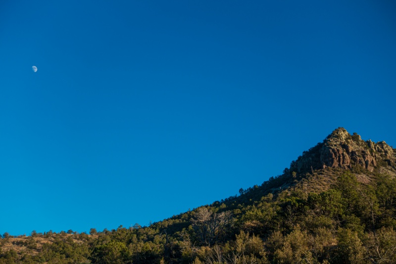
Moonrise over one of the 6000' peaks.
My night in the preserve was one of the quietest I've ever spent outside. I'm used to having the isolation of camping in the mountains broken by the sound of an occasional plane flying over but in the Davis mountains there was none of that. I fell asleep in the back of my Subaru to the sound of a gentle breeze rustling the long grass and tinnitus ringing in my ears.
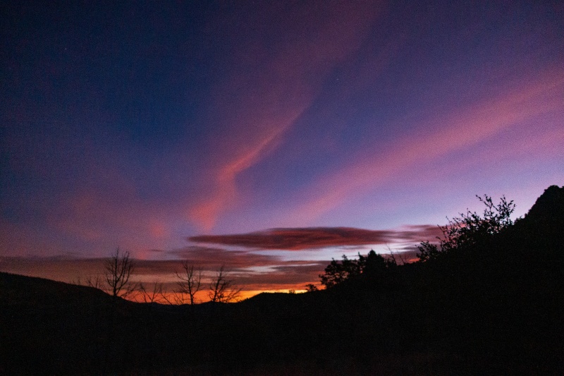
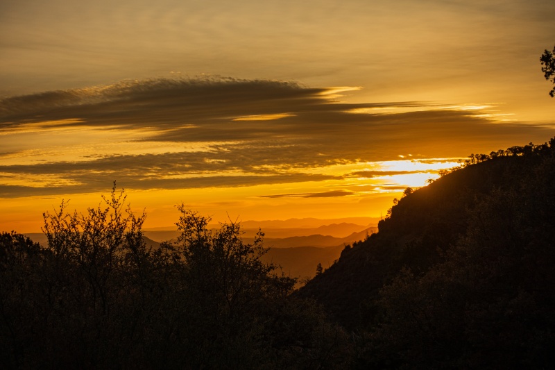
I got up and moving at about 6am and hit the trail at 7am. It was pitch black for the first half hour but easy to navigate the road by headlamp. I hustled to try to gain a good vantage point for sunrise.
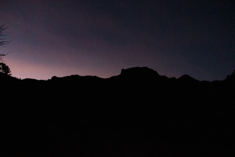
Livermore silhouette.
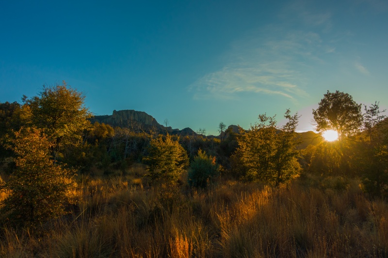
Desert sunrise.
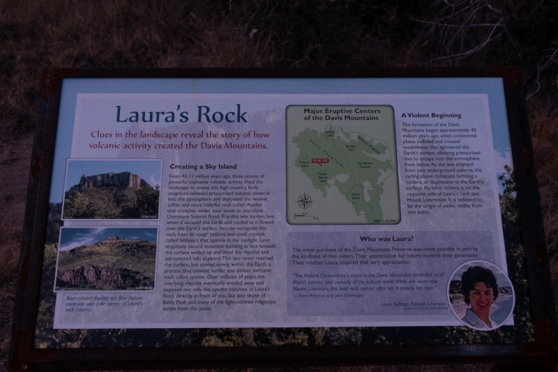
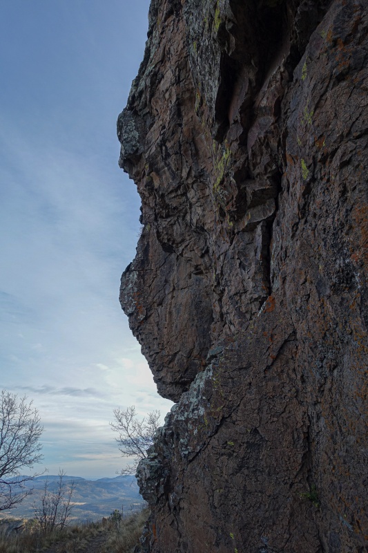
I came across a sign which identified what I thought was Mt. Livermore as "Laura' rock." This was the third name for what I thought was a single summit.
Caption Here
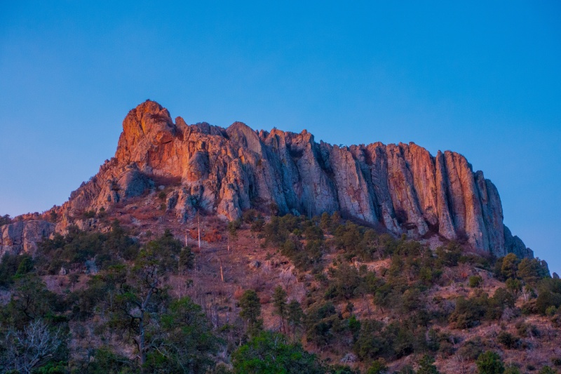
Alpenglow on what I thought was the summit.
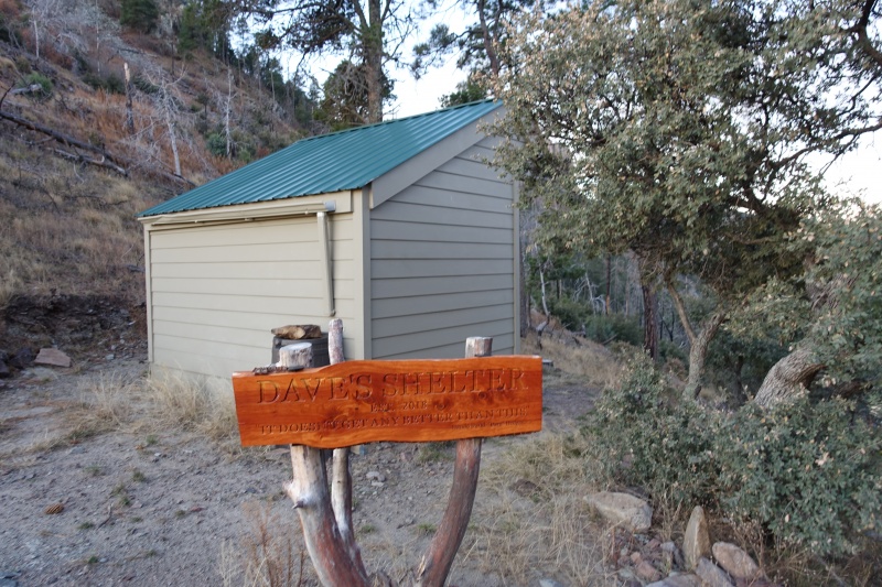
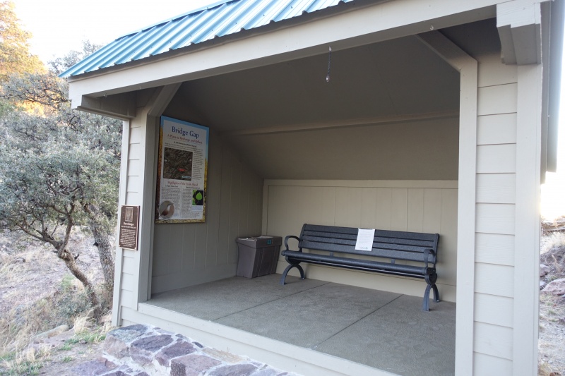
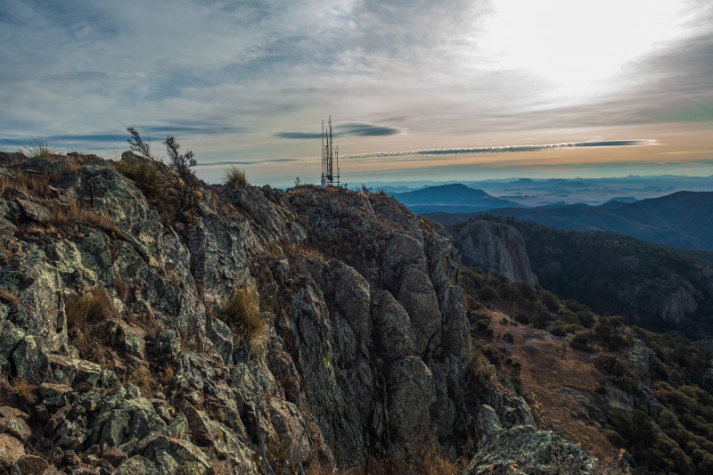
After a few miles of steady uphill, the road comes to a saddle called "Bridge gap," between Mt. Livermore and Mount Richman, a neighboring 7000'er. A shelter called "Dave's Shelter" sits up there. I hung out here for awhile taking pictures of the sunrise over the desert in the steady and chilly wind. The shelter includes a complete first-aid kit inside a barrel that has a rock sitting on top of it to keep bears out of it. I'm not sure how successful that is.
The open side faces west, which is the prevailing wind direction. Oops.Texas 8000'ers come with amenities
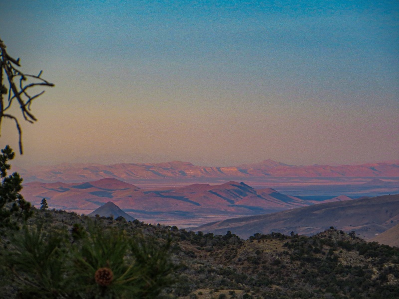
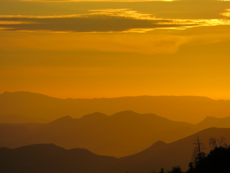
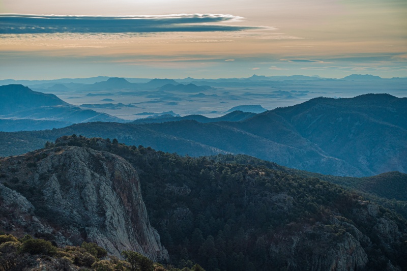
Davis mountains sunriseDeep reds on the sandy peaks. The Guadalupe mountains are barely visible in the haze.
Nuclear sunrise.
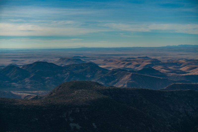
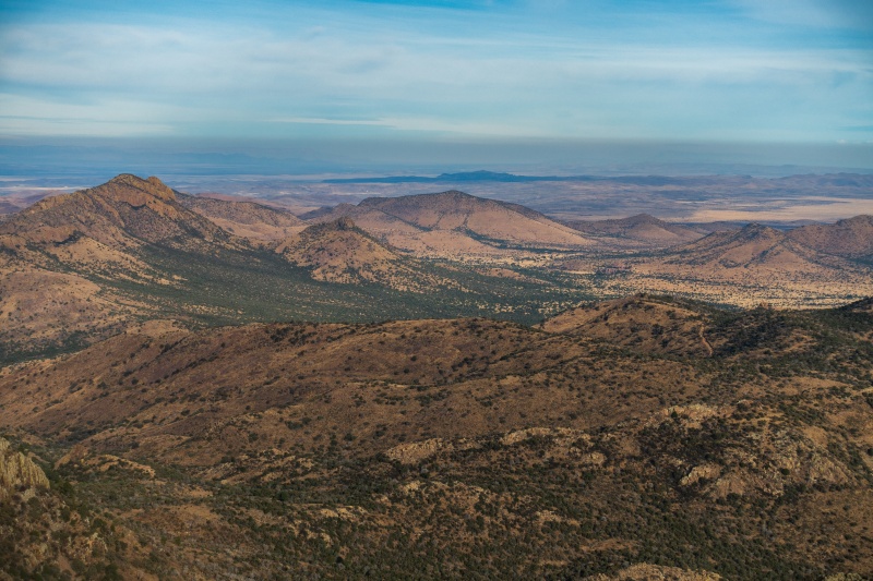
Desert mountains
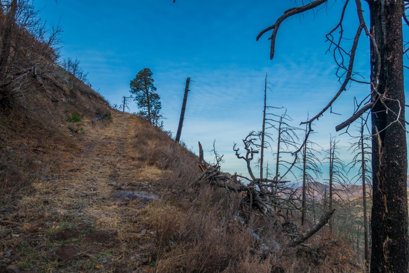
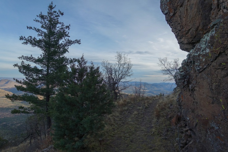
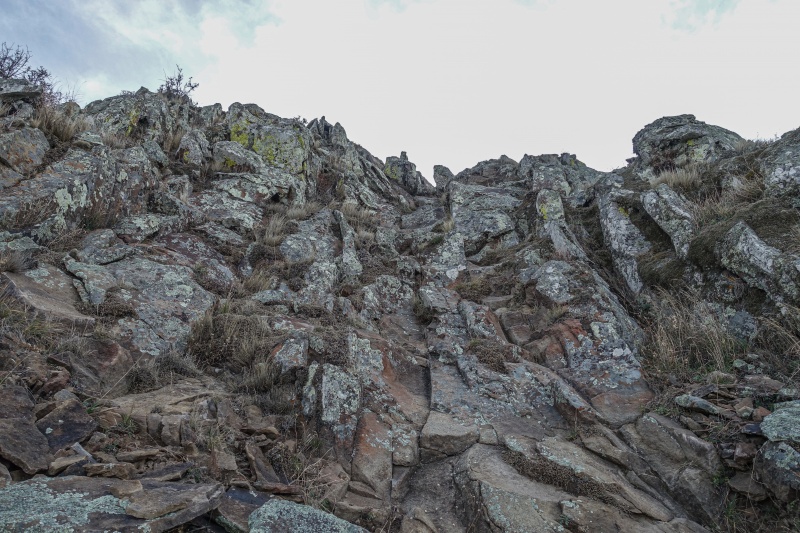
From Bridge gap one has two options to ascend to the Livermore summit trail. Option A is the direct route and is described as very steep and loose. But it's still a road so how loose could it be? Option B is the Limpia Chute trail, which drops down the bridge gap into thick forest including aspen, and takes a more gentle meandering route to the summit block. As I had a concert to be back home for at 5pm and home was a 5 hour drive away, I opted for the less scenic, more direct route.
The direct route.
Sky Island
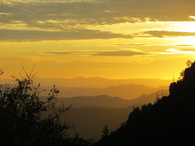
Cold December light spilling into the valley.
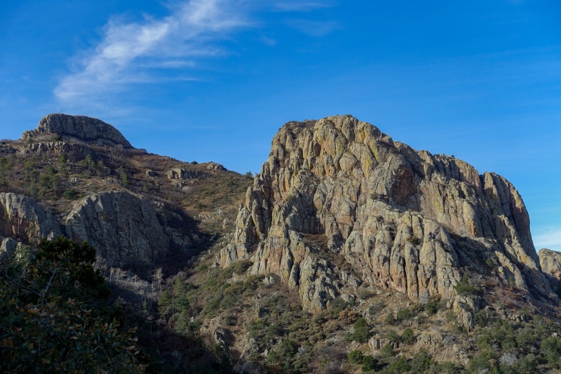
After grinding out a few more hundred feet of elevation gain, I turned the corner and realized that the big rock formation I'd been looking at all morning wasn't the summit. The real summit was a slightly higher, much smaller and less impressive blob of rock.
Laura's rock on the right, Mt. Livermore on the left.
Like in Colorado, the tall one so often seems to have less personality than a nearby shorter sibling.
Laura's rock from the east.
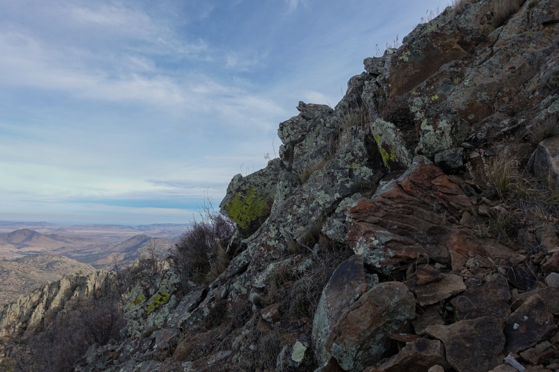
The direct route follows a long steep ramp that traverses as a shelf road underneath some impressive cliff bands.
Shelf road
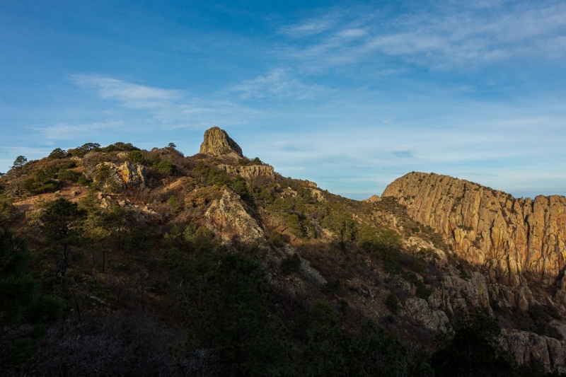
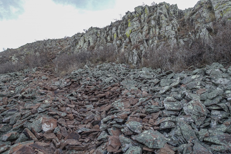
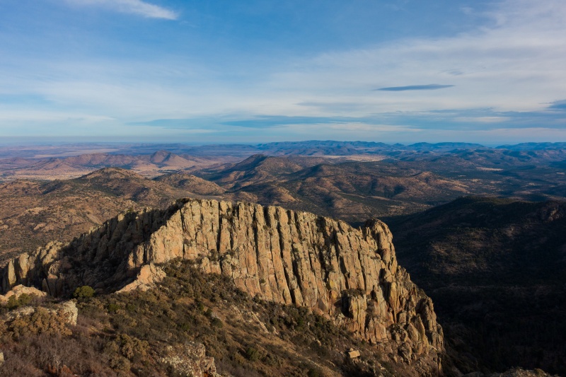
Solid rock for climbing in this range
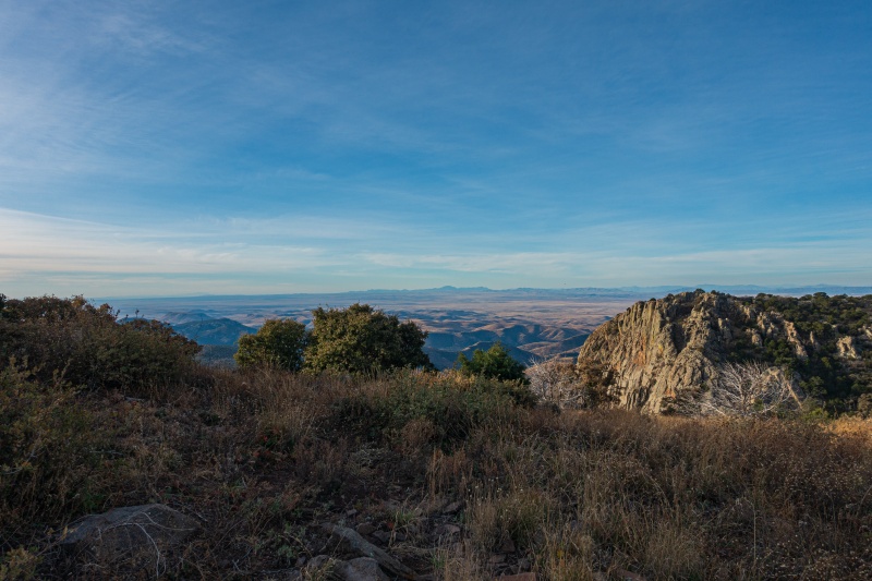
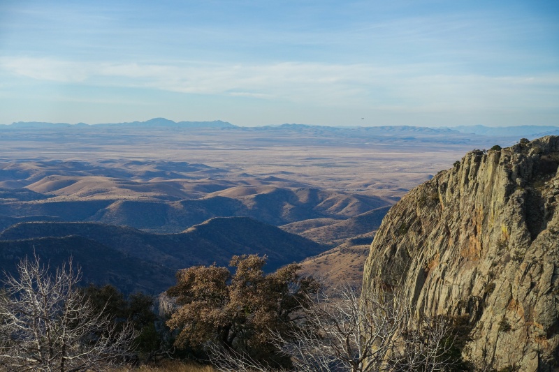
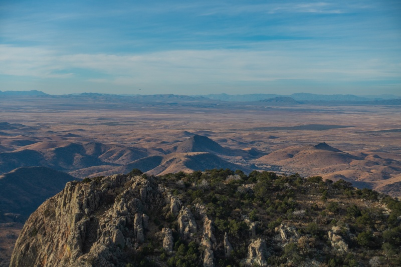
The direct trail converges with the meandering Limpia chute trail near the flat plateau up by the summit block. The views towards the south finally open up to reveal vast flat desert and a few distant peaks which Peakfinder identified as being in Mexico.
The Chihuahuan desert.
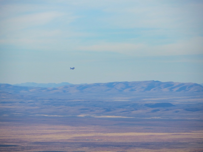
There was a UFO hovering over the desert.
A blimp sitting over either a resource extraction point or an extra-terrestrial research facility.
Forests thins out and desert scrub returns as you crest the 8000' mark.
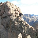
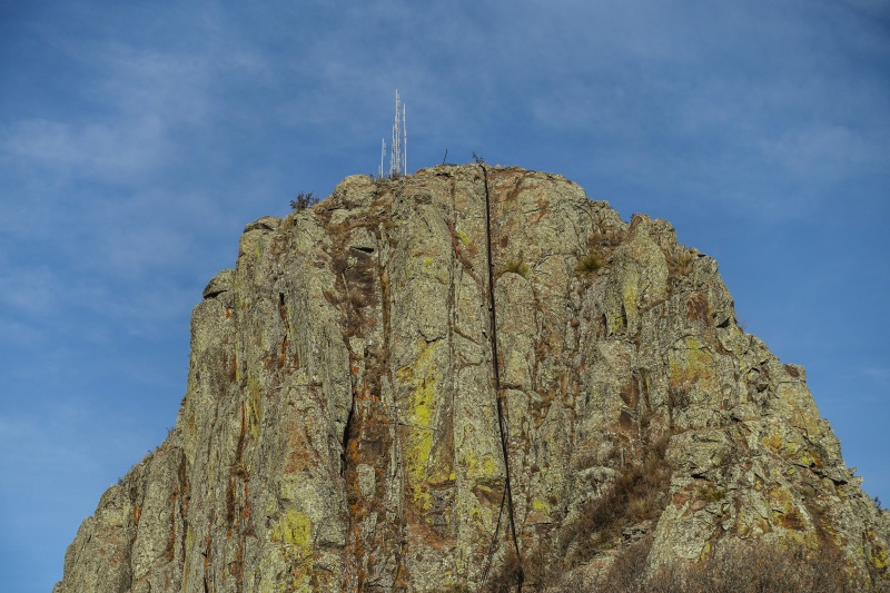
Summit block of Mt. Livermore
The trail reaches the summit block on it's east side and passes to the north of it before traversing across the plateau between Livermore and Laura's rock.
Trail traversing along the north side of the summit.
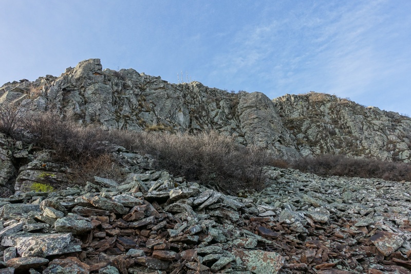
Actual talus like one would find on a real mountain!
The trail ends on the western end of the block, leaving some talus and cliff bands to be scrambled through to reach the top of the block.
Trail through the talus.
Looking back out to the south towards Mexico.
Once through the talus, there's a short scramble on stable rock to reach the summit block.
Easy class 3 scrambling.
The Texan Homestretch.
The view back over to the south and west on the scramble.
Summit views from the summit at 8,378.'
Looking north at Laura's rock. The ribbon of ridge descending towards the scrubby saddle looks like it might go at class 4.
Summit views east.
Looking northeast.
Looking south over the desert.
Looking southwest.
Looking west.
Haze over the desert.
Mescalero mountain, the other 8000'er in this range, at lower left. There are actually four distinct points that reach over the 8000' mark.
Looking northwest towards Sawtooth mountain at far left.
Dropping back off the summit.
I reached the summit at about 9am, about two hours from the trailhead. The distance from TH to summit went at 3.5 miles and around 2000' of gain. I spent half an hour on top enjoying the windy solitude and the desert colors before dropping back off and hauling to my car. I had planned to hike out via the Limpia chute trail to see the locally famous Texan aspen grove but in my haste to get back home in time for the concert I took the direct trail back down. There were only a few other hikers encountered on the descent.
The two big rocks in daylight.
I was back at my car by 11am and returned to the conservation center to sign out. While signing out, the volunteers running the place asked me if I'd seen anything unusual on my hike. I replied that I hadn't but found the way they were asking it to be odd. It turned out to be a segue for the preserve managers to tell me their stories of seeing coyotes bringing their hauls over Bridge gap and down into the reserve. I thought I understood what we were talking about and was picturing a nature documentary of predators moving their kills until another volunteer said that a few weeks ago he was up there at the gap when he ran into about a dozen Guatemalans who had just hiked up from the south side of the gap (the side without a trail leading down to the desert). Apparently most of the people who operate the conservancy have encountered migrants passing through the preserve, and apparently most of the migrants enter via Bridge gap. I asked them why after crossing miles of desert migrants would decide to go up and over the mountains as opposed to going around them, and nobody seemed to have a legitimate answer. One of them said they try to avoid roads. Another guy said he thought they were looking for water and the aspens in Limpia creek look bright green from the desert floor and may lure people to them in the hopes of finding water, but there isn't any to be found. At any rate, the volunteers said when they encounter migrants they typically give them water and let them continue on their way. I couldn't tell if this was from an altruistic side or if it was because trying to apprehend them or contact authorities meant a long drive into cell service outside the preserve first. At any rate, I can't imagine crossing that stretch of desert for 4-5 days and then doing an up-and-over climb of a mountain range without water and without a trail on the uphill portion.
Big stretch of desert that migrants cross before climbing up and over the Davis Mountains near their highest point.
The better quality rock here makes me prefer the Davis mountains to the more visually impressive Guadalupes further west, but the limited public access makes peakbagging in the Davis mountains difficult. That said, I'll be back next December to collect the other 8000'er and some of the 7000' peaks.
Thumbnails for uploaded photos (click to open slideshow):
Great trip report, looks like a place to check out. I've been to the national parks out there and seen the classic Davis mtn road photo, such a remote area.
I have a habit of putting out just a chair to mark my camp as occupied since I sleep in my vehicle. Only count on holding a spot at a campground though, not dispersed sites. That didn't stop my neighbor from taking my chair last year at a campground. He thought I left it behind, apologized for taking it, my tag was still on the post. Although I had to go all around the campground to find it and even checked with hosts.
Having a smaller ride allows for more site options and privacy vs the RV set.
At one point in my life, I thought I'd move to Alpine. Livermore's one peak I wanted to try back in my Texas days.
The Davis Mountains look, not surprisingly, like a combo of the Chisos and Guadalupes. As a no-snow hiker, either sounds awfully good to me right now.
Thanks for this!
I've moved from tent to car-sleeping as well and have had worries about saving a dispersed site on crowded holiday weekends, but in those instances, I set up my tent to claim wherever I plan on camping that evening before heading up the hill. I didn't read it in a book, just seems like it makes an obvious statement that someone is sleeping there. That's weird your neighbor moved your chair in a campground while your tag was still posted.
@mtnman,
Yeah, recreational common sense. In short supply with some people who don't get out much.
@Matt,
I haven't explored the towns of Fort Davis, Alpine or Marfa yet but that part of Texas is surprisingly compelling and I've been ignoring it from my home in Lubbock in favor of driving up to the Sangres when I want to get out but keep the drive within seven hours. I'm planning a weekend in February to check out the Chisos before it gets too warm down there, and if the Guadalupes ever get even a quarter-inch of snowfall, I'm dropping everything and driving out there to hike and photograph the range with a Christmas coat on it.
Great photos. It was fogged in when I was there in 2018 so didn't get any views. I plan to go back to bag Mescalero, wasn't comfortable heading off-trail in dense fog on my first trip. From other reports, I wasn't expecting Mescalero to be Class 4, looks like a nice ridge run in your photo. March 2020 is my plan, weather permitting. Thanks for the nice report.
Caution: The information contained in this report may not be accurate and should not be the only resource used in preparation for your climb. Failure to have the necessary experience, physical conditioning, supplies or equipment can result in injury or death. 14ers.com and the author(s) of this report provide no warranties, either express or implied, that the information provided is accurate or reliable. By using the information provided, you agree to indemnify and hold harmless 14ers.com and the report author(s) with respect to any claims and demands against them, including any attorney fees and expenses. Please read the 14ers.com Safety and Disclaimer pages for more information.
Please respect private property: 14ers.com supports the rights of private landowners to determine how and by whom their land will be used. In Colorado, it is your responsibility to determine if land is private and to obtain the appropriate permission before entering the property.


")
")
")
")
")
")
")
")
")
")
")
")
")
")
")
")
")
")
")
")
")
")
")
")
")
")
")
")
")
")
")
")
")
")
")
")
")
")
")
")
")
")
")
")
")
")
")
")
")
")