| Report Type | Full |
| Peak(s) |
Mt. Wilson - 14,256 feet |
| Date Posted | 12/05/2019 |
| Modified | 12/06/2019 |
| Date Climbed | 08/29/2019 |
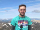
| Author | DeTour |
| Additional Members | CharmingCatastrophe |
| Settling a score on the Traverse |
|---|
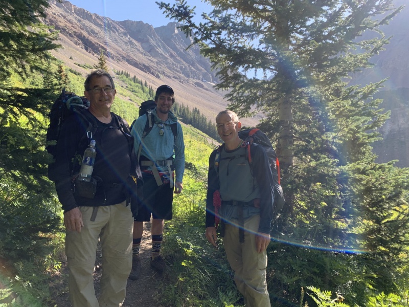
 In 2008, with a grand total experience of one 14er summit, I helped hatch a plan for a peak-bagging trip to the San Juans. Things started splendidly, with fun and successful summits of Uncompahgre, Wetterhorn and Sneffels. On the final climbing day of the trip, my brother Mark and I summitted El Diente and started on the traverse to Mt. Wilson, feeling pretty darn good about what we had accomplished as newbies from the Midwest. Then things went bad, real bad, real fast. Details are in my trip report, but the short version is: we were unprepared for the exposure and stress of crossing the gendarmes, realized we needed to turn back, and made a bad decision (mine) to try to descend a gully that looked like it went right down into Kilpacker Basin. Of course it didn’t – it cliffed out, as does almost everything on the south side of that ridge. We ended up wandering lost for hours on steep, loose, dangerous terrain, unable to find a route down, exhausted, out of water, brains addled from too long at altitude and too much sun, and more than a little panicked. We finally made it down, but the experience left a scar. After some consideration we decided the next year to continue climbing 14ers, and regained the joy of climbing with some valuable lessons learned, chief of which was some much-needed humility. For years I thought I would never want to return to the scene of that experience, but in recent years my attitude began to shift. The desire to go back and “do it right” took root. It was an inspiring, and somewhat frightening, matter to contemplate. I tried not to make it personal, but deep down I knew it was something of a grudge match. Unfinished business, not with the pile of rocks that constitutes those mountains, but with myself, after making such a mess of things the first time. The endeavor had red flags all over it. I was 11 years older, now past age 60, and definitely a step slower than in past years. I had to realize that my stubbornness to win this fight could lead into new bad decisions. My daughter Maryjane knew how much I now wanted to take on this challenge. She and my and son-in-law, Dennis, signed on to the idea. My older brother Mark would finally retire from climbing 14ers on this trip, but he accompanied us to camp. We generally choose to tackle summits from a backcountry camp rather than in a long day trip. That was especially true for this climb. With help from an informative account by Phil Bergmaier (pbergmaier), we identified what seemed to be the highest reasonable campsite, right at tree line, about four miles in from the trailhead. Phil even graciously shared the spot’s GPS coordinates: 37.8315N, 108.0243W. We left the Kilpacker trailhead on a sunny Wednesday afternoon, Aug. 28. El Diente stands tall right from the trailhead. 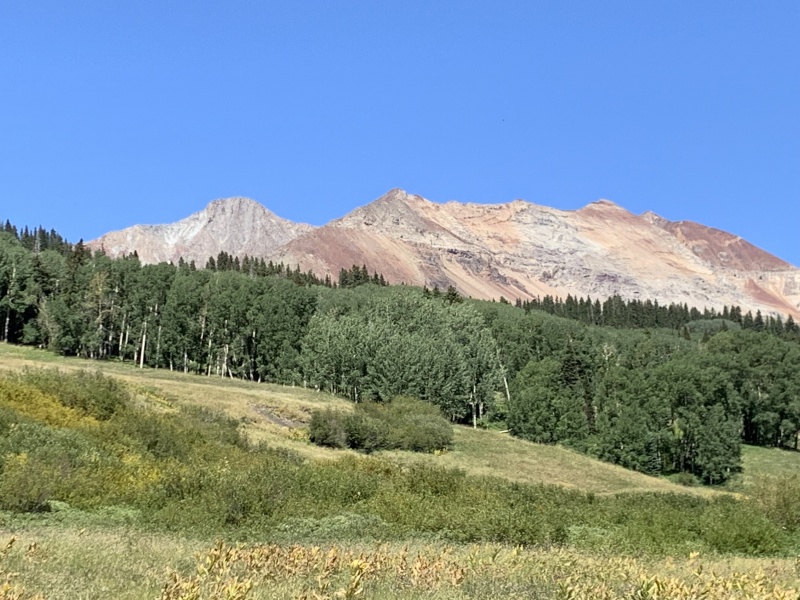
Our group made a lot of progress this year in both lightening our camp packs and learning how to pack properly to make hiking much more enjoyable. Mark, Dennis and I all weighed our packs right in the neighborhood of 35 pounds; Maryjane’s a bit less, but probably a higher percentage of her body weight than ours. Between a somewhat lighter overall weight, better packing, and a far superior Osprey pack that I’d picked up at an REI garage sale a month previously, it was a night-and-day difference for me. Long hikes in to camp had been miserable sufferfests for all of us at one point or another in the past. This year, while we were still feeling it by the end, the majority of the hike was carefree and fun. 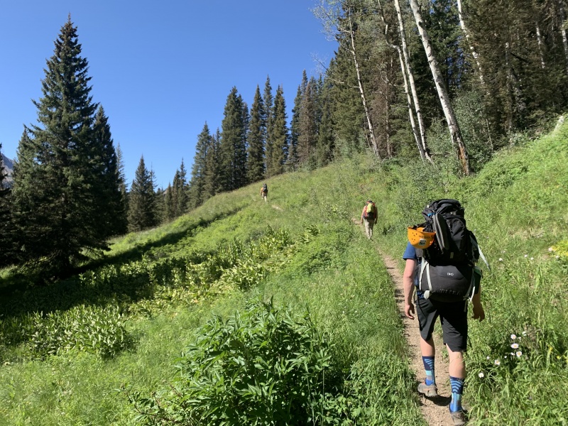
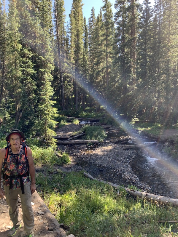
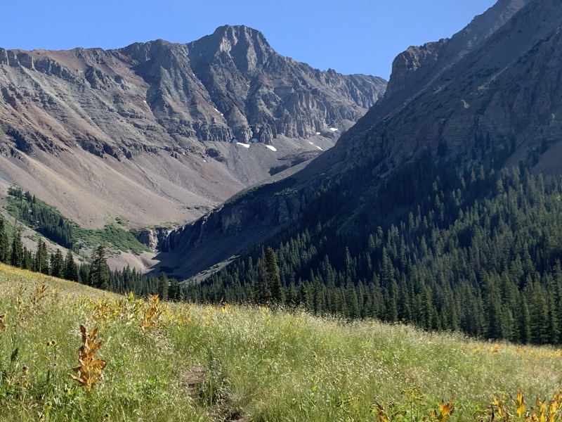
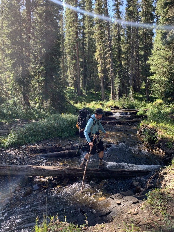
And beautiful, one of the best I’ve experienced. The trail meanders gracefully through alternating forest and small meadows, with abundant wildflowers still in bloom the days we were there. A log crossing of Kilpacker Creek at about 3 miles in leads to a charming meadow with a stunning view of El Diente. As Bill Middlebrook states in his route description, this is a beautiful place and worth the hike, even if you don’t plan on continuing higher. 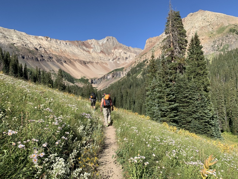
The campsite was excellent, with a fire ring, nice level spots for our three tents, and more spots nearby had we needed them. The only drawback was that there’s no water source nearby. Maps showed the trail crossing a small creek bed shortly before the campsite, but it was dry. A quarter-mile cross-country hike down to Kilpacker Creek resolved that issue and left us well stocked for the next day’s exertions. 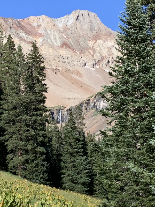
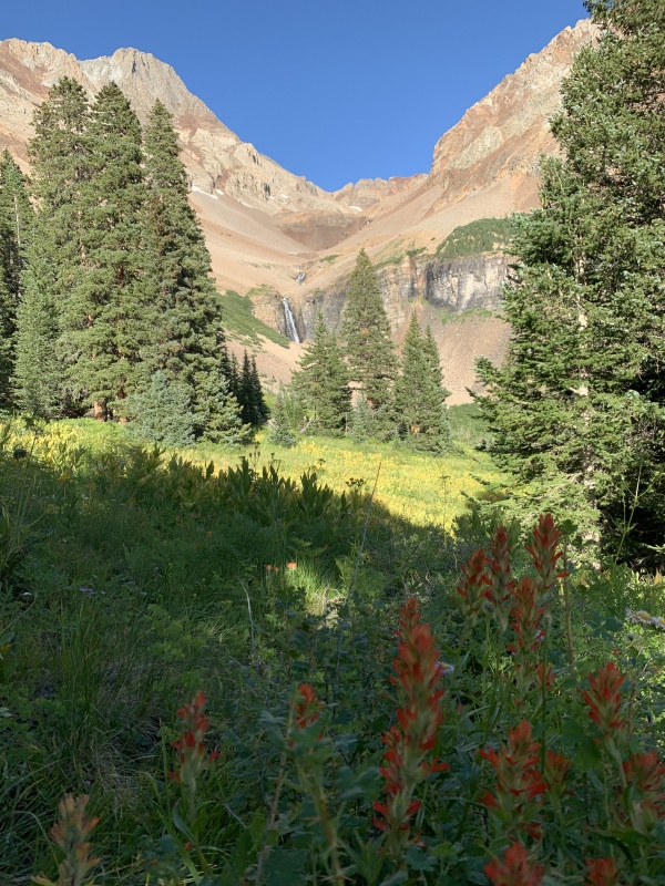
We set alarms for an early start. Though the route is only about five miles round trip from camp, we expected the rigors of the terrain to be time-consuming, and the ridge is an unforgiving place to be if bad weather rolls in. Our forecast was good, but not quite as bluebird as we hoped, with something like a 20% chance of thunderstorms mid-day at higher elevations. We departed camp to follow the trail through a few willows (which were, thankfully, dry) and a final small stand of pine trees near the waterfall. Soon we were clopping our way in the ocean of barren talus that is upper Kilpacker Basin – not that we could see much of it in the dark. About a half-mile in, we lost the trail briefly on a rubbly slope. We cast our headlamps about in various directions for a surprisingly long time, searching for a cairn or trail segment to lead us out of the rubble. Finally we found it off to our right, and moved on. A bit further along, we encountered our first snowfield. It sloped down to our right, and rolled over steeply down into darkness. We had no traction gear for our feet – only our footwear and hiking poles. A slip on that frozen snow would have been disastrous, but it was easily bypassed on a fractured rock formation to climber’s left. Somewhere in this vicinity we were passed by a much faster solo hiker, one of only two other people we would encounter this day. We had seen his headlamp gaining on us from below, and now he would move out in front of us. For something like 1.5 miles we plodded on as darkness gave way to faint morning light. We crossed one snowfield that was level enough to walk without traction, and came to a spot that we recognized as the turnoff to El Diente. Here I picked out a large distinctive rock to stash two Smartwater bottles for the descent. I thought that was a clever strategy, but it proved to be too clever, as it turned out we had sufficient water when we arrived back at that spot later that day on our descent. I had carried that extra three pounds of water weight that far unnecessarily. Regardless, I was glad to be relieved of the weight at that point. 
From the turnoff point, the El Diente trail ascends a talus slope a short distance, then loops to the left between two rock formations before swinging back right. We knew that from the route description (photo 2), but you wouldn’t know from standing there, because the area between the two rock formations was nothing but a large snowfield. Ahead, above the rock outcropping, we saw the guy who had passed us. I called up to him to ask if he was on the trail, which he confirmed. We followed, going essentially straight up the slope, through the rocks. It went nicely, nothing challenging about the terrain. Above the rocks, we picked the trail back up. Not far above that we would encounter the most challenging snow field of the ascent, at around 13,200’. As we approached, Maryjane made it known that she was fighting extreme drowsiness. She has had some troubles with nausea when hiking by headlamp in some recent hikes, and she had taken someone’s suggestion of a children’s does of Dramamine. She didn’t think that dose would make her drowsy, but here she was, practically falling asleep as she hiked. We decided it would be a good idea to pop a Five Hour Energy to counteract the Dramamine. The results would be dramatic. 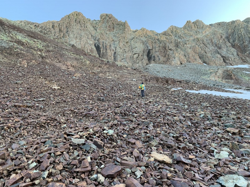
The snow field at first looked like it might be walkable, but it turned out to be steep and frozen enough that a slip would likely result in an uncontrolled slide into rocks below. After a brief test by Dennis, we concluded a backtrack would be required. Upon hearing this news, my Five Hour Energized daughter launched into a mini-rant about backtracking, punctuated by a few choice expletives about being unprepared. Dennis and I exchanged a look that said, “do you know this person?” and started back down the trail. Dear daughter charged ahead of us, still sputtering, and led the way as we worked around the snowfield. It was a pretty short detour. I would guess it added less than a quarter-mile total between backtracking and looping around the snowfield. We would discover a few cairns along that path, which I speculated may have been built this season by previous hikers who had to circumvent the snow. Soon we were above the snowfield, which put us on grey rock in front of water-washed cliffs – photos 5-6-7 in the route description. In front of us the distinctive red rock rib shone brilliantly in emerging sunlight. Beyond that was a glimpse of the grey gully that would lead to the vicinity of the ridge. Maryjane had calmed down and apologized for her rant, and our spirits soared as we put on our helmets. 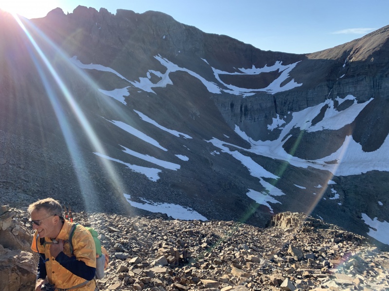
As we entered the gully, a young man approached us from behind, the only other hiker we would see this day. He was clearly fit, nimble, lightly outfitted and moving fast. “How ya doooinnnn?” he cheerfully called out, followed by a question: “hey, which way is El Dentay?” There was a brief pause while all three of us wondered if it was a serious question or a joke. I concluded from his body language that he really was asking for information, not knowing the route to the summit. I waved to the left and said “right up that way” or something to that effect. After a few more zealous pleasantries, he quickly darted ahead of us up the gully. The gully is pretty solid and not real long, offering easy class 3 climbing that is a welcome change from the hour of talus slog that preceded it. As we neared the base of the Organ Pipes, Maryjane looked up and saw our new friend way up on the ridge, far above the standard route. Clearly this fellow didn’t bother with route research, nor did he seem to need the security of an established route. His laid-back approach seemed to work just fine for him on this day. 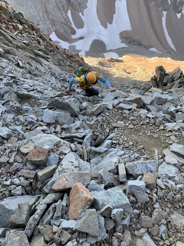
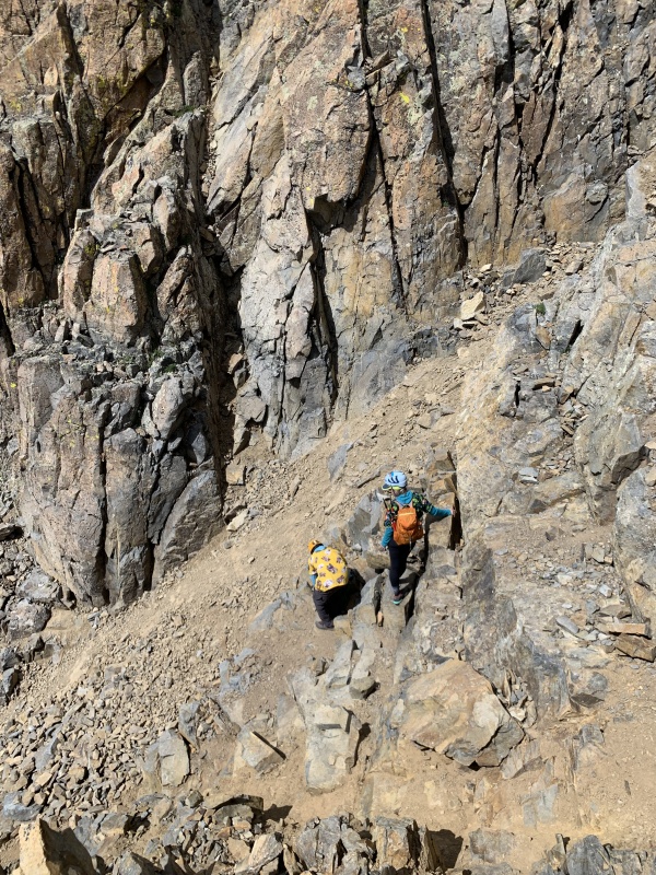
We stuck to the route, traversing left (west) below the Organ Pipes. We climbed through the opening formed by two large vertical slabs forming the “almost chimney” referred to in the route description (photo 15). Here’s a tip if you plan to do this route: immediately after you pass between the two parallel slabs, the trail offers you two choices, one lower and one higher. The two will merge back to one not too far ahead. Take the higher route here. The lower route crosses a steep, loose, nasty gully. It’s only a couple steps, but it’s the kind of thing worth avoiding. We had crossed that gully when we did the route in 2008, and I considered it one of two really dangerous spots on the route. 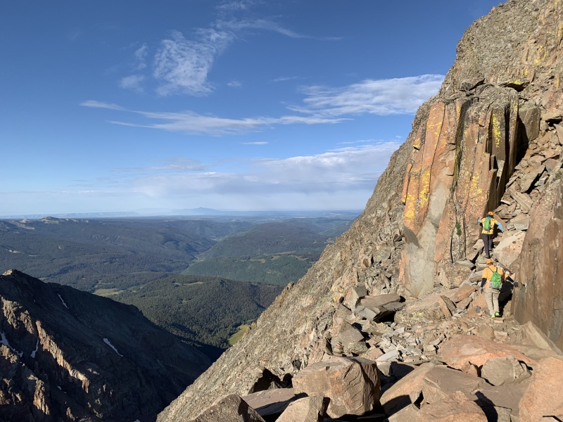
We continued on the traverse and came to the next ascent gully in a surprisingly short time. This one leads to a notch in the ridge to cross over to the north side. Much of it is loose, but Maryjane and I found relatively stable footing through most of it by sticking to climber’s right at first, then crossing over to climber’s left roughly halfway up it. The lower right-hand part offered handholds in the large rock that forms the right side of the gully, adding stability even where the footing was mediocre. 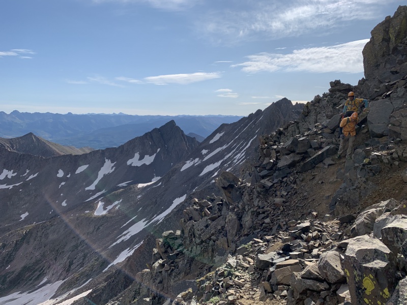
Excitement about nearing the summit started to build in my when we crossed to the north side of the ridge. Not too far ahead we could see a steep rib dropping off the north side of the ridge, and a distinctive notch in that rib. We knew that notch would lead directly to the final summit pitch. An easy class 2 trail led to the notch, with big air to the right as the shattered boulders that comprise this mountain locked together in a remarkably steep slope down toward Navajo Basin. 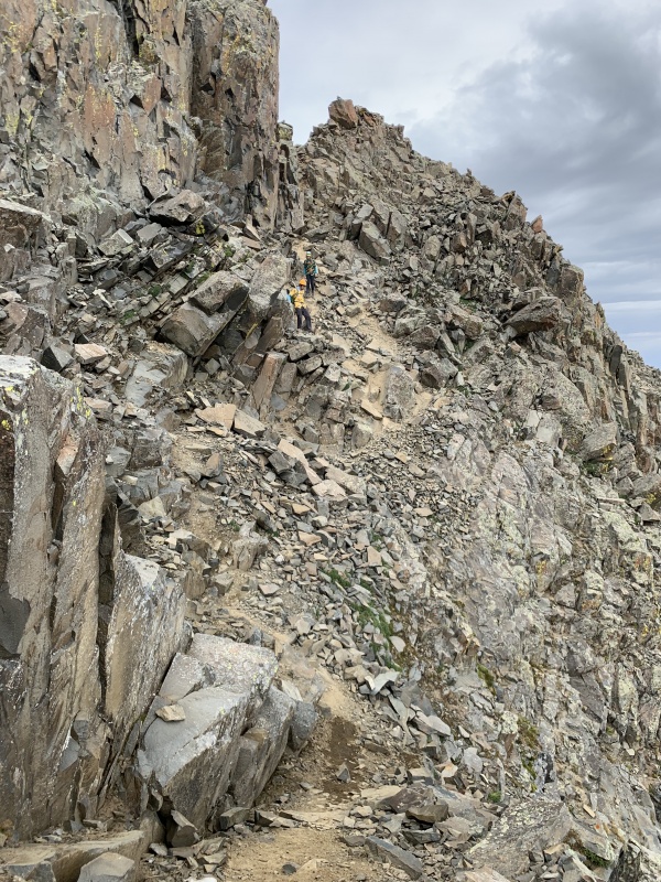
From the notch, the most common approach to the summit (and the one described in the route description) entails ascending (or traversing across) another extremely steep, nasty scree gully. Eleven years ago, my brother and I had found this gully to be notably lacking in any solid footing. We used a small downsloping embedded rock to cross over scary dangerous ball-bearing scree. Further research for this trip had revealed that the mountain offers an alternate ascent route directly up from the notch, to climber’s left of that gully, on solid class 3 rock. It was easy to spot once we were looking for it. Maryjane led the way up a very enjoyable climb. Immediately to our right, the entire slope where that gully lay was one solid snow slab, sloping steeply down to a point where it appeared to pitch over a cliff below us. We emerged at the easterly of three rock pinnacles that adorn the top of El Diente. They are aligned roughly east to west and are so close in elevation that it’s hard to tell which one is highest. Over on the westmost pinnacle, the young man who had passed us greeted us with an ear-to-ear grin. We worked our way over the top of the first two pinnacles, through sharp but short notches between, to the westmost point. That one had an empty summit register holder. Between that and our eyes, we thought maybe that westerly pinnacle was the true summit, a few feet (or who knows, maybe a few inches) higher than the other two. 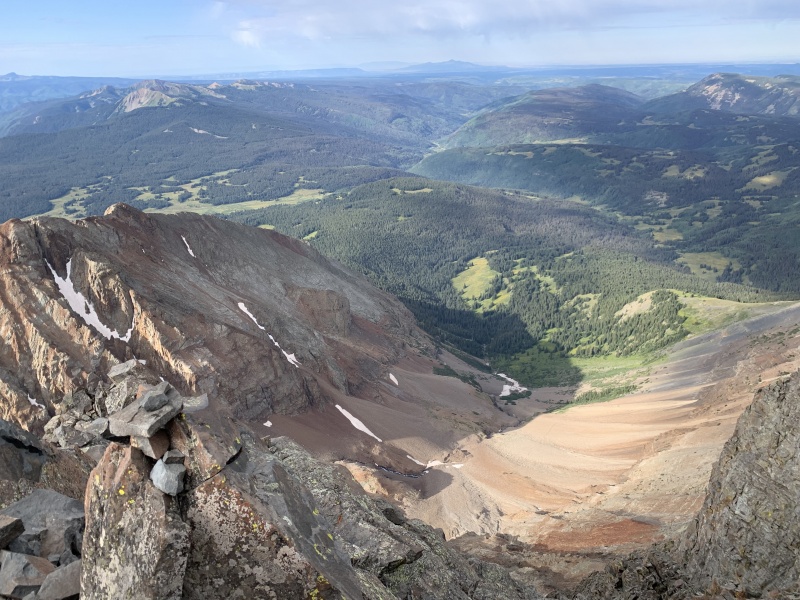
Our friend relinquished the tiny summit to us and headed back. We enjoyed some summit food and rest, and eyeballed the weather as we considered conditions for the traverse. It was a few minutes after 9 am – a full hour later than I had hoped to reach the summit. The weather looked clear in three directions, but to the west were some misty clouds that were clearly dropping some precipitation. We watched them closely during our time on the summit. They appeared to be drifting toward us, but they also seemed to be dissipating a bit, looking less ominous by the time we left the summit than when we first arrived. The precip that fell from them didn’t seem to be reaching the ground. I pointed out that we didn’t need to make a final go or no-go call from the summit. Regardless of whether we were descending or heading across the traverse, we would return the way we came until the top of the grey gully below the organ pipes. We should be able to assess the weather at that point, I said. If we couldn’t see everything from there, not far to the east of that junction lay a notch in the ridge, from which we almost certainly would be able to get a clear view of the entire sky. But first, we had the descent from the El Diente summit. I led the way down from the summit, following what I though was our ascent path. We reached a point where I thought we should be emerging onto the trail. I peered over a rock and sure enough, there was the trail – about 50 feet below me, which a sheer vertical cliff separating us. Oops. We were above the cliff visible at the top of photo 39 above. 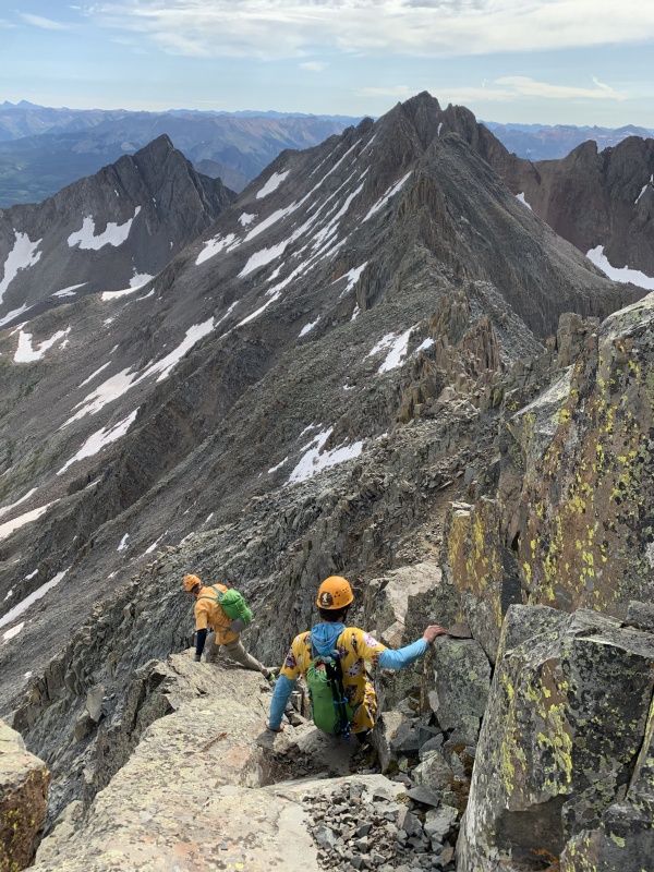
I sheepishly told my companions we had to backtrack. Fortunately it was not far. I had wandered too far right, down terrain that was inviting, until it wasn’t. When we got back to where we belonged, it was embarrassingly obvious. The snowfield was clearly visible immediately left of the correct route. 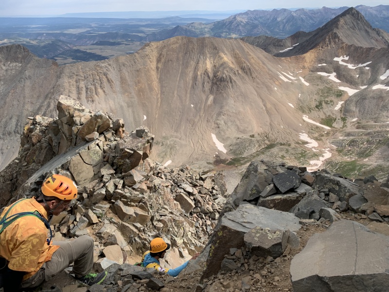
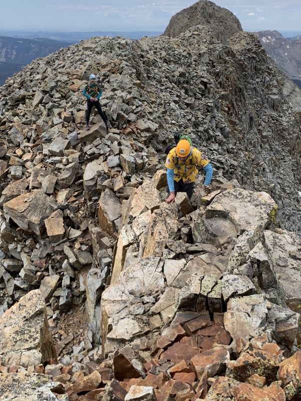
Once back on the trail along the north side of the ridge, I started to make the argument that the weather should be fine to go ahead with the traverse. The traverse was sort of my personal obsession, and I was most aggressive about proceeding. Dennis was cautiously optimistic, Maryjane a bit skeptical. I said (correctly) that the clouds to our west didn’t look anything like well-defined building thunderstorms, but rather a light, misty layer dropping a minimal amount of precip. “It didn’t even look like it was reaching the ground,” I stated authoritatively. “Okay fine,” said Maryjane, “but … it’s snowing right now.” I looked around. Sure enough, a few pebbles of light graupel were bouncing around us. It would be the only precip we saw that day. By the time we reached the vicinity of the organ pipes, we all agreed that whatever threat there had been was gone. We would enjoy clear skies all the way to the summit of Mt. Wilson. We headed east on the traverse route. The first section entails crossing loose, stacked grey slabs, route description photos 8 and 9. Ever since our 2008 venture, I had thought of this stretch as an easy, incidental part of the route, but this trip showed just how treacherous those slabs were. Dennis and Maryjane were ahead of me, around a corner, when I heard the bone-chilling roar of a rockslide. I couldn’t see either of them, but knew Dennis was in the lead. For a few seconds I didn’t know if he might be in the midst of that slide. I took a couple quick steps and was relieved to see them both safe. Maryjane was standing with her back to me and Dennis was retreating toward her, facing me. His eyes and mouth were open wide with a classic “holy sh!t” expression, even as the boulders continued to crash down the slope behind him. Dennis would relate how he had tested a large flat slab with one foot and though it to be stable – “no different than every other rock we’re walking on.” But when he put his full weight on it, it shifted, and the slope gave way beneath him. He was able to leap off the slab even as it slid away beneath him, back onto stable rock behind him. It was the end of that leap that I saw, and the unforgettable expression that accompanied it. We would take only a brief break following that before heading on, with elevated caution, even though we thought we were being cautious before that. The scare, and the fact that we still had to cross quite a bit of the same type of terrain, took the biggest toll on Maryjane. She kept hissing how much she hated this stuff as we gingerly worked our way across an extended section of it. 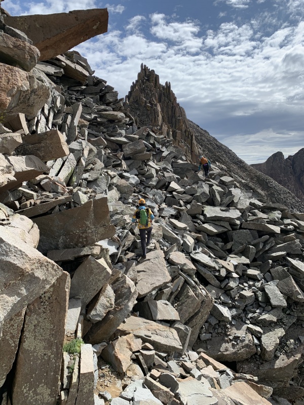
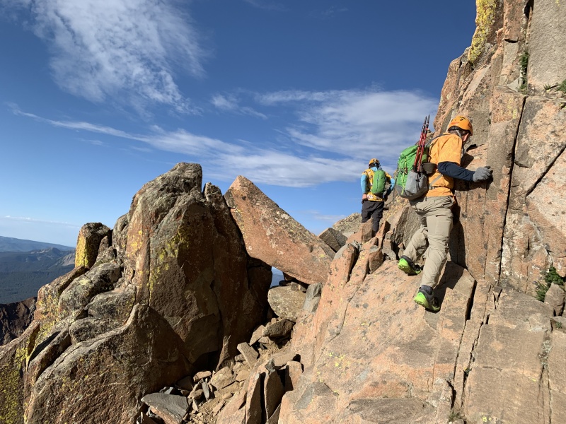
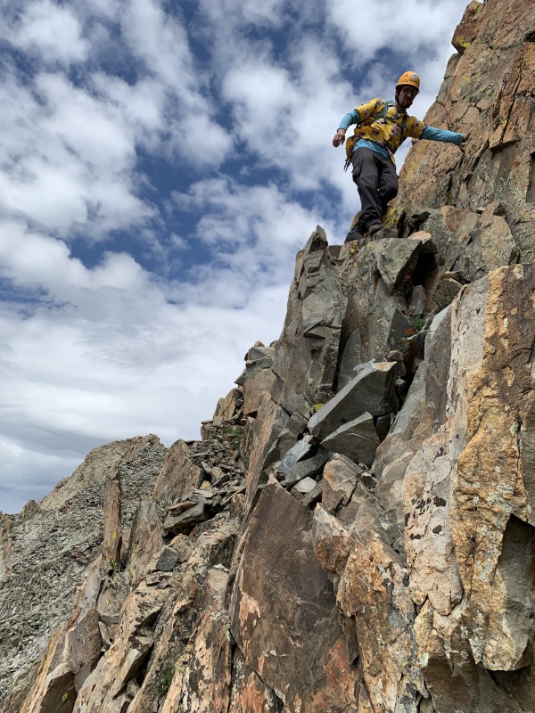
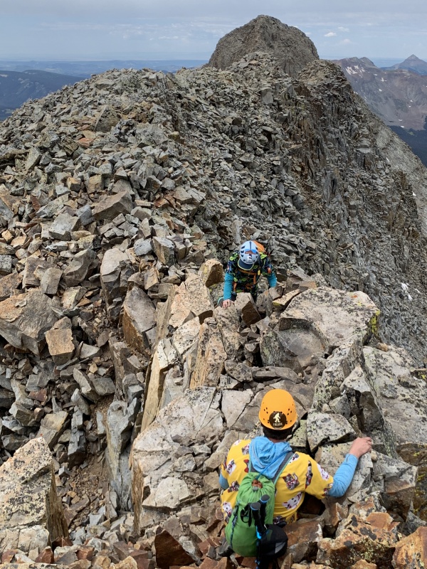
The loose grey slabs would persist until we reached the next daunting challenge of the route: the vertical slabs known as the gendarmes. These rocks are stable, but working around them requires some awkward and exposed moves. Mark and I had taken the highest of the “standard” options for the traverse 11 years ago, essentially the path shown in photos 11-14 of the route description. We had made it across, but the difficulties had beaten us pretty bad mentally by the time we reached the other side. I had told Maryjane and Dennis that I didn’t think it would be a good idea to take that higher route this time. As we approached the gendarmes we could see the cairn marking the higher route. The other options didn’t look very good. We knew from research that there were other, lower, options; but we couldn’t see any cairns. Worse, descending that loose grey rock looked like a bad idea. It appeared steeper and looser as you went down from our vantage point, with no apparent stable route down. 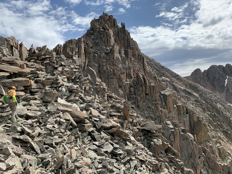
At this point I began to internally question the wisdom of persisting in the traverse. I thought about asking the other two if we should just forget about the traverse and head down. I was pretty certain if I raised the matter, they would probably agree to call it off, especially Maryjane, still shaken from witnessing Dennis’s close call. Ultimately I kept my thoughts about calling it off to myself. As we neared, a reasonable line became visible to descend on the stable slabs of the gendarmes, down to a point where it turned a corner out of our line of vision. “Let’s get to that point and find out what we can see from there,” I suggested. We worked down to it, finding a short, spicy downclimb to continue along stable slabs that formed a narrow ledge leading left, around another corner. We worked our way down to that point and found another similar downclimb-ledge-corner. We repeated this sequence several times, I don’t recall exactly how many. There were no cairns. Each time we turned a corner I worried that our ledges would cliff out, leaving us with a difficult and potentially dangerous retreat. 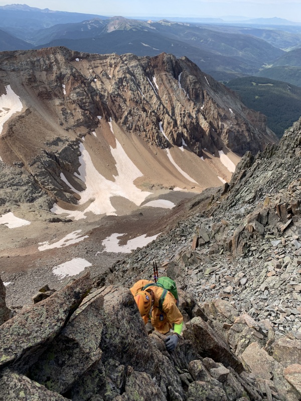
After several such downclimb-ledge-corner sequences, we reached a point where there was a break in the ledge ahead. A very long step over air might be do-able to reach more ledge across the gap, but with 20-30’ of drop below and a lack of good handholds to assist in the step, it didn’t look like anything I was willing to do. At this point Dennis stepped forward from behind me and pointed out a line that ascended to our left up a rib. He headed up it and, after reaching the rib, called back that he saw a cairn ahead and a clear path to reach it. 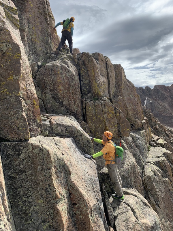
That was a turning point. A palpable sense of relief came over me, especially when I reached the rib and saw what Dennis had spotted. A few more careful, exposed moves would be required from here, but the worst was over. We were on an established line. Soon the vertical rocks to our left gave way to a slope, and cairns began to point the way up toward the ridge. After we ascended some distance, our route merged with the higher route across the gendarmes. We were back on the standard route. 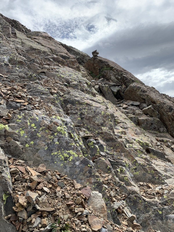
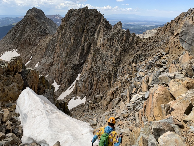
Around the place where the high route merged with our path, we rounded a rib and saw the massive slope of convoluted debris shown in photo 15 of the route description. If you haven’t seen it, I couldn’t begin to describe how intimidating it is in person. That view had utterly overwhelmed me 11 years ago. It seemed like the entire world was just one chaotic slope of deadly debris. Any human foolish enough to venture into it would quickly be swallowed by a massive rockslide, his body pummeled and buried, never to be found. Fortunately – I hadn’t realized this in 2008 – there was no need to venture onto that slope. Just look left, above, to see cairns marking a relatively easy, stable path toward the ridge. There was still some loose debris requiring care, but the angle relented, and others had established the way. Soon we emerged with great satisfaction and excitement back onto the ridge, on the rise known to some as West Wilson. I wanted to take a short rest and enjoy the relief. I picked a large, comfy looking slab and was about to sit down, until I peered beyond it over the north side of the ridge. The drop was vertical, and the slab I had picked looked cantilevered out over it. Beneath my chosen resting point were several hundred feet of air. I decided to pick a different spot to rest. We didn’t rest long, because the opportunity for quick, easy progress lay before us. The run along that ridge is pretty much the easiest stretch of the traverse. Large, stable boulders, many of them slabs laying flat, paved the way. Gentle inclines led up to several humps of about equal elevation, with minimal dips between. It was hard to tell which of the high points was highest, i.e. the “summit” of “West Wilson.” I eventually decided that I thought the easternmost point of that stretch was the highest, a conclusion supported (in my mind anyway) by a cairn there. Immediately before that easternmost point lies the only climbing challenge of that stretch, several vertically oriented slabs with big air on the left and a nasty, steep rubble slope dropping off to the right (route description photo 19). I found this spot fascinating because it looked to me like the massive forces that created the ridge eons ago sought to rip a gash in it right there. Those slabs looked like they should have tumbled 500+ feet down to join millions of similar boulders in Navajo Basin; but for whatever geologic reason, they stood their ground. I decided to name them The Marching Band, because, like the band in Don McLean’s classic “American Pie,” they refused to yield. 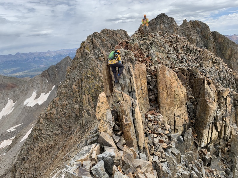
From the easterly high point of West Wilson, we observed the next challenge. A deep gash in the ridge drops down to a saddle, with a steep climb of maybe 150’ on the other side. More than one trip report assesses this climb as the crux of the traverse. We studied the line and discussed it from our high vantage point, then dropped down to the saddle, no easy task in itself. 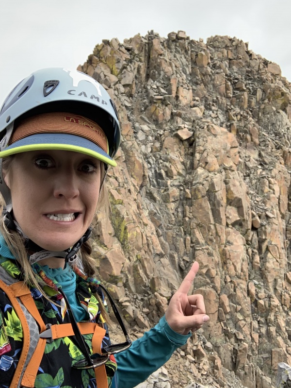
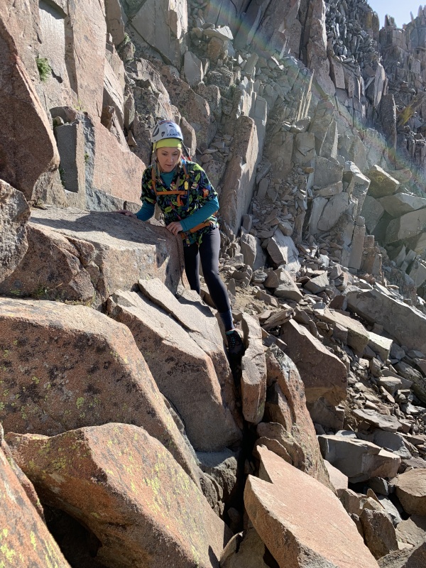
At the saddle we took the briefest of breaks to prep for the challenge ahead. As I tightened shoelaces and checked my pack I reveled in the intensity of the moment. It was past 12:30 pm, way later than we had planned, but a scan of the skies showed that the weather remained ideal. It was a foregone conclusion that Dennis would lead this stretch. He and Maryjane have honed their skills at the gym and more than a few sport climbing routes, with Dennis leading 5.11-something routes and Maryjane not far behind. They decided I should follow Dennis, with Maryjane in the rear. Clearly they were looking out for the old man in putting me in the middle, a decision I was glad to follow. We climbed almost the entire pitch in the distinct gully that sweeps down it, angling to climber’s right at the bottom. The greyish rock in the gully contrasts with the mostly-reddish rock on both sides. The steep slope relents slightly about halfway up for a short stretch, and the upper section is steeper yet, split by a deep, distinctive vertical crack. We would climb up the right side of the gully for the entire lower section and about halfway up that crack. At that point we followed Dennis’s lead in crossing over the crack and angling left in front of a large reddish slab with a splash of yellow lichen. From there we wound around the left side of the ridge briefly before emerging at the crest of the ridge. 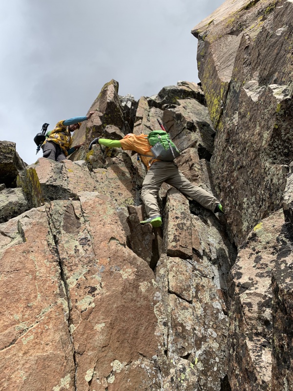
The entire climb was pure joy, the purest essence of why I love climbing 14ers. It was definitely at the high end of my ability, but at no point did I feel at my limit. It was all solid and there were always good handholds and foot placements, although some required long reaches and committing moves. It seemed to me to be perfectly safe for all of us. 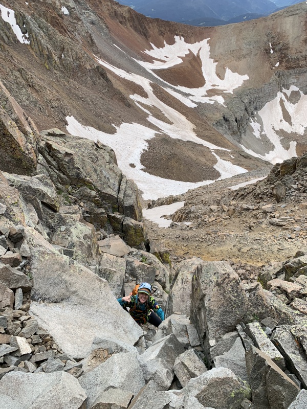
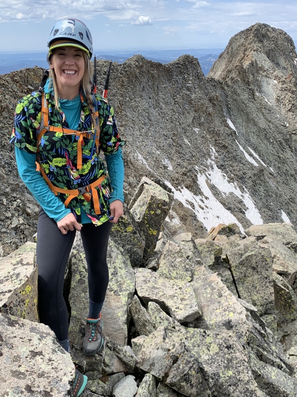
After another very brief break to enjoy the satisfaction of that ascent, we headed out along the ridge, now with me in front. Most of that ridge is really narrow, with big air on both sides; but again, always solid and with secure holds for hands and feet. As we worked our way along it, an idiosyncrasy of our group emerged which some of us find amusing. We had seen it last year on the knife edge on Capitol: although Dennis is clearly the strongest climber, he doesn’t have much appetite for an exposed ridge. Behind me I heard a pretty steady stream of stress-relief comments like “whew,” “oh boy,” and “okaaayyyy.” At one point – which Maryjane caught on video – he asked, almost pleading, “is this going to let up soon?” My unthinking reply is a cheerful “Nope!” This ridge section, including the climb up from the saddle to reach it, is the highlight of the traverse in my opinion. According to the topo map, we were above 14,120’. The spectacular view of the ridge in both directions from here, and the steep drop on both sides from the narrow crest of the ridge, gave me a commanding feeling superior to most of my summit experiences. It’s higher and more pronounced than the preceding section of ridge named West Wilson. It seems to me this spot needs a name. Given that it’s between West Wilson and Mt. Wilson, I decided it should be called Midwest Wilson. The name appealed to me, a guy from Michigan living in Illinois. 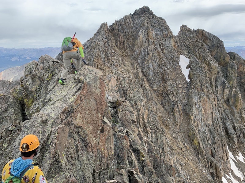
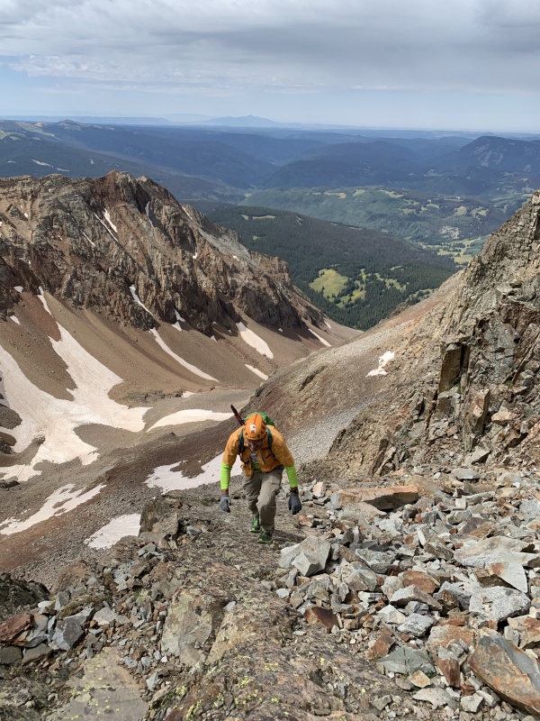
The ridge never does widen out, but eventually you reach the east end of it where it descends to an unremarkable section of talus trail. From here the summit of Mt. Wilson loomed thrillingly close. We traversed quickly along the talus and started up the final gully leading to the summit ridge. Some have described this gully as difficult due to loose rubble, but as is so often the case, we found solid footing along the edge of the gully, climber’s right in this case. Shortly before the notch, we spotted what looked like a nice line up to the right of the gully. Dennis scrambled up it and confirmed both its ease and that it did indeed lead directly to the summit ridge. From this vantage point he could see that if one remained in the gully up to its saddle, you could follow a walkable trail below the crest of the summit ridge to the east. But we were fine with the line we found – it was shorter and sportier, but not difficult. The summit ridge is short and very sweet. (Phil Bergmaier’s TR has a nine-minute GoPro video that’s pretty much the entire ridge section.) It was as airy as advertised, with steep drops always looming on one side or the other. It was pretty straightforward class 3 climbing, solid, ample holds, nothing too difficult. That is, until we got to that section – the notorious exposed crux rock in photo 33 of the route description. Dennis, in the lead again, paused for only the briefest of moments to assess it. He reached up on top of it with both arms, found holds he liked, and smoothly powered up it. Maryjane was next. She asked Dennis “how was it?” “Kinda scary but really not bad,” he said. She shrugged and basically repeated Dennis’s move. But even as she was still in the process of finishing the move, she said down to me, “I don’t like it. Go the other way Dad.” I had decided many months ago that if I ever got this close, I wasn’t going to worry about ringing up extra style points getting to the summit. I took Maryjane’s advice and worked around the supposedly “easier” route to the left. It was no piece of cake. I don’t remember exactly what it required, but I recall reaching up well over my head on near-vertical rock at some kind of shallow, broken weakness in that final 8’-10’ challenge. I emerged a few steps from the summit, to a joyful greeting from Maryjane and Dennis. 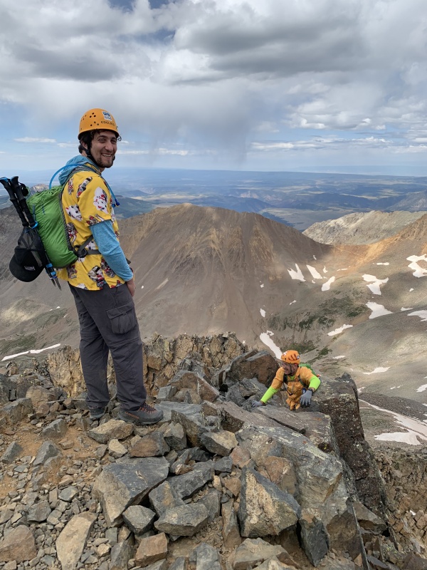
It was a deeply satisfying moment. I made sure to take a minute to admire the ridge, probably the only one of the four “great traverses” that I will ever do, the scene of so much trauma eleven years ago. It had provided all of the beauty and enjoyment that I could have possibly hoped for. The three of us had worked well together to meet every challenge it had thrown at us. 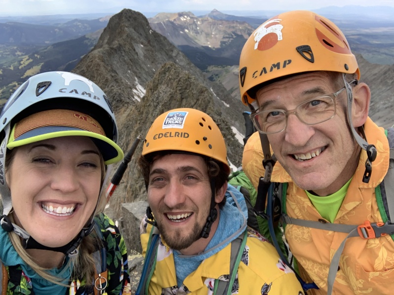
Every challenge to that point, anyway. We still had the descent. And a quick glance to the south revealed a threatening dark-bottomed cloud headed straight toward us. We snapped a couple quick photos and started down, forgoing even a celebratory summit snack. We thought the descent route would be easy to follow, and it was, thanks in no small part to the recent route addition on 14ers.com. The threatening cloud was a loner, and quickly drifted over and east of us with nary a drop or snowflake. Dennis led the way off the summit into the southwest descent gully, following a few cairns, trail segments, and common sense. Our descent route actually dropped into the gully a decent distance below the saddle. There may be other options, but ours went easily and got us down quickly. 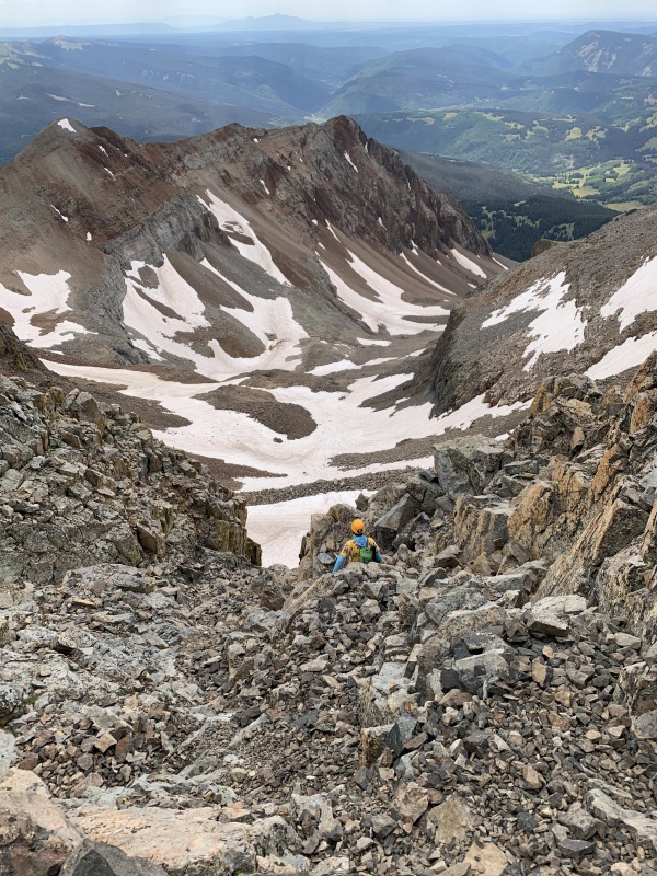
A few hundred feet down the gully you cross a rib to descender’s right to intersect a different gully, dropping from the northwest of Wilson’s summit. The crossover is easy to locate, especially if you take advantage of Bill’s route description. The first gully rolls over into a markedly steeper cliffy section just below the crossover. Dropping from the rib into the northwest gully had a couple spicy spots that I would consider the most difficult of the descent. 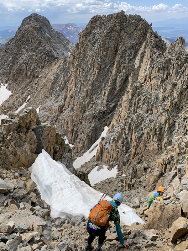
I’m not sure if the snow obscured better route options, but most of the terrain in that northwest gully below the crossover was a loose chossy mess. Below, the snowfields in the basin loomed large. We had trusted that they would be soft enough to negotiate without crampons or ice axes, and they were. Taking no chances, I followed (slightly better at this point) rock down to a point where snow sat a relatively low slope. That probably wasn’t necessary, but it was easy enough to do. Once we descended onto the snow, it was a combination of plodding in soft snow, a little boot-skiing, some soggy slow glissading, and hiking over some islands of rock. It all went, I’d guess maybe a tad faster than hiking on talus would have had the snow been melted. At some point I became concerned about the prospect of someone slipping into some injury like a wrenched knee or torn ligament. I figured if such a thing were to happen, odds were that the “someone” would be the 60+ dad, not the thirtysomething kids. But nothing of the sort happened. 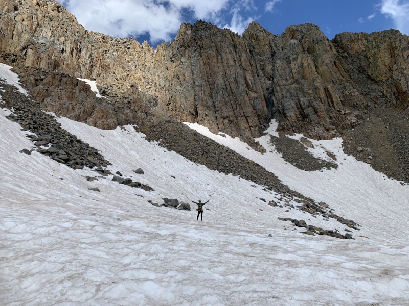
We did encounter one risk I hadn’t thought of in advance. At some point lower in the basin, maybe a bit below 13,000 feet, Maryjane pointed out that she heard water flowing underneath the snow. Was there any risk of breaking through into a stream below? If there was a risk, could that be catastrophic, maybe even deadly? I thought the risk was probably negligible – the water sounded more like a small brook than any heavy flow. But it didn’t seem like any of us had much perspective to judge, other than a few melted footprints showing that others had walked across this section sometime in the fairly recent past. Dennis and I, descending behind Maryjane, opted for a slow glissade of maybe 50’ horizontally over this spot, to reach talus below the snow. From that point down our descent was mostly on talus, interrupted by a few more small snow patches. We reached the junction where we had ascended to El Diente that morning, retrieved our water (which we didn’t need but weren’t going to leave), and settled in to the still-long hike back to camp. By agreement, Dennis went ahead to reassure Mark that all was well. Maryjane stayed back with the slowpoke descender, me. She and I reached camp sometime approaching 6 pm, about 13 hours after we had left that morning – for a 5.5-mile round trip. 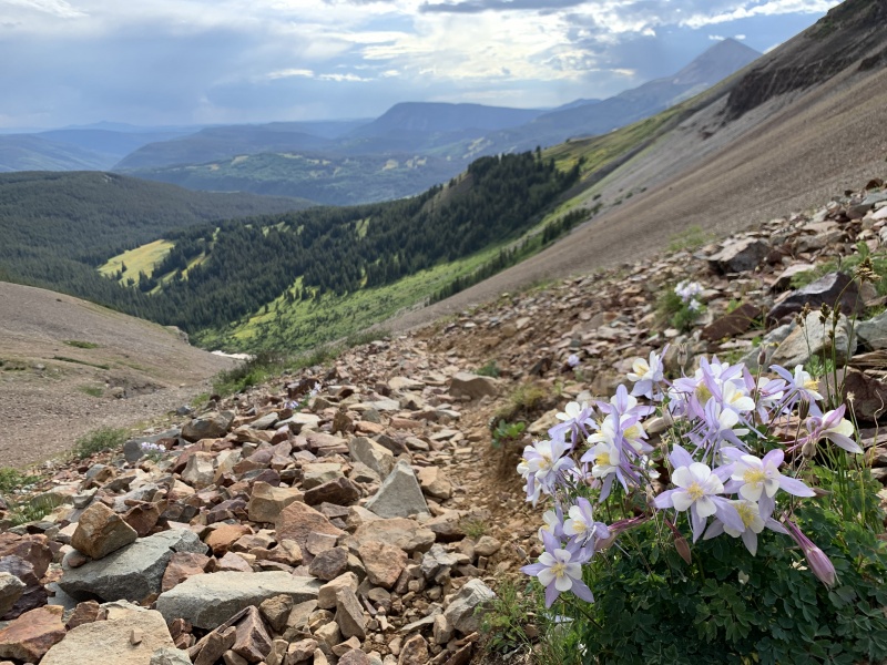
We decided a forced march out that evening was unnecessary, and instead stayed in camp a second night. It made for a nice enjoyable hike out the next day. Reaching the trailhead was a bit bittersweet – joy from a fabulous trip, mixed with a hint of sadness knowing I may never see this wonderful place again. 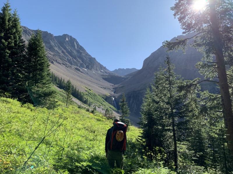
 At 34 summits now (of the list of 58), and age 61, I’m doing the math about finishing. The “list” I’m watching most closely is not total peaks, but the most difficult ones. My big three remaining are Capitol, Little Bear and Maroon Peak (which I personally think looks most daunting of the three). I figure if I can get those in the next few years, I have a decent chance of still plodding up Sawatch walkups well into my 70s if I want to – and that’s probably what it would take to finish. Only problem with that plan is that some of those second-tier peaks are no piece of cake (cough, Wilson Peak, Blanca, Holy Cross). And I really want to experience Massive in some variation of Mania. Oh, and the loft route on Longs – and if you’re that close, you gotta get Meeker too, right? So my ambitions may run smack into a harsh reality check in years ahead. But I know this: I’m not giving up on the idea yet. 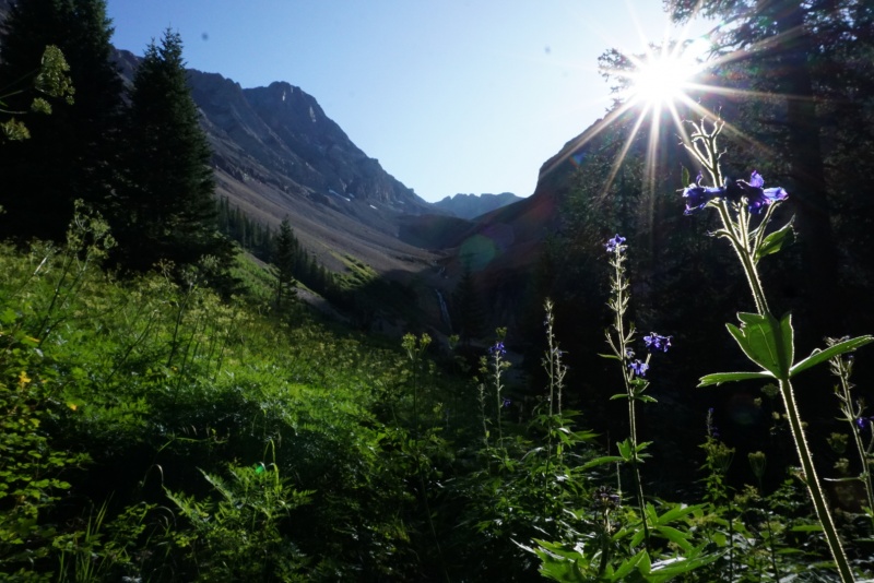 Thumbnails for uploaded photos (click to open slideshow): ")
")
")
")
")
")
")
")
")
")
")
")
")
")
")
")
")
")
")
")
")
")
")
")
")
")
")
")
")
")
")
")
")
")
")
")
")
")
")
")
")
")
")
")
")
")
")
")
")
")
|
| Comments or Questions | ||||||||||||
|---|---|---|---|---|---|---|---|---|---|---|---|---|
|
Caution: The information contained in this report may not be accurate and should not be the only resource used in preparation for your climb. Failure to have the necessary experience, physical conditioning, supplies or equipment can result in injury or death. 14ers.com and the author(s) of this report provide no warranties, either express or implied, that the information provided is accurate or reliable. By using the information provided, you agree to indemnify and hold harmless 14ers.com and the report author(s) with respect to any claims and demands against them, including any attorney fees and expenses. Please read the 14ers.com Safety and Disclaimer pages for more information.
Please respect private property: 14ers.com supports the rights of private landowners to determine how and by whom their land will be used. In Colorado, it is your responsibility to determine if land is private and to obtain the appropriate permission before entering the property.