| Report Type | Full |
| Peak(s) |
"East La Plata" - 14,186 feet "East Crestone" - 14,299 feet "Northwest Lindsey" - 13,988 feet "North Snowmass" - 14,024 feet "Southeast Longs" - 14,067 feet "West Wilson" - 14,101 feet "South Little Bear" - 14,028 feet "South Wilson" - 14,105 feet "Northeast Crestone" - 14,251 feet "Sunlight Spire" - 13,996 feet |
| Date Posted | 02/10/2020 |
| Date Climbed | 09/21/2019 |
| Author | TakeMeToYourSummit |
| The Bonus List |
|---|
|
Getting Started My 14er adventure started in the summer of 2011. After hiking my first peak - I had no idea that I'd eventually go on to summit more & eventually become obsessed enough to finish the list of 74. Near the end of the journey my progress stalled out & I found myself being drawn more to 13ers. I only had 4 peaks remaining & had specific routes & conditions required to summit them in the style I'd wanted. Luckily the heavy snow year allowed for snowboard lines, albeit not full, down Sunshine & Redcloud. This put me into position to next face the crux of this project: the Sunlight Spire. After the business with the Spire was handled, I made the trip down to Handies Peak to finish on its ranked summit. Plenty of info exists on the list of 58. I've decided this trip report should focus on the additional 16; for those inclined to see this list to the end. I will discuss the routes I'd chosen up these peaks & also likely the easiest ways to obtain these summits. The report will start with the easier summits & transition to the harder peaks in roughly the order I'd rank this list (via easiest possible route). West Evans 
At only 8 feet lower than the main Evans summit (so similar views, etc...) - I'm kinda surprised that this sub-summit doesn't have more ascents. Tour De Abyss got into my head in a big way once I learned of its existence. When the route made its way to the top of my shortlist - I stayed with a couple of friends in the Denver area & the 3 of us headed up the Mount Evans road the following morning. The route was overall a blast; especially the East Ridge of Bierstadt. Grabbing West Evans entailed not much more than heading for the ridge once we had found the Sawtooth highpoint. A bit of exposure looking down the north side - but nothing exceeding class 2. This is certainly one of the more fun ways to snag the West Evans summit - but definitely not the easiest. That would likely be via the Mount Spalding route (I did this route a year or two later)... or for the easiest of the easy - from the summit parking area on Evans (if you feel okay about counting that). And for that last bit... West Evans makes the first spot on this list. South Bross 
This sub-summit has less than 100 feet of prominence & joins the ranks of the talus giants like Cameron & Bross. I'm guessing the fact it is even listed is because for a short section on the Alma side of Hoosier Pass it appears to be twin in size to the "real" Bross (same as the old Bross). A friend, my wife, & I nabbed this one as part of a 5 peak day that we dubbed "DeCaLiBro… SoBro" (a clear play on the 4 peak name). Obvious easier ways to obtain this summit would involve cutting out the other peaks - grabbing it by itself or combined with Bross (options abound). South Elbert 
South Elbert (& Cosgriff for that matter) were never on my radar leading into my 4th 14er ever (make that 4 & 5 after how the day played out). Rewind to my second summer hiking 14ers (I'd only done one my first summer) as an inexperienced hiker (relatively) & an unseasoned trailhead locator. My friend & I drove her 4Runner to the TH for the East Ridge route. We arrived at the proper TH & I felt like we hadn't driven close enough (surely that was just the 2WD stopping point!). I knew some of the roads going to THs cross private property - so when we saw the sign we kept going. Eventually the switchbacks tightened and we had to make a few 3 point turns on a couple of the corners. At the end of the road we found ourselves above treeline & at a bit of mining ruins. I explained to her that this wasn't our intended TH but I could make it work! We hiked up the East Face of Cosgriff & connected into the Black Cloud route up South Elbert & eventually Elbert proper. We didn't have any issues with land owners that day... I can't advocate this route though. Likely the easiest way to reach this summit would be from the Black Cloud TH or possibly up and over Elbert via the East Ridge (this route would have a bit of regain to get back up Elbert though). South Massive 
I’m grouping the Massive sub-summits together as that is how I experienced them & they should all roughly sit near this point on this list. I had originally hiked Mount Massive my second season going at them. A group of us hiked up the Southwest Slopes route & had even contemplated adding on South Massive at the end of our day. When it came down to it – we were all feeling a bit tired. This was the 1st 14er for 3 of the guys – so very understandable. I ended up getting all the Massive sub-summits a few years later with a couple of different friends via an Oklahoma to Tour De Massive linkup from the same trailhead. Since that route starts on North Massive (after Oklahoma) I’ll tell the story there. As far as getting this summit by its easiest route – I’d have to say that the Southwest Slopes is the way to go; less mileage and vertical gain. Most of the terrain was 2 or 2+, with the chance to find some 3- if you wanted. Massive Green 
The linking route from North Massive was a little scrambly (2+ or 3), with options to up the difficulty further if wanted. Once at the low point between NM and MG, the remaining terrain up MG is straight forward. It was snowy the day we did it – but that was the only complicating factor. Acquiring this summit from the top of Massive proper using the SW route would be the most expedient option & not exceed class 2. 
North Massive 
This route is a blast. We started up towards Oklahoma as listed in the RD on this site. A bit before we hit the gully (described in the RD), we saw options up some of the ribs & other gullies leading to the ridge. We did have a few small rocks come loose, but nothing to be too concerned about. Fun scrambling ensued. The ridge from Oklahoma to North Massive starts on down-sloping slabs - really fun with the snow we had that day! 

Sticking ridge proper (or near) works for most of the route up until you hit the crux headwall. It is definitely class 4 or low 5. We were not feeling it that day so poked our heads around to the left & found a bypass. Once atop this section of ridge you are greeted with a flatter section before the final push to the NM summit. It could be argued that the most direct route to get this summit would be via an approach from Windsor Lake in the summer. Plenty of other options would also be available – with needs for other sub-summits possibly making Tour De Massive (or the variation we took) make the most sense. 
East La Plata 
La Plata is where my story begins. I had been hanging out on Indy Pass fairly regularly snowskating on a patch of snow near the top that faced La Plata (on the flanks below 13,500 – aka Blarney). The same two friends that I would eventually climb with on the Tour De Abyss (and other routes) - had talked to me about trying a 14er. It was an obvious choice. We were all Colorado mountain boys (I dislike the term “native”)… so let’s do Ellingwood Ridge! In our predawn movements we missed the turn for the TH off the 391 road and ended up walking about a mile and a half too far. Once we saw the private property ending sign – we knew we’d messed up. Okay - nothing like a 3 mile warm up to get going! We decided to try for it anyways. The sun was definitely up by the time we made it back to the turnoff. Instead of taking the ridge head-on as is recommended in the RD; we opted to ascend a random loose gully to the south. To this day, I’m still not sure how we rationalized this. We hit the ridge around 13K and made moves to the Ellingwood Ridge unranked summit – our first thirteener! As we worked toward ELP - the clouds started darkening. Amongst some slabby scrambling the skies opened up with hail. It’s crazy to think how little we’d thought of the forecast (I believe it was a 60% chance!). We all had a talk – time to bail! My friends had taken this route very seriously (in this case it really payed off) & our group carried a rope, gear, & harnesses. Time for me to learn to rappel! It went fairly smooth & I swore I’d retrieve the gear if I ever reattempted the route. The slog through the basin was brutal on our weary bodies. On the short drive back over Indy Pass I had to let people pass me as I was too tired to drive the speed limit & keep my focus. My friends & I spoke a couple of weeks later – we wanted redemption! One of the friends was trying to convince me to try the same route; I needed to get a mark in the win column. We compromised & went for the standard route with the caveat that if any of us wanted to try Ellingwood Ridge in the future that all 3 of us would be invited. We made it to the top with wonderful weather & enjoyed our first 14er summit! 
A few years later & once my mind was made up to pursue the 73 list (before the Spire changed lists on this site) – I hit those friends up. They couldn’t swing it with their schedules but were more than happy to hear that I was going to give it another go. Another friend had been discussing the route with me & we pulled the trigger. No TH snafu and no 60% chance of weather this time! We made our way across the low route and stayed on the described route to the ridge this time. Higher up we spotted out a notch in the ridge. Would we need to drop around? Before we made any moves to do such – we watched a group of 3 or 4 jump across it one at a time! Okay – so it is doable. With some sort of yolo vibe – we too jumped it! A fall would be painful or painless (or you’d hope) but bypassing to the east was definitely an option (I’m guessing that is what we did years prior). 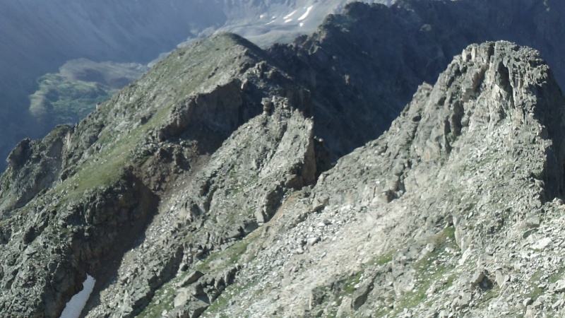
Plenty of ways to enjoy this route. Options on the ridge can often go into the class 4 or 5 rating; with easier options almost always to the east. 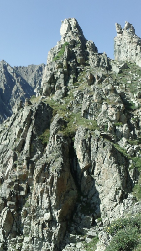
I never could definitively locate the spot that we’d rappelled from on the last trip here – so much of the terrain looks similar. 
Reaching East La Plata’s summit was a special one; the redemption felt so good! 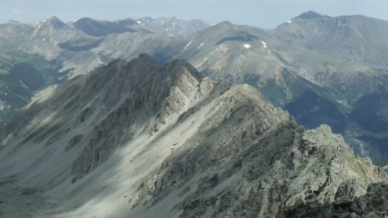
The remaining route to La Plata is a mix of 2+ and 3-. For those seeking out the easiest route: I’d suggest the Southwest Ridge to La Plata’s summit, followed by the ridge run to ELP and back. 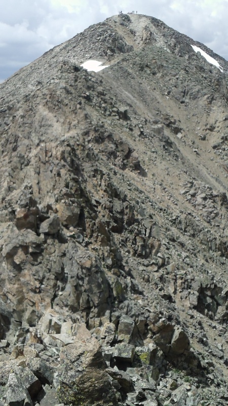
East Crestone 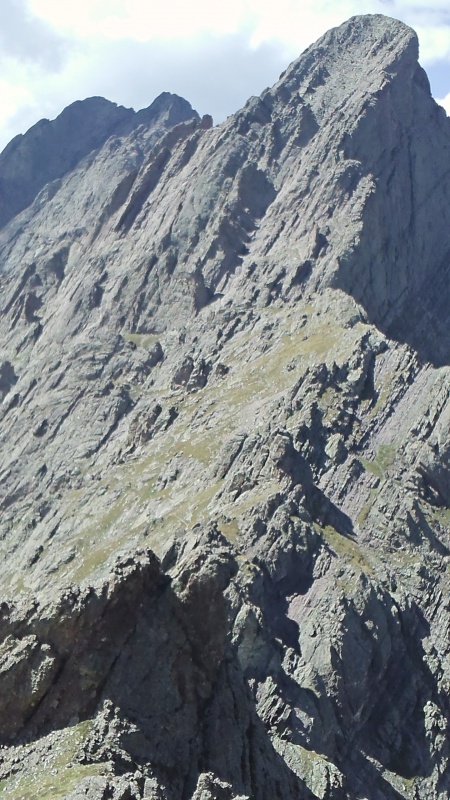
This bonus point has a shared approach with Crestone Peak & is almost certainly easier than the ranked peak. 
Variations can still keep this in the class 3 or harder realm if that is desired. 
The views are quite impressive from the top; as is the exposure. Pick your poison on how to get to the saddle between Crestone Peak & East Crestone. The easiest route to that saddle is possibly the standard route of CP, but I have yet to try the full NW Gully (doubtfully easier, but yes - less vertical gain) or hike any of the Cottonwood Creek approach. Northwest Lindsey My first trip into the Sangres! The same friends that joined me on the Ellingwood Ridge attempt & later the Tour De Abyss joined me for this one. We opted for the Northwest Ridge route with the “crack” variation being our flavor that day. Fun scrambling & an unforgettable trip! 
We returned via the standard route & were left feeling like we should have descended via the ridge. Your preference between the loose rocks of the standard route or the exposure & scrambling of the ridge route would determine your choice on easiest route up as they have almost identical distance & vertical numbers otherwise. The ridge between summits is a mix of class 2 & 3. 
North Snowmass 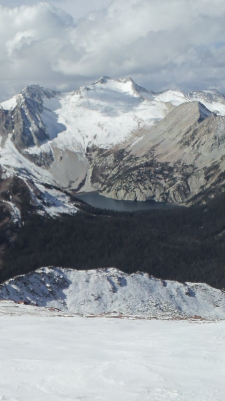
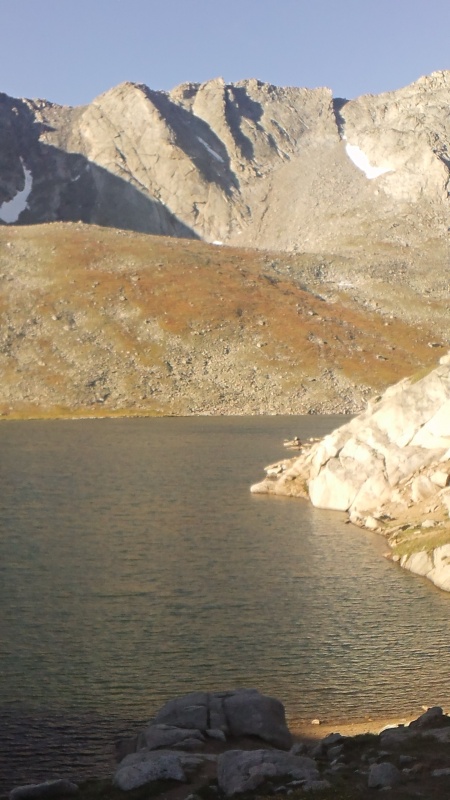
Playing on the snow to get both Snowmass summits was one of my favorite days in the mountains ever. We went up in mid-July on a decently snowy year with a number of friends (8 if I recall correctly). After a night camping at the group sites we headed up before dawn. 
We all stuck fairly close around the lake & eventually did split as we all had different ideas about how to tackle the steeper section above the lake. I ended up being solo as no one else had interest in North Snowmass. I was originally aiming for a snowy notch near the saddle between the peaks. As I worked higher the snow quality deteriorated – time to head for the rocks! 
I popped out on a section of kitty litter and loose blocks (some the size of refrigerators). It was a tense few minutes until I hit the ridge proper. From there I stayed on the ridge or slightly on the west side of things. 
The route stays at class 2 or 3 (from where I had started). Looking down the North Face of North Snowmass is quite impressive (anyone ever dream of climbing this?)! 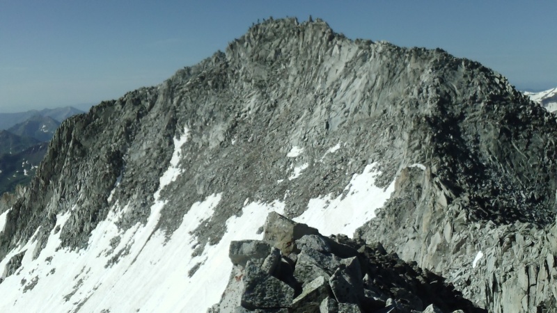
Even the East Ridge of NS is a bit “S-like” in its nature; and would be quite an interesting route! 
For anyone linking this route with Snowmass Mountain (advised) – there is a bit of class 4 at a headwall on the SM side of things. Other than that most the route can be kept at class 2 or 3. 
I was able to descend from Snowmass Mountain via the “Direct Notch” variation – first facing in, then heel plunging, and finally going to full glissade mode (so much fun!). The easiest approach (hiking distance & with a capable vehicle) would be from the Lead King side (options between S Ridge and West Slopes will be determined by preference of scrambling and exposure versus rock quality). The easiest approach (overall scrambling & snow climbing difficulty-wise) would be the standard approach to Snowmass Lake. So the choice really is yours - unless you only have a 2WD… Southeast Longs This duo marked my finish to the Front Range 14ers. Four of us headed out in the early morning toward The Loft route. The fastest in our group topped out on The Loft and made some quick moves to get Mount Meeker. I headed straight for Southeast Longs & was the first to reach its summit that day. The other 3 followed & somewhere on The Loft we met a lone hiker. She joined our group for the remainder of our day. Next we made an effort to locate Clark’s Arrow. We never actually saw the marking – but the cairns did the job just fine. From the Longs Peak summit we headed down the standard route. At the keyhole the group split into 3. One went for MLW, two went for Storm, & one of the ladies and I were tired enough to call it a day on the vertical gain, so we headed down the boulder field. A fun & tiring day in RMNP. The likely easiest way to summit SeL would be an out & back using The Loft route. 
West Wilson 
Even from my first trip up Mount Wilson with a friend & our snowboards – I knew I’d be back for the traverse one day. It was a few years later & with a group of 5 total. We camped at the Kilpacker TH & started out early the next morning. We made it to treeline as the sun rose. The route up the south side of El Diente was a bit loose but then transitioned to some fun scrambling. The route continued to be loose in spots (some of my friends kicked rocks at each other - far from intentionally) and also continued to have some wonderful scrambling. We enjoyed the route – but would probably not repeat it (too many other great peaks to climb!). West Wilson isn’t a very descript summit – I walked the highest points of the ridgeline to insure I hit the summit. We continued on to Mt. Wilson; I got to enjoy the class 4 crux again and then we dropped back into Kilpacker via a short downclimb and several fun glissades. This one would be hard to isolate into an easier (or more logical) route than the traverse. It’s considered a classic in that regard too - so pick your poison; Navajo (options) or Kilpacker and get your scramble on! 
South Wilson Mount Wilson was my 14th 14er & felt rather special as it was the first 14er snowboard descent for a friend & I. That day we had noticed South Wilson & agreed it was a highly shreddable peak as well. I won’t rehash the story on this one too much – it took two tries. I’ve already written about my attempt & success in TRs on this site. Some people will recommend climbing this sub-summit from Kilpacker – up loose, unpleasant dinner plates. I’m not going to recommend that approach. I honestly think the easiest way to acquire this mountain’s highest reaches is using our route. If skiing or snowboarding isn’t your thing – wait until the lower part of the route melts out (easier cruising) & snowclimb directly up our ascent route or descent route. 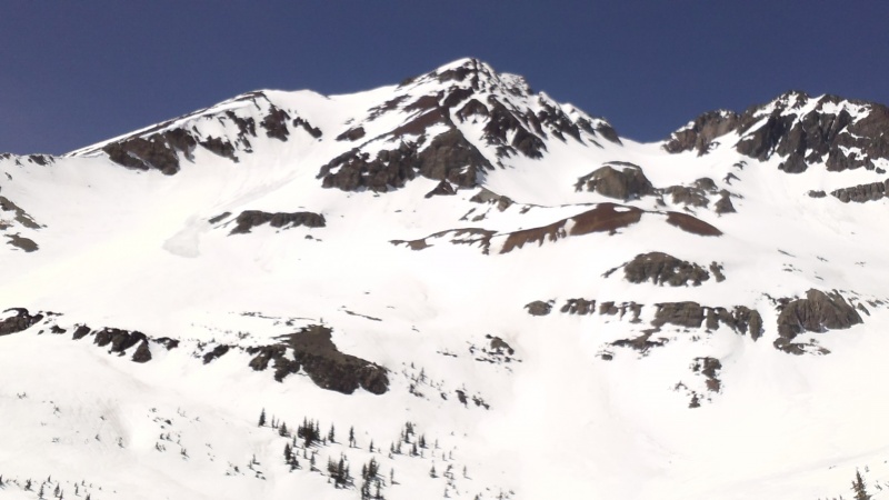
South Little Bear 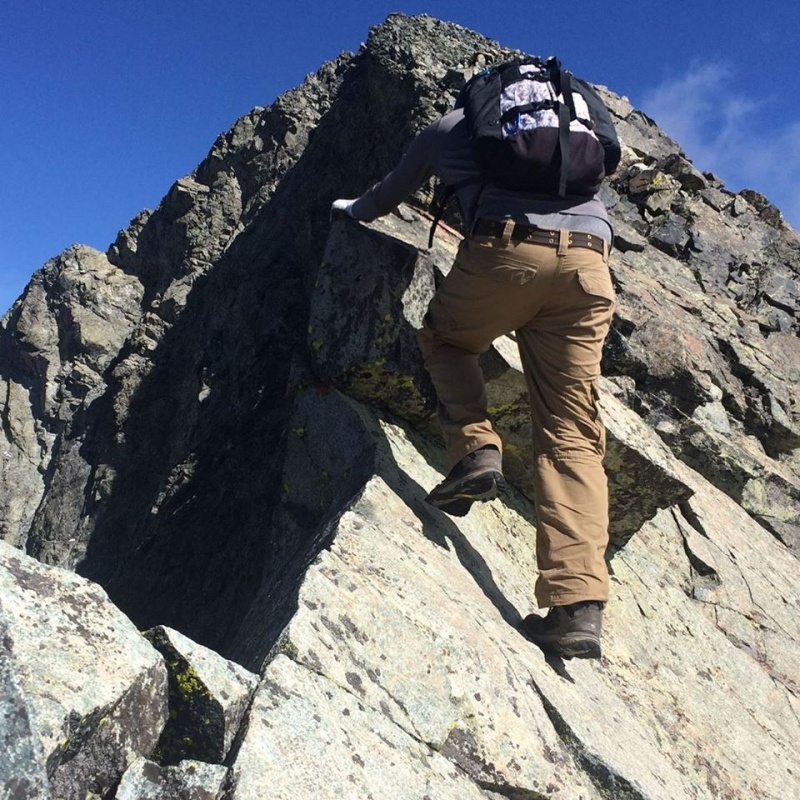
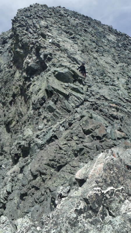
One of the bigger hurdles of this project no doubt! I even consider this route (& the North Ridge of KC) to be more demanding than Capitol’s standard route. There are entire forums debating the topic of the 24th Street TH. Let’s just say growing up skateboarding – I’ve done a lot of trespassing. I understood the risks; angry landowners with guns or possible criminal charges. I won’t endorse starting here (do as I say, not as I did?!). The viable alternative (which I had studied less) is starting up the Lake Como road & splitting off. In any case – the Southwest Ridge is a big route through some rough terrain. We didn’t bring a GPS, but it would have been helpful. We made our way up through the brushy approach & neared treeline as the sun crested the horizon. Lots of tedious rock hopping eventually leads to a narrowing ridge. The real fun starts. Mainly class 3 for a bit – with some interspersed class 4 in the mix. The knife edge on this route is not long but features a step-up of about a foot and a half. After the sub-summit we continued on to the main LB summit as well. The Mama Bear Traverse as it is known – is where the most exposed moves of this route are located. Not 30 seconds after I reminded my partner about “don’t kick any rocks” – she'd kicked a rock at me! I caught it one handed (baseballish sized) & somehow maintained my grip on the mountain. She apologized and we moved on. After enjoying the main summit the return went smooth. Just as tedious as we remembered. We bailed off the ridge at a different point – dipping down toward Tobin Creek. This is not advisable – I didn’t know forests in Colorado could grow this dense! In the fading light we found ourselves downclimbing a few sections to get around the waterfall. A few moments after this we found some flagging! We knew that we getting close now… but it all looked so similar! Using a compass and key land marks (roads mainly) out in the San Luis Valley I managed to navigate the two of us to within 150 feet of my truck as we popped back out on the road. We had started the day by headlamp & now had made it back just minutes before having to get them back out again. We met another friend at the Zapata Falls Campground & sleep came easy. Using this route (or the variation that starts off the Lake Como Road) is almost certainly the easiest way to summit this peak – anything to avoid the hourglass was my feeling on this one. 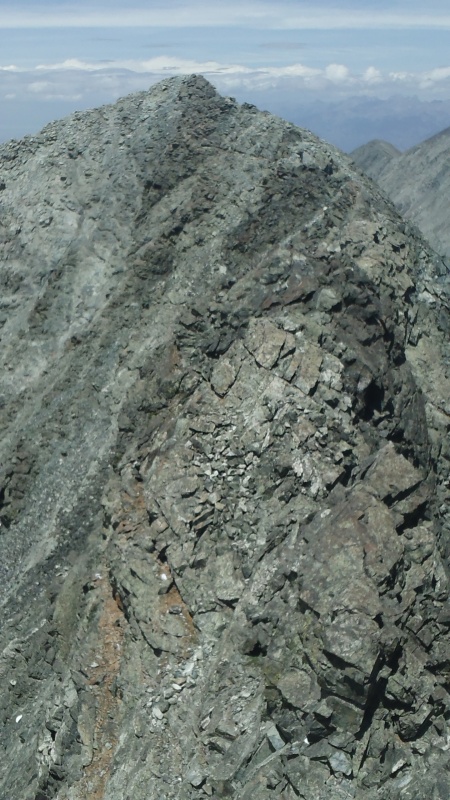
Northeast Crestone 

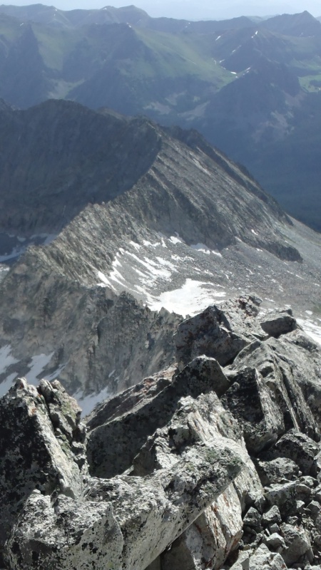
My final four pack of Sangre 14ers (including the sub-summits) all came in one day. The same friend that had joined me on SLB and I teamed up again and made our way from the 4WD TH to the old 4WD TH. We took a camp spot here to insure we’d be easily visible & have room for the other 3 friends that would be joining us later in the day. We headed off to go hike up Broken Hand Peak. Turns out – it has plenty of fun scrambling options and great views. Day 2 was the big one – up and over BHP & onward to the Red Gully (bacon!). Near the top of the gully we lost one friend as he charged ahead. As I reached the saddle I looked up to Northeast Crestone – he was already on top! Of our group of 5 only 3 total were wanting the NE summit. So two of us carefully downclimbed the chimney into the NW Gully. It’s been listed as low 5th & I’d agree with that – at least the holds are solid and not overly exposed. It’d be a different game with ice or snow though. The scramble up NeC is mainly 3rd class but a couple of moves about ½ way up are definitely in the 4 realm. On the way back after summiting I opted to bypass the chimney on the ascenders left. I’d read about some class 3 and 4 slabs that are airy but give an alternative to the chimney. Our group went on to get Crestone, East Crestone, and after the traverse; the Needle. The next day we headed back down to our vehicles, drove a short bit, then two of us headed up Marble Mountain with a 14ers.com member we’d met the previous day. A fun trip with lots of peaks! As far as the easiest route goes? Same story as East Crestone – the NW Gully would mitigate some of the elevation gain at the expense of difficulty. The other side of that coin is via the Red Gully either using the standard approach or Cottonwood Creek. Whatever you decide – enjoy! This was probably the most gratifying sub-summit on this list. Before the Spire was added – it was surely the crux. 
Sunlight Spire I’d been to the Chicago Basin before. In fact the timing was a bit of an issue on that first trip. The Spire was just “upgraded” to its current status (at least on this website). I knew I wouldn’t be able to get my climbing skills up to par for the route in time. Let alone find someone to lead the route! I came to terms with enjoying the trip – knowing I’d be back in the future to handle other business. Coming back to the basin years later was a fond trip down memory lane. Since the trains currently only allow backpackers to start out of Durango – this added a new feel to this part of the trip as well. A friend & I found a nice camping spot amongst the meadows on the flatter section of trail before the Columbine Pass trail junction. 
For day two my friend slept in and enjoyed some high mountain solitude. I’ve decided to go for the centennials at this point (I was 75/100 before this trip) – so I went ahead and made the hike up to Jupiter Mountain. A bit of fun scrambling on the final section – made a bit spicier by the dusting of snow on all the high route. A couple of guys topped out just a few minutes after I did – hopefully I’ll ski or hike with them again in the future. 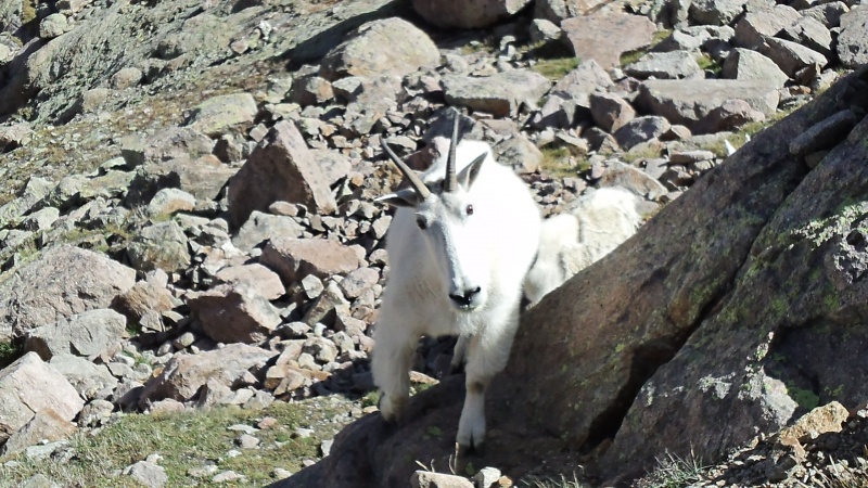
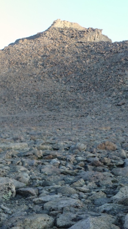
The next day (September 21, 2019) would have been my dad’s 64th birthday (he passed away a few years ago). He’d watched my mountain journey for years & in fact was responsible for it; as he’d fostered a deep love of the mountains in me at a young age. Most of the high snow had melted & we felt confident as we worked up the trail. Above the first lake we noticed a group of a half dozen mountain goats. My friend had needed to relieve himself – so he found a rock a few feet off the trail & did so. The goats approached rapidly. A medium sized one did the usual & starting licking it up. A larger one bucked him off it & took it for himself! Okay… I guess we know who the alpha is! A few snow patches, then some slabby stuff (anything to stay off the scree as long as possible), & before we knew it we were at the spot to split off from the Sunlight Peak route. 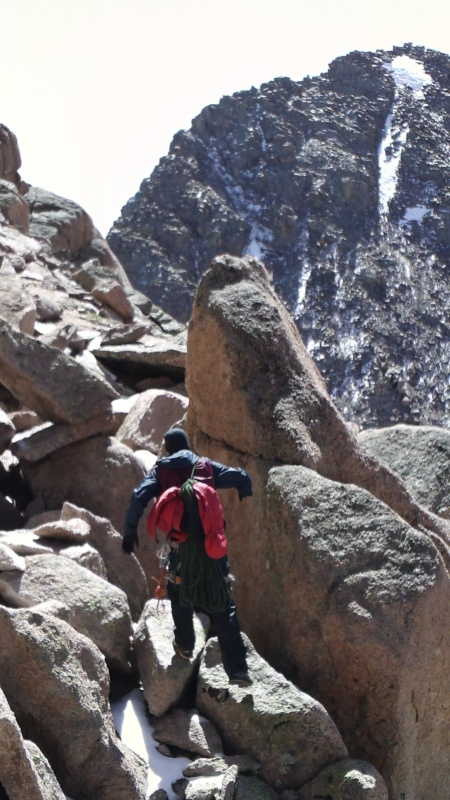
We scrambled along the way (class 3) & were quickly at the spot that some describe as class 4 or low 5. Not knowing exactly how fast it transitioned to the 5.7 section – we roped up. Turns out as you go up, then down, there is a large ledge before the 5.7 section. My friend was already on top of the 5.7 pitch & shortly after a slip on a snowy foothold (my hands held strong) – I was too. I’d worn my regular hiking boots – knowing I was jugging the 5.10 handjam. My friend led using climbing shoes & did a bit of aiding. He felt he probably could have free climbed the route in his prime. I knew I wouldn’t be able to climb it in a fashion like that without years of practice & especially focusing on handjams. I know some will balk at my choosing to climb this peak in this fashion. I look at it this way – I chose the easiest, safest way to get to the top still using human power. It was still (for me) the hardest physical day in the mountains I’ve had. Or was what I was feeling more mental strain?! After years of overthinking this peak? It is apples to oranges with a lot of the snow routes I’ve done - really any time in the mountains is time well spent (crazy that it can still stress us out). 
Most of the route up went smooth - I was getting a rhythm going. I’d practiced using the grigri, handle ascender, & nut key in the time leading up to this day. The final move at the top proved a bit awkward – swinging my right leg up while reaching back as far with my hands as possible. We stayed on top for just a few minutes. Rappelling is one of my favorite things to do in the mountains (once you get past the first push off). It went quick and we were both at the ledge in no time. We just climbed ropeless up & down the class 4 section, downclimbed a bit more class 3, and were soon back at the loose gully from the Sunlight Peak standard route. 

It would be silly not to go get the ranked summit of Sunlight since we were so close. We dropped all our gear except our cameras and headed on up. A fun 2nd lap on this peak for me & a new 14er summit for my friend. On the way down my friend spied out an alternative route back – probably stout 4 or 5.easy. This alternative involved us continuing down the ridge where the standard route goes through the “hole in the ridge”. Most of the moves were pretty intuitive – until the last one. I watched my friend do it & doubted I would be able to pull the move myself. He agreed and said he would “spot me” & coached me into leaping the last mid-chest high drop (he had done a swinging & twisting move). Sure – why not! It all worked out & it was fun making a different route work – I can see this being difficult in reverse. What I jumped down would be a reachy move as an ascent route. 
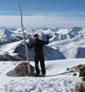
We made our way back to camp & enjoyed our last night in Chicago Basin. The following day we made good time down the trail & were able to kill some time in Silverton eating, drinking, & watching the Broncos lose. All in all a great trip! I won’t mind coming back here a 3rd time or more in the future as well. The easiest route is likely the way I looked at tackling this peak. Find a good friend that can lead the route & practice your jugging techniques. Of course for the purists or stronger climbers – maybe you will be the one to lead up this route (or at least deliver a solid climb as the 2nd up). What’s Next? I’d promised myself long ago that I’d stop completing lists after finishing the 14ers. I broke that promise once I saw how close I was to the Centennials. Maybe I’ll break that promise more in the future too… it’s hard to say. I’m not trying to focus only on the 13ers either – I enjoy hiking peaks of many heights. My wife is from Chile; so hopefully I’ll get the chance to try some higher peaks there in the future. Backcountry (also sidecountry) snowboarding (or skiing) is a funny thing too - many of our lines start far from any summit. This might help explain why a "ranked" summit is less important to me. All I know is that I want to keep hiking, climbing, & splitboarding my way up mountains as long as my body will allow it. At this point I would like to thank Bill M, all of the forum users on this site, and my friends & family who have helped me get to this point in my life (all the while enjoying some fun mountain adventures!). Some people look at what I'm doing in the mountains and think its completely crazy. I'd like to think it's just my style of "fun". To quote one of my favorite movies; "Get busy living, or get busy dying." I'm still on the "living" side of that one. Thumbnails for uploaded photos (click to open slideshow): ")
")
")
")
")
")
")
")
")
")
")
")
")
")
")
")
")
")
")
")
")
")
")
")
")
")
")
")
")
")
")
")
")
")
")
")
")
")
")
")
")
")
")
")
")
")
")
")
")
")
|
| Comments or Questions | ||||||||||||||||||||||||
|---|---|---|---|---|---|---|---|---|---|---|---|---|---|---|---|---|---|---|---|---|---|---|---|---|
|
Caution: The information contained in this report may not be accurate and should not be the only resource used in preparation for your climb. Failure to have the necessary experience, physical conditioning, supplies or equipment can result in injury or death. 14ers.com and the author(s) of this report provide no warranties, either express or implied, that the information provided is accurate or reliable. By using the information provided, you agree to indemnify and hold harmless 14ers.com and the report author(s) with respect to any claims and demands against them, including any attorney fees and expenses. Please read the 14ers.com Safety and Disclaimer pages for more information.
Please respect private property: 14ers.com supports the rights of private landowners to determine how and by whom their land will be used. In Colorado, it is your responsibility to determine if land is private and to obtain the appropriate permission before entering the property.