Download Agreement, Release, and Acknowledgement of Risk:
You (the person requesting this file download) fully understand mountain climbing ("Activity") involves risks and dangers of serious bodily injury, including permanent disability, paralysis, and death ("Risks") and you fully accept and assume all such risks and all responsibility for losses, costs, and damages you incur as a result of your participation in this Activity.
You acknowledge that information in the file you have chosen to download may not be accurate and may contain errors. You agree to assume all risks when using this information and agree to release and discharge 14ers.com, 14ers Inc. and the author(s) of such information (collectively, the "Released Parties").
You hereby discharge the Released Parties from all damages, actions, claims and liabilities of any nature, specifically including, but not limited to, damages, actions, claims and liabilities arising from or related to the negligence of the Released Parties. You further agree to indemnify, hold harmless and defend 14ers.com, 14ers Inc. and each of the other Released Parties from and against any loss, damage, liability and expense, including costs and attorney fees, incurred by 14ers.com, 14ers Inc. or any of the other Released Parties as a result of you using information provided on the 14ers.com or 14ers Inc. websites.
You have read this agreement, fully understand its terms and intend it to be a complete and unconditional release of all liability to the greatest extent allowed by law and agree that if any portion of this agreement is held to be invalid the balance, notwithstanding, shall continue in full force and effect.
By clicking "OK" you agree to these terms. If you DO NOT agree, click "Cancel"...
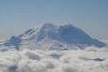
Peak: Mount Kennedy (13,125') Date: November 3, 2019 Where: Weminuche Wilderness Trailhead: (not quite) Lime Mesa (11,040') Distance: ~14 miles Elevation Gain: ~3,000' Participants: solo Time: 9 hours
It's been a long time since I've regularly written trip reports. Not sure why that is. Life moves fast! Well, here's another.
Back in 2017 I hit Endlich Mesa on 2 separate outings, but I've never quite made it over to Lime Mesa until this past weekend. I also think this might be my first successful trek into the Weminuche this late in the year, "successful" being the key word.
One note on the Lime Mesa TH. I didn't actually ever get to the Lime Mesa TH. You don't actually have to to ever get to the Lime Mesa TH. Your vehicle will thank you for not ever actually getting to the Lime Mesa TH. You don't even have to slog the last 2 miles on foot to the trailhead. Instead, lose your vehicle at about mile 24 when the road starts to eat it, walk a little further to the hairpin turn, and then begin your journey northeast from there. There's a solid trail that will eventually link you back up with the Lime Mesa trail and this method might even be shorter. Keep Reading...
Thanks for posting this. I drove out that way back in August with the idea to park at the Lime Mesa TH. Wow! This road has deteriorated in the 12 years since my last visit! I parked at the hairpin also for a hike out to the Ruby Lake overlook. You get some of best views of the San Juans from there!
Yep. A totally different view and perspective coming in from that way. Nice job. I may go check out those lakes next spring/summer and sneak in to Chicago Basin.
Hey Dillon, what is the road like up to the Lime Mesa TH, or at least to where you parked? Gorgeous shots, this time of year is gorgeous in the San Juans!
You should have no issues with the first 23 miles on missionary ridge road. Bumpy, but nothing major, with little to no snow except in some north facing sections. When you turn off missionary ridge towards Henderson Lake it's 5 miles to the real TH. This part is steeper, but still not too bad in the beginning, and some parts are snow packed hiding the rocks and holes which is helpful. 3 miles up the Henderson Lake road about a football field or 2 before the hairpin turn the road looks it may have been a stream for most of the spring and summer... mud, snow, boulders, rocks, and a huge gash. This is where I parked. I'd imagine there's probably not much snow left by now. Enjoy! Sure is!!!
Thanks Dillon! Would you say high clearance is required? We have AWD but pretty low clearance. I've always wanted to go up to that area and might be able to squeeze it in before it snows again. Let me know if you ever want a partner for peaks around Durango/San Juans, I'm based out of here through the school year.
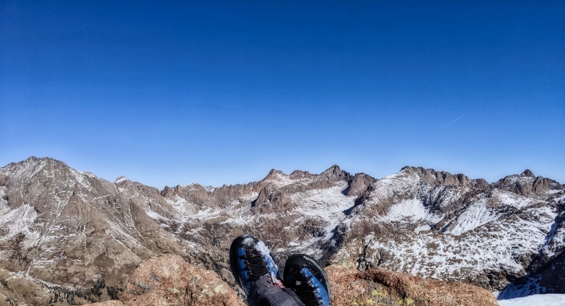
Great report, Dillon! I was up there this past 4th of July and parked where you did. Snow was still high and I didn't risk the Rav on the creek crossing. I was planning that trip as an alternative approach to Aztec, McCauley, Grizzly, Jupiter, but my air mattress valve broke and all I got was the twelver, Overlook Point. Cool to see the area in drier conditions, and the views of the Turret Needles from there are just amazing, as you captured.
Damn, I'm slow. Sarah, i would imagine it's snowed. haha. sorry! There's one spot where you'd probably want high(er) clearance just before the turn off to Henderson where you have a slight water crossing at a 90 degree turn. Maybe! You'd probably also want it after mile 2 on the Henderson Lake road. I'm in Durango too for a few months, building a house in Salida. Keep me posted. Tax season is coming unfortunately so I must hibernate. :) Steve, thanks!! What does an air mattress valve have to do with those 13ers? haha. The views from that 12er are pretty sick. Let me know when you're going back.
Caution: The information contained in this report may not be accurate and should not be the only resource used in preparation for your climb. Failure to have the necessary experience, physical conditioning, supplies or equipment can result in injury or death. 14ers.com and the author(s) of this report provide no warranties, either express or implied, that the information provided is accurate or reliable. By using the information provided, you agree to indemnify and hold harmless 14ers.com and the report author(s) with respect to any claims and demands against them, including any attorney fees and expenses. Please read the 14ers.com Safety and Disclaimer pages for more information.
Please respect private property: 14ers.com supports the rights of private landowners to determine how and by whom their land will be used. In Colorado, it is your responsibility to determine if land is private and to obtain the appropriate permission before entering the property.
")
")
")