| Report Type | Full |
| Peak(s) |
Mount Emmons, 4,040ft Donaldson Mountain, 4,140ft Azure Mountain, 2,518ft |
| Date Posted | 10/27/2019 |
| Modified | 11/22/2019 |
| Date Climbed | 10/19/2019 |
| Author | nyker |
| Autumn (Winter?) in the Adirondacks |
|---|
|
Autumn (Winter?) in the Adirondacks Day One: Day Two: Despite their lower elevations, the Adirondack mountains never cease to amaze me how challenging some of the “routes” are to climb, particularly in marginal conditions. I use the term route loosely as after flat marked approaches many of the mountains here have no marked routes. While some have loose herdpaths in the wooded areas, the degree that these are identifiable differ with each peak and season. As clouds cleared, Snow was covering most high peaks. Those straighter snow covered slopes to the right are Adirondack "slides", slick bare granite where the vegetation has been washed away/eroded away or torn away due to avalanches or mud and rock slides or some combination of all three. Some slides make good climbing routes when "in"... 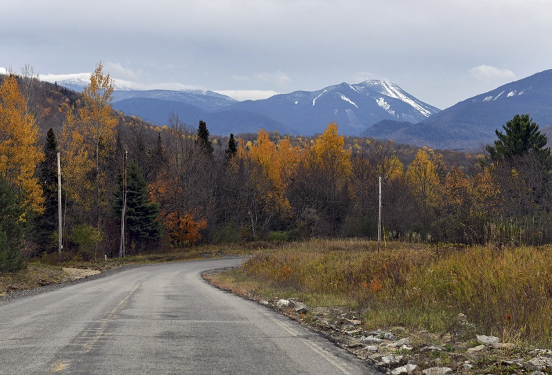 These mountains seem low (a thousand feet lower than the city of Denver!), but remember tree line around these parts is about 4,200ft +/- , alpine zone a few hundred feet above that with the climate and flora reflects that designation. On this trip I did two 46ers and a fire tower (Azure Mountain). My goal was at least one, hopefully two of the three peak system that makes up this part of the Seward Range (Emmons, Donaldson and Seward, and then Seymour Mountain nearby). The road to the trailhead, taken later on the return 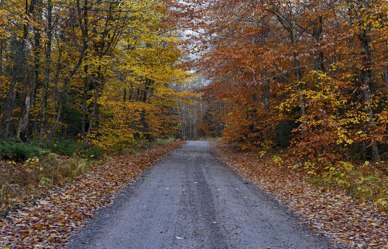 I try to make it up there at least once each Fall to hit some peaks, whether “Official 46ers”, lower peaks with noteworthy features or good views or Fire Tower climbs. Many mountain summits (25 to be exact) up here have a fire tower lookout on the summit and typically due to the rationale of the tower placement are often 360 degree views and are great climbs. There is the "Adirondack Fire Tower Challenge, which also includes a few Fire Towers in the Catskill Mountains further south downstate in New York, challenging peakbaggers to summit 23 of the 30 Towers in both (not sure why the challenge does not include all 30)... The Climb I anticipated that I was going to have a long day ahead of me, so I started out two hours before sunrise. Under my headlamp, I moved fairly quickly up the flat approach. Most of the water here was frozen over so made for easier movement, at least in the morning. After the sign below which appears at 1.2 miles in, the route is formally unmarked, though does follow a decent path for another 2 miles before heading up the mountain. 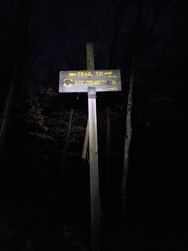 It’s amazing how comforting a little light can be once the sun rises. It’s so basic and fundamental, but daylight and warmth can do wonders to change the spirit of the day. The morning air was hovering in the low to mid 20s and made for a brisk ascent, I had three layers on which felt just right as long I kept moving. 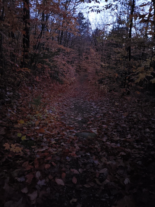 Colors were past peak in this part of the forest, which consisted of mostly northern hardwoods, but still looked nice in the pre-dawn light. This was among the last dry sections of the route for the day… 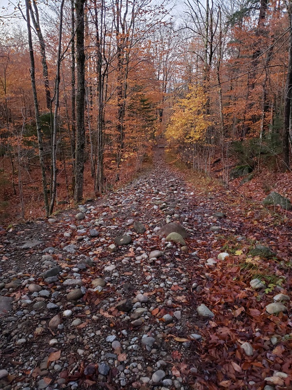 The morning was silent. A random squirrel would chirp or a lone crow would occasionally let loose a series of “caw caw caw ” calls, but otherwise the morning was meditatively silent. When stopped, I could hear the blood coursing through my veins. You’ll pass a few waterfalls/cascades which will make for icy footing in the morning, so be careful. It was pleasant to sit here for a few minutes and take it in. 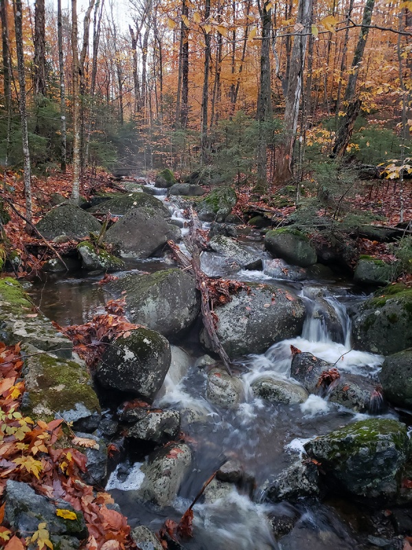 Soon there was a lot of water on the route, pretty much everywhere and more on the return as things warmed up and melted. This pic was taken on the way back, but most of the approach trail portion was pretty wet. 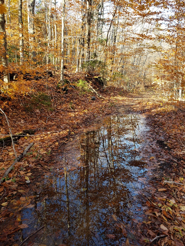 In addition to Sugar and Red Maples, Beech and Yellow Birch together coloring the lower forest, there was a lot of Paper Birch on the route in the mixed hardwood/conifer forest lower down. 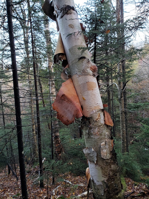 The approach goes on for another two miles or so after which you need to pay attention to a cairn/rockpile which marks the spot to leave the approach trail and turn up the mountain proper. Upon seeing the cairn on hikers left, turn sharp left (East). The turnoff easy to miss in the dark is a crucial turn you need to make or else you will be far off track going off in the wrong direction. This is where you’ll start to follow Calkin’s Brook east, then gaining elevation straight away. 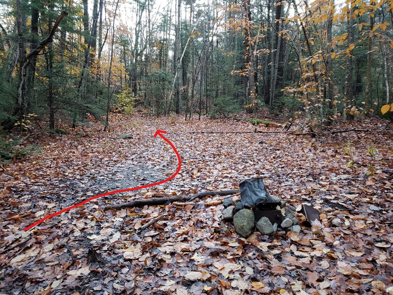 As it was becoming mid-Autumn, I was expecting colder weather and since it was the Adirondacks, wet conditions. However, I wasn’t quite expecting the extent of ice and snow and near winter conditions higher up while on the descent the Spring-like snowmelt driven mud and waterlogged ground and very wet slick conditions below the freezing line. The route does not gain much elevation up until the cairn marker. After the turnoff from the cairn, you will start to gradually gain elevation. The terrain then becomes abruptly steeper in sections as the semi-trail morphs into muddy ravines, rock piles, giant boulders and glacial erratics that you must get up and over. You’ll have to cross Calkin’s Brook at least twice – the main crossing below, which I imagined in October would be almost dry. I was wrong. Given the heavy rains this past week and what I’d later discover, snowmelt, the water was near Springtime levels. I walked around for 20 min trying to find a way across. The near side of the creek was shallow and easy to start crossing but then about three quarters of the way to the other side, there were large gaps with no stones or logs and the water was a couple feet deep in most parts and running fast. The logs were all slick and super slippery so not good candidates to use. Taking a dunking so early in the day in 20 degree temperatures was not something I wanted to do. There was really no way to cross the creek without getting a little wet, so I just choose the way across with the lesser of available evils, made sure not to dunk my feet entirely and got across. 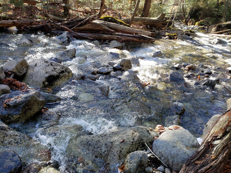 Soon after the water crossing the “route” gets into the traditional Adirondack terrain – no trail, only steep wet ravines and slippery boulders and icy rock. The deciduous and mixed forest down below gave way to coniferous forests of spruce and fir higher up 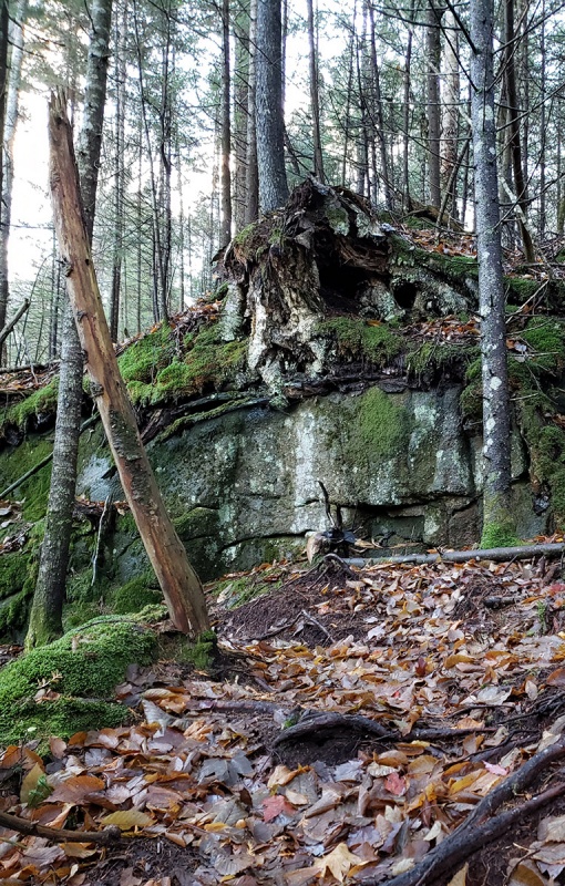 The leaf cover on the ground made it hard to discern any route and care has to be taken to pay attention to landmarks or if carrying one, mark your route on a gps. It was also very slippery this morning. I was a little surprised when I started seeing snow, though light as it was at this point. 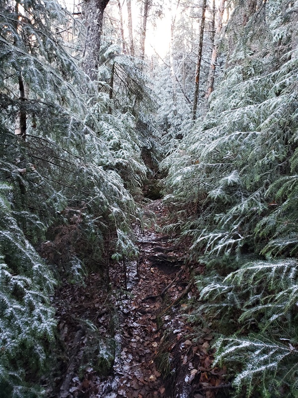 It would get heavier and start to stick on the ground…while it looked like a Christmas card, I was a little concerned of what the conditions would be like further up as I had a lot to go ahead of me at this point. 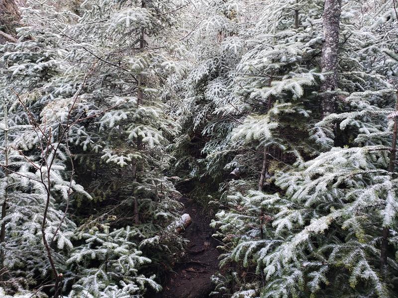 Eroded sections with roots like this, when dry would not to pose much of a challenge other than to take care not to turn an ankle or get your foot caught and fall, though when powder coated with snow atop a layer of ice, they become a different story to deal with… movement was slow now, necessarily moving up at a snail’s pace. 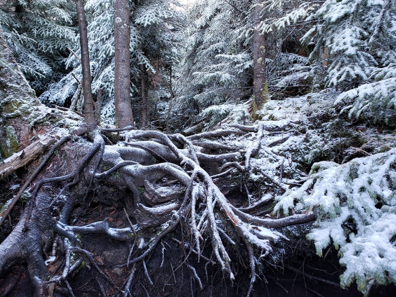 The snow became heavier as I climbed up. Any path that might suggest the correct route was hard to decipher at this point. I was relying on map and compass more than not and stopped a few times to correct and adjust my direction. There was a lot of blowdown in the area, both fresh and from older storms, some of which you need to meander around to find your way up the mountain. Take care because many of these logs are loose and at least today covered with ice and snow. 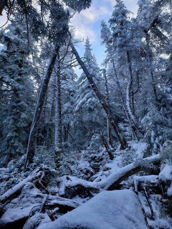 The boulders and rock slabs increased in both frequency and size the higher you go. Boulders started to be regularly covered with ice and ranged from the size of Volkswagen Beetle to a Four Story Town House. This is where your yoga would come in handy. 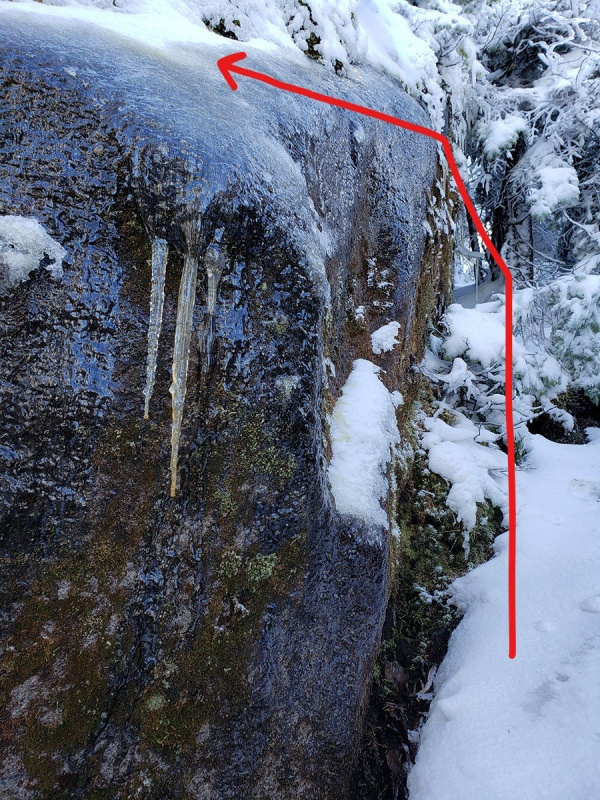 In spots, I could make out sections of a route. No footprints anywhere. Branches of the spruce and fir were caked in snow and ice which would usually flake off as I squeezed through the brush. I needed to cinch my hood as to try and prevent the snow getting down my neck all morning. 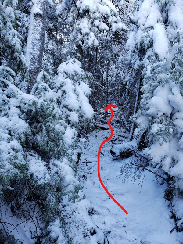 Some of the Granite slabs were vertical. Luckily I brought a pair of microspikes sort of a last minute thought which I threw in my pack the night before. They became essential to ascend the ice covered granite. Any more ice on the rock, a short ice tool will come in handy. 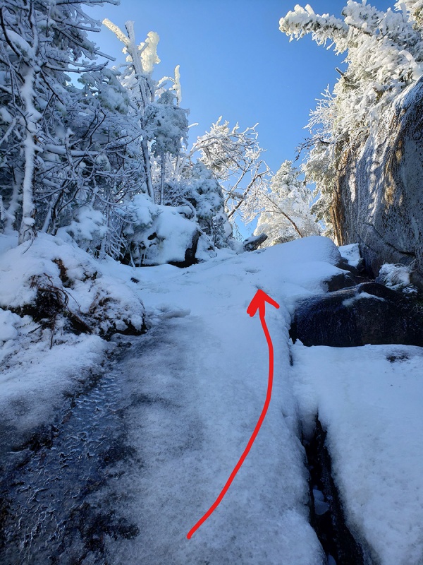 The trees held more snow as I climbed higher. Much of this would rain down on me as I bumped into the trees shaking loose the caked snow and ice on the upper branches. 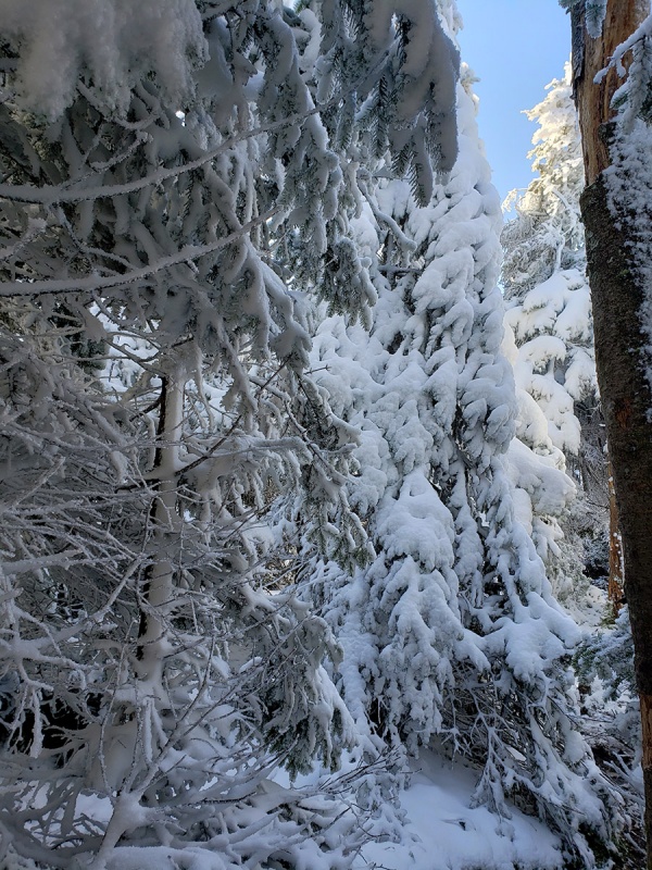 Some of the boulders and terrain here made me stop and contemplate how to get up. I had some pretty intensive problem solving moments during the ascent. There are a few ways up the rockier sections but most involved Class 3, 4 and some short class 5 sections. My hands were getting cold as I grabbed on the ice covered rocks. Gloves only helped temporarily as they soon became waterlogged. I had a backup pair I was planning to use for the descent but those were not waterproof either. Mental note: pack waterproof gloves next time. Skies were clear now fortunately with clouds dissipating. 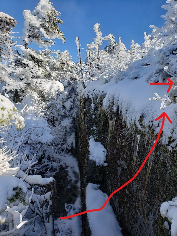 Not summer anymore... 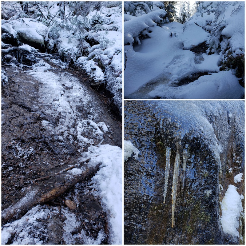 My speed here slowed to a crawl, literally. You’ll use your whole body to get up these sections, grabbing trees, roots where available, or chipping spots in the ice to grab or kicking holes in the ice to put your feet in. The terrain here will test your resolve. Sections of and spruce and fir forest would appear which I’d have to crawl on all fours given the tight dense growth pattern of trees and the weight of the snow and ice making the branches meld together in tighter areas. Note the shorter trees higher up, stunted by the elevation. If you stepped on one snow laden branch, you'd have to be careful it didn't whipsaw back in your face after it was unfrozen to the adjacent branch and unburdened from the weight of any snow that was stuck to it. 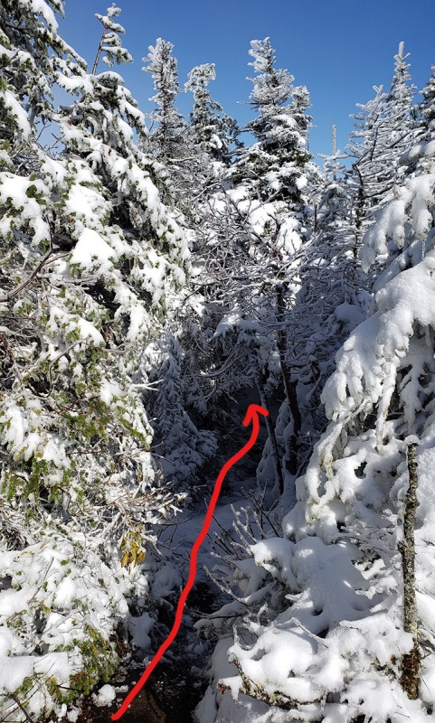 A white blanket of snow covered everything up high. I felt and hoped I was nearing the summit, though was still in the forest and hard to tell. My altimeter hit 4,000ft. It’s not unheard of and actually common for people to put all this effort in and to climb the wrong mountain since these routes are unmarked and some summits have no signs or markers on them evidencing the correct peak. A Winter wonderland soon unfolded in front of me. A layer of snow on top of ice. 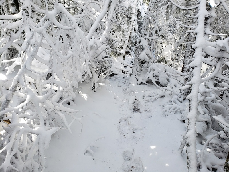 I could finally see the surround landscape, as a view opened up around me. Clouds lifting in the distance. Stunning. 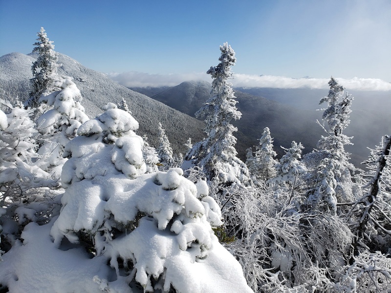 At the clearing as I turned around to find the remaining way, I see the summit sign! I made it! I had the summit to myself. This is often how summits appear up here, one moment you are wondering where the summit it, the next you are standing on it. 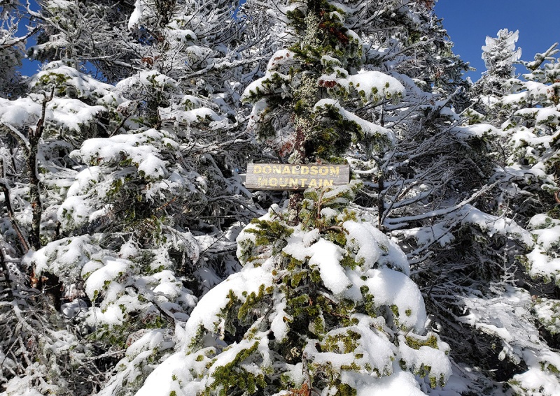 I was pretty determined to try and get the other two peaks in the area this morning so without resting beyond the time it took to get some water, down a Powerbar and clean the packed ice and snow out from my spikes, I moved onward to what I hoped would be a route towards Emmons Mountain about a mile away. A wet mile that would be. The route was tight and again found myself crawling and snaking around and under wet and icy tree branches and tree trunks 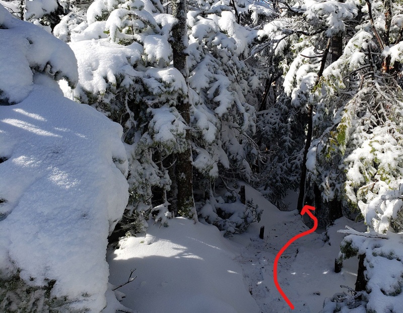 A steep descent awaits. There is a lot of elevation loss which must be regained enroute to Emmons and then regained back up to Donaldson. The terrain is either rock, ice or in flatter areas deep mud puddles waiting to swallow your leg with one wrong foot placement. It is now that transition season where the ground hasn’t frozen deep enough to freeze the mud in some spots, especially the spots with running water but often plenty of fresh ice and snow around. 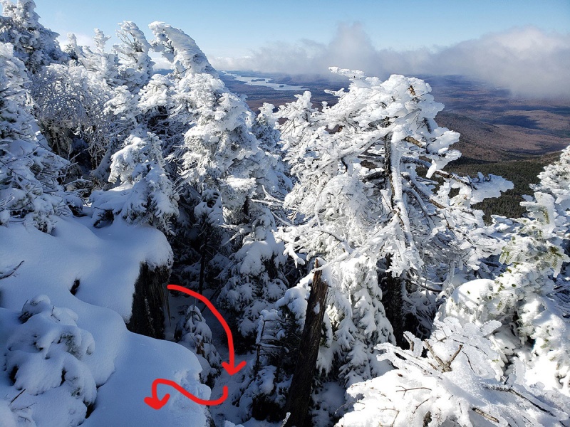 The shot above was a 10ft vertical rock that you need to climb, the angle doesn't really give the right perception of the steepness and height. You can see my foot/hand print in the snow to the middle/lower left. A cold snow world surrounded me. I was in four layers and just about comfortable but cold if I stopped since I was pretty wet underneath my shell, something I usually take lengths to try to avoid. I would swear if I closed my eyes and woke up here I would have thought it was mid-February. 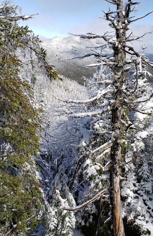 Walkin' in a Winter wonderland 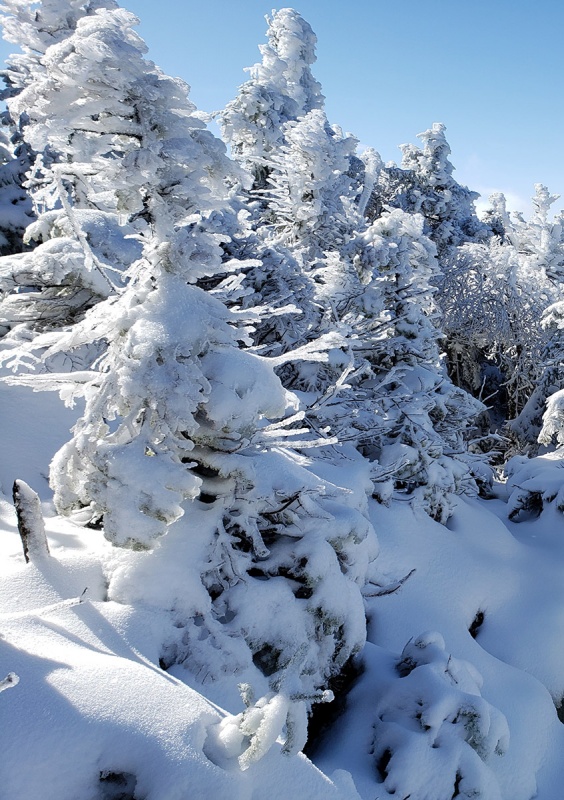 I believe that is Seward Mountain in the distance 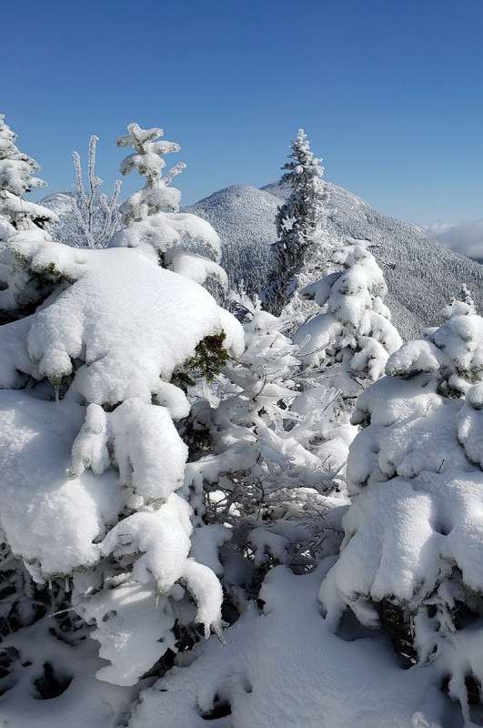 After navigating around the messy terrain towards what I really hoped was Emmons, again, without warning and as a very pleasant surprise, I turned around and saw the summit sign for Emmons! I almost hit my head on the wooden sign. This was one of the more welcome summit signs I’ve seen. As on Donaldson, I had the summit to myself. 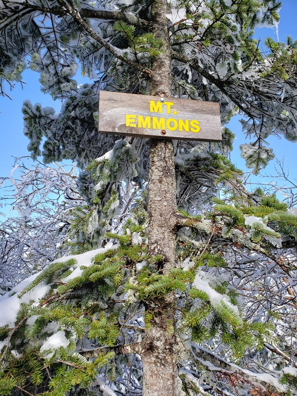 I was pretty spent, it took 6.5hrs to get to the summit of Emmons on hard terrain and another 60+ minutes to get back to the second climb up Donaldson. I imagine in dry, warmer conditions you can shave a good 2hrs off this since you can move faster on the entire route. With the warming sun the push back was filled with muddy ground, ice and snow melting out from the trees above, effectively raining on my the entire time. Coupled with the branches brushing against me at every turn soaking me to the bone, I was pretty much waterlogged and cold not to mention a bit beat up from these peaks today. After my soft shell soaked through I removed that and put on my hard shell, but that soaked me from the inside from sweating given I cinched the top to keep the ice and snow from falling into my neck and inside my jacket which it seemed determined to do. I was kicking myself for not bringing an extra base layer and extra mid layer to change into. Even both of my hats were soaked from my melting snow dripping on me. Weird weather and conditions today. Since these peaks are lined up in a row, from this side of the mountain, in order to gain Seward Mountain, once summiting Emmons, you need to downclimb Emmons and reclimb Donaldson to get to Seward, then descend and reclimb Donaldson a third time before going down making it a five summit day. Soaking wet, mentally drained and physically getting tired, I figured I had enough and after eight hours and two solid rewarding summits, despite lingering by the supposed turnoff to Seward for a moment contemplating an attempt, decided to wait another day and descend down. Being on these peaks all day was like a day of tryouts for American Ninja Warrior. On the descent back, everything was more wet with creeks running faster now and trees raining melting snow and ice on any hiker that happened to be there…I actually kept the spikes on to deal with the wet leaves and mud, which helped on those sections from falling on my bum at every turn. Fire Towers As I mentioned there are 25 mountain summits in the Adirondacks that have a fire tower on top. Many of the towers have been restored by donations and allow you to climb to the top lookout, weather permitting. Notably these peaks are not the “46er” High Peaks, but other distinct summits chosen for their strategic locations and good lookout points with 360 degree views. After the brutal day in the Seward Range, I rewarded myself by an “easy” and scenic summit hike up a nearby mountain with a Fire tower on top. The trailhead was an hour drive. I started just after sunrise so was able to get the full view of the nice forest the whole way up. Colors were pretty nice here. Very windy though with 30 knot winds forecast, which despite the nice day was cold. 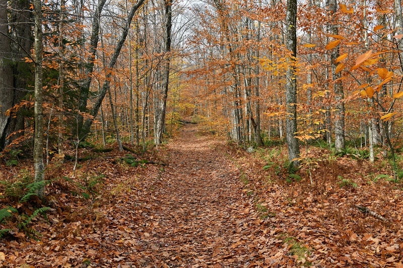 Vibrant. There was a trail here and easy to follow for a nice change of pace 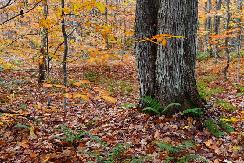 Azure Mountain was located in the northern Adirondacks well away from the higher peaks to the south. Higher up, all the leaves on the trees were now gone. 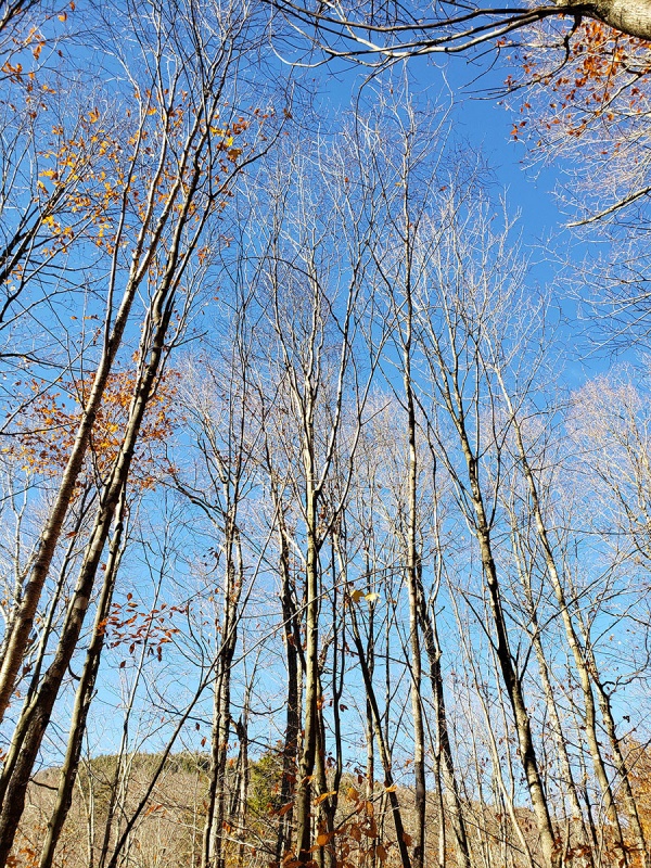 Beautiful views of the surrounding mountains to the south. 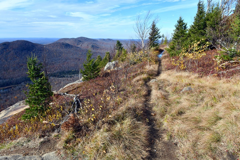 Rock slab formations characterize the terrain up here in many places, adding to the unique landscape higher up The taller mountain in the far distance to the right is Whiteface Mountain 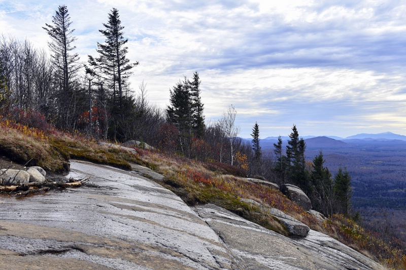 It always feels good to approach the summit of a peak, even a smaller one. Approaching the summit tower! 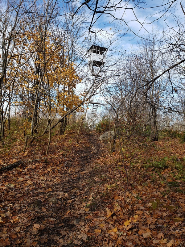 Blue skies appeared as if on queue as I neared the top 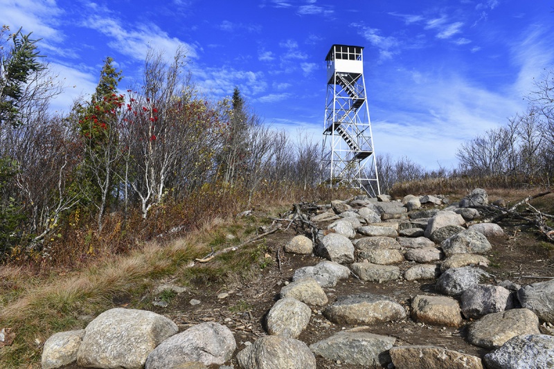 Fast winds made clouds move in and out quickly all afternoon 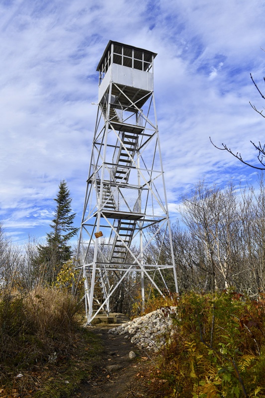 View from inside the top tower house/shelter looking out across the wilderness. 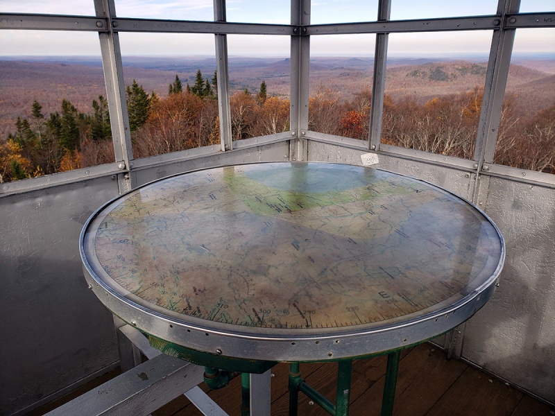 The round table is covered in a map of the area pointing out compass bearings, peaks and other landmarks 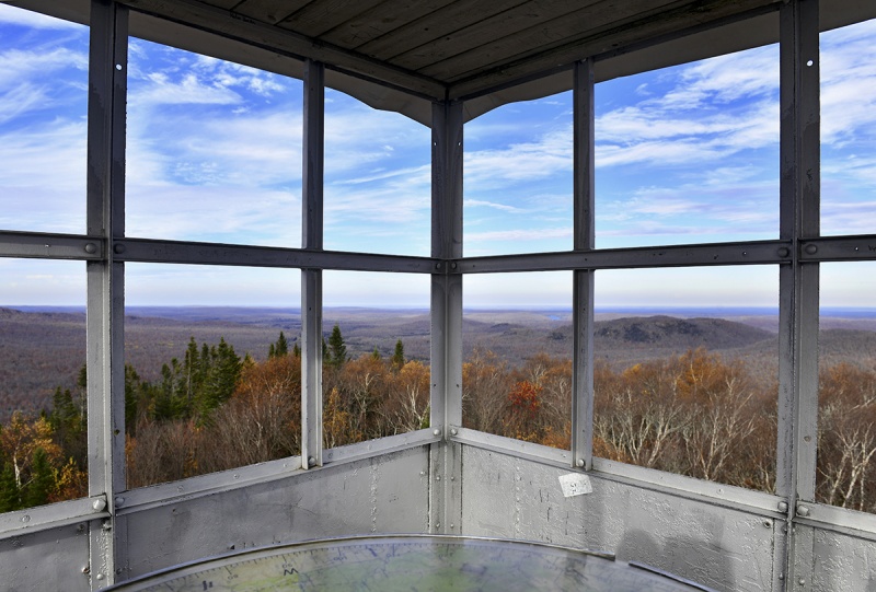 The winds were howling up here. Other summit shots 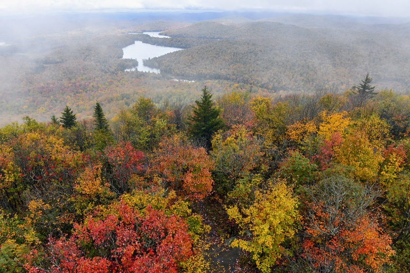 A sea of trees and lakes 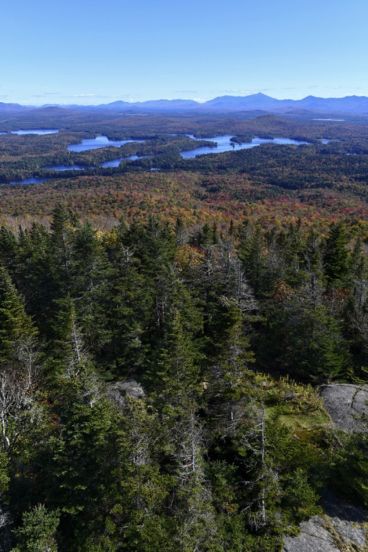 You really get a nice reward to effort ratio on these fire tower summit climbs and make a great “light” day after a tougher day on more demanding peaks. Most of the fire towers are nice hikes (though some are 15+ miles on harder terrain) and give you that satisfaction of a nice summit view and interesting features after the climb up! At this point, most of the leaves are off the trees and are past peak foliage color around this area and the temps are getting lower with snow in the forecast more often than not. Any hike up here after this week will likely need traction if not snow gear, unless there is a warming period. The Seward Range peaks are not heavily trafficked and usually only climbed by aspiring “46ers” i.e. those looking to complete the Adirondack 46ers and not those out for a pleasant Sunday afternoon hike. But if you want a good challenge, willing to put up with some stress along the way and want a day out in the wild and burn off calories, these would surely fit the bill for they represent well the chartered ideal of the Adirondacks of being Forever Wild. Thumbnails for uploaded photos (click to open slideshow): ")
")
")
")
")
")
")
")
")
")
")
")
")
")
")
")
")
")
")
")
")
")
")
")
")
")
")
")
")
")
")
")
")
")
")
")
")
")
")
")
")
")
")
|
| Comments or Questions | |||||||||
|---|---|---|---|---|---|---|---|---|---|
|
Caution: The information contained in this report may not be accurate and should not be the only resource used in preparation for your climb. Failure to have the necessary experience, physical conditioning, supplies or equipment can result in injury or death. 14ers.com and the author(s) of this report provide no warranties, either express or implied, that the information provided is accurate or reliable. By using the information provided, you agree to indemnify and hold harmless 14ers.com and the report author(s) with respect to any claims and demands against them, including any attorney fees and expenses. Please read the 14ers.com Safety and Disclaimer pages for more information.
Please respect private property: 14ers.com supports the rights of private landowners to determine how and by whom their land will be used. In Colorado, it is your responsibility to determine if land is private and to obtain the appropriate permission before entering the property.


