Download Agreement, Release, and Acknowledgement of Risk:
You (the person requesting this file download) fully understand mountain climbing ("Activity") involves risks and dangers of serious bodily injury, including permanent disability, paralysis, and death ("Risks") and you fully accept and assume all such risks and all responsibility for losses, costs, and damages you incur as a result of your participation in this Activity.
You acknowledge that information in the file you have chosen to download may not be accurate and may contain errors. You agree to assume all risks when using this information and agree to release and discharge 14ers.com, 14ers Inc. and the author(s) of such information (collectively, the "Released Parties").
You hereby discharge the Released Parties from all damages, actions, claims and liabilities of any nature, specifically including, but not limited to, damages, actions, claims and liabilities arising from or related to the negligence of the Released Parties. You further agree to indemnify, hold harmless and defend 14ers.com, 14ers Inc. and each of the other Released Parties from and against any loss, damage, liability and expense, including costs and attorney fees, incurred by 14ers.com, 14ers Inc. or any of the other Released Parties as a result of you using information provided on the 14ers.com or 14ers Inc. websites.
You have read this agreement, fully understand its terms and intend it to be a complete and unconditional release of all liability to the greatest extent allowed by law and agree that if any portion of this agreement is held to be invalid the balance, notwithstanding, shall continue in full force and effect.
By clicking "OK" you agree to these terms. If you DO NOT agree, click "Cancel"...
HikerGuy posted an excellent trip report of a snow climb of Gladstone’s east face in July 2019. He commented: “I have a suspicion that even in dry conditions this would be a good route.” In September I confirmed HikerGuy’s suspicion and climbed Gladstone’s east face after the snow had melted. This route is a reasonable alternative for those who want to avoid the narrow, loose, and dangerous north ridge.
After reading HikerGuy’s report, JChitwood contacted me to suggest we try Gladstone from the east. We camped out near the Cross Mountain trailhead on September 9. JChitwood is an astronomer-extraordinaire and identified numerous stars and constellations in the night sky, which is exceptionally brilliant at 10,000 ft. far from city lights. Unfortunately, he was not feeling well on September 10, so didn’t reach the summit until a month later. But he went far enough to help me scout a route.
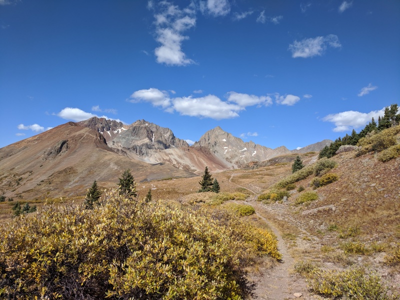
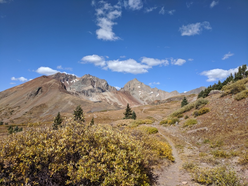
Gladstone comes into view after turning left onto the Lizard Head trail from the Cross Mountain Trail.
October view of Lizard Head trail and Gladstone by JChitwood, blessed by the weather gods, as is customary
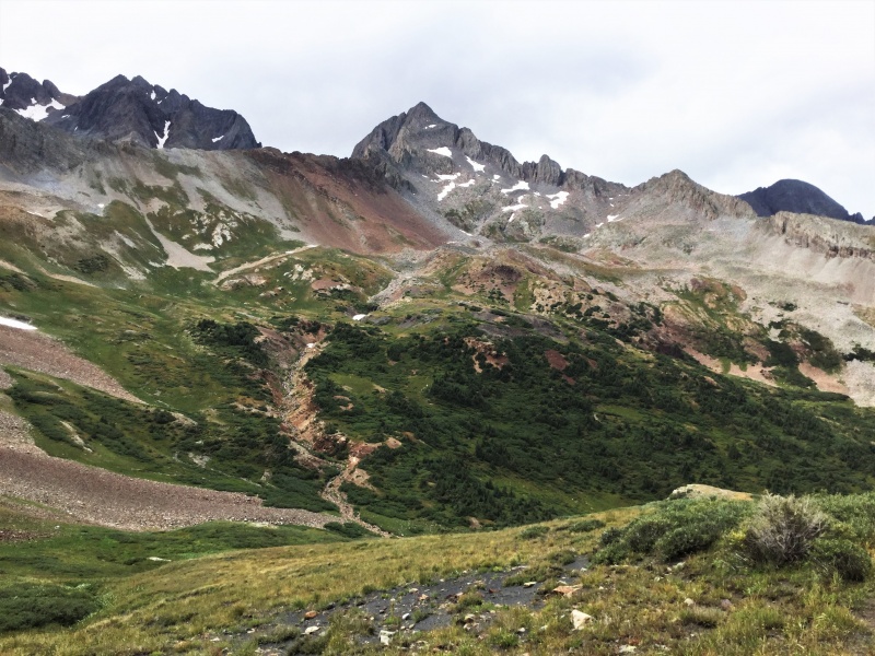
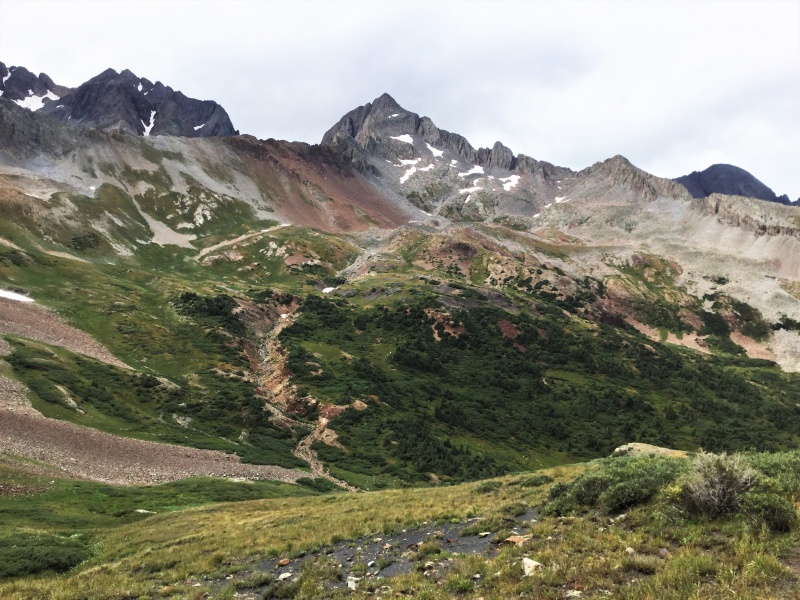
From the Lizard Head trail, the best route up the mountain is not obvious.
The east face as seen from the saddle on the Lizard Head trail
As the crow flies, Gladstone is less than 1.5 miles from here, but my GPS hiking distance was closer to 2.5 miles. There is a faint trail partway down into the basin, but there is no established trail across the basin or up the mountain. Lots of easy options for crossing the basin. The main issues are how much elevation you are willing to lose and how much you want to be on grass vs. rock glaciers (more time on rock glacier if you stay high). The descent into the basin is about 400 vertical feet.
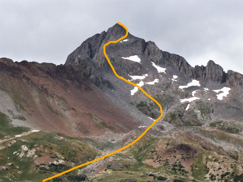
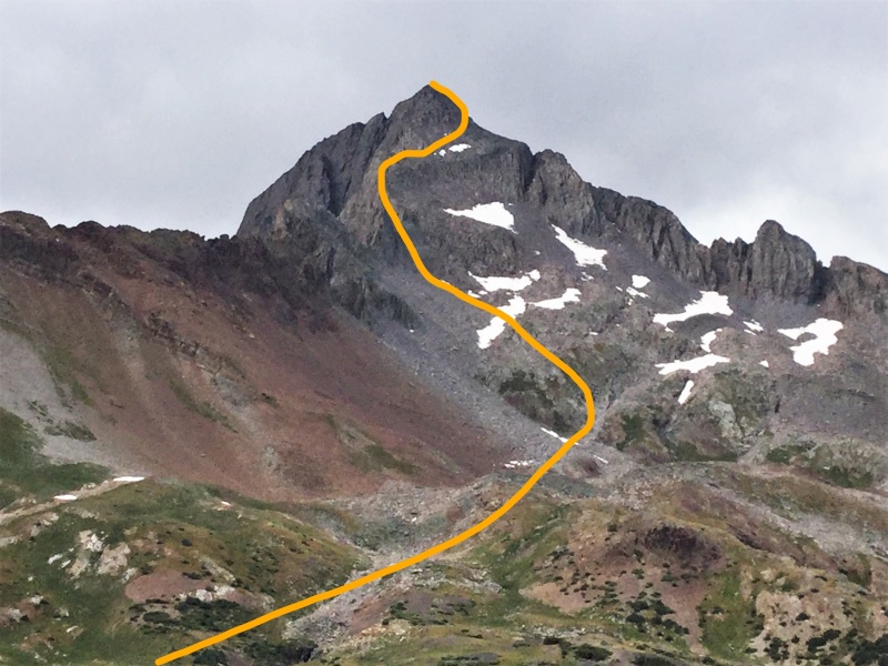
Approximate route up the mountain
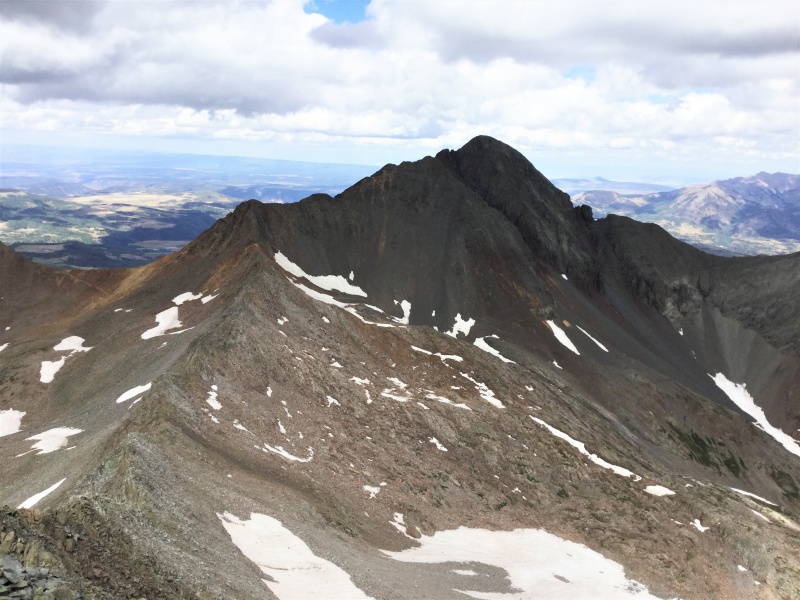
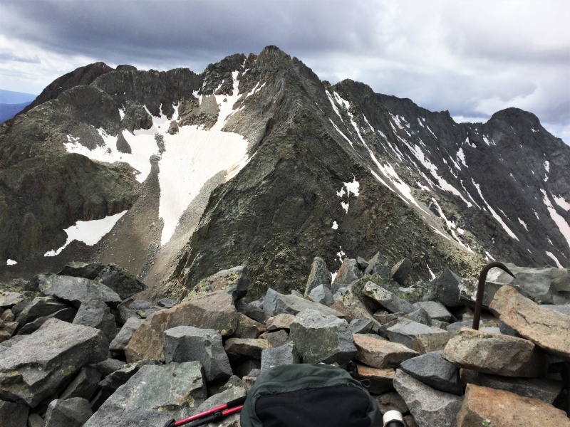
I took a route similar to HikerGuy across the basin (per his GPS track). But my route from the basin to Gladstone’s southeast ridge was east (left) of his. After the snow melts, there is a well-defined gully with stable rock and some grassy steps that provides a comfortable route up to the southeast ridge. After reaching the ridge I followed it toward the summit to about 13,700 ft., then traversed over to the northeast ridge on a clearly defined ledge, as shown in my route photo above and in HikerGuy’s final photo. Once on the northeast ridge, two hundred feet or so of boulder hopping takes you to the summit. This ridge is relatively stable, unlike the famous north ridge.
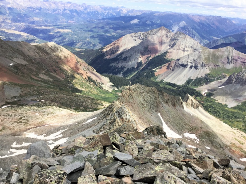
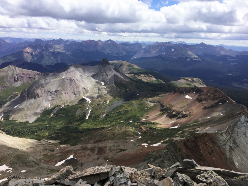
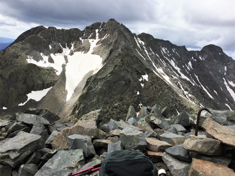
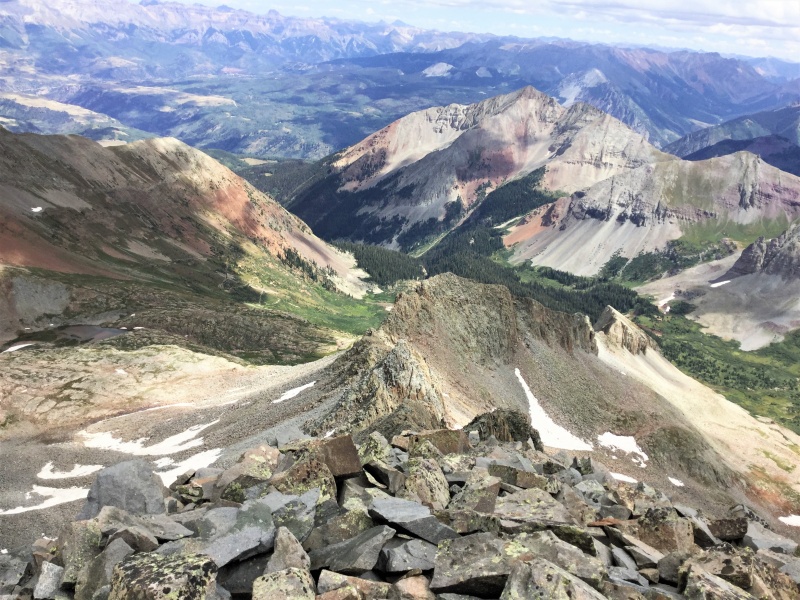
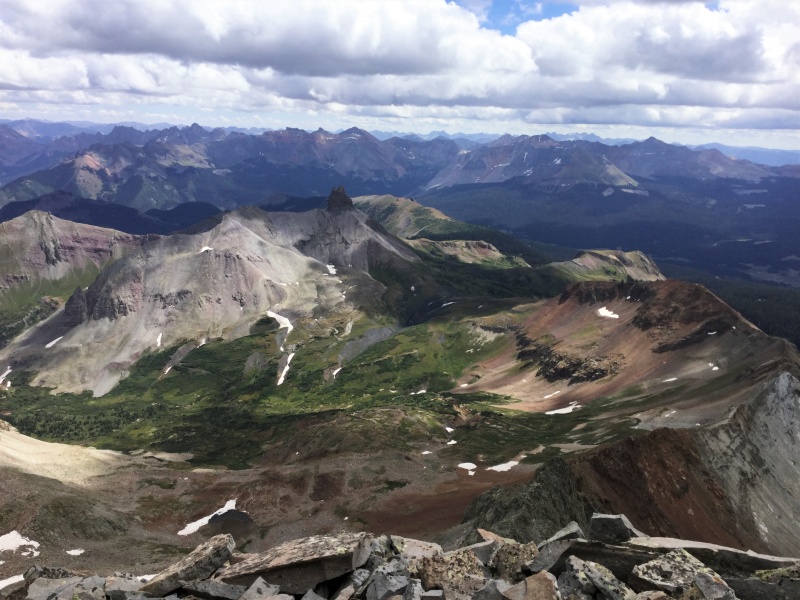
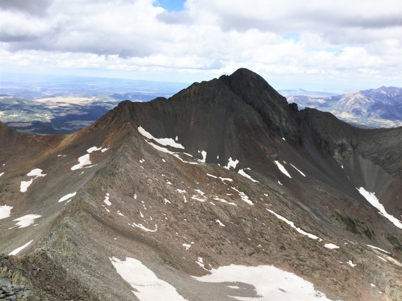
Summit view toward the northeast ridge approachSummit view east toward approach basin, that's Lizard Head in the shadowsSummit view west of Mt. Wilson, those clouds were shooting thunderbolts an hour laterSummit view of hazardous north ridge, Wilson Peak in background
As a cautionary note, there is some disagreement about my description of the gully as a comfortable route to the ridge. When JChitwood climbed Gladstone in October, his climbing buddy christened the gully: “Golob’s Gully of Doom” (that’s Golob, not Gollum). However, both returned safe and sound, so were not literally doomed. Take his description with a grain of salt.
To sum up, even though this route has more mileage (13 miles on my GPS), more vertical (4700 ft), and more off-trail boulder hopping than the standard route, I recommend it as a reasonable alternative. Both routes share the disadvantage of extended lightning exposure. Even though the east face route drops off the mountain more rapidly, it rises back to a saddle near Lizard Head and stays high on a ridgeline for about a mile as it drops from 12,000 to 11,600 ft. A thunderstorm was moving in from the west during my return, so I had to race my geezer ass as fast as possible until below treeline. When I finally hit the trees, I took a long break to bask in the satisfaction of Centennial #98.
Thumbnails for uploaded photos (click to open slideshow):
Congrats on #98, Wineguy! It's great to have additional beta on this route and to hear that it's also a good alternative in summer/dry conditions. Unless adding on this summit to a Wilson Peak outing, I don't see any reason not to use this approach/route.
I climbed this route as well just after hiker
Guy with tons of snow in the beg of aug. A lot of crampon
Climbing until like 700 ft from the top.
It was super fun and did not see a soul
All day. Great route and great peak
Without having to do that horrible ridge.
Another great climb by the fearless wineguy. You have to be the wittiest economist ever and it has been my pleasure to attempt these big peaks with you. Sorry I didn't make it to the top on the day of this report but glad you were bold and made it solo. My partner in October was just joking about your gully and he would have climbed it but as is so often the case he got ahead of me speeding upward with his head down and flat out missed the left turn to access the gully. Going behind the rock protrusion in the middle of the face then cutting left below the cliff band gets you to the same spot on the far left by the dramatic drop off between Gladstone and Mt Wilson. I moved some rocks on the descent probably because I outweigh you by 75 lbs and things tend to slid around putting that much downward force on them, but it was nothing like the Maroon Bells or the reports I've read about the north ridge route. I have a lot of good things to say about this route and recommend it for sure. The trailhead is on pavement, the approach is not grungy just a nice trail to the top of the pass, it goes right by the base of Lizard Head so you can scout that for future climbs, and the rock was relatively stable. I have no plans to do the north ridge for comparison purposes.
Caution: The information contained in this report may not be accurate and should not be the only resource used in preparation for your climb. Failure to have the necessary experience, physical conditioning, supplies or equipment can result in injury or death. 14ers.com and the author(s) of this report provide no warranties, either express or implied, that the information provided is accurate or reliable. By using the information provided, you agree to indemnify and hold harmless 14ers.com and the report author(s) with respect to any claims and demands against them, including any attorney fees and expenses. Please read the 14ers.com Safety and Disclaimer pages for more information.
Copyright: Route information, text, risk factors, maps, GPX files, charts, photos, 14ers.com-created map imagery, flythroughs, and other content provided in this route description are copyrighted by 14ers.com and may not be copied, reproduced, republished, distributed, modified, or used to create derivative works without prior written permission.
Please respect private property: 14ers.com supports the rights of private landowners to determine how and by whom their land will be used. In Colorado, it is your responsibility to determine if land is private and to obtain the appropriate permission before entering the property.