Download Agreement, Release, and Acknowledgement of Risk:
You (the person requesting this file download) fully understand mountain climbing ("Activity") involves risks and dangers of serious bodily injury, including permanent disability, paralysis, and death ("Risks") and you fully accept and assume all such risks and all responsibility for losses, costs, and damages you incur as a result of your participation in this Activity.
You acknowledge that information in the file you have chosen to download may not be accurate and may contain errors. You agree to assume all risks when using this information and agree to release and discharge 14ers.com, 14ers Inc. and the author(s) of such information (collectively, the "Released Parties").
You hereby discharge the Released Parties from all damages, actions, claims and liabilities of any nature, specifically including, but not limited to, damages, actions, claims and liabilities arising from or related to the negligence of the Released Parties. You further agree to indemnify, hold harmless and defend 14ers.com, 14ers Inc. and each of the other Released Parties from and against any loss, damage, liability and expense, including costs and attorney fees, incurred by 14ers.com, 14ers Inc. or any of the other Released Parties as a result of you using information provided on the 14ers.com or 14ers Inc. websites.
You have read this agreement, fully understand its terms and intend it to be a complete and unconditional release of all liability to the greatest extent allowed by law and agree that if any portion of this agreement is held to be invalid the balance, notwithstanding, shall continue in full force and effect.
By clicking "OK" you agree to these terms. If you DO NOT agree, click "Cancel"...
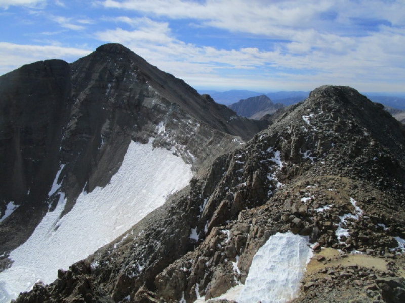
This is going to be a short report just to highlight the difference between the route up Castle on the Northeast Ridge that is described here on the 14ers.com site, and also in the Gerry Roach guide as route 25.2 and the variation described in the Roach guide as 25.2V.
The reason I am posting this is because after climbing Castle several different ways, I am convinced that the variation is the most fun. It not only avoids snow, allowing me to climb this late in the season in trail running shoes, but is just a lot more fun than scrambling up the loose talus and scree on the standard route.
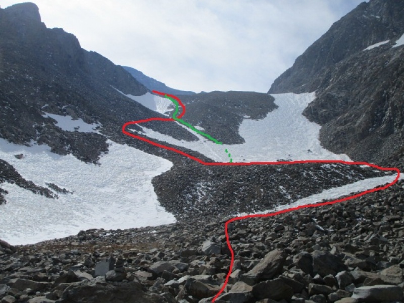
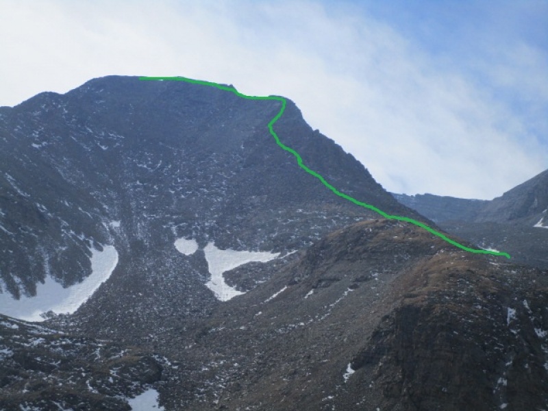
An additional observation. I climbed up the variation and descended on the standard route, so I have a fresh impression of both. When I got nearly to the bottom of the standard route, I found the little patch of snow, at a very low angle, maybe 25 degrees, impassable. The snow this time of year is hard, and by hard, I mean it might as well be clear water ice. Do not plan on getting up or down the snow on this route without crampons and an axe. Jumping ahead here, but the next photo shows the end of my day.
Green, attempted descent. Red, actual descent. Would be ok on ascent as well.
So I came down the usual route and had just this small patch of snow to get down. Lots of foot prints, even some evidence of previous butt slides. But today, nothing doing. In trail runners, with only the hiking pole I found near the summit, I decided to hoof it up just a bit and regain the red line where they intersect. I am no slouch in the snow, but this was like an inclined skating rink. Serious business.
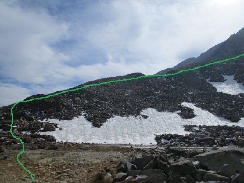
But the variation, leaves from the upper 4WD parking lot by turning immediately to the left and accessing the ridge immediately. It looks improbable, at least harder than class 2, but it was really fun.
From the upper parking lot. Just get after it!
It was less than 45 minutes before I intersected the standard route on the crest of the ridge, above all the loose rock of the standard route. If I had taken this as the descent as well, I would have saved more than 30 minutes on the day.
Not too many photos of the rest of the climb. There is no snow or ice anywhere on the route once the crest of the Northeast Ridge is reached by either route. Also clear of snow and ice for the traverse to Conundrum.
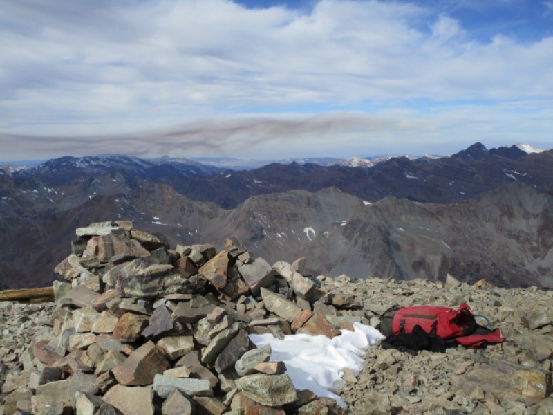
Summit view from Castle, smoke from Ridgway "Cow Creek" fire.
View from Summit of Conundrum looking back at Castle
Fork in the Road
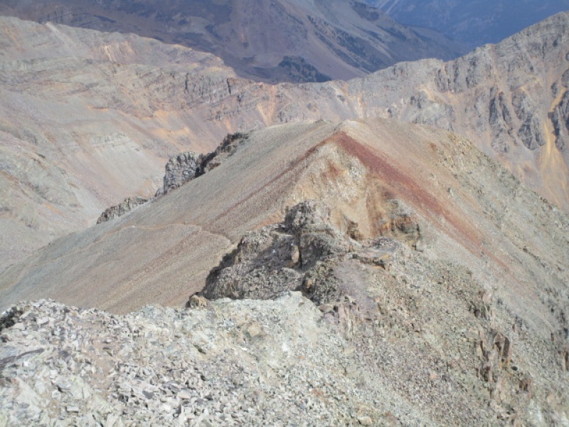
The previous photo shows the obvious trail down the standard access to the Northeast Ridge. The variation mentioned in this report continues along the ridge, through the obvious red rock and continues on the ridge all the way to the parking lot. This is a great route. Not a lot of cairns along the way. Not much of a trail. Lots of small decisions to make along the way. Never harder than a class 2 with careful route finding. Harder options available. Did I mention it was fun? And no snow at all. This should be a first choice on this mountain. I can't see how it has been missed.
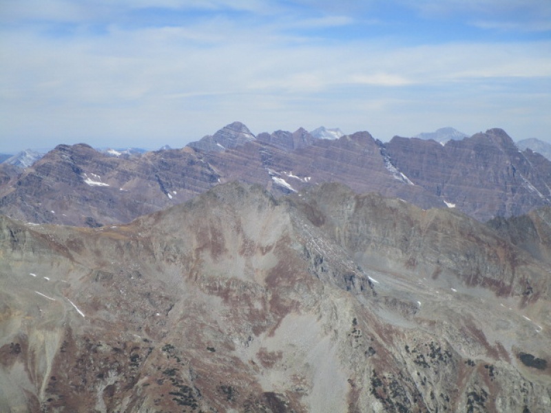
Elk Range on Display. From Left to Right on the skyline: Maroon; N Maroon; Snowmass; N Snowmass; Thunder Pyramid; Capitol; Pyramid
In the previous photo, the last one off in the distance on the right might be Sopris. Anyone?
Northeast Ridge Direct as seen from 4wd road about 1 mile from upper parking.
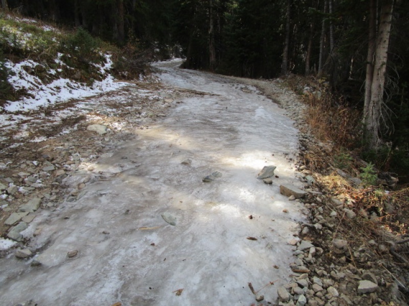
Not summer
See my trailhead report
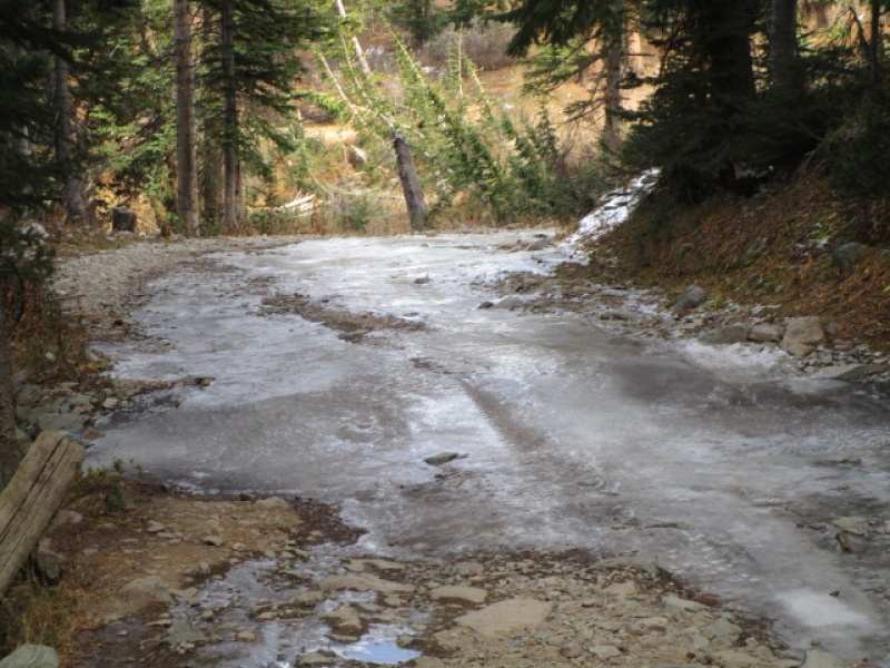
I tried to drive over this. You should NOT!
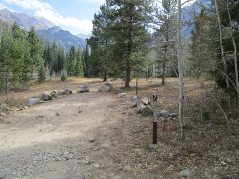
Final thought. There are 9 designated campsites along the road between the 2wd parking lot and the creek crossing. There are a few good sites above the creek, but it looks like they don't want those to be used any more. Given a choice, I think site 7 is the nicest.
Site 7
Splits on this hike:
Start hike at Ice Dam: 8:00
Pearl Pass cut off: 8:10
Upper 4wd trailhead: 9:15
Summit Castle: 11:00
Summit Conundrum: 11:30
Return to Castle: 12:15
Return to Car: 2:20
Thumbnails for uploaded photos (click to open slideshow):
Nice! I would have assumed that route would just be all loose rock. Pretty sure the peak in your photo of the bells on the right is Capitol, snowmass and Hagerman is just to its left.
I hiked the duo last Sunday, October 13th. I have a 98 mountaineer with 33' tires and a 3' lift. I started up and made it past the first ice patch, then expected there to be many more the rest of the way up. I backed down and parked in the small dirt area off the side before the ice. After hiking up the road we realized I could have probably made it to 12,500 or so. It was slippery and pretty dangerous, especially with that little drop off near the ice patches.
A few years back I was up there in late November and stopped at that ice. It gets pretty tricky. In November I needed to put the crampons on just to walk past it.
Caution: The information contained in this report may not be accurate and should not be the only resource used in preparation for your climb. Failure to have the necessary experience, physical conditioning, supplies or equipment can result in injury or death. 14ers.com and the author(s) of this report provide no warranties, either express or implied, that the information provided is accurate or reliable. By using the information provided, you agree to indemnify and hold harmless 14ers.com and the report author(s) with respect to any claims and demands against them, including any attorney fees and expenses. Please read the 14ers.com Safety and Disclaimer pages for more information.
Please respect private property: 14ers.com supports the rights of private landowners to determine how and by whom their land will be used. In Colorado, it is your responsibility to determine if land is private and to obtain the appropriate permission before entering the property.

")
")
")
")
")
")
")
")
")
")
")