| Report Type | Full |
| Peak(s) |
Wilson Peak - 14,021 feet |
| Date Posted | 10/07/2019 |
| Date Climbed | 10/06/2019 |
| Author | cnlevan |
| Rocks for Ages |
|---|
|
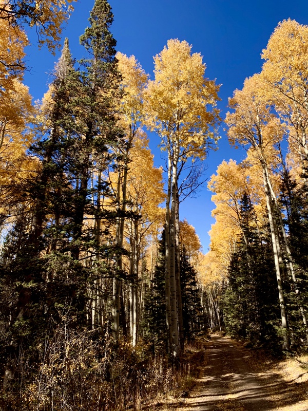
Because of working so many hours over the summer in preparation for the beginning of the semester and the lateness of the snow melting, I did not climb as many peaks this year as I would have preferred, Kelso Ridge (G&T) alone actually. So I wasn't ready for the climbing season to end, but I only get every other Sunday off of work (I student teach Mon-Fri and work on the weekends) so planning to go out of town to climb isn't easy. But I was resolute in my determination to at least climb one more! The plan was to go Sunday 09/29, but the forecast was 50 mph winds and a chance of snow, and nobody wanted to join (from here or anywhere else) so I decided to work that Sunday and postpone till this Sunday 10/06, and I am very glad I did. Despite an additional post to the "Climbing Connections" forum page, I was unable to find someone to climb with, though I almost had someone join me! But hiking alone never bothered me. So I got off work and threw all my gear into my vehicle and hit the road. I live in Junction so the projected drive was 2 hr 50 min and I left at about 5:30pm. As I was leaving town I called my mother to let her know that I was on my way out, where I was planning to camp, and when to expect a call from me when I got back to the TH the next day (as per usual in my family when adventuring alone). When she found out that I was unsuccessful in finding a climbing partner for a C3 peak in October she politely but firmly asked me to refrain from climbing if there were no other people on the trail. She was so insistent that the likelihood of something dangerous happening on a C3 peak is much greater than on any other climbs I have done alone, and despite having done other similarly rated climbs (with companions) she was not comfortable with it. I told her I would definitely consider her words and promised to turn around if at anytime I felt uncomfortable on the peak whilst alone, but assured her that it was unlikely that I would indeed be alone for the entirety of the climb. On the way to the Rock of Ages TH, I took the wrong turn South off of 145 onto C57 instead of C60, which led me up over and around Wilson Ranch property, after driving around for an extra half hour or so, I just decided to retrace my steps, found out where I went wrong and got back on track. I made it to the TH at about 9:00pm and set up camp about a minute down the road in a campsite. I woke up at 5:00am the next day ready to climb. There were two other vehicles at the TH, so I was not worried about climbing alone, so I set off at 5:45am. The approach starts with a steady incline through the trees for about 1.3 mi. And just like every other 14er climb in the first mile.... it wasn't my favorite. These first miles always make me second-guess my fitness level. I just comforted myself by reminding myself that it is always like this and once my legs and lungs warmed up I would be fine, like always. 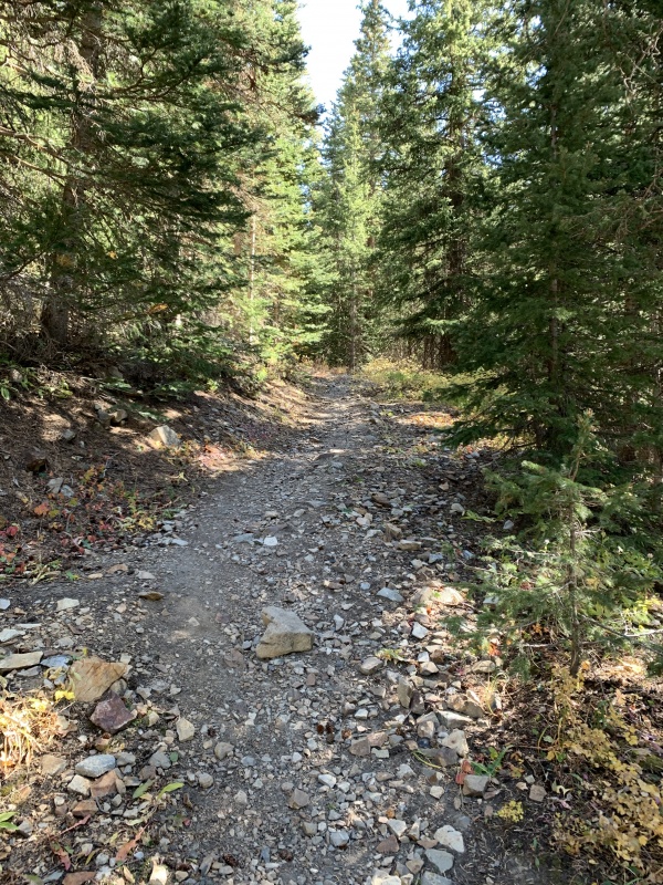
I finally hit trees-end and encountered the talus at 6:21am. 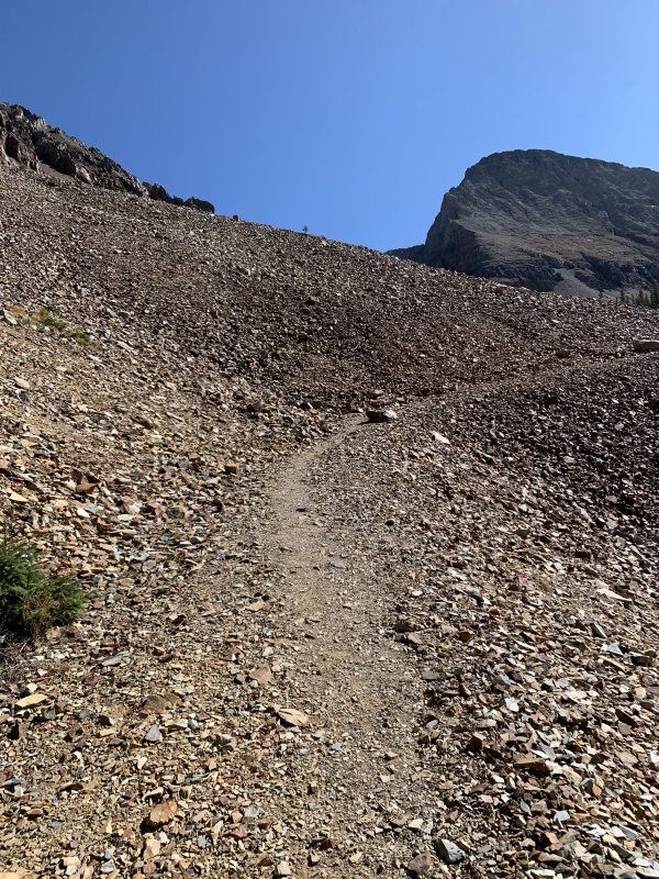
It only took about 20 minutes of hiking on the talus before I hit some more trees! My legs and lungs finally caught up with me and now I felt like myself again. 
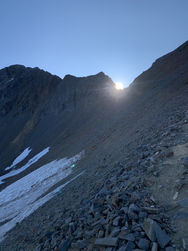
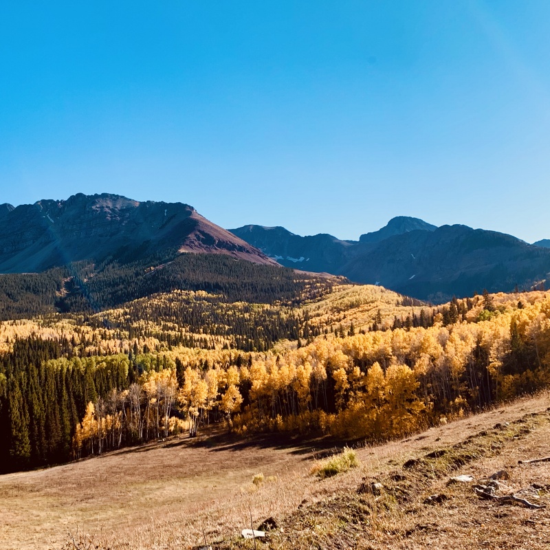
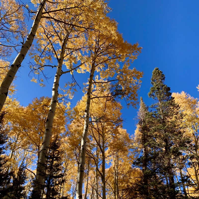
I was able to turn off my headlamp at 6:45 after taking the above photo, and saw the end of this batch of trees at 6:50. I kept looking over my shoulder into the valley back behind/below me and I was laughing because of how stupidly beautiful it was with the sun rising and the fall colors! Too bad it was too dark for quality photos of it! 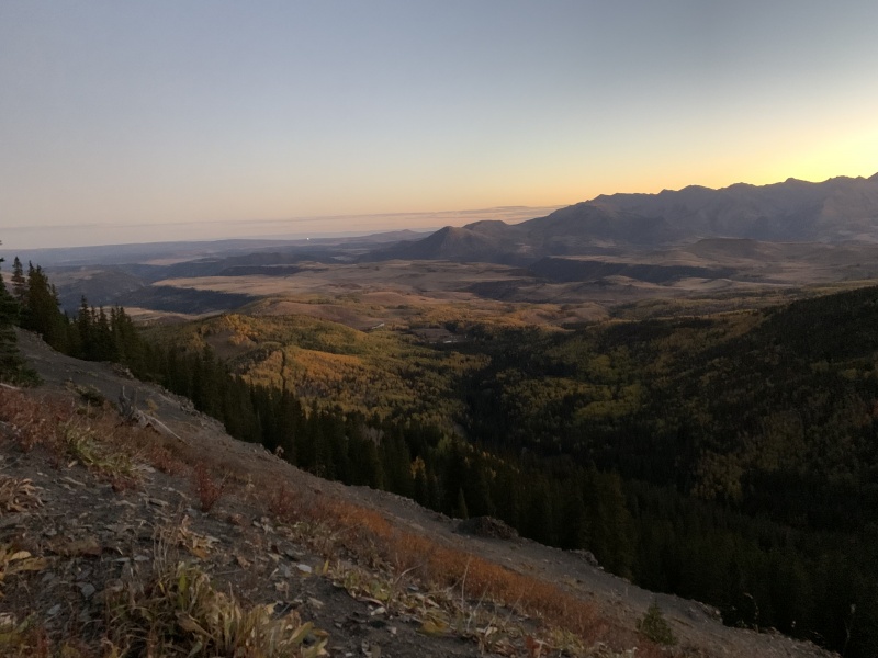
After the trees we head down the hill and get our first glimpse of the conquest ahead! 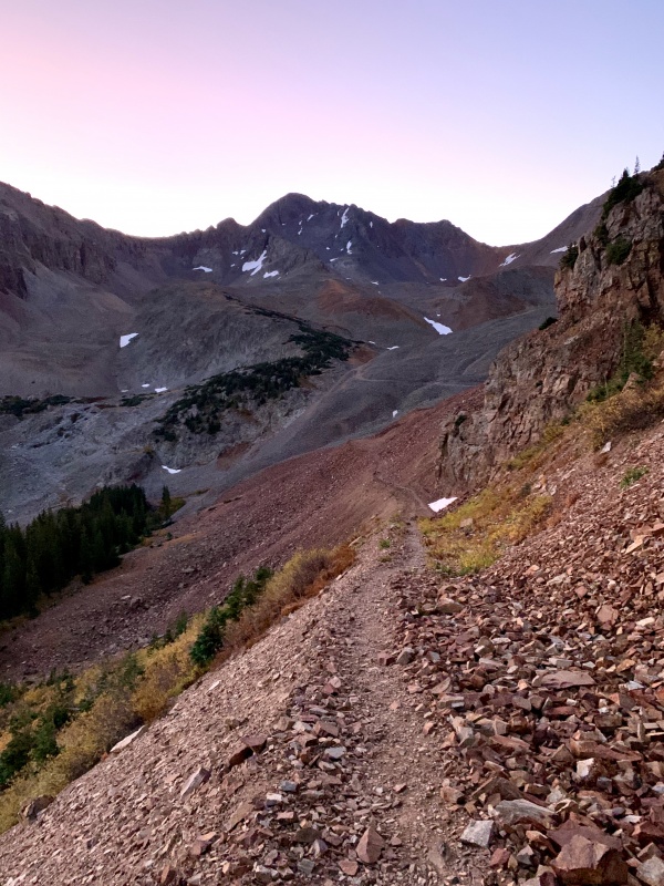
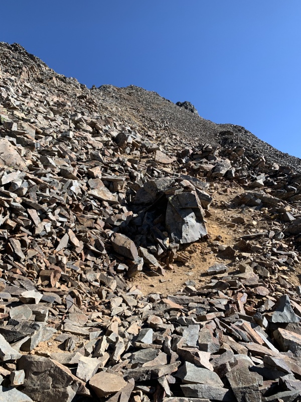
This trip report was named "Rocks for Ages" because this approach feels like it takes FOREVER to get through the rocky basin. You slowly hike up, and up, and up and seemingly never get any closer to that saddle. 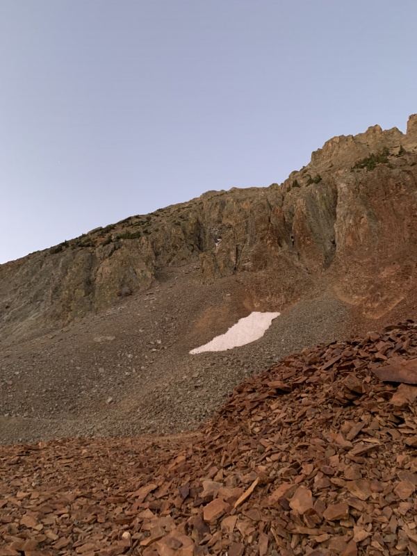
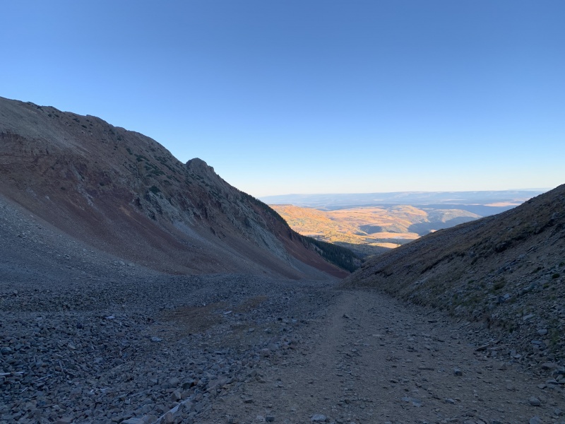
This part of the route climbs up an old mining road, there are other mining roads coming up from private property, but this one is where the actual trail is. This is the long boring sloggy stuff that most of us aren't the biggest fans of, but it wasn't super steep so if you are adverse to steep, I guess this approach is a good one for you. It just went on and on... and then I reached the stone "shack" at about 7:45. 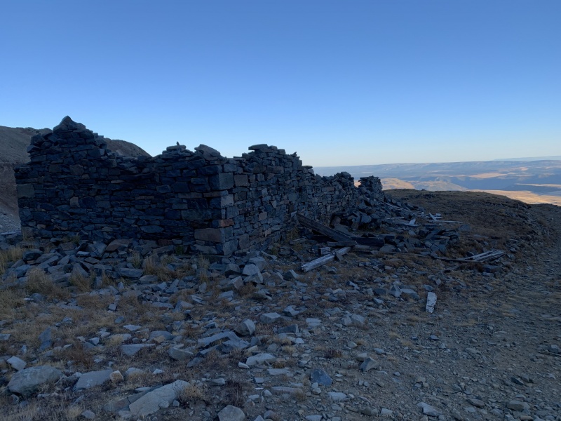
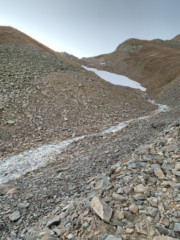
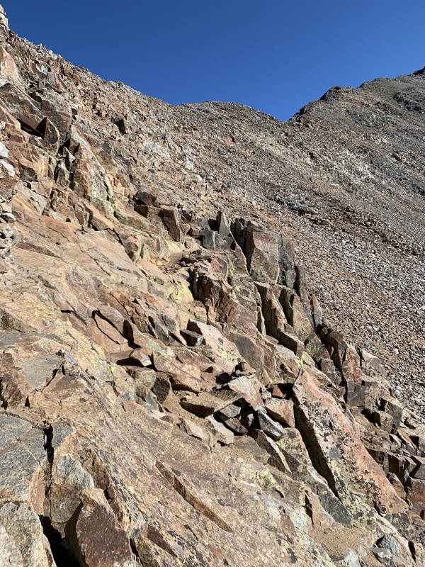
I kept on keeping on, wandering through the rocks for what seemed like ages..... but finally gaining some real elevation. There were a couple inconsequential snowfields to cross, but nothing to write home about. The trail steepens, and loosens and I start kicking myself in the pants for not bringing my trekking poles (because I know the loose stuff is going to be a real pain on the way down). 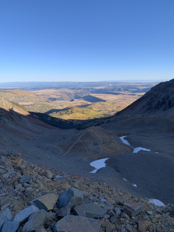
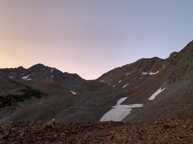
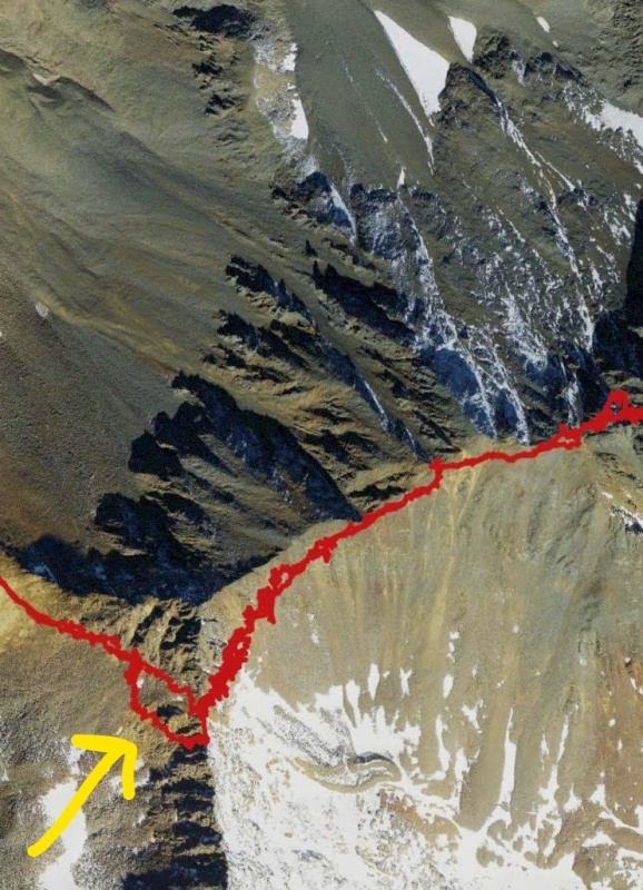
This whole time I kept looking back on the trail below hoping to see any other hikers, but for everything I could tell, I was all by myself. Now my mother's words start ringing in my head like a bell..... What if I really am the only hiker on the trail today? Should I turn back when I get to the saddle? I am confident in my abilities, and am rarely bothered by doing things alone, but I really would have preferred to have seen at least one other hiker on the trail by now, just in case I fall off a cliff or something, there would be someone to call SAR... or whatever. But alas.... no one showed up. So I just kept hiking up. I gained the RoA saddle at 8:45 am after about 5.4 miles of hiking. Three hours of hiking, just to gain the saddle... I mean, I guess it isn't that long, but it felt like it! 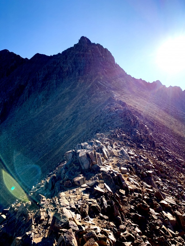
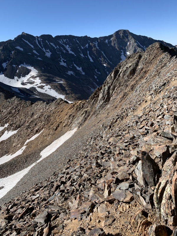
Now it was time to traverse on over to the Wilson Peak/Gladstone summit. The trail is pretty clearish so that went off without a hitch but I made sure to follow the route description and the little arrows from photo #4 (route description) so I didn't surface in the wrong spot. 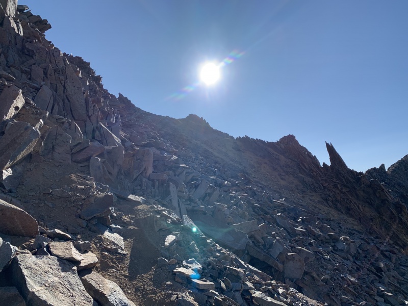
Be careful to stick really solid to the "trail" on this section, if you get too low, you could get yourself into a sticky situation (as I did later that day....read till the end to find out what happened) 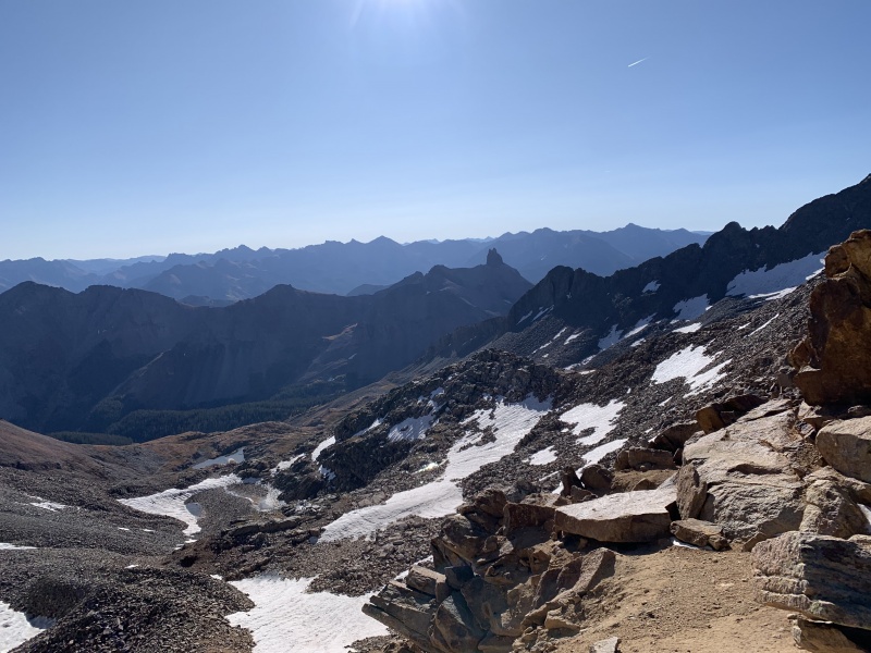
After reaching the Wilson/Gladstone summit it is time for the sleeves to get rolled up. I knew from the route description and other's advice that when rounding the corner, you need to stay low or it gets too tricky, so I downclimbed a bit and started working my way over. There were even moments where I was unsure about the route choices I was making, but there was absolutely no definitive route choice, you just had to sort of choose your own adventure and hope your choice was a good one. 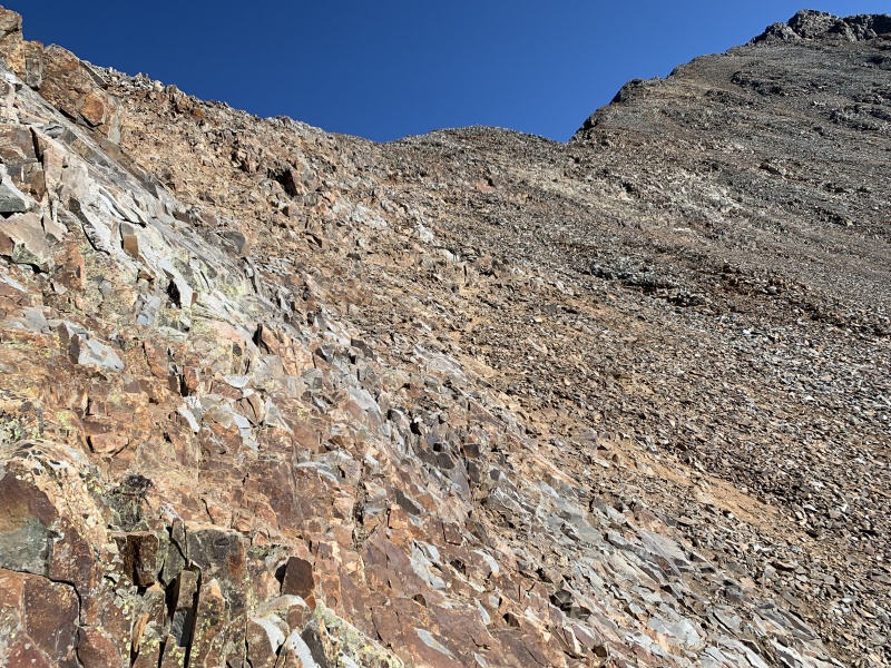
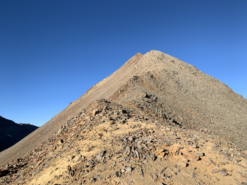
Eventually, after you traverse in the general trajectory you may see a sparingly placed cairn or two, this will help you find the "trail". After getting on this path really speeds up progress. I really can not express how non-existent the route is until this point. I mean, it isn't too difficult or anything, but I wouldn't call it fun. Finally, when I looked back on the route behind me I saw two figures navigating the terrain. This made me happy because I was nearing the ridge line at this point and that is when the spicy stuff would start. For my mother's sake, and the whole guilt thing, I finally felt free to push towards the rest of the climb. It did not take long for these (very fast) climbers to catch up to me, and just before the false summit, they passed me. Their names (I think...) were Luke and Pete. 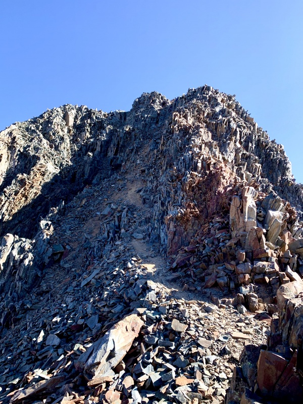
I't didn't take long to scramble up to the top of the false summit, and then at last... there directly ahead was the final summit pitch. 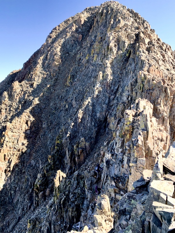
I down-climbed to the left a smidge and then headed up the summit pitch. This was a blast. Honestly, the best part of the climb for sure. There were some tiny patches of snow in the little corners and cruxes of the shadows, but they were easy to stay away from. The guys topped out as I was about 50% up the final pitch, they didn't stay long on the summit, and as they were about to come back down, I caught up with them and asked if they would be cool to just hang back a little slower and allow me to descend the summit "pyramid" with them. They graciously obliged and waited as I got a very fast summit selfie with a timer, and a summit view shot. Time: 10:50 am 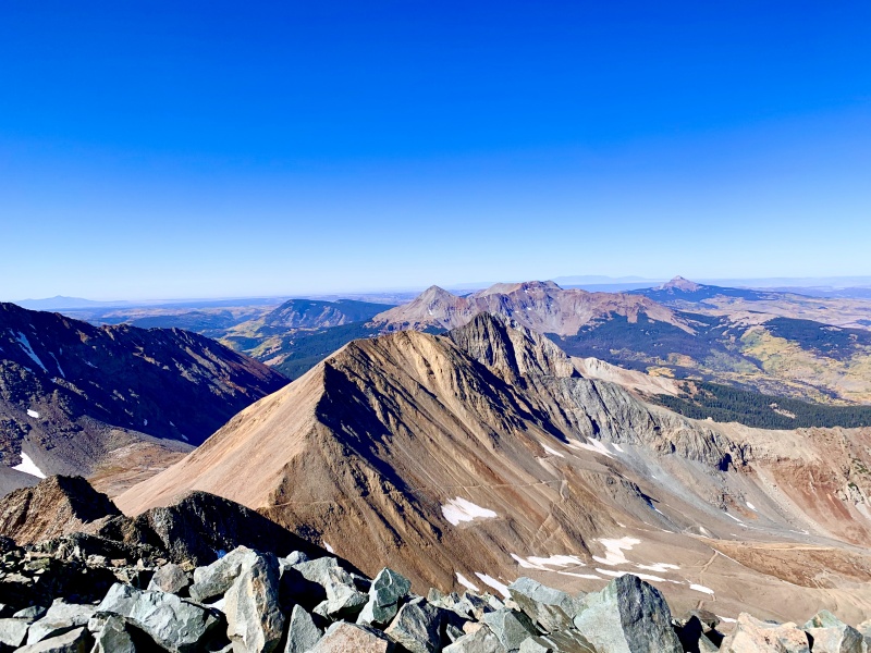
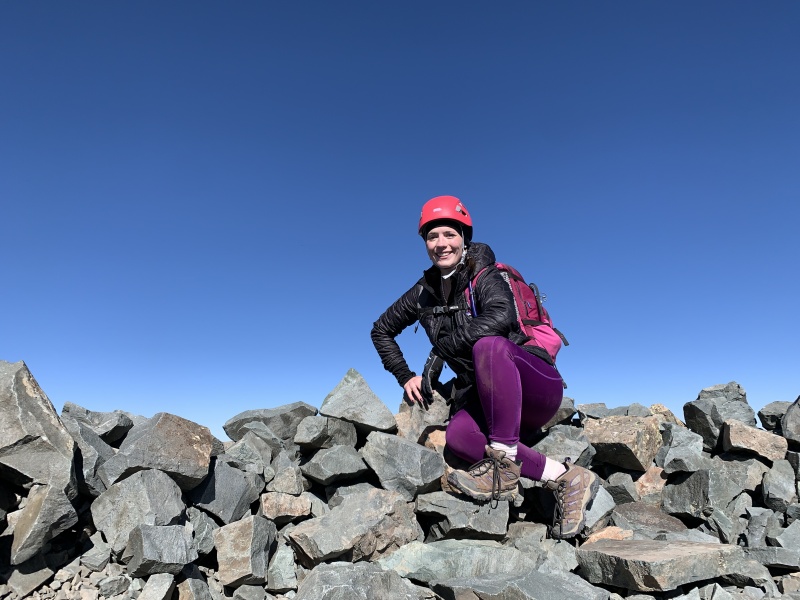
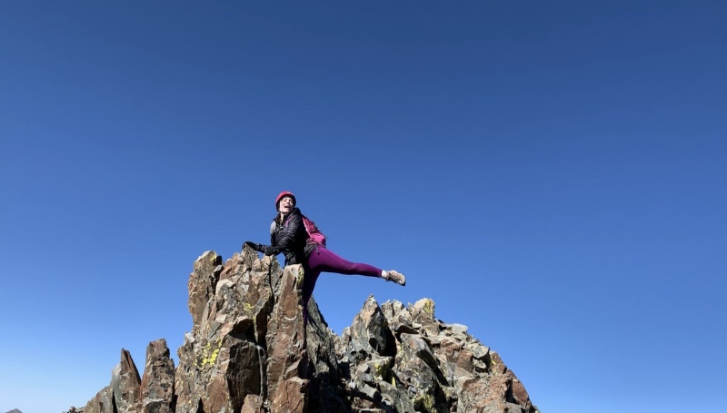
I probably spent 2 minutes total on the summit before I turned around to join the guys. We all navigated with ease down off the summit and back up to the false summit. At this point, I told the guys thanks for letting me tag along, and sent them back on their very fast paced way! I used this moment to take my moments of rest and ate a snack. I had cell reception so I texted my parents to let them know that I was off of the summit and made it through the "trickiest section" safely. Then, unsatisfied with my summit selfie, decided to play around on some rock formations to get a better shot! Time: 11:15 am 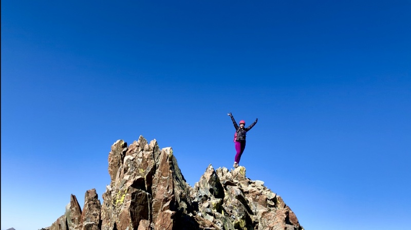
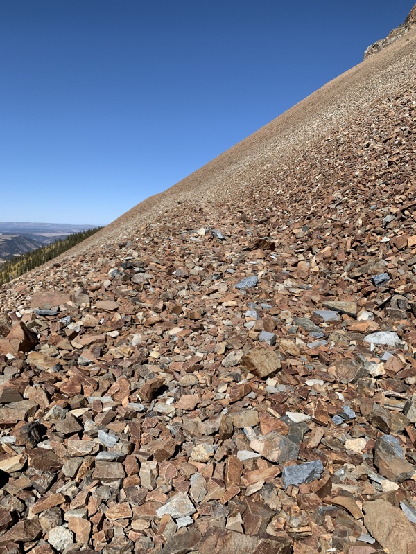
After this little break I headed back down the face. The trail on the way back was somehow much easier to locate than it was on the way up, until it disappeared. It was on this section where I encountered a handful of other hikers, all of them male, and none of them wearing helmets. I am not saying that they weren't wearing helmets because they were male.... it was just something I noticed. Navigating around the corner to the Wilson/Gladstone saddle was a bit tricky, I don't know where I went wrong here, but I definitely had to do some C4 moves to get myself across. But it wasnt too bad and I made it to the little saddle. Now here is where it began to really suck. At some point, a guy who summitted after me passed me up, and wandered directly over the little saddle and down to head over to the RoA saddle. Without even skipping a beat, I followed him. He was going in the right direction, I could see the RoA saddle.. but none of this terrain I was walking on felt familiar at all. It was MUCH more loose. I kept thinking "I don't remember this part being so loose and slippery." But that guy ahead of me kept on heading over in the right direction, so I kept following him. He traversed this terrain without incident and dropped off the RoA saddle and down into the Navajo Basin trail system. But as I traversed across this talus/boulder field, the rocks became more and more unstable. I tried to call to him to see if he could help me navigate the best route across, but he was too far away and could not hear me. (I remembered then that he had his headphones in). So I kept trudging...I just had to go straight across and I would get to the saddle, just like he did. But at one point, the rocks became so unstable and loose that I literally could not take a step in any direction without causing talus/boulder sliding. I was able to hop/skip/jump from biggest rock to bigger rock onto a couple of giant unmoving stacked boulders where I stopped to breathe. After calming my heart rate I tried again to navigate up, over, back, or down.... ALL options caused rock slippage and some resulting slides. Now the worry set in. I clambered back onto the boulder formation knowing full well that I was stuck. But other than that guy who was still hiking down below in the basin, there was no one to be found. I got out my emergency whistle and blew over and over trying to get the guys attention, but his headphones were in and I was never able to get his attention. I sat on those rocks for about 20 minutes trying to reason my way through every option. I could wait it out until another hiker passed by. I could wait it out until someone in my family didn't receive a call later in the day and called SAR, I had a space blanket and food and water. I could keep blowing my whistle and hope someone would hear.... I didn't have service, so calling anyone to inform them of my situation was not an option. But I am stubborn. I am not one to panic, and I am definitely not one to go down without a fight... I decided that I would try again to get myself out of this mess. So I put my helmet back on, (I took it off once I got past the corner at the Wilson/Gladstone summit) and decided that if the rocks slide and I get caught, at least I gave it a good solid effort to get my idiot butt out of there. I decided to clamber up on top of these giant stacked boulders via some C4 moves to gain some ground. And from there, I was able to do some very tenuous careful skip-like moves to higher ground, where the rocks were stable enough to help me navigate up the boudlerfield and regain the trail. Where I quickly traversed over to the RoA saddle. I have never been in such a sticky/scary situation whilst adventuring alone, and I am not anxious to enter one again. I am thankful that it was not worse, and am doubly thankful that I was trained to keep a level head in these situations. But I am aware that it could have gone horribly wrong and have learned some very important lessons from this experience. I got to the saddle at 12:30 and ate another snack, sent up a prayer of thanks, and headed down the trail into the RoA basin. And, my earlier thoughts about how much the decent through the basin is going to suck without trekking poles was 100% accurate. I walked and walked and walked for again what seemed like "ages" on looseish rocky talus terrain through the basin. By the time I hit the uphill stretch, I was blessing the climb for the sake of my poor feet. I trekked through the trees, the section of talus, and then through the trees again till finally at 3:00pm I made it back to the TH. Time to RoA saddle: 3 hours. Time to summit: 5 hours. Total climbing time: 9 hours 15 minutes. Garmin watch tracked it as 12.83 miles, and 3,940' of elevation gain. Here are some GPS tracks: 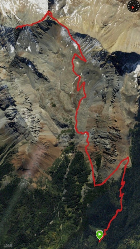
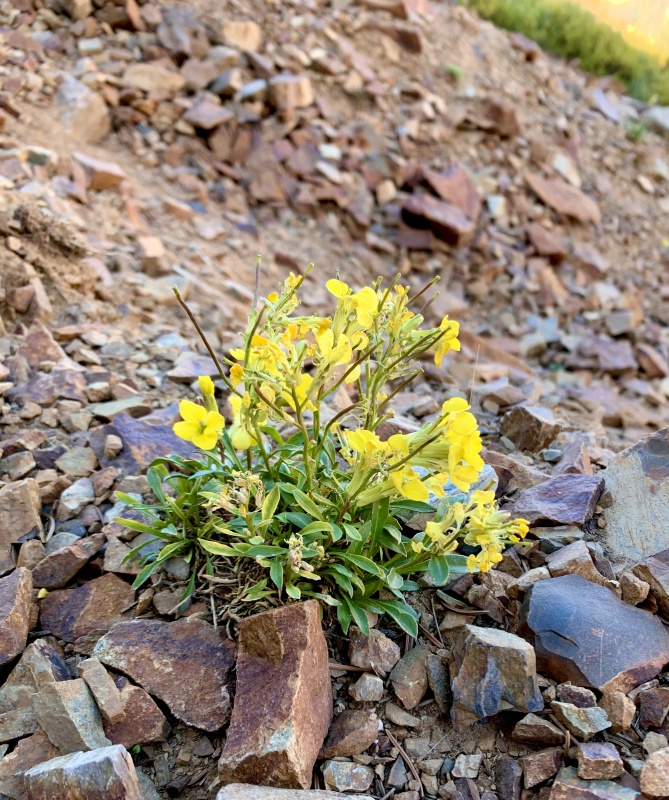
It was a long day on the mountain. I am glad I did it, I am glad for the accomplishment. Would I say I had fun? With the exception of the parts closest to the summit... not really. But it was beautiful, and the experience this mountain has brought me as a learning climber is invaluable. Lessons learned: 1: Bring your dang trekking poles, even if you think that the C3 sections wont need them, just bring them. 2: Before the next solo venture, purchase a PLB (which is on my "to purchase list" but I don't have the money right now). 3: Don't follow people into unfamiliar terrain, even if they look like they are doing the right thing. 4: Invest in some toe protectors for when those blisters break open on the decent. Thanks for reading this incredibly long report... if you stuck around this long, here are some photos of the beautiful sights along the way as your payment. haha! 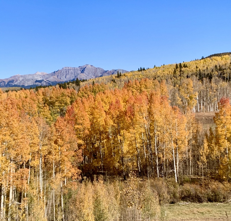
Thumbnails for uploaded photos (click to open slideshow): ")
")
")
")
")
")
")
")
")
")
")
")
")
")
")
")
")
")
")
")
")
")
")
")
")
")
")
")
")
")
")
")
")
")
")
")
")
")
")
")
")
")
")
|
| Comments or Questions | |||||||||
|---|---|---|---|---|---|---|---|---|---|
|
Caution: The information contained in this report may not be accurate and should not be the only resource used in preparation for your climb. Failure to have the necessary experience, physical conditioning, supplies or equipment can result in injury or death. 14ers.com and the author(s) of this report provide no warranties, either express or implied, that the information provided is accurate or reliable. By using the information provided, you agree to indemnify and hold harmless 14ers.com and the report author(s) with respect to any claims and demands against them, including any attorney fees and expenses. Please read the 14ers.com Safety and Disclaimer pages for more information.
Please respect private property: 14ers.com supports the rights of private landowners to determine how and by whom their land will be used. In Colorado, it is your responsibility to determine if land is private and to obtain the appropriate permission before entering the property.