|
Chiefs Head Peak (13,579')
SE Ridge via Wild Basin
15.5 miles, 5,250' vert, 10:03
9/28/19
Saturday, September 28 was a free entry day at National Parks across the country. Yet at 7:30 AM on a weekend during the Fall, the Wild Basin parking lot was still half empty. Wild!
Around 1 mile from the trailhead, Becca casually utters "Moose on your right". I almost wet myself when I turned my head 90 degrees mid-stride and saw this guy just off the trail.
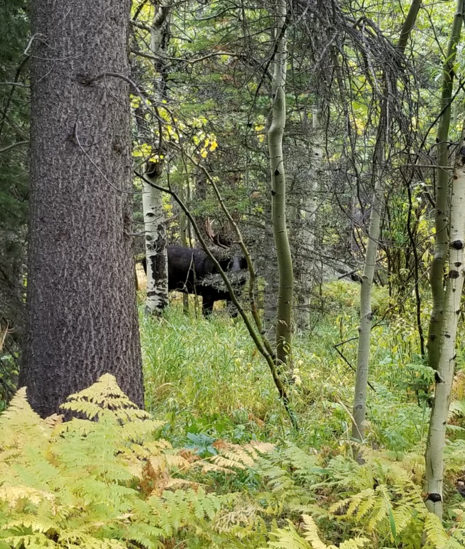
Moose
I was unaware that Wild Basin was a decent place for Fall colors, but we were pleasantly surprised.
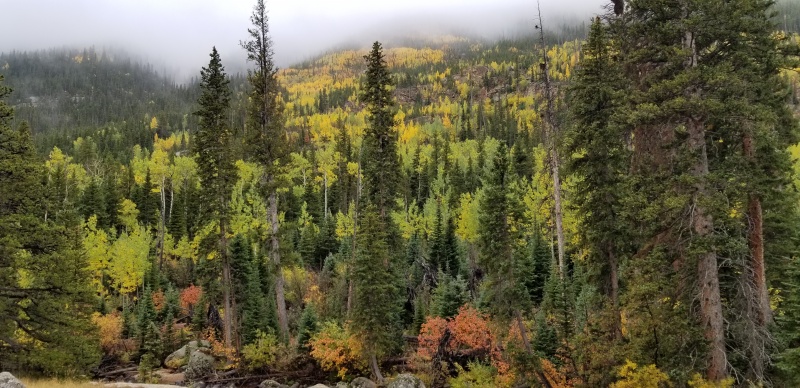
Colors
1.4 miles up the Thunder Lake Trail from the trailhead we turned right onto the unnamed (?) trail that leads to several backcountry camp sites. This signed trail stays on the north side of the creek until it meets back up with the Thunder Lake trail 1.3 miles later, saving you about half a mile each way.
Back on the Thunder Lake trail, we continued the gradual ascent for another 1.3 miles before veering right onto the well-signed Lion Lakes Trail. The pitch kicks up a bit at the start before mellowing out as it approached Lion Lake No. 1.
All morning Becca and I had been hiking under thick cloud cover with only the occasional opening in the sky. One of these openings did reveal that Copeland and other high peaks had received a little snow overnight! We eventually popped out above most of the clouds just before Lion Lake No. 1. At the first lake, 6.2 miles from the trailhead, the views of Alice and Chiefs Head got us excited to be climbing above the inversion!
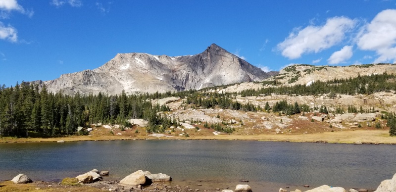
Alice
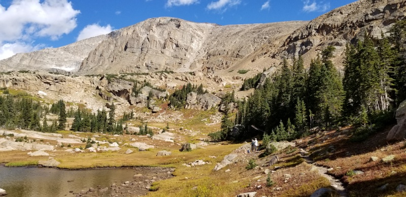
Chiefs Head from Lion Lake No. 1
Just past Lion Lake No. 1, we left the trail as it began to bend northwest toward Lion Lake No. 2, working our way up the grass and talus gully that begins low and dead center in the photo above. This funnels you into a small gully that leads to the SW facing rock gullies which grant access to the SE Ridge of Chiefs Head. Several options present themselves when you reach the base of the 300' slopes leading to the ridge. We took a line further north on the ascent and took the next gully south on our descent. Neither was pleasant, but neither too sketchy if care is taken. Once on the SE Ridge of Chiefs Head, it's nothing more than tundra walking and talus hopping to the summit.

Inversion on the SE Ridge
Plenty of others mention this, but I figure I'd make note as well: the SE Ridge of Chiefs Head actually reads "North Ridge" on topographic maps of the area. This is clearly a misnomer, unless the folks at USGS intended this to be named as the North Ridge of Mt. Orton (11,724'), which lies at the southern terminus of the ridge.
The SE Ridge almost could not be considered a ridge. It's more of a grassy tundra, typically several hundred feet wide, until it nears the connecting ridge with Pagoda. We angled a little to climbers left of the Pagoda-Chiefs Head saddle on the ascent and continued on or just below the ridge crest to the summit. From around 13k on, we had 1-2" of fresh snow on part of the ground :)
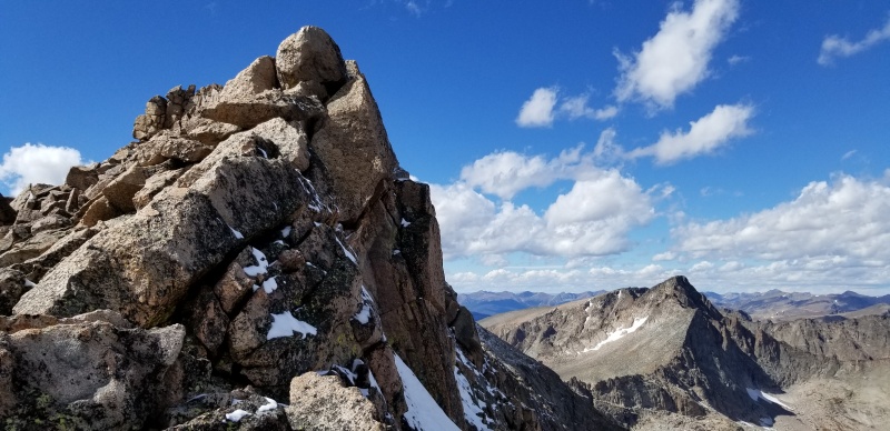
False summit
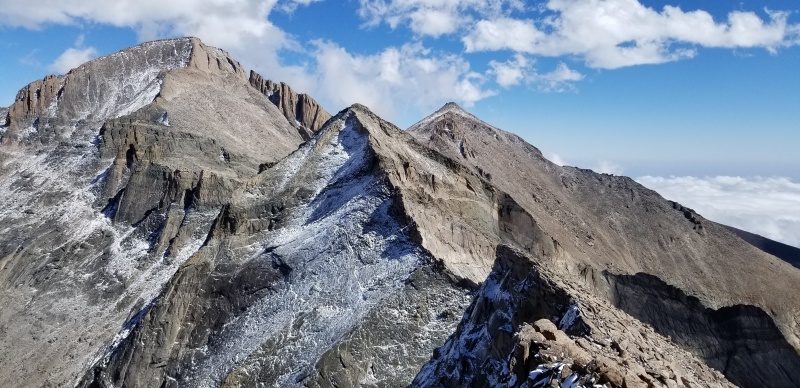
Wild Basin to the right, Glacier Gorge to the left. (L > R) Longs, Pagoda, Meeker

Feel free to use this as the background for an inspirational quote you'll post to social media
At the summit we admired the excellent views of the inversion with Glacier Gorge, Longs massif, Wild Basin.
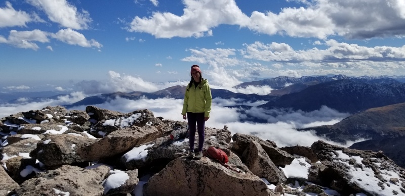
Becca on the Chiefs Head summit
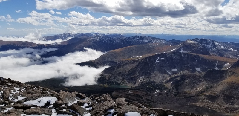
Wild Basin
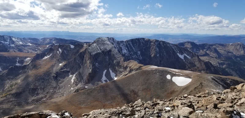
Hourglass Ridge to Alice
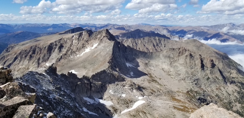
SE Ridge to McHenrys
A couple summers ago Becca and I climbed the N Ridge of Spearhead. It was really neat to see Spearhead from this vantage with the same partner I climbed it with :)
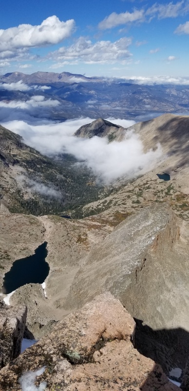
Frozen Lake, Spearhead, Blue Lake

Glacier Gorge summit pano
We descended the SE Ridge quite a bit further to the west than our ascent. It all went pretty easily and quickly.
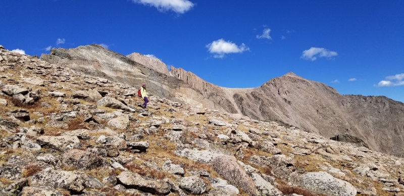
Interesting look at the Loft and SE Longs from the SE Ridge of Chiefs Head
When we arrived back at the gully used to gain the SE Ridge, we kicked down the cairn we built as a marker and continued south to the next gully. This one wasn't much better, but with careful switchbacking down the slope we were able to get back onto solid ground below.
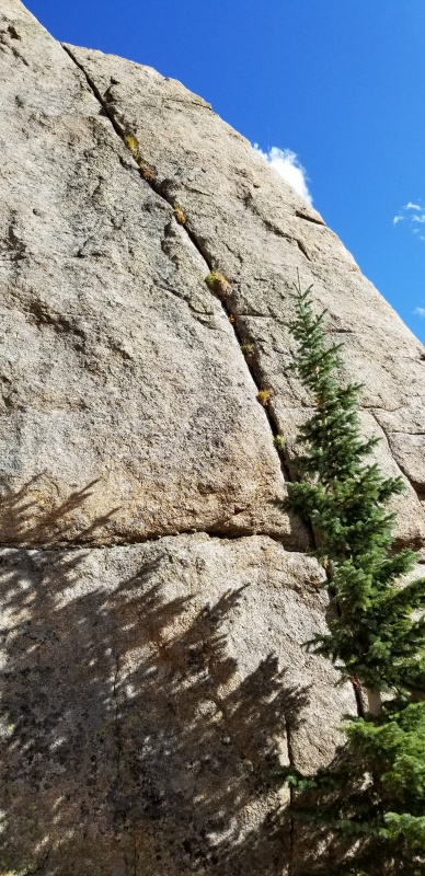
Someone needs to clean and climb this crack above Lion Lake No.1 that was getting me excited
Back down at Lion Lake No. 1, the clouds continued to push up valley and partially engulfed Chiefs Head and Alice, making for some cool scenes.
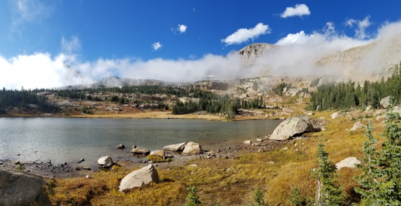
Chiefs Head, chiefing
After a long break at the lake, we marched the 10K back to the car in one continuous push, closing out a ten hour, three minute day.
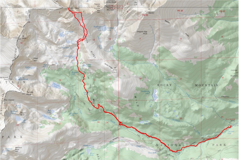
Thumbnails for uploaded photos (click to open slideshow):


|
