Download Agreement, Release, and Acknowledgement of Risk:
You (the person requesting this file download) fully understand mountain climbing ("Activity") involves risks and dangers of serious bodily injury, including permanent disability, paralysis, and death ("Risks") and you fully accept and assume all such risks and all responsibility for losses, costs, and damages you incur as a result of your participation in this Activity.
You acknowledge that information in the file you have chosen to download may not be accurate and may contain errors. You agree to assume all risks when using this information and agree to release and discharge 14ers.com, 14ers Inc. and the author(s) of such information (collectively, the "Released Parties").
You hereby discharge the Released Parties from all damages, actions, claims and liabilities of any nature, specifically including, but not limited to, damages, actions, claims and liabilities arising from or related to the negligence of the Released Parties. You further agree to indemnify, hold harmless and defend 14ers.com, 14ers Inc. and each of the other Released Parties from and against any loss, damage, liability and expense, including costs and attorney fees, incurred by 14ers.com, 14ers Inc. or any of the other Released Parties as a result of you using information provided on the 14ers.com or 14ers Inc. websites.
You have read this agreement, fully understand its terms and intend it to be a complete and unconditional release of all liability to the greatest extent allowed by law and agree that if any portion of this agreement is held to be invalid the balance, notwithstanding, shall continue in full force and effect.
By clicking "OK" you agree to these terms. If you DO NOT agree, click "Cancel"...
I wanted to make sure this report has a lot of photos and (maybe) less talking. Everyone gets their moment.
This climb was a long time coming. A group of us first discussed Teakettle back in early June, but myself and another person ended up calling it off due to questionable snow conditions (me bailing on snow climbs was apparently the theme of the spring). Unfortunately, our sherpa (osprey, also known as Tom) had an accident a couple of weeks later, and our plans for warm beverages appeared shelved for the year.
But as it turns out, Tom is partially made of vibranium and was back to hiking just a couple of short months later. Who knew?
The fall gathering was then announced to be in Lake City, and my wonderful wife was going to be out of town for the weekend. I knew that meant I was going to be driving to the San Juans no matter what; the question became for what peak? Half Peak would be fun, and I love the gatherings....but hey, there might be a window to order drinks! (I'll stop at some point, I promise).
So I put out the feelers. Even though these peaks are better done as snow climbs (as you'll soon see), everyone was in. We had a crew of five: myself, Brian prime (BKS), Brian squared (CheapCigarMan), Kirsten (koeffling), and our sherpa, Tom. The only question mark was the weather, and while gusts were supposed to be annoying enough to keep your attention, the full day of forecasted sunshine made us optimistic.
Kirsten, Brian prime, and I crammed in the trusty Crosstrek after work on Friday, drove 6 hours straight, and made it to Governer's Basin turnoff at 12:45 AM. We all promptly passed out, got our recommended 8 hours of sleep (math isn't my strong suit), and woke up to the blaring of my alarm at 3:30 AM. It seems early for a 4 1/2 mile hike....but we needed every minute we could get.
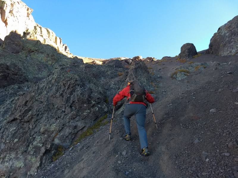
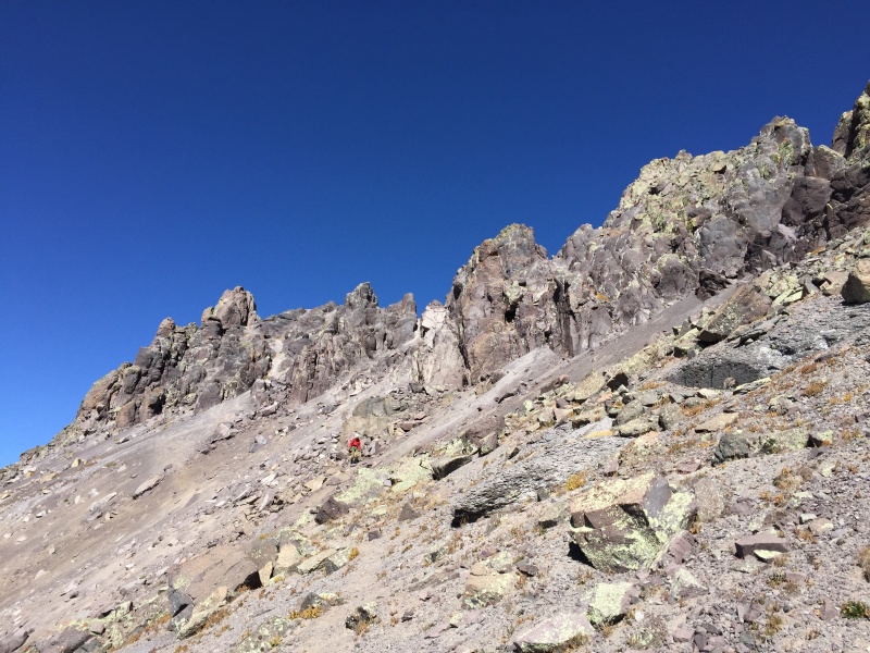
We started up the hill and immediately lost the trail in the dark. We talus hopped, walked up a stream bed, clawed our way up steep grass, and slip and slid our way up loose scree. It took forever. I don't have anything good to say about the slopes leading to Coffeepot's shoulder so I'll just say this: prior trip reports undersell how miserable it is. It's also step enough that if a backpack starts to roll, it'll pick up speed, roll 500 vertical feet, and take a header off a cliff. Ask us how we know...
Routefinding isn't bad if you know what you're doing (which we half did). Basically, go up, and stay to the right of any cliffs/outcroppings.
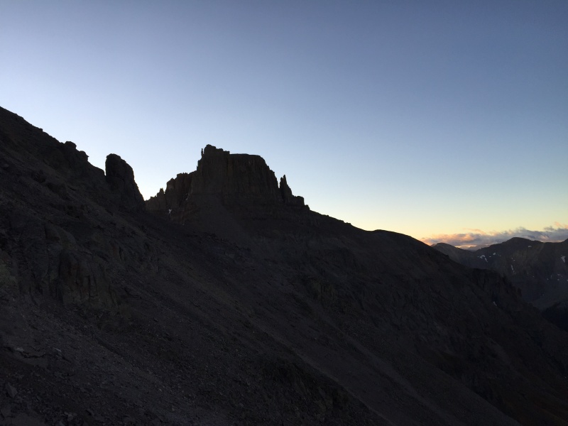
The view going up. Stay right. It's better in the dark so you don't have to look at the crap you're climbing.
Potosi as the sun rises.
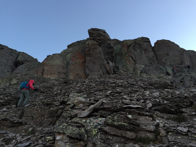
Stay right. Those rocks look solid, right?
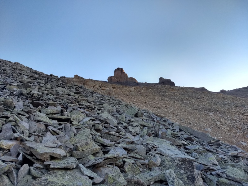
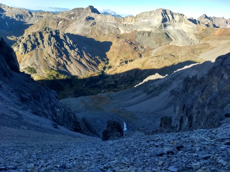
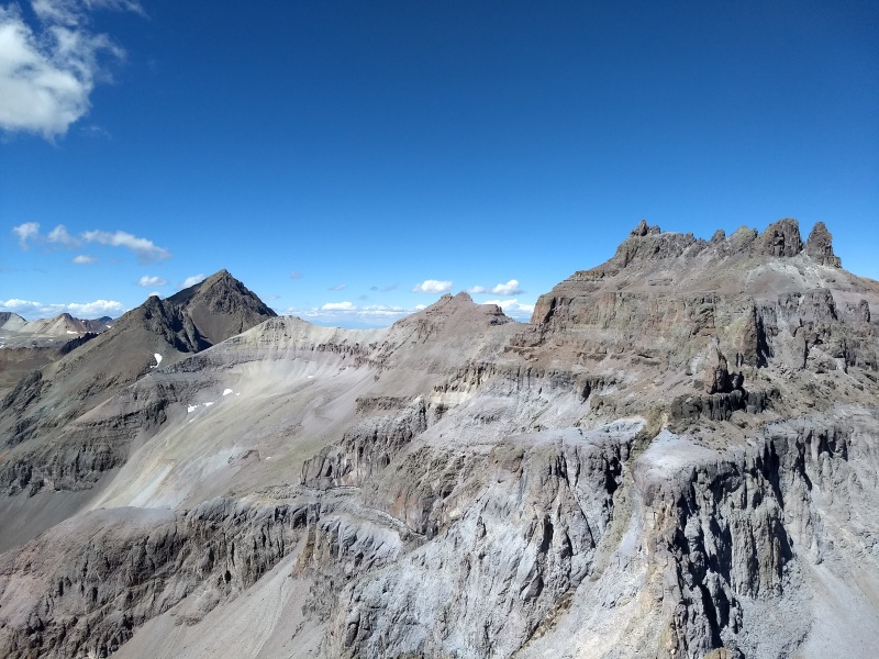
If you aren't hiking stupidly early in the morning, you can actually see Coffeepot (and Teakettle) from the parking lot at 11.3k. It looks so close!
Coffeepot! Doesn't look much like a coffeepot from my view.
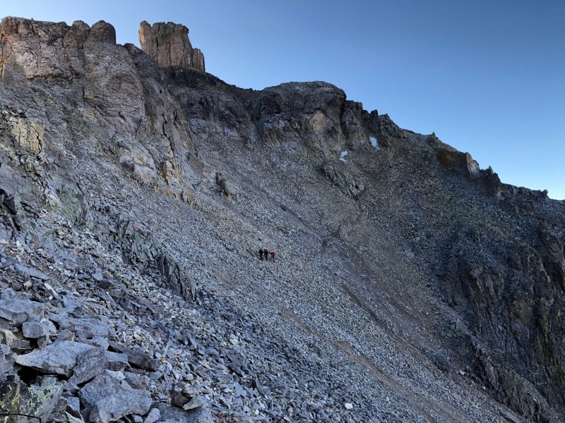
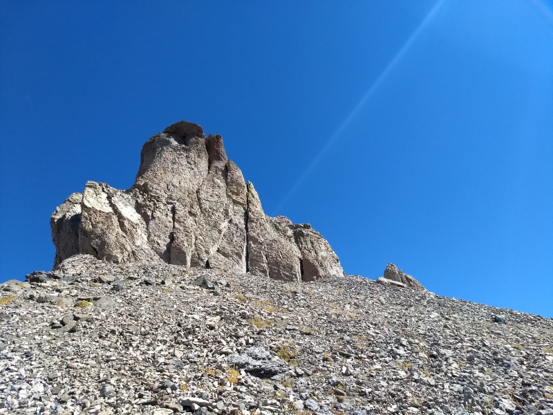
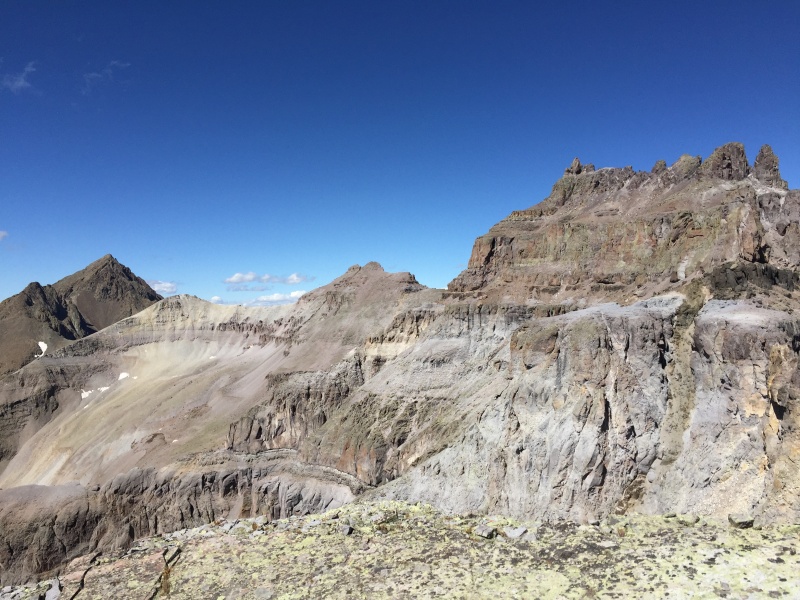
Once on Coffeepot's shoulder (after a minor routefinding error.....stay right of everything....) we were greeted with an intimidating view of Teakettle. It's a freaking fortress of a peak. Luckily, there's a weakness: the black gully. Which is not really black, more of a poop brown. We floated other names for it. Several were partial to "the shit stain". I had to veto "the poop chute".
The traverse to the poop brown gully
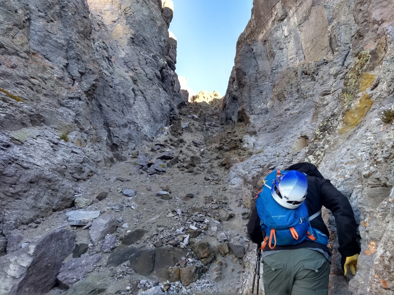
Black gully direct. No thanks.
From the base of the poop chute, a look back on the route from Coffeepot's shoulder.
See? Where's the black?
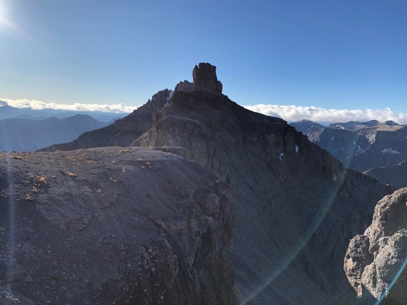
The gully goes quick, and we found ourselves on the upper plateau of Teakettle. From here, it's a quick traverse under the upper cliffs to the sandy gully, up the sandy gully, then a clear climber's trail to the summit block.
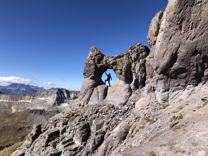
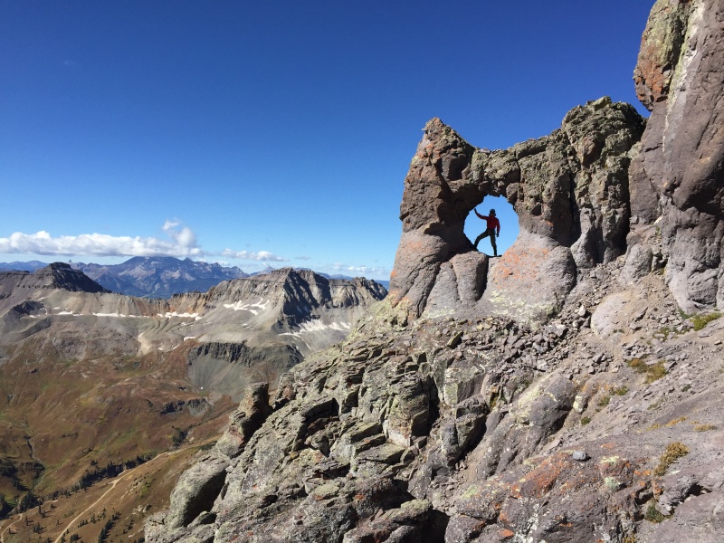
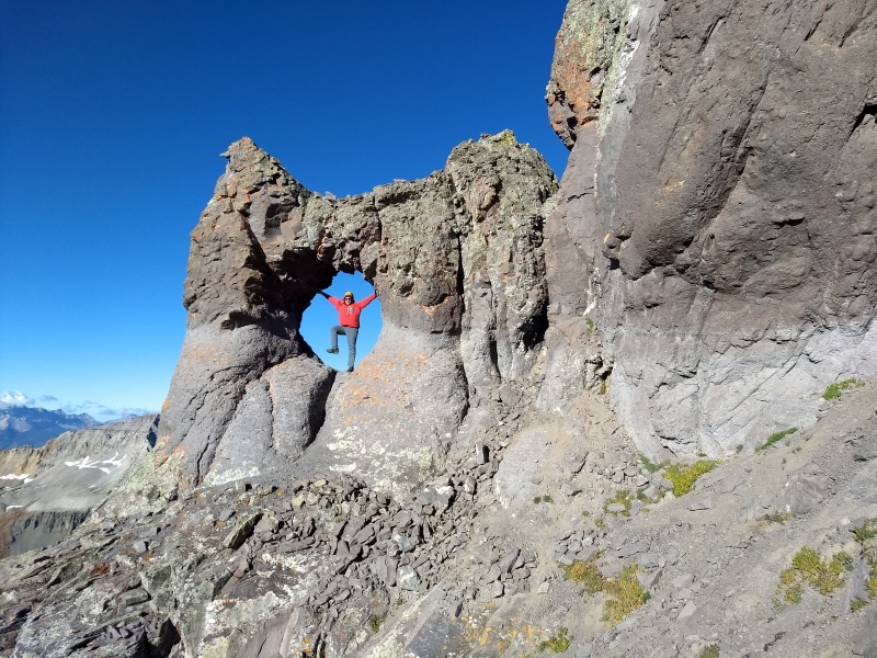
Looks more like the Hamburger Helper logo
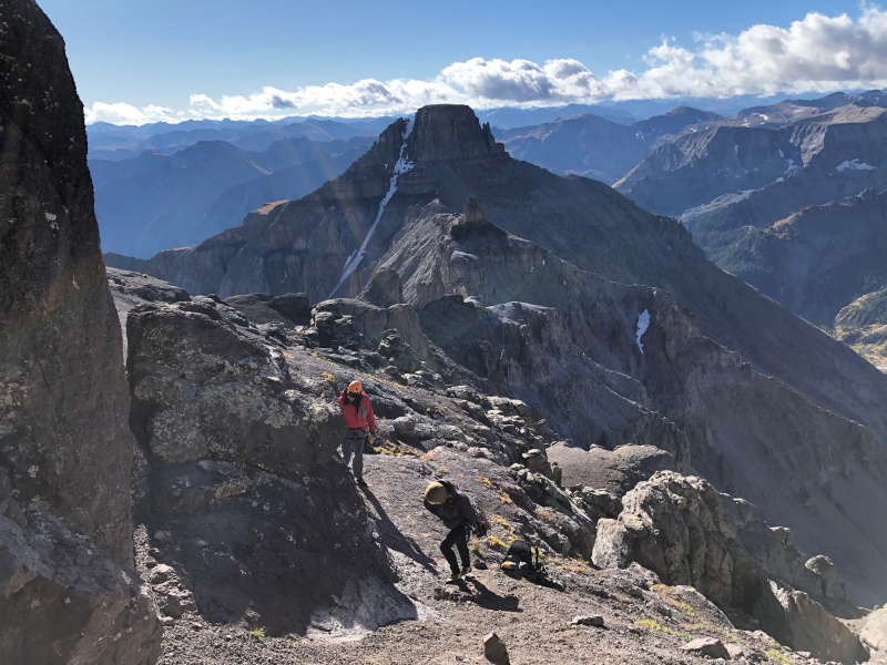
Brian prime bombing the aptly-named sandy gully
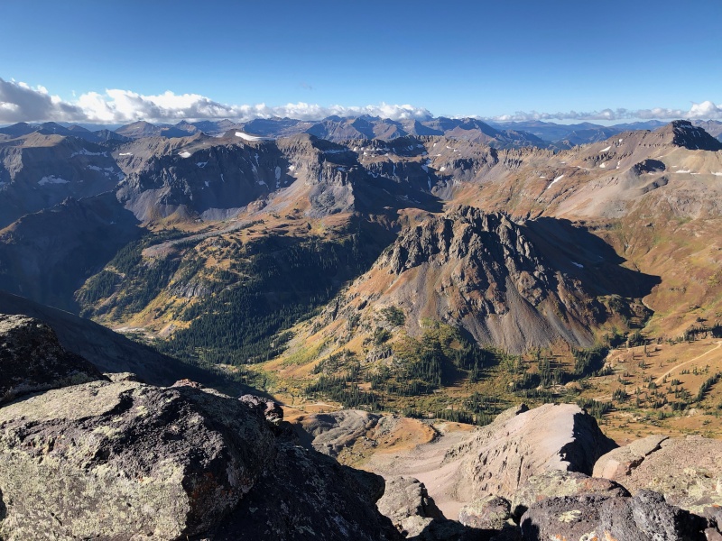
Yankee Boy Basin
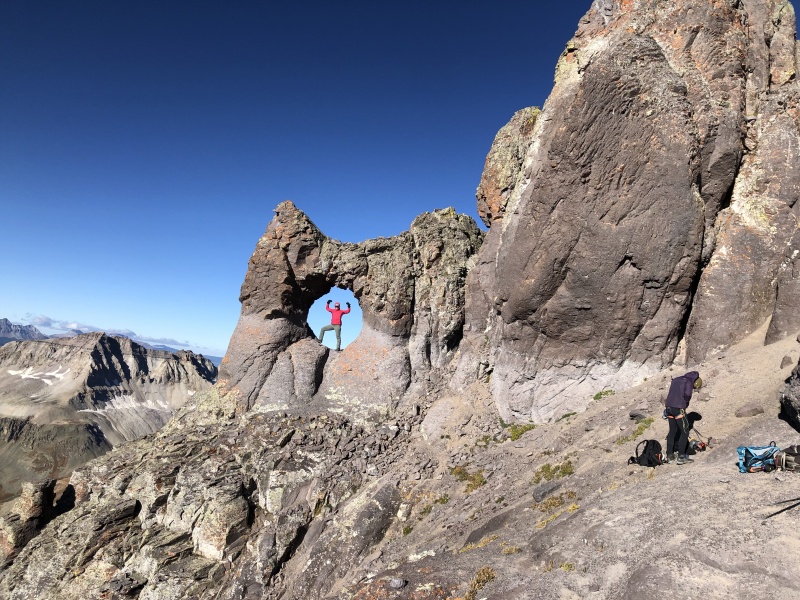
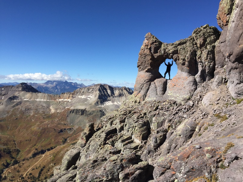
Finally, we made it to the summit block. It is somehow cooler in person than it is in pictures. It truly seems fake. Everyone got their handle shots, and we geared up to climb.
Gearing up.
No flex zone
They knooooow better
Is that Freddie?
Part 3
I want to make a bunch of photoshops of Brian stomping on things.
Not a bad place to be.
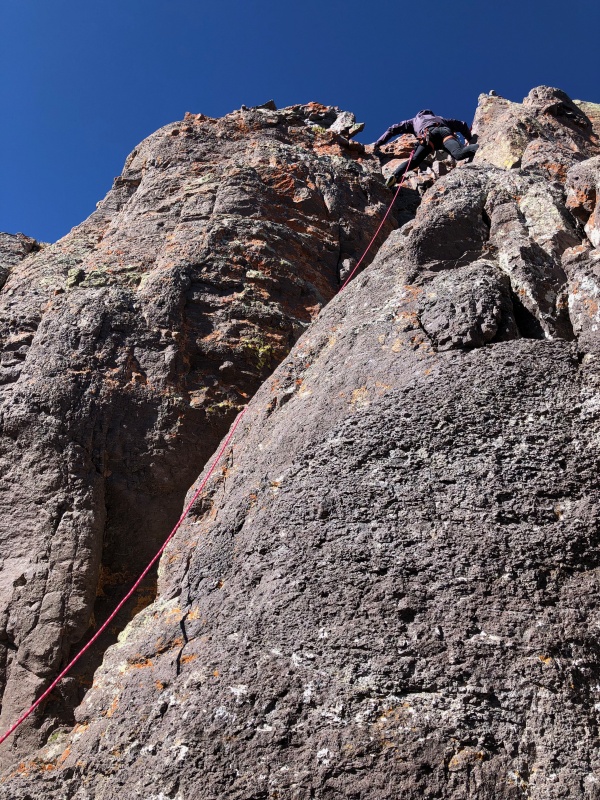
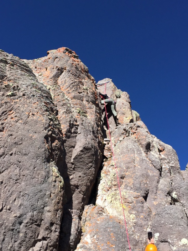
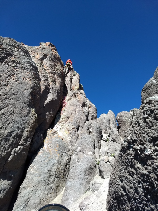
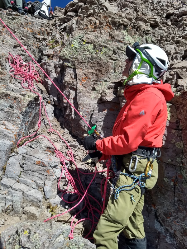
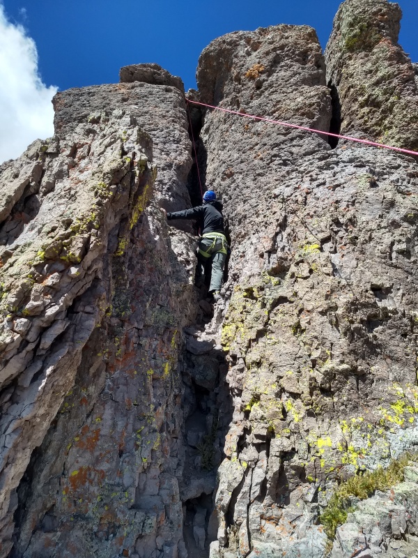
Now came the fun part. I was concerned earlier in the week about forecasted gusts to 50 MPH (which I guess is probably a bad thing when soloing), but that forecast dropped to gusts of 25-30. I soloed the block, brought up the rope, and set an anchor for the rest of the group to toprope.
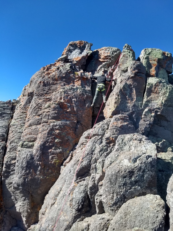
I didn't think the climbing was that difficult. I felt there were maybe 3 or 4 moves of low fifth class. The first third of the climb is a class 3 scramble, then some slab climbing with a couple of cracks in it, then the upper chimney. The group consensus was the crux was the first move getting off the class 3 section. It consists of two vertical cracks, which lead to a high foot and easier climbing.
Me climbing the summit pitch.
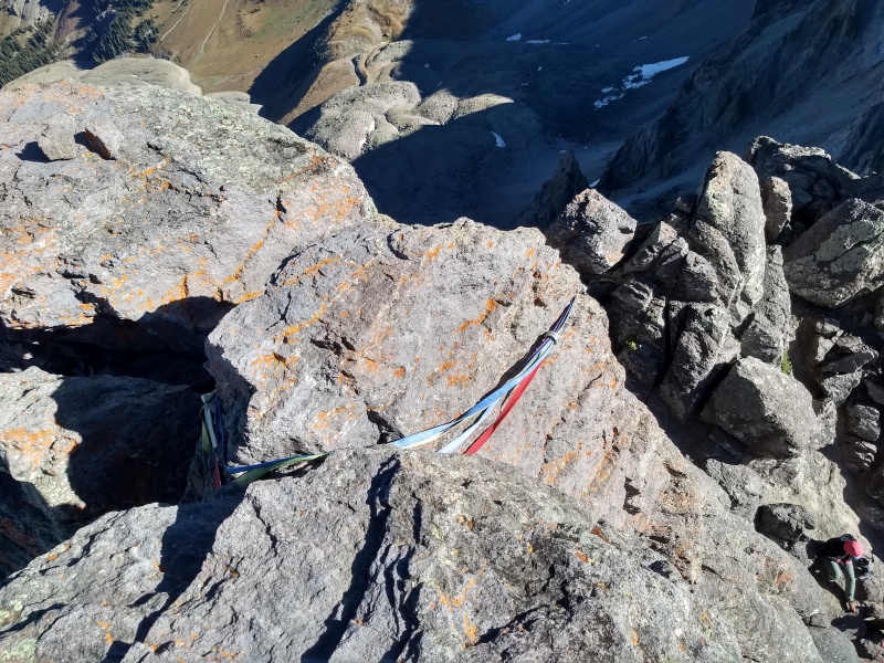
Anchor up top. Rap rings and slings are in good shape. I clipped a couple of biners to make a top-rope anchor.
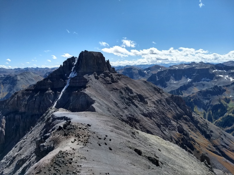
Summit views of Sneffles and Gilpin.
Kirsten bombing up, Brian can hardly wait
Stemmin
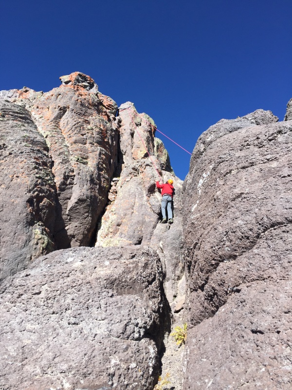
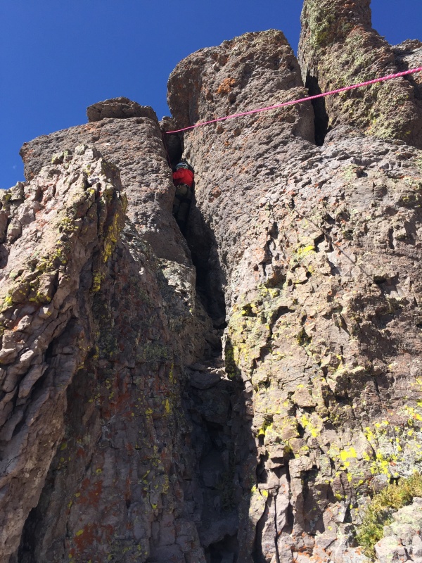
Brian prime finally gets his chance.
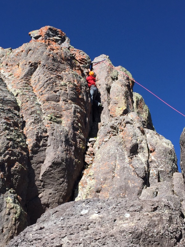
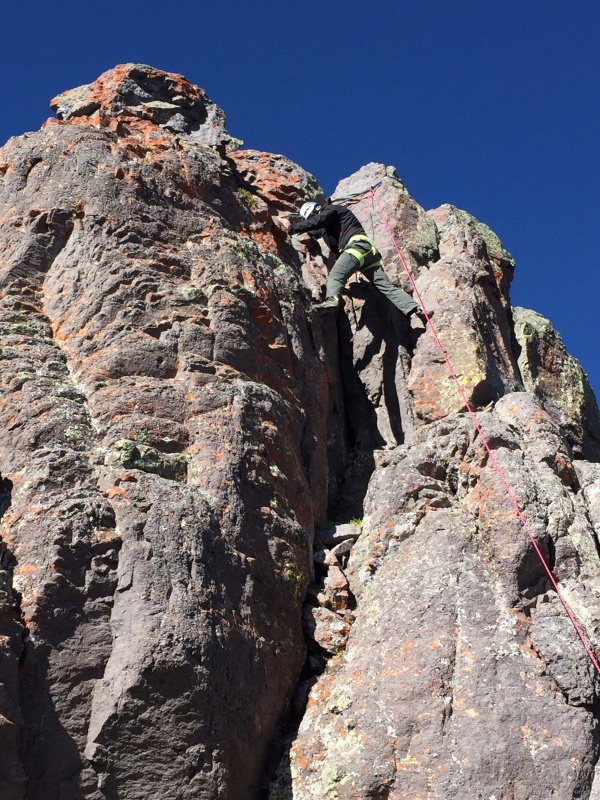
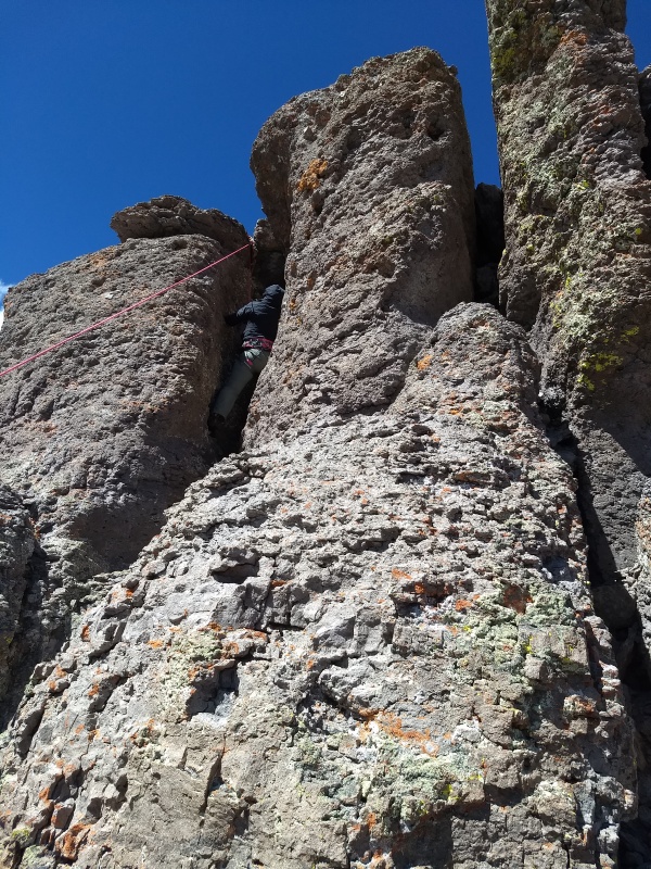
Crossing over into the chimney
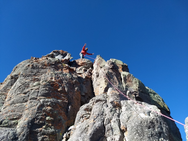
Reach for the top!
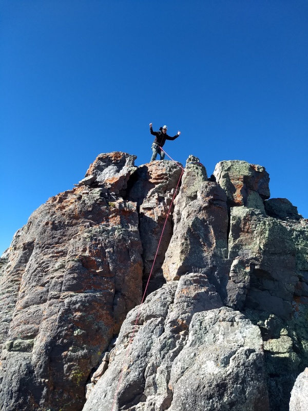
Success!
First move of chimney
That's a pulled groin
"Don't drop your cookies!" Ahh Roach you a funny one.
Brian squared summing up our feelings
Tom moving into the chimney.
Gotta be one of the first guys to climb this in boots and gaiters, right?
Tom cleaning the anchor
...and rapping down.
It takes a long time to get five people up and down an alpine pitch. Of course, we weren't in a hurry either, as the sun was shining and the atmosphere around this peak is otherworldly. We eventually had to meander, so we reversed course back to Coffeepot's shoulder.
Tom coming down off the summit ramparts.
After descending the gullies and traversing back to the top of the initial slope, Coffeepot lies only a hundred or so feet above. A quick jaunt up and around to the east of the 'Pot puts you at the base of a short, loose scramble to the final pitch. I soloed up and set an anchor again.
The class 5 section is short, maybe 20 feet. It's a chimney, but after the initial moves, the easiest route is up the south wall of the chimney. There is a picture perfect finger pocket on the south wall that made my day. I've never seen a better finger pocket, even made of plastic. The hardest move is the exit to the summit. You have to simultaneously duck under an overhanging block while getting your left foot high to pull the move. Fun climbing, easy class 5. I thought it was similar difficulty to Teakettle, the rest of the group found Teakettle harder.
Tom approaching the 'Pot
Still not sure I see a coffeepot...
Our fearless and stylish belayer
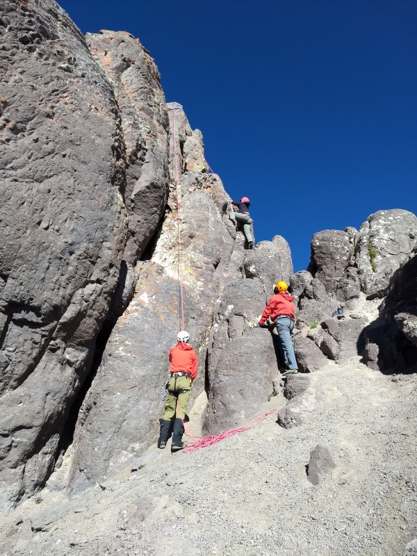
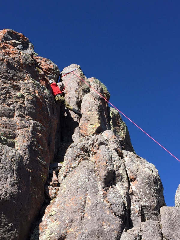
Brian squared entering the chimney.
Brian prime making moves.
Kirsten at the FINGER POCKET
Tom squeezing his way up.
Kirsten pulling the final move.
Brian squared on the summit!
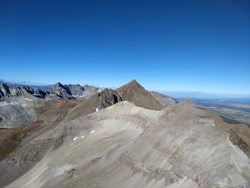
Summit views; Potosi
Emma, Gilpin, Dallas
Sneffels, Teakettle
Uno mas....just such an awesome view.
Originally we were hoping to go for Potosi too, but the wind was started to pick up and we'd been out for a looooong time. Not moving, per se, but you know....out. We chose to start the descent back to the cars, which looked close enough to reach with a 9-iron.
The descent honestly wasn't as bad as I feared. The mountain is so loose it basically moves you down for you. But at least the views are great! Oh, and about the escaping backpack? Ask me at the next gathering.
One party shot.
To you GPSers out there: ignore the detour on the descent. That was in the name of backpack finding.
My GPS Tracks on Google Maps (made from a .GPX file upload):
..... to the ending of the world thou shall be known as RopeGun!
RopeGun is a 5.10 climber so he thought the free climb with no protection up Teakettle was a walk in the park.
It is, in reality, a 5.8 climb for mere mortals.
Thank you for organizing the trip and for the leading of Teakoffee.
Have a good trip on Jagged.
Wow Eric! You're a natural Trip reporter! Fantastic TR!!!
You summed it up way better than my TR, 2,500' of pure steep loose suck for 60' of sheer delight!
I'll always remember those indescribable views with the four of you as I couldn't have climbed with a better troop! You are all amazing people. Thank you for allowing me to be a part of your journey.
And yes, I'll always owe you for helping me tame that wild backpack of mine!
Caution: The information contained in this report may not be accurate and should not be the only resource used in preparation for your climb. Failure to have the necessary experience, physical conditioning, supplies or equipment can result in injury or death. 14ers.com and the author(s) of this report provide no warranties, either express or implied, that the information provided is accurate or reliable. By using the information provided, you agree to indemnify and hold harmless 14ers.com and the report author(s) with respect to any claims and demands against them, including any attorney fees and expenses. Please read the 14ers.com Safety and Disclaimer pages for more information.
Please respect private property: 14ers.com supports the rights of private landowners to determine how and by whom their land will be used. In Colorado, it is your responsibility to determine if land is private and to obtain the appropriate permission before entering the property.


")
")
")
")
")
")
")
")
")
")
")
")
")
")
")
")
")
")
")
")
")
")
")
")
")
")
")
")
")
")
")
")
")
")
")
")
")
")
")
")
")
")
")
")
")
")
")
")
")
")


