Download Agreement, Release, and Acknowledgement of Risk:
You (the person requesting this file download) fully understand mountain climbing ("Activity") involves risks and dangers of serious bodily injury, including permanent disability, paralysis, and death ("Risks") and you fully accept and assume all such risks and all responsibility for losses, costs, and damages you incur as a result of your participation in this Activity.
You acknowledge that information in the file you have chosen to download may not be accurate and may contain errors. You agree to assume all risks when using this information and agree to release and discharge 14ers.com, 14ers Inc. and the author(s) of such information (collectively, the "Released Parties").
You hereby discharge the Released Parties from all damages, actions, claims and liabilities of any nature, specifically including, but not limited to, damages, actions, claims and liabilities arising from or related to the negligence of the Released Parties. You further agree to indemnify, hold harmless and defend 14ers.com, 14ers Inc. and each of the other Released Parties from and against any loss, damage, liability and expense, including costs and attorney fees, incurred by 14ers.com, 14ers Inc. or any of the other Released Parties as a result of you using information provided on the 14ers.com or 14ers Inc. websites.
You have read this agreement, fully understand its terms and intend it to be a complete and unconditional release of all liability to the greatest extent allowed by law and agree that if any portion of this agreement is held to be invalid the balance, notwithstanding, shall continue in full force and effect.
By clicking "OK" you agree to these terms. If you DO NOT agree, click "Cancel"...
We’ve owned a week in September at a timeshare in the Fraser-Winter Park area for many years that has a great view of James Peak and Parry Peak. I decided to hike one of them this year and settled on James Peak. I found quite a bit of information about hiking James Peak from the southeast, St Mary Glacier side, but I found little detail about hiking it from the west from Winter Park/Fraser, so decided I’d also write up a report for others.
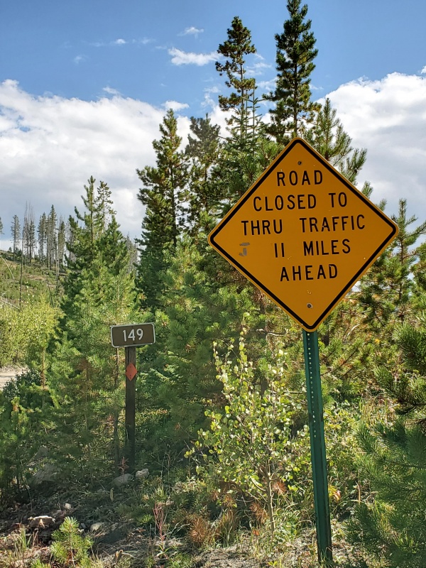
The trail head is at Rogers Pass which is about 11 miles north of the Winter Park ski area on the Moffat Road Hill Route, aka Corona Pass Road (aka Rd 80 which turns into Rd 149). It's a dirt road with an entrance off Highway 40 just after Winter Park ski area if coming from Denver over Berthoud Pass.
The sign at the entrance to Moffat Road off Highway 40 opposite Winter Park ski resort.
The road is well maintained for the first 3.8 miles at which point you come to a Y – go to the right on road 149.
Signs at the Y – take 149.
Drive another 7 miles to the Rogers Pass trailhead. The road gets rougher the higher you go, but I had no problem driving it in a stock 4WHD Toyota Tacoma. I think a 2 WD car can make the drive – a bit bumpy in spots, but clearance shouldn’t be a problem.
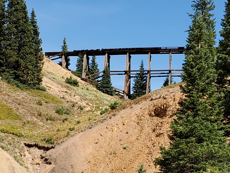
The key landmark at the Rogers Pass Trailhead is an old railroad bridge ( The Rifle-sight Trestle on the Moffat Railroad) which is by itself worth the drive – the trail head is just to the right of the bridge. There is parking space on the road below the bridge and you can hike up to the right side of the bridge to the trailhead or you can continue driving to the right up a short switch back of some of the roughest road on the drive. There is not a parking lot above at the trail head – but there is parking on the road side and space for one or two vehicles to park beside the bridge. BTW, the road continues beyond the trail head.
The Rifle-sight Trestle on the Moffat Railroad
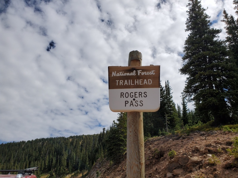
Sign at the trail head.
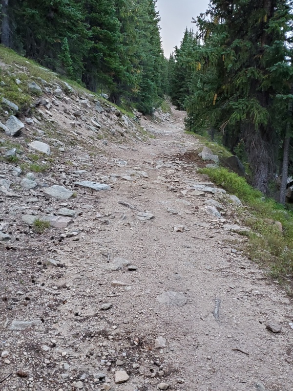
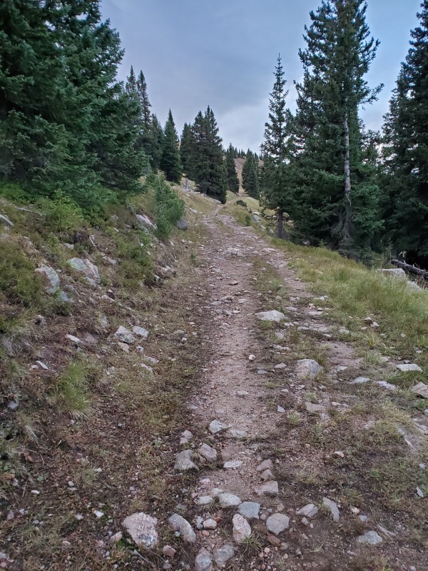
The first 20 minutes of the hike is a wide trail thru forest.
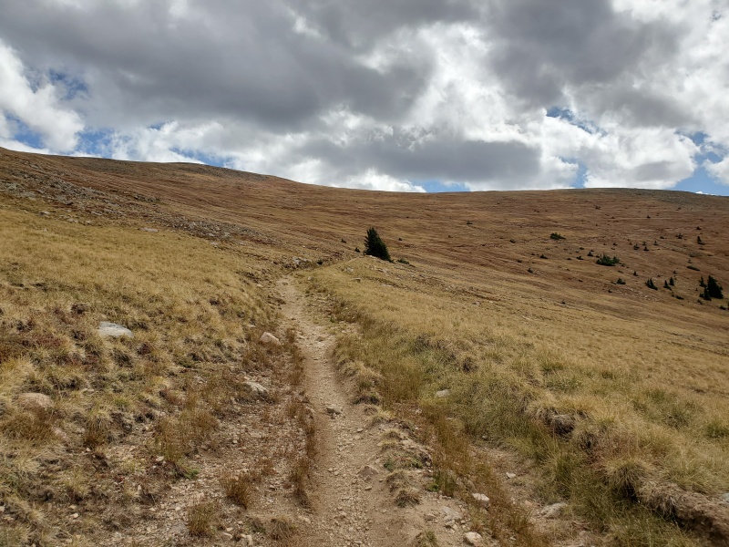
The trees slowly thin out as you enter a meadow above timberline.
The meadow – there is a long switchback at the end of meadow.
Continue on the trail, there is a long switchback to gain elevation, and then the trail curves to the right and then back to the left, at which time James Peak comes into view.
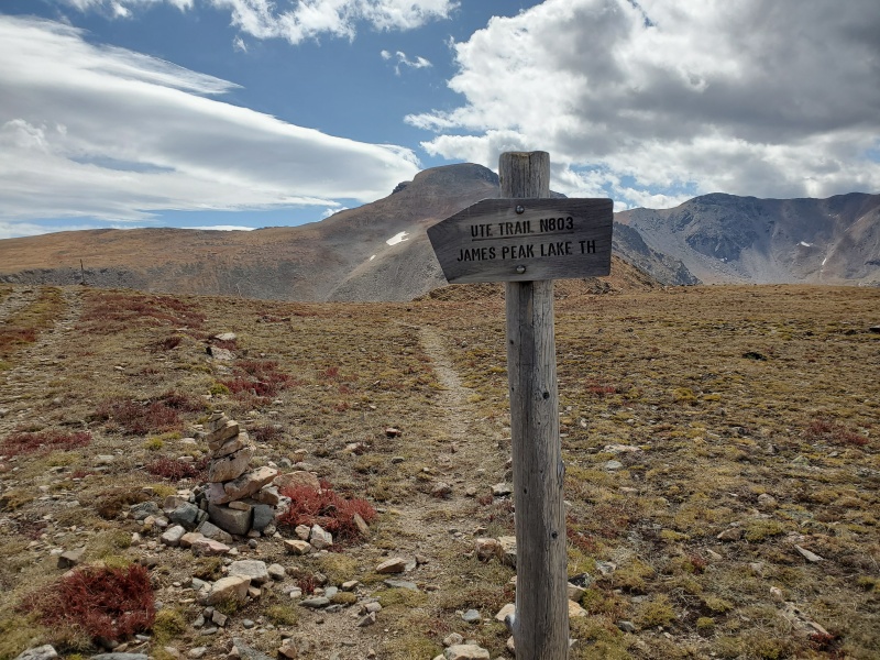
James Peak on the left.Take a right on this trail – the sign with James Peak in the background.
Continue on this trail to the sign above where you go right and the trail to the peak is now the Continental Divide Trail.
…and a second sign indicating you’re on the Continental Divide Trail.
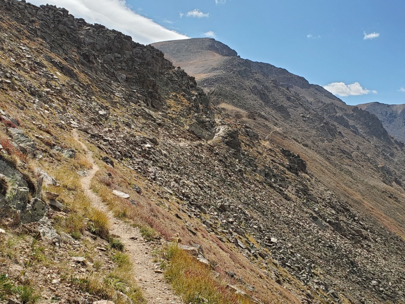
You will now be on the Continental Divide trail - it proceeds on the right side of a ridge.
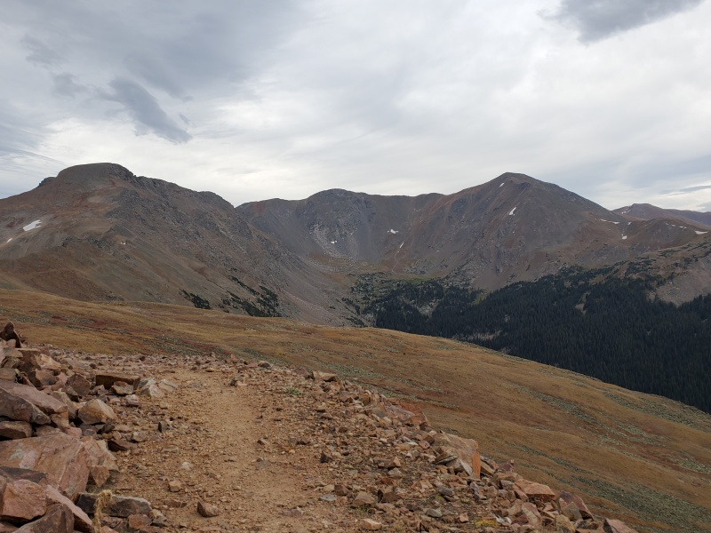
Several times the trail is fairly narrow – you can see the trail in the far distance just right of the middle of this photo with James Peak above in the distance.
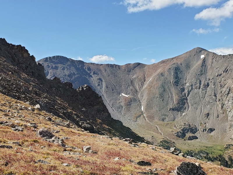
Parry Peak just before you cross left over the ridge. James Peak is out of view to the upper left.
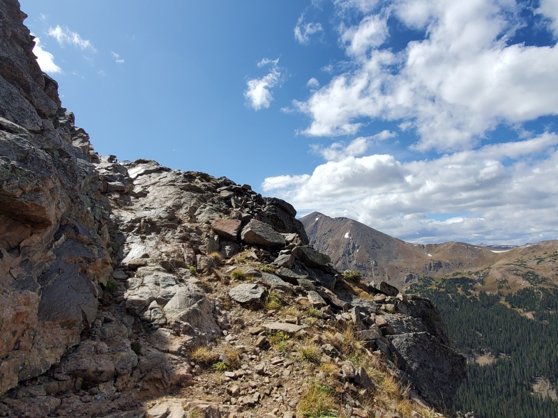
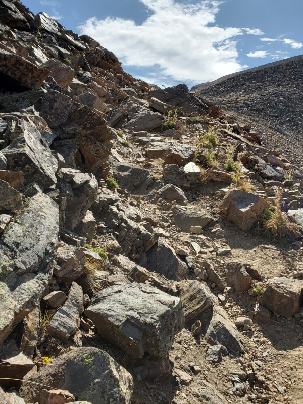
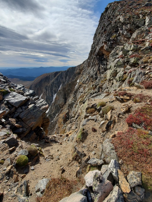
A couple pictures of the two most difficult places on the trail along the ridge:
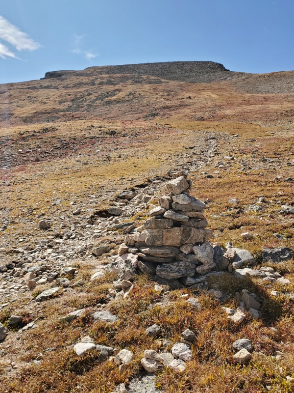
The trail then cuts over to the climbers left into the meadow that slopes up toward the peak. The trail will ultimately lead you diagonally to the far side of the meadow via a series of switchbacks with a few cairns.In the meadow going up toward the Peak. Your initial destination is in the upper left via a series of relatively easy switchbacks.
When you reach the far side of the slope, there is a small opening where you can look down on the far side of James Peak – a very steep drop off. Just a place to look at - you'll now go to the upper right of this on steeper talus.
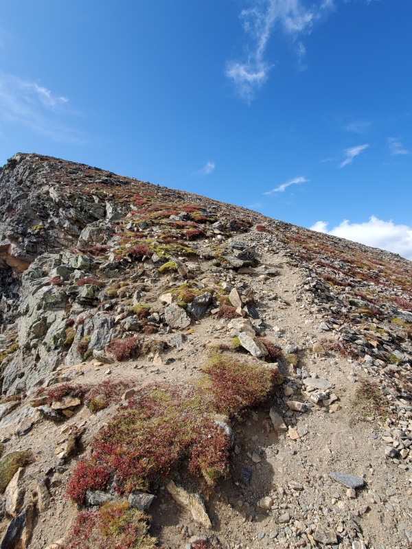
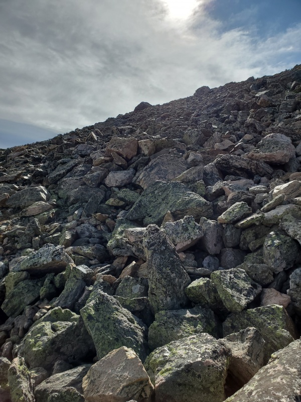
The remainder of the route is considerably steeper via a series of short switchbacks over talus with a few areas of dirt trail. This photo above is the start of the final approach proceeding to the right of the previous photo.
This final approach is a series of short switchbacks leading to the summit. There are a few cairns and the trail is primarily over talus.
One impression – the peak finishes very slowly. The final approach to the summit is rounded, so as you proceed up the peak when you look up at the horizon it appears you are close to the summit. So, you climb up another minute or so, when you look up, it looks like the end of the peak is still the same distance as when you previously looked up.
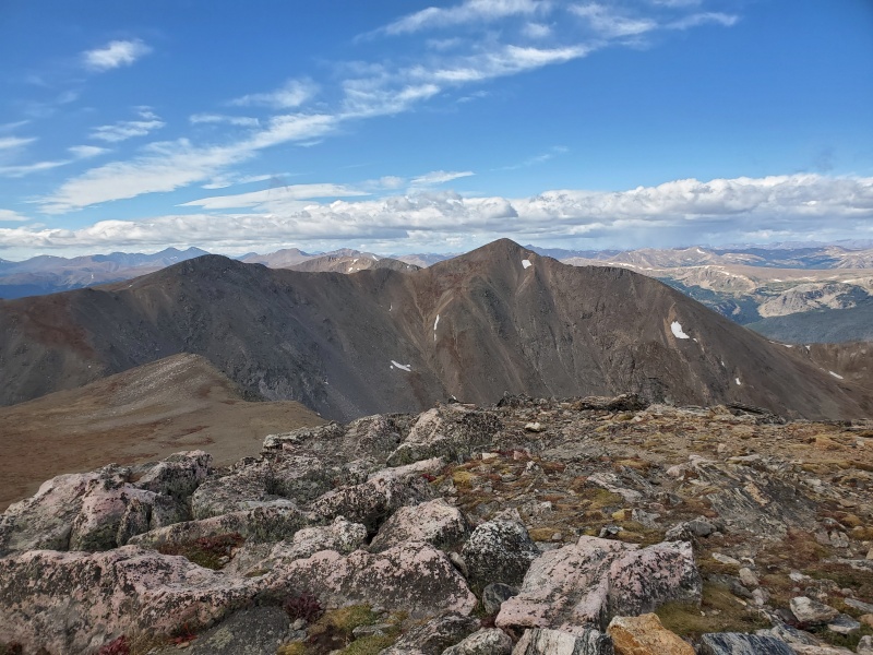
A picture from the summit looking toward Parry Peak. There are 3 – 4 rock, dugout wind shelters on the summit which were very welcome on this cold, windy day. I’ve heard this area is notorious for wind – certainly was on this day.
The difficulty of the hike? It’s not exactly a walk up … there are several places on the trail around the ridge and the talus on the final approach that are more than hiking on a trail…14ers that are similar are Mt Bierstadt and Mt Evans….so maybe an easy class 2???? Distance - Google Maps says it ’s 4.2 miles one way. Another place I read indicated 3.5 miles one way. Altitude gain is @ 2,294 ft – 11,000 to 13,294.
...and, out of order, but a sunrise photo from the trailhead just before I started the hike.
Thumbnails for uploaded photos (click to open slideshow):
Ah, I tried this route many moons ago, only to get thundered off about 3/4-mile from the summit. This report makes me want to return. I eventually summited James via St. Marys, thus the Riflesight/Rogers approach took a backseat. Somebody needs to a St. Marys to Riflesight traverse...
You are spot on about the road, the 7 mi is rocky and tedious, but passable and I did not scrape bottom with my 8" of clearance on a stock SUV. I agree with your class 2 rating, steep in areas on the final approach and some minor talus hopping but overall an easy to follow and well-maintained section of trail. I clocked RT at 8.3 mi and 2,400 ft gain on my GPS due to some minor side jaunts for views on the CD proper along the way. Definitely a fun one.
Thanks for comments on distance and elevation gain. Will be helpful to future hikers. Glad you enjoyed it. Since hiking James Peak, I've also done the traverse from Berthoud Pass to Mt Flora, Mt Eva, and Parry Peak which is definitely longer/harder - 13 miles RT and @ 3850 total elevation gain. It feels good to be able to look at those 4 peaks on the continental divide and know I've stood on top of all of them.
Caution: The information contained in this report may not be accurate and should not be the only resource used in preparation for your climb. Failure to have the necessary experience, physical conditioning, supplies or equipment can result in injury or death. 14ers.com and the author(s) of this report provide no warranties, either express or implied, that the information provided is accurate or reliable. By using the information provided, you agree to indemnify and hold harmless 14ers.com and the report author(s) with respect to any claims and demands against them, including any attorney fees and expenses. Please read the 14ers.com Safety and Disclaimer pages for more information.
Please respect private property: 14ers.com supports the rights of private landowners to determine how and by whom their land will be used. In Colorado, it is your responsibility to determine if land is private and to obtain the appropriate permission before entering the property.


")
")
")
")
")
")
")
")
")
")
")
")
")
")
")
")
")
")
")
")
")

