Download Agreement, Release, and Acknowledgement of Risk:
You (the person requesting this file download) fully understand mountain climbing ("Activity") involves risks and dangers of serious bodily injury, including permanent disability, paralysis, and death ("Risks") and you fully accept and assume all such risks and all responsibility for losses, costs, and damages you incur as a result of your participation in this Activity.
You acknowledge that information in the file you have chosen to download may not be accurate and may contain errors. You agree to assume all risks when using this information and agree to release and discharge 14ers.com, 14ers Inc. and the author(s) of such information (collectively, the "Released Parties").
You hereby discharge the Released Parties from all damages, actions, claims and liabilities of any nature, specifically including, but not limited to, damages, actions, claims and liabilities arising from or related to the negligence of the Released Parties. You further agree to indemnify, hold harmless and defend 14ers.com, 14ers Inc. and each of the other Released Parties from and against any loss, damage, liability and expense, including costs and attorney fees, incurred by 14ers.com, 14ers Inc. or any of the other Released Parties as a result of you using information provided on the 14ers.com or 14ers Inc. websites.
You have read this agreement, fully understand its terms and intend it to be a complete and unconditional release of all liability to the greatest extent allowed by law and agree that if any portion of this agreement is held to be invalid the balance, notwithstanding, shall continue in full force and effect.
By clicking "OK" you agree to these terms. If you DO NOT agree, click "Cancel"...
The primary purpose of this report is to provide information about the NW Couloir of Crestone Peak. People interested in doing the Crestone Traverse, take note. This is much more fun than going up and over Broken Hand Pass to access the Red Gully. But the Couloir is notorious for holding ice and snow, making it impractical for some. This year, especially, it has been a tough nut to crack. I liked this report https://www.14ers.com/php14ers/tripreport.php?trip=19697 by Tynoland showing how much ice still lay in here as late as August 21, 2019. Anyway, as this report will show, it can hold ice all year, but that does not mean it can not be climbed without ice tools, as will be outlined in more detail in this report.
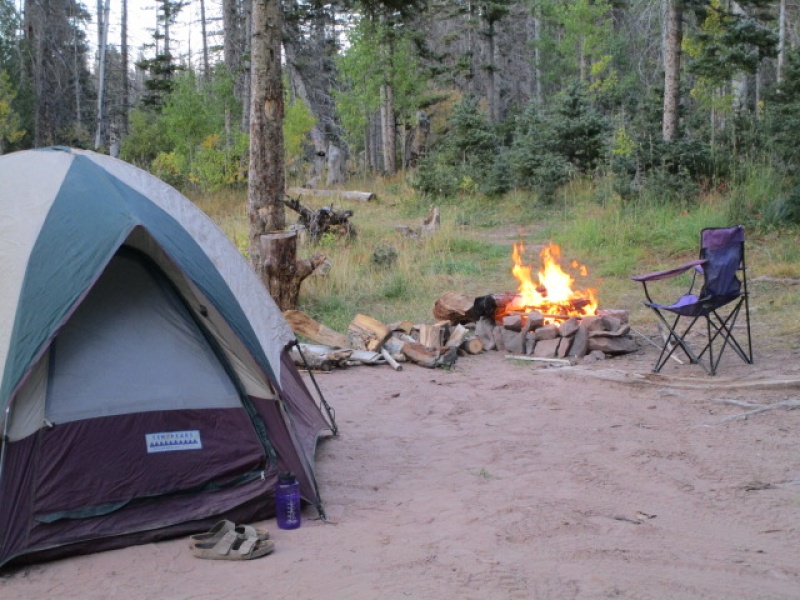
So we begin. For those who have not visited the South Colony Lake trailhead, the 4WD road is rough, but there are not big obstacles like some of the other roads. Just a constant jarring over rocks and ruts. Once you get a couple miles past the 2wd parking lot, and get into the national forest, there are about 10 or so really sweet campsites along the road. I pulled out just about 1/8 of a mile from the parking lot in this spot.
Dispersed camping along South Colony Lake access road.
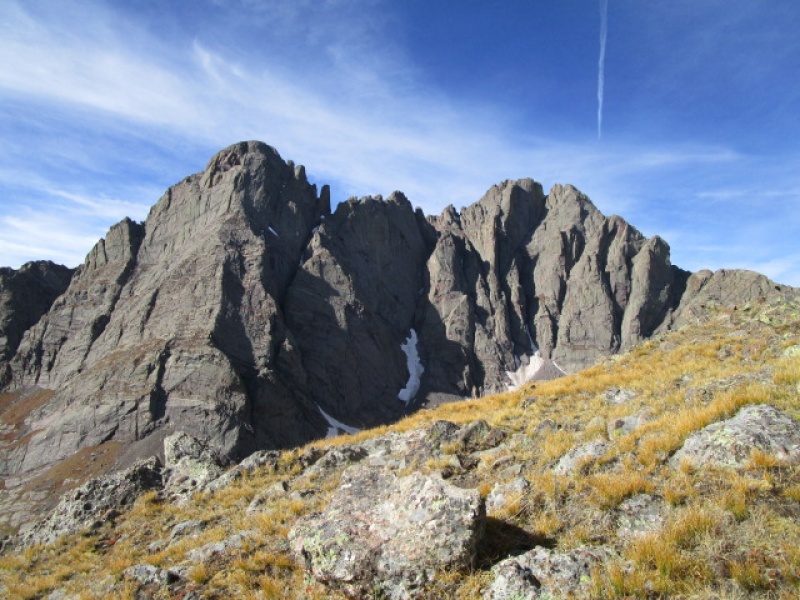
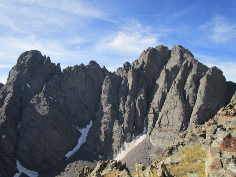
I hit the trail at about 7:30 after a fine night. Temperature dipped a bit below freezing, as attested to by the frost covered morning. After about an hour I was above the trees and heading to the Crestone/Humboldt Saddle. The Crestones are in full display most of the morning.
Crestone Needle and Crestone Peak from near S Colony Lake
What little traffic there was on the trail this morning were all headed up to Humboldt Peak.
Folks heading to Humboldt
From the saddle, head West on an ill defined trail. The small summit ahead can not be avoided, don't try to go around, just bust up and over on the way to "Bears Playground".
Looking back toward Humboldt shortly after leaving saddle
The view of the Crestones captivates the view the entire morning.
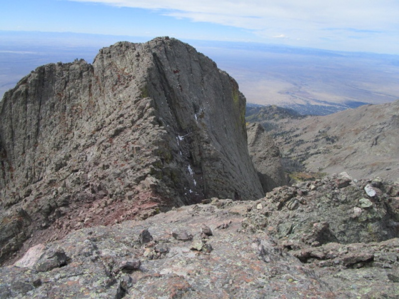
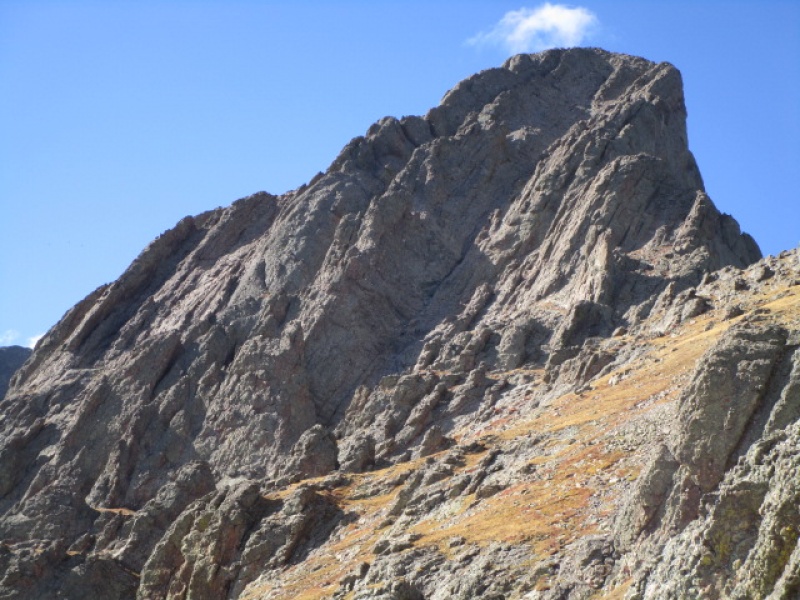
Heading around to the North side of Crestone Peak. Note the Black Gendarme on the Needle.
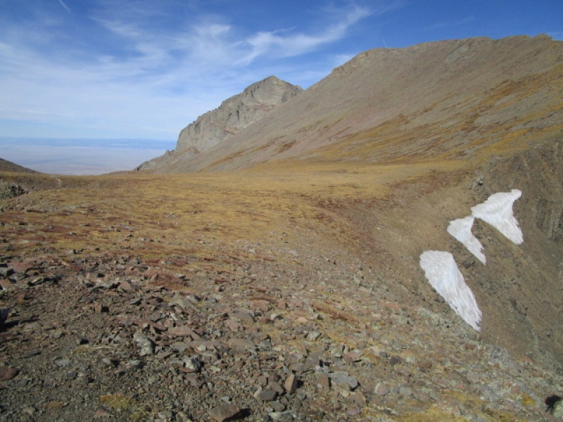
30 minutes or so after leaving the saddle you come onto the area known as the "Bear's Playground". Across the way Kit Carson can be seen. This would have been my alternate if the ice in the Couloir proved insurmountable later on. The hike from the saddle to the playground is pretty straight forward, requiring an occasional 3rd class scramble, but mostly just hiking.
Bear's Playground
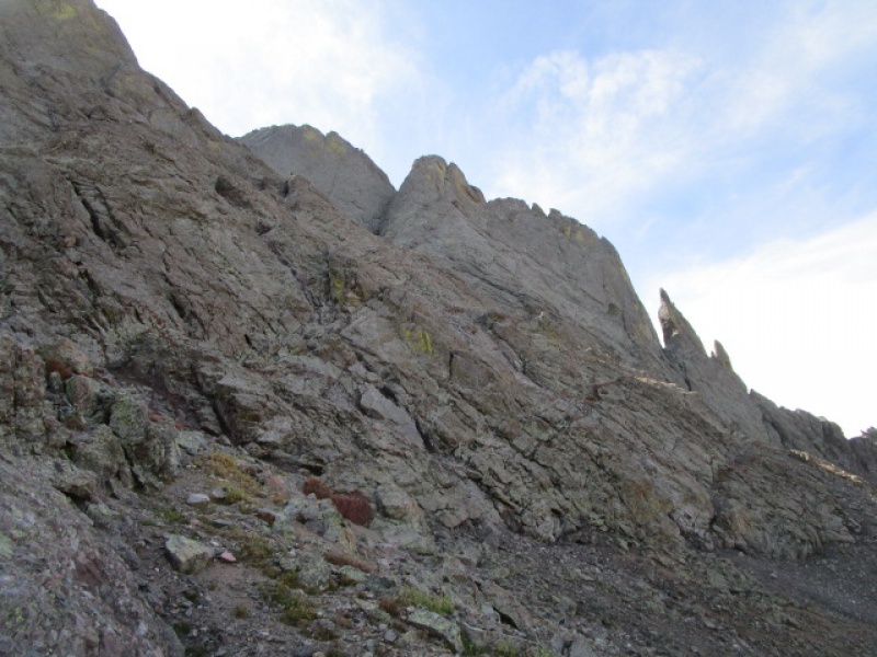
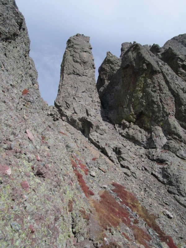
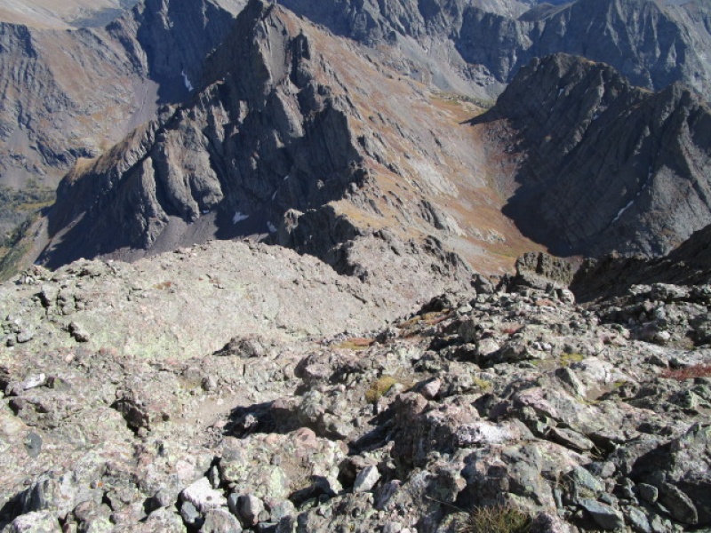
Once you reach this point the hiking is very pleasant, low angle and easy under foot. Traverse below the imposing N face of Crestone, passing by the N Buttress route. After 15 or 20 minutes, angle down away from the solid rock wall and look for a cairned trail. There is actually sort of a gate, composed of a couple rock towers, that leads directly to the start of the NW Couloir.
North Buttress. Traverse below this
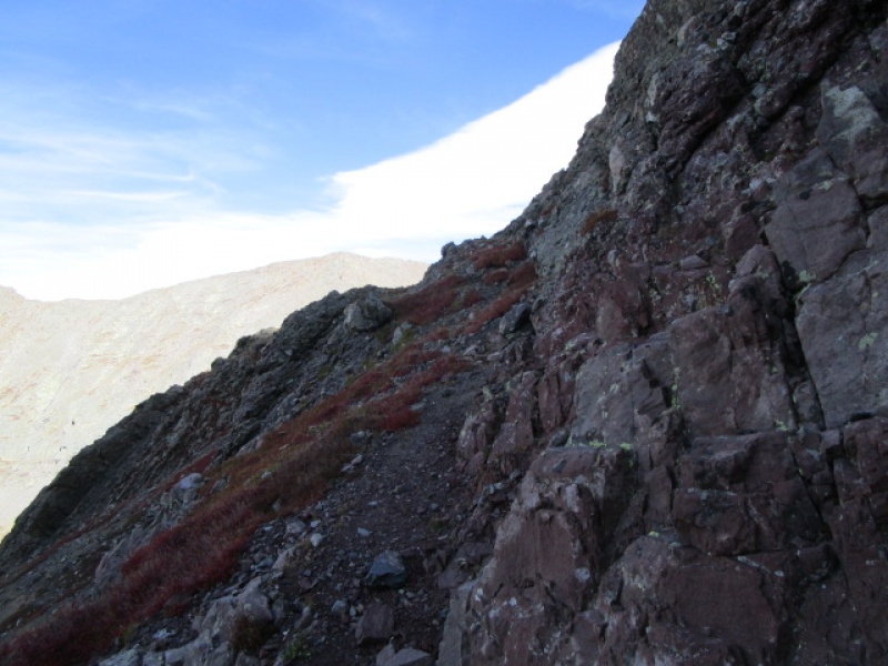
This is looking back from the start of the NW Col at the trail leading here.
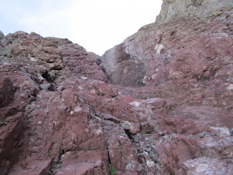
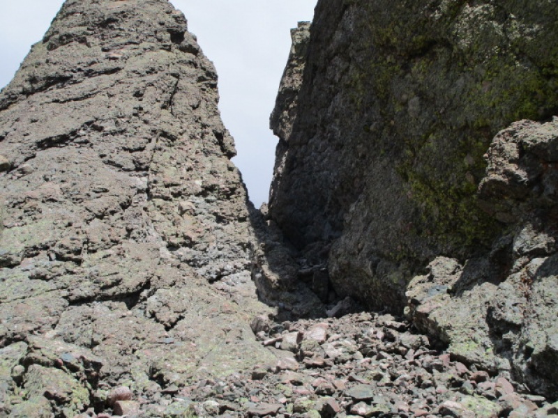
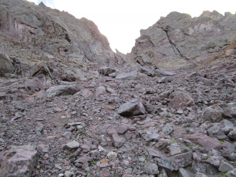
The NW Couloir looks rotten and difficult, but it is neither. I have been fortunate enough to find this in dry conditions in the past and it is an excellent route. It was fun on this trip too, but required a little creativity.
NW Col, first impression
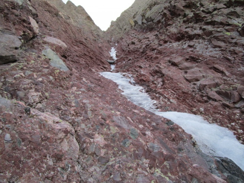
A short 5 minutes into the ascent I came onto the ice.
Ice as seen from start of NW Couloir
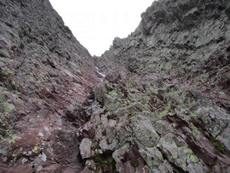
I didn't take a lot of photos, but it went like this. There were three sections of ice, each separated by a dry area where you could cross from side to side with ease. Getting from one side to the other, without ice tools, anywhere else would be reckless or impossible. This first section was easily passed higher up on the right. After that, it was necessary to exit the Couloir to the left and get under the N Buttress route. On this face, it was possible to climb about 200', just below where it turns sharply steeper, and find a descending gully leading back to the NW Couloir, accessing it at the second dry patch. There was insignificant ice from this point, about 2/3 of the way up, which was easily passed, again on the right.
This is what remains of the Couloir after rejoining it above the second patch of ice
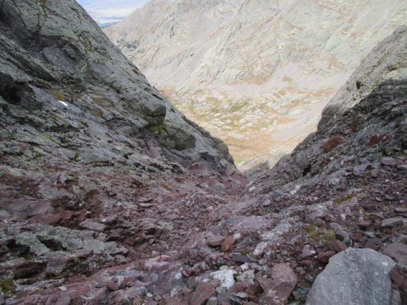
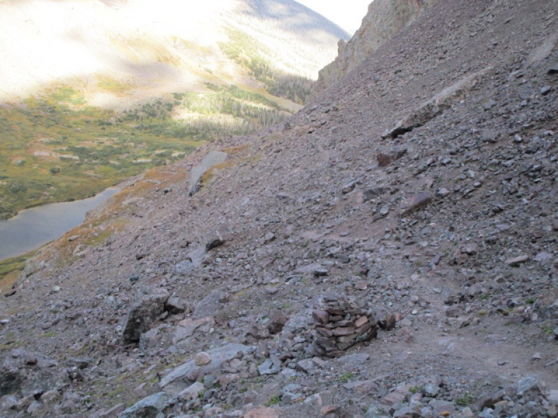
This would be a nasty surprise for anyone descending this route. From the saddle between the Red Gully and the NW Couloir it appears dry and free of snow and ice.
Looking down the NW Couloir from top of Red Gully
I would not have enjoyed descending this and have to discourage anyone who is not very familiar with the terrain from using this route as a descent as a first experience in these conditions.
The rest of this report does not add much info to the many reports on the traverse between Crestone Peak and Crestone Needle, but does add a few photos with short narrative for anyone interested.
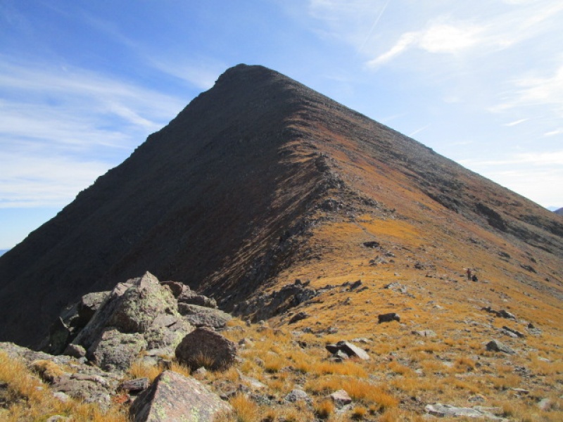
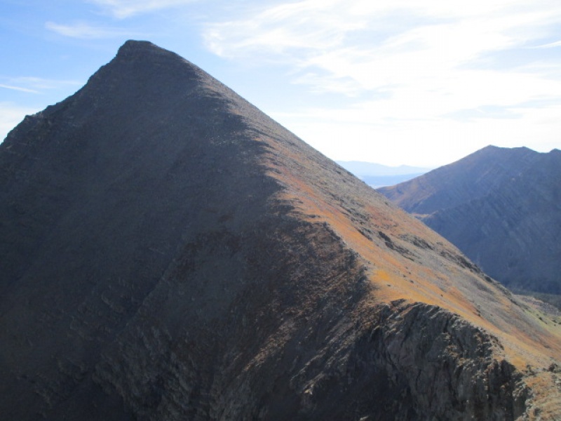
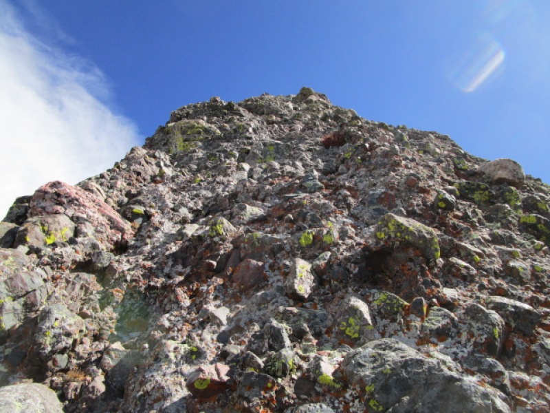
Crestone Peak from "East Crestone". Less than 10 minutes from the top of Red Gully. Go get it.
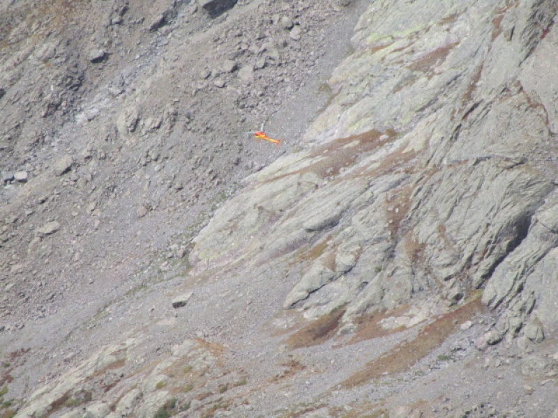
This chopper buzzing around Spanish Creek below the S face of Kit Carson for a while. Not sure why?
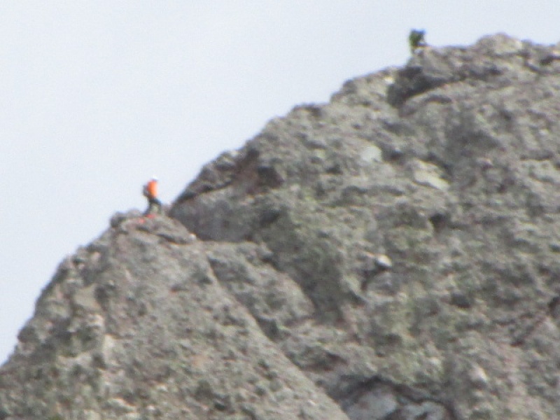
Two folks finishing up on the Needle ahead of me. I met up with them on the way down.
Crappy zoom lens on point and shoot
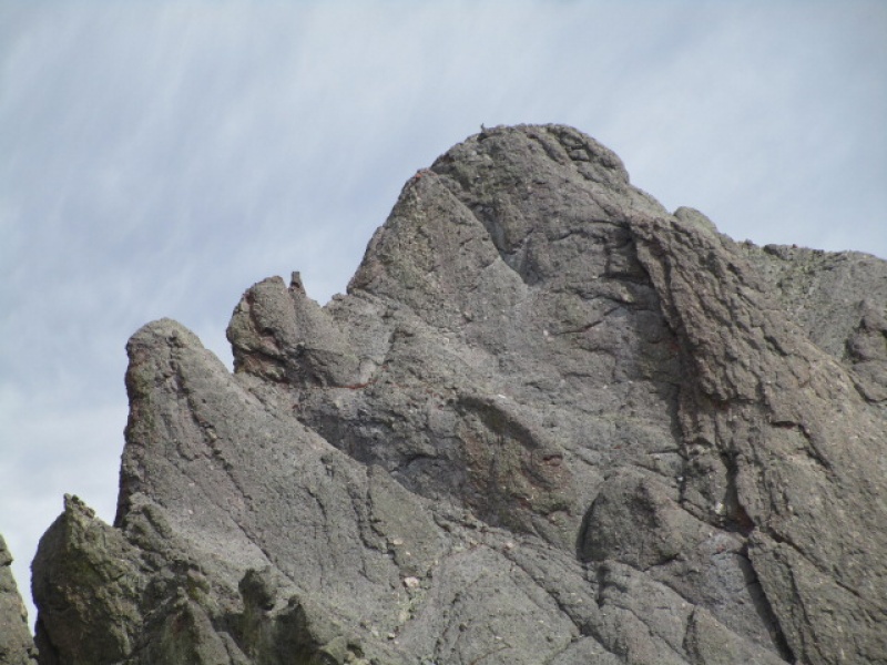
Black Gendarme
I have done the traverse 4 times now. 3 times Peak to Needle and once Needle to Peak. The Roach guide describes it a bit differently from the description on 14ers.com. On this trip I found the route to be especially well marked by cairns and easy to follow. I enjoyed the variation leading right up to the Black Gendarme and over the 5.2 bulge, which I had missed on previous trips. The move over the bulge was straightforward and the climb from there to the final pitch to the summit was easier and more enjoyable than the lower variation which I had used in the past.
Trail well marked from here.
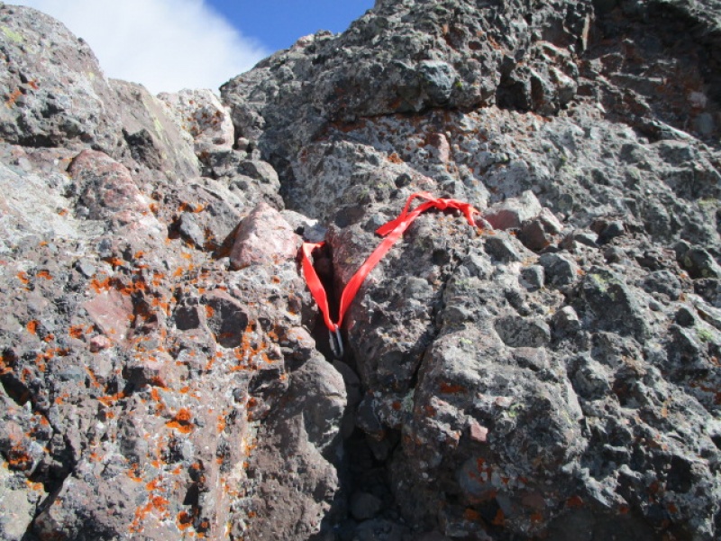
5.2 bulge directly ahead
Final Pitch
This sling left by a previous party.
Looking down toward Broken Hand Pass from near the summit of Crestone Needle
Looking back up at the Needle from near Broken Hand Pass
Looking back up at Broken Hand Pass after getting down past the worst of it
I had not been up or down Broken Hand Pass in some time and had forgotten what a mess it is. Don't underestimate this. I figured a couple hours from the pass back to the car, but in fact took nearly 3 1/2 hours.
Coming down off the pass, once you hit this section, it is pretty smooth sailing back home.
The splits on the day went like this. 7:30 start hike from 4WD trailhead. 1:00 summit Crestone Pk. 3:00 Summit Crestone Needle. 7:15 back at car.
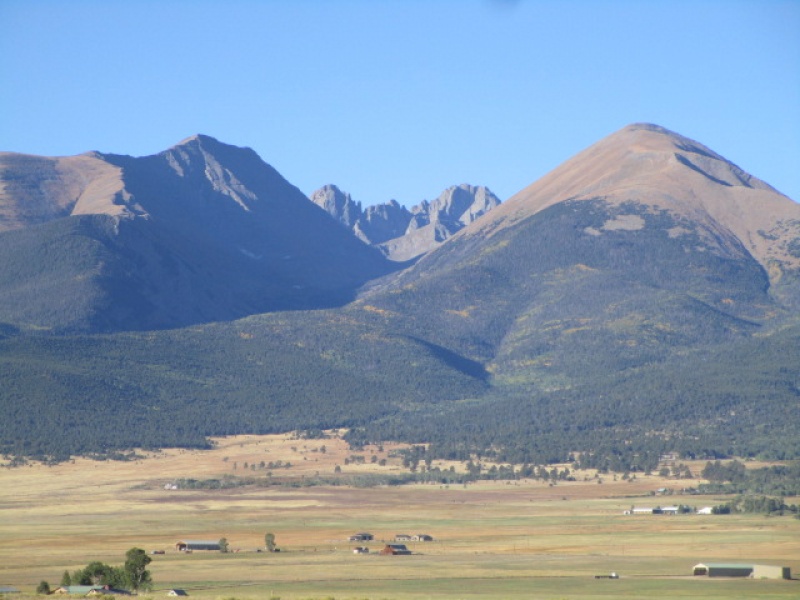
Crestones from 10 miles out, at the intersection of Rte 120 and Hwy 69.
Thumbnails for uploaded photos (click to open slideshow):
"I would not have enjoyed descending this and have to discourage anyone who is not very familiar with the terrain from using this route as a descent as a first experience in these conditions". In the late 1980's, we did the Needle to Peak traverse (in the fog for the entire traverse). We rappelled off the Needle and stayed very high on the traverse as we couldn't see anything and didn't want to lose too much elevation. As a result, we kept climbing up stuff (the further we got on the traverse) that we didn't need to thinking it was the Peak. As we (6 guys and me) were discussing the issue of not finding the top of the Peak, a voice came out of the fog and said "are you looking for the summit of Crestone Peak"? We said yes. He said, "well, we're on it and I'll keep talking and you guys follow my voice to find it". That's what we did. Lucky for us, he and his friend had come up the NW couloir which was our descent route (this used to be the standard route off Crestone Peak). It would have been very difficult to find that exit. It stayed foggy until we hit the Bears Playground where the sun came out, the clouds went away and we had awesome views.
Good on you for taking a less than traveled route! Thanks for posting. Happy trails! :)
We actually summited Crestone peak via Broken Hand pass and SW couloir in August 2017. Then we decided to descend the NW couloir on the way back. It worked fine without any ice tools. There were two ice/snow patches that we bypassed on skiers left/climbers right, in one place barely. The only misteake we made was not going all the way to Humboldt saddle but rather descending directly to the Upper S Colony lake from the corner of Bear's Playground. That slope was as loose as anything I have seen in Colorado. Plus, jumping boulders near the lake was not fun either. But NW couloir is a great alternative to going over Broken Hand pass, absolutley agree!
Caution: The information contained in this report may not be accurate and should not be the only resource used in preparation for your climb. Failure to have the necessary experience, physical conditioning, supplies or equipment can result in injury or death. 14ers.com and the author(s) of this report provide no warranties, either express or implied, that the information provided is accurate or reliable. By using the information provided, you agree to indemnify and hold harmless 14ers.com and the report author(s) with respect to any claims and demands against them, including any attorney fees and expenses. Please read the 14ers.com Safety and Disclaimer pages for more information.
Please respect private property: 14ers.com supports the rights of private landowners to determine how and by whom their land will be used. In Colorado, it is your responsibility to determine if land is private and to obtain the appropriate permission before entering the property.

")
")
")
")
")
")
")
")
")
")
")
")
")
")
")
")
")
")
")
")
")
")
")
")
")
")


