| Report Type | Full |
| Peak(s) |
North Maroon Peak - 14,022 feet |
| Date Posted | 09/25/2019 |
| Date Climbed | 09/21/2019 |
| Author | arianna2 |
| Our 50th! |
|---|
|
I think that I have said in previous reports that when we started this 14er journey, the Elk mountains (with the exception of Castle and Snowmass) were not on the list that we planned to do. We figured that they would be too dangerous for us to do. After years of successful climbs and improving skills, we decided to give one a try in 2015. We looked at these three options and decided to do the one we thought would be the easiest for us-S Maroon. We were so surprised and elated that we were successful that we figured if we could do that one then we could do Pyramid the next year. Now, we tackled N Maroon. Ironically, it turns out now that we have done all three...we did it backwards in terms of difficulty/exposure/endurance etc. At least in our opinion (maybe mine more than Craig's) that N Maroon was the easiest of the three. More on that later. The night before: So there is always questions about how to deal with parking in this area. We have experienced three different options over the years. The first year, we came during the afternoon with the misnomer that "campers" were allowed in anytime. Not true (although it seems each ranger has a little different heart depending on ...who knows what). They let us in that day but usually they don't. You have to ride in on the bus during operational hours. So if you want to get up there in your car-you need to go some time other than 7a-7p. We camped that first time and it was wonderful but depending on the popularity of the time of year you go-it could be busy (and you will always have to have a bear-proof container) For pyramid in July, we came late after 7p and discreetly car camped in the overnight lot...although accidently triggering the car alarm was not so discreet, but we tried and had no ranger problems. We have read that they might patrol and you could get ticketed and fined. This time being September, it was close to peak colors and it was busy. We arrived around 8 or 830pm and the overnight lot and the overflow lot were full. I am sure the day lot was open but we are not gamblers. Maybe we could have "creatively" parked somewhere but we decided to head back down and figure out what to do. I had noticed that there were pull offs right at and after the White River National Forest sign and a couple more that people were parked at right before the park entrance. We finally got back down there, bought our pass for the next day so that we wouldn't have to do it in the morning, and got one of the last pull off spots. Someone had a tent pitched in between cars but I think most people car camped. Okay, now it was time to prepare our packs and beds and get some sleep. Sometimes things don't go quite the way you planned. It reminds me of a church sermon we heard once. Briefly, she booked her vacation flight into the wrong city and they had to drive 4 hours to barely make their cruise on time. She called it "Mud", that sometimes things in life are dirty, muddy, crappy...but you make some of the best memories in the "Mud". You don't remember the times you flew into the right city. You don't remember the times you didn't get a flat tire on the way to the trailhead at 4 in the morning, you don't remember the times that there wasn't a mudslide that stopped the train from running to get you to the trailhead. But you DO remember all those crappy, muddy times and laugh at it and they make beautiful memories. So don't get SOOoo mad at your wife if she forgets your water!!! Your just building great memories:) 
Well, I did remember 4 Gatorade's, my liter of water, and a frozen liter to keep the Gatorade's cold. So we did just fine with that. It was pretty cold and it is hard for me to drink much then anyway. I had almost brought our filter bottle which would have worked well as there were a couple spots we could have filled that. We got up at 3, drove up to the day lot and got ready and left by 4. That was actually earlier than we had planned. We wanted to get to the rock glacier by sunrise. Very pretty outlines of Pyramid and surroundings.
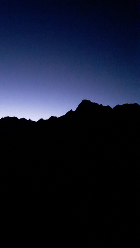
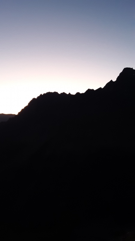
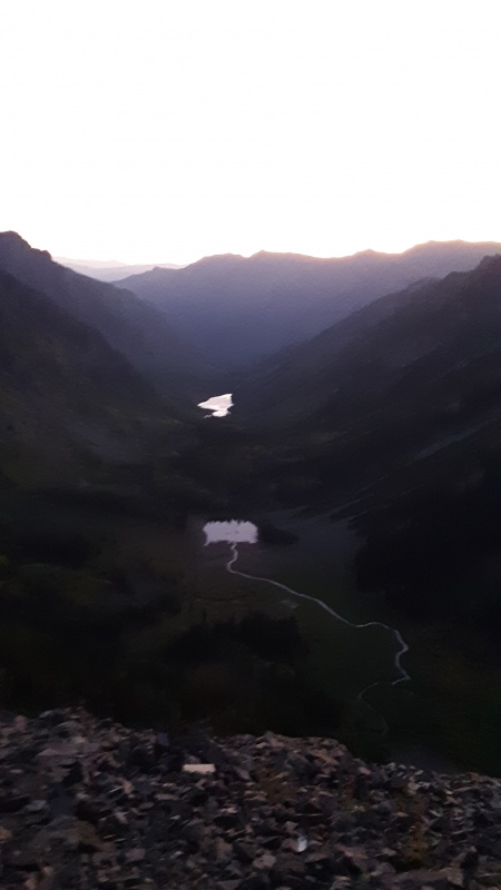
We consider ourselves about average on speed. It takes about 2 hours from the parking lot to get to the Rock glacier. It is probably better to time this with the sunrise because here's your view if you don't.
This is what it looks like in day light and you are heading for the bottom of the picture.
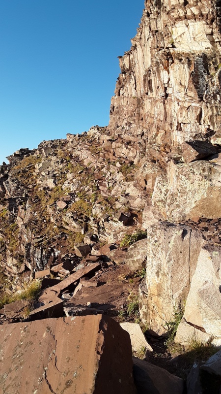
It's important to remember that you shouldn't gain or lose much elevation as you cross the rock glacier. There are some cairns, at least at first, but we seemed to lose them sometimes. It was just easy to head towards the bottom of the cliff. Once we got across the rock glacier we put on microspikes which I am a big fan of. I've mentioned it in a few of my reports in the past and there was a recent Forum about it so I won't belabor the point, but to us they are indispensable.
Then you do turn the corner and traverse for a little while before you reach the first gully. I think it took us about an hour to get across the glacier and to that point. Finally, daylight. As you come around the corner and first see the gully we noticed that the trail seemed to go down a little bit and then across then up the gully but when we looked to the right there was a big boulder that looked climbable, so we chose that route. When you get to the top of that there is more established trail so I'm not sure which is the correct way to go, but that was certainly easier. I suspect that people come down that way but don't necessarily see that option on the way up.
You climb up the gully and and watch for where it exits to the left. It is below the white band of rock and over on the left you can see a big square rock and you head for that. 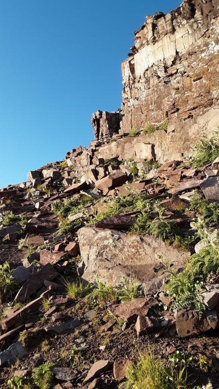
You traverse on some ledges for just a bit to reach where you can see the entrance to the second gully. At this point it took us about a 40 minutes to get to the second gully.
Looking at what is to come. 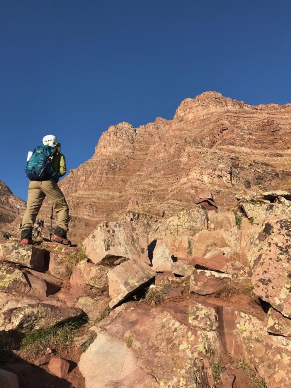
The second gully 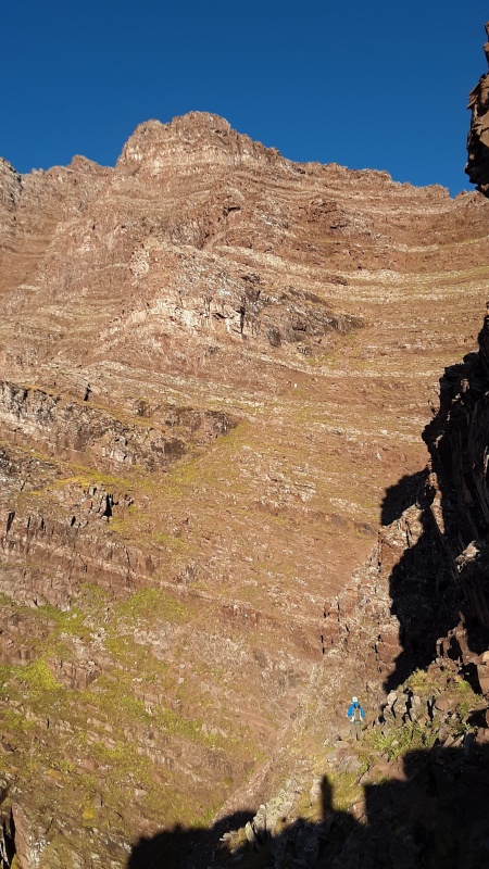
Looking back at where you first see the second gully.
 Obviously you want to be careful but it looks dramatic.

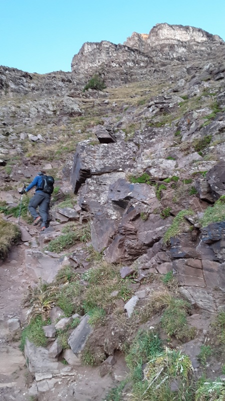
Looking at the very top you can see a break in the rock formation, looks like the letter "W". We worked our way up the gully heading for that. You hike along that rock formation which kind of leads to a trough that we just followed up towards that notch. 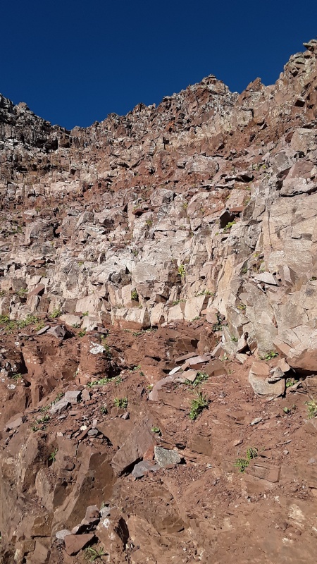
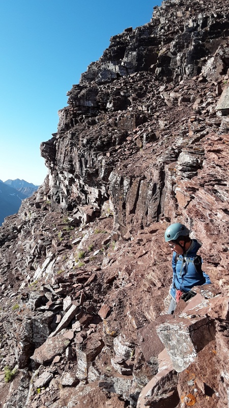
Then you go left and climb up ledges along the ridge crest. These ledges reminded me of Eolus quite a bit. S Maroon is like this too. Although it was a little easier because you could see the ledges above you usually. Cairns get put up marking various routes that people do which can be a little confusing. It's best to head the right direction and go up the ledges the way that easiest for you. There is fun climbing.  
One spot we had to think about for a minute on which way to go. We picked our route then saw that we probably made the right choice. 
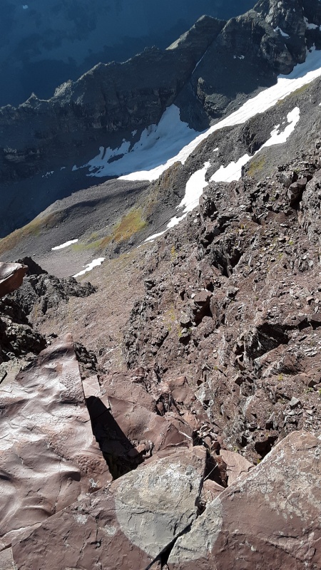
Your first view of the other side. 
Ok, I would like to know the route this grasshopper or its ancestors took to get this high up in the mountains. Did it catch a ride on a bird, stow away on a climber or what? 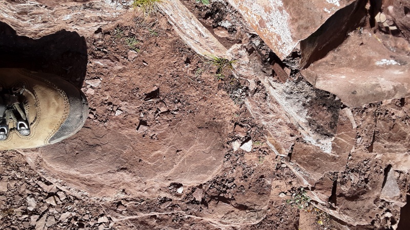
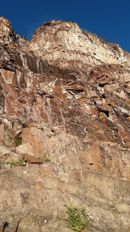
We had a gorgeous sky all day. It was still cold though. There was a breeze that would kick up through most the climb. 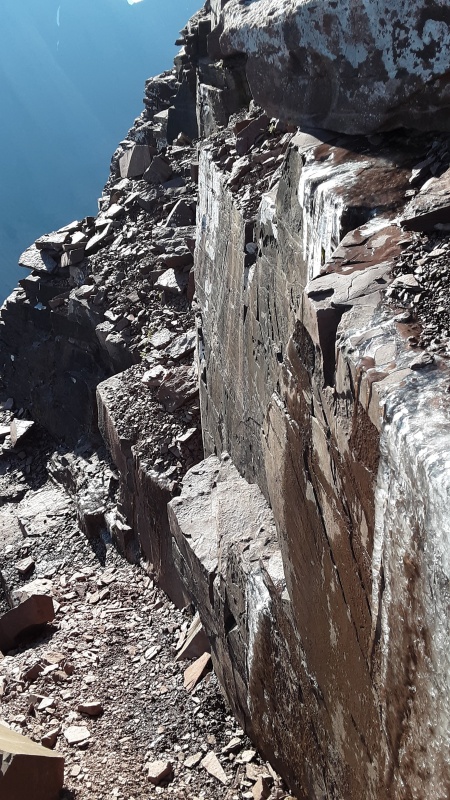
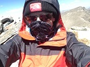
Now the infamous chimney. I was looking forward to this because we like to rock climb so I really wondered how hard it was going to be. I am 5'3" and hearing these stories of people who had a hard time pulling themselves up with their arms worried me. 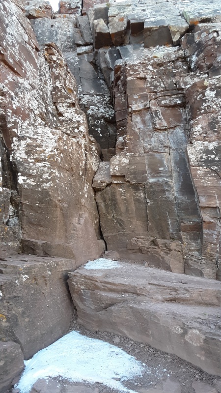
There are a couple small cracks you can get your fingers into to get your knees up on the slanted rock to stand up. From here you can go to the left but I think that is a much harder way to go. There are good foot holds but no easy hand holds up higher. Craig remembered the crack in the top of the middle right rock. 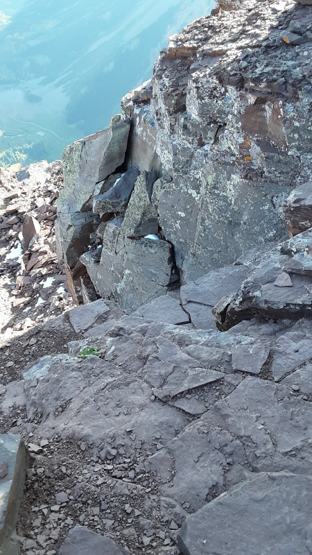
You can't see it from below but you can step up on the rock and feel for it and grabbing that makes it easy to get up and back down from there. Another 30 minutes or so to the summit. 
But first, the precipice. Gotta admit, a little freaky seeing someone you love on that thing. 
Awesome summit. Got there at about 930 am. 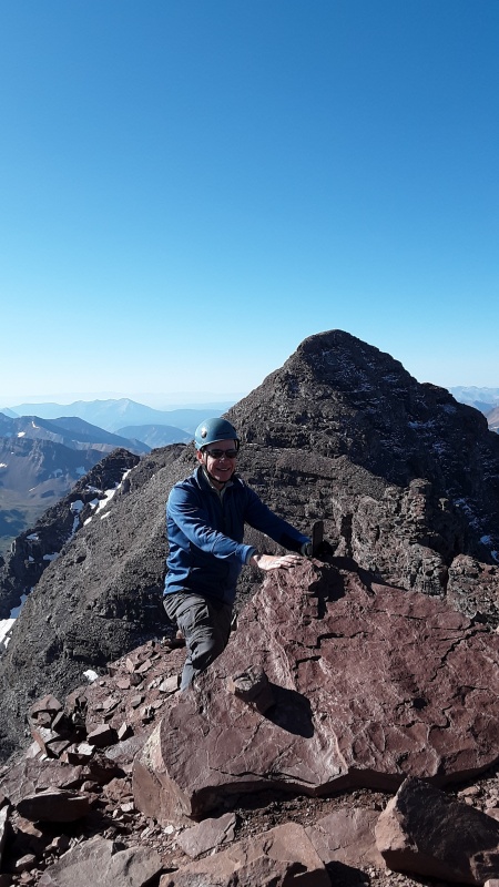
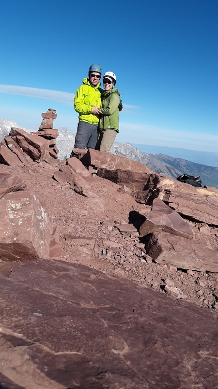
One other person just coming down and one lady with a guide behind us a bit is really all the people we saw. For a second we saw one lady in a league of her own, who came breezing by having just climbed Maroon and the traverse. We went down a little ways to find an alcove out of the wind. Which by the way was not a very bad wind, just cold. 
We really took our time coming back down. Took some pictures of Pyramid, checked out the surroundings, plus I hate coming down. Everything always looks so different. Make a mental note of where you come up so that you don't get off track especially since there are so many cairns going every which way. You can pull off some leaves of a nearby plant and put it with a cairn so that you know which one you went by on the way up. 
It is always good to remember that you are not alone on these type of mountains even if you see no people. These goats that you can see on the top of the ledge were fine but there must have been a few higher than them that we couldn't see because as we were stopped to take pictures, a rock bigger than a bowling ball came smashing down the trough toward us. We watched in astonishment as the rock came closer and closer gaining speed but luckily it turned downward from us. We were on a switchback that was going to head the other way but makes you think, what if we didn't stop to take pictures. 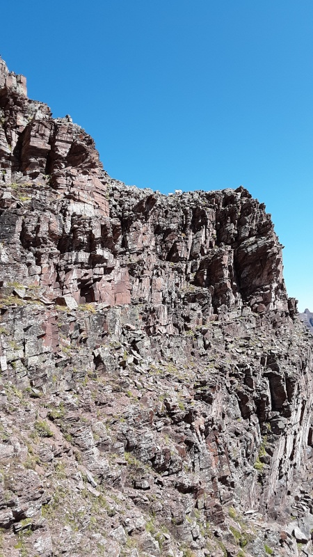
Looking back on the majestic mountains 
Coming around the corner to get towards the first gully, there was a billy and kids.
A little too close for comfort. She/He seemed to be posturing a bit. This billy was tagged and had a big collar with transmitter on it. Not sure who follows where they go or why. Can't get over the beauty of Pyramid
Interesting going back through the rock glacier in daylight. You can see where you want to exit from quite a ways away. I still say there aren't many cairns to follow accurately. Use your judgement and don't gain or lose elevation and you will be fine.
Colors were more vibrant and further along than I thought they were from the view above.
The main trail was packed with people as usual. I joked that the wildlife that people were staring at know at least 6 different languages by now. I will also never understand the mentality of people that walk in the middle of a trail with a line of people behind them. It is just like the car driving 15 miles an hour slower than the speed limit up a single lane road and has 15 cars behind him. Why don't you move over and let quicker people by?? Anyway, has to be one of the most beautiful places around. The light wasn't perfect for pictures but still gorgeous.
We were slow on the way down. I was surprised that it was 330. Great time to get to dinner for this area though! So as I was saying at the beginning, I actually thought N Maroon was the easiest of the three and overall a lot easier than I thought it was going to be. There is some challenging climbing on N Maroon as well as Pyramid. However, S Maroon took a lot more endurance and had more difficult route finding. The exposure was probably more on Pyramid. Craig and I disagreed a little that N Maroon had exposure. I think there were a couple areas of exposure but nothing that I really felt concerned about. I have a hard time deciding between Pyramid and S Maroon on exposure but probably Pyramid. There is no disagreement at all that the 2800 feet in a mile- and that being just the beginning - on S Maroon took the most endurance. The mental work out was more for us on that one as well. Maybe if we had done Pyramid first though, we would have thought differently on that. Thumbnails for uploaded photos (click to open slideshow): ")
")
")
")
")
")
")
")
")
")
")
")
")
")
")
")
")
")
")
")
")
")
")
")
")
")
")
")
")
")
")
")
")
")
")
")
")
")
")
")
")
")
")
")
")
")
|
| Comments or Questions | ||||||||||||
|---|---|---|---|---|---|---|---|---|---|---|---|---|
|
Caution: The information contained in this report may not be accurate and should not be the only resource used in preparation for your climb. Failure to have the necessary experience, physical conditioning, supplies or equipment can result in injury or death. 14ers.com and the author(s) of this report provide no warranties, either express or implied, that the information provided is accurate or reliable. By using the information provided, you agree to indemnify and hold harmless 14ers.com and the report author(s) with respect to any claims and demands against them, including any attorney fees and expenses. Please read the 14ers.com Safety and Disclaimer pages for more information.
Please respect private property: 14ers.com supports the rights of private landowners to determine how and by whom their land will be used. In Colorado, it is your responsibility to determine if land is private and to obtain the appropriate permission before entering the property.