Download Agreement, Release, and Acknowledgement of Risk:
You (the person requesting this file download) fully understand mountain climbing ("Activity") involves risks and dangers of serious bodily injury, including permanent disability, paralysis, and death ("Risks") and you fully accept and assume all such risks and all responsibility for losses, costs, and damages you incur as a result of your participation in this Activity.
You acknowledge that information in the file you have chosen to download may not be accurate and may contain errors. You agree to assume all risks when using this information and agree to release and discharge 14ers.com, 14ers Inc. and the author(s) of such information (collectively, the "Released Parties").
You hereby discharge the Released Parties from all damages, actions, claims and liabilities of any nature, specifically including, but not limited to, damages, actions, claims and liabilities arising from or related to the negligence of the Released Parties. You further agree to indemnify, hold harmless and defend 14ers.com, 14ers Inc. and each of the other Released Parties from and against any loss, damage, liability and expense, including costs and attorney fees, incurred by 14ers.com, 14ers Inc. or any of the other Released Parties as a result of you using information provided on the 14ers.com or 14ers Inc. websites.
You have read this agreement, fully understand its terms and intend it to be a complete and unconditional release of all liability to the greatest extent allowed by law and agree that if any portion of this agreement is held to be invalid the balance, notwithstanding, shall continue in full force and effect.
By clicking "OK" you agree to these terms. If you DO NOT agree, click "Cancel"...
I quit writing trip reports mainly because there are so many… but when I come across a peak where there are less than 20 reports and/or the route is not well described, then I feel an urge to do so.
We attempted this peak about 5 years ago and even with descriptions of the route from the Dziezynski book we could not it figure out, plus the weather did not cooperate either. I have read some of the trip reports on this route, but couldn’t find much beta or detailed descriptions. Peaks are lumped together or reports are somewhere else on another website… So, I hope this will add some important info and pictures on the route followed.
I would divide the route in 4 parts:
Piney Lake to split of trails (9,700 feet)
Up to the basin (at 11,100 feet)
Up to Kneeknocker pass (12,200 feet)
Down and up the gulley that goes to the summit (13,534 feet)
So, here we go:
We camped the night before just before the split of the trails, this saves 3 miles each way, we figured out it would be easier the next day.
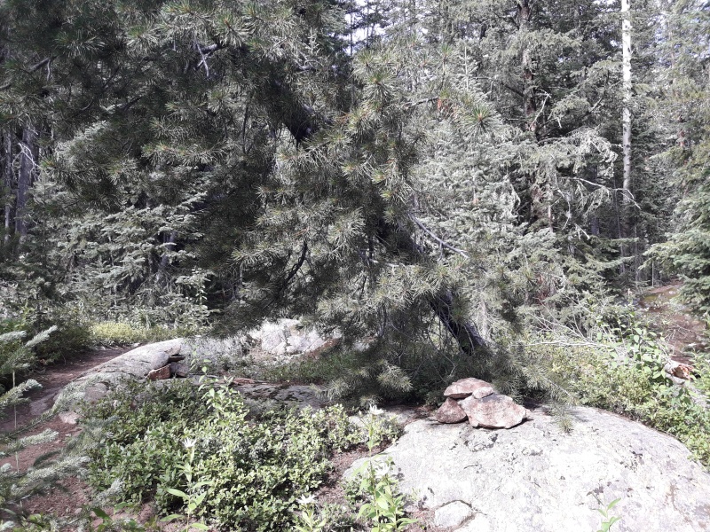
This is the key picture of the split of the trails, the one on the right goes to the upper Piney Lake and the one on the left goes to Mt. Powell summit. The route description on the Dziezynski book shows two trees, could not figure out which ones, there are so many! In fact in that same area there are a maze of trails because of the waterfalls and all the day-hikers that visit them. So, this shows the most recent one:
Split of the trails, left goes to Mt. Powell, right goes to upper Piney Lake
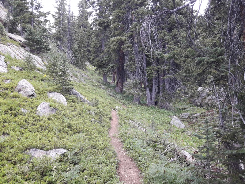
From here on, the trail is really good and it is difficult to lose it. It is steep though!
Through the trees
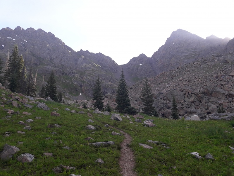
At 11,100 feet you come up to a beautiful basin:
Upper basin
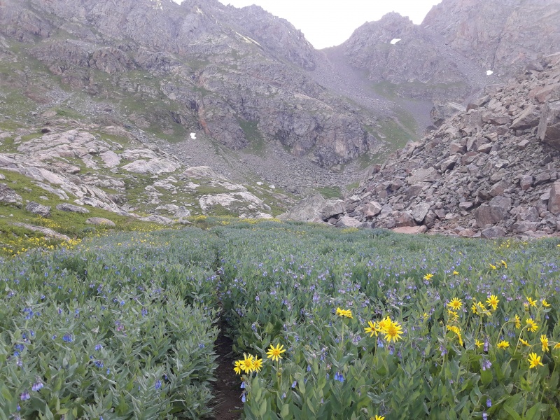
Flowers still blooming:
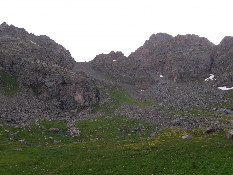
From here you can see the route up to Kneeknocker saddle (there is a trail all the way up).
Kneeknocker saddle
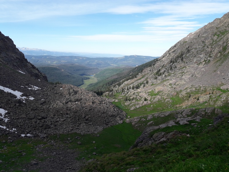
Looking back at the basin and Piney Lake in the distance:
Looking back from Kneeknocker
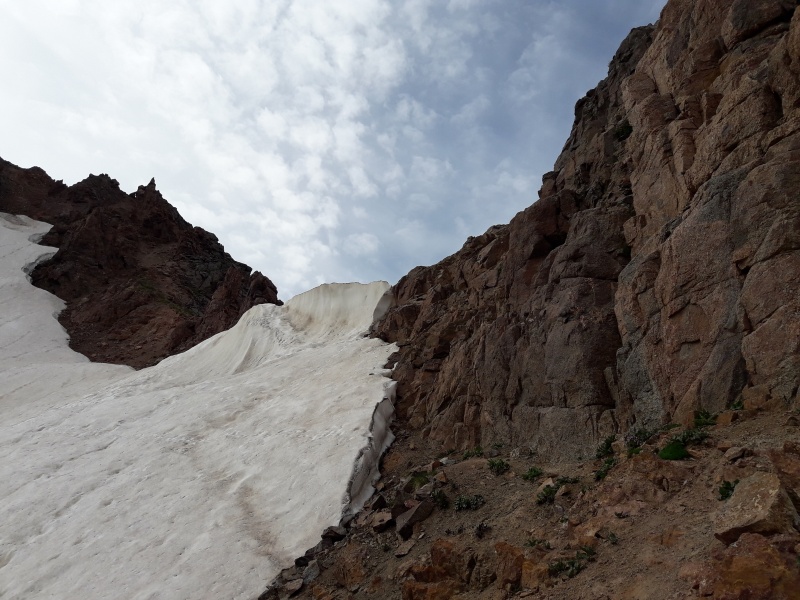
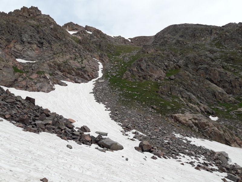
From the saddle at 12,200 feet you can barely see the summit. Here it got tricky as we had to descend a steep area that was holding some snow. But we managed to find a path through, just next to the rocks. Microspikes would have been nice to have, but the snow bank looked really steep.
East side of Kneeknocker saddle
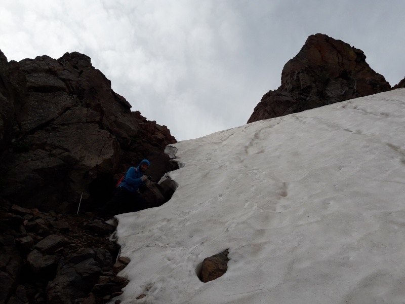
There was another section with snow. Again, there was a path through it. Looking back:
This family wanted us to follow them, mmmh not there... but after a goat glissade (yes, we witnessed that!), they were the ones following us all the way to the summit though, pretty cool! And no, they were not interested in our urine, just some company :-) It gets lonely up there...
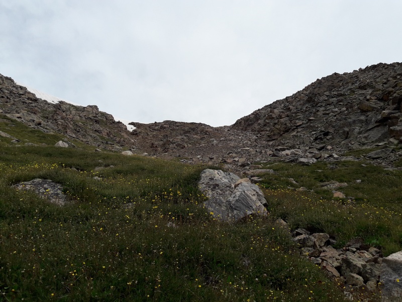
After descending about 100 feet we crossed a snow field. This one was not so steep so it was easy to cross without spikes.
A look at the gulley that goes all the way to the summit. We stayed to the left on grassy slopes.
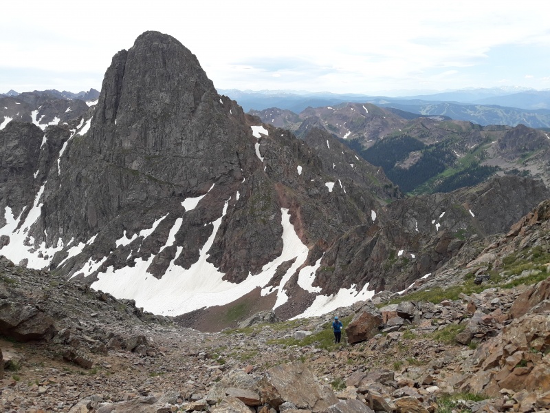
Nice view of Peak C and the saddle:
Peak C
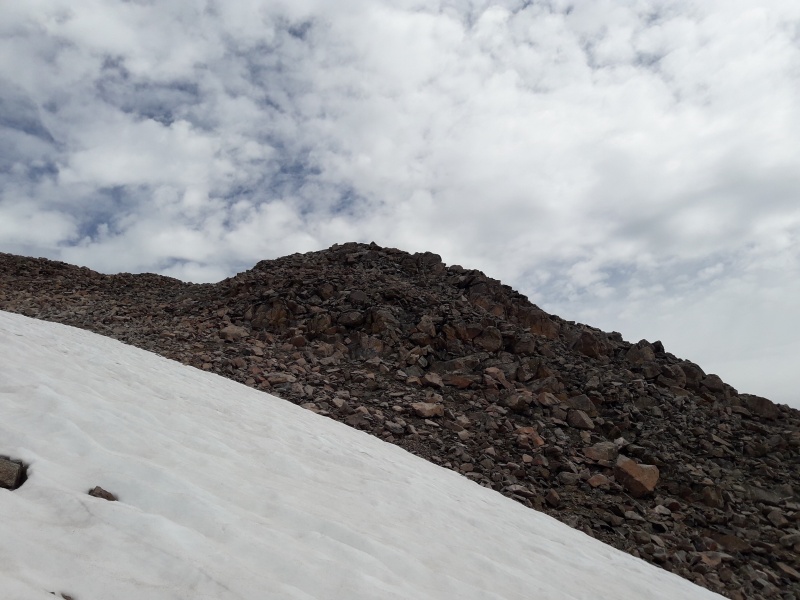
Finally the summit in view, and another snow patch to cross.
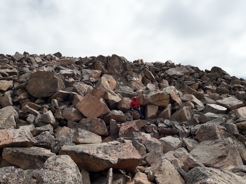
Last part on boulders!
And the summit!
Same route going back, a bit faster, but still slow because it gets really steep and scree walking is still slow, so make sure you allow enough time for this peak, especially if done in one day. Take into account that it is 12 miles round trip as noticed by others here, not 10.2 miles as described in the above mentioned book.
Oh, and there is a reason why the name Kneeknocker saddle, our knees were hurting when we got back to camp!
My GPS Tracks on Google Maps (made from a .GPX file upload):
Thank you for the report!. I am going to attempt Powell soon. I was wondering if when the trail splits and you take a left, from there to the saddle the trail is visible, overgrown, dead tress or hard/easy to find.
Cheers,
Teresa
Hi Teresa, we found the trail to be quite visible all the way to the upper basin, except for one little stretch where it goes around a big rock. I remember only one dead tree blocking the trail. There is also an area with lots of willows, but the trail is still visible if you look carefully.
Enjoy!
Very cool wildlife sighting! Nice TR, I will certainly use the beta to help when I attempt this some day. Looked like an awesome hike! Beautiful wilderness!
Caution: The information contained in this report may not be accurate and should not be the only resource used in preparation for your climb. Failure to have the necessary experience, physical conditioning, supplies or equipment can result in injury or death. 14ers.com and the author(s) of this report provide no warranties, either express or implied, that the information provided is accurate or reliable. By using the information provided, you agree to indemnify and hold harmless 14ers.com and the report author(s) with respect to any claims and demands against them, including any attorney fees and expenses. Please read the 14ers.com Safety and Disclaimer pages for more information.
Please respect private property: 14ers.com supports the rights of private landowners to determine how and by whom their land will be used. In Colorado, it is your responsibility to determine if land is private and to obtain the appropriate permission before entering the property.


")
")
")
")
")
")
")
")
")
")
")
")
")
")
")


