| Report Type | Full |
| Peak(s) |
White Rock Mountain - 13,523 feet |
| Date Posted | 08/27/2019 |
| Date Climbed | 08/25/2019 |
| Author | jladderud |
| How not to climb White Rock |
|---|
|
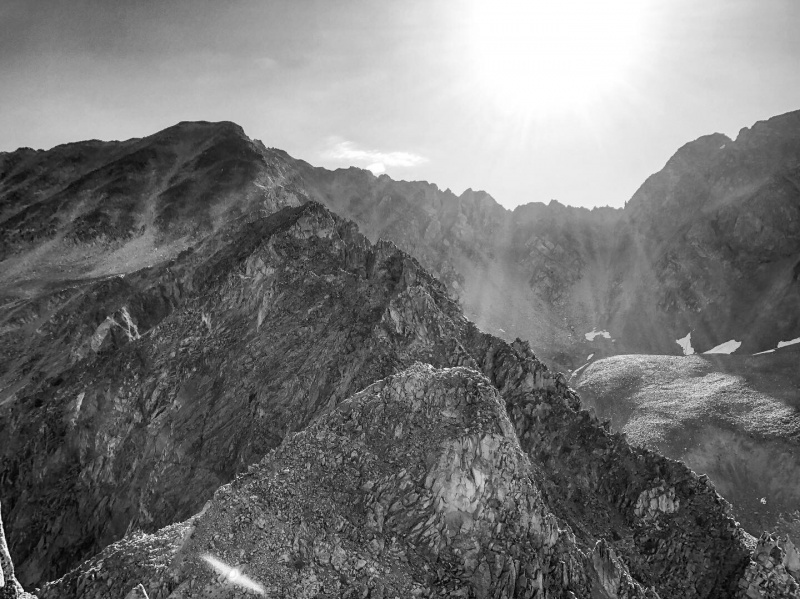
Copper Creek TH (2WD) 11.5 miles 4,600' 6.2 hours --------------------------------------------------- Being the recipient of a work trip to Crested Butte and a recent medical clearance to once again be above 12,000' I had summits on the mind. Given I only had a 2WD low-clearance rental car, one that rose to the forefront was White Rock. There are some great trip reports for this peak on here already. I just wanted to add this brief one as a cautionary note lest my errors be repeated. Namely, THE WEST RIDGE DOESN'T GO (at least not entirely). The first ~4 miles from the trailhead are very joggable. As advertised, be prepared to get wet at the first crossing of Copper Creek. Also as advertised, getting in and out of the Silver Queen Basin tends to suck--the passage being replete with heinously steep slopes and deadfall. Thinking myself clever, I tried to avoid this suck by following the "nice" contours on my topo map and ascending the West Ridge. However, what looks good on paper turned into a dangerously crumbly series of gendarmes. I found myself at the red arrow in the photo below and had to backtrack down the ridge and then bail south into the basin. 
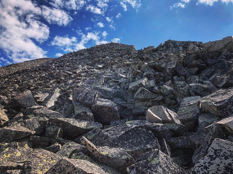
Once in the basin I was able to follow the green arrows "safely" to the summit. Though this route still involved a lot of not-so-stable choss. Be careful! 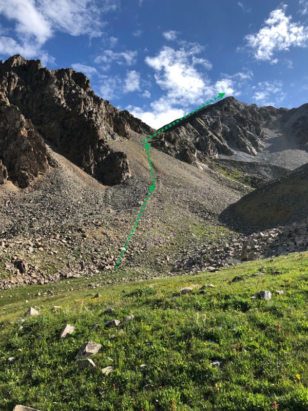
I'm generally a speedy hiker and, given my poor route finding, it took me 3.5 hours to reach the summit, not enough time to head over to White Benchmark. This would have involved descending back into the basin and ascending an obvious gully to the south of the BM--the ridge connecting White Rock and White BM appears to be 5th class. 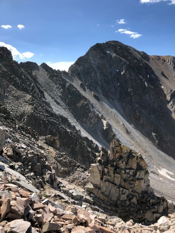
Once I was back in the Silver Queen Basin I made my way first through gentle talus fields, then annoying deadfall, then dangerously steep deadfall/canyon terrain (needless to say my route-finding was poor). Once I made my way south of the main drainage I found a more-established path. In talking with a local later on it sounds like there is indeed a "trail on the south side of the main drainage. It would behoove one to find in when accessing Silver Queen Basin. In summary, don't follow my GPX tracks up the West Ridge or gain the West Ridge below 12,600'. Try to enter/exit Silver Queen Basin using a "trail" to the south of the main drainage. Be ready for choss. Wear a helmet! Thumbnails for uploaded photos (click to open slideshow): ")
")
")
")
")
")
|
| Comments or Questions |
|---|
|
|
Caution: The information contained in this report may not be accurate and should not be the only resource used in preparation for your climb. Failure to have the necessary experience, physical conditioning, supplies or equipment can result in injury or death. 14ers.com and the author(s) of this report provide no warranties, either express or implied, that the information provided is accurate or reliable. By using the information provided, you agree to indemnify and hold harmless 14ers.com and the report author(s) with respect to any claims and demands against them, including any attorney fees and expenses. Please read the 14ers.com Safety and Disclaimer pages for more information.
Please respect private property: 14ers.com supports the rights of private landowners to determine how and by whom their land will be used. In Colorado, it is your responsibility to determine if land is private and to obtain the appropriate permission before entering the property.

