Download Agreement, Release, and Acknowledgement of Risk:
You (the person requesting this file download) fully understand mountain climbing ("Activity") involves risks and dangers of serious bodily injury, including permanent disability, paralysis, and death ("Risks") and you fully accept and assume all such risks and all responsibility for losses, costs, and damages you incur as a result of your participation in this Activity.
You acknowledge that information in the file you have chosen to download may not be accurate and may contain errors. You agree to assume all risks when using this information and agree to release and discharge 14ers.com, 14ers Inc. and the author(s) of such information (collectively, the "Released Parties").
You hereby discharge the Released Parties from all damages, actions, claims and liabilities of any nature, specifically including, but not limited to, damages, actions, claims and liabilities arising from or related to the negligence of the Released Parties. You further agree to indemnify, hold harmless and defend 14ers.com, 14ers Inc. and each of the other Released Parties from and against any loss, damage, liability and expense, including costs and attorney fees, incurred by 14ers.com, 14ers Inc. or any of the other Released Parties as a result of you using information provided on the 14ers.com or 14ers Inc. websites.
You have read this agreement, fully understand its terms and intend it to be a complete and unconditional release of all liability to the greatest extent allowed by law and agree that if any portion of this agreement is held to be invalid the balance, notwithstanding, shall continue in full force and effect.
By clicking "OK" you agree to these terms. If you DO NOT agree, click "Cancel"...
A beautiful way to get Golden Bear Peak and Hagar mountain, from the west, with a loop.
8 miles, 2800 feet. Mostly class 1, with some class 2 and 3 on Hagar.
After reading cdeno606's excellent report on Golden Bear from the west via Upper Straight Creek Trail, https://www.14ers.com/php14ers/tripreport.php?trip=19701#, I was reminded that a friend had once told me that it was a very pretty area back there. I had ignored their suggestion to hike there, because I figured it was so close to I-70 that all I would hear was traffic, and all I would see was highway and trash. But clearly I was mistaken.
However, I had already gotten Golden Bear, even if it was a pretty easy hike from the Loveland side... if you get ski lift and snow cat rides to just a couple hundred feet below the summit as I did. However, I had orphaned Hagar mountain after getting Citadel this past spring via Snoopy's backside couloir. So I thought I could go back and get Golden Bear with honor, and also get Hagar at the same time. I was planning on just doing cdeno606's route, and retracing my steps back over Golden Bear after Hagar. However, an idea came to me while looking at the google maps satellite view. There was a trail that appeared to go from the saddle of Coon hill and an unnamed point in between Golden bear and Hagar. It was not mentioned on any trip report. What if I could utilize this trail, and make a nice loop out of it. I always enjoy loops, as I get to see new things or new perspectives. Plus it would shave off significant mileage on the return trip, as well as some elevation gain.
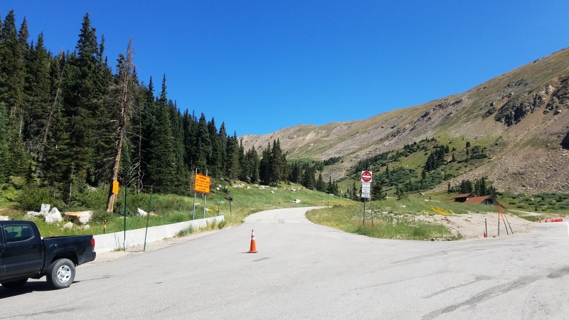
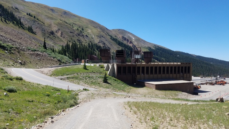
The Trailhead is just barely west of the Eisenhower tunnel. Basically go through the tunnel, then immediately exit onto the shoulder. There is a large opening in the crash barriers, and a road/parking area. It's used both for CDOT vehicles, and truckers chaining up or down, or just taking a nap. There are no signs forbidding parking there, and several cars parked there throughout the day. IF you are coming from the dillon side, you simply exit right before the tunnel, and take a small road that goes OVER the tunnel, and drops you off at the trailhead. Again, there were no signs forbidding using that road. The road is also useful for at the end of the day if you are heading back to Denver, as you can use it to go right over the tunnel, and can merge right onto I-70 East. Its a real time saver versus going west to the next exit in Dillon then turning around.
Trailhead
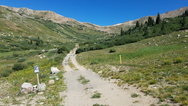
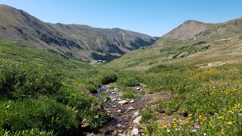
So I started fairly late at 7:30, due to a fantastic forecast. You start by taking the paved road that goes around a maintenance building. It heads into the basin, and changes into a dirt road fairly quickly. After about half a mile, it turns into a trail. The trail is quite good, however, it crosses a bunch of small streams. The water level in late August was pretty low, and I didn't get my feet wet. But in spring, it might be a different story.
Start of trail
Trail continuing alongside a stream
The road noises fades very quickly, and the streams drown out any remaining noise. I was shocked how pleasant this little valley was.
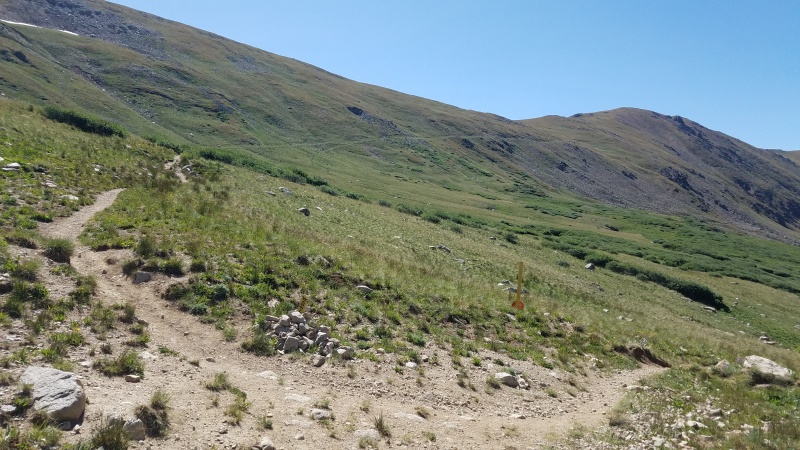
Heading up the trail, you come to a fork. Its marked with a cairn and a yellow warning sign (which appeared to be an old repurposed sign, not an actual warning). Head right to continue up the same trail. Left will put you onto the Coon hill saddle, which was my descent route.
The turnoff cairn. Turn right to switchback up towards Loveland ski area.
Looking back at the intersection, from the left fork trail.
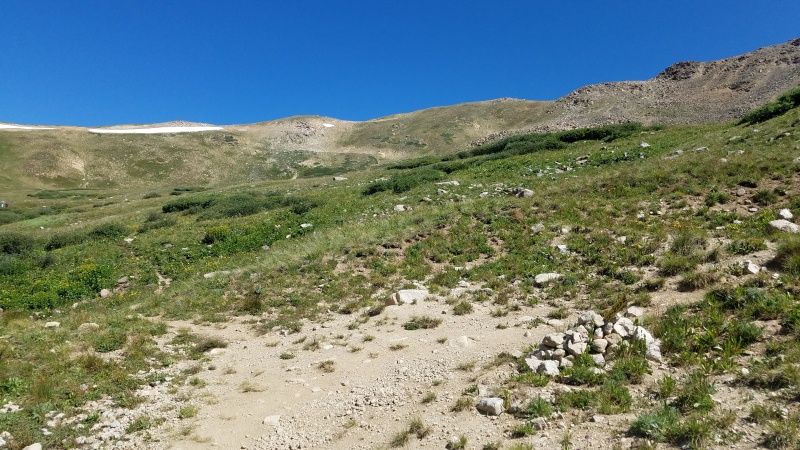
The trail heads up the headwall above the tunnel, with a nice gradual gain. After a couple switchbacks, you can begin to see the top of the ridge. This is where I turned off trail heading north. I began following the fence posts that I think mark the in bounds loveland ski area.
Where I turned off trail for ridge direct
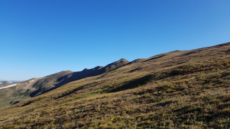
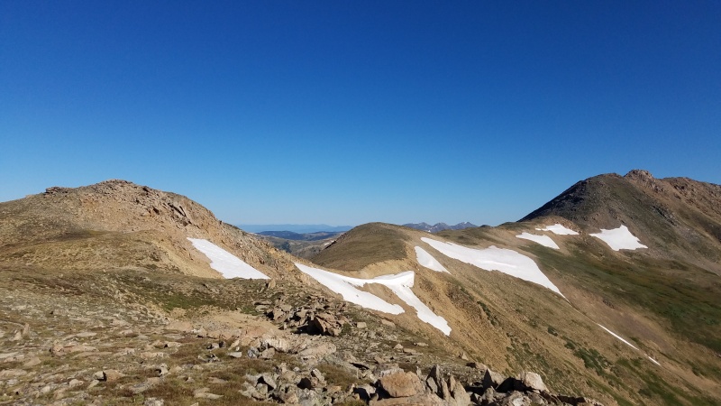
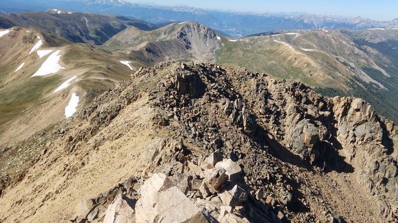
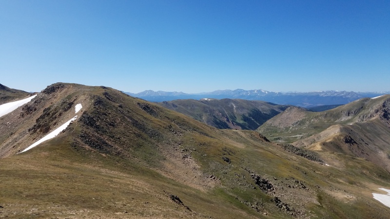
There was a few hundred feet gain, and soon you top out on Golden Bear. I could see Hagar on the ridge, looking very far away. Its just over a mile, along a class 1 and 2 ridge. I hiked that way, cursing the strong continental divide winds that always seem to be present.
Looking towards Hagar and Citidel
Looking back at where trail tops out, above Loveland
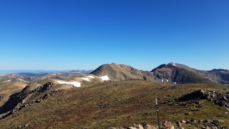
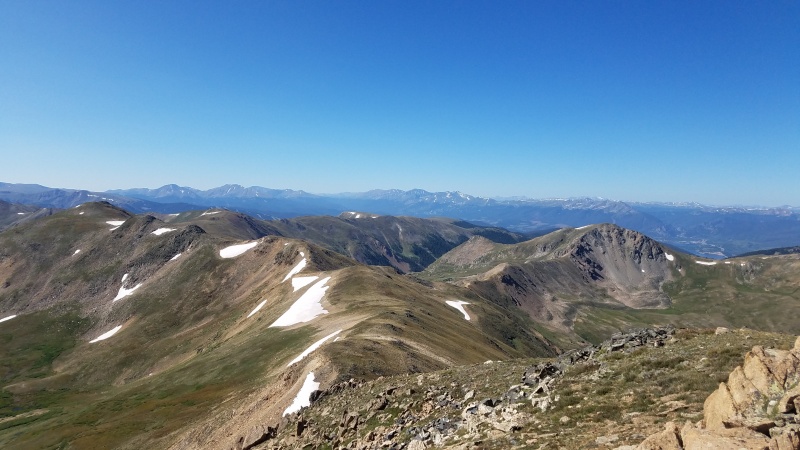
The ridge undulates quite a bit, with about 4-5 small bumps you have to gain, then lose elevation on. Some of them can be barely bypassed without bad sidehilling, however you end up saving maybe 30 vertical feet per bump. The views were fantastic, especially of the quite rough looking 12er Coon hill, and also the Gores.
Ridge towards Hagar
Gores
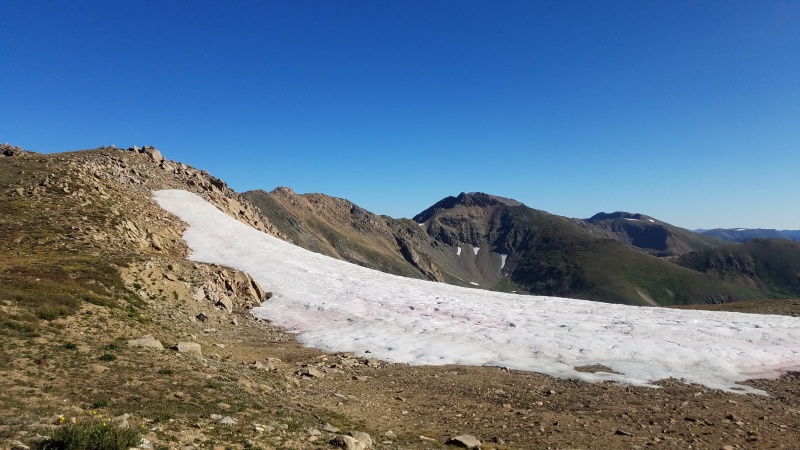
Watermelon snow. It didn't taste like watermelon.
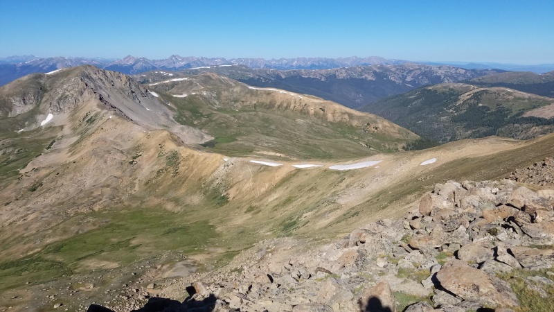
I was also able to scope out my planned descent route. It looked good.
Looking down at Coon Hill and descent route, trail visible in center.
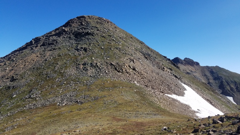
Soon I came to the base of Hagar. It has a fairly steep climb of about 300 feet , which is quite a shocker after the mellow ridge. I proceeded up it, linking together trail remnants and switchbacking. Some of it was loose scree, but generally I was able to stay on grass or rocks.
Hagar false summit.
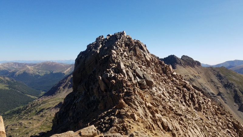
Once gaining the false summit, I had a good view of Hagars class 3 summit. There is a single tower before the summit, which I bypassed on the right side. After that, I headed straight up the spine to the summit. The rock was quite stable, and it was a fun class 3 section. There is some big exposure on the left side of the ridge.
Hagar class 3 section
The summit is 3 small blocks grouped together. I had trouble telling if the first or second block was the highest, so I tagged them both. However, the summit register was on the first block, so I think its the highest. However, the pipe end was broken. I've seen this before, and this always confuses me, as I can't see it being smashed naturally. Is there some ahole who smashes the pipe then leaves it there? Why?
Looking over middle summit block towards Citidel
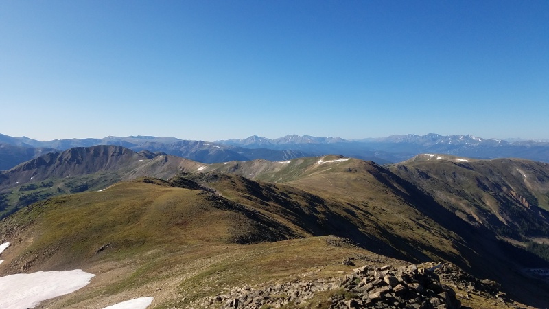
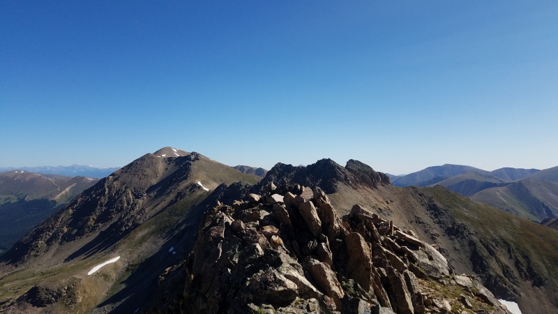
The wind was strong at the summit, so I descended to the false summit for a snack. From there, I had a good view of the ridge I would need to take to go down my unmarked trail to make a loop.
Looking back at Hagar false summit
Looking back at ridge to Golden Bear
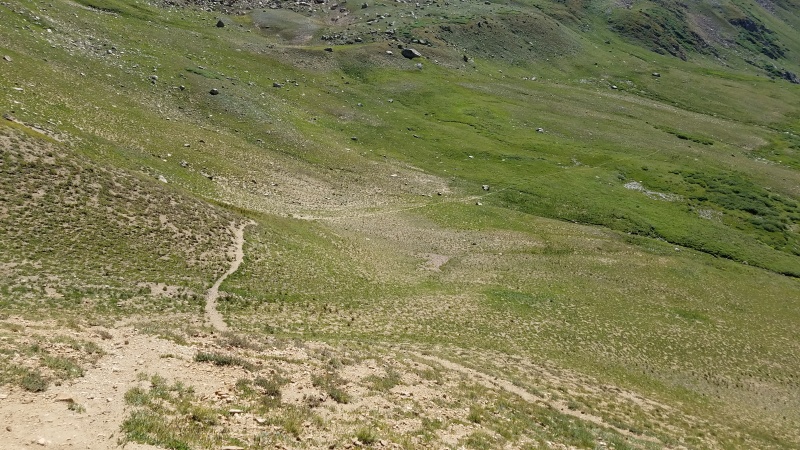
On the way back, on my second major ridge bump, I began contouring around the bump on the west/north side. I stayed fairly high, which in hindsight was unnecessary, as the saddle drops pretty low.
Hill I contoured around to right. Ridge to Coon Hill on right side.
Coon Hill and ridgeline. Trail visible
Once I gained the saddle ridge, I began to peek over the left side until I could spot the trail. The trail comes up the the ridge in two very close places. I took the first one, which was loose and steep. I think the second trail would have been better.
Trail down to valley
After descending about 300 feet of fairly crappy dirt/scree, the trail flattened out into some beautiful wildflower areas. This side of the valley was about ten times better for wildflowers then the side I took up.
Wildflowers
Wildflowers
Tunnel facility
After crossing a couple creeks, I rejoined the original trail at the aforementioned cairn with the yellow warning sign.
It was a very warm and pleasant stroll back down to the trailhead. After driving on the loop road over the tunnel, I was able to immediately merge right onto I-70 east.
Loop road above tunnel
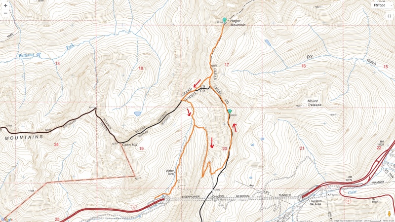
Route map
In conclusion, a great loop. It could also be used to loop just Golden Bear.
Thumbnails for uploaded photos (click to open slideshow):
I did this route about two weeks ago- I was pleasantly surprised too! The wildflowers are ridiculous! I just did an out and back to Hagar but I lingered on the ridge a long time- it's a special place, isn't it?
Thanks for posting this, and thanks Chelsea for posting the initial report! I followed this earlier in the week, and learned from your comments about when to descend to and off of Coon's ridge. Worked out great.
Loved the TR! I really need to do this one! What gorgeous weather!
Caution: The information contained in this report may not be accurate and should not be the only resource used in preparation for your climb. Failure to have the necessary experience, physical conditioning, supplies or equipment can result in injury or death. 14ers.com and the author(s) of this report provide no warranties, either express or implied, that the information provided is accurate or reliable. By using the information provided, you agree to indemnify and hold harmless 14ers.com and the report author(s) with respect to any claims and demands against them, including any attorney fees and expenses. Please read the 14ers.com Safety and Disclaimer pages for more information.
Please respect private property: 14ers.com supports the rights of private landowners to determine how and by whom their land will be used. In Colorado, it is your responsibility to determine if land is private and to obtain the appropriate permission before entering the property.


")
")
")
")
")
")
")
")
")
")
")
")
")
")
")
")
")
")
")
")
")
")
")
")
")