| Report Type | Full |
| Peak(s) |
Longs Peak - 14,259 feet |
| Date Posted | 08/22/2019 |
| Modified | 08/23/2019 |
| Date Climbed | 09/15/2001 |
| Author | flyingmagpie |
| Landmarks Along the Clark's Arrow Route on Longs |
|---|
|
First of all, I would like to explain that this “Trip Report” is not part of my series of trip reports on climbing all the RMNP 13ers. Longs is obviously not a 13er, but a 14er. Secondly, I would like to add that this is a not a full trip report at all. It is only a partial trip report on a specific segment of a specific route on Longs. It is a series of photos of landmarks along the Clark’s Arrow Route, including the initial downclimb, the traverse under the Palisades, the climb up a short distance of Keplinger’s Couloir, and finally, the traverse from Keplinger’s to the Home Stretch of Longs. Before I climbed Longs via the Loft Route, I had already used the route to climb Meeker, which I did solo. I had found that switch-backing series of ledges through steep cliffs above Chasm Lake known as the “Ramp.” I would like to emphasize that the Loft Route on Longs, which includes the Clark’s Arrow downclimb and traverse, is not a climb for beginning climbers. Practiced route-finding skills are necessary to complete this climb successfully. I didn’t yet possess such skills as a beginning climber when I first climbed the Clark’s Arrow Route. Yet I was lucky enough to do Clark’s Arrow from the Loft for the first time with a lady climber who already possessed those skills, and who later became recognized through her accomplishments as one of the premier women climbers in Colorado, Teresa Gergen. She and I had tagged Meeker first, then headed for Longs via Clark’s Arrow. I tell you, how much luckier could a guy get to find such a climbing partner? So, this is a series of photos, with a little bit of narration, to help other climbers find their way through the complicated terrain of the Clark’s Arrow Route. This series of photos was prompted by a recent forum topic on 14ers.com begun by ds67, and continued by bmcqueen, notably. I would like to thank ds67 for beginning the discussion, and for providing a link to alan arnette’s fine narrative and video of his climb of the Loft Route in winter. I reproduce ds67’s link here: http://www.alanarnette.com/co14ers/longspeakloft.php And I would like to thank bmcqueen for correctly identifying the most dangerous segment of the Loft Route as the “Ramp” through some steep cliffs that are the crux of the route from Chasm Lake up to the Loft proper. The Clark’s Arrow route from the Loft to Longs’ summit is complicated, but not that dangerous. Please read my own trip report, “Climbing Mount Meeker” (one of my series on climbing all the RMNP 13ers) if you have any doubts about how deadly the Ramp segment of the route can be when wet or icy. I have climbed or descended Longs via the Loft Route quite a number of times, both solo and with other people. My favorite Longs circuit is to climb Longs via the Loft Route and Clark’s Arrow, and then to descend the peak by the standard route, except by taking the Kneeling Camel Route from the Boulder Field down to Chasm Lake, and from there out to the trailhead. If you are wondering what the Kneeling Camel Route might be, please refer to my trip report titled “Two Shortcut Trails For Longs Peak.” All of that said, let me now get to the photos at last! Here are some of the main landmarks along the Clark’s Arrow downclimb and traverse to the Home Stretch of Longs! Any climb of Longs, as you should know, demands a 3 a.m. start from the trailhead. For the Loft Route, you want to be at or near Chasm Lake at dawn. This photo of the sunrise over Twin Sisters Mountain was taken by B.J. Cox near Chasm on the day that he, Randy and Rose Key, and I climbed both Meeker and Longs via the Loft Route in September, 2001. Randy had just finished climbing all 54 Colorado14ers that summer. 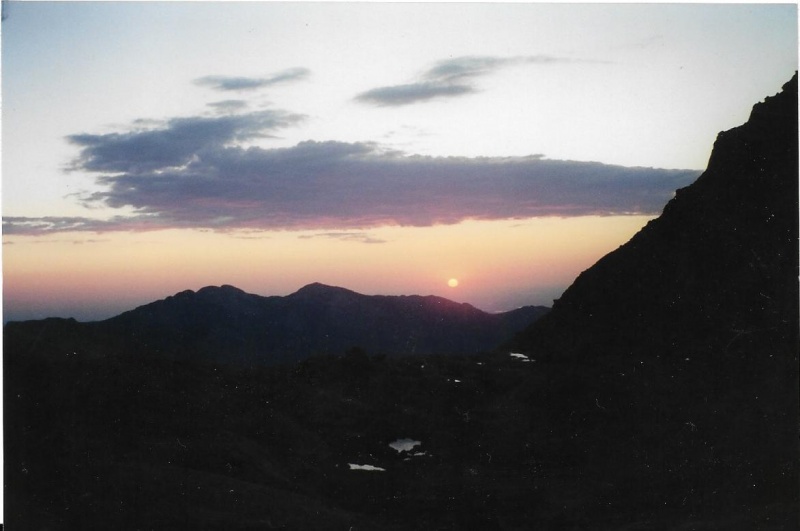
The Loft is a huge, broad saddle between Meeker and what is commonly called the snout of the “beaver” on Longs Peak. I took this photo of Randy, Rose and B.J. resting for a moment on the Loft during our 2001 climb. 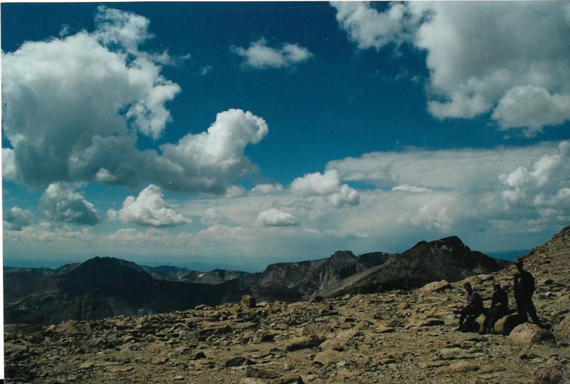
Near the northern end of the Loft below the beaver’s snout, you can see the summit of Longs, and a rock formation called “Zumie’s Thumb.” The sharp pinnacle is named after Clerin “Zumie” Zumwalt, a Longs Peak guide through the 1930’s. The pinnacle was first climbed by Tom Hornbein and two other technical climbers in 1951. Hornbein would later achieve fame by pioneering the West Ridge Route on Everest in 1963. 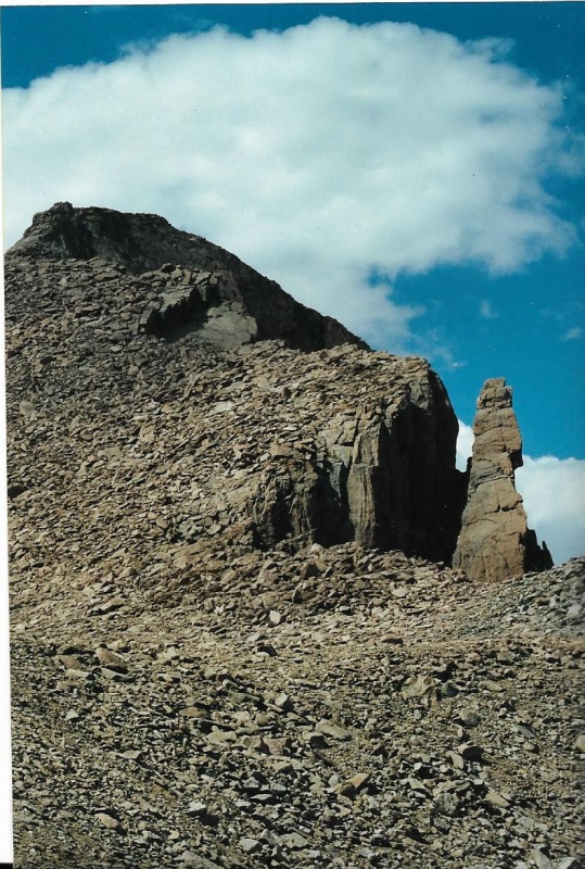
The downclimb on the Clark’s Arrow route begins approximately west of the close-up view of Zumie’s Thumb. You should not approach Zumie’s Thumb, but rather by walking along the left edge of the Loft toward the beaver’s snout. That way you might be able to spot the big cairn marking the start of the route. When Teresa Gergen and I climbed the route for our first time, it was her keen eyes that spotted the big cairn marking the start. Much later, I discovered there is another way to find the start of the route. Out there in the middle of the Loft, I was amazed on one climb to find a sheltered bivy location. There is a flat rock about 5 ½ feet long and 2 ½ feet tall, tipped up on its side to shelter a flat spot about as big as an average man is tall on its leeward, eastern side. The rock is not thick, and is tipped up vertically. It doesn’t lie flat. This flat rock is actually half buried in the ground, and is not going to tip over any time soon. I think this rock was placed that way by human hands a long time ago. Let me tell you why I think this. From the bivy site, there is a sequence of whitish stones placed every so often and also embedded a bit into the earth. The stones are placed maybe 25 feet apart and lead across the Loft directly to the Clark’s Arrow downclimb. The whitish stones serve the same function as cairns, marking the most direct way from the bivy site to the downclimb. I wonder if the origin of the site and the stones is not a very early modern climber, which it could indeed be, but rather Native American climbers who used to trap eagles on the summit for their tail feathers? Whoever placed the rocks, the bivy site and the white stones are certainly up there, and have been there for a long time. Anyway, however you find the start of the Clark’s Arrow Route on the Loft, the route begins with a long downclimb. The route descends because it later must traverse around the very base of the Palisades, towering rock cliffs that block any direct route from the Loft to Longs. Here is an important photo of most of the beginning downclimb. After first doing the route with Teresa, I know the way and I am leading the others in my group. Behind me in the blue hat, Randy is negotiating one of the tougher sections. Above Randy, Rose, wearing a red down jacket against the morning cold, is waiting for Randy to clear the tough spot before she follows. B.J. is right above Rose in the same shadowed cleft, but out of sight behind that massive rock to Randy’s right. The guy up top near the sky is not part of our group, but I am glad he is there because he is right at the start of the descent point from the Loft. Rose is waiting for Randy to clear the tough section before she herself starts down it. 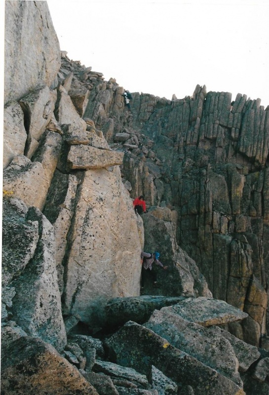
Here is a shot of B.J. at the beginning of the Clark’s Arrow Route from the Loft. The downclimb in the previous photo begins immediately. That pile of rocks at the right upper edge of the photo may be the big cairn Teresa was able to spot. 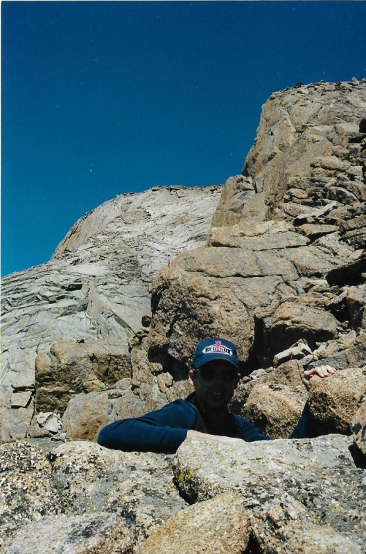
Here is a photo taken by B.J. of Rose actually beginning to descend that tough section she was waiting for Randy to clear in my photo. Randy has cleared, and now Rose is starting down. 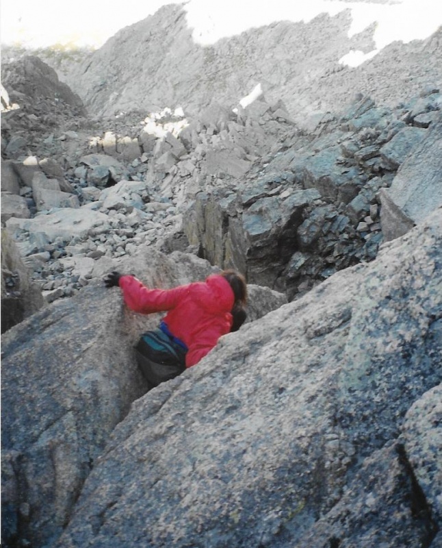
In my trip report titled “Climbing Fairchild Mountain (And Meeker and Longs)” I describe briefly how Teresa and I, after tagging Meeker by the Loft Route were headed for Longs via Clark’s Arrow when we discovered a group of three climbers, two young men and a woman, in trouble. They had descended far too low and were off-route. They didn’t know where the route was, and how to climb out of the predicament they had gotten themselves into. The young woman was crying. Above them, and confident we were on-route, Teresa and I could clearly see the moves each needed to make in order to climb back up to us through the complicated terrain. One by one we talked them through what they needed to do until they joined us. They seemed relieved and grateful. The young woman had stopped crying. We invited them to follow us, and they did, eventually. But they needed a little bit of time to rest, shake off their mistake, and recover their will to press on toward Longs. As Teresa and I moved ahead, I shot this photo of the group together, and now on-route. I share this photo because it shows the route beyond the initial downclimb. Take a look at those tipped rocks on the skyline, the ones tipped right as you view them. Those rocks appear in the next photo as well, and show another portion of the route beyond the initial downclimb. 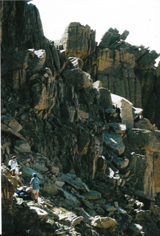
In this next photo, even more of the Clark’s Arrow Route is visible. Teresa and I are moving on. We are following cairns, and our own instincts from prior climbs on other routes as to where Clark’s Arrow has to go to be able to clear the Palisades ahead. If you look closely in this photo, you can see silhouetted against a slab of rock just to the left of mid-photo one of the climbers from the previous photo beginning to follow Teresa and me on toward the summit. 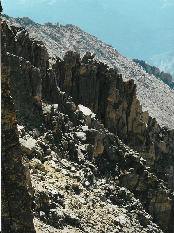
The next two photos are of me, and were taken by B.J. Cox on our climb with Rose and Randy. This was just my second journey along the Clark’s Arrow route. In these two photos you can readily see how complicated the terrain ahead is. I have moved ahead of the others to locate Clark’s Arrow to be certain we are still on-route. In the first photo I am looking for Clark’s Arrow. In the second photo I have found the arrow and am standing near it. Clark’s Arrow was painted onto a near-vertical slab by a Park Ranger named Clark many years ago. The paint is fading, but the arrow was still visible, inside a circle. When the others caught up to me, I asked B.J. if he would climb up off-route and touch the arrow and circle to show where it is. That is the arrow inside the circle right at the tip of his hand. 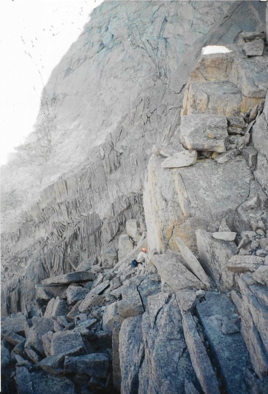
The next photo was taken on one of my solo climbs of Longs via Clark’s Arrow. I don’t know who the other climber is, but we are both on-route. Clark’s Arrow is located on the face of that rock near upper left. The face of the rock tapers to a kind of a point just below the arrow, 
And here is another shot of the rock that tapers near its bottom to a point below Clark’s Arrow. I took this shot on my climb with B.J., Rose and Randy. B.J. stands below Clark's Arrow. Rose is below me as I climb to the traverse around the base of the Palisades. 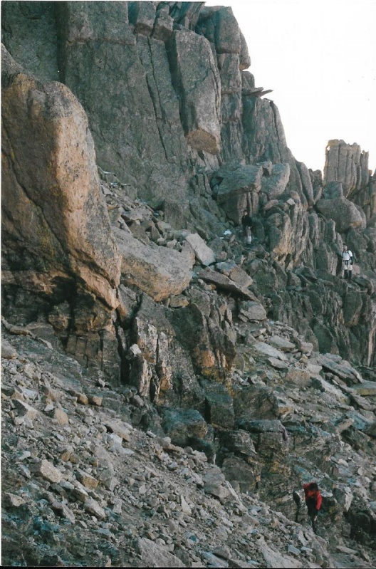
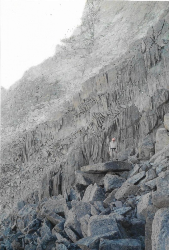
When you stand at the base of the Palisades, and look up at their tops, which form part of the snout of the beaver on Longs, you can’t help but think of yourself as a small creature in a very big world full of powerful geologic forces. And you also think about time, and how big that is, the immensity of time from the beginning, and all that has happened in the world since, and how very brief each of our lives really is. There are massive rock boulders up above wedged between columns of rock. But after thinking about that, and while continuing to think about it, you realize, too, that you’d better get on with your climb, finish it, and descend before any possible thunderstorms move in. And that thought too makes you feel small, and confronted with great forces. At the base of the Palisades, moving toward Keplinger’s Couloir, you will find a remarkable and huge fin of rock sticking up improbably. The route passes between the fin and the Palisades. In the distance, you can see into Wild Basin. You are usually in shadow back here if you started your climb at 3 a.m. as you should have done. The sun is still on the other side of the great peak you are climbing. In this photo, the Palisades rise along the left edge of the photo. They tower above. 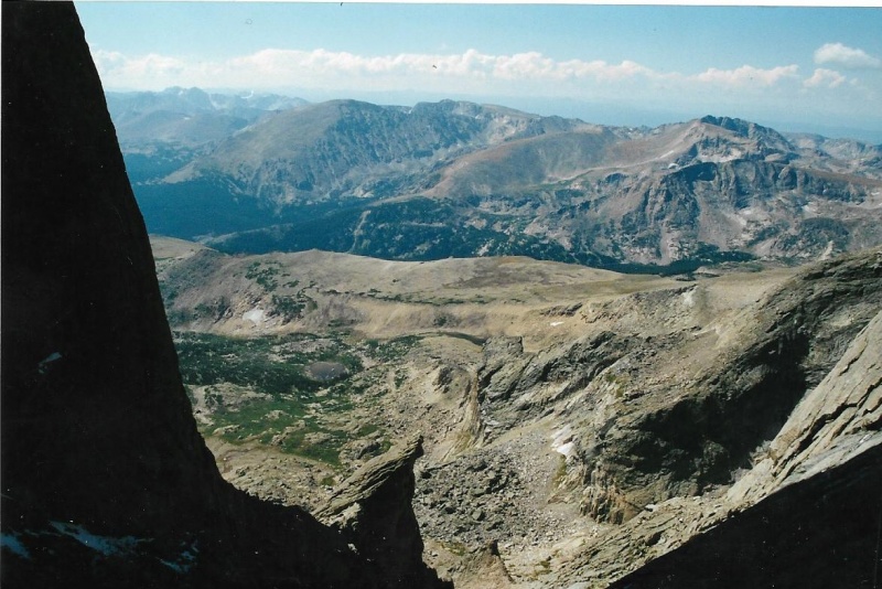
Another photo of the fin, with climbers on-route. This photo gives you an idea of the scale of things. This was taken by B.J., and the climbers are not in our party. They have already summited Longs, and are heading back down along the Clark’s Arrow and Loft Routes. 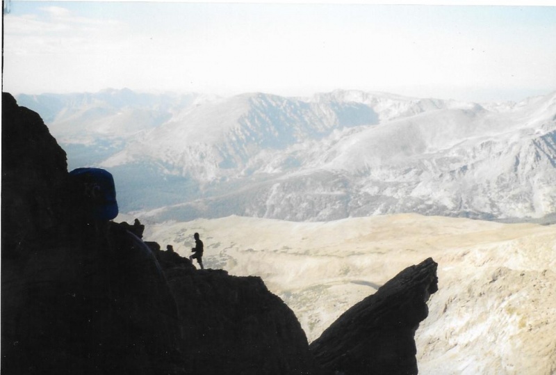
After traversing around the Palisades (on the left), we entered Keplinger’s Couloir as soon as we could do so without sacrificing elevation. Once in Keplinger’s, we climbed up a bit until we could see the easiest route to cross over onto the massive rock block of the peak itself. 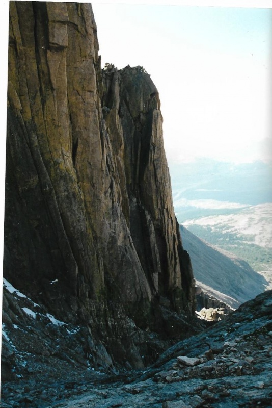
Here is the route ahead, greatly foreshortened by an optical illusion produced by the camera. There are cliffs immediately to the left of the projecting shadow. The route passes above the cliffs, but below the steep slabs of rock above. The slabs are steeper than they appear in the photo! The route follows that whitish band of rock just above the shadow. 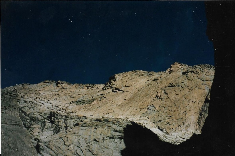
The next photo is still from Keplinger’s couloir. We haven’t left it yet, but are just about to climb left along the whitish band of rock, which begins right here in Keplinger’s. The “Notch” between the snout of the beaver and Longs proper, is just out of sight from here, to the right. The rock formation above at the upper edge of the photo always reminds me of the profile of a human face. 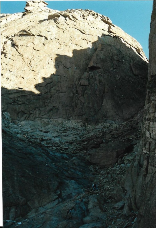
The next photo I took is of the “Notch” itself. It is close, and if you have time, it is fun to climb up to it and look down, and into the distance as well. 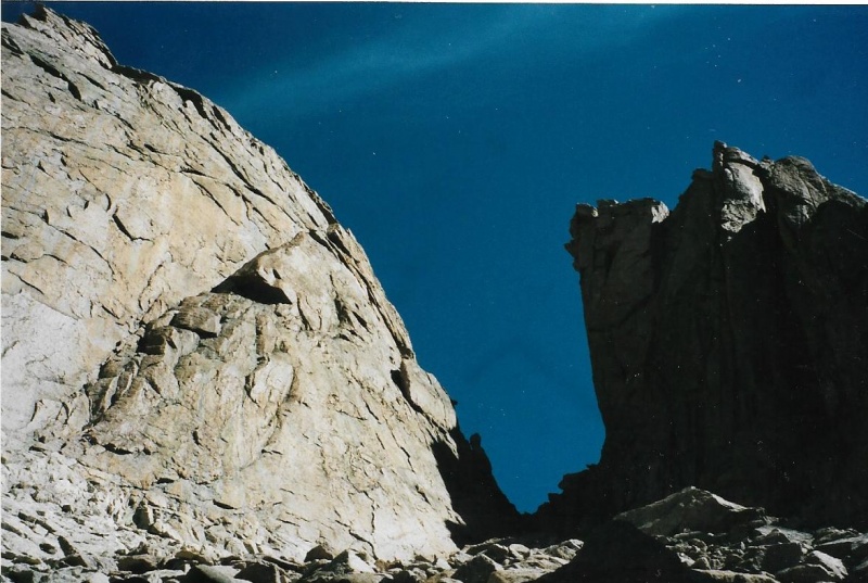
On my climb with Teresa, I gave my camera to her, and she went ahead and took this photo of me. We have left Keplinger’s and are moving along the whitish band of rock. That’s the snout of the beaver behind me. 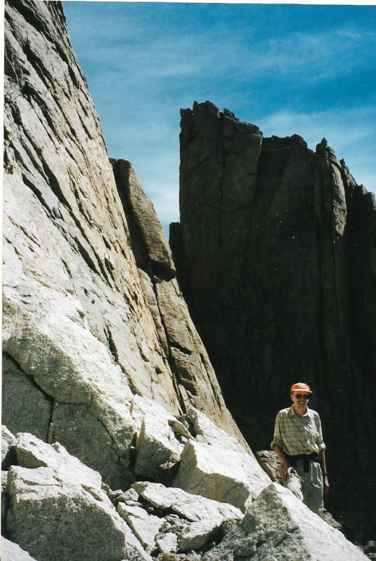
The next photo is of Rose and Randy on the whitish band of Rock. This photo was taken on our descent after summiting, but you can see the route above Rose, passing left above cliffs, but below the steep slope above it. As you follow the route shown here far enough, you will actually arrive at a view of the Home Stretch of Longs. The terrain from the route up to the Home Stretch is not too complicated, or all that difficult. 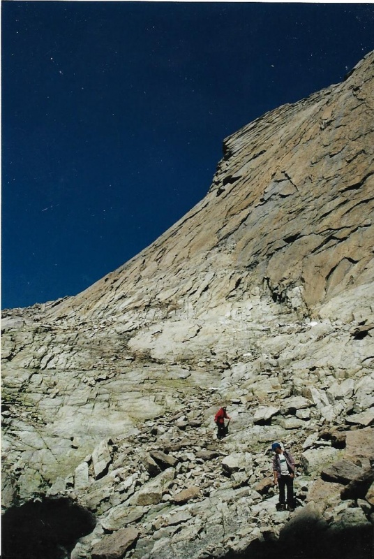
I took this photo from the whitish band of rock as we moved toward a point where we could easily reach the Home Stretch of Longs. Sometimes, early in the year, a gash of snow still follows the whitish band, above it. The rock below the snow field is wet, slick, and dangerous. I always climbed just above the snow, at its upper edge, where the rock was dry. 
Once you can see the Home Stretch, just move toward it by the best and safest route you can find. Of course, rarely is the Home Stretch empty of people who are both ascending and descending! 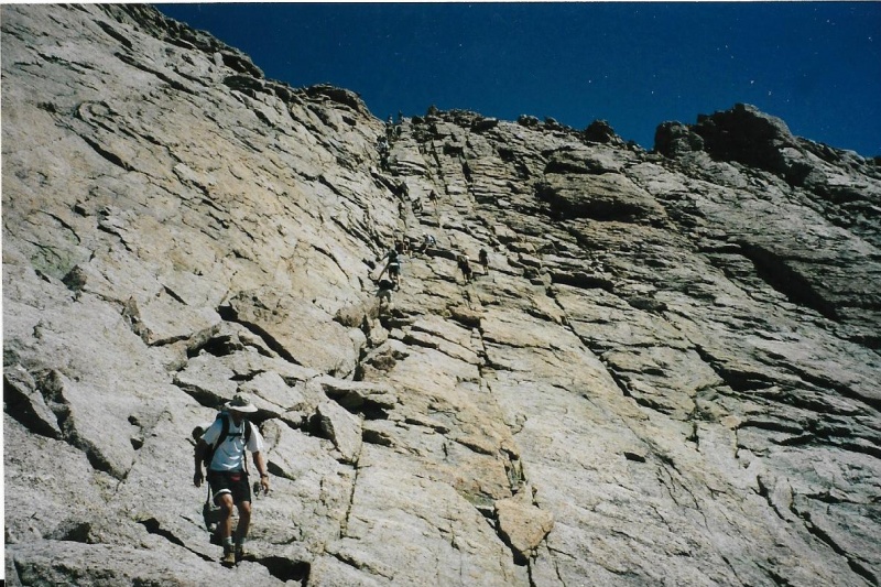
Hope these landmarks help! Happy, safe climbing! Thumbnails for uploaded photos (click to open slideshow): ")
")
")
")
")
")
")
")
")
")
")
")
")
")
")
")
")
")
")
")
")
")
")
|
| Comments or Questions |
|---|
|
|
Caution: The information contained in this report may not be accurate and should not be the only resource used in preparation for your climb. Failure to have the necessary experience, physical conditioning, supplies or equipment can result in injury or death. 14ers.com and the author(s) of this report provide no warranties, either express or implied, that the information provided is accurate or reliable. By using the information provided, you agree to indemnify and hold harmless 14ers.com and the report author(s) with respect to any claims and demands against them, including any attorney fees and expenses. Please read the 14ers.com Safety and Disclaimer pages for more information.
Please respect private property: 14ers.com supports the rights of private landowners to determine how and by whom their land will be used. In Colorado, it is your responsibility to determine if land is private and to obtain the appropriate permission before entering the property.

