Download Agreement, Release, and Acknowledgement of Risk:
You (the person requesting this file download) fully understand mountain climbing ("Activity") involves risks and dangers of serious bodily injury, including permanent disability, paralysis, and death ("Risks") and you fully accept and assume all such risks and all responsibility for losses, costs, and damages you incur as a result of your participation in this Activity.
You acknowledge that information in the file you have chosen to download may not be accurate and may contain errors. You agree to assume all risks when using this information and agree to release and discharge 14ers.com, 14ers Inc. and the author(s) of such information (collectively, the "Released Parties").
You hereby discharge the Released Parties from all damages, actions, claims and liabilities of any nature, specifically including, but not limited to, damages, actions, claims and liabilities arising from or related to the negligence of the Released Parties. You further agree to indemnify, hold harmless and defend 14ers.com, 14ers Inc. and each of the other Released Parties from and against any loss, damage, liability and expense, including costs and attorney fees, incurred by 14ers.com, 14ers Inc. or any of the other Released Parties as a result of you using information provided on the 14ers.com or 14ers Inc. websites.
You have read this agreement, fully understand its terms and intend it to be a complete and unconditional release of all liability to the greatest extent allowed by law and agree that if any portion of this agreement is held to be invalid the balance, notwithstanding, shall continue in full force and effect.
By clicking "OK" you agree to these terms. If you DO NOT agree, click "Cancel"...
Let's be honest to each other, I know you clicked on this for the dog pictures. I'll write some text anyway but really what's the point? If you want dog pictures it's fine. Go ahead and scroll down.
Day 1: 4.5 miles to Black Mandall Lake Day 2: 13.5 miles out to the trailhead after climbing all the peaks, 9 miles if you camp a second night at Black Mandall Lake
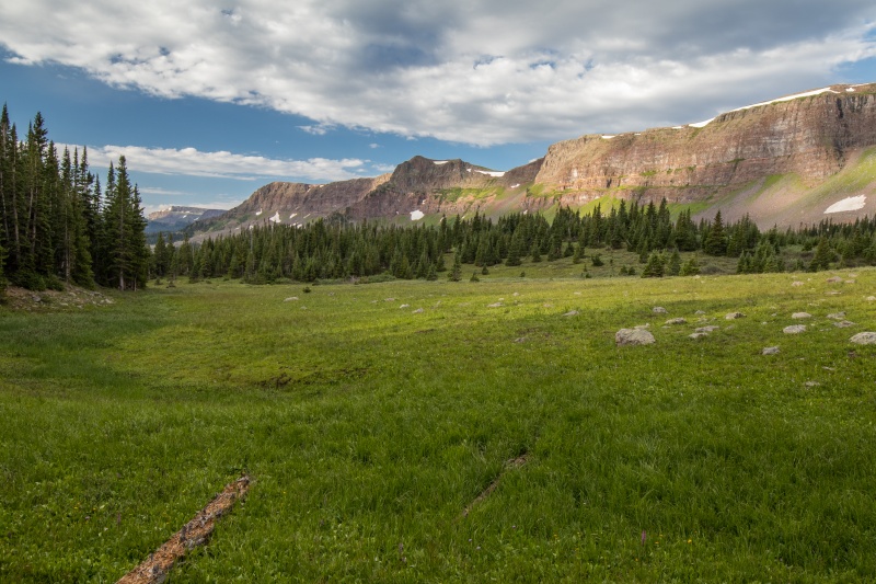
We bounced around a number of ideas for this past weekend and ended up deciding that we should head out to the Flattops for a different sort of adventure. Neither of us had ever been out there and it seemed like a good backpacking destination. We headed out from Denver on Friday and arrived at the Mandall Lake TH near Yampa mid-afternoon. The trailhead was empty and we didn't figure we'd have much company out here. I mean, 12ers, who does that? The backpack in went fairly quickly and we arrived at Black Mandall Lake in about 2.5 hours....and promptly got assaulted by every mosquito in a 2 mile radius. Making the best of it we cooked dinner in our large vestibule of the tent and then retreated inside to wait out the darkness until the next morning.
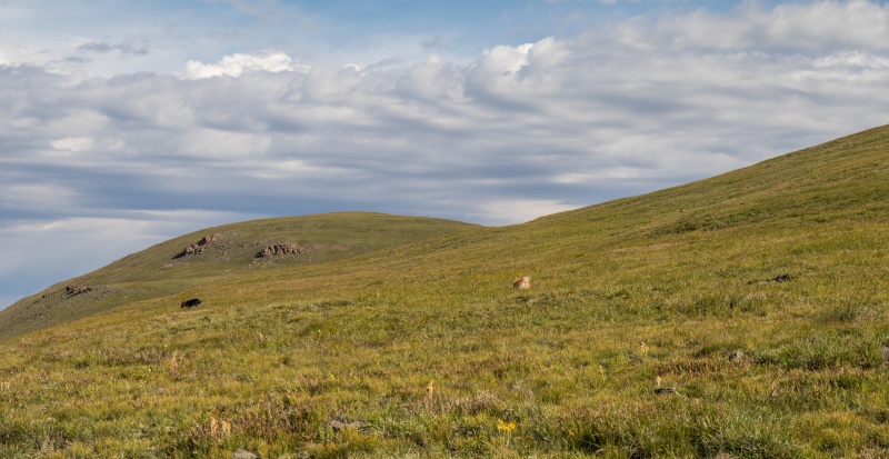
On the way to Black Mandall Lake
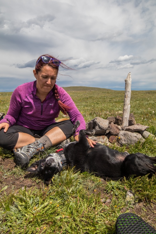
The next morning the hordes of bloodsuckers returned while I filtered water and we got packed up for our hike. A wily Pomeranian stole half my bagel I was eating for breakfast. If this was how the day was starting I could only imagine how the rest would go. We started to hike up the Mandall Pass trail and then things got worse. Someone rolled in poop. By someone I mean a cute black dog named Sprinkles. Who was now covered in poop. And a bit less cute. And stank.
Poopycock. How would the rest of this day go?
Morning meadows smell delightful, if the dog isn't near you
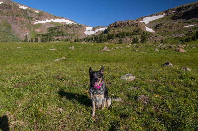
Dog, and Mandall Pass
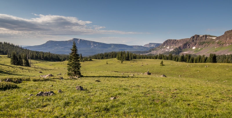
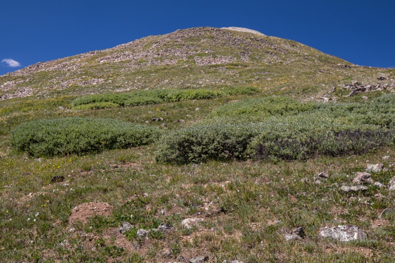
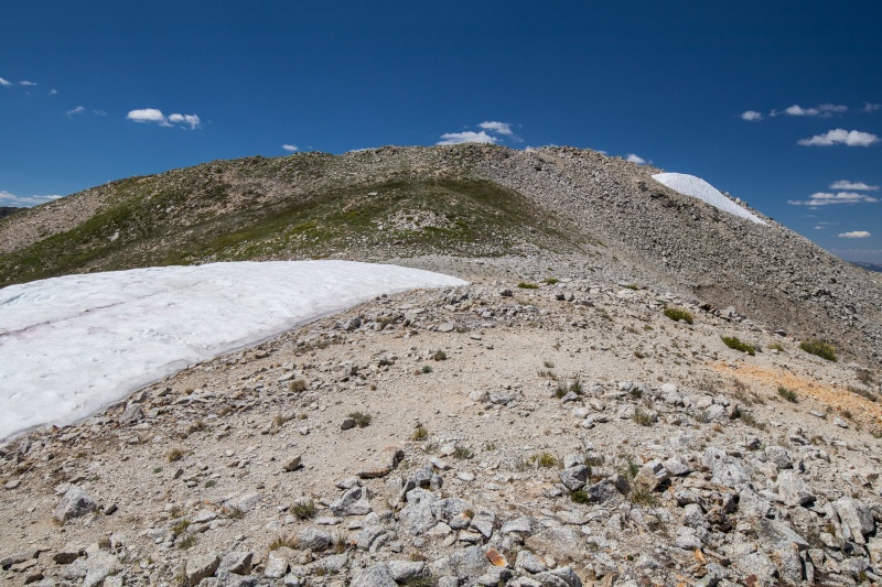
Onwards towards Mandall Pass we ascended with a poopy dog on our heels. It was a gorgeous morning. The trail up was decent enough. The dogs found some snow. We got close to the pass and headed up a slightly steeper section to get to the top of the mesa. Flat Tops is not an exaggeration. These are not the steepest mountains we've ever climbed.
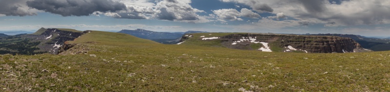
Looking over to 12008
Ascending the steep part
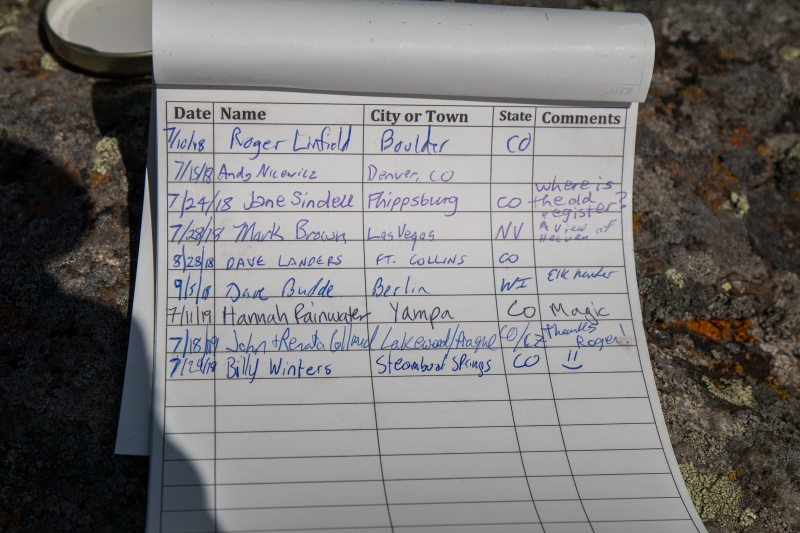
After a 1.5 mile stroll across the tundra with some faint trails to follow we finally saw the intimidating summit of Orno Peak ahead. It's massive bulk and Class 2 slopes looked like they would present a challenge. After an exhausting few minutes we found ourselves on top. There was a summit cairn and a sparkling new white register. With no pen. Billy Winters of Steamboat, if you're reading this, bring back the pen.
Summit of Orno behind Maya
Summit block
Terrifying exposure
Maya side eye to her sister
Billy, where's the pen?
Gross
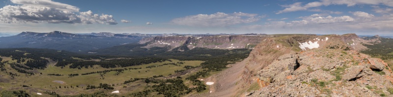
To the north
Looking back from Orno
Not being able to sign the register we were forced to pose for a summit photo with the poo covered dog. That part quickly dealt with we decided to move on to Northwest Orno. Back across the flats we go. An almost 2 mile stroll that tested our endurance brought us to the summit of Northwest Orno and we found another register. This one had a pencil. Billy apparently only takes pens. This time no one picked up the dog for a summit photo. We found some familiar names in the register and looked over to the summit of 12008. How would the next part go? We'd never seen anything so....flat.
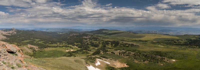
Pano from NW Orno
Dog, just because
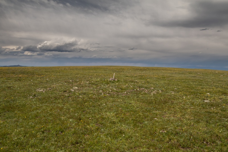
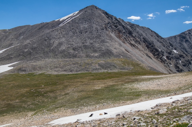
We returned to Mandall Pass and began the grueling ascent back up. We followed the GPS towards what it said was a summit. We trudged onwards across the expanse. We saw little of note. Then, in the distance, is that a cairn? It could be. It might be.
Dog, difficult stretch ahead
At last we reached the summit and congratulated ourselves on the ascent. We studied the expanse and marveled at the ruggedness of the surrounding terrain.
Umm, well....it's flat
. We found a register placed by the Roaches themselves. Clearly we had ascended a notable summit indeed. We took pictures to document the adventure.
It smells so bad
Still smelly
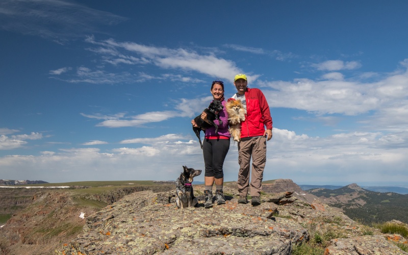
Dramatic summit photo....or not
Best summit photo ever
After a while we decided to descend back to safety. We returned to the pass and made our way back to the lake. We packed up camp and decided to deny the mosquitoes their meal today. The Pomeranian disputed our choice and wanted to take a nap. After some coaxing she decided to follow us back to civilization. After a few hours we returned to the trailhead and headed for Yampa and food.
Pomeranian log crossing events will be an Olympic sport soon
Just a dog named Maya in the flowers
Along the way we had considered trying to climb 8260 near Yampa for a possible milestone. After obtaining food from Antlers Bar in Yampa we headed north to investigate. We soon realized that we would be denied this summit due to its brushy nature and surrounding fences and headed back to town to eat our food and drink our beer in the middle of the street in town on the tailgate. Locals waved at our ingenuity and we eventually decided to move on.
Day 3: 1.2 miles and 750 feet of gain to Peak 9
After a night of sleep in a real bed and a shower we decided to continue our epic journey by climbing Peak 9 in Breckenridge. I'd been saving this notoriously difficult summit for a special occasion and the time had come. After a masterful ascent of the 4wd road by my trusty driver along with some cursing at the other terrible drivers in front of us we finally reached a suitable spot to begin the ascent. I provisioned ourselves for the long hike with suitable snacks and beer and we set off up the ridge.
This is going to be tough
Class 2.65444 terrain
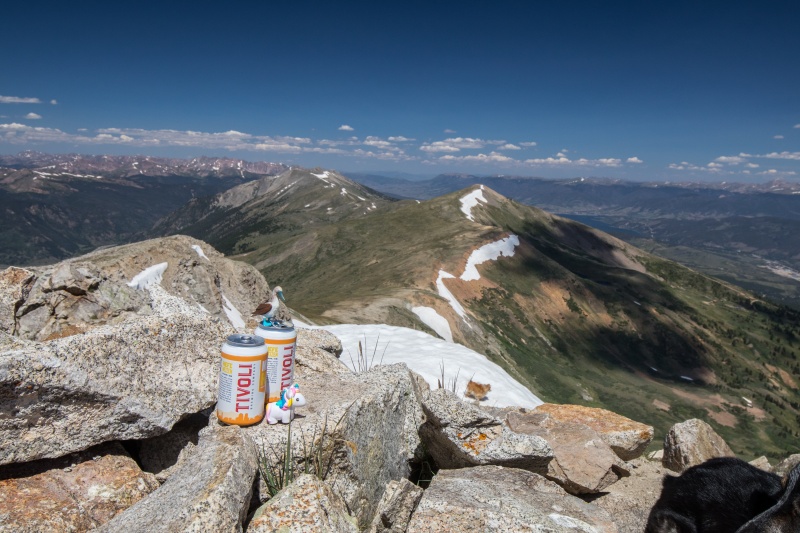
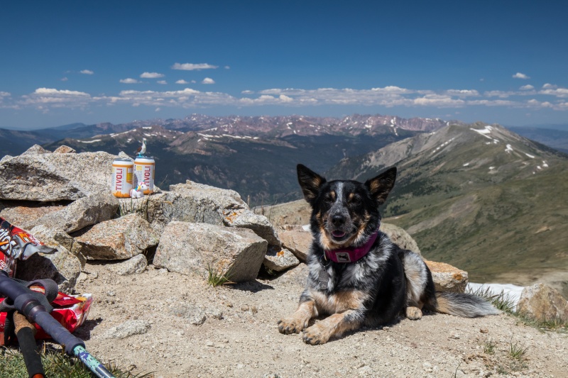
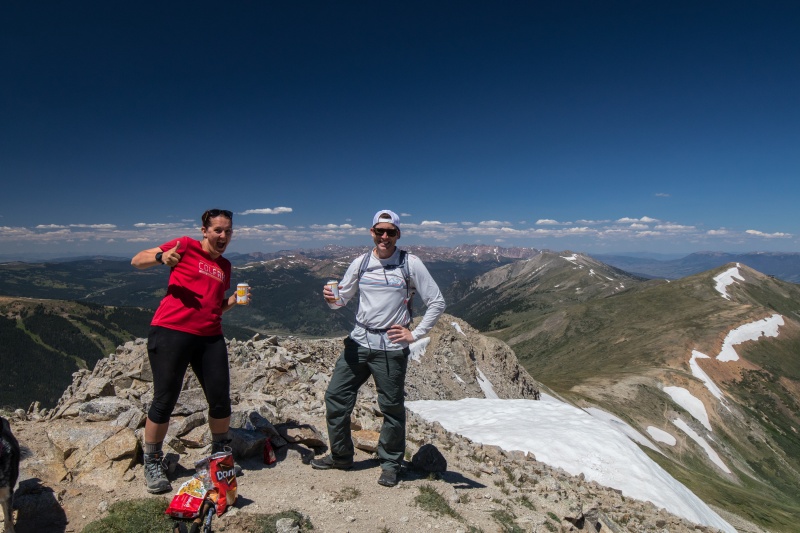
The ascent went slowly and after many minutes we found ourselves almost at the top. We made our way up the last 50 feet and I dropped my pack and sighed with relief. The ascent had taken just over 50 minutes and we were exhausted. We rested while we drank beer, ate Doritos, and cookies. After some time a random stranger startled the dogs and joined us. We gave him a beer for his trouble and he celebrated with us. This was my 200th ranked peak in Colorado and my Tenmile/Mosquito 13er finisher (serious note: I refuse to do Bartlett, it may not be a 13er anymore, and I'm not risking trespassing).
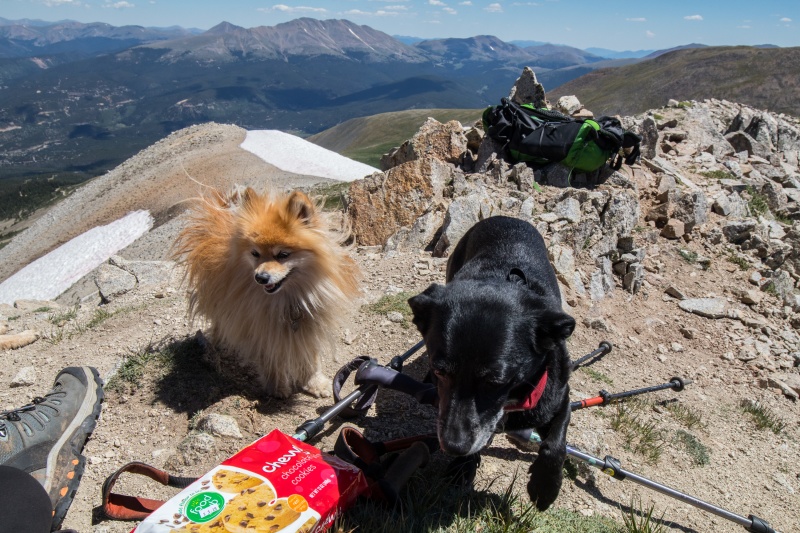
Mascots and beer
Dog
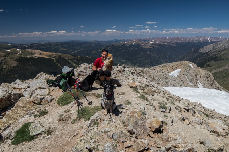
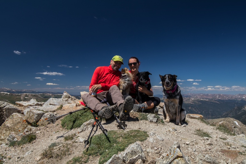
Dogs and human
Humans and dogs
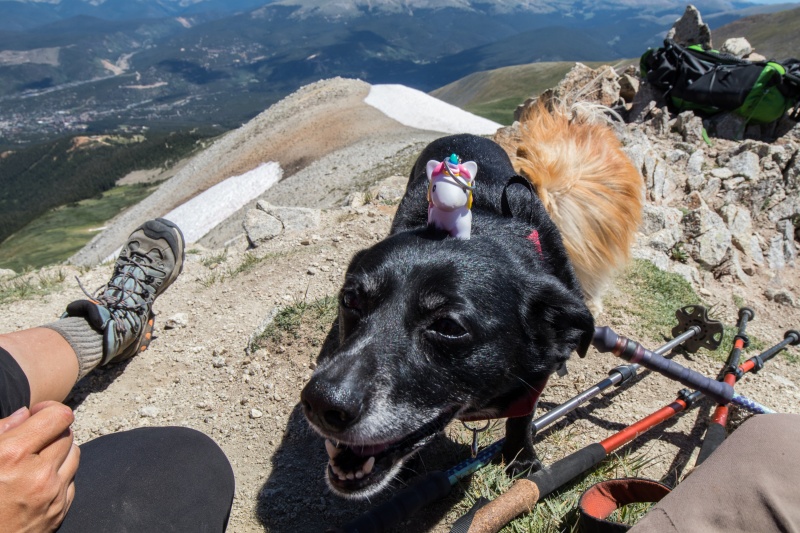
Some days you ride the unicorn, sometimes the unicorn rides the dog
Cookies?
Random stranger with beer, and snacks
Rollin.....
After 45 minutes on top we said goodbye to our new friend and headed down to some snow so the dogs could roll around. We returned to the 4Runner and basked in the success of a job well done.
I hope you enjoyed the dog pictures. Here's one more.
The rear view of a wild pomeranian in her natural habitat. Be free little dog, be free.
Thumbnails for uploaded photos (click to open slideshow):
looks exactly like the blue heeler mutt (german shepherd? collie?) we had for 13 years of my childhood, Penny (because of the copper spots over her eyes). Great dog. Loved to roll in and eat poop and rotting carcasses.
Loved this trip report! You have missed your calling Mr. Frohlich ... sarcastic comedy is right around your corner of life. The views down the valley are very nice. However, some of the summits remind me of Nebraska. ;-) I LOVE THE DOG PHOTOS. Wish I could have tagged along (if nothing else, to smell the dog as your trip report does not include "smell-o-vision"). Thanks for posting. Happy trails!
P.S. - My sister had a great dane for many years. Named Dawber. Loved to eat horse poo (had the worst breath of any dog I have every met). When Dawber had to be put down due to old age, they buried him in their back acreage (where the horses lived).
have a Corgi that liked the elk droppings and dead fish to freshen up with before tenting with us
a very calming affect that this report has
Caution: The information contained in this report may not be accurate and should not be the only resource used in preparation for your climb. Failure to have the necessary experience, physical conditioning, supplies or equipment can result in injury or death. 14ers.com and the author(s) of this report provide no warranties, either express or implied, that the information provided is accurate or reliable. By using the information provided, you agree to indemnify and hold harmless 14ers.com and the report author(s) with respect to any claims and demands against them, including any attorney fees and expenses. Please read the 14ers.com Safety and Disclaimer pages for more information.
Please respect private property: 14ers.com supports the rights of private landowners to determine how and by whom their land will be used. In Colorado, it is your responsibility to determine if land is private and to obtain the appropriate permission before entering the property.


")
")
")
")
")
")
")
")
")
")
")
")
")
")
")
")
")
")
")
")
")
")
")
")
")
")
")
")
")
")
")
")
")
")
")
")
")
")
")
")
")
")
")
")
")
")


