| Report Type | Full |
| Peak(s) |
Castle Peak - 14,274 feet Conundrum Peak - 14,037 feet "Castleabra" - 13,804 feet |
| Date Posted | 08/19/2019 |
| Date Climbed | 08/17/2019 |
| Author | Chicago Transplant |
| The Rule of Three: Castle Triple Trio |
|---|
|
The Rule of Three: A Castle Triple Trio Peaks climbed: Castle Peak (14,265): 12th Highest Somewhere around 16 miles and 6500'. I didn't track it with a GPS.
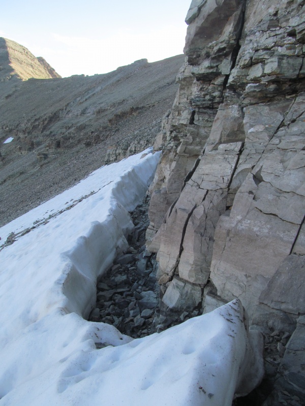
Act I: Castle "The Rule of Three" is used in writing, the idea being a trio of characters or events is more interesting: Three Musketeers, Goldilocks and the Three Bears etc. So seeing as this was my third ascent of Castle, I climbed 3 peaks this day, and actually went over the summit of Castle 3 times in the same day, it seemed an appropriate title for Saturday's adventure. I tend to only write trip reports if I feel there is something new to offer, and in this case I decided to write this one to share the traverse over to "Castelabra" with you. Many people have posted interest in climbing Castle from Conundrum Hot Springs, and the West Ridge via "Castelabra" is a great option to do so. There is some route finding and some loose class 3 cliff bands that Gerry Roach accurately calls "scruffy" in his guide book, but this can be a reasonable route if you give it the proper attention and respect required to find the safest path. Most of this report will focus on the out-and-back to "Castelabra" from Castle, and I will not be giving much more than a conditions report on the standard route or Conundrum. I know for most reading this the 14ers are the main characters, while the 13ers are background that fill the view. For me, they are center stage. "Castelabra" has been my highest remaining ranked peak in Colorado since I finished the Highest 100 almost 7 years ago, so as you can imagine it was a prized summit in my mind. It is also a remote summit, that unless you can drive well up the Pearl Pass Road from Crested Butte, is a long day hike or a backpack. In talking to my friend Scot (Floyd) the other day, he mentioned that way back when he did Castle over a decade ago he ran into Steve Knapp who had come over from "Castelabra" and it got me thinking that maybe I should research that route to save some mileage and driving, the reports were vague and the descriptions made the route seem quite nasty, but 560 13ers into this game, I have had my share of nasty and felt I could find a way to make it work. I will go through my morning ascent of Castle for the day fairly quickly, as there really isn't anything new to offer. Current conditions on the road are that it is completely clear of avalanche debris thanks to the hard work of a couple of locals who cut through it all themselves. I parked my Outback near the last designated campsite and hiked up the road. The bridge is gone, but there are stable logs in its place. Hiking up the road in the moonlight was nice, and I often would turn my headlamp off in the areas where I was out of the forest, and then off completely once above treeline where the moon and early dawn light provided plenty of illumination. There are patches of snow above the end of the road through the headwall, and at 6.30am they were very firm and I was glad to have used microspikes to make quick work of them. There are rockier options if you want them, though stability of the rock may be an issue. At the top of the headwall the northeast ridge trail starts immediately, it would be easy to miss, especially in the dark, so look up to your left where the terrain flattens out and you will spot it. A few gravely switchbacks to start and then the trail is strong to the ridge crest. Fortunately, the route finding is pretty straightforward on the ridge. A few spots may have multiple choices, but generally it is easy to follow with some staircase like spots that are 2+ or easy 3 depending on your path. All in all I think the northeast ridge on Castle is a fine route for someone looking to move beyond the simple walk ups to get a taste of what the harder peaks hold. It was my first Elk 14er back in 2005, and 18th overall, and I remember it being an enjoyable Elk intro. 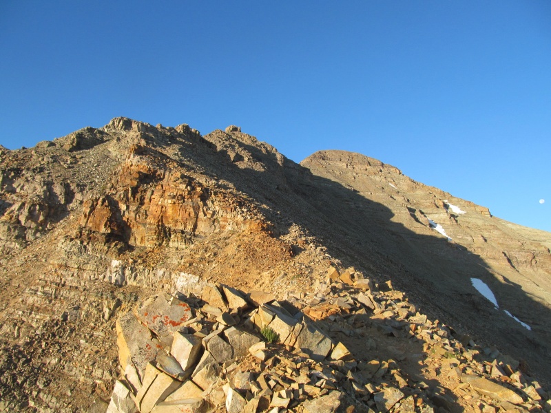
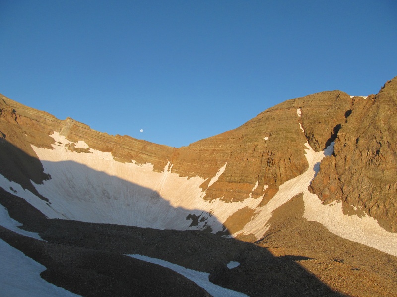
Above the last cliff it was easy walk to the highest point where I had it all to myself at 7.30 in the chilly morning air as I basked in the views of being at the highest point in the Elks. "Castelabra" is a little over 3/4 of a mile away, and only rises about 425' from the low point of the ridge. Sounds simple, but the unknown of the west ridge and the difficulties of the notch with PT 13820 await and I set off to see what the western battlements of the Castle had in store. 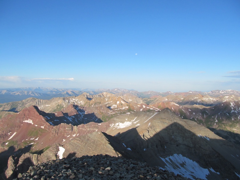
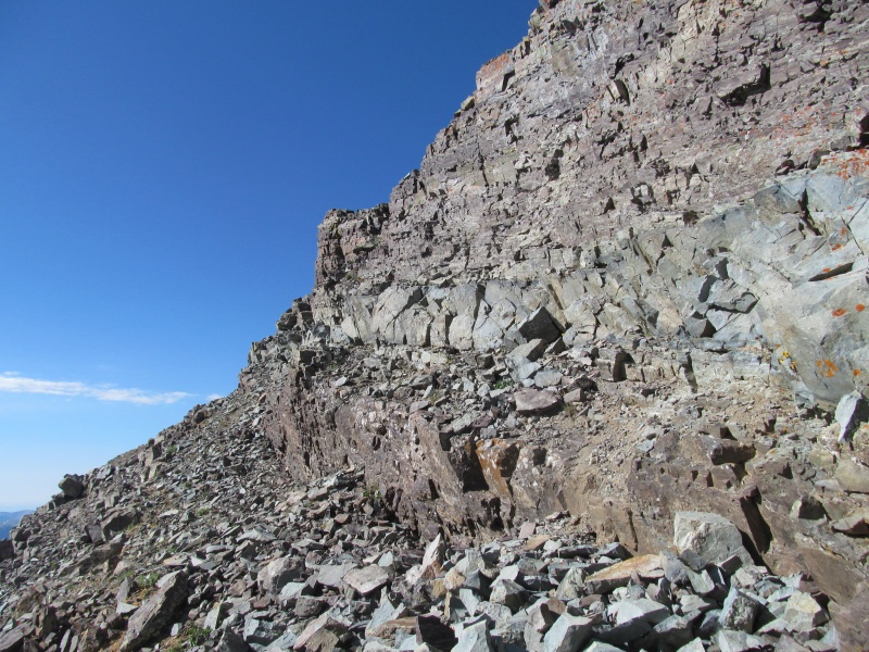
Act II: "Castelabra: I had done some research on the West Ridge route of Castle over the previous couple of days to figure out how feasible this would be as a way to get to "Castelabra". Words like "steep", "loose", "scruffy", "dangerous" and "spicy" kept coming up but the consensus was it could be kept class 3. At this point in my climbing career I could have used those same words to describe at least half of the Elk peaks I have done, so I put on my helmet at the summit of Castle and set off. The ridge splits the Conundrum (north) and Cumberland (south) basins, and I will try and use those basin names when describing which way to bypass so that people using this description as an ascent are clear. Initially there was a bit of climbers trail, and generally the ridge crest proper was the best route. The ridge is easiest closer to the summit, and gradually steepens and has bigger cliff bands as you proceed down that require some bypasses. If you are using this as an ascent from Conundrum Hot Springs, of course this will be the opposite, with the ridge gradually getting easier as you go up. The ridge near the summit was similar class 2+ terrain to the NE ridge route, just without the defined trail. A little lower a 10-15 foot class 3 cliff presented itself and worked well just going straight down it with solid rock. 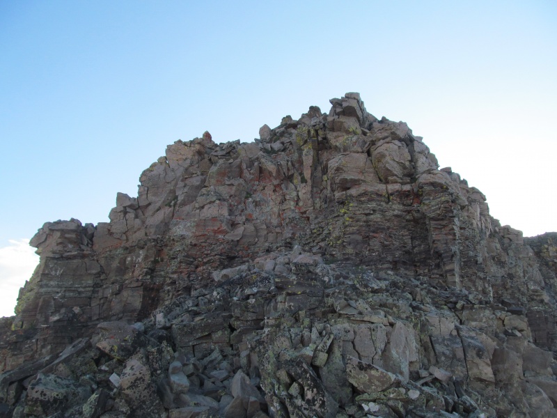
I stayed ridge proper for a bit until a larger cliff presented itself. I traversed slightly towards Conundrum Basin until the terrain eased a bit and I was able to find a shorter drop through the cliff, but with a little harder moves and more loose rock both above and below it than the first cliff band. After a slightly exposed step off the cliff, I traversed off the ridge slightly to the Conundrum Basin side of the ridge again to reach easier terrain to bring me back to the ridge crest. From below, I could see where this entire section could have been kept at 2+ even farther towards Conundrum Basin, but the rock would be loose. 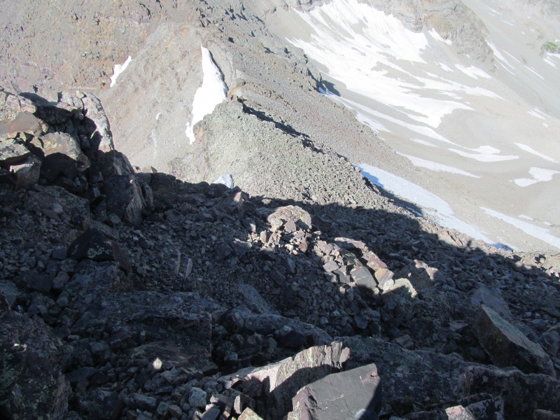
After a short bit on the ridge I was approaching an even bigger and steeper drop in front of me. Here past reports have mentioned traversing towards Conundrum Basin above this cliff until a weakness presents itself, and that is what I did. As with earlier reports, the rock above the cliff is loose and much care is needed to avoid sending rocks (or yourself!) over the cliff below. After about 50' along the cliff I saw a weakness that would work, but there was snow below it. Luckily the snow had detached from the cliff leaving a 2 to 3 foot wide gap to traverse between. This put me tight to the cliff above, and reinforced my belief that this is a small party route as being below people traversing the loose rock would not be fun. The snow ended near the ridge crest and I followed it further downwards. Up to this point the ridge had lived up to its reputation of loose and scruffy with bits of class 3, and I could see the potential for danger in a large party and if people were not careful. 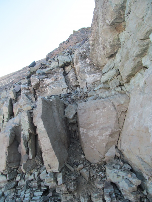
Here the ridge flattened somewhat and became the easiest terrain of the traverse so far, and less exposed to rocks from above. On the Conundrum Basin side a large cornice remnant stole the show with a dramatic overhang as a few small class 2+ areas needed to be scampered over. I knew the main obstacle was still ahead and I didn't let the easier terrain turn me complacent. 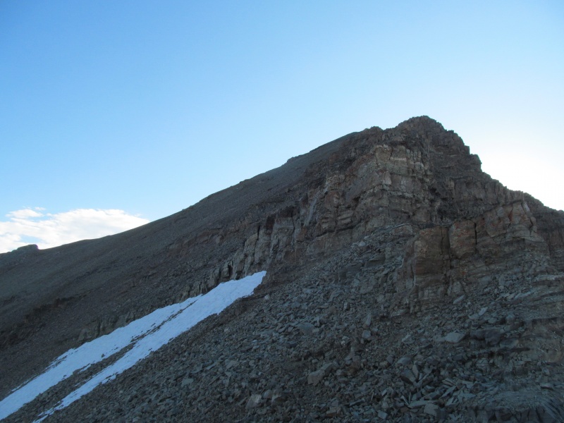
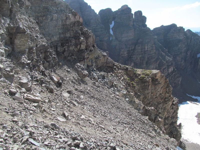
I kept on the ridge crest moving towards a rock outcrop that looks like an oversized cairn, but I think is just a natural part of the mountain. From it I could peer down into the notch and agreed with previous groups that this is a no-go and a bypass is necessary. Immediately below this is a very steep and rough looking descent that may be able to be kept to Class 4, the terrain both towards Conundrum and Cumberland being about the same, but looked like an ugly descent either way. 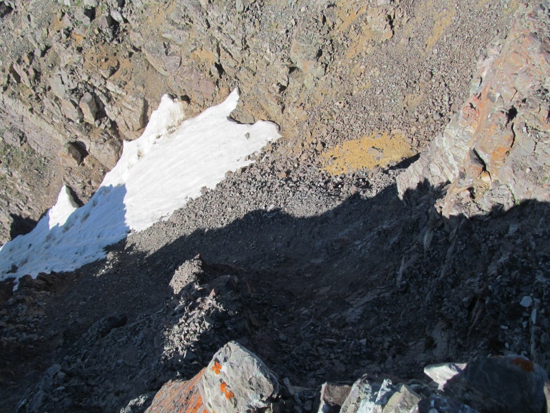
Below me to my left was a cliff guarding the Cumberland side bypass, but I saw a grass patch about 20 feet lower than the saddle and 75 feet away from it (still at least 100 feet below me). This seemed reasonable if I could get to it. I back tracked the ridge towards the cornice remnant to clear the cliff that was immediately below me, finding a weakness that allowed me to drop off the ridge with a few easy class 3 moves. Then traverse loose terrain back to the slope I saw above the grass patch. 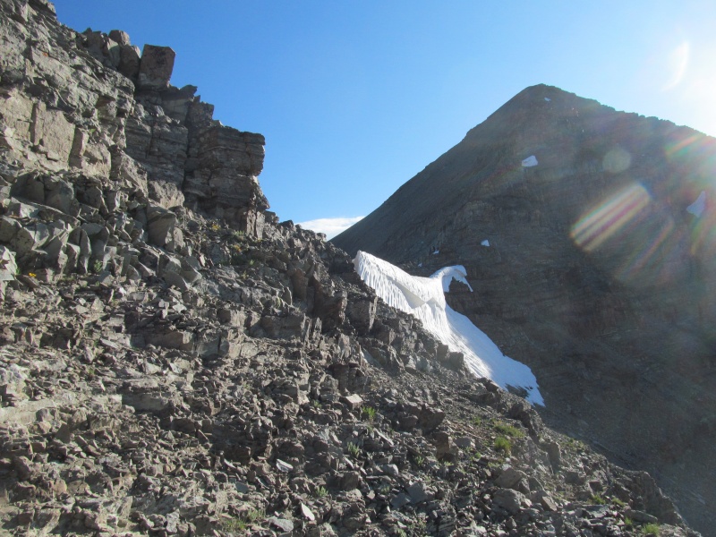
This put me on steep class 2 rubble, the likes of which are common in many of the Elk thirteeners. A large cliff to my right kept my attention. Shifty ankle biters abound, but moving slowly kept rockfall in check and I soon found myself at the grass patch, below which was a large drop into a couloir into Cumberland Basin. 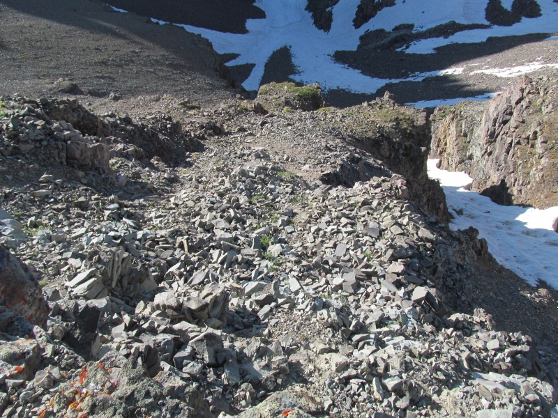
To my right, however, the upper cliff had relented and the break I spied from above proved out, despite not being apparent when on the class 2 slope. A loose ascending traverse (20 feet up, 75 across) below the cliff guardians of the Castle side of the notch and the worst is over. The traverse to the base of the notch is not trivial, however, as there is plenty of loose rock to keep you on your toes and the first few moves off the grass area are exposed to the cliff guarding the side of the couloir. 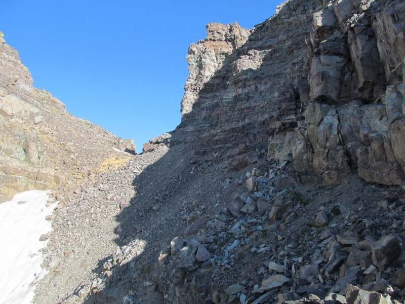
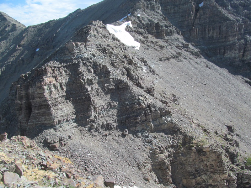
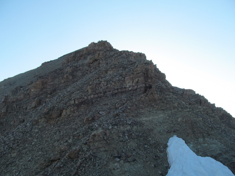
Now to ascend the pesky PT 13820, higher than my objective and yet not prominent enough to be ranked, it is a mighty battlement indeed. The initial climb out of the notch is also worthy of the word "scruffy", with a ships prow of a cliff splitting the ridge proper. Either side is an option, I went up the Conundrum (right in the photo) and down the Cumberland side (left in the photo) and thought the Cumberland side was better despite requiring you to traverse more distance away from the ships prow to get above it. This was a more Bells-like experience as the rock even picked up some of the classic maroon color. 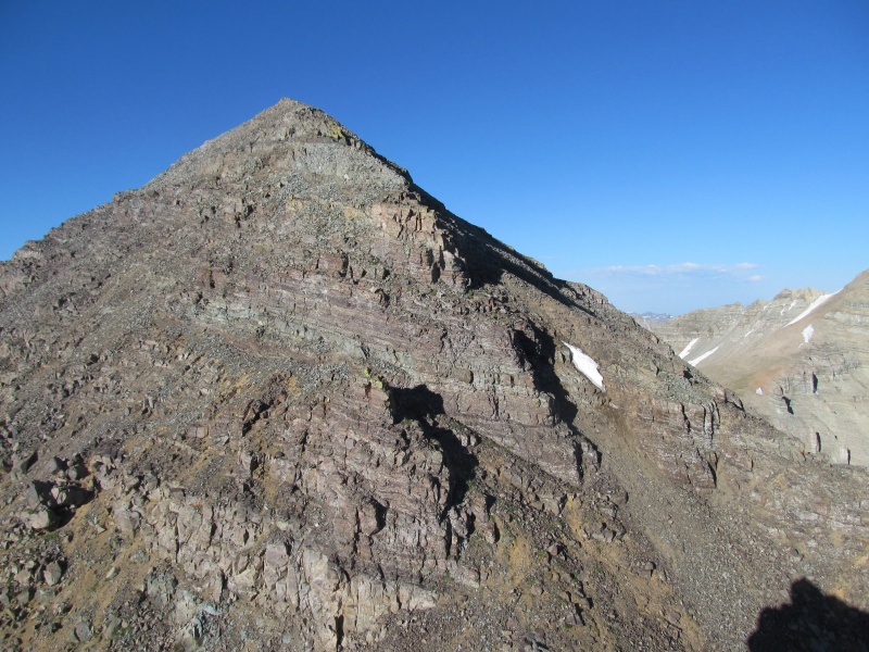
Once clear of the cliff, I made a zig-zag scamper back to the ridge crest and up and over the PT 13820 summit. The "Castelabra" side of the ridge had another series of small cliffs near the saddle, all of which are either scrambled over or to the Cumberland Basin side of the ridge on the now very familiar loose rock. 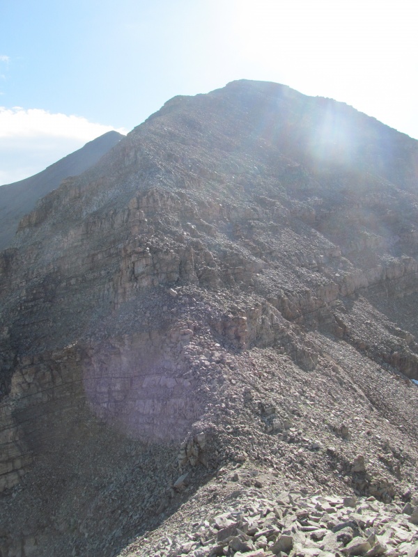
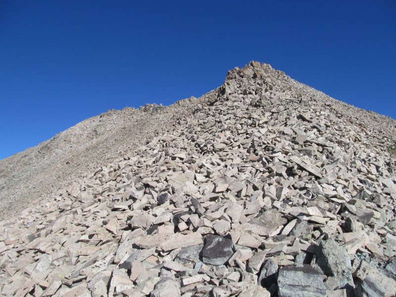
At last the difficulties are behind me (for now, at least - I still have to go back!) and the remaining route to "Castelabra" is a welcome reprieve. A loose climb out of the saddle gives way to a ridge that is more grassy for a stretch before steepening with some loose talus and easy scrambling along the ridge crest to the 105th highest peak in Colorado. Just low enough to keep the crowds away. 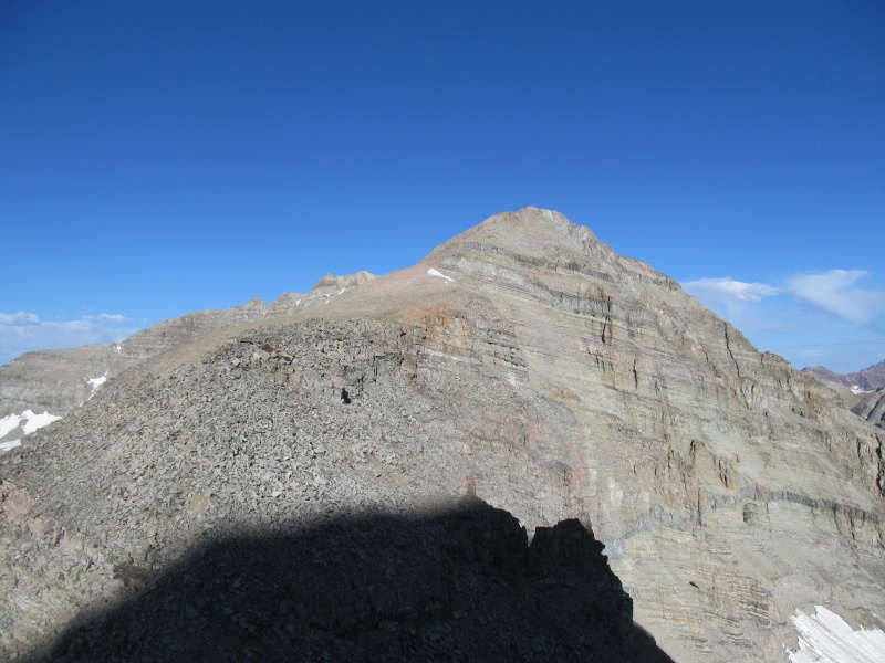
From Castle it was about 80 minutes to make the traverse, but the finish from the saddle to "Castelabra" was only 18 of them. The rest of the time can be attributed to route finding and loose rock management through the scruffy cliff bands. 9am and a beautiful day to be in the Elks. "Castelabra" is no longer my highest unclimbed peak in Colorado, the new title holder is Storm King. I hung out for 20 minutes in the clear skies. The view down to Conundrum and Cumberland Basins shows why this is such a special Wilderness area. I may have to come back to visit Cumberland Basin's lush green someday, with or without a repeat of this peak. 
Despite the clear forecast I didn't want to linger, I figured it would take about as long to get back over Castle, and I was in the wrong drainage from my car. One thing to keep in mind on this route, if you have to bail to Conundrum Creek you not only have about 3000' of scree to get to the hot springs, you then get 8 miles of trail back to a trailhead that is 10 miles from your car. Needless to say, you want good weather as going back over Castle is the easiest exit. Easy being relative, as I still had to reverse all of the scruffiness and loose rock I had come down along with about 1100' of elevation gain. 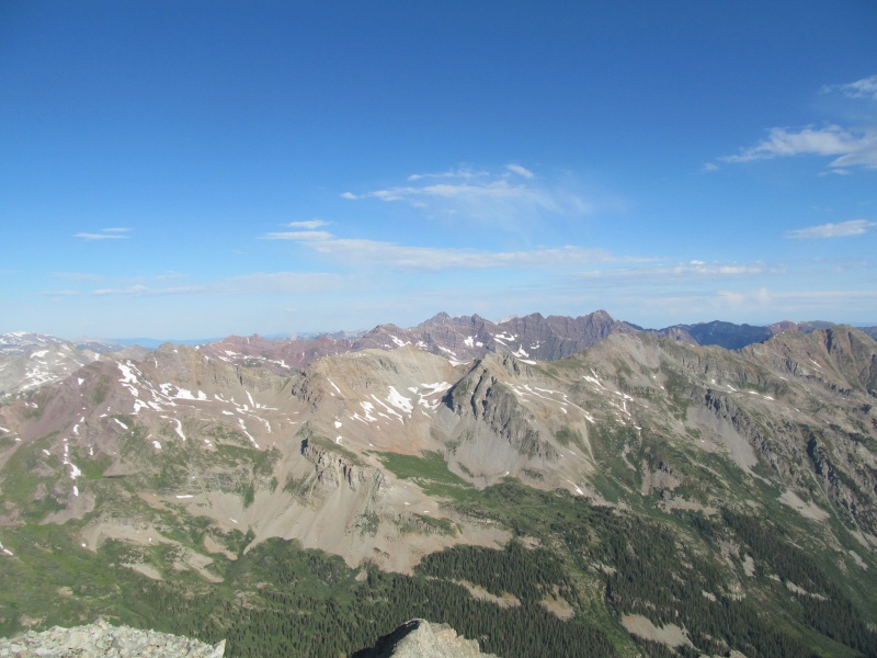
Act III: Conundrum: My assessment of time was pretty accurate, as it took about 80 minutes once again to re-climb Castle for the second time today. To give you an idea of how much the loose rock and cliff bands slowed me down, from the end of the Jeep road (12,800) earlier in the morning to the summit of Castle via the NE ridge route was only about an hour. The route finding going back over PT 13820, through the notch and up the West ridge was easier as I now knew where I was going, but the loose rock was just as loose and there really wasn't any noticeable time savings in either direction for me. Below are some photos of the reclimb: 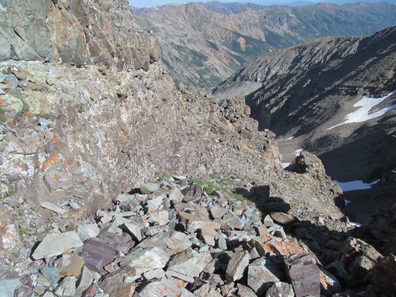
Looking across at the saddle between Castle and Conundrum, the side hill did not look appealing, and going back over Castle was the best option. 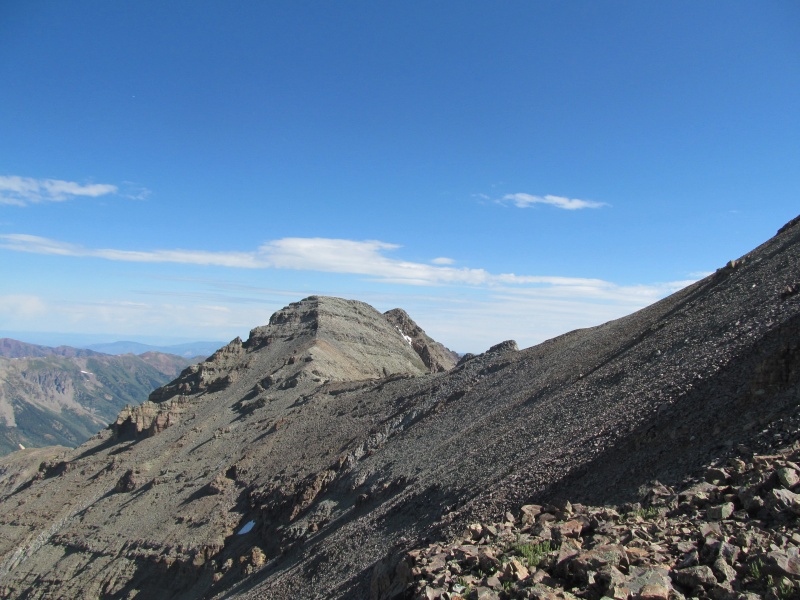
As I neared the summit of Castle I could start to make out the tops of the heads of other climbers, and see a few more in profile on the NW ridge headed for Conundrum. 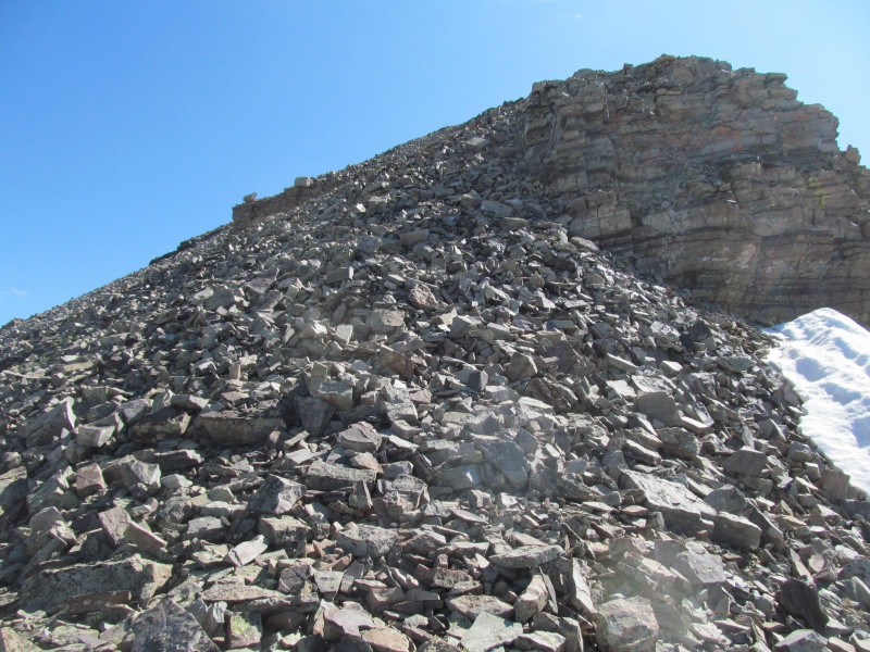
I didn't stop, and instead just pressed on for Conundrum. The trail on the NW ridge is in my opinion a little easier than that of the NE ridge, and the saddle was quickly reached. 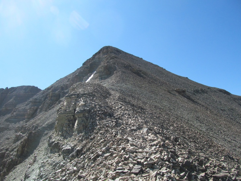
On the Conundrum side I started on the trail, but there was some solid looking scrambling directly on the crest that I took up instead as I neared the top of the false summit. From there its a short flat traverse then a descent with a little loose rock to get into the notch at the top of Conundrum Couloir. A quick scamper up the left side of the true summit and I was on top about 20 minutes after leaving Castle. 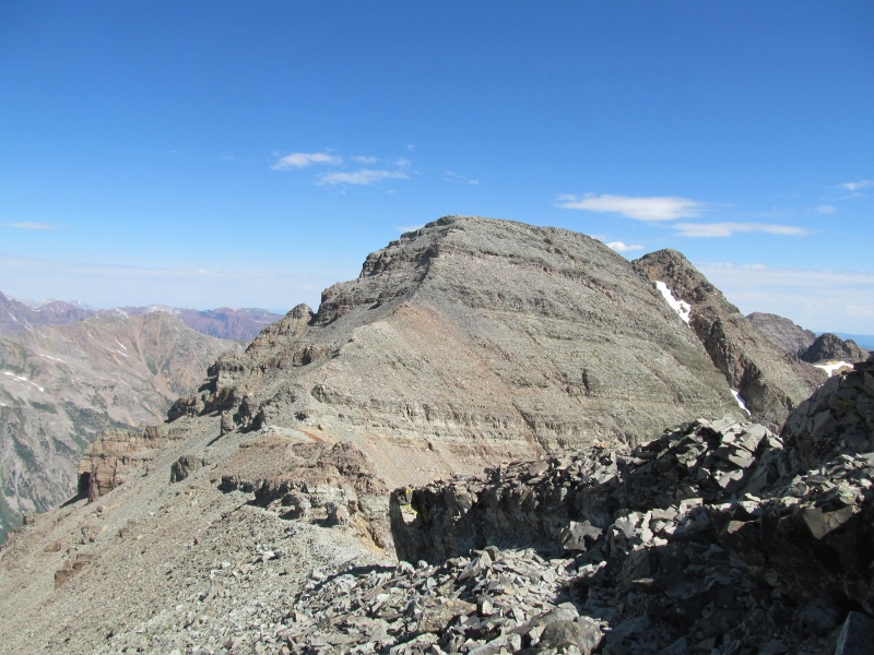
Perhaps the funniest part of this story is that this was my first time on Conundrum. Given all the 13ers in the state, I never prioritized any of the unranked 14ers after I finished the ranked ones in 2008. My list back then was always the Highest 100 anyway, and I just figured I would get the unranked ones along the way. That worked for El Diente and North Eolus, but I didn't get Cameron until the winter following my ranked finisher, and 10 more years after that I now had finally stepped foot on Conundrum. Somehow between weather and taking alternate routes, a few of the unranked ones just didn't fit in. I wonder if I will manage to get up North Maroon before finishing the 13ers? 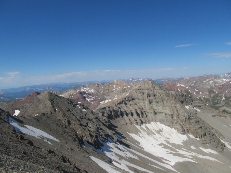
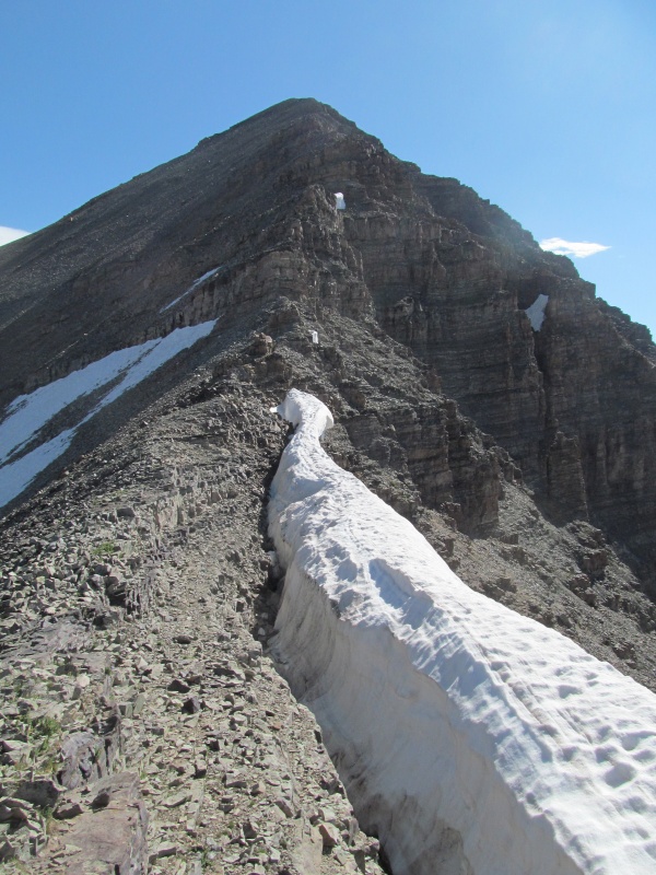
For the descent, most people were heading off the Castle Conundrum saddle and glissading snow back to the basin. If the snow reaches the saddle, this is probably the best plan. Today the snow was a good ways below the ridge with a nasty looking mess of loose rock above it. On the way over to Conundrum I had heard people calling out "rock!" to glissaders below, and seen many a butt-scoot down the scree to even get to the snow. This did not seem appealing, so I instead opted to reclimb the 445' to Castle and go down the dry trail of the Northeast Ridge I had come up that morning. That put me back over Castle's summit for the third time today. The hike out was mainly uneventful, but unfortunately the hard snow from the morning was soft around the rocks to the point of postholing through with my left foot and driving my right knee into the rocks giving it a nice cut that I had to bandage up. At the time it didn't affect my hike out, but now that it has had time to stiffen and bruise up, it's definitely sore. Take extra care near the areas where the snow transitions to rock. 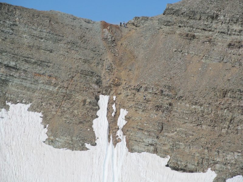
As an added bonus to the day, I was able to hike out most the road with Eric (thebeave7) and his girlfriend. I hadn't seen him in probably 10 years and it was really fun to chat with them. It seems the 14ers still manage to draw us in for the occasional repeat even when we have moved on to other projects. If you are lucky, you get to see an old friend. Walking out in the daylight the avalanche debris was now apparent, and was impressive. You could see where most of the old slide paths ran either wider, longer, or both as new matchsticks that were once trees now lined the sides and piled up in a jumbled mess next to the road. Everywhere I have been this year it has been the same story, winter 2019 forever changed the landscape of our peaks and valleys. Without a 4WD capable of getting up to Cumberland Basin's trailhead, this is probably the shortest route on "Castelabra", though not it's easiest. It would be an interesting way to make a Conundrum Hot Springs base camp work for a climb of Castle, and could be made into a loop by descending the ridge off Conundrum back towards the hot springs - look on the site, I found a trip report for that route. Just come prepared for the loose rock on the ridge, wear a helmet, and keep your party small. It was a beautiful day out in the Elks, and I was glad I decided to give this route a try. Thanks for reading. Thumbnails for uploaded photos (click to open slideshow): ")
")
")
")
")
")
")
")
")
")
")
")
")
")
")
")
")
")
")
")
")
")
")
")
")
")
")
")
")
")
|
| Comments or Questions | |||||||||
|---|---|---|---|---|---|---|---|---|---|
|
Caution: The information contained in this report may not be accurate and should not be the only resource used in preparation for your climb. Failure to have the necessary experience, physical conditioning, supplies or equipment can result in injury or death. 14ers.com and the author(s) of this report provide no warranties, either express or implied, that the information provided is accurate or reliable. By using the information provided, you agree to indemnify and hold harmless 14ers.com and the report author(s) with respect to any claims and demands against them, including any attorney fees and expenses. Please read the 14ers.com Safety and Disclaimer pages for more information.
Please respect private property: 14ers.com supports the rights of private landowners to determine how and by whom their land will be used. In Colorado, it is your responsibility to determine if land is private and to obtain the appropriate permission before entering the property.