Download Agreement, Release, and Acknowledgement of Risk:
You (the person requesting this file download) fully understand mountain climbing ("Activity") involves risks and dangers of serious bodily injury, including permanent disability, paralysis, and death ("Risks") and you fully accept and assume all such risks and all responsibility for losses, costs, and damages you incur as a result of your participation in this Activity.
You acknowledge that information in the file you have chosen to download may not be accurate and may contain errors. You agree to assume all risks when using this information and agree to release and discharge 14ers.com, 14ers Inc. and the author(s) of such information (collectively, the "Released Parties").
You hereby discharge the Released Parties from all damages, actions, claims and liabilities of any nature, specifically including, but not limited to, damages, actions, claims and liabilities arising from or related to the negligence of the Released Parties. You further agree to indemnify, hold harmless and defend 14ers.com, 14ers Inc. and each of the other Released Parties from and against any loss, damage, liability and expense, including costs and attorney fees, incurred by 14ers.com, 14ers Inc. or any of the other Released Parties as a result of you using information provided on the 14ers.com or 14ers Inc. websites.
You have read this agreement, fully understand its terms and intend it to be a complete and unconditional release of all liability to the greatest extent allowed by law and agree that if any portion of this agreement is held to be invalid the balance, notwithstanding, shall continue in full force and effect.
By clicking "OK" you agree to these terms. If you DO NOT agree, click "Cancel"...
Distance/Elevation: 8.5 miles / 2500 ft (rough approximates)
Mountain Conditions: Summer conditions with minor snow patches on north-facing slopes near the summit.
Weather Conditions: Dry. Moderate temps. Clear the entire day.
Crowds: Very sparse. Encountered only one person at the summit.
A great friend of mine and I did this hike more than ten years ago (before the advent of smart phones and the like). I decided to share this trip report to try to highlight similarities and important differences between the High Sierra and the Colorado 14ers. Each are amazing in their own ways.
The California Sierra are the first mountain range that I really fell for. We spent the better part of a month in Yosemite National Park conducting geologic fieldwork on the Sentinel Granodiorite, an attractive stone emplaced near White Wolf Campground. The Sierra Nevada batholith has abundant hard rock exposure and accommodating underbrush, making the entire park above 8,000ft a literal hiker's paradise. With a good topo map in hand, you can hike to your heart's desire.
The main thing to stress about the Sierra Nevada is the sheer size and scope of the range. It's massive in its length (400 miles) and depth (60+ miles from foothills to crest), which dwarfs the Sawatch Range dimensions. Road infrastructure is limited except for the National Parks and a couple major roads, but the distances are still significant. In Yosemite NP alone, the drive from Yosemite Valley to the Tioga Pass is 65 miles and nearly 2 hours.
The weather was dry and stable the entire month we were out there. We saw none of the afternoon thunderstorms that flare up in Colorado's summer monsoons. 2008 was a relatively dry year (and fires in the area produced a lot of smoke), but it was remarkable how stable the air mass was the entire time.
The last major point is that the California black bears (often golden in color) are real, very large and will raid your food stash in an instant if it's not secured in a bear box.
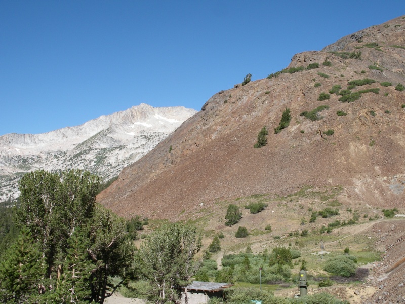
We chose Mt Conness because we had heard good reports of the hike. It also probably didn't hurt that the peak is the third highest point in the park at 12,590ft (13ers Mt Lyell and Mt Dana have it beat). Using our USGS topo map as our guide, we parked at Saddlebag Lakes Campground just north of Tioga Road (near the pass) and hiked west up the mountainside to the peak. A rough approximation of our path is represented in the map below.
We started west from the parking lot and crossed Lee Vining creek near the reservoir dam. The trail starts in the red, crumbly metamorphic terrains. We hiked off-trail near the point where the mountain slope breaks into the valley, since the landscape stayed dry and passable while not requiring too much scrambling that would be necessary just up the slope.
Saddlebag LakeTowards Mount Conness (west)
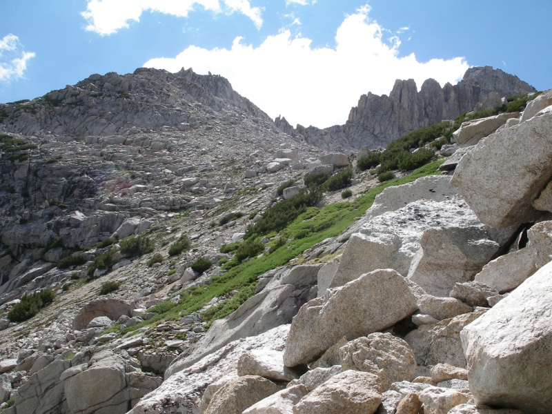
After 1.5 miles, we began our hike up the much steeper mountain slope towards Alpine Lake. We gained about 1000ft elevation in just under a mile, mostly on steep hillside and talus. Before you know it, the High Sierra scenery begins to open up before you.
High Sierra Country towards Mt Dana
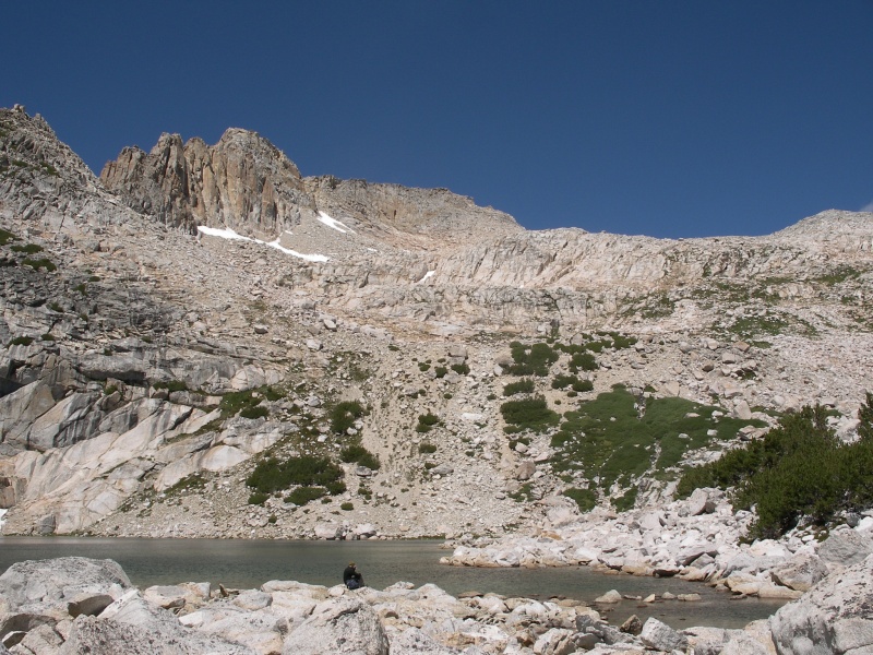
Alpine Lake was a great stopping point and nearly half way up the mountain. Just glorious scenery. However, it was at this point that we started to second-guess our map reading skills and wondered how easy it would be to get up the rim.
Alpine Lake
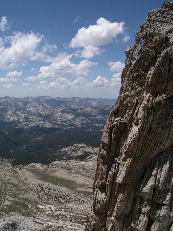
Hiking was slow-going and the altitude was beginning to become more apparent. We carefully navigated the talus and exposed bedrock towards our interim goal (the slight slope break two-thirds the way). From there, we decided to make our way towards "the notch" in the rim, scrambling up the rock ridge and making our way across the bedrock exposure just above the snow bank. The final scramble was very steep but still doable without climbing gear. Probably Class 2+.
Conness - Eastern approach towards "the notch"
Once reaching the notch, we found ourselves on a very flat slope with incredible views.
"The Slope" near the summit.
However, the mountain had one last surprise in store. The Conness summit stands oddly above the slope like a giant knob and can be accessed by scrambling up the "ramp". It was great fun and had moderate exposure. While I didn't take a picture of the general feature, folks have posted wider angle shots in other forums ( https://www.alltrails.com/trail/us/california/mount-conness-north-ridge/photos ).
Conness Summit - Final ScrambleConness Summit Scramble - Exposure to the North
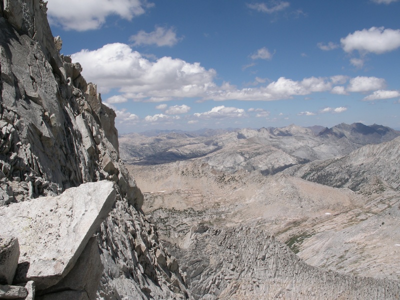
Summit views were breathtaking in every direction. There's enough room on top for a handful of people but not much more. It was finally at this point that we met our first hiker on the trail, who had summited from the north. I must stress that the vastness of the Sierra were incredibly obvious from the top, where mountains stretched in every direction and there was little sign of humanity anywhere. Views to the east went clear out past Mono Craters to the White Mountains.
Conness Summit - West towards Mt Hoffmann and Hetch Hetchy ValleyConness Summit - Looking NorthConness Summit - SW towards Yosemite Valley and Half Dome
We encountered no major issues on the way down from the summit, but the views still boggle the mind.
Glorious Scenery just below the summit
Back on "the slope", you get great views of the Twenty Lakes Basin and can also very easily see the geologic junction of the white granite batholith against the red metamorphic pendant rocks. Geology exposed before your eyes!
Twenty Lakes Basin
We continued back more or less the same way we went up. No major issues but the lack of trail and steepness of the slope kept our pace slow.
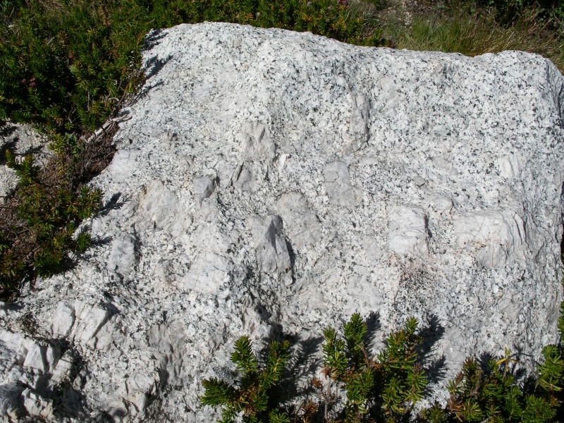
Mountainside below Alpine LakeMassive K-Feldspars in the Cathedral Peak Granodiorite of Mount Conness
I would highly recommend this hike to anyone visiting the Central Sierra Nevada. I think it gives a good representative experience of the High Sierra, provides just astounding views of the area, and offers you with general map reading, route finding and boulder-hopping challenges that are not always available on the well-engineered trails of the Colorado 14ers. And there's no better place to study Cretaceous Granites in the Lower 48! Have fun.
Thumbnails for uploaded photos (click to open slideshow):
Thanks for posting this. The Sierra are wonderful. I remember contemplating Conness while climbing Mt Dana but couldn't get to it on that trip. How difficult was the route finding and scrambling up top? Most of the year there's also that glacier that's guarding the summit.
Nyker: As I remember it, the main "Conness Glacier" was just to the north of that tall East-West ridge and makes route finding more difficult from the Twenty Lakes Basin. As to our Eastern approach, the only real snowbank that we saw was the one just below the "notch" and it looks much larger in spring and early summer pictures and may prevent that route without snow equipment during those times.
As to general route finding, we were not experienced scramblers and never had to turn around. We never felt in danger for our lives. For most of the hike on the steep terrain, we boulder hopped. Tallus is giant, cobble to boulder sized, so slippage was not a real issue. This is not the San Juans! The most difficult part (as I remember it) was that last push to the ridge before the "slope". There were steep granite steps that we had to climb up, maybe 3-4ft with each scramble.
Some other folks online appear to stay on the East-West ridge just south of the Conness Glacier all the way up to the "slope", but I can't comment as we didn't go that way.
Caution: The information contained in this report may not be accurate and should not be the only resource used in preparation for your climb. Failure to have the necessary experience, physical conditioning, supplies or equipment can result in injury or death. 14ers.com and the author(s) of this report provide no warranties, either express or implied, that the information provided is accurate or reliable. By using the information provided, you agree to indemnify and hold harmless 14ers.com and the report author(s) with respect to any claims and demands against them, including any attorney fees and expenses. Please read the 14ers.com Safety and Disclaimer pages for more information.
Please respect private property: 14ers.com supports the rights of private landowners to determine how and by whom their land will be used. In Colorado, it is your responsibility to determine if land is private and to obtain the appropriate permission before entering the property.


")
")
")
")
")
")
")
")
")
")
")
")
")
")
")
")
")
")
")
")
")