Download Agreement, Release, and Acknowledgement of Risk:
You (the person requesting this file download) fully understand mountain climbing ("Activity") involves risks and dangers of serious bodily injury, including permanent disability, paralysis, and death ("Risks") and you fully accept and assume all such risks and all responsibility for losses, costs, and damages you incur as a result of your participation in this Activity.
You acknowledge that information in the file you have chosen to download may not be accurate and may contain errors. You agree to assume all risks when using this information and agree to release and discharge 14ers.com, 14ers Inc. and the author(s) of such information (collectively, the "Released Parties").
You hereby discharge the Released Parties from all damages, actions, claims and liabilities of any nature, specifically including, but not limited to, damages, actions, claims and liabilities arising from or related to the negligence of the Released Parties. You further agree to indemnify, hold harmless and defend 14ers.com, 14ers Inc. and each of the other Released Parties from and against any loss, damage, liability and expense, including costs and attorney fees, incurred by 14ers.com, 14ers Inc. or any of the other Released Parties as a result of you using information provided on the 14ers.com or 14ers Inc. websites.
You have read this agreement, fully understand its terms and intend it to be a complete and unconditional release of all liability to the greatest extent allowed by law and agree that if any portion of this agreement is held to be invalid the balance, notwithstanding, shall continue in full force and effect.
By clicking "OK" you agree to these terms. If you DO NOT agree, click "Cancel"...
V2 is a lowly tricentennial but the views from the summit are rivaled by few others.
The "usual" approach to V2 is to hike the the trail up to Ice Lakes and then to Island Lake and gain Swamp Grant Pass which lies between US Grant and V2. Rob and I decided to approach it from the north side by driving a short ways up the Ophir Pass road and parking at Iron Springs. Iron Springs is the location of a Hardrock 100 race aid station.
We decided on this approach because it is a much shorter drive from our homes as opposed to the longer drive through Silverton. It also avoids the hordes on the Ice Lakes trail and going through what is becoming a public toilet below the lakes.
View of the north side of US Grant from Iron Spings at 0615. The Swamp Grant Pass can be seen to the left of the ridge descending to the left.
We started at 0630 and followed the Hardrock race course, which starts out as a road, to the Pass. Within the first mile ( all distances were measured by my Garmin Forerunner 230 watch which may have some resemblance to reality) you will come to the following features:
First an aspen grove reduced to matchsticks by avalanches.
Second you will cross a stream on a bridge. ( Picture taken on the descent.)
Third: at the first split in the road take the right fork.
Fourth: take another right turn onto a trail. There is a blaze on a tree at the fork. Do not follow the road.
Fifth: go straight (south) at this trail intersection.
You will soon come to a clearing with a view of South Lookout Peak.
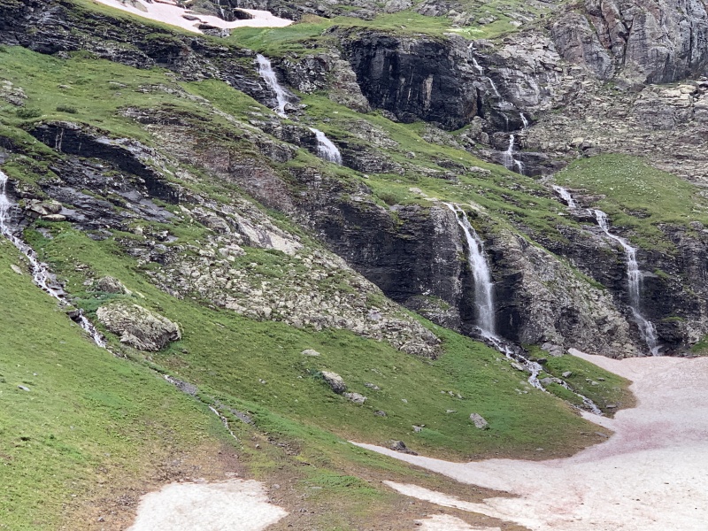
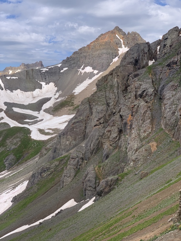
You will also see the route ahead which goes across the high grassy bench at the base of US Grant. The grassy bench lies at the base of several waterfalls.
Make the turn to the south after passing the grassy bench. This picture looks back down after entering the high valley leading to the saddle. Ophir Pass Road is to the north. Lookout Peak is to the far right.
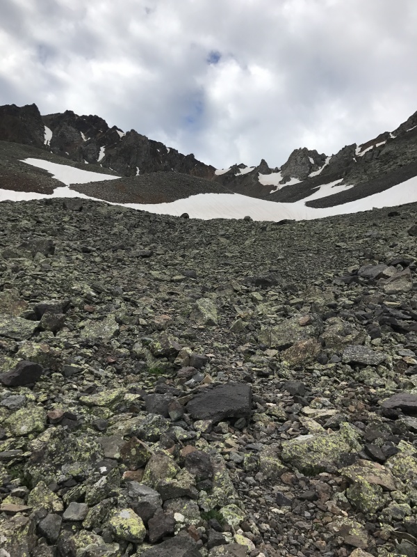
The valley becomes rocky after gaining elevation. The trail disappears in the scree. Aim for the snowfield to the right of the sharp point.
One ascends the very loose scree the final pitch before the pass. The scree cannot be described in language which can be used in polite company. But fortunately it took only 20 minutes to ascend.
Looking down at the route immediately prior to the final pitch to the pass.
Showing the steepness of the slope.
Rob at the pass..
Looking down the slope.
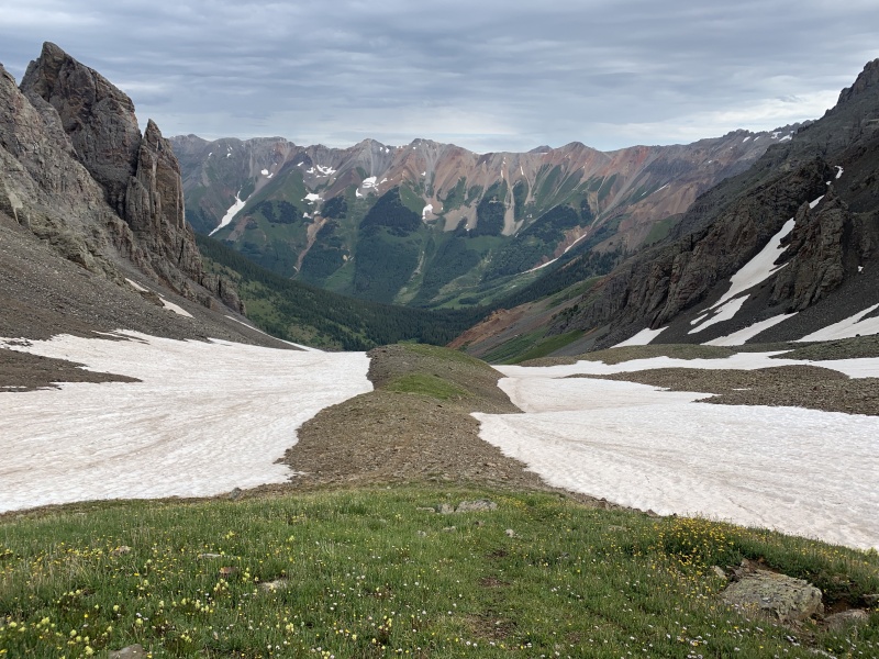
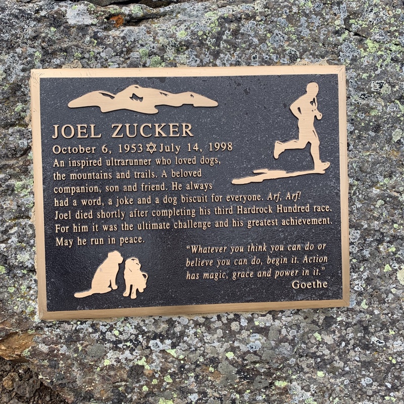
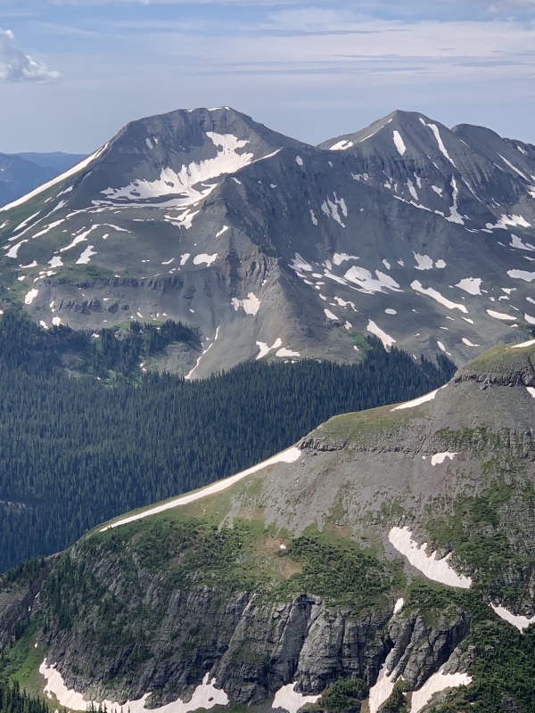
There is a memorial plaque to a Hardrocker on the pass. A life well lived.View of Pilot Knob and V4 from the pass.
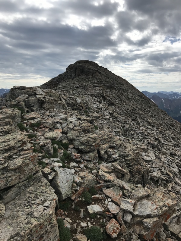
Turn east at the pass and follow a well defined trail to the V2 summit. The far summit is a false summit,
There is an ancient Druid alter between the false and real summit. We left offerings of shining wine.
The real summit.
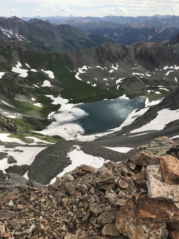
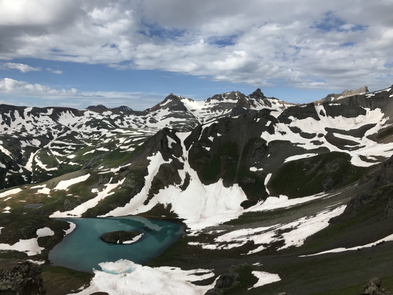
Clear Lake is seen from the summit.
Even though there was a cairn on the summit and GAIA confirmed we were on the summit it looked like the ridge ascended to the east. We followed the ridge almost to the end and looked back UP at our packs and so returned to the summit.
Rob on the summit with US Grant looming behind. It had taken us 3 hours 30 minutes to summit. My watch read 4.25 miles.
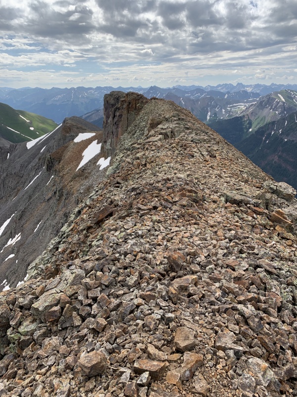
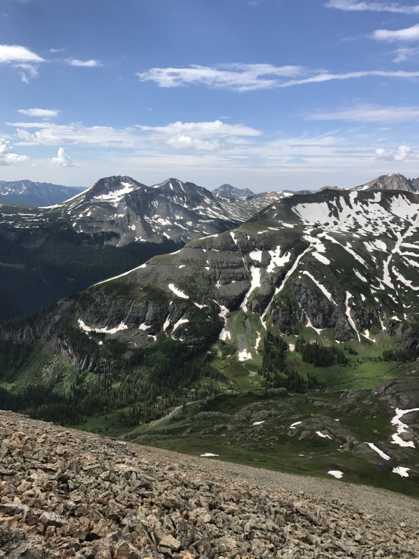
Views.
We encountered a solo hiker on our descent to the pass. He was from Phoenix and not a member of 14ers.com and so, even though he was a nice gentlemen, I had to write him a ticket and assess a hefty fine.
Thumbnails for uploaded photos (click to open slideshow):
The views were hard to beat. The total crowd of three souls for a whole day wasn't bad either. I later talked to Howie Stern (10 time Hardrock finisher) about that sec tion directly below the saddle, lamenting the things that would make it worse: doing it in the dark, by headlamp while hallucinating from tiredness. He said simply: that is my one of my favorite places on the course, whether going up or down. I was like: dude, you are sick. It was a fabulous day in the mountains Tom. I'm glad we could share it.
I think you will enjoy this peak and the approach.
It took us 3.5 hours to summit and about 3 hours on the descent for a total of about 6.5 hours.
Rob had torn a knee meniscus a few weeks ago which slowed him on the descent, which is the only reason I was able to keep up with him.
It is indeed good to return to the peaks. Donna has kept me occupied by allowing me to do the pasture irrigation duties but it is somehow not quite the same.
I remember reading your well written trip report of the Vermilion group.
It is a delightful peak with moderate milage and easy Class 2 trail. It is very well worth the effort.
Caution: The information contained in this report may not be accurate and should not be the only resource used in preparation for your climb. Failure to have the necessary experience, physical conditioning, supplies or equipment can result in injury or death. 14ers.com and the author(s) of this report provide no warranties, either express or implied, that the information provided is accurate or reliable. By using the information provided, you agree to indemnify and hold harmless 14ers.com and the report author(s) with respect to any claims and demands against them, including any attorney fees and expenses. Please read the 14ers.com Safety and Disclaimer pages for more information.
Please respect private property: 14ers.com supports the rights of private landowners to determine how and by whom their land will be used. In Colorado, it is your responsibility to determine if land is private and to obtain the appropriate permission before entering the property.


")
")
")
")
")
")
")
")
")
")
")
")
")
")
")
")
")
")
")
")
")
")
")
")
")
")
")
")
")
")
")
")
")
")
")
")
")
")
")
")
")
")
")
")