Download Agreement, Release, and Acknowledgement of Risk:
You (the person requesting this file download) fully understand mountain climbing ("Activity") involves risks and dangers of serious bodily injury, including permanent disability, paralysis, and death ("Risks") and you fully accept and assume all such risks and all responsibility for losses, costs, and damages you incur as a result of your participation in this Activity.
You acknowledge that information in the file you have chosen to download may not be accurate and may contain errors. You agree to assume all risks when using this information and agree to release and discharge 14ers.com, 14ers Inc. and the author(s) of such information (collectively, the "Released Parties").
You hereby discharge the Released Parties from all damages, actions, claims and liabilities of any nature, specifically including, but not limited to, damages, actions, claims and liabilities arising from or related to the negligence of the Released Parties. You further agree to indemnify, hold harmless and defend 14ers.com, 14ers Inc. and each of the other Released Parties from and against any loss, damage, liability and expense, including costs and attorney fees, incurred by 14ers.com, 14ers Inc. or any of the other Released Parties as a result of you using information provided on the 14ers.com or 14ers Inc. websites.
You have read this agreement, fully understand its terms and intend it to be a complete and unconditional release of all liability to the greatest extent allowed by law and agree that if any portion of this agreement is held to be invalid the balance, notwithstanding, shall continue in full force and effect.
By clicking "OK" you agree to these terms. If you DO NOT agree, click "Cancel"...
This report is an attempt to provide useful information to those who want to climb Wetterhorn and Uncompahgre in a single day.
A couple observations right off the bat. The Gerry Roach guide describes this hike, but the map page does not show an informal hikers trail that has developed to contour around the base of Matterhorn. The text does reference "contour west into the basin between Matterhorn and Wetterhorn", it just does not show this on the map.
Roach also suggests it makes more sense to climb Uncompahgre first. I am not sure why he suggests this, probably because after summiting Wetterhorn, it is shorter and all down hill to the trailhead.
But there are good reasons for doing it the other way round. We climbed Wetterhorn first. When eyeballing the traverse that contours below Matterhorn to intersect the Stock Trail that leads to Uncompahgre, the climbers trail, which is not marked and does not show on maps, is easy to spot. This makes accessing the good trail across the valley very easy. Coming from Uncompahgre to Wetterhorn, this trail is not obvious or easy to find. The consequence of missing the trail would be difficulty in making the traverse and likely losing and regaining elevation unnecessarily.
Also, Wetterhorn is the more difficult mountain. There is something to be said for knocking off the difficult peak earlier in the day, before fatigue and bad weather sets in.
The Southwest Slopes route on Uncompahgre does have a little bit of up and down after getting out of the Matterhorn Creek basin, but it is not extreme by any means and the hike back out late in the day is pretty mellow.
So, while I hate to contradict Mr. Roach, as his guide was my sole resource for about 2/3 of the 14ers back in the late 90's early 00's, I think the better way to tackle these two peaks is to climb Wetterhorn first.
One final observation. This hike is listed as 16.5 miles and 5,850' vertical. We did this in 9 hours. Capitol is 17 miles, 5,000' vertical and last week, same two people hiking, took 13 1/2 hours. Not sure what to make of that, especially since I was dogging it yesterday and felt I was moving much more quickly on Capitol. Just throwing this out there for reader's planning purposes.
We left the 4WD Matterhorn trailhead at 6:00 a.m. and followed the usual SE Ridge route to the summit of Wetterhorn. There are plenty of Wetterhorn reports, so not much to add here. I will show the one large snow field which remains, but this is easily crossed in trail running shoes and no need for any special gear.
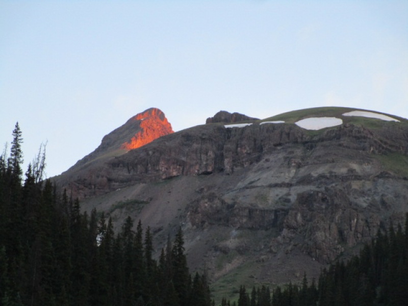
First light on Wetterhorn summit
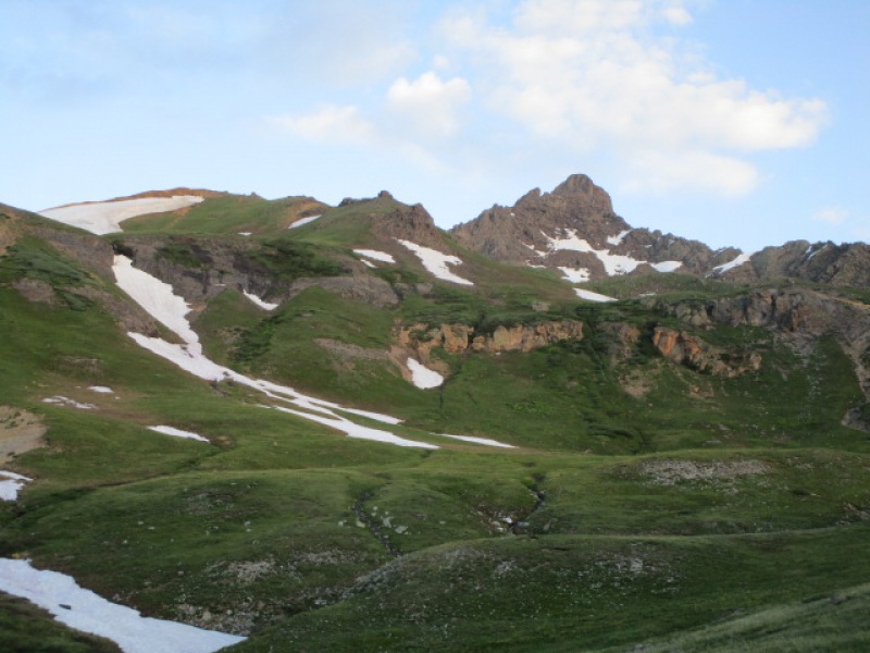
Wetterhorn after clearing tree line
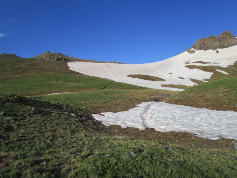
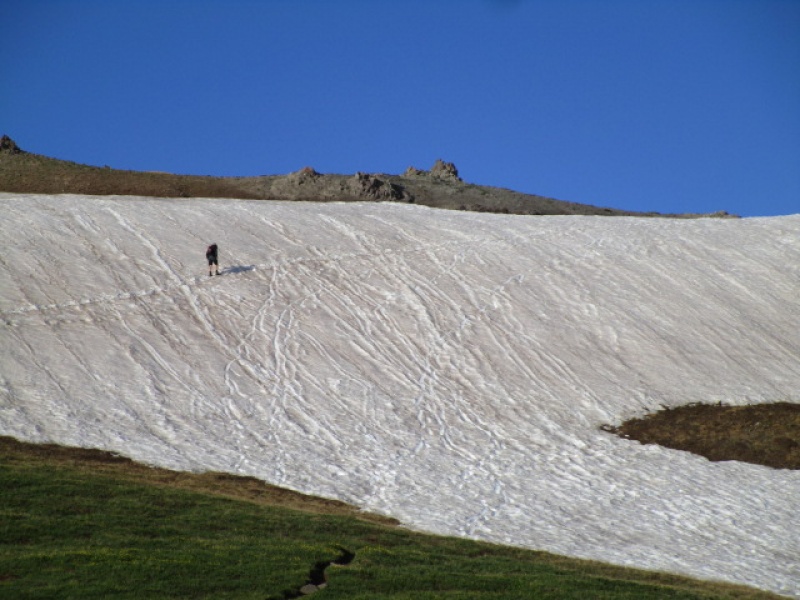
Paul crossing the snow field just below accessing the ridge at 13,060
Closer look at snow
Once on the ridge, there was no remaining snow worth mentioning.
We reached the summit at 8:30 a.m., which might be the earliest I have ever been on a 14er summit!
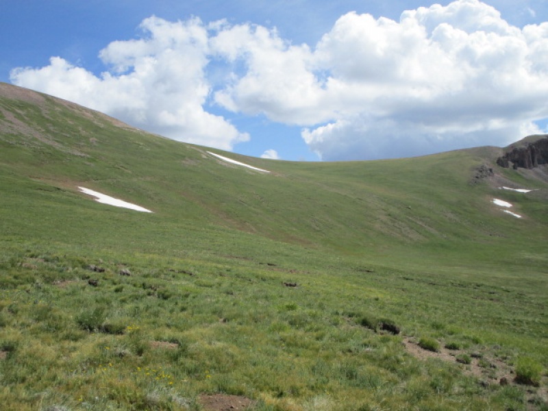
Once back on the trail below 13,000' keep an eye on the valley floor where it contours around Matterhorn. There is an obvious creek, and at the top of that creek, there is an unmarked trail. On this day, there was a short snow field to cross before reaching the creek and start of the trail. Finding this is key to enjoying this day. Going all the way down to where the Wetterhorn and Stock trail fork would mean losing and regaining something like 1000' vertical and add at least a couple miles to the day.
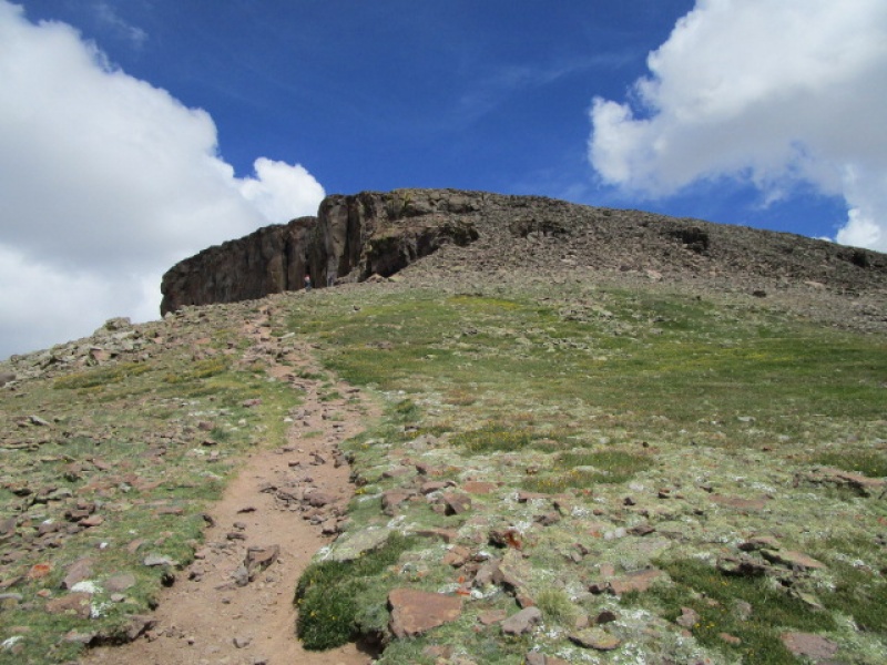
The climber's trail fades before intersecting the Stock Trail, which is why it would be more difficult to do this hike in reverse. When it fades, just continue gradually climbing towards the Stock Trail, which is obvious and visible during the whole traverse below Matterhorn. Eventually you reach a sign marking a trail up Matterhorn. From here is looks a little disheartening because it appears as if you will give up a lot of elevation working around the SW slopes of Uncompahgre, but in fact the up and down is pretty minimal and the line the trail takes is very efficient.
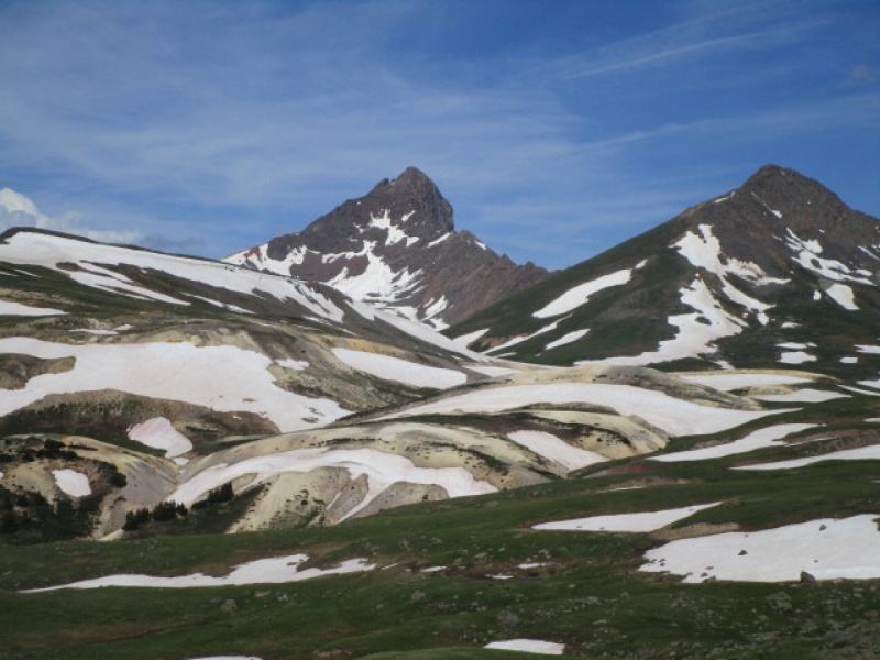
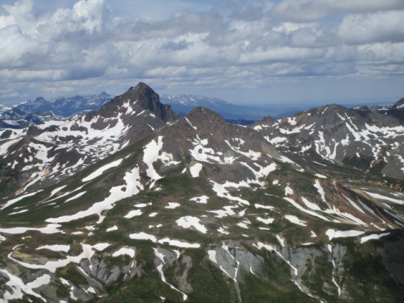
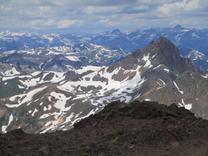
Looking back at Wetterhorn and Matterhorn from SW Slopes of Uncompahgre
Elevation lost between SW Slopes and Matterhorn Pass
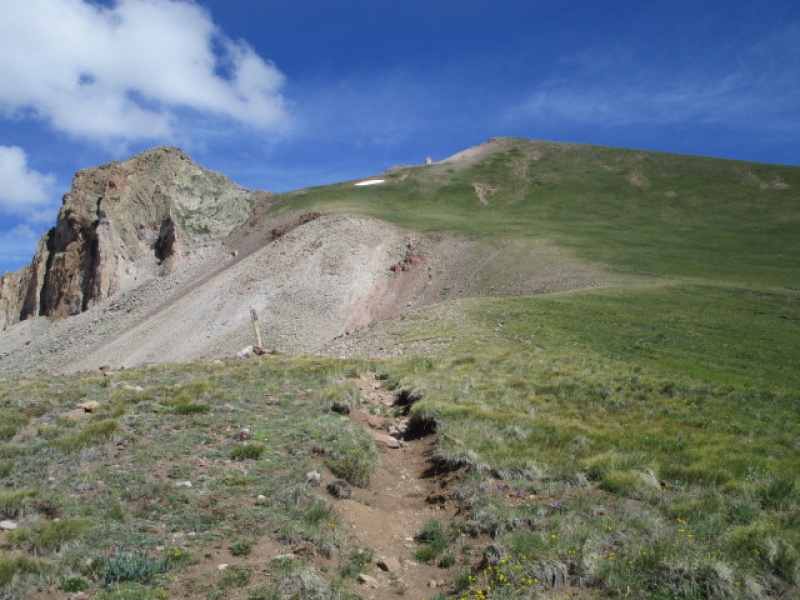
The trail works its way around the south side of Uncompahgre before eventually winding around to join up with the East Slopes route coming from Nellie Creek trailhead.
South face of Uncompahgre
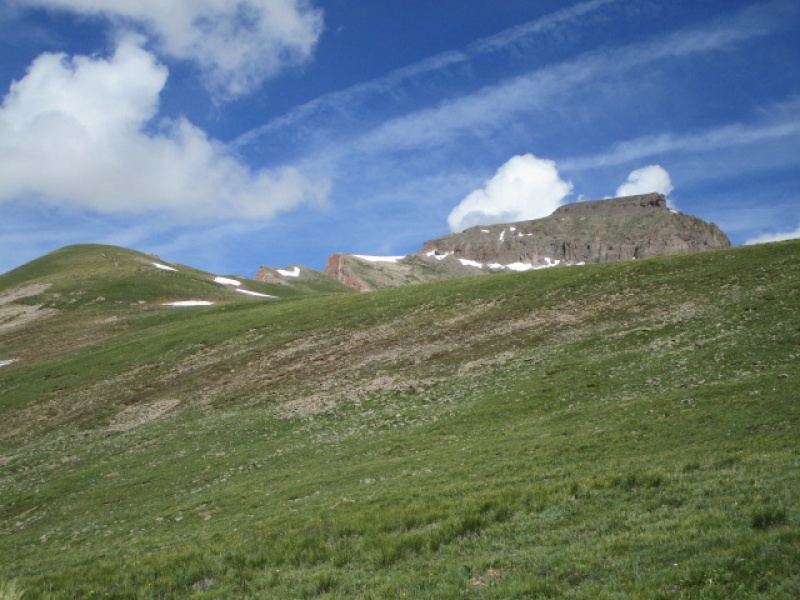
Uncompahgre just before reaching the East Slopes trail
Looking back at Wetterhorn before reaching Uncompahgre summit
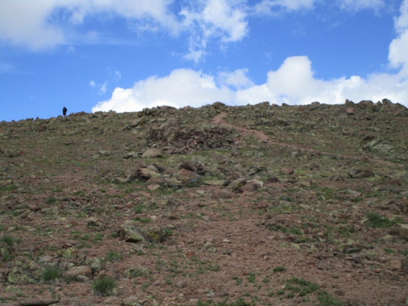
Nearing the summit
Paul waiting patiently
I reached the summit of Uncompahgre at around 12:15 .
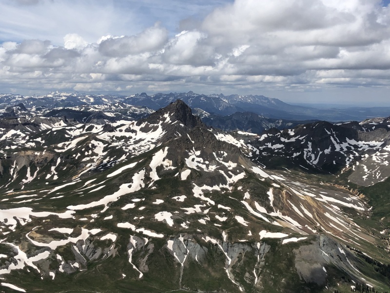
Wetterhorn from summit of Uncompahgre
Wetternorn from Uncompahgre Summit
Retrace the SW Slopes route back to the trail head. We were back at the car at 3:00 p.m.
Thumbnails for uploaded photos (click to open slideshow):
Thanks for this. I'm eyeing this route for mid August and this answered some of the questions I had ping-pinging in my head.
I would assume the ridge on Capitol soaks up a lot of that time. I'm planning to do that from the TH this year too, so I guess I can compare as as well!
Do you possibly have a GPX file from you day? Would love to get it from you if possible.
Thanks
Caution: The information contained in this report may not be accurate and should not be the only resource used in preparation for your climb. Failure to have the necessary experience, physical conditioning, supplies or equipment can result in injury or death. 14ers.com and the author(s) of this report provide no warranties, either express or implied, that the information provided is accurate or reliable. By using the information provided, you agree to indemnify and hold harmless 14ers.com and the report author(s) with respect to any claims and demands against them, including any attorney fees and expenses. Please read the 14ers.com Safety and Disclaimer pages for more information.
Please respect private property: 14ers.com supports the rights of private landowners to determine how and by whom their land will be used. In Colorado, it is your responsibility to determine if land is private and to obtain the appropriate permission before entering the property.
")
")
")
")
")
")
")
")
")
")
")
")
")