| Report Type | Full |
| Peak(s) |
Grizzly Peak - 13,997 feet Garfield Peak - 13,778 feet |
| Date Posted | 08/05/2019 |
| Date Climbed | 07/14/2019 |
| Author | supranihilest |
| Roar of the Grizzly | |||||||||||||||||||||||||
|---|---|---|---|---|---|---|---|---|---|---|---|---|---|---|---|---|---|---|---|---|---|---|---|---|---|
Table of ContentsGrizzly Peak The Sawatch doesn't seem to have much as far as classic climbing. The rock is usually suspect and the there just doesn't seem to be much that rises above a hike. Surely there are hidden gems among the numerous thirteeners but by and large the Sawatch are gentle giants. The range and state's highest 13er, Grizzly Peak, however, is not included on this list of gentle peaks. Rising thousands of feet above the valleys in all directions Grizzly is a behemoth, and its north face holds Grizzly couloir, a picturesque snow climb that begins at a high alpine lake (aptly named Grizzly Lake) and curves gracefully up towards the summit ridge. 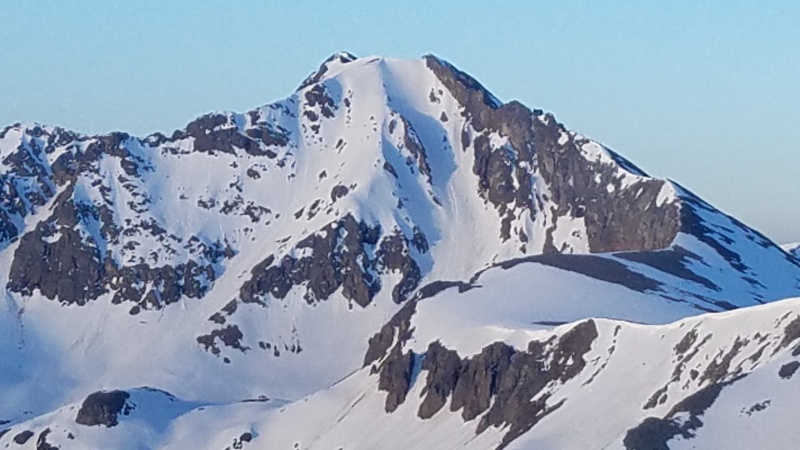
hoping it would be in by the time I had a chance to climb it. 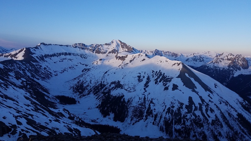
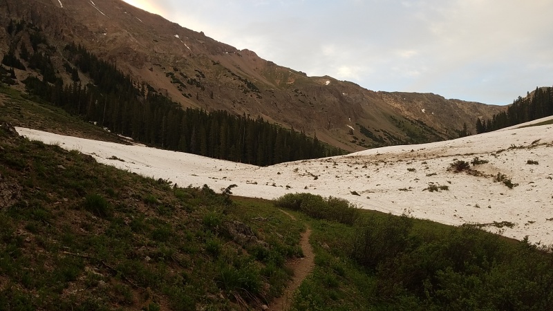
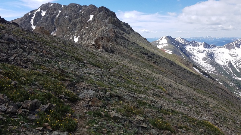
I called up my roommate Mac after climbing Ice Mountain's Refrigerator couloir and he drove down and picked me up at the La Plata trailhead, then drove us to the Grizzly Lake trailhead (I have a 2WD car and Lincoln Creek Road is long and rough). He planned to snowboard the couloir while I went over to Garfield Peak, a nearby 13er. Lincoln Creek Road was absolute carnage. The avalanches that ran through the drainage were some of the largest I'd seen in a season of already unusually large avalanches. All of them were thousands of feet long and several were hundreds of feet wide. They were like stripes, one right after another. The debris was mostly left on the side of the road (or piled up in the creek like enormous beaver dams), just sawed up and cleared for driving. It was a preview of the kind of thing we'd see on the approach. We left early the next morning, at 5:15. Mac wanted to leave later so the snow would board better but I wanted to leave earlier while it climbed better; he ended up being right in the end, for his goal. We didn't encounter much as far as difficulty goes. The Grizzly Lake Trail is awesome in it's gentleness. It's not long and not steep and takes one through an incredible cirque, shown above, that I can only imagine was carved by ancient glaciers. I'm not sure how else to explain that eastern wall, it's just phenomenal. There were plenty of avalanches in the basin as well, but I wouldn't quite call it carnage like I did for Lincoln Creek Road, at least until the upper basin. 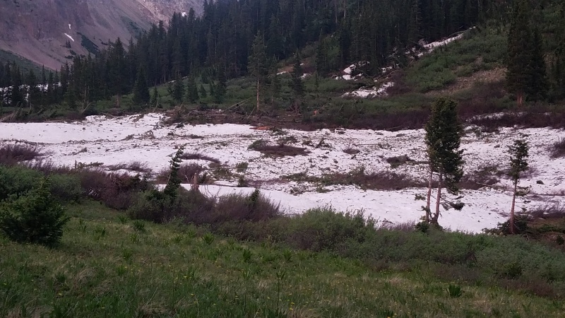
Mac and I encountered a couple of easy creek crossings that didn't require getting wet before the trail finally became submerged completely in snow. I couldn't tell what was actually just old snow and what was Massive Avalanche #∞. 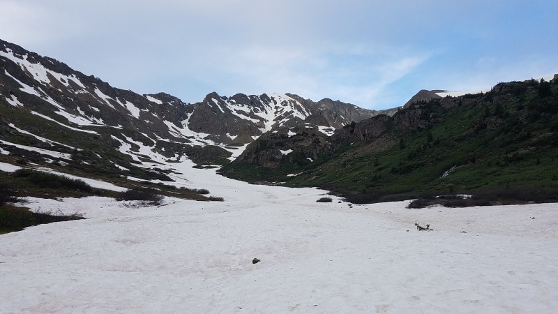
northeast face. 
By the time we reached the upper end of the basin, but below the lake, Mac had decided to turn around. The snow was too suncupped for his liking and carrying his snowboard was wrenching his back out of place. We would keep in contact via radio as I climbed and traversed and he snowboarded and hungout, so off we went in different directions. As I climbed an easy slope up to the lake the northeast face looked pretty tempting. I couldn't see Griz couloir from my position but there was an alright looking one right in front of me, and I almost went for it instead. 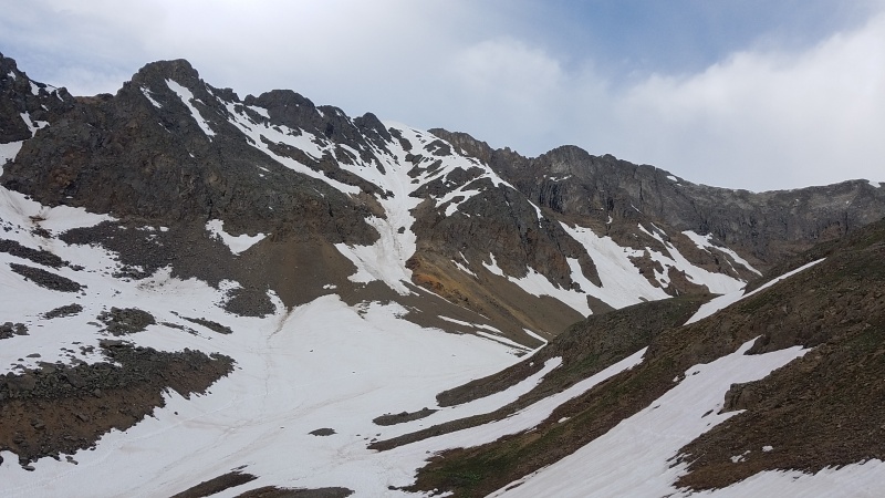
A few minutes later I arrived at Grizzly Lake where I scouted a spot to stop and change out my trailrunners for boots and crampons. I still couldn't see more than a hundred or so feet of the bottom of the couloir, but another, extra credit couloir appeared northwest of the lake. 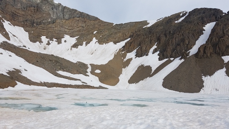
of some sort. 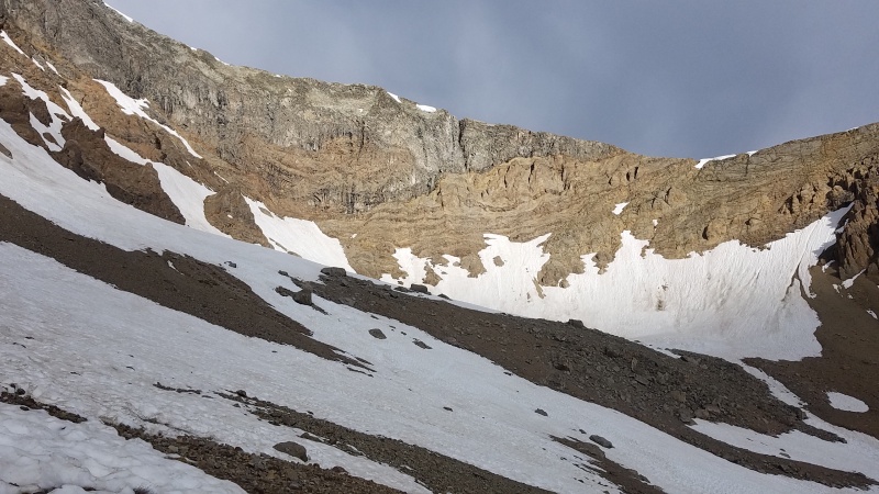
After hanging out a bit I launched up the couloir. One thousand feet of moderate to steep snow to nearly 14,000 feet, here I come! 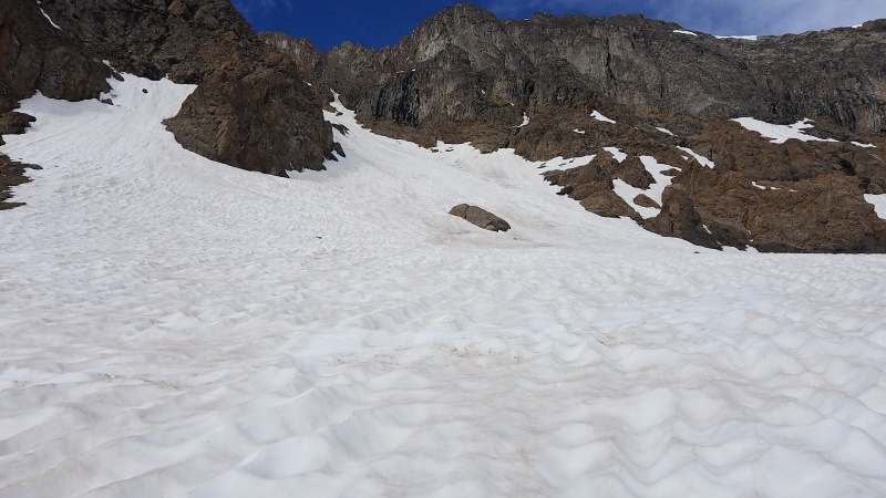
The snow in Griz was a little softer than it was the day before when I climbed Refrigerator on Ice Mountain. It was still nice and firm at such an early hour, around 8am, but it wasn't practically ice like, well, Ice was. A set of tracks paralleled the left side of the couloir but I went straight up from my point until it made sense to join the older track. A couple hundred feet and she's all cruiser all the way. 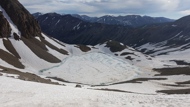
Approximately halfway up the couloir it splits into two branches. The right branch continues to the summit and the left goes over a snow hump to the northeast face. Again I was tempted, now I'd get a twofer, but I continued up the right branch anyway. It was just so good! 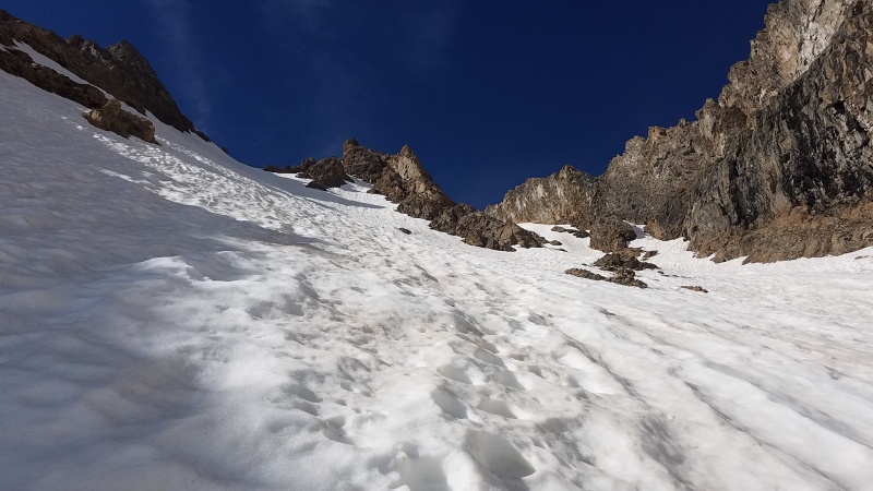
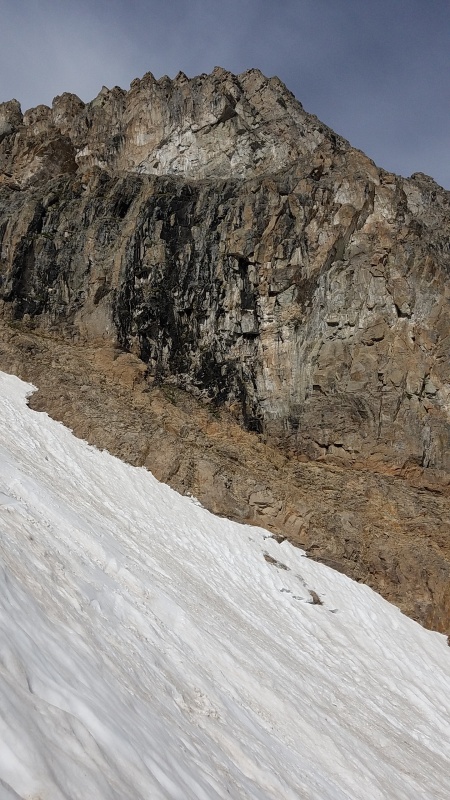
pretty bad. The photo doesn't show the chossy texture. From just above the Y-split the lake was lookin' mighty fine and the snow got even steeper. 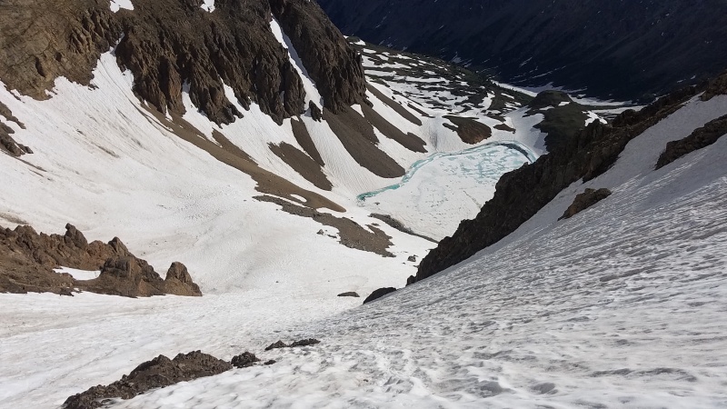
The tracks I followed up most of the couloir were perfect. They were the full size of a boot so I barely had to kick at all. I was practically StairMaster-ing my way up this thing. I could have put away my ice axe and tool if I wanted and just used a trekking pole, but safety first, kiddos. Not like I'd be able to self-arrest on snow this hard and steep, but whatever, I was having a grand ol' time getting my climb on. It seemed like the couloir was flying by, and soon enough there was equal parts sky and snow. 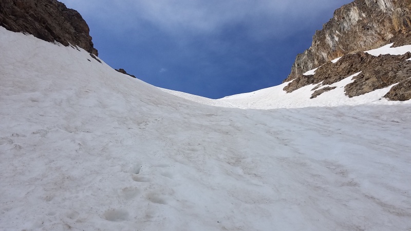
The topout was, as usual, the steepest part of the climb. I wish I had a person to use as a reference but since I was solo you'll just have to pretend. 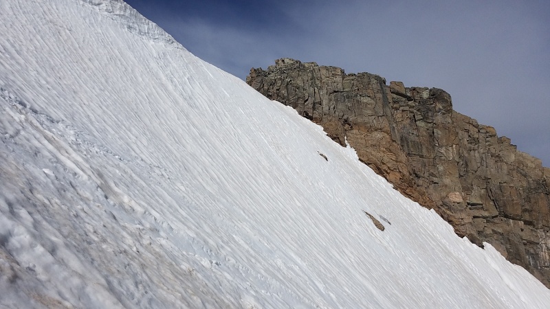
The couloir doesn't actually top out at the summit. In fact, nor can you see the summit from the top of the couloir. Still a worthwhile climb as a peakbagger, but if you're only going up to go down real fast on a stick or sticks, then that's irrelevant. 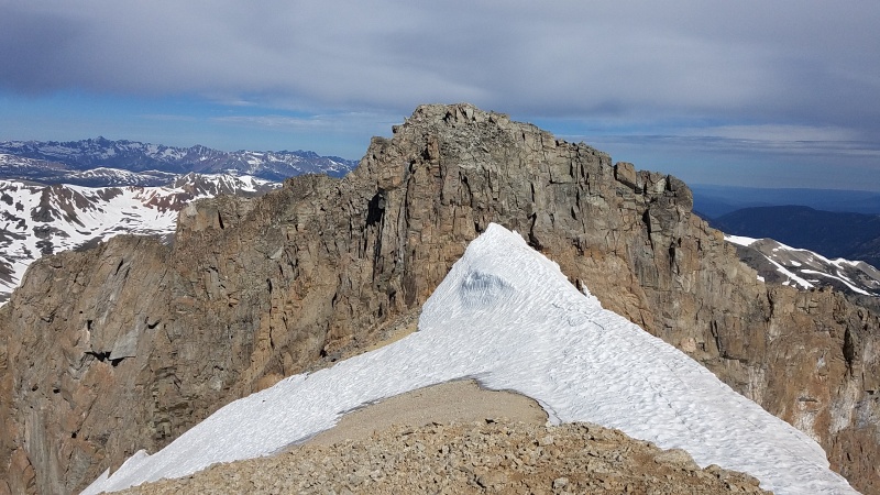
The true summit is a short walk away on scree followed by a short Class 2 to Class 2+ scramble up loose talus. 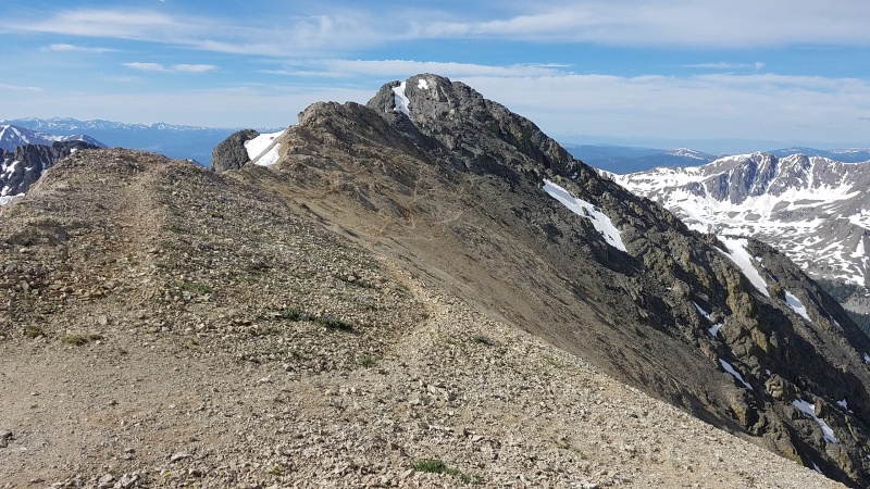
Being entirely dry from this point I quickly popped my my crampons off but kept my boots on. I'd spare them the crunching (and my ears that ear-shattering metal-on-rock screeching) and change footwear on the summit. 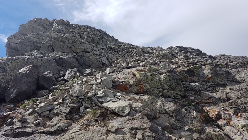
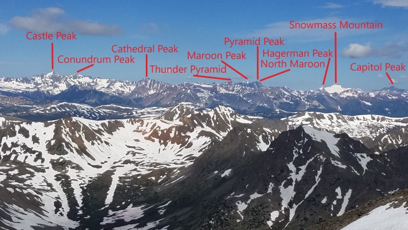
From the summit I was able to get a good view of Garfield Peak, my next objective, as well as a view into the Elks to the west. 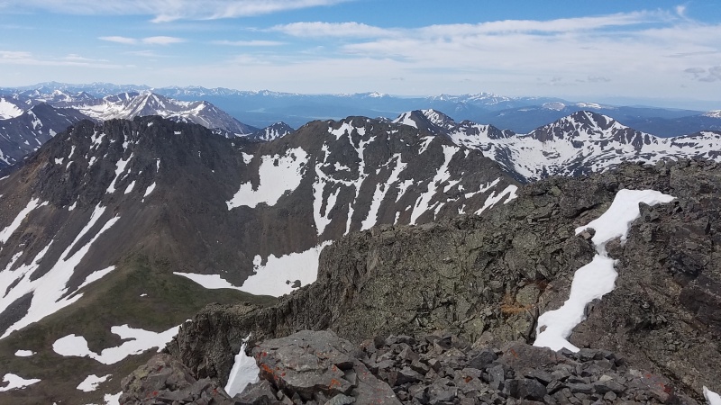
The route over to Garfield required a little scrambling on more poor rock, then Class 2 grass/rock, and then scrambling on abysmal rock. First up: poor rock. 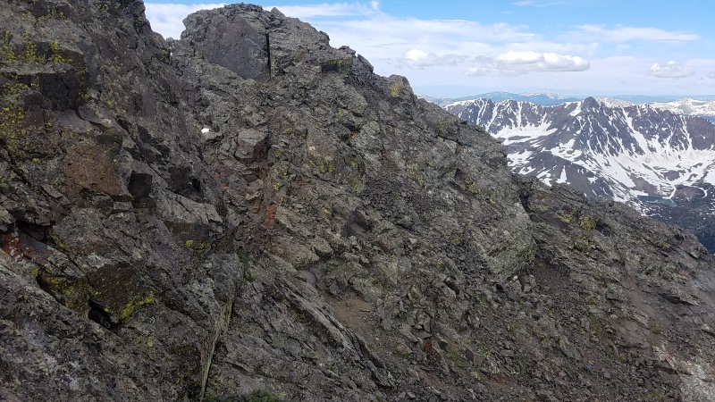
Next up: Class 2 talus strewn grass. 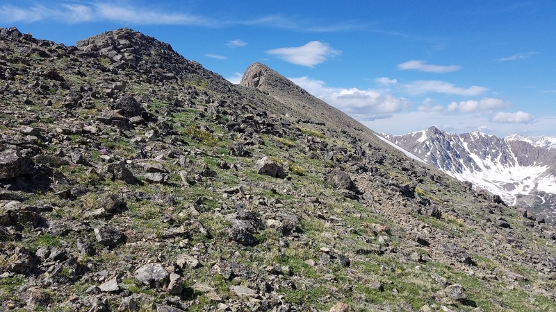
The grass quickly runs out as the trail winds around the high point at the ridge's elbow and it turns entirely to steep, loose rock. 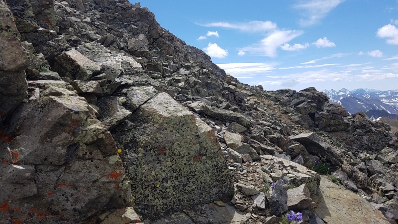
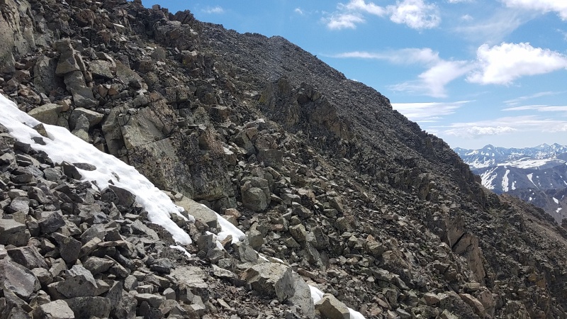
The scrambling up Garfield wasn't difficult, perhaps Class 3 at the hardest, but man was it loose, and there were several steep spots and gullies to cross before getting to the summit. The ridge crest, which I took a little bit on the way out, was slightly more solid. Atop Garfield yet another peak appeared! What is this? Did I miss something? Is this another 13er I didn't know about? 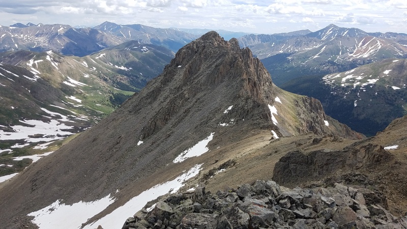
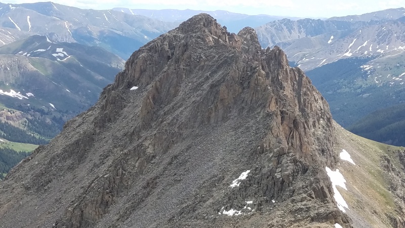
I believe this is Point 13,740, an unranked, unnamed peak also sometimes called "East Garfield" (at least one reference as such in Garfield's summit register). My brief research into it says it has about 200 feet of prominence and goes at Class 4, but that is unverified and I didn't go over there because it looks nasty, getting to it and getting up it (and then reversing it of course). I have, as you can clearly see, dubbed it Scary Peak Q. I work for the USGS so that's as close to official as completely making up unofficial nonsense gets. Time to print new maps. After reversing the climb up Garfield I had to figure out a way back down to the road, which would be the easiest and fastest way out. Maybe not easiest, as I was about to find out, nor the fastest, but probably both easier and faster than climbing back up Grizzly and down the couloir. I picked an arbitrary spot along the way instead of going back to the Grizzly/Garfield saddle, but perhaps I should have gone further and attempted to find a use trail. The terrain on the west side of the entire Grizzly/Garfield massif is perhaps some of the junkiest, loosest, most awful stuff I've been on, and I've climbed Columbia, my self-ordained King of Kitty Litter. There was several thousand feet of a mix of dirt, scree, and talus, and somehow this stuff was deep, like inches deep. Taking a step into it I sank up to my ankles. All the rock within a foot or two would slide down the slope. It was like pulling my foot out of sucking mud to take another step, except instead of mud it was tiny little razor sharp bits of rock. It would not be incorrect to say I felt like I was swimming in scree. 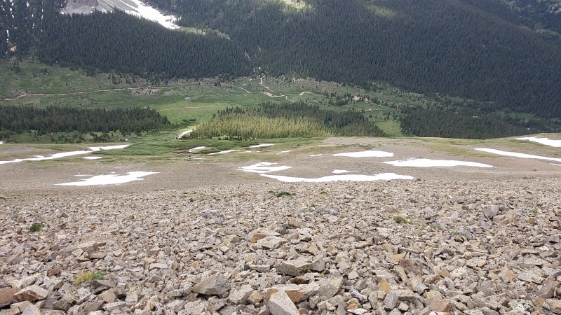
Not only was it loose but it was also steep, steeper than the photo belies. I took it very slowly so I didn't end up faceplanting into or rolling down it, and with each step I literally slid a few inches closer to the bottom. I tried aiming for grass or snow but that didn't really help since there was very little of it. I painstakingly made my way down, taking what felt like hours, which it ended up being. Eventually I found myself in willows, clearly an avalanche path between stands of trees. I willowbashed over to the trees because I knew it'd be easier and less brushy. 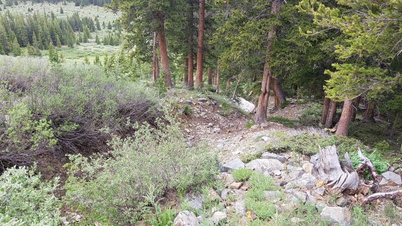
A few short minutes of relief in the trees and I popped back out on the road, completely alone. I had no idea where I was so I just started walking north towards the reservoir. It sounded like Mac wasn't able to drive all the way up the road but it wasn't totally clear either, so I just hiked and hiked for a while, taking in the views of Grizzly from a new, western perspective.
Meeting Mac at his car we bumped fists and I told him about what a dope climb he missed. Oh well, he said, he was only there for the snowboarding, climbing's just a means to an end. On the drive out we got some better, more well lit views of the avalanches along the road, and boy were these things beastly.
I'm sure they sounded just like a grizzly's roar as they crashed down the mountainside, but for me it was the couloir that roared. I roared back. StatisticsClimbers: Ben Feinstein (myself, full climb), Mac P. (approach only)
Splits:
¹ I obviously had some rest time to change footwear and put crampons on/take crampons off but I just rolled that into this leg. Thumbnails for uploaded photos (click to open slideshow): ")
")
")
")
")
")
")
")
")
")
")
")
")
")
")
")
")
")
")
")
")
")
")
")
")
")
")
")
")
")
")
")
")
|
| Comments or Questions | |||||||||
|---|---|---|---|---|---|---|---|---|---|
|
Caution: The information contained in this report may not be accurate and should not be the only resource used in preparation for your climb. Failure to have the necessary experience, physical conditioning, supplies or equipment can result in injury or death. 14ers.com and the author(s) of this report provide no warranties, either express or implied, that the information provided is accurate or reliable. By using the information provided, you agree to indemnify and hold harmless 14ers.com and the report author(s) with respect to any claims and demands against them, including any attorney fees and expenses. Please read the 14ers.com Safety and Disclaimer pages for more information.
Please respect private property: 14ers.com supports the rights of private landowners to determine how and by whom their land will be used. In Colorado, it is your responsibility to determine if land is private and to obtain the appropriate permission before entering the property.