| Report Type | Full |
| Peak(s) |
Gray Wolf Mountain - 13,604 feet |
| Date Posted | 07/22/2019 |
| Modified | 07/23/2019 |
| Date Climbed | 07/21/2019 |
| Author | Alrightmax |
| Additional Members | frigidridge |
| Gray Wolf's Northern Slopes - from South Chicago Creek TH |
|---|
|
Gray Wolf Mountain's Northern Slopes
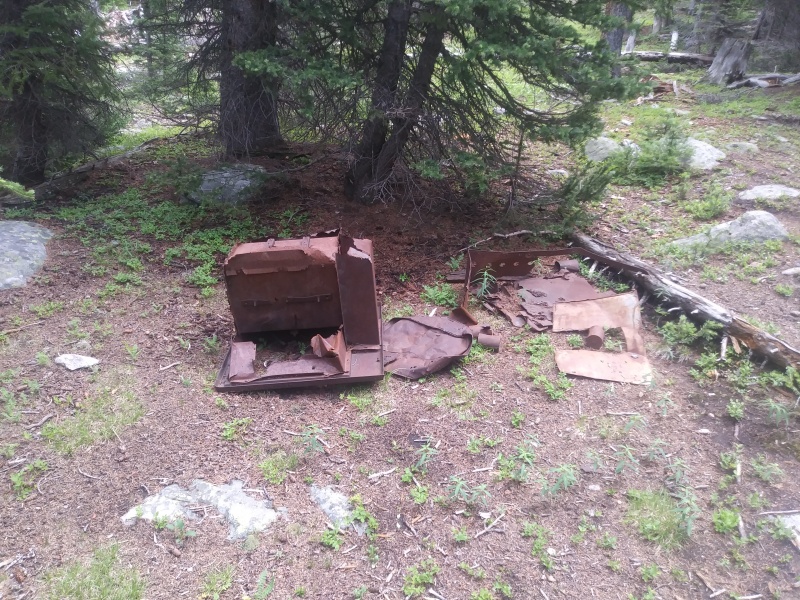
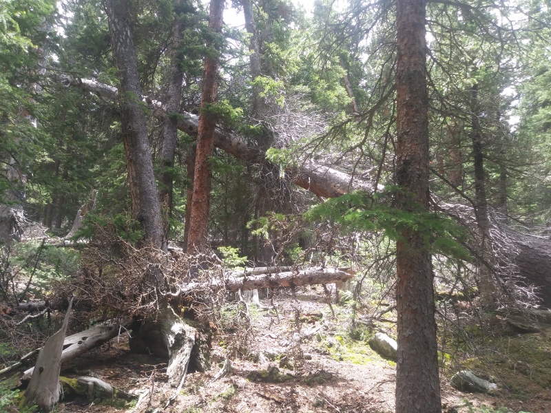
The idea of trying Gray Wolf came to my mind as I was looking for a way to acclimate my dog to altitude. He gets very carsick, so I wanted it close to Denver. I realized I hadn't done anything in the Mt Evans area (besides driving to the summit a few years ago), so I narrowed my search to there. Gray Wolf's Southern slopes are easily accessible from Mt Evans Road, but I noticed the South Chicago Creek trail led straight to its Northern spur and thought that might be more interesting. We ultimately found this route to be very enjoyable due to the remarkably pristine alpine and dramatic cliffs at the Gray Wolf/Spalding saddle. Given that the TH is less than an hour from Denver, it is the perfect day-hike for monsoon season when you don't want to get up before sunrise! I am writing this report for anyone interested in this route, so it is presented more like a route description. The first section of the hike is along the South Chicago Creek trail, starting from the South Chicago Creek trailhead. This trail is remarkably well maintained, so there isn't much to say about it. Here is the forest service page for it. After 1.5 miles, the trail suddenly disappears at some illegal campsites and rusty... uh... junk. Do your best to locate cairns as you navigate a social trail that borders a marshy, willow hellscape on your right, and a forest riddled with beetle-kill on your left. It might be tempting to stay in the trees to avoid the water, but many of those widowmakers are ready to go. This is probably the most dangerous part of the hike. We also encountered mosquitoes here, so bring bug-spray if they bug you. (Get it?) Oh aren't I making this sound like fun? Well, it was the worst part of the hike (by far) but mercifully only lasts about 1/2 a mile. 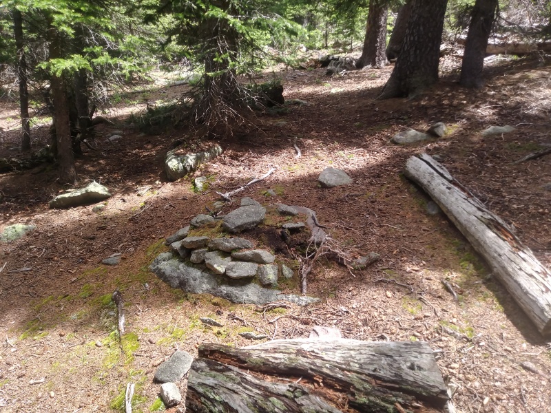
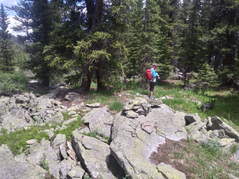
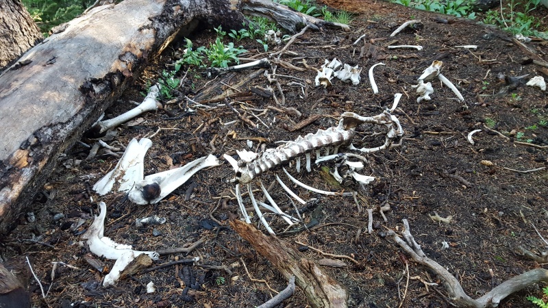
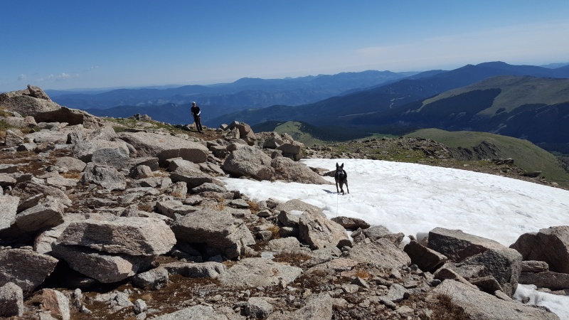
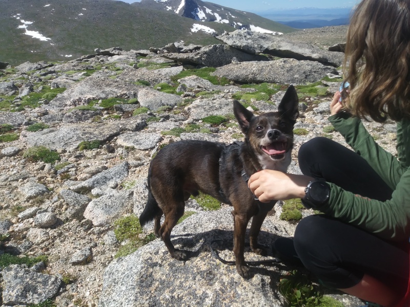
Once you hit treeline, the real fun begins! The social trail quickly deteriorates into game trails that weave through the remaining willows, and soon this too disappears. Now it's just grassy slopes to the top. The steepness here might feel a bit unrelenting, one could switchback a bit to alleviate (as I did). These slopes have numerous rock patches home to pika, marmot, and nesting ptarmigan. My dog was more than happy to terrorize wildlife, and would have caught the juvenile ptarmigan if he wasn't leashed (as is required in Mt Evan's wilderness). We also saw scat from nearly every large CO mammal - a LOT of bear in particular. My dog thought it was all tasty , except for elk. 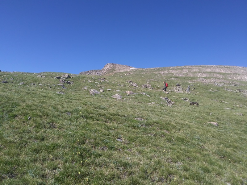
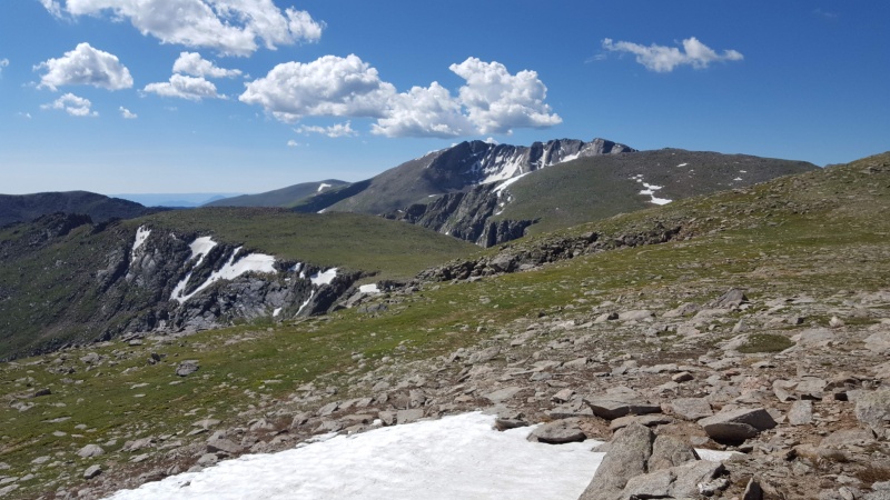
As the slopes funnel you up to the summit, it is definitely worthwhile to gain the ridge to the Southeast. The cliffs between Gray Wolf and Spalding, and the Chicago Lakes basin, are gorgeous. Continue up this way, cross a few false summits, and the cairned true summit comes into view before you know it. We hit it right around 10:00
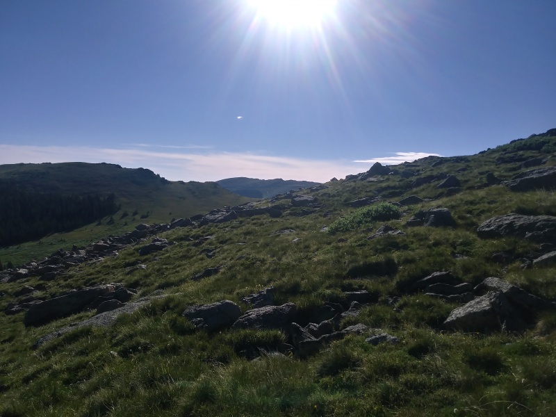
We lingered on the summit watching clouds gather to the East, cars drive up to Mt Evans, searching for moving dots on Bierstadt. The GPX will show us wondering along the Southwest aspect of the summit ridge, trying to get a better view of The Sawtooth. You could probably traverse to Mt Spalding if you were so inclined, but you'd have to regain Gray Wolf to return (unless you maybe tried to hike over to Mt Evan's road and hitchhike?). In any case, there were afternoon storms nearby so we headed down. We kept higher on the ridge, looking for a more obvious way though the willows. We did not see another soul the whole hike, save for waaayyy in the distance. It was nice to be so secluded on such an accessible hike. There was one other car at the trailhead when we left at 1:30. 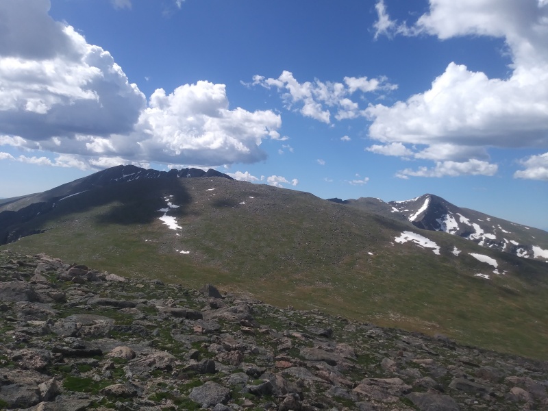 Thumbnails for uploaded photos (click to open slideshow): ")
")
")
")
")
")
")
")
")
")
")
")
")
|
| Comments or Questions |
|---|
|
|
Caution: The information contained in this report may not be accurate and should not be the only resource used in preparation for your climb. Failure to have the necessary experience, physical conditioning, supplies or equipment can result in injury or death. 14ers.com and the author(s) of this report provide no warranties, either express or implied, that the information provided is accurate or reliable. By using the information provided, you agree to indemnify and hold harmless 14ers.com and the report author(s) with respect to any claims and demands against them, including any attorney fees and expenses. Please read the 14ers.com Safety and Disclaimer pages for more information.
Please respect private property: 14ers.com supports the rights of private landowners to determine how and by whom their land will be used. In Colorado, it is your responsibility to determine if land is private and to obtain the appropriate permission before entering the property.


