| Report Type | Full |
| Peak(s) |
Capitol Peak - 14,138 feet |
| Date Posted | 07/17/2019 |
| Date Climbed | 07/16/2019 |
| Author | Wentzl |
| Additional Members | PaulMillar |
| Capitol Season Opener |
|---|
|
Mid July seemed long enough to wait for winter to loosen its grip on this peak. Having been back there in June of '08, another epic snow year, I estimated my chances good to repeat this classic climb. Paul Millar and I planned to set out from the trailhead and make a long day of it. When the alarm went off at 5:00 a.m. the wind was howling, the valley below us socked in and a misty rain threatening to shut down the effort early despite the favorable forecast. We postponed our start by 30 minutes and things improved according to plan. Don't like the weather in Colorado? Wait 15 minutes. So true! The night before, we encountered a hiker coming back from Capitol Lake who reported that the avalanche damage and snow fields made finding the trail to the lake difficult. We found the warning exaggerated. It is pretty straight forward and while there is some snow on the trail, it is very easy to figure it out and there is almost no debris of any kind obstructing the path. We hit the ditch trail at 6:00 and made the river crossing in a little under 2 hours. Be prepared to get wet. We opted for the barefoot solution to keeping dry feet for most of the day. But man oh man, did the cold water feel good on the way out, shoes and all! 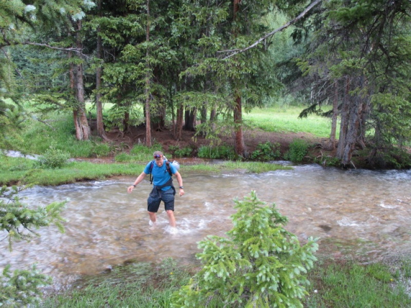
Another hour or so and we were at the lake, roughly 9:00 a.m. Just before reaching the designated camp sites, there is a section of trail that goes up a steep narrow incline. This is still snow packed and will be for some time. It was the most significant snow obstacle of the day and was easily crossed without micro spike, crampons or axe. For the record, we did bring axes on this hike, but never used them. The 900' slope from Capitol Lake to the Daly/Capitol saddle was virtually snow free. There was still one short section of the switchbacks which were under snow, but this was easily bypassed, staying off the snow. This will likely be clear by next week. 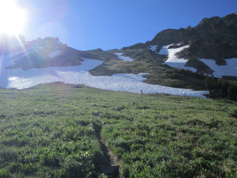
Capitol Lake is still half iced over. 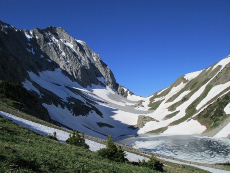
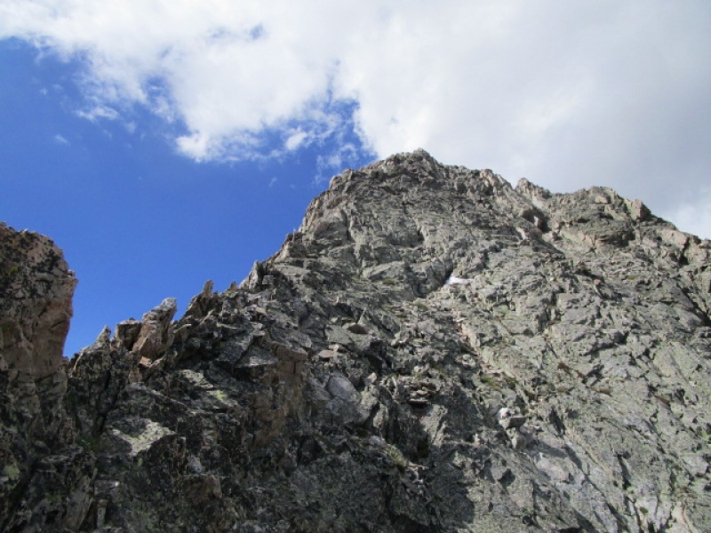
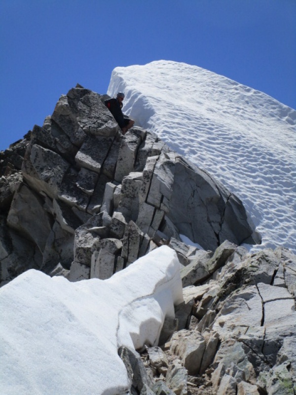
A couple years ago I posted a report about climbing on the NE Ridge Direct. It is still fun. But on this trip our focus was more on the imposing looking snow cap on K2. The ridge is a solid 4th class scramble. This is not a shortcut for the faint hearted or inexperienced. A few photos follow: 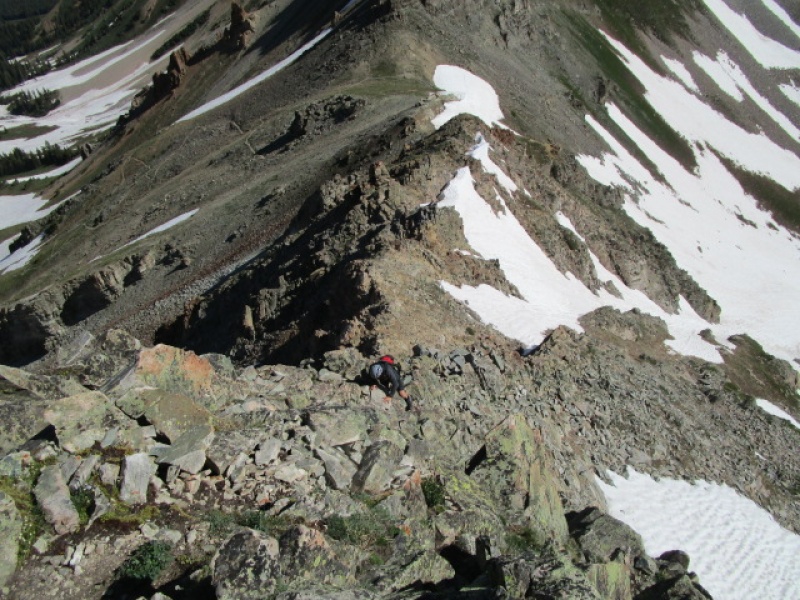
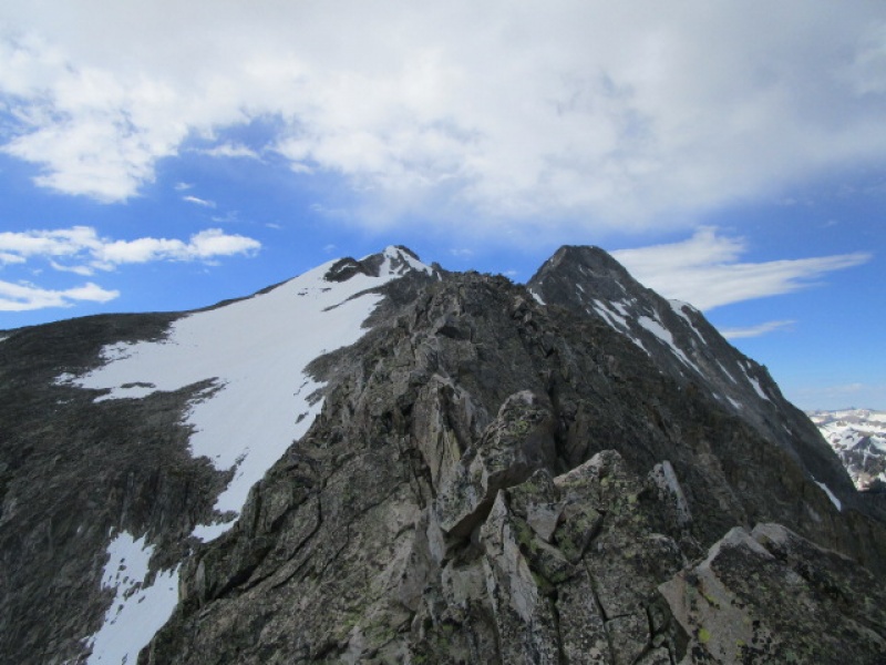
It was impossible to tell how the snow on the summit of K2 would impact our day until we were standing on it. More to the point, stepping over it. The snow on the back side of K2 had melted off enough to allow dry passage through. It is not likely that this would have been the case just a week or two ago. 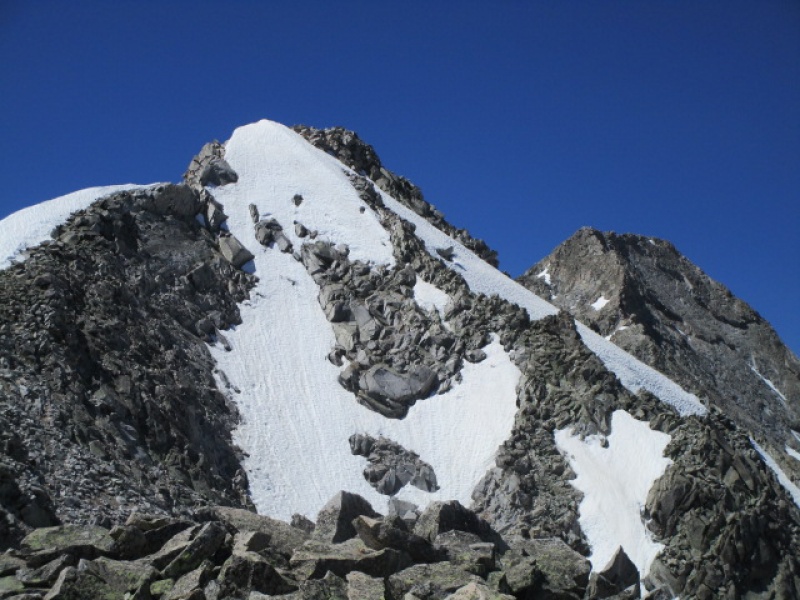
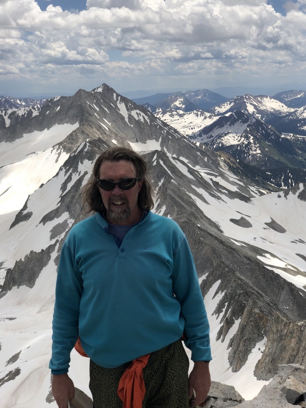
From the summit of K2 to the summit of Capitol it was basically summer conditions. While the upper face did hold some snow, most of it was easily bypassed on the route marked by cairns. There was only one small section that required a foot placement or two in snow, but that will certainly be melted out by the time this report is posted. 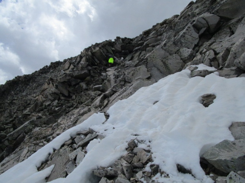
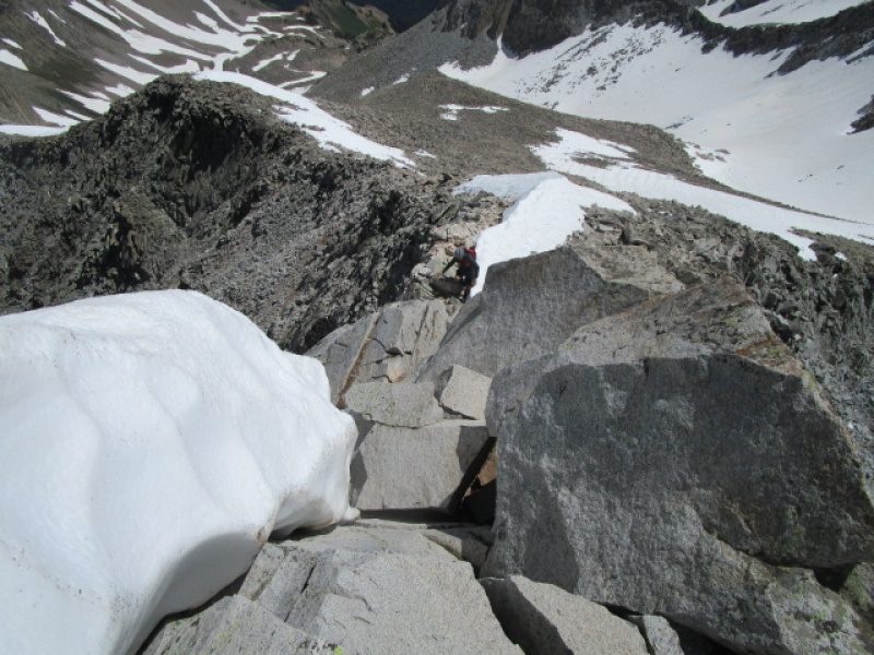
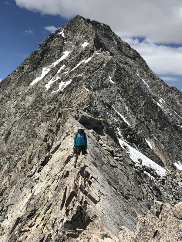
The upper face of Capitol is complex. Getting to the point in the previous photo takes some careful route finding. After this point, there seems to be cairns placed almost randomly. IMO, the key to easy safe passage requires finding the wall which just happens to be highlighted by Paul's bright jacket. There are cairns marking a route around to the lower left of the photo, but just after this feature, climbers will be confronted with an obvious grey wall. While it is possible to traverse below this feature, going high is preferable. (this opinion based on 4 trips trying to find the best route) The next photo shows the passage above the grey wall mentioned. From where this next photo was taken, it is easy to find the summit. Also, the next photo shows what is directly above the steep section in the previous photo. 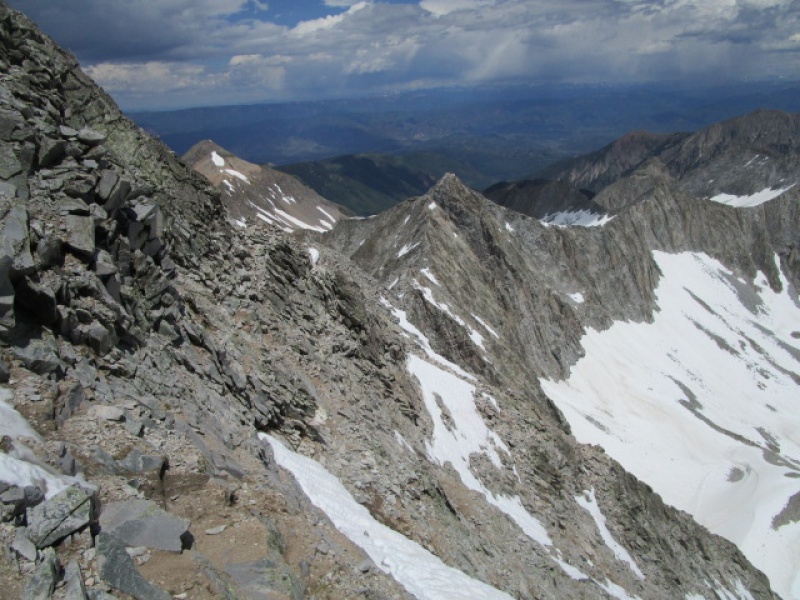
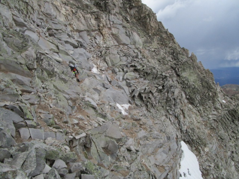
Side note, just below Paul in the previous photo is a pretty nice cave where we were prepared to hunker down for a while if the storms passing by decided to pass directly overhead. We did have a bit of graupel earlier in the day, but the storms were scattered and fast moving so we pressed on. Lightening was seen, thunder heard, but sunshine was the theme of the day and the weather held, the cave left unutilized. 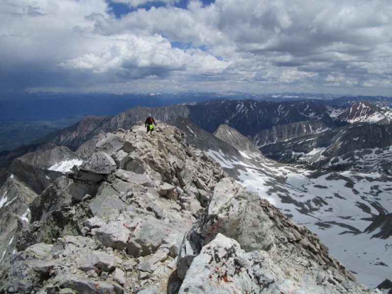
Just the same, we tagged the summit and blasted back the way we came without delay! 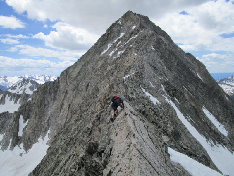
The weather steadily improved allowing us a casual and careful descent down the NE Ridge direct. We did consider using the standard route as an alternate descent, and probably would have taken that option if the weather turned foul, as being on that ridge in a storm would not be a good idea. Anyone considering Capitol via the standard route be advised. You will be on snow almost the entire way from the moment you drop off the Daly/Capitol saddle until you reach the summit of K2. In the right conditions it could be a really fun climb. And in hindsight, the soft snow would probably make a fantastic glissade over what is usually a miserable trek over unstable boulders. But it might also be a soft slushy post holing nightmare. Looking forward to the next report to set me straight on what's what down there. Back at the trailhead by 7:30p.m. for a total travel time of 13h 30m. 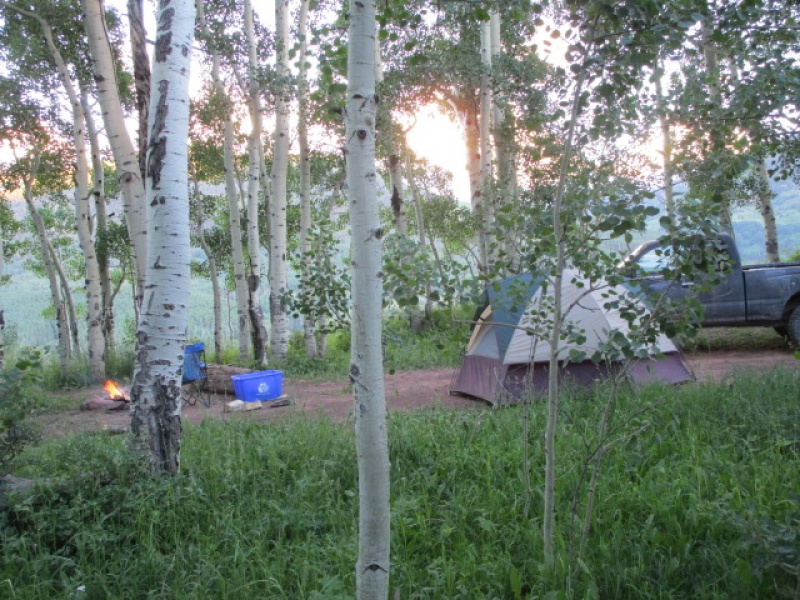
Thumbnails for uploaded photos (click to open slideshow): ")
")
")
")
")
")
")
")
")
")
")
")
")
")
")
")
")
|
| Comments or Questions | ||||||
|---|---|---|---|---|---|---|
|
Caution: The information contained in this report may not be accurate and should not be the only resource used in preparation for your climb. Failure to have the necessary experience, physical conditioning, supplies or equipment can result in injury or death. 14ers.com and the author(s) of this report provide no warranties, either express or implied, that the information provided is accurate or reliable. By using the information provided, you agree to indemnify and hold harmless 14ers.com and the report author(s) with respect to any claims and demands against them, including any attorney fees and expenses. Please read the 14ers.com Safety and Disclaimer pages for more information.
Please respect private property: 14ers.com supports the rights of private landowners to determine how and by whom their land will be used. In Colorado, it is your responsibility to determine if land is private and to obtain the appropriate permission before entering the property.


