| Report Type | Full |
| Peak(s) |
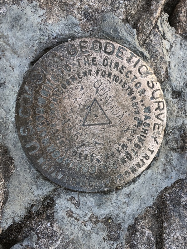
Quandary Peak - 14,272 feet |
| Date Posted | 08/01/2019 |
| Date Climbed | 07/15/2019 |
| Author | rob runkle |
| Quandary Peak with Unicorns and T-Rex |
|---|
|
After doing the BroLinCam group, we drove to The Blue Lakes Road and picked a camp site, near the lake. Our plan was to do Quandary the next morning. At this point, it was about 6pm. Just as we pitched our tents, the skies opened up, and it started hailing; hard. The downpour continued for about an hour and a half. During the worst parts of the storm, the thunder and lighting was right on top of us. We were confined in our tents the whole time, but I considered multiple times making a run for the car. I really would have hated to be high on a peak, as that storm came through. Eventually the storm subsided, and we were able to close our eyes and fall asleep. Due to the storm the night before, our Quandary quest was in doubt. I crawled out of my tent around 5 am and asked Chris if he and Garrett still wanted to do Quandary. Chris was up for it, but Garrett was resisting. Chris and I made the call that we would go for it. I figured if things did not go well, or the skies looked bad, we could always turn back. It was tough to get the kids going. Even though the storm let up before we fell asleep, the tent was soaked, with a small amount of dampness inside the tent. We did not sleep very well. The air was a bit chilly also. Ultimately, I was able to get the kids motivated. We decided to leave our tents up, hoping that they would dry off a bit during the day. We finally made it to the trailhead and got a great parking spot. We started our hike at 545 am. The hike up Quandary starts with some immediate up hill hiking. Even though we were tired from a rough night, and several longs days in the mountains, everyone was doing great. I knew almost immediately, that Chris and I had made a good choice to continue the hike. 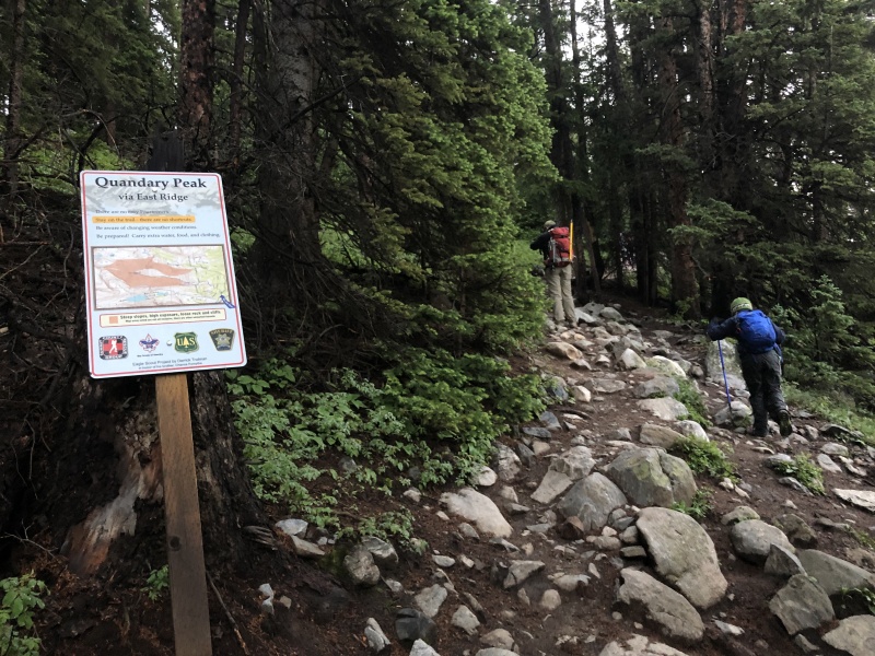
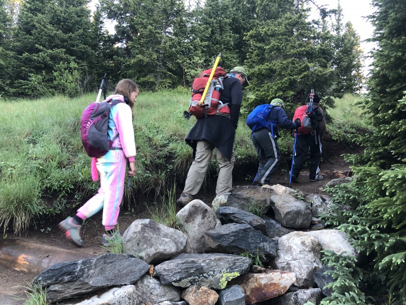
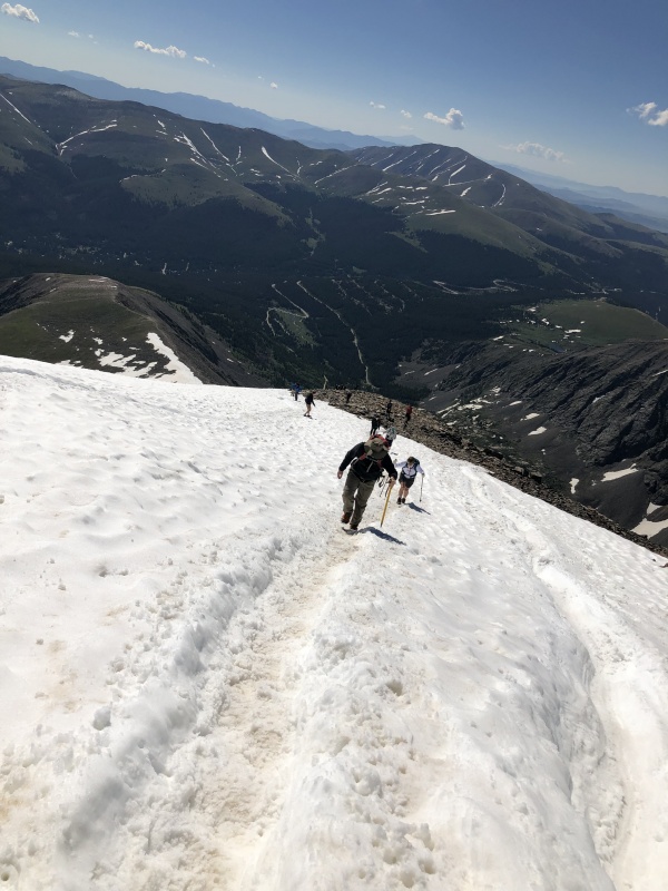
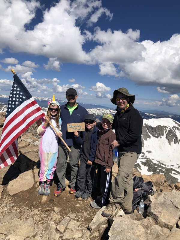
Anna had decided to put on her Unicorn one-zee at the trailhead for this hike. Her and the boys were all cold, and just about everyone overdressed. As we hiked up the steep trail, we stopped a few times to remove layers. Even with our delayering stops, we continued at a pretty strong pace, keeping up with most of the groups on the mountain that morning. We made it above treeline pretty quickly. Above treeline, the steps get steeper for a while, then it flattens out for a short time, before it gets super steep for the final pitch. 
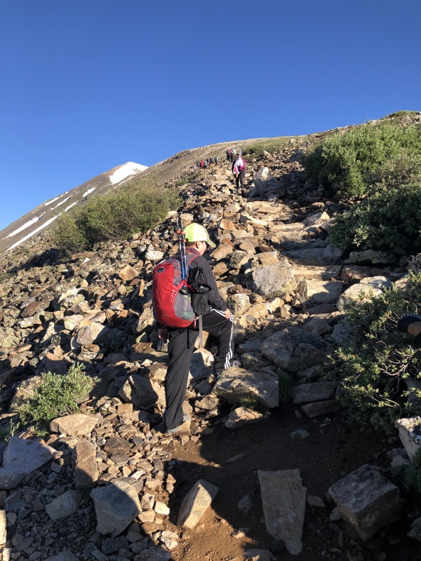
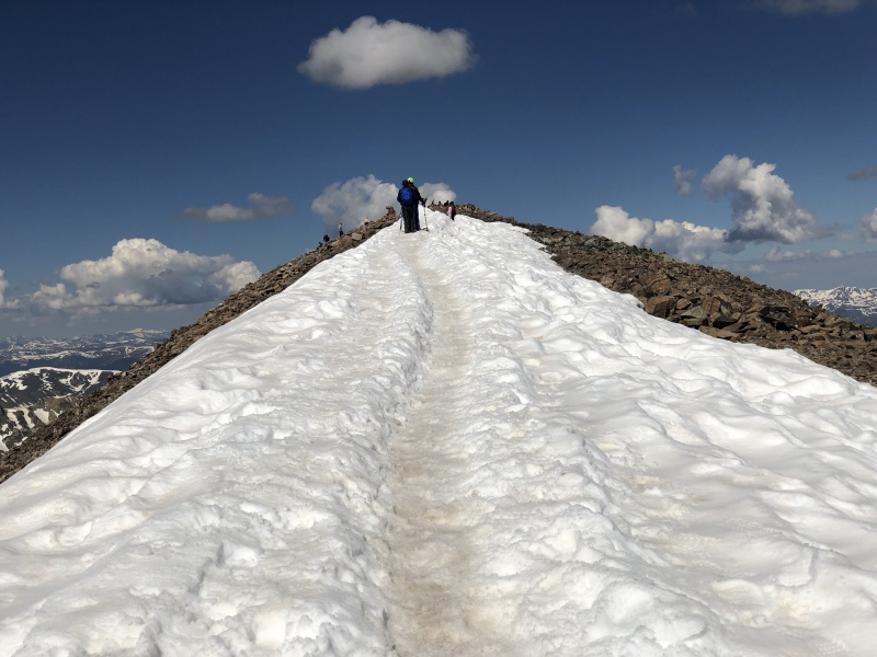
At this point, we had not encountered any snow on the trail. There was plenty of snow on the mountain, but luckily, it was just off to the right of the trail. We continued up the steep final pitch. As we climbed the final pitch, we all slowed down a bit, but we kept moving. At the top of the final pitch, we finally encountered snow that was blocking the route. We climbed a small snow field that was maybe 50 feet of climbing. After the 50 foot climb, the trail again leveled out for an easy walk to the summit. The flat walk to the summit was completely covered in snow that formed a short cat walk. Falling off either side of the catwalk would have not been catastrophic, but it would have sucked a little bit. 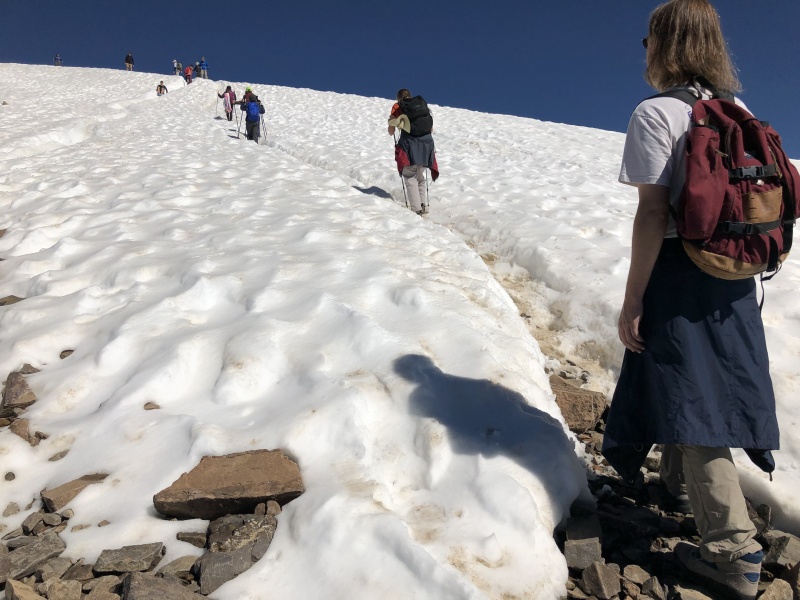
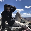
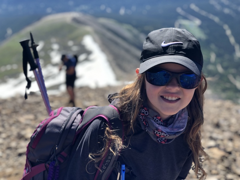
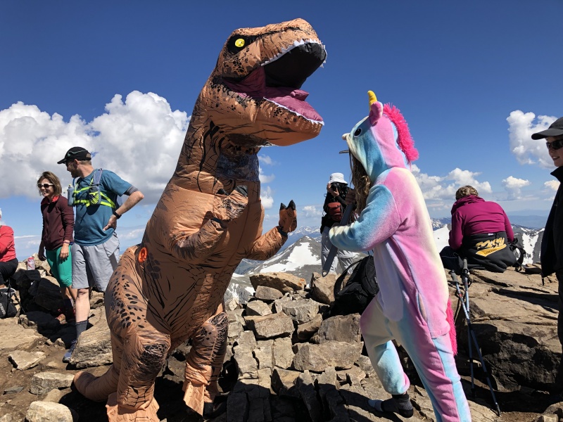
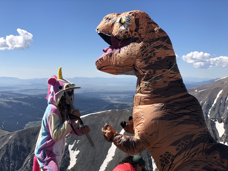
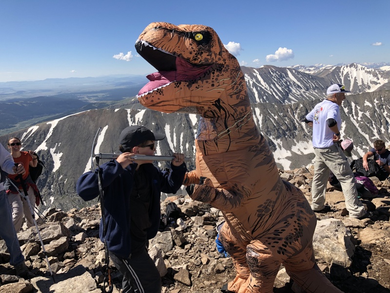
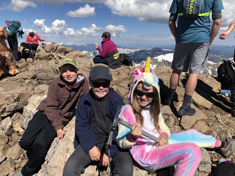
We made the summit in about 4 hours, 15 minutes from the trailhead. As we approached the summit, we spotted another hiker in a blow up T-Rex costume. Ironically, Anna and I had been discussing what we could do in 2020 for a summit costume, instead of the Unicorn One-zee. Getting a T-Rex blow up costume was the first thing that we thought about doing. Already been done! Darn! Anna had delayered here one-zee early in the hike. She put it back one so that we could pose for the "great T-Rex/Unicorn battle." The Unicorn, with ice axe in hand, won the battle, of course. We stayed about 40 minutes on the summit, munching food, drinking agua and taking pictures. 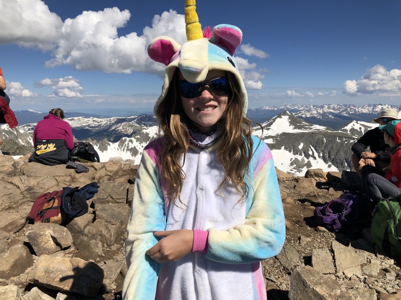
As we descended, we decided to do a bit of glissading. I led the glissade, since I had my ice axe. The rest of the team only had trek poles (except Chris, who had both). I dropped down into an already established snow trough, and started sliding down. Pretty quickly it became clear that the snow was soft enough and the steepness of the grade was gentle enough that I did not need to use my axe to control my slide. I held my axe in the air the whole time. Once I confirmed the safety of the glissade, I indicated for the kids to follow me, and Chris to take up the rear. Everyone did awesome, and they really enjoyed the "butt sliding." We continued to glissade down the slopes. Doing this we were able to avoid some of the steepest sections of the downclimb, saving the legs some grief. I did notice that we were not getting down any quicker than the people who ere hiking, but were were sure having a lot of fun. Eventually, we got down far enough, that we were starting to run out of snow. We traversed the snow, and jumped back onto the main trail. We were able to bypass 90% of the steep final pitch, and dropped to almost 13,500 ft, using the snow. Our butts got a bit chilly, and wet, but other than that, there was not drawback. The kids talked about how much fun the "butt sliding" was, for days. 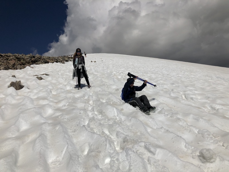
As we reached 13,100 feet, Anna was leading the hike, and going super strong. Suddenly, about 100 feet ahead of us, Anna stopped, turned around and started back towards us. She was upset. She said that she didn't have her rain jacket, and thought that she had dropped it on the trail somewhere. I was pretty sure that she must have dropped it somewhere in the transition from snow back to trail. She had been using it under her butt, to help slide down the snow. I dropped my pack, told the boys and Chris to continue, and told Anna to wait for me. I ran back up to 13,500 feet. I looked everywhere around the rocks, where we exited the snow, and could not find the jacket. I went back down to Anna, and asked her a few more questions about where she thought it might be. She clarified, and said that she thought it might be at the bottom of the final glissade. She thought that she might have stood up, and left it sitting in the snow. I hadn't looked out onto the snow, because I though for sure it would be in the rocks. But, the place that we stopped glissading, and the spot that we entered back onto the rocks was probably a 100 foot traverse across the snow, from where we stopped glissading. I could have easily missed seeing it in the snow. I ran back up to 13,500 feet, again, and as I got closer, I saw what could be a jacket, out on the snow. I traversed out onto the snow, and as I got closer, it was clearly Anna's jacket. Jacket recovery success! We must reconsider the color of our jackets in the future. Black is just too difficult to see in the rocks, or the snow. I hiked back down to Anna, we grabbed our packs, and continued to descend. I was impatient to catch back up with the boys, so I was flying down the trail, sometimes even jogging. It had taken us close to an hour to recover the jacket, and I didn't want the boys worrying about where we were. I was impressed to see that Anna was also going super strong, keeping up with me on the downhill without any difficulty at all. In fact, I stumbled a few times during the descent, and Anna did not stumble at all. We finally made radio contact with the boys just below treeline. And, we caught up with them, about a quarter mile before the trailhead. The boys had taken their time getting down, stopping multiple times to let us catch up. Ultimately, even with the jacket recovery efforts, descent to the trailhead, from the summit, took us about 3 hours. Total round trip was around 8 hours. Overall, a very successful trip. (6) new fourtneers for the kids and Chris. The weather was great. The team did great. And, most importantly, they had so much fun, they want to do it again in 2020. Thumbnails for uploaded photos (click to open slideshow): ")
")
")
")
")
")
")
")
")
")
")
")
")
")
")
")
")
|
| Comments or Questions | ||||||||||||
|---|---|---|---|---|---|---|---|---|---|---|---|---|
|
Caution: The information contained in this report may not be accurate and should not be the only resource used in preparation for your climb. Failure to have the necessary experience, physical conditioning, supplies or equipment can result in injury or death. 14ers.com and the author(s) of this report provide no warranties, either express or implied, that the information provided is accurate or reliable. By using the information provided, you agree to indemnify and hold harmless 14ers.com and the report author(s) with respect to any claims and demands against them, including any attorney fees and expenses. Please read the 14ers.com Safety and Disclaimer pages for more information.
Please respect private property: 14ers.com supports the rights of private landowners to determine how and by whom their land will be used. In Colorado, it is your responsibility to determine if land is private and to obtain the appropriate permission before entering the property.