Download Agreement, Release, and Acknowledgement of Risk:
You (the person requesting this file download) fully understand mountain climbing ("Activity") involves risks and dangers of serious bodily injury, including permanent disability, paralysis, and death ("Risks") and you fully accept and assume all such risks and all responsibility for losses, costs, and damages you incur as a result of your participation in this Activity.
You acknowledge that information in the file you have chosen to download may not be accurate and may contain errors. You agree to assume all risks when using this information and agree to release and discharge 14ers.com, 14ers Inc. and the author(s) of such information (collectively, the "Released Parties").
You hereby discharge the Released Parties from all damages, actions, claims and liabilities of any nature, specifically including, but not limited to, damages, actions, claims and liabilities arising from or related to the negligence of the Released Parties. You further agree to indemnify, hold harmless and defend 14ers.com, 14ers Inc. and each of the other Released Parties from and against any loss, damage, liability and expense, including costs and attorney fees, incurred by 14ers.com, 14ers Inc. or any of the other Released Parties as a result of you using information provided on the 14ers.com or 14ers Inc. websites.
You have read this agreement, fully understand its terms and intend it to be a complete and unconditional release of all liability to the greatest extent allowed by law and agree that if any portion of this agreement is held to be invalid the balance, notwithstanding, shall continue in full force and effect.
By clicking "OK" you agree to these terms. If you DO NOT agree, click "Cancel"...
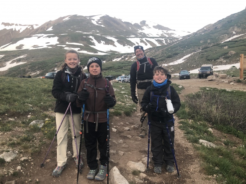
We had done Democrat two years ago. So, for 2019, I had it on the radar to complete the remainder of the Lincoln group. Initially, I had planned this for Day 2 of our trip. But, after doing Grays and Torreys on Day 1, we decided that we needed a break. Our stuff had gotten a bit damp during the Grays hike/camping. And, the weather for Day 3 looked like it might be slightly better than Day 2. So, for Day 2, we decided to do some Ziplining, which was very cool. After our ziplinging adventure, we drove to the Kite Lake trail head to setup camp. We struggled to find a descent sized spot that could support two tents, and was flat. We ended up dropping camp a few hundred yards from the trail head, along the road. We setup camp and were in bed by around 8 pm.
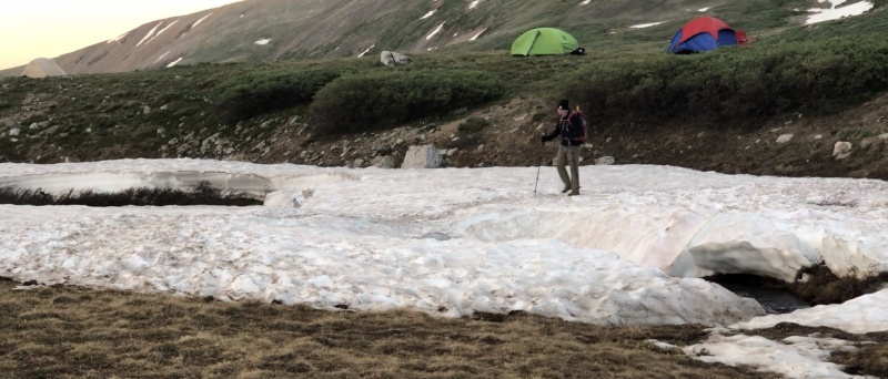
I was hoping to get started earlier, but we ended up leaving camp around 530 am. I knew this would be a short day, so I wasn't too concerned about a later than planned start. Chris and I had checked out the beginning of the trail the night before, and noticed that the creek crossing was really nasty. There were no good rocks for making the crossing. But, there was a snow bridge option. The snow that covered the creek was still pretty solid, and it was complete across the creek. We tested it out the night before, and even in the soft afternoon snow, it was very solid. So, when we crossed it in the morning, we knew that it would be plenty solid, and safe.
Starting at the trail headSnow bridge crossing
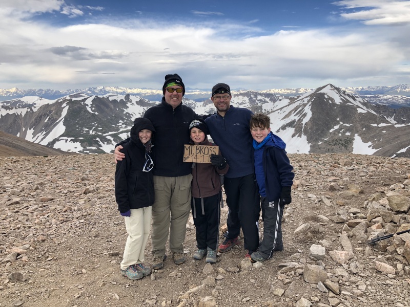
For this trip, my plan was to tackle Bross first, then Lincoln, and finally Cameron. If we felt the urge, we could also do Democrat for a repeat summit. This would be my third time hiking this group, and the first time that I was going counterclockwise (Bross first).
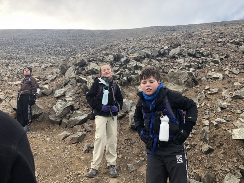
Once we crossed the snow bridge, the route up Bross was very clear, and easy to follow. It becomes steep almost immediately, which is almost a blessing, because the elevation gain is pretty consistent, for a short mileage hike. It was good to get the gain started immediately, rather than having to deal with excessively steep terrain later. The uphill was pretty moderate. Everyone in the group moved along pretty solid. We took minor breaks, but kept moving very efficiently. As we continued up the slopes, we had a pretty good view of our camp site. We had left the tents pitched while we hiked, just to give them a chance to dry off a bit. Watching our camp, as we ascended gave us a good gauge of our great progress up the slopes. About a mile into the hike, I was looking down at the camp, and noticed that Chris' rain fly was blowing pretty hard in the wind (I could see the color from the underside of the rain fly). I pointed this out to Chris, and about the time I pointed it out, his tent started rolling down the road. Yikes! Holy cow, that was a big gust of wind. Both Chris and I had staked down our tents pretty good. Our tent spot was full of shallow rocks, so I guess our stakes were not locked down as good as we thought. Luckily, his tent stopped rolling pretty quickly. It pretty much rolled across the oad, and into the willows on the other side of the road, and stopped. We were hoping that it would hold that position, until we got back down from the hike. Going back for it at this point would have lost of more than an hour, and a lot of extra leg energy.
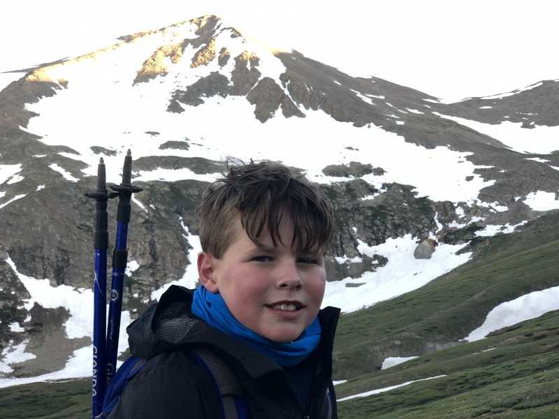
Nolan during the ascent of BrossDemocrat during the ascent of Bross
We continued up the slopes. As we ascended, a few groups passed us, but in general, not too many people passed us. Most groups were going about the same pace as we were. In our previous years, this was not the case. In previous years, we were the "turtle," and everyone passed us. It was neat to see the progress in performance that the team had made this year. Let's be honest, these things are tough, and it helps more if you are not "dragging" yourself up the whole way, and if you still have some reserve energy at the top, and even better, have some reserve energy when you are done hiking.
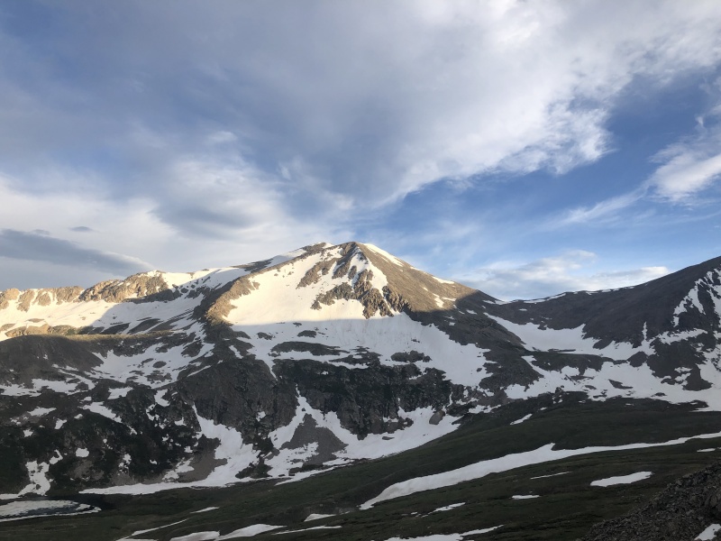
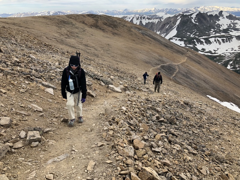
Getting close to the summit area of BrossLast stretch to the Summit area of Bross
As I mentioned before, I had never done this mountain group in this direction, going up Bross first. I found this direction to be pleasant. Honestly, although a lot of people complain about going down Bross, I have never had problems going down Bross. As long as you stay on route, the path down Bross is pretty gentle, and there is a clear trail. If you were to lose track of the trail, and end up going down talus descending Bross, I can imagine that would be miserable. Also, I can imagine potentially losing the trail, if you were using it to descend. The trail is very easily to follow, ascending, but there are several places where it might be difficult to find the trail on descent.
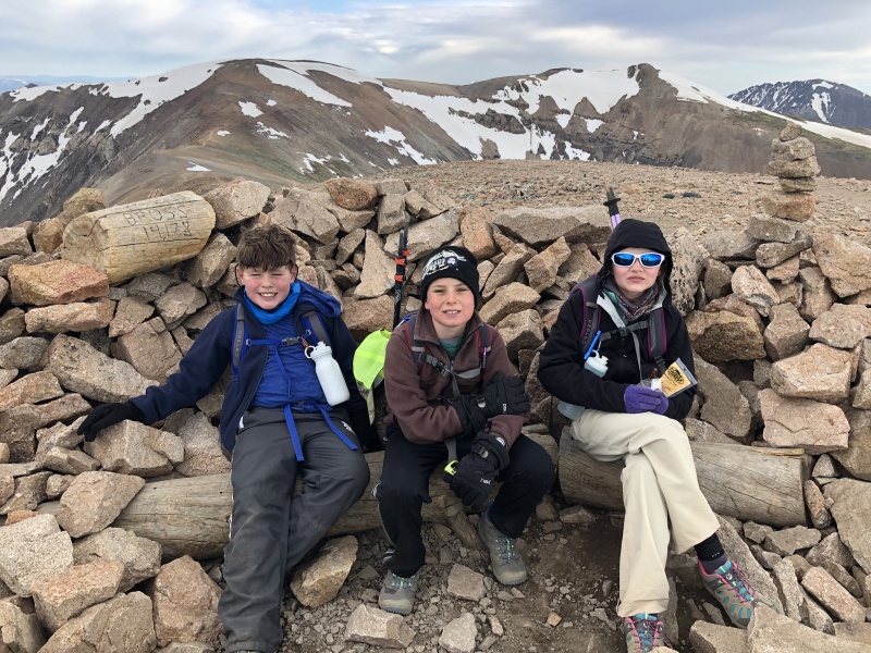
Somewhere near the summit of BrossSomewhere near the summit of Bross
We continued the ascent. Ultimately, we reached the summit area in around 3 hours. We spent about 20 minutes around the summit area, then headed towards Lincoln. At this point, the weather was holding. It had been moderately windy in the morning, causing us to change layers a few times. But, it wasn't crazy windy or cold.
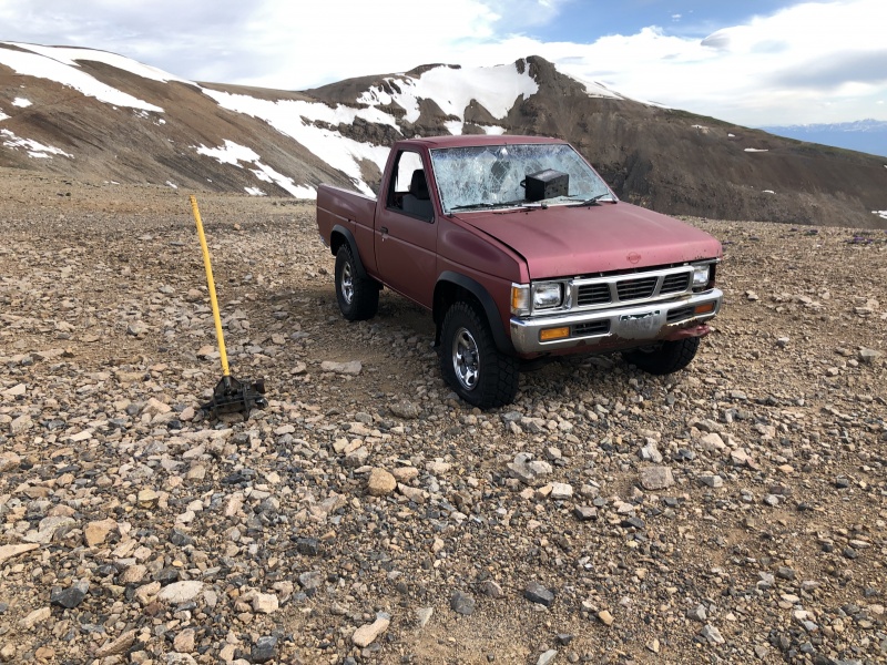
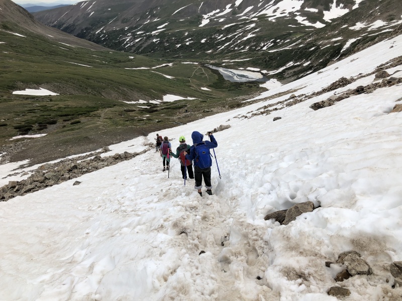
Abandoned truckAbandoned truckSnowfield from Bross to Lincoln
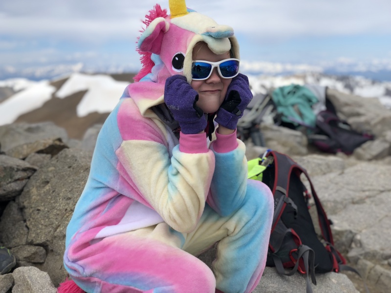
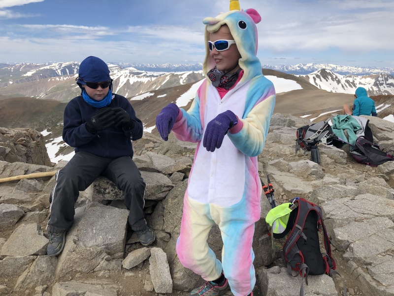
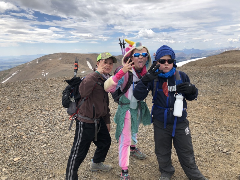
The trip over to Lincoln was pretty easy. Along the way, we checked out the abandoned truck that has been mentioned on the site and the Facebook page. There was one minor snow field that we had to cross along the way also. I should mention that this snow field was the first snow that we crossed, since we crossed the snow bridge. We arrived on top of Lincoln about and hour after leaving Bross. While we were on the summit of Lincoln, Anna put on her Rainbow Unicorn One-zee. She said that it was warm and cozy, so she was planning on hiking in it, after Lincoln. We spent 40 minutes on top of Lincoln, absorbing the awesome views, and great conditions.
Geo markerSelfie with my kidsRainbow UnicornNolan and the UnicornGroup Summit Pic on Lincoln
The trip from Lincoln to Cameron was quick and easy. As we traversed over to Cameron, another hiker pointed at Anna, and said, "I know you from the Facebook posting." I had forgotten that Anna was still wearing the one-zee. Once I looked back at Anna, I realized why she recognized her. The mountaineering fame made Anna's day. We made Cameron in about 25 minutes from leaving Lincoln. We didn't spend much time on Cameron, but continued towards the Democrat saddle. Along the hike to the saddle, I posed the question to the team if they wanted to repeat Democrat, before we hiked back the car. Consensus was, "NOPE!"
Kids on CameronGroup selfie on Cameron
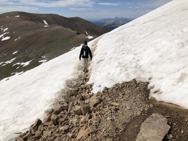
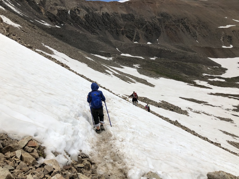
We continued passed the saddle, and down the slopes, toward Kite Lake. The descent from the saddle felt longer than it had in the past, but that might have been just because the trail was heavily covered by snow, and in several places, we had to either cross snow, or go slightly off route in order to bypass snow. So, instead of a quick run down, we had to use our brains, and navigate. Ultimately, the snowfields did not cause us any issues. In general, the snow was soft, and easy to kick steps. And, the slopes were not steep enough to cause concern if we were to slip a little in the snow.
Snow field crossing during the descentSnow field descentFinal stretch of trail during the descent
We made it back to the trail head, from the summit of Cameron in about 2 and a half hours. Total round trip was 7 hours 50 minutes. Like on Grays, the whole team did awesome. As we were descending, I started counting the peaks that the kids had now completed. Anna was now up to 11, including a repeat on Sherman. Chris and Garrett were both now at 10 14ers (minus the Sherman repeat). Nolan was now at 9 14ers, only missing Bierstadt from the rest of the group. When we starting doing 14ers, I never would have thought that the kids would get into the double digits.
I should mention that Chris' tent stayed in place in the Willows, and was without damage.
My GPS Tracks on Google Maps (made from a .GPX file upload):
My 14 year old an my 16 year old son's and I did the exact same route you did two days ago. We had zero snow to deal with. I have an 8 year old son that I want to take up Evans and Grays/Torreys next summer when he's 9 years old. How old were your kids when they got their first 14ers?
My son was 6 yo when he did Handies. He is a freak of nature for pain tolerance tho. My daughter was 8 yo on Handies and that was probably a better age for a typical kid from Out of State. I was prepared to carry them on my shoulders on Handies and I did need to. Same for my daughters next 14er when she was 9 yo. My son skipped that year. I havent needed to carry my kids since Bierstadt.
Caution: The information contained in this report may not be accurate and should not be the only resource used in preparation for your climb. Failure to have the necessary experience, physical conditioning, supplies or equipment can result in injury or death. 14ers.com and the author(s) of this report provide no warranties, either express or implied, that the information provided is accurate or reliable. By using the information provided, you agree to indemnify and hold harmless 14ers.com and the report author(s) with respect to any claims and demands against them, including any attorney fees and expenses. Please read the 14ers.com Safety and Disclaimer pages for more information.
Please respect private property: 14ers.com supports the rights of private landowners to determine how and by whom their land will be used. In Colorado, it is your responsibility to determine if land is private and to obtain the appropriate permission before entering the property.


")
")
")
")
")
")
")
")
")
")
")
")
")
")
")
")
")
")
")
")
")


