| Report Type | Full |
| Peak(s) |
Grays Peak - 14,275 feet Torreys Peak - 14,272 feet |
| Date Posted | 07/29/2019 |
| Modified | 07/30/2019 |
| Date Climbed | 07/12/2019 |
| Author | rob runkle |
| Grays and Torreys via Steven's Gulch standard route |
|---|
|
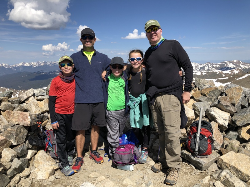
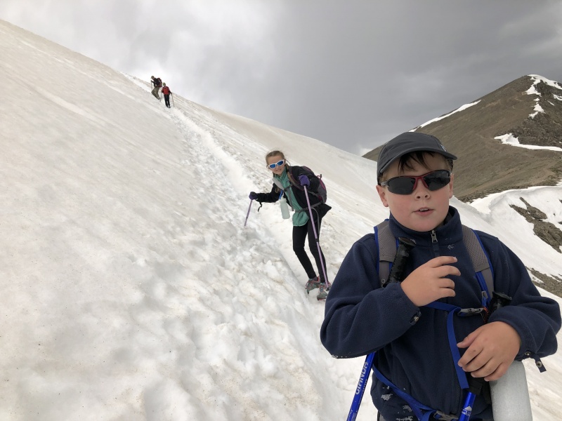
When planning our 2019 Summer Colorado 14ers trip, I seriously wanted to target Grays and Torreys. I had done the group four times myself. It is still one of my favorite 14er hikes. The kids each had 5+ 14ers under their belts, and I felt that they could handle the 8.5 miles of G&T. But… the Winter/Spring of 2019 brought a ton of snow onto Colorado, and avalanche damage had made the trail head road impassable at about 1 mile below the upper trail head. Adding 2 miles to the hike put this one just out of reach for the kids, I felt. As the trip got closer, the trail head status reports indicated that the county was going to attempt to clean up the road. Based on the damage reported on previous trail head status, it sounded like it would take a serious effort, and many days, or weeks, to clean up the damage. 24 hours after the status report about the cleanup, the status indicated that the road was now opened to the trail. Go Clear Creek County road crews! Two days to spare, and G&T was now back on the "potential list." We arrived at DEN midday. Our plan was to take our time, get groceries, then head to a trail head. We decided to go ahead and check out the G&T trail head on our way. If it was clear to the trail head, we would climb G&T the next day. If it was sketchy, we would head over to Quandary instead. Although the trail head status report indicated “all clear,” there was still talk on the 14ers.com Facebook site of the road being closed. We made our way to the road, and started up. The road seemed a bit more bumpy than usual, but definitely passable, with moderate high clearance. Our rental company upgraded us to a Jeep Wrangler this time, so we were having zero problems with clearance. As we got closer to the trail head, we definitely saw where the avy damage had occurred. We continued passed the avy damage, and easily made it to the upper trail head. The trail head status report was solid. I think that I could have made it to the trail head in a stock SUV, but having the Wrangler sure made it nice, not having to worry about clearance. We parked at the trail head, and found a few semi-flat tent spots, just off the parking lot. We setup camp, and were in bed and asleep by 8 pm (10pm EST, home time zone). I really wanted to get early starts this year. I knew that we would be trying some longer mileage than we had in the past. Also, I wanted to get started down from the summit early enough to avoid super mushy snow, and also to avoid the PM thunderstorms. We got up around 4am, and were on the trail by 445am. Our group consisted of myself, my two kids Anna (12 yo), Nolan (10 yo), my neighbor, Chris and his son Garrett (11 yo). Everyone was looking solid, as we hiked up the lower trail. This would be our 5th year of doing 14ers with the kids, and every year, they get stronger, and faster. Starting off solid from the trail head was a great sign. A little over a mile from the trail head, the main trail was covered by a snow field. The snow was still pretty hard, and was easy to cross. We walked for sometime on the snow, until we got to the creek crossings, just below the Kelso ridge turn off. I wasn’t expecting quite as much snow. I figured that most of the lower elevation snow would have been melted by now, but I guess the gulch is pretty protected from the sun. The snow did not cause us any issues at all. 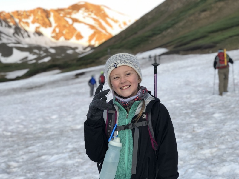
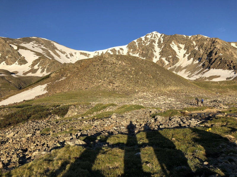

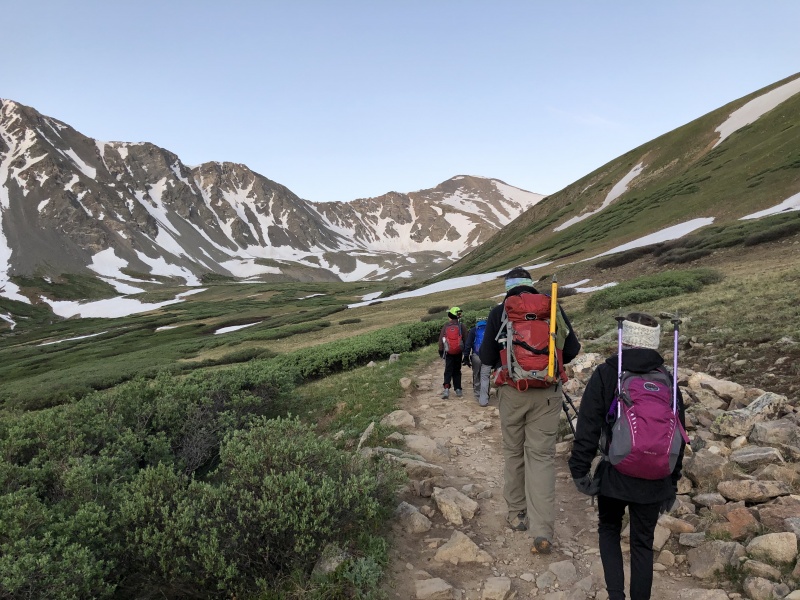
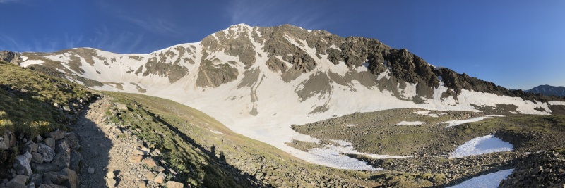
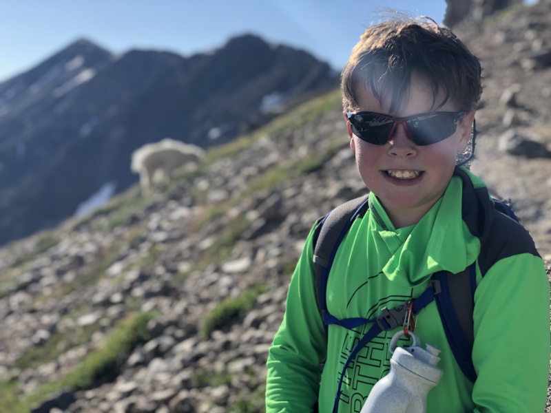
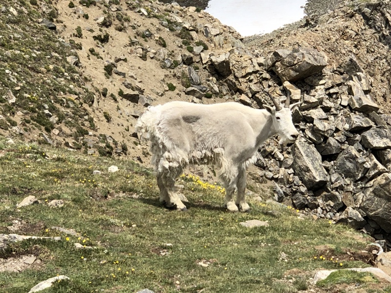
When we arrived at the Kelso Ridge turn off, Nolan and I tried to petition the group to do the ridge route, instead of the main route. Consensus vote was to hike the main route, so we continued along the main route. As we continued along the route, Anna spotted a coyote, down in the gulch, below Torreys. The coyote was definitely hunting Pika, or Marmot, and by the squeak sounds everywhere, they were fully aware of his presence. We watched the Coyote for a while to see if he caught anything, but he didn’t look like he was going to be having any luck. We continued along the trail. The main route was pretty much snow free all the way to the summit of Grays, except for a very small snow field at the very top. This snow field was optional (we could go around it), but we chose to follow the footprints of others, and climb the snow. It was moderately steep, nothing too difficult, just enough to give you a hard time. The hardest part was the first step. The first step onto the snow field was a 3 foot step up. It gave me only slight pause, but it was very tough for the kids. Some trekking pole and ice axe tugging and we were able to get the kids up the first step, and easily up the snow field to the top. Time to hike the summit of Grays, from the trail head was about 4 hours 45 minutes. 
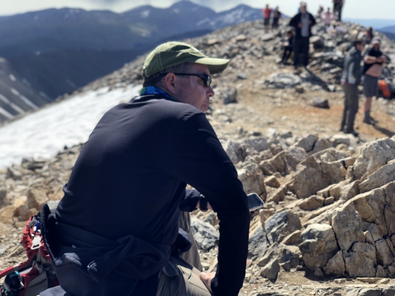
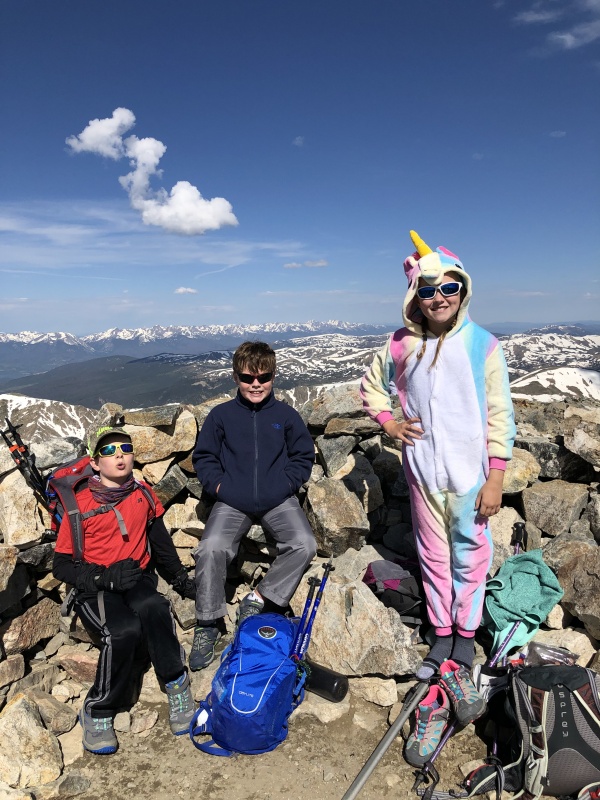
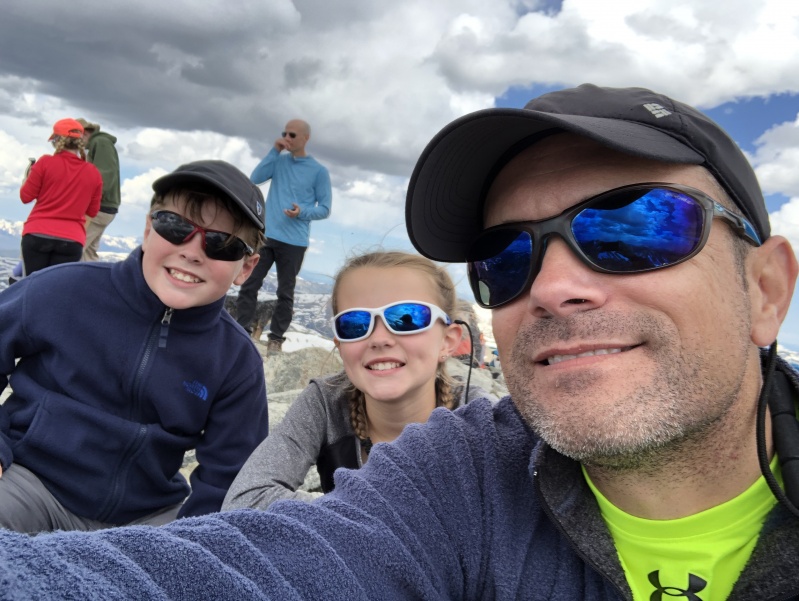
Everyone was super strong going up grays. Our pace was great and we did not take any major breaks. Everyone was eating and drinking and no major altitude issues, except for a few with minor headaches. We paused on top of Grays for some snacks, ibuprofen, as required, and a short rest. Anna put on her Rainbow Unicorn one-zee, which she had brought to the top with her. Chris looked a little zonked on top and he told me later that he actually fell asleep for a few minutes on top. We spent about 40 minutes on the summit of Grays. 

Based on the condition and performance of the crew, I knew that they would be very capable of doing Torreys. So, I was surprised that I actually got some resistance from the crew to continuing up Torreys. Chris and my two votes were the only ones collected this time and those votes were to do Torreys. We descended to the saddle, and started up Torreys. I could tell that going uphill again was tough on the crew. So, just above the saddle, I told everyone to drop their packs at a cairn marker. We would pick them up on the way down. The kids seemed confused by this plan, but I explained to them that we would be coming back down the same way. I kept my pack, so we would have snacks and water for Torreys. We made the summit of Torreys in about an hour from leaving Grays. We spent about 20 minutes on Torreys. At this point, I was pretty sure that we could out run any weather concerns. There had been some clouds building over by Evans, and also some to the North. But, all cloud formations were either holding in place, or moving slowly away from us. 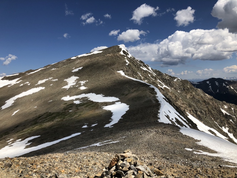

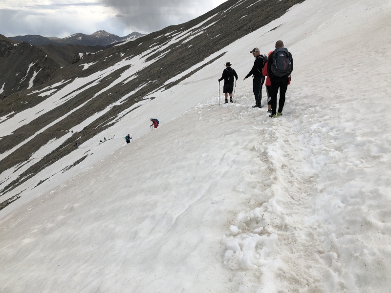
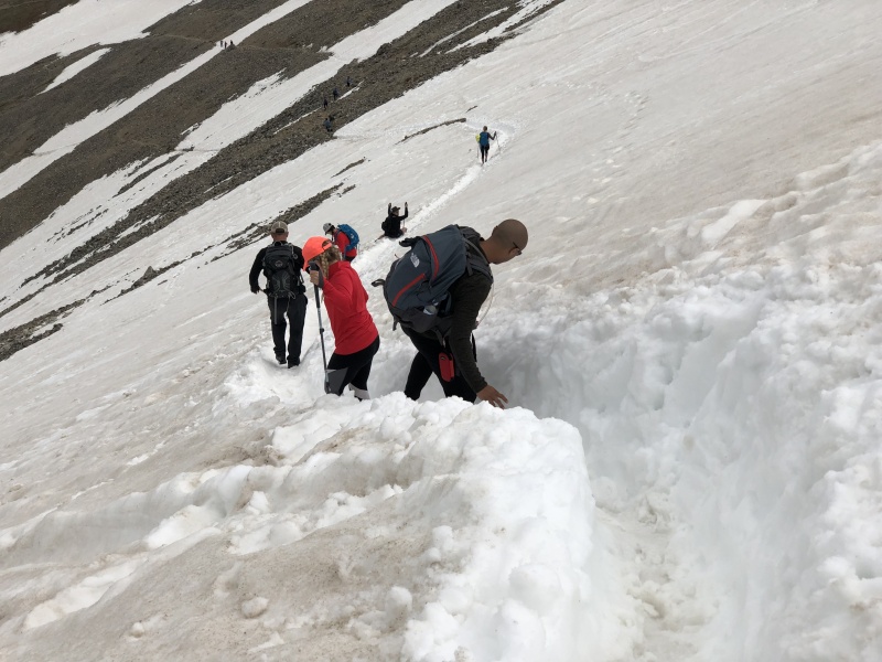
We left Torreys, and reached the saddle pretty quickly. From the saddle, we climbed back up Grays a very small amount, in order to gain the cross over spot on the massive snow field across the face of Grays. We reached the entry point on the snowfield. The snow was pretty soft at this point, but I told the crew that this was a “no fall area, so to be very careful.” I had my axe, and everyone else had their trek poles. I stayed close to the kids, in case anyone stumbled. Travel across the snow was not particularly difficult, but it was key to stay in the snow-trough. We did a little bit of walking, and a little bit of butt sliding to get across/down that snow field. If we had brought our microspikes, I definitely would have thrown them on. It would have made our footing more predictable. Everyone made it across the snow field pretty easily. Once we got across the snow field, we continued down a vague trail, until we made it back down to the main route. Once we got back down to the main trail, we were able to pick up the pace. We cruised down the main trail. As we continued toward the trail head, our group separated a bit. Nolan and I took the lead. I was cruising pretty fast, and was amazed at how well Nolan was able to keep up with me. We raced the rain back to the trail head. Nolan and I got back to the trail head, just when the rain started to come down, so we only got a little bit wet. Chris, Anna and Garrett got back to the trail head about 15 minutes later. They had stopped to put on their rain jackets, as the skies had opened up on them. Our descent from Torreys took about 2 hours 30 minutes. Total round trip was around 9 hours 15 minutes. Overall, this was probably the best "Day-1" that this crew had ever had. Everyone was super strong. We barely took any breaks, and when we did take a break, it was only for a very short time, with no complaints to get started again. A few had mild headaches, but that was about the only altitude related issue. I was initially planning for G&T, for later in the trip; after some acclimatization. So, I was super impressed with the teams ability to tackle it within 24 hours of being at sea level. Thumbnails for uploaded photos (click to open slideshow): ")
")
")
")
")
")
")
")
")
")
")
")
")
")
")
")
")
")
")
|
| Comments or Questions | |||||||||||||||
|---|---|---|---|---|---|---|---|---|---|---|---|---|---|---|---|
|
Caution: The information contained in this report may not be accurate and should not be the only resource used in preparation for your climb. Failure to have the necessary experience, physical conditioning, supplies or equipment can result in injury or death. 14ers.com and the author(s) of this report provide no warranties, either express or implied, that the information provided is accurate or reliable. By using the information provided, you agree to indemnify and hold harmless 14ers.com and the report author(s) with respect to any claims and demands against them, including any attorney fees and expenses. Please read the 14ers.com Safety and Disclaimer pages for more information.
Please respect private property: 14ers.com supports the rights of private landowners to determine how and by whom their land will be used. In Colorado, it is your responsibility to determine if land is private and to obtain the appropriate permission before entering the property.


