| Report Type | Full |
| Peak(s) |
Mt. Silverheels - 13,828 feet |
| Date Posted | 07/14/2019 |
| Modified | 07/15/2019 |
| Date Climbed | 07/04/2019 |
| Author | nyker |
| Independence Day on Mount Silverheels |
|---|
|
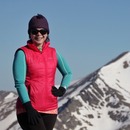
Mount Silverheels A mountain steeped in American history, Mount Silverheels was named as a tribute to and way to remember somewhat of a mysterious woman who came to what became a temporary mining town named Buckskin Joe near current day Fairplay. Her real name was not known to most and there are various accounts of how exactly she factored into the life of this then-bustling mining community but most accounts portray her as a ray of light, pointing to her talents as a dance performer wearing her silver heeled shoes and compassion as a selfless caregiver to the soon to be smallpox-stricken town. Excerpting from a book by Joyce B. Lohse, (referencing the History and Legal Proceedings of Buckskin Joe) and alluding to its mining history “That mountain is like Silverheels – beautiful to look at and containing a heart of gold.” As July Fourth was for celebrating a piece of our nation’s history, I figured this was a good peak to climb today in this historically rich part of the state. Nicole and I started out just around sunrise. There were only three other cars in the lot on this Independence Day. The Climb This route up Silverheels starts off with an easy-to-get-to trailhead at Hoosier Pass at 11,550ft. I usually feel like I am cheating when starting that high, but with all the up and down on this route and the elevation you need to re-gain on the return, I didn’t feel too bad since you’re still getting a solid 3,500+ ft. vertical gain and we just arrived into Colorado the day before so we'd be planning on moving slower anyway. Start out by crossing the road (watch both ways), passing through a gate and continuing up the meandering dirt road where you’ll get some pretty amazing views if you turn around to the west side of Route 9 into the Tenmile and Mosquito Ranges, especially in morning sunlight. ...Can never get enough of this. There is still plenty of snow on the eastern exposures of the peaks here and because you’re already up at 11,000+ft, the landscape that unfolds here is just wonderful. 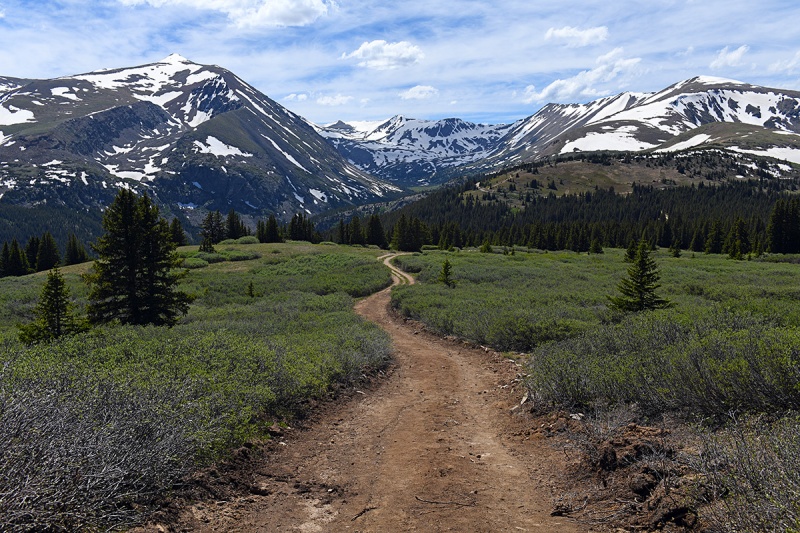 You'll find yourself surrounded by postcard scenery After a short walk on the road the radio towers come into view. We walked along the road to the actual towers and then found our way up from there in the then-snow covered woods leaving the towers, not sure if there was a trail under the snow there. As we discovered on the way down (at least with the snow that was there), it makes better sense and had less impact on the willows and shrubs to break away from the road earlier and just head up the mountain, which was dry. 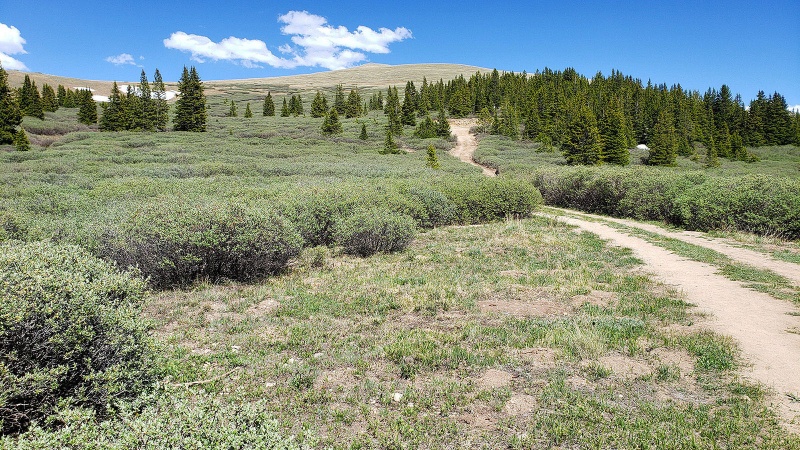
Much of the initial route can be seen right up the first “bump” though after leaving the dirt road you won’t much of a trail to follow, so dead reckon to the point there then you’ll see your choices. The initial ascent is up a rather featureless gentle hill up to that first bump at about 12.8k. There were some marmots out and about this morning. 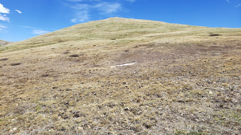 The easy terrain as you make your way to the first point on the ridge: 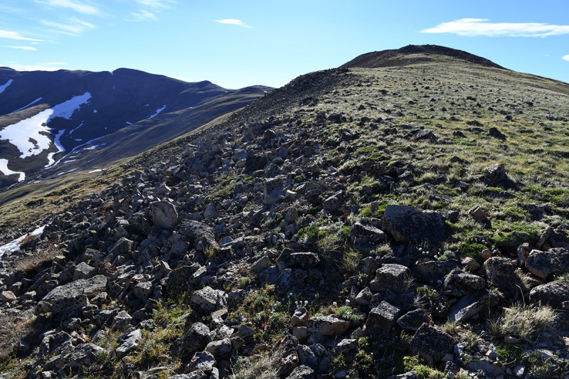 Once on this point, you can see the remaining stretch of terrain to both Hoosier Ridge to the left (North/Northeast) and Silverheels to the Southeast. This is a good spot to check on the weather and your time, since you’ll be committing to a long approach here and while the terrain is not treacherous, you’ll have an uphill return which will slow you. As you climb up, Hoosier Ridge comes into view: If you're climbing that 13er, turn left (North) here. Note the ups and downs on that ridgeline... 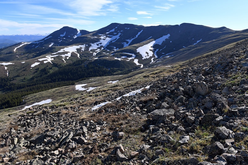 Great views west continue... The initial bump on the ridge makes a nice spot to take it all in Shadowy photographer bottom left... 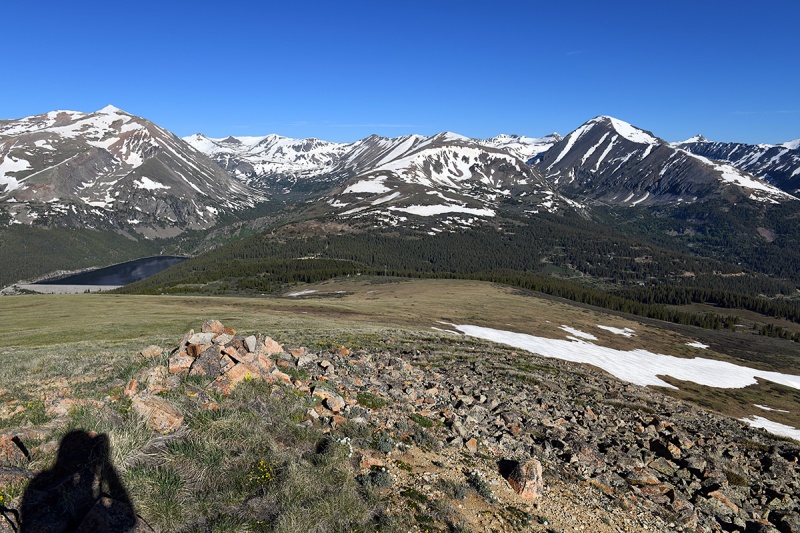 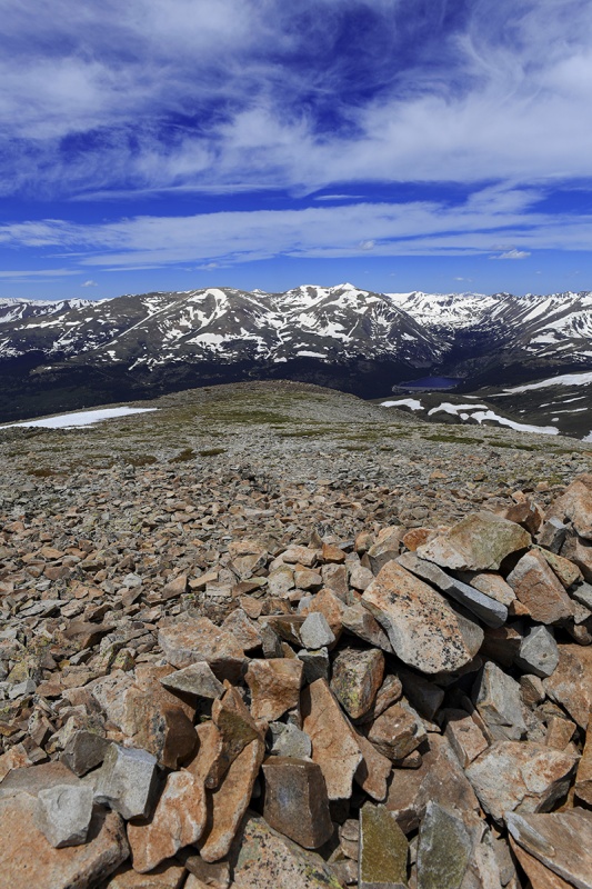 You get a nice view of the East Ridge of Quandary here. I imagined there were a *few more* folks climbing Quandary today than Silverheels. Were any of you on it? I might have a zoomed in pic of you! 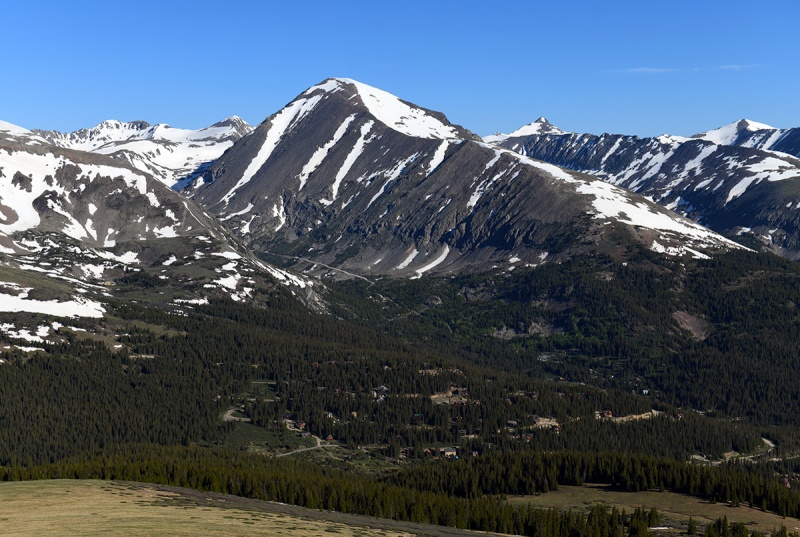
As you walk up to and across this first point, there are a couple of options to take enroute to the North Spur on Silverheels, either (i) over the bump moving more on top /across the ridge then veering a sharp right (south) or (ii) dropping down and moving southeast sooner down and across the high meadow. We opted to drop down sooner given the snowpack underneath the east-west ridgeline. Cool dune-like snow features on and under the ridge. Most of this was avoidable by moving further to the south, though the ground was soggy. 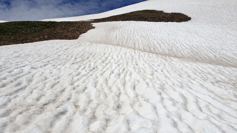 Hiking under and roughly parallel to the snow on the ridge. I am assuming in drier conditions, it would make sense just to continue on that ridge above the snow, though this works as well. This area here looked really cool as the snow was retreating leaving fingers grasping at the ground as if it were clawing at the alpine grass. 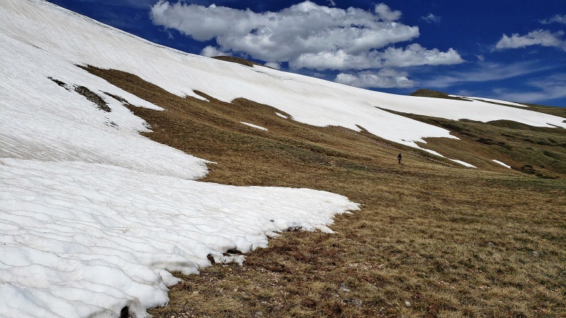 Melting out... 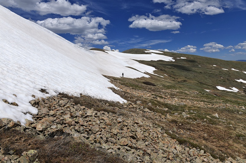 Silverheels coming into view. In the pic below, the route proper traversed along the ridge in the distance to the left making your way above the steeper north slope. From here, you can get to the summit without stepping on snow if you so choose. After the Spring season filled with longer snow climbs, this was a nice reprieve being able to leave the snow gear back for a change. The remote feel and open landscape was beautiful up here. Great energy. 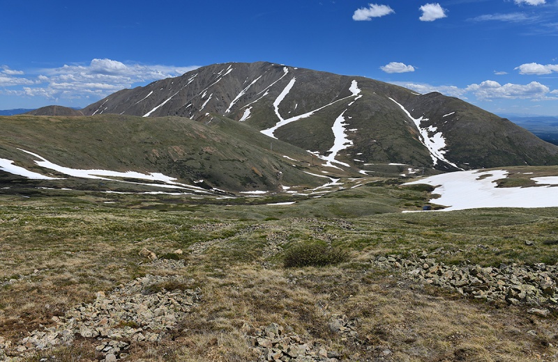 Alternatively, in the pic above you can drop down much sooner and pick up the more gentle slope further to the west on Silverheels. This option requires a bit more elevation drop to pick up that line from this starting point, though from speaking with a couple folks who had done it, the remaining route once there would be faster to walk up since the terrain was more gradual and footing more solid than the more direct, but looser terrain on the North Spur. Looking back along the route towards the north spur some trail segments appear in the flat area that lead us to where we wanted to go. Note that if you want to take that more western approach, you should have already turned off to do that since doing it from this path means you’ll have to drop down a another couple hundred feet to gain that slope which now is to climbers right (west). 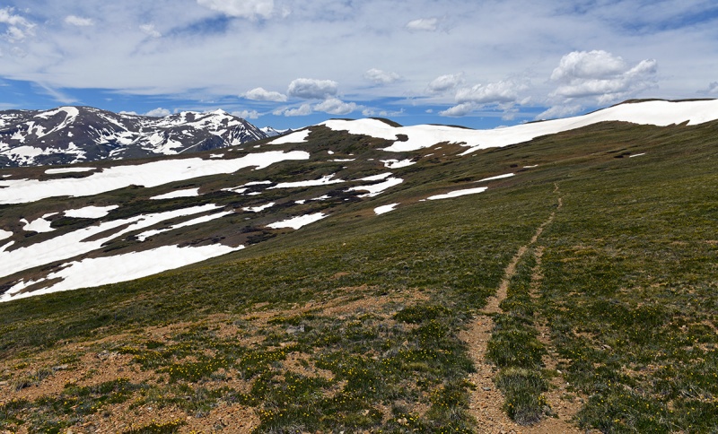 Another view of your objective-the route we took, the north spur ascends just left of the obvious thicker more vertical looking snow patch/couloir in the right third of the image below. 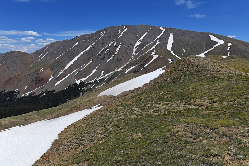 A view from the return, Nicole with the Silverheels massif as a backdrop, showing the route we took up just above her to the left of the main snow line. 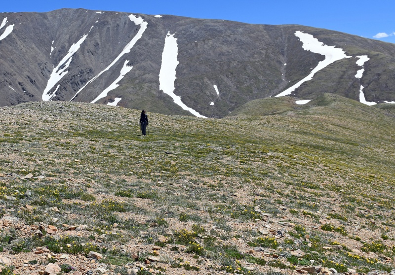 If you opt to the lower traverse over to the western ridge rather than the North Spur Route, you’ll need to either drop away early from the initial route off that first bump you run into at 12,800ft, or you’ll have some snow to cross to re-pick that up such as that below. Depending on where you exit, the amount of snow and steepness of terrain will vary. I imagine in a few weeks, much of this will melt out. Note cornices. Two folks starting around the same time as us opted for this route and they crossed higher up away from these cornices. 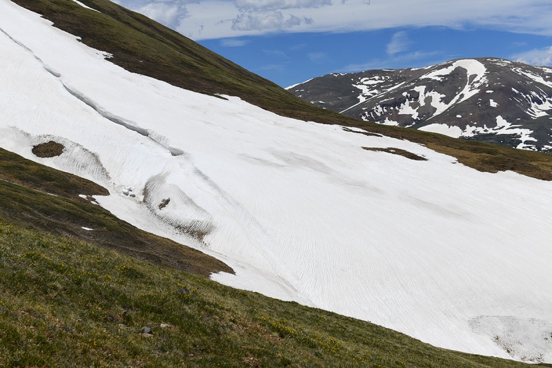 In the pic below, I marked our line of ascent There were only about a half dozen other people on mountain today, which was a bit shocking since it was July Fourth, but no complaints from here. Interestingly most others took the western flank up the mountain and not the more direct North Spur. 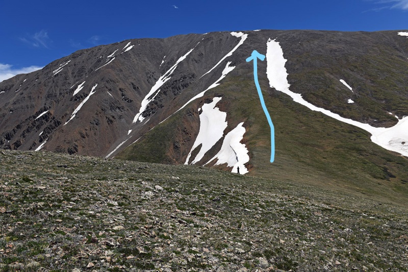 It was steep and loose, but not too bad and the directness of it let us exit right on the summit ridge with only a 15 minute walk to the summit. I was thinking it might be better as a snow climb. Below is a shot looking back with the line we took around the high meadow. Having Quandary in view provided a good visual landmark from which to navigate if needed. However, in bad weather or whiteout conditions if there is still snow present, it would make sense to mark waypoints here to make sure you don't veer off too far right flirting with that corniced ridge or too far left (west) dropping into the valley too soon. 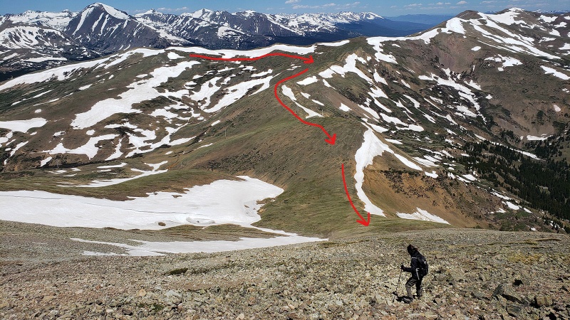 Closer look at the edge/corniced area, to steer clear from as you ascend. Down at the base of this in the valley on the east side, there were some huge (think compact car size) blocks of snow that had fallen off this cornice line. Hoosier Ridge off to the distant right of the image. 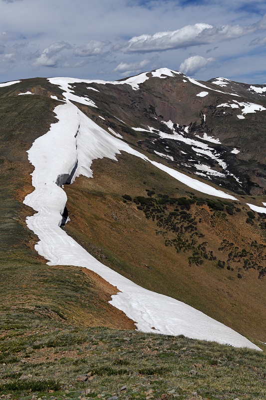 Below is a zoomed in shot of the blocks of snow (lower right) that had fallen under the cornices. 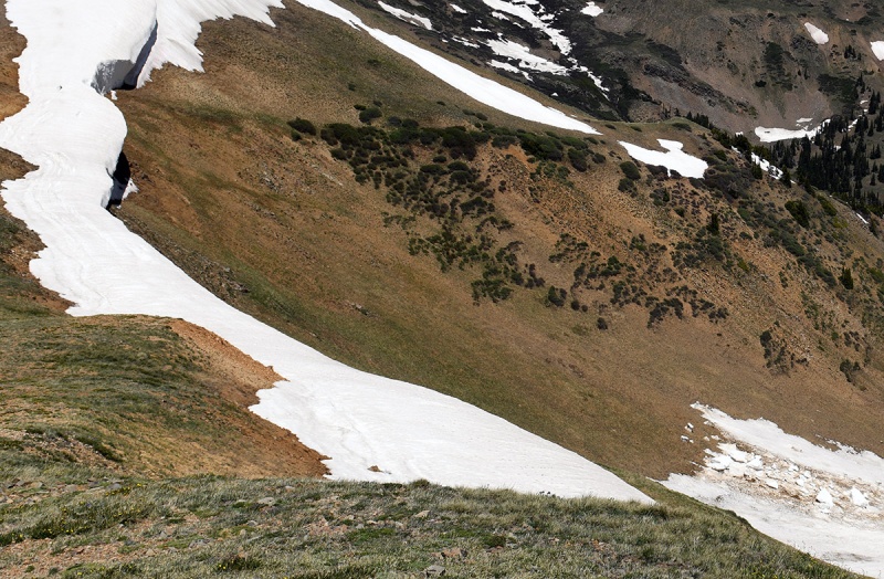 A lot of wildflowers were blooming along the way. Would be great types of of plants for an alpine rock garden. 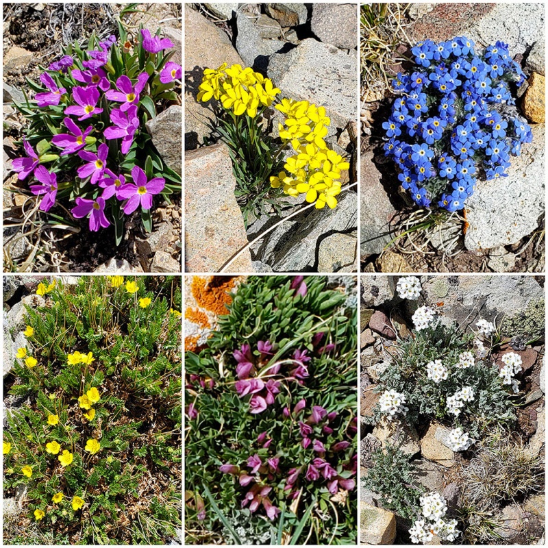 Shots of the terrain and lingering snow on the way up. In the first pic below, moving along the ridgeline on the horizon towards the right, you can just barely see four other climbers going up the western slope. I assume they dropped down earlier coming into and then out of the basin and maybe took a direct line from that initial “bump” on the route up from Hoosier Pass. 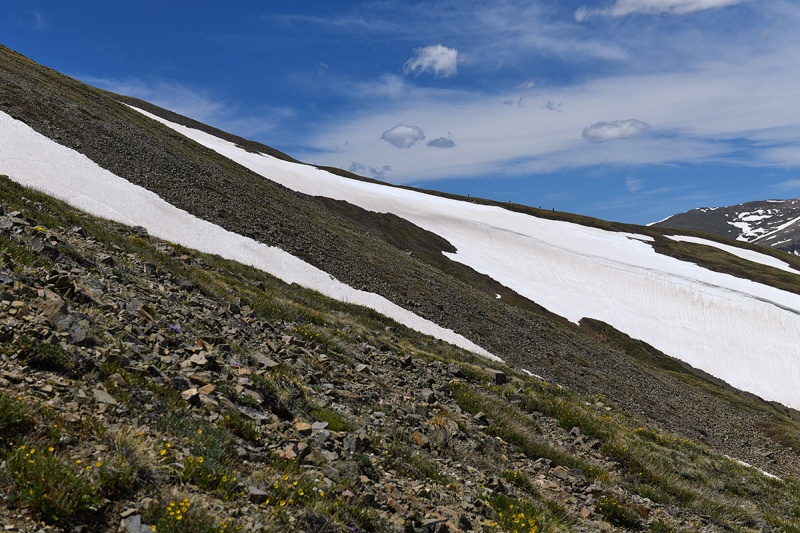
Moving higher 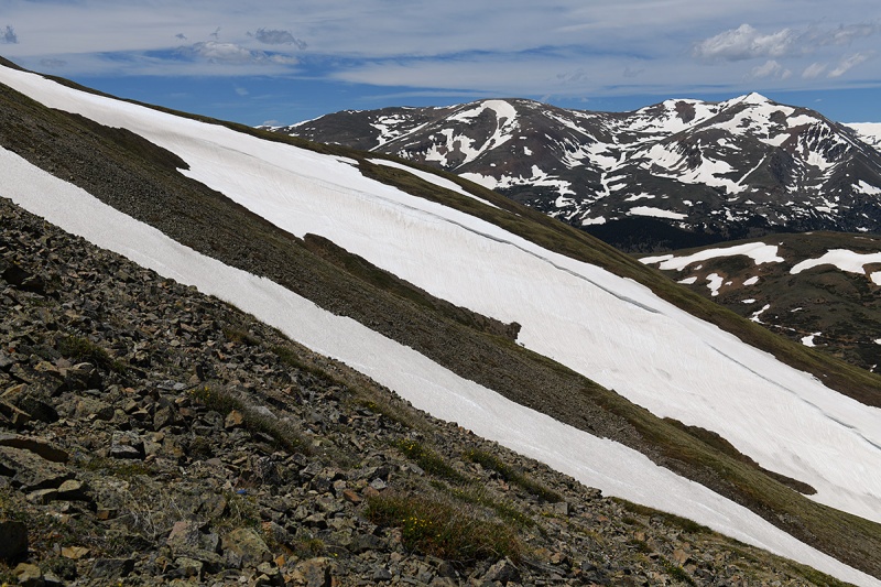 Another view as we get closer to the summit ridge The green grassy slopes will end soon and start to steepen...any trail is long gone by now. 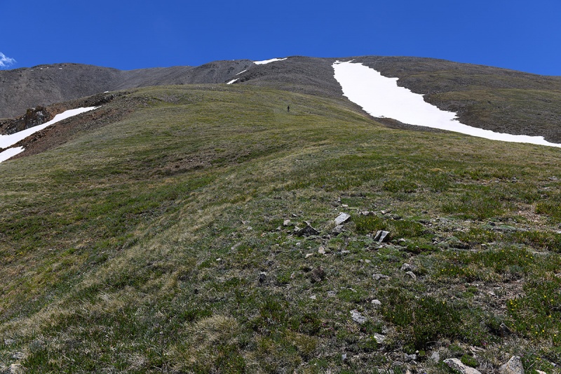 Closeup of the loose terrain that comprises most of the upper route. 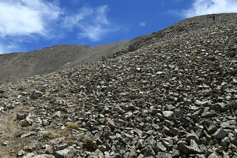
Just off the summit ridge…awesome views of the western landscape! 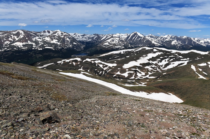 On top! 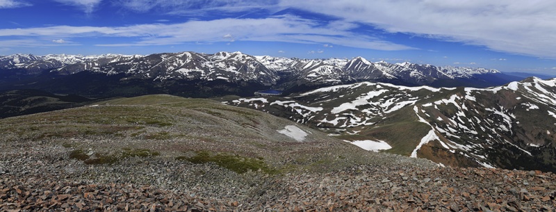
The summit! This was Nicole’s first Centennial 13er :-D 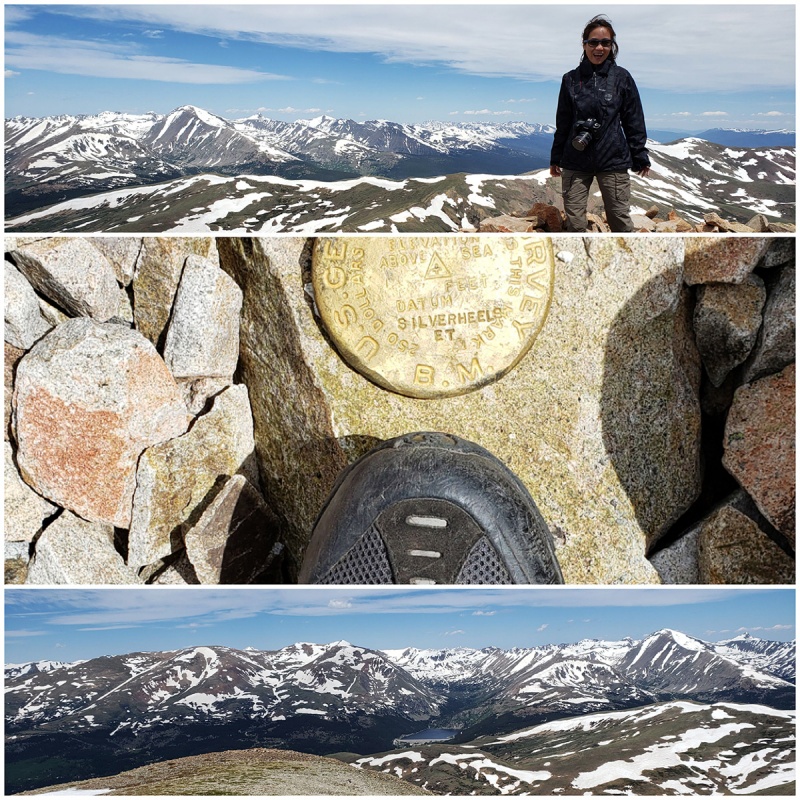 As I mentioned, the way back entails regaining the elevation lost on the way up, which maybe felt extra tough because we arrived in Denver the day before, and were still "getting our legs" The views didn’t disappoint though and the afternoon clouds made for a picture perfect descent back to the road. This was a great, lightly traveled mountain which makes a wonderful day! Highly reecommended Thumbnails for uploaded photos (click to open slideshow): ")
")
")
")
")
")
")
")
")
")
")
")
")
")
")
")
")
")
")
")
")
")
")
")
")
")
")
")
|
| Comments or Questions | ||||||
|---|---|---|---|---|---|---|
|
Caution: The information contained in this report may not be accurate and should not be the only resource used in preparation for your climb. Failure to have the necessary experience, physical conditioning, supplies or equipment can result in injury or death. 14ers.com and the author(s) of this report provide no warranties, either express or implied, that the information provided is accurate or reliable. By using the information provided, you agree to indemnify and hold harmless 14ers.com and the report author(s) with respect to any claims and demands against them, including any attorney fees and expenses. Please read the 14ers.com Safety and Disclaimer pages for more information.
Please respect private property: 14ers.com supports the rights of private landowners to determine how and by whom their land will be used. In Colorado, it is your responsibility to determine if land is private and to obtain the appropriate permission before entering the property.