Download Agreement, Release, and Acknowledgement of Risk:
You (the person requesting this file download) fully understand mountain climbing ("Activity") involves risks and dangers of serious bodily injury, including permanent disability, paralysis, and death ("Risks") and you fully accept and assume all such risks and all responsibility for losses, costs, and damages you incur as a result of your participation in this Activity.
You acknowledge that information in the file you have chosen to download may not be accurate and may contain errors. You agree to assume all risks when using this information and agree to release and discharge 14ers.com, 14ers Inc. and the author(s) of such information (collectively, the "Released Parties").
You hereby discharge the Released Parties from all damages, actions, claims and liabilities of any nature, specifically including, but not limited to, damages, actions, claims and liabilities arising from or related to the negligence of the Released Parties. You further agree to indemnify, hold harmless and defend 14ers.com, 14ers Inc. and each of the other Released Parties from and against any loss, damage, liability and expense, including costs and attorney fees, incurred by 14ers.com, 14ers Inc. or any of the other Released Parties as a result of you using information provided on the 14ers.com or 14ers Inc. websites.
You have read this agreement, fully understand its terms and intend it to be a complete and unconditional release of all liability to the greatest extent allowed by law and agree that if any portion of this agreement is held to be invalid the balance, notwithstanding, shall continue in full force and effect.
By clicking "OK" you agree to these terms. If you DO NOT agree, click "Cancel"...
I've been wanting to take advantage of the snow in the San Juan's to pave the choss with white gold. The weather looked marginal on Saturday but pretty sweet for Sunday and Monday so me and Angie took off to do a leisure 3 day loop to link up Rolling Mountain, Grizzly B and San Miguel. The plan was loose, conditions were unknown but we had lots of extra time to work things out.
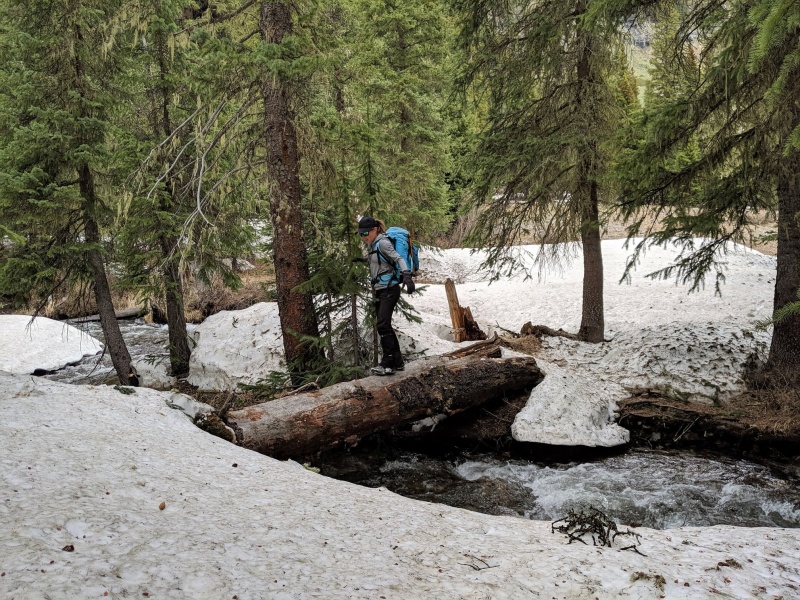
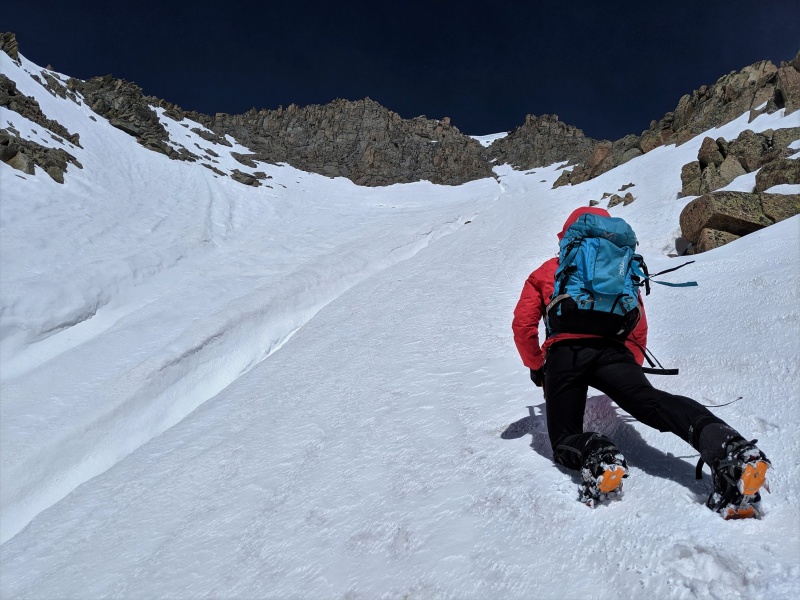
We started in South Mineral Campground where my truck sat helpless for 3 days while marmots chewed through all the wiring in the back! For us, we hit snow almost immediately (~10.3k ft) but made easy work on foot. We didn't bother with snowshoes or skis since we were already taking overnight gear. As normal for this time of year, the first challenge was a river crossing.
Caption Here
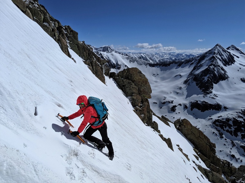
The weather was holding as we worked our way up perfect snow on the east face of Rolling Mtn then onto the north ridge to the top
Caption Here
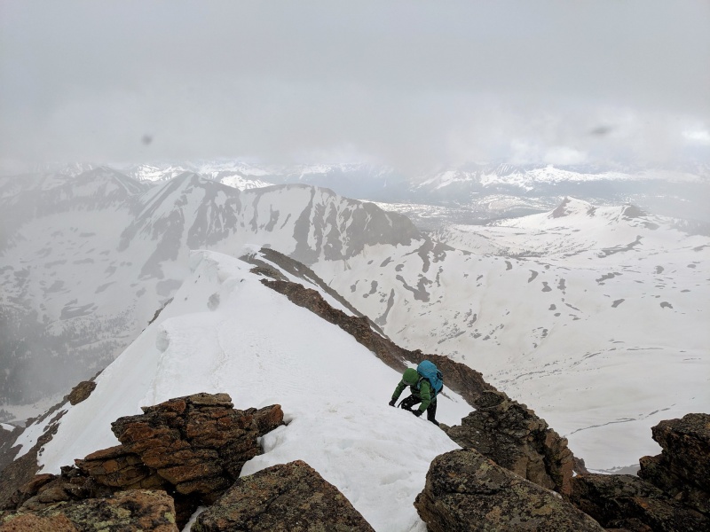
Just finishing up the ridge, the weather moved in. Second day of Summer!!
Caption Here
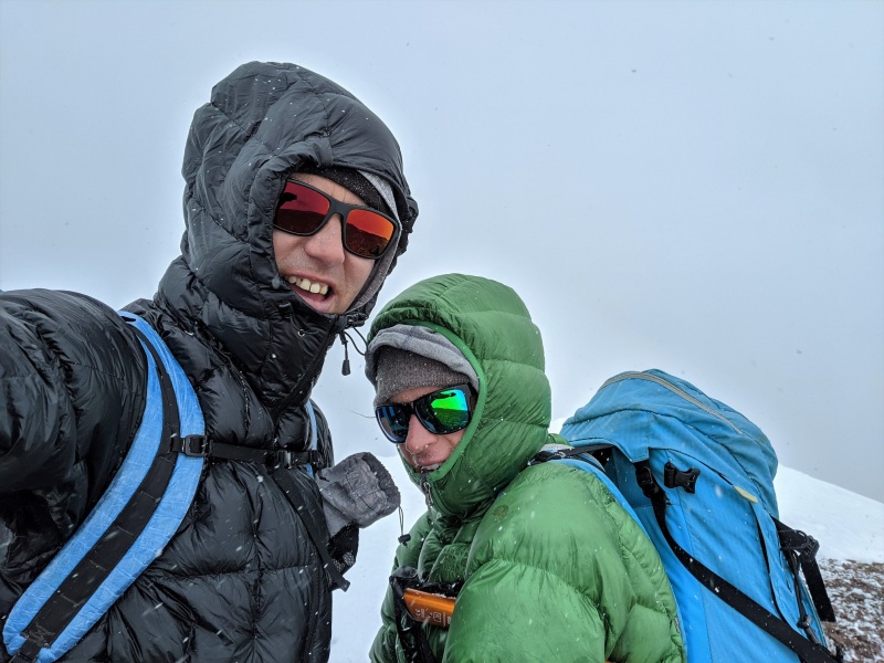
A bit of snow wont make us sad.
Stoked! no wait, frozen! Second Day of Summer!
We made it to the top and didn't loiter. Snow, thunder, wind, cold, at least there weren't any Sasquatches chasing us!
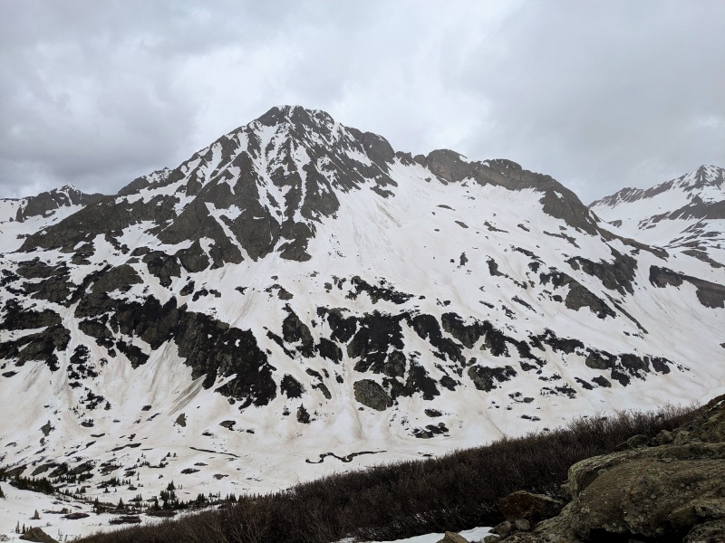
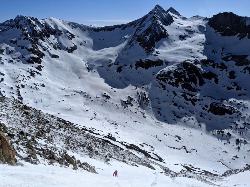
Cruising down the SW face of Rolling, we were able to scope out our next day's target. The couloir straight up the center looks inviting so that's where we went.
CT trail! Bridge over the Cascade River.
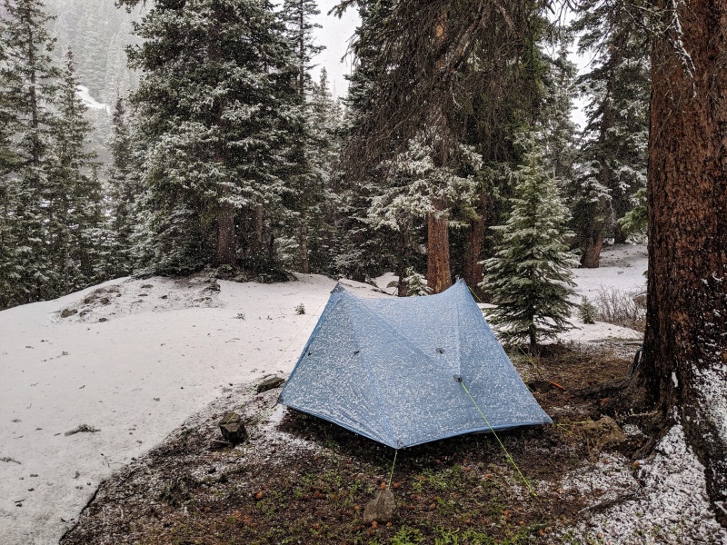
Wrapping up our day one, we headed down to the CT and were getting a bit desperate for a camp spot. Angie was trying to sell me on how cool it would be to sleep on the bridge.
Nothing like a bit of summer grapple to make the memories stronger
But we found a sweet little spot 2 minutes away. Home sweet home.
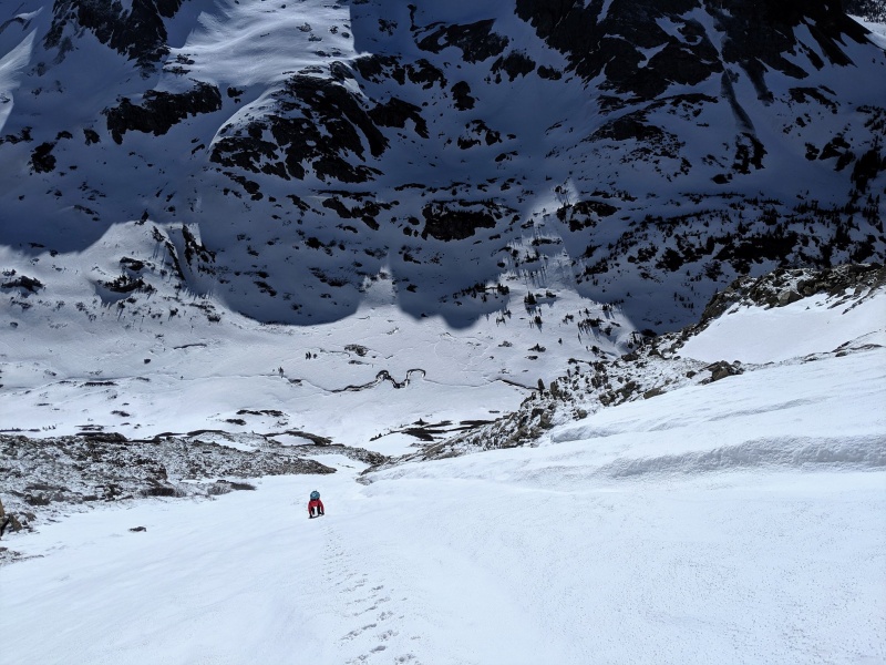
Day 2, up the super highway of Grizzly
Woke up the 2nd day ready to roll. The sky was bluebird and my camera was ready for a good workout.
Checking out yesterday's summit on the horizon.
Snow was so cruiser
Up, up and away!
And the last stretch of snow that had a cool Star Wars trench we had to get across. The pic doesn't show it well but that sucker was over 6 feet deep!
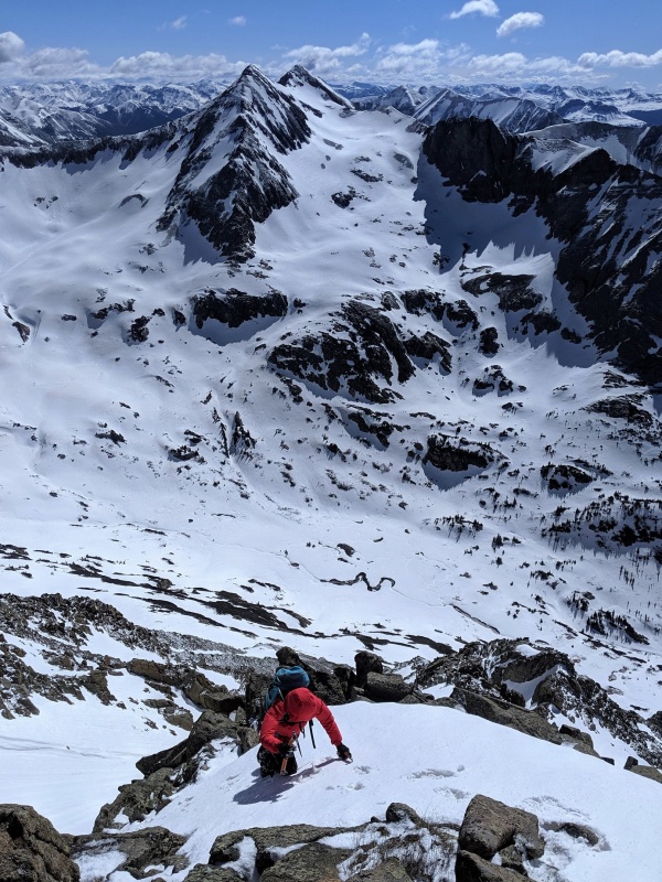
Almost to the top! The views were amazing!
We spent so much time just soaking it all in!
And now into our final peak, San Miguel. Figuring out what was the high point was the crux of the afternoon! Luckily we have a 50/50 chance and got it right the first time.
After that, we made our way down to Hope Lake in the afternoon. Snow was still cruiser even at 3pm! Not a single post hole was made in the making of this journey!
And down to the trees for anther campsite.
The forest was dominated by avalanches! After 2 hours of wandering around in the snow trying to find something flat and dry, we finally found a place to camp. We were down to 10.5k ft
and just for fun, the next morning we hiked over the Vermillion saddle into the Ice Lake area. More perfect snow, especially in the early AM. We giggled all the way down!
My GPS Tracks on Google Maps (made from a .GPX file upload):
Stephakett - I think the pic you are asking that's thawed out (3rd from last) is the backside of the Wilson group. Or more accurately, the southern foothills of it. The peaks themselves were still white but right near treeline the green took over!
Good call on getting those peaks with snow. I did a bunch of the peaks around Ice Lakes, plus Rolling, V9, V8 and Beatie last year. Can't say that coming down all the choss and scree on Rolling was all that fun.
RyGuy - For sure!! Like yourself, I did Pilot Knob, Grant, Vermillion and Goldenhorn in fall conditions (dry and loose!) a few years back and was looking for a different experience!! I'm also saving the last few by Yankee Boy Basin (Gilpin, Cirque and Emma) for snow. The neighbor, T0, in the dry has to be the absolute worst peak I've ever hiked. I've never been so terrified and it's only class 3! Ahh, the things I do for a list of 200 rocks to stand on top off.
Caution: The information contained in this report may not be accurate and should not be the only resource used in preparation for your climb. Failure to have the necessary experience, physical conditioning, supplies or equipment can result in injury or death. 14ers.com and the author(s) of this report provide no warranties, either express or implied, that the information provided is accurate or reliable. By using the information provided, you agree to indemnify and hold harmless 14ers.com and the report author(s) with respect to any claims and demands against them, including any attorney fees and expenses. Please read the 14ers.com Safety and Disclaimer pages for more information.
Please respect private property: 14ers.com supports the rights of private landowners to determine how and by whom their land will be used. In Colorado, it is your responsibility to determine if land is private and to obtain the appropriate permission before entering the property.


")
")
")
")
")
")
")
")
")
")
")
")
")
")
")
")
")
")
")
")
")
")


