| Report Type | Full |
| Peak(s) |
Taylor Peak - 13,157 feet Powell Peak - 13,195 feet |
| Date Posted | 06/24/2019 |
| Modified | 06/28/2019 |
| Date Climbed | 07/15/2004 |
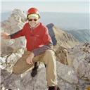
| Author | flyingmagpie |
| Climbing Powell Peak (and Taylor, too) |
|---|
|
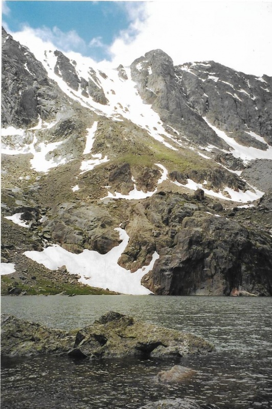
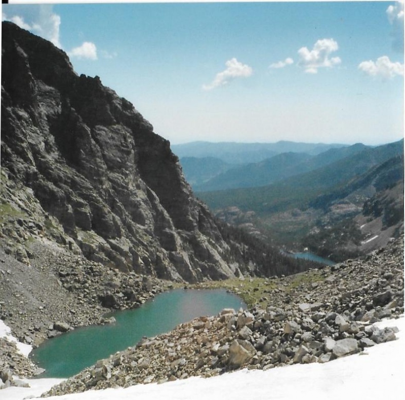
I first tried to climb Powell Peak together with nearby Taylor Peak from Andrews Glacier and Pass in July, 2000. The two mountains are so close together I wanted to do them both on the same climb. I found, however, that the long slope from Andrews Pass to the summit of Taylor wore me out so much that it broke my will to climb a second peak that day. Tired enough on the summit of Taylor, instead of even trying for Powell, I just headed down and back out to the old Glacier Gorge Trailhead, the one that used to be located in the tight “v” of the last switchback before the Bear Lake Parking Area. Powell Lake and Peak, of course, are named after the remarkable John Wesley Powell who led the first successful expedition to climb Longs Peak. That was only one among his many significant accomplishments.Taylor Glacier and Peak, according to Mary Hagen in her “Larimer County Place Names,” was named by early Estes Park pioneer Abner Sprague after Albert Reynolds Taylor, who was President of the Kansas State Normal School in Emporia, and who visited Colorado in 1895. Again according to Mary Hagen, Andrews Creek, Glacier and Tarn were also named by Abner Sprague after Edwin B. Andrews, widower of Sprague’s wife’s sister. I tried to climb Taylor and Powell peaks again in August, 2000, less than a month after my first attempt, and met with the same result. What I should have done was gone for Powell first, and then caught Taylor afterwards, if I had enough energy left to do so. But Taylor is closer to Andrews Pass, so once again I climbed it first. And once again, its long slope to the summit wore me out. So, in those two months I climbed Taylor twice, but left Powell unclimbed. In 2000, I had yet to develop my climbing endurance! I would not succeed at climbing Powell until August, 2002 by a much longer and more difficult approach. My approach was longer and more difficult because Andrews Glacier by late summer of that year had become a technical ice climb! Evidently, little snow had fallen in the Park in the winter of 2001, and the summer of 2002 had been a hot one. Andrews is usually one of RMNP’s easiest glaciers to climb, but not that August. Crevasses had opened up in the glacier, and there was even a cliff of ice that required a roped, nearly vertical ascent with ice axes. So instead of parking at Glacier Gorge, and approaching Powell from Andrews Pass, I drove on, parked in the Bear Lake Parking Area, and approached Powell from the Flattop Mountain trail. On this climb, I had sense enough to bypass Hallett, Otis, and then Taylor. I headed straight for Powell, and Powell alone. My approach was going to be a very long tundra trudge, and I knew I probably would only have the time and energy to climb one peak that day. Up on the Continental Divide, beyond Andrews Pass, I ran into a party with ice axes hanging from their packs, and I knew they had come up via Andrews Glacier. We hiked together for a while. I asked them if climbing the glacier had taken a lot of time. They told me yes, it had been more difficult and taken longer than they had expected. They were headed for McHenry’s Peak, and their climb involved McHenry’s Notch. We parted ways at the point where I had to split away to head toward Powell, while they headed past Powell toward McHenry’s. Because my first Powell ascent was not by the standard approach, I am not going to write this trip report about that ascent. Instead, I am going to describe my second ascent of Powell and my third ascent of Taylor in July, 2004 via the standard route over Andrews Glacier and Pass. On this climb, I successfully tagged both peaks. Also, I carried my good, 35mm Pentax single lens reflex camera that day, so my photos would be good ones. On my 2004 climb of Taylor and Powell, before I climbed Andrews Glacier and Pass, I first hiked up climbed up through Timberline Falls to Lake of Glass and then Sky Pond to photograph Powell Peak from below. Unlike the winter of 2001, the winter of 2003 had brought a lot of snow to the Park, and much of it was lingering well into July, making my photos much more interesting and dramatic. What I wanted to show in my photo of Powell was that while Taylor cuts a fine, steep-faced image on the skyline from below, Powell seems little more than a small bump on a ridge-line. Bump or not, it is a named and significant RMNP 13er, and I wanted to climb it again, and I wanted to climb it together with Taylor this time. To get to Lake of Glass and Sky Pond, you have to climb past Timberline Falls. You don’t “hike” past Timberline Falls. It is not a stroll. Timberline Falls is the biggest obstacle to reaching the high cirque above with its two picturesque lakes. When the flow over the falls is low, you can scale the Class 3 cliff right next to the falls itself. When the flow over the falls has swollen with spring snowmelt, as it was on this day, you have to rock-hop around the cliff and falls. I usually rock-hopped around on climber’s left. Here is what Kent and Donna Dannen, in their book “Hiking Rocky Mountain National Park,” have to say about the falls: “At any time Timberline Falls must rank among the finest in the park. In early summer, when the flow if Icy Brook has sculpted winter’s deep snowdrifts around it, the cascade is unexcelled in beauty.” Instead of photographing Timberline Falls from below, I photographed it from one side, catching part of the skyline of Thatchtop behind, complete with some jagged gendarmes. Then I rock-hopped up around the falls, hiked past Lake of Glass, and took a good photo of Powell Peak over Sky Pond. 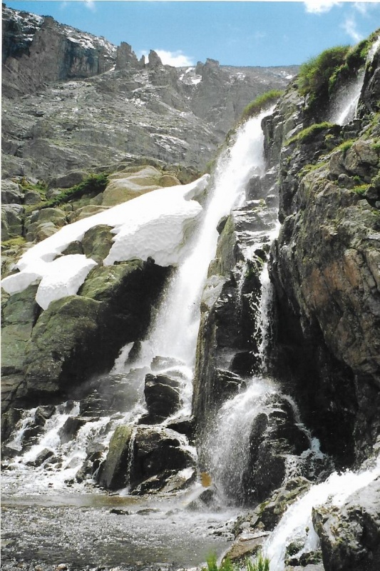
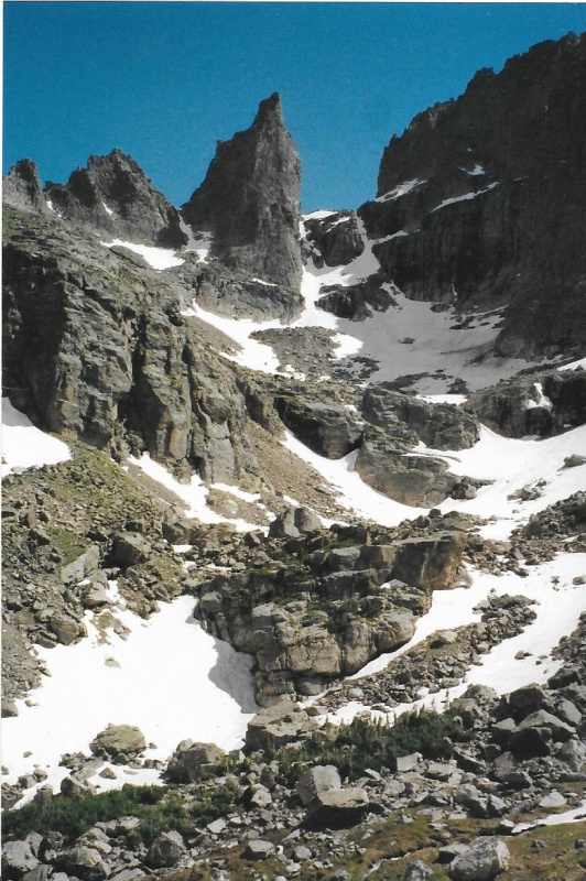
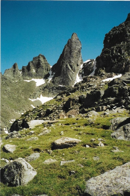
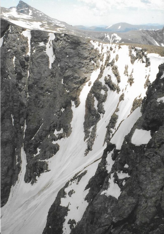
I retraced my route back down to where Icy Brook joins Andrews Creek, and headed north to the Andrews Creek Back-Country Campsite, and turned west, bound for Andrews Glacier and Pass. I climbed steeply up Andrews Valley. When I came to that incredible view of the sharp, skyward pointing blade of rock known as Sharkstooth, I could not keep myself from snapping a few photos, even though I had photographed it a number of times before. I liked the contrast of the white of the snow and the green of the grass against the bare starkness of that blade of rock. Technical climbers have a route on this north face of Sharkstooth below, as well as other routes. 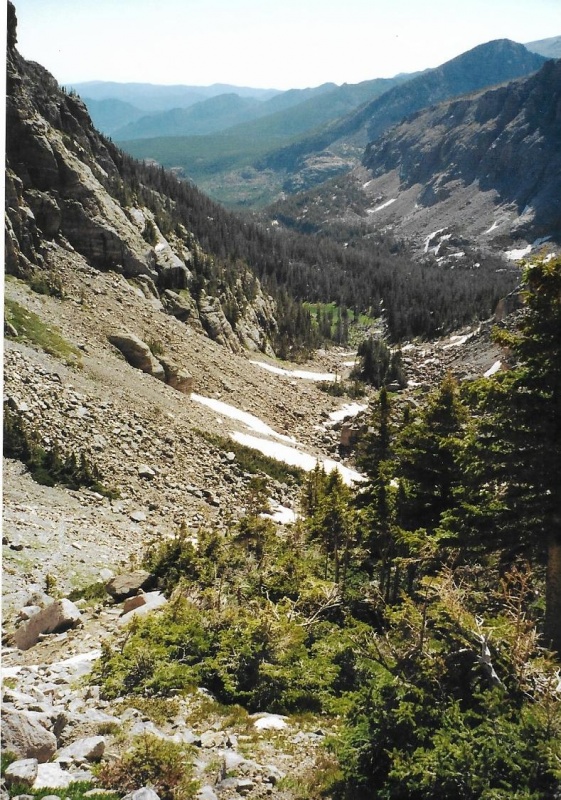
When I reached Andrews, I found that this year, in spring, it was in fine shape for climbing. I could even see a trail made by prior climbers across and up the huge snowfield. I am sure I paused at the base of the glacier, sat down, and put at least Yaktrax onto my boots. I didn’t carry an ice axe, but I did have my trekking pole to lean on occasionally and to help my balance. 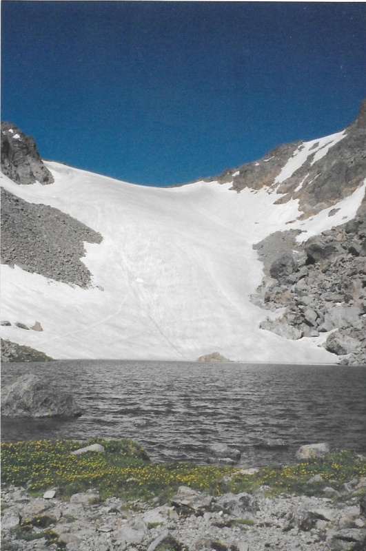
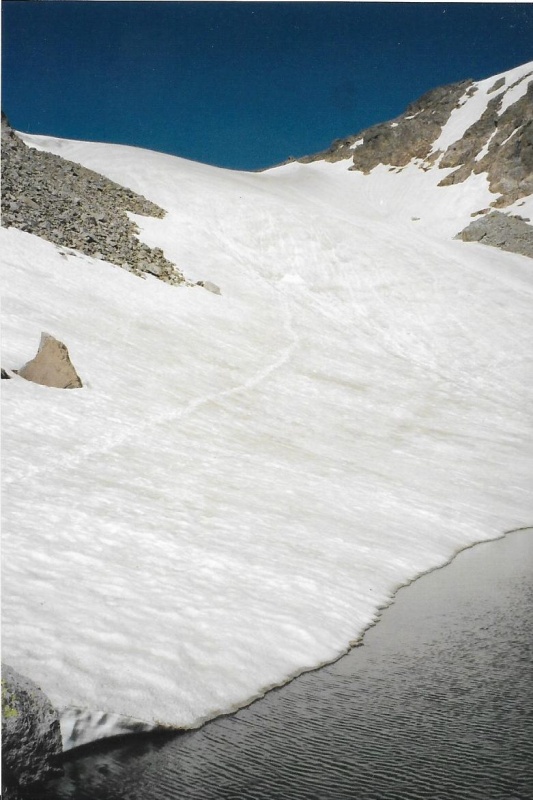
I climbed up the glacier. I tried to avoid any ice, and stay where the snow was softer, and held my boots in place securely as they sank in a bit. Some other climbers started ascending the glacier maybe a hundred yards behind me and after I reached the top, and was off the snow on solid ground, I turned around and photographed them. 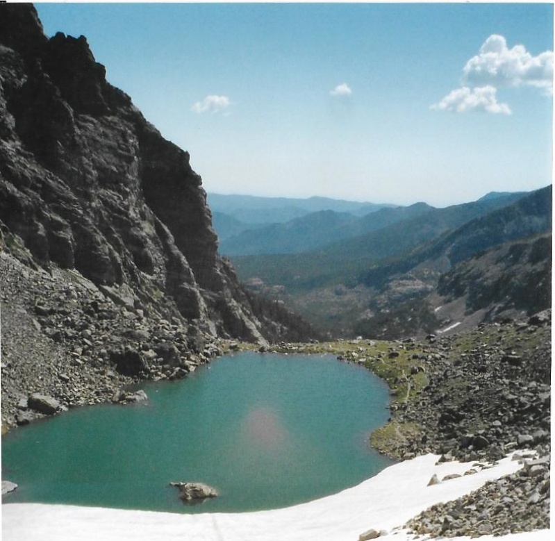

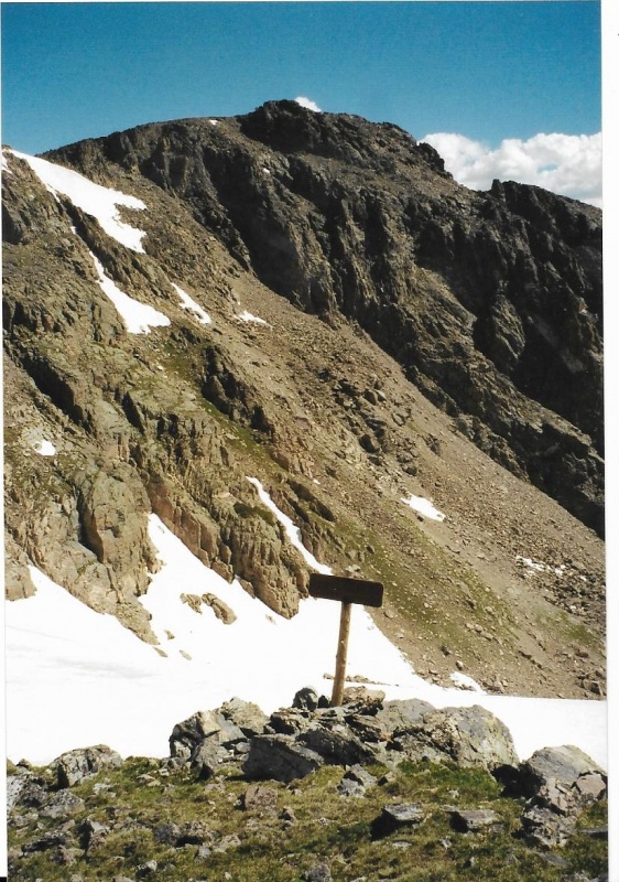
The tundra above Andrews Pass was very green, and full of tiny flowers as well. 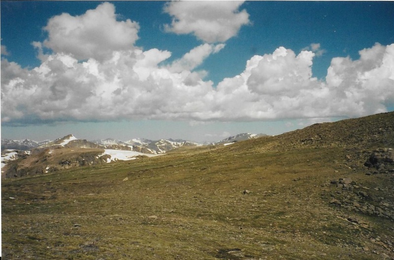
Beyond Andrews Pass, I photographed Otis Peak, and further away, Hallett Peak. The Mummy Range in the distance still held a lot of snow, too, this July. 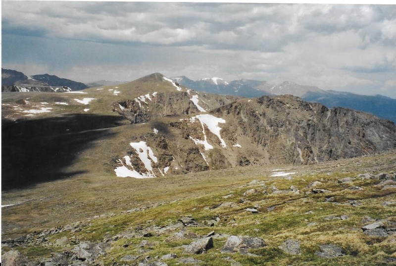
Then I continued on in the direction I had been going, and began my climb up the long steep north slope of Taylor Peak that had robbed me of so much energy on prior climbs. Don’t be fooled by the photos. They make the slope look shorter, less steep, and easier than it really is! 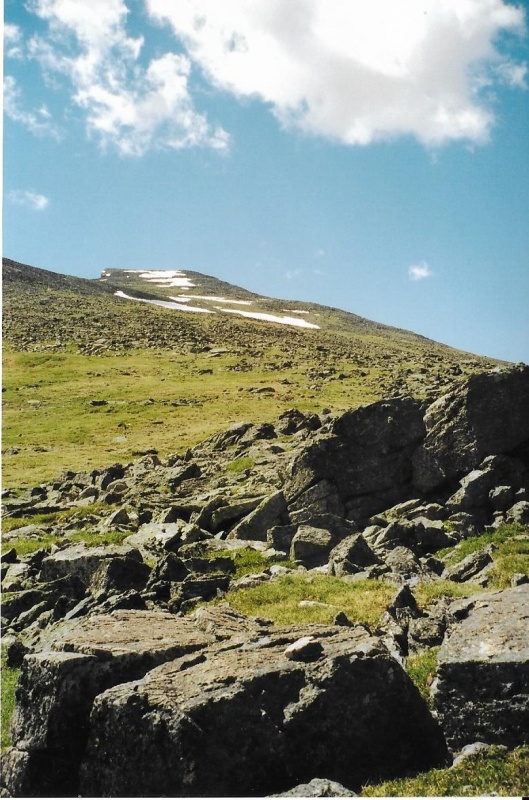
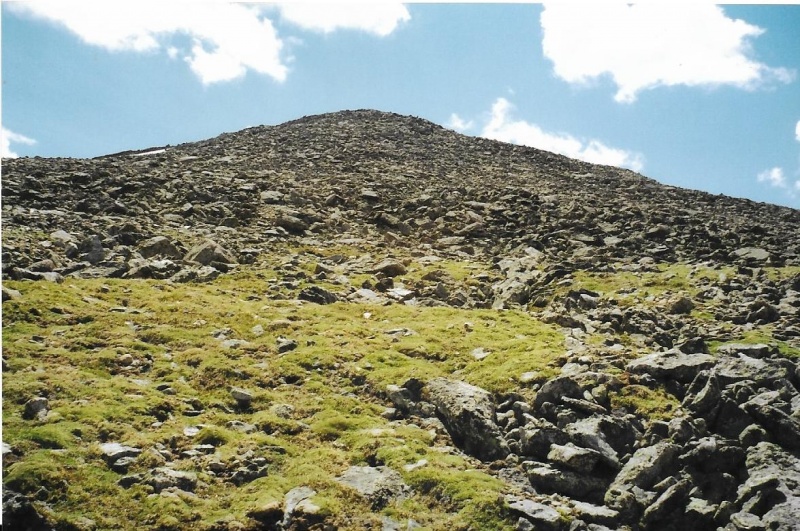
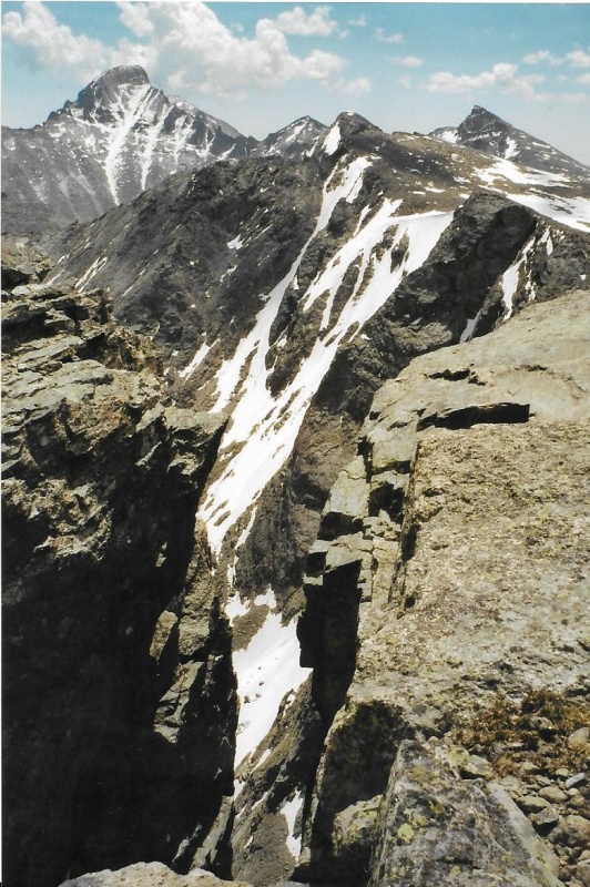
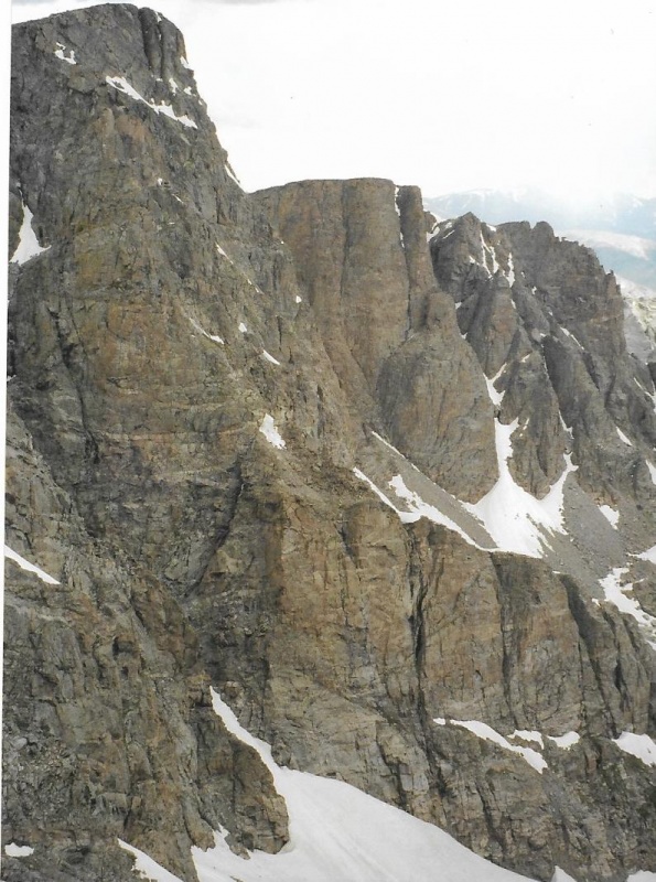
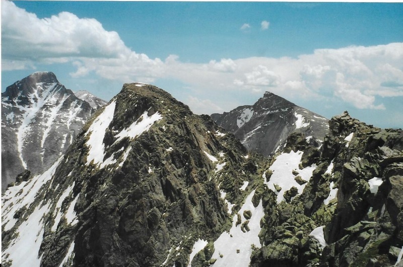
The weather was holding beautifully, and after a time I reached the summit of Taylor. From the summit, I had a fine view south of Colorado’s northernmost 14er, and four of its great 13ers: Pagoda, McHenry’s, Powell and Chief’s Head. 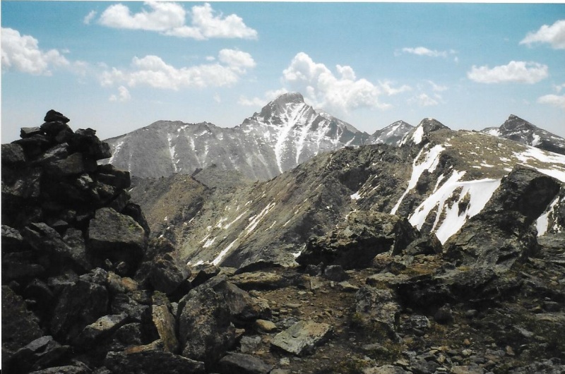
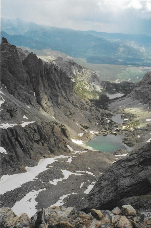
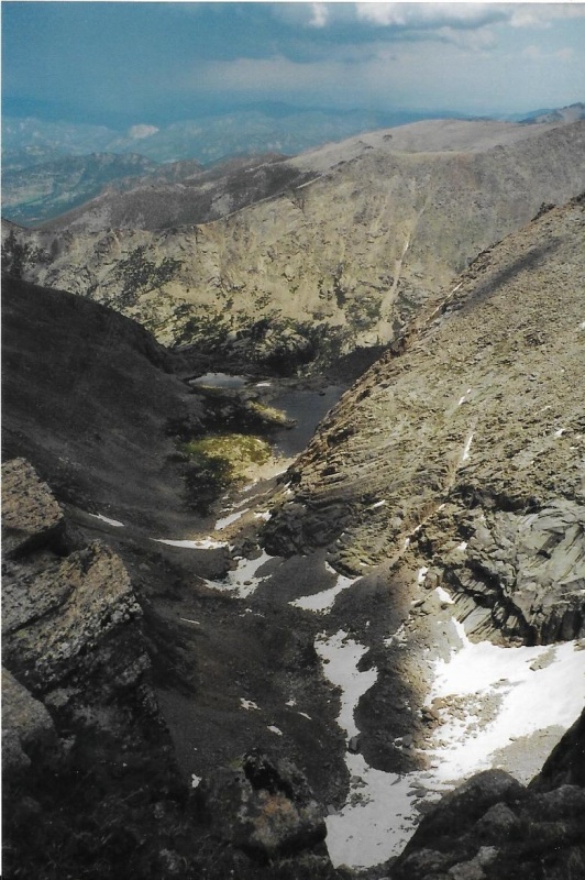
Below me to the northeast, the cirque fell away through Sky Pond, Lake of Glass, and the arrow-head shape of the Loch. I enjoyed these views, took off my pack, got out an energy bar and ate it, then took a long swallow of water. I re-applied sunscreen on my face, neck, and hands. I was going to be up this high for a good long while. Then I re-shouldered my pack, and pressed on toward Powell. I hiked pretty close to the Continental Divide, to the cliff’s edge, close to the great faces with such yawning exposure below. I took photos. It would be quite an understatement for me to comment that I was in a very photogenic place. It was photogenic, all right. 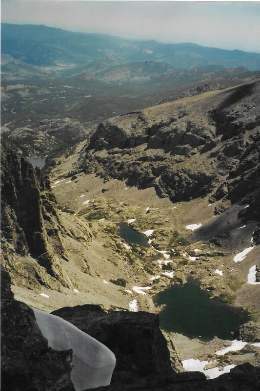
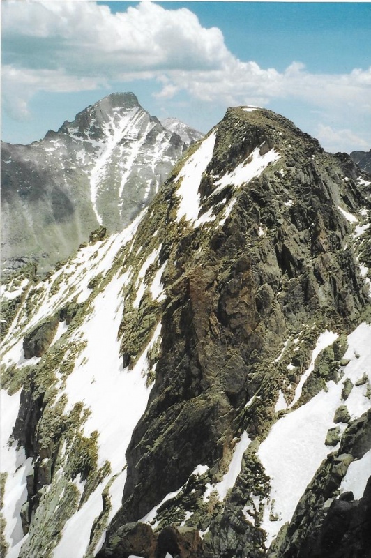
I got a pretty good, early season view of Taylor Glacier. In fact, I took a photo of it through that long, deep crack near Taylor’s summit, the one I wrote about in my trip report on Taylor, the one that another climber I had encountered on the summit that day and I had joked about it being “the quick way down.” “The elevator,” he had called it. And we had both laughed. I thought about how long ago that climb had been, nearly four years before, and how I had thought I might be able to tag Powell, too that day, since it was “so close.” Now, it looked like I might finally be able to summit both peaks in a single day. My endurance at elevation had certainly gotten better through much practice in the intervening years. 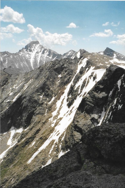
I took a photo of Alice, and its ridge-line to Chief’s Head, the ridge-line Lynn Prebble and I had ascended in 2002, Hourglass Ridge, on our complete circuit of Alice. We had descended via Boulder-Grand Pass, not only on the Continental Divide, but the borderline between two Colorado counties. 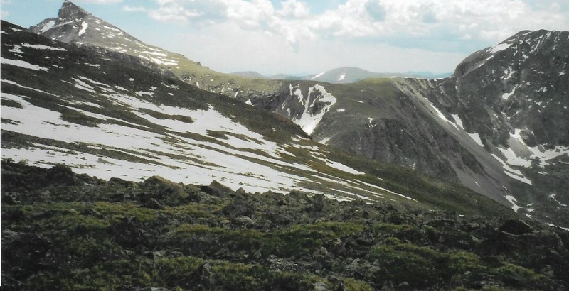
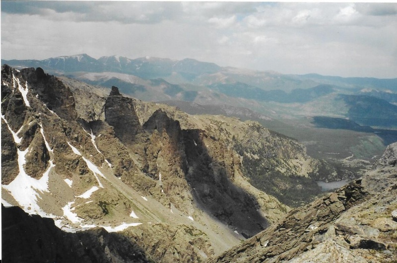
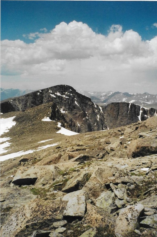
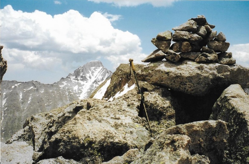
I took a photo looking back at the great profile of Taylor Peak. Clouds were beginning to build, and I began to worry a bit about the weather. At last, finally, I began my final push up toward Powell’s summit. As I climbed, I got a good view of McHenry’s, which I had climbed a couple of times via Stone Man Pass. I was close enough now to Powell’s summit that I could clearly see its summit cairn. Slowly, it seemed, I drew closer to it. Then, at last, I was there. Finally, Taylor and Powell on the same climb! 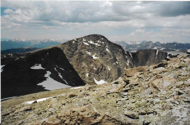
I looked down once more at Lake Powell, on the “wetter, better” western side of the Park. I didn’t remain on the summit long, though the clouds I had worried about now seemed to be breaking up. It was once again a blue-sky day! I ate another energy bar, and took another long swallow of water. Then I put the water bottle back into its pocket on my pack. 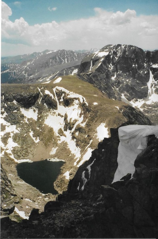
I had done it. Finally, I had done it. Taylor and Powell together. It was a good day, all right. I took one final look at those views from Powell's summit, then I re-shouldered my pack, and began the long descent and hike back out. Thumbnails for uploaded photos (click to open slideshow): ")
")
")
")
")
")
")
")
")
")
")
")
")
")
")
")
")
")
")
")
")
")
")
")
")
")
")
")
")
")
")
")
")
|
| Comments or Questions | ||||||
|---|---|---|---|---|---|---|
|
Caution: The information contained in this report may not be accurate and should not be the only resource used in preparation for your climb. Failure to have the necessary experience, physical conditioning, supplies or equipment can result in injury or death. 14ers.com and the author(s) of this report provide no warranties, either express or implied, that the information provided is accurate or reliable. By using the information provided, you agree to indemnify and hold harmless 14ers.com and the report author(s) with respect to any claims and demands against them, including any attorney fees and expenses. Please read the 14ers.com Safety and Disclaimer pages for more information.
Please respect private property: 14ers.com supports the rights of private landowners to determine how and by whom their land will be used. In Colorado, it is your responsibility to determine if land is private and to obtain the appropriate permission before entering the property.